Chapel Notre-Dame des Œufs
Quick hike with access from the south
hike
average
45 min
no
yes
no
mountain
Introduction
In the Verdon region there are chapels which are always far from any inhabited place such as the Chapel Ste. Maxime. They are not always easy to access and often even less within a hiking loop. So it would have been interesting to combine the Notre-Dame des Œufs chapel with the Lac d'Esparron reservoir. But that's not possible and so this is the shortest hike on the site. The tour is enriched by an off-road section to see a very original shooting range. The chapel is of course dedicated to fertility (Œufs = eggs).
The facts
1,7 km total distance
45 min walk time
90 m total elevation
orientation average
mark 55% of the total distance
45% moderate trails
45% easy trails
10% cross country
dangers slippery sections
children yes
useful picnic stuff
required hiking boots, hiking equipment and water
GPS coordinates (WGS84) of start and end point 43.745366,5.8986
downloads ![]()
![]()
Public transport
There is no public transport leading to the starting point. The marked access path starting from Gréoux follows exactly the access by car described below. Gréoux is accessible by bus in the network Zou! (only french).
Access by car
There is only one access road leading to the start of the hike. We leave Gréoux by the south at the roundabout with the fountain: take the direction of St.-Julien-le-Montagnier. Cross the single-lane bridge over the Verdon and turn left just afterwards. Leave aside the campsite entrance and follow this road for 1 kilometre. We pass the last houses and we come into a pine forest. After a hangar on the right follows a free area on the left. Then the road begins to climb. 100 metres later, there are two small parking areas on the right and the start of the hike is a little further on the left.
Useful parking spaces
As described above, we indicate the two small areas for parking on the right of the road. If those are occupied, it's better to drive back to the free area further back. Do not park in the access to the hike, it is also a forest road for the firefighters.
Hints
The hike is very short, but there are some steep sections that can be slippery. We still recommend hiking shoes.
The pathless part was clear cut in 2021, the vegetation will grow back in the following years and the passage to the shooting range will be more difficult. Long pants are recommended. If the passage is not possible, continue on the forest track towards the large free area and go up along the road towards the starting point.
The whole region is a zone with a high risk of forest fires. In summer, but also in other seasons when it is very dry or by strong winds, access to the forest areas can be regulated. As a result, the roads may be closed to traffic and/or the trails prohibited to hikers. Current information: Access map to the forests of Alpes de Haute Provence (also english). The map shows the colours green, yellow, orange and red which correspond to levels of danger. The affected area is: Luberon-Plateau de Valensole.
The sections
- Route du Lac to Notre-Dame des Œufs from the south and on a marked path.
- Notre-Dame des Œufs to Route du Lac via the west and partially pathless.
Section 1: Route du Lac- Notre-Dame des Œufs
➙ 0,7 km ... 15 min ➚ 85 m ➘ 0 m ↝ easy
30% easy trails, few marks
60% moderate trails, few marks
10% easy trails, few marks
The clues
- Route du Lac, 345 m
- Notre-Dame des Œufs chapel, 430 m
A flat portion followed by a direct and unique climb.
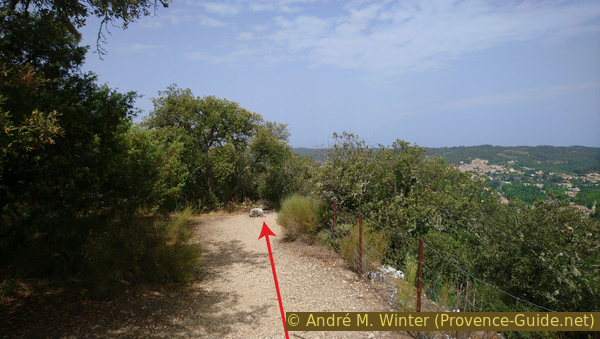
The starting point is about 100 meters after the road begins to climb. It is on the left, therefore on the north. The only landmark is the signpost in the photo.
We first follow yellow and red markings, these mark the Grande Randonnée de Pays trails around the Lac d'Esparron.
No reproduction is permitted without the written consent of the author. (id6303)
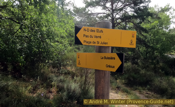
Signpost at the hike start
As the arrow on the signpost indicates, one takes the path to the left, but it then turns right again.
No reproduction is permitted without the written consent of the author. (id1140)
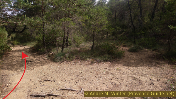
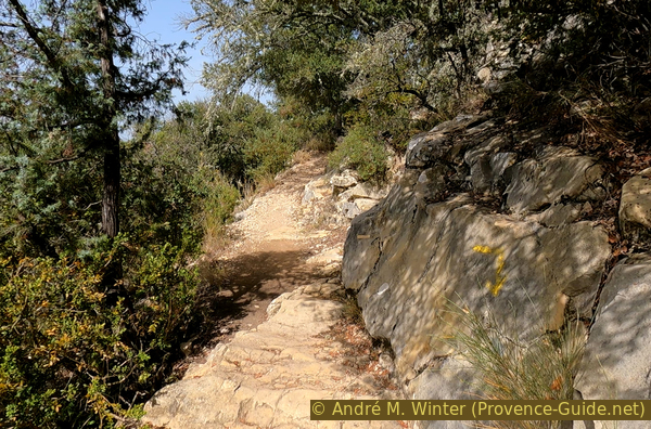
Bifurcation in front of Ravin de la Vallée Obscure
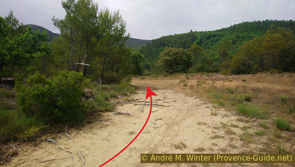
We walk in a wooded plain of pines and oaks. The path remains straight to the north for 60 meters.
No reproduction is permitted without the written consent of the author. (id1149)
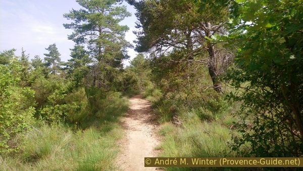
Path in the plain south of Notre-Dame des Œufs chapel
We arrive on paths that go to the left, one of these will serve us for the return. We stay however on the main track on the right. It begins to rise without transition.
The continuation marks almost all the elevation gain of the tour. Higher follow small turns.
No reproduction is permitted without the written consent of the author. (id1607)
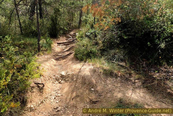
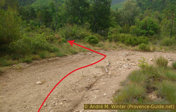
Way up south of Notre-Dame des Œufs chapel
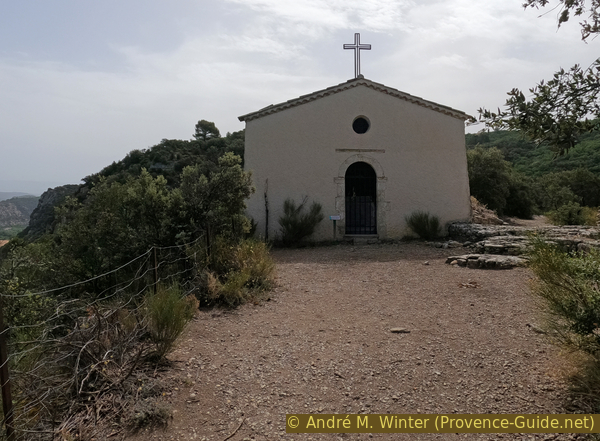
You arrive on a flat rocky strip where you turn left. We see nothing yet, but we arrive in a short time at the chapel.
No reproduction is permitted without the written consent of the author. (id1655)
Path towards Notre-Dame des Œufs chapel
Here we are at the chapel. The interior is quite empty. But the story about the place is quite interesting.
The chapel in its current state seems to date from the 17th century because it hat been mentioned under the name of Notre-Dame d'Aurafrède. The hamlet south of the bridge over the Verdon still bears this name.
No reproduction is permitted without the written consent of the author. (id1828)
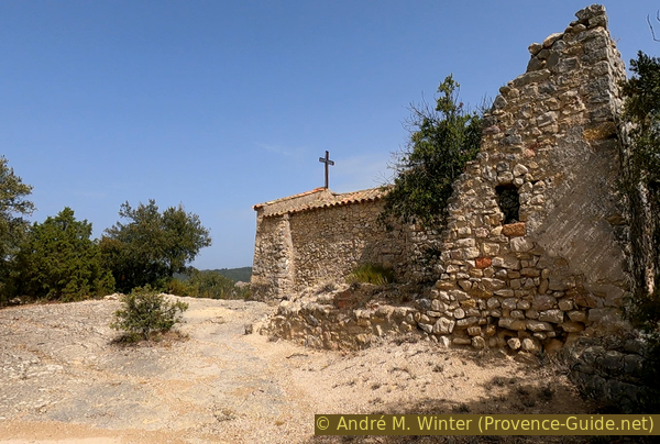
Notre-Dame des Œuf chapel and the ruin of the hermitage
Without this being documented, the popular tradition affirms that it is a very old shrine to which a pagan cult of fertility remains attached.
Women wishing to have a child went up to the chapel with an egg in each hand. The eggs, symbols of fertility, had to arrive intact. When they reached the chapel, the women swallowed one of the eggs and buried the other at the foot of the chapel. On 8 September, the day of the Nativity of the Virgin, they returned to dig up the egg. A country meal, consisting mainly of egg preparations, punctuated these two ceremonies.
When you see the natural forecourt of the chapel, you doubt very much the possibility of burying eggs.
Traditionally, a pilgrimage to this chapel took place on Easter Monday.
No reproduction is permitted without the written consent of the author. (id6327)
Chapelle Notre-Dame des Œufs
A hermitage attached to the chapel was inhabited by successive religious hermits from 1676 to the end of the 19th century. It is now collapsed.
No reproduction is permitted without the written consent of the author. (id2174)
Ruin of the hermitage at Chapelle Notre-Dame des Œufs
Section 2: Notre-Dame des Œufs - Route du Lac
➙ 1 km ... 25 min ➚ 0 m ➘ 85 m ↝ difficult
35% moderate trails, without marks
25% easy trails, without marks
20% cross country, without marks
20% easy trails, few marks
The clues
- Notre-Dame des Œufs chapel, 430 m
- Shooting range, 345 m
- Route du Lac, 345 m
Return by an unmarked path and trackless section. The shooting range is historic and ruined.
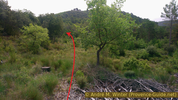
We leave the chapel behind us and walk along a fence towards the trees and in a westerly direction. This fence also closed the forecourt at this place, but it is now completely lowered and trampled.
Beyond continues a good path along the rest of the western ridge.
No reproduction is permitted without the written consent of the author. (id2848)
Plateau of Notre-Dame des Œufs and Gréoux
It doesn't last long and the descent gets steeper. It's steep as the climb. The path makes a few switchbacks before continuing downhill. We're still walking westwards.
No reproduction is permitted without the written consent of the author. (id4781)
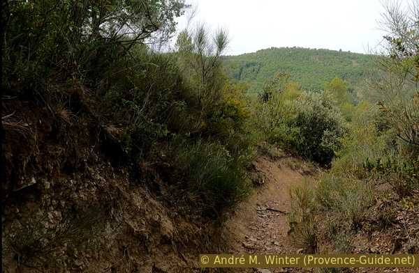
Path down west of Notre-Dame des Œufs chapel
Arriving in the plain, the path is crossed by various trails of wild animals. We always keep the west direction. Little by little we turn in a south-westerly direction, therefore to the left.
No reproduction is permitted without the written consent of the author. (id5543)
Path down from Notre-Dame des Œufs chapel
At times, we see the old city under the castle of Gréoux-les-Bains. Here on the plain, it's the last time though.
No reproduction is permitted without the written consent of the author. (id1009)
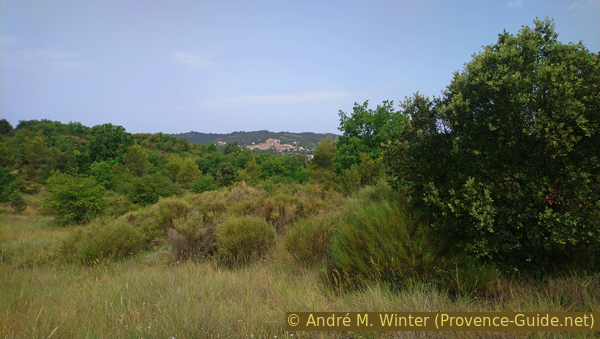
View to Gréoux les Bains
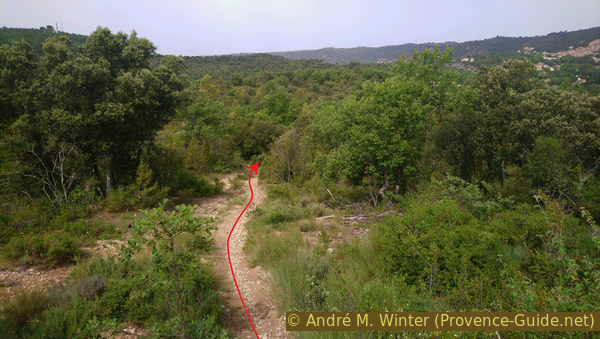
The path gains in width and forming a long bend to the left, it turns into a forest road. Inside the bend was in 2022 a cross formed by two branches.
No reproduction is permitted without the written consent of the author. (id2754)
Curve in the plain south-west of Notre-Dame des Œufs chapel
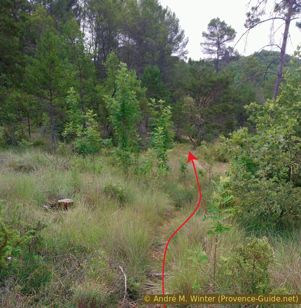
In the following right turn, you go straight into the sparse pine forest to the left. The area seems to have been cleared in 2021. We walk along the remaining large trees on the left at some distance.
There is no path here, you have to pass between the boxwood and the heather which will undoubtedly grow back. Long pants are recommended.
No reproduction is permitted without the written consent of the author. (id2710)
Turn left on right bend
We pass a first group of older trees on the left and aim for another similar group further ahead.
No reproduction is permitted without the written consent of the author. (id2676)
Wayless to the east
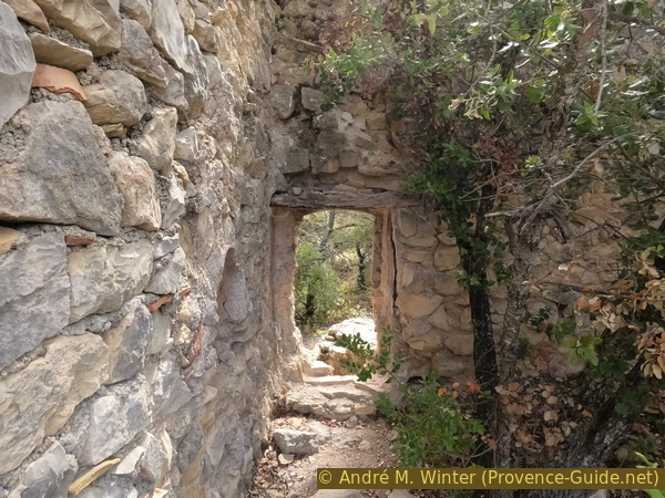
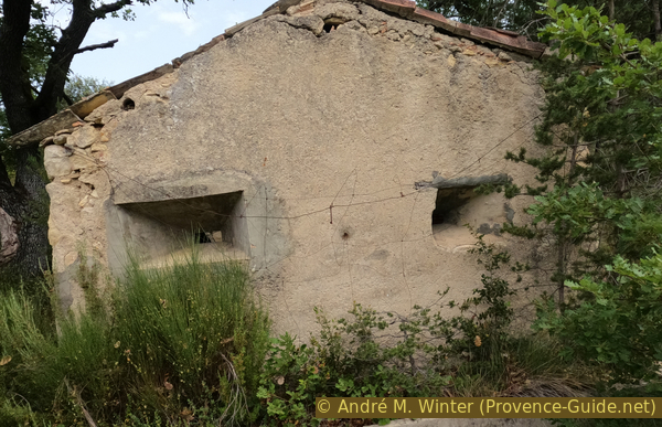
Not even 90 meters after leaving the bend of the forest road, we see the ruin of a small house under a large oak tree. It seems too small to have been a dwelling.
No reproduction is permitted without the written consent of the author. (id2002)
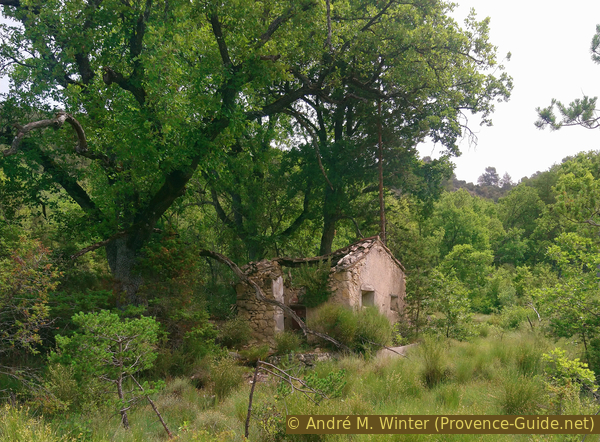
Ruined hunter shooting range
On all the faces open to the plain are small openings that look like embrasures.
No reproduction is permitted without the written consent of the author. (id6255)
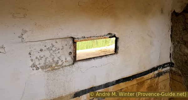
Loophole of the shooting range
Seen from the inside, these embrasures could be closed by a sort of sliding shutter.
No reproduction is permitted without the written consent of the author. (id6256)
Loopholes of the shooting range
The small single room also had a fairly well-shaped fireplace. It is covered with marble and a slab of earthenware shows a hunting scene.
The walls are painted yellow. A cupboard is still visible. This hunter's shelter was quite luxurious. The roof beams and the lintel of the door are rotten and the little house is collapsing.
No reproduction is permitted without the written consent of the author. (id218)
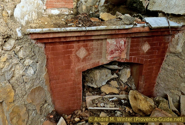
Open fireplace in the shooting range
We arrived at the shelter for hunters on the side of the door of the ruin, we leave it now almost at a right angle, that is to say leaving the face with the two embrasures in our back.
We almost aim for the green hill visible in the photo at the top right and we approach the tall pines further ahead on the left.
No reproduction is permitted without the written consent of the author. (id6301)
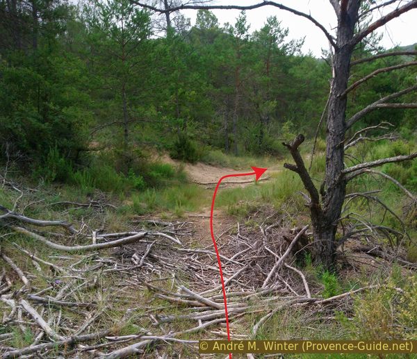
Path in the plain south of the shooting range
We return to the beginning of the path of the climb to the chapel, specifically where the climb began.
We take right here to return to the starting point.
No reproduction is permitted without the written consent of the author. (id6302)
The path reaches the way up
Sources and additional information
It is better to use a good topographic hiking map: this tour is on the IGN map "Gréoux-les-Bains", scale 1:25000, 3343OT.
If you don't want to bother with a paper map, you can also use mapping apps on your cell phone. On the one hand, it is the Cartes IGN app from the official map service. However, it requires access to the data network and this is sometimes difficult in canyons or remote locations.
Alternatively, you can use apps that store data directly on the device. They're generally not free, but they don't cost much. We mainly use OSMAnd, here it is possible to add contour lines, relief shading, markings and others. To store this data on your phone you need a lot of space.
Of course, one needs access to satellites for the GPS signal with any app. In some canyons this is not the case. Therefore, do not rely on the position shown, but read the map on your phone as you would read it on paper. Most apps are available for Android and iPhone. The applications usually allow us to record the route travelled and also view the GPS files offered for each of our hikes.
This page has been seen 2265 times since 20 March 2024.
No reproduction is permitted without the written consent of the author. (id6328)
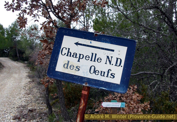
Sign Notre-Dame des Œufs
This sign can be found on Col du Défens saddle where passes the road to St. Julien beach.