Tour du Cousson starting in Entrages
A chapel and a lot of panoramic views
hike
easy
3 h 45 min
no
yes
no
mountain
Introduction
Rarely do peaks below 2000 metres offer so much panorama and very different paths. The Cousson overlooks the town of Digne-les-Bains and borders the Bléone and Asse valleys. The mountain has another special feature: it has two peaks of about the same height, although the northern peak seems higher. The main tour described here is limited to the south summit, which offers a more complete view of the valleys. A crossing of the north summit is also outlined.
The facts
12,3 km total distance
3 h 45 min walk time
740 m total elevation
orientation easy
mark 100% of the total distance
80% easy trails
15% dirt roads
5% forest roads
dangers exposed sections
children yes, but it's long
useful picnic stuff
required hiking boots, hiking equipment and water
GPS coordinates (WGS84) of start and end point 44.045626,6.265484
downloads ![]()
![]()
Public transport
There are no public transports that reach the starting point. The last reachable point is Digne-les-Bains. Local buses only go into the valleys and don't really get you anywhere useful. The easiest way is to take a taxi, it is a 10 kilometres and 20 minutes journey.
It is possible to do the tour directly from Digne-les-Bains. From the large roundabout, continue towards Les Thermes, but take the first right onto Avene François Cuzin towards Piscine. After 150 meters there is a steep road on the left, this is the Chemin du Causson, there is a signpost at the top. This access alternates between forest roads and easy paths and is marked as GR406. In addition 230 meters of ascent and an hour of walking (if you return to Digne without going down to Entrages).
Access by car
Digne-les-Bains is in a valley parallel the Durance valley, this central place is signposted everywhere. In the town itself, at the large roundabout, head towards Les Thermes. We come into a valley south-east of the city. Follow the signs to the village of Entrages and drive through it.
Useful parking spaces
Free parking spaces for hikers are located at the end of the village behind the church.
No reproduction is permitted without the written consent of the author. (id6320)
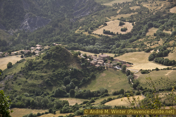
View on Entrages
No reproduction is permitted without the written consent of the author. (id6325)
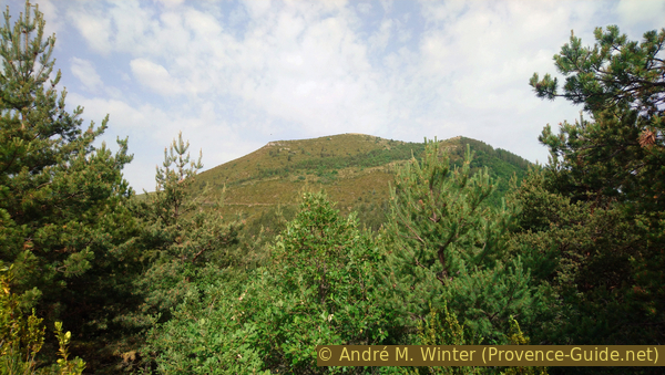
Saint-Michel de Cousson seen from Vallée de l'Asse
Hints
This is a panoramic tour, it is better to choose a day with good views and dry air. Avoid foggy and windy days.
The access to the north summit of the Cousson is described alternative below, this means an additional ascent of 125 metres.
The whole region is a zone with a high risk of forest fires. In summer, but also in other seasons when it is very dry or by strong winds, access to the forest areas can be regulated. As a result, the roads may be closed to traffic and/or the trails prohibited to hikers. Current information: Access map to the forests of Alpes de Haute Provence (only french). The map shows the colours green, yellow, orange and red which correspond to levels of danger.
The sections
- Entrages - Pas d'Entrages saddle
- Pas d'Entrages saddle - St. Michel chapel - Le Cousson south
- Le Cousson south - Col des Estourons saddle - Hautes Bâties de Cousson
- Hautes Bâties de Cousson - Ravin de Richelme - Pas d'Entrages saddle
- Pas d'Entrages saddle- Entrages
Section 1: Entrages - Pas d'Entrages
➙ 1,9 km ... 35 min ➚ 255 m ➘ 0 m ↝ with marks
50% dirt roads, few marks
50% easy trails, with marks
The clues
- Entrages, 962 m
- Pas d'Entrages saddle, 1215 m
This is the main part up.
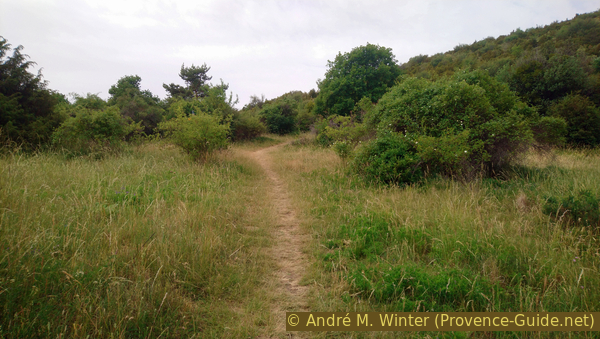
We leave the village behind and walk west uphill on a farm track.
No reproduction is permitted without the written consent of the author. (id6286)
Start in Entrages
At the only notable fork in the road, we turn left and stay uphill. Further up we pass the Ravine des Houerts.
No reproduction is permitted without the written consent of the author. (id6287)
First branching off above Entrages
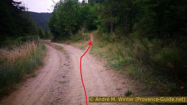
The gravel road gets lost in a field around 1050 metres above sea level. Our path continues in the same direction and stays uphill. The trees don't really provide shade.
No reproduction is permitted without the written consent of the author. (id6288)
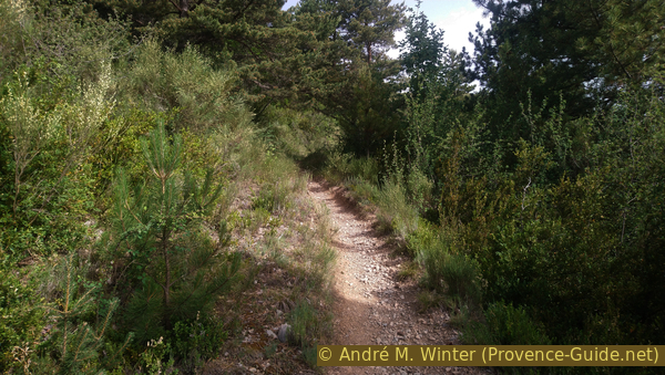
Path upwards to Pas d'Entrages saddle
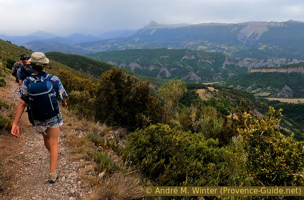
After half an hour of walking, we change direction at the only hairpin bend in this path. This allows us to see back to the starting village and to the south.
No reproduction is permitted without the written consent of the author. (id6289)
View to Entrages and Col de Pierre Basse saddle
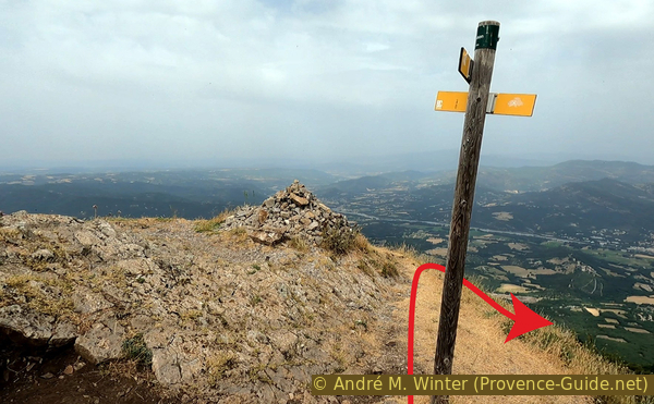
Five minutes later, we are in the Pas d'Entrages saddle. We are in a low forest which obstructs all view. It is a junction, we keep the direction to the south, that is to the left.
No reproduction is permitted without the written consent of the author. (id6326)
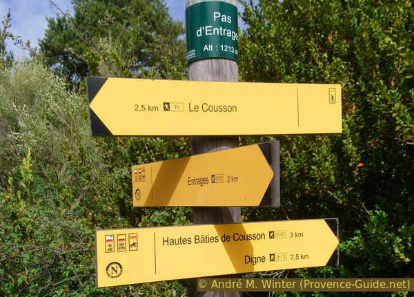
Signpost on Pas d'Entrages saddle
Section 2: Pas d'Entrages - Le Cousson
➙ 2,5 km ... 55 min ➚ 330 m ➘ 35 m ↝ with marks
100% easy trails, with marks
The clues
- Pas d'Entrages saddle, 1215 m
- Le Merle, 1400 m
- St. Michel de Cousson chapel
- Le Cousson south, 1512 m
A final climb, then a plateau with a lot of view and a fairly exposed chapel.
The climb remains constant beyond the Pas d'Entrages saddle. Now we are walking on a ridge.
No reproduction is permitted without the written consent of the author. (id6290)
Path upwards above Pas d'Entrages saddle
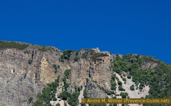
Every now and then we see a mountain to the left through the trees. This is the main summit of the Cousson, the mountain we are going around.
No reproduction is permitted without the written consent of the author. (id6291)
Sommet de Cousson
At 1285 metres height, the ridge rises more directly, shortly after, we pass on the western slope to arrive in a grassy and flat pass called Le Merle. Follow the sign to the Sommet du Cousson another twenty meters in the same direction. The path then turns right.
No reproduction is permitted without the written consent of the author. (id6292)
Path on the Prés du Merle meadows
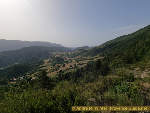
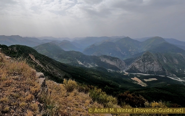
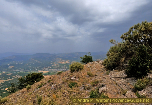
We've done most of the ascent, now we just have to head west on the slightly hilly plateau. In the south, on the other hand, the abyss of the Vallée d'Asse lies more than 800 meters below. In the background are the mountains and ridges north of the Verdon.
No reproduction is permitted without the written consent of the author. (id6293)
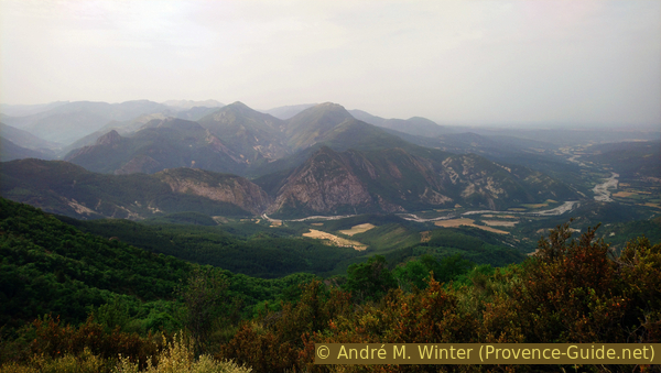
Clue de Chabrières and Vallée de l'Asse
We quickly see a small chapel on the left, but also a large hole between us and the small building. It is in fact necessary to go past the chapel before going downhill to reach it. You will also come across the distant bell tower and the cross beforehand.
No reproduction is permitted without the written consent of the author. (id6295)
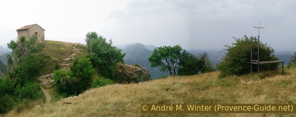
Cross, bell and St. Michel de Cousson chapel
A chapel has been attested here since 1035, but it is not the one we see today. The actual one was built in the 17th century and renovated several times. It has an almost perfectly square floor plan.
The chapel is open and people leave some ex-votos there. It can be used as a shelter in case of bad weather. Please close the door tightly when leaving to preserve the building.
No reproduction is permitted without the written consent of the author. (id6296)
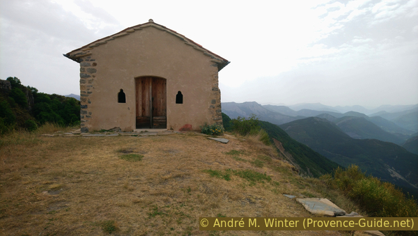
St. Michel de Cousson chapel
The natural forecourt of the chapel lends itself to a break. We admire the same panorama and we believe we see the sea in the distance.
No reproduction is permitted without the written consent of the author. (id6297)
Clue de Chabrières as seen from the chapel
To the south-west flows the Asse river towards the Durance. It is also the most probable direction to see the sea by excellent weather, even if this remains very theoretical.
No reproduction is permitted without the written consent of the author. (id6298)
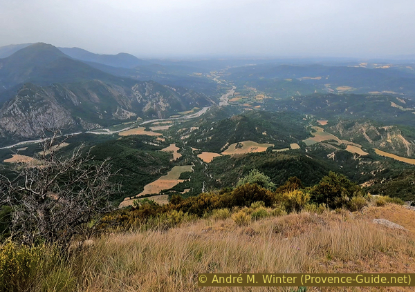
Vallée de l'Asse near Mézel
We go back up from the chapel to the path and continue our trek in a westerly direction. The terrain remains very similar and slightly uphill.
The photo shows the back view, we recognize the chapel to the right of the centre of the photo.
No reproduction is permitted without the written consent of the author. (id6299)
View back on the meadows and the chapel
The highest point of Cousson south is quickly reached. It is closer to the abyss than the rest of the way. Only a cairn and a signpost mark the summit.
The place is windier than at the chapel.
No reproduction is permitted without the written consent of the author. (id6300)
Le Cousson south summit
Section 3: Le Cousson - Hautes Bâties
➙ 3,2 km ... 1 h ➚ 10 m ➘ 455 m ↝ with marks
100% easy trails, few marks
The clues
- Le Cousson south, 1512 m
- Les Estourons, 1410 m
- Pas de Boudillon saddle, 1355 m
- Hautes Bâties, 1080 m
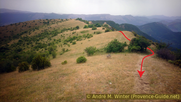
We begin the great descent of more than 400 meters. We pass a curious artistic installation.
The descent of Le Cousson is quite rough, the path is in a straight line, however, we would like to make hairpins. In front of us is the Sommet de Cousson north, we will go around it on the left (west).
No reproduction is permitted without the written consent of the author. (id6304)
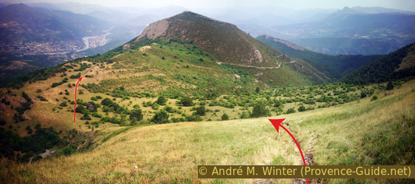
View to the main Sommet de Cousson
During the summer of 2019, the work called Le Col du Deuxième Jour (Second Day Pass) by Richard Nonas was installed at the Col des Estourons saddle. It is an alignment of seventy-seven oak beams. The work is 90 meters long and marks the pass between the two peaks of Le Cousson. Richard Nonas was an American sculptor (1936 to 2021).
No reproduction is permitted without the written consent of the author. (id6305)
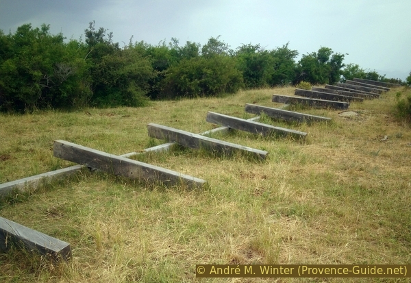
Beams by Richard Nonas on Col des Estourons saddle
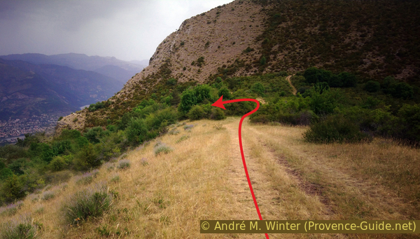
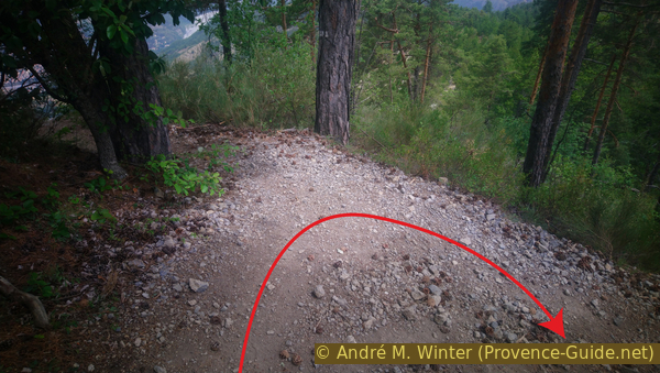
After the beams, you either stay on the rounded ridge or on the lower path to the right. Both lead into a wooded pass with a signpost. Here left and downhill to stay on the main path described here.
If you follow the path to the right and turn immediately left at the next bend, you can climb the Sommet de Cousson North, which is four metres higher than the Cousson South. The path crosses the south ridge and then turns towards the summit. Then we proceed on the north ridge in the direction of the antenna and descend there in hairpin bends. Follow the two hairpin bends in the forest path under the antenna and the long left turn. Leave the path at the next curve and descend steeply north, turn left at the only junction, then right on the main path and continue downhill north. 125 metres more in altitude. The route is on the map of this page and also included in the downloadable GPS/KML files.
No reproduction is permitted without the written consent of the author. (id6306)
Access to Pas de Boudillon saddle
The Pas de Boudillon saddle is a rock on the left. Here is the rockiest passage of the tour.
No reproduction is permitted without the written consent of the author. (id6307)
Path on Pas de Boudillon saddle
We pass under the cliff forming the Sommet de Cousson North. The path goes up a few times, but we remain mainly downhill.
No reproduction is permitted without the written consent of the author. (id6308)
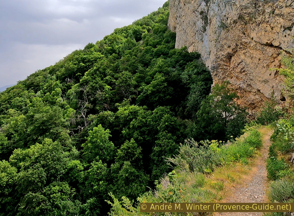
Path west under Sommet de Cousson rock wall
You don't have to climb the Sommet de Cousson North to see Digne-les-Bains, you can see the town very well along this path west of the summit.
No reproduction is permitted without the written consent of the author. (id6309)
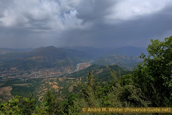
La Bléone river and Digne les Bains
We therefore circumvent Sommet de Cousson without really changing direction. Further north, we pass on a wooded ridge and the descent becomes gentler. This is also the time when the path from the alternative via the north summit rejoins the main route.
No reproduction is permitted without the written consent of the author. (id6310)
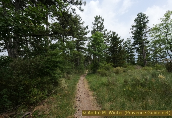
Path on the ridge south of Hautes Bâties de Cousson
Further ahead, the path becomes more irregular and steep. It also does some short switchbacks. We can see through the trees that the western slope of our ridge is massively eroded.
No reproduction is permitted without the written consent of the author. (id6311)
Hairpin bend down
We often see this type of erosion in the Alps around Digne. Even if it looks sad, the cause is not always human fault. The geological lime marl layers are sometimes very unfavourable for any vegetation settlement.
No reproduction is permitted without the written consent of the author. (id6312)
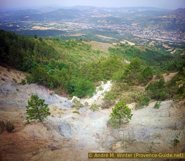
Erosion south of Hautes Bâties
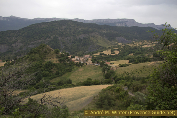
The path leaves the ridge to the right and leads to a large crossroads with a ruin, a source of drinking water, picnic tables and some very tall trees that have taken advantage of the water available here. We are at the Hautes Bâties de Cousson, a long-abandoned forest farm.
We are here on the classic hiking route from Digne to Le Cousson.
No reproduction is permitted without the written consent of the author. (id6313)
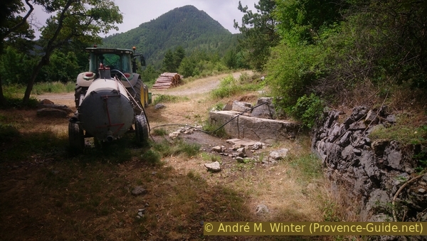
Spring tapping at Hautes Bâties de Cousson
Section 4: Hautes Bâties - Pas d'Entrages
➙ 2,8 km ... 40 min ➚ 130 m ➘ 0 m ↝ with marks
10% forest roads, few marks
45% easy trails, few marks
15% forest roads, few marks
30% easy trails, few marks
The clues
- Hautes Bâties, 1080 m
- Ravin de Richelme, 1050 m
- Leaving the ravine, 1160 m
- Pas d'Entrages saddle, 1215 m
A shaded ascent back to the first pass of the tour.
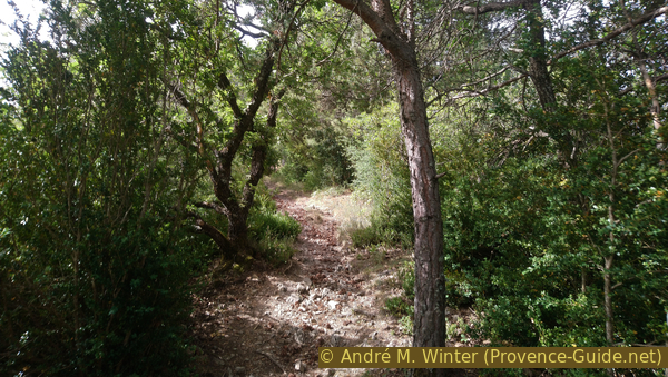
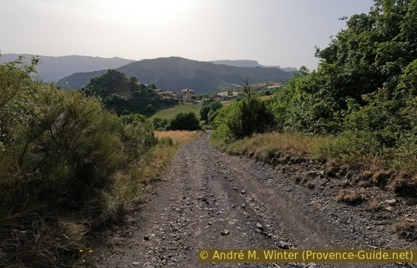
We now take the direction towards the north and the left forest track which is slightly downhill.
No reproduction is permitted without the written consent of the author. (id6314)
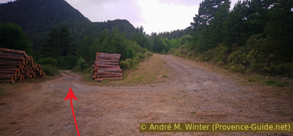
Forest roads at Hautes Bâties
Not even five minutes later, we take the path to the right of the forest track. It first runs along the track, but shortens it by entering directly into the Ravine of Richelme.
No reproduction is permitted without the written consent of the author. (id6315)
Path above the forst road south of Hautes Bâties
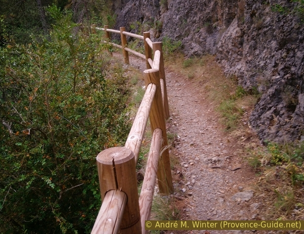
This path is quite flat, but partly built in the cliff. This is the old path between Digne, Entrages, Barrême and Castellane.
No reproduction is permitted without the written consent of the author. (id6316)
Path north-east under Sommet de Cousson
It is clear that the Hautes Bâties must have been inhabited. In the Richelme Ravine, which widens higher, are meadows full of cherry trees of all ages. They don't have a lot of fruit per tree, but one could have a good harvest here. These are very light cherries that are very ripe and sweet as they are in the photo taken on 21 June 2022. We are here at around 1100 meters above sea level though.
No reproduction is permitted without the written consent of the author. (id6317)
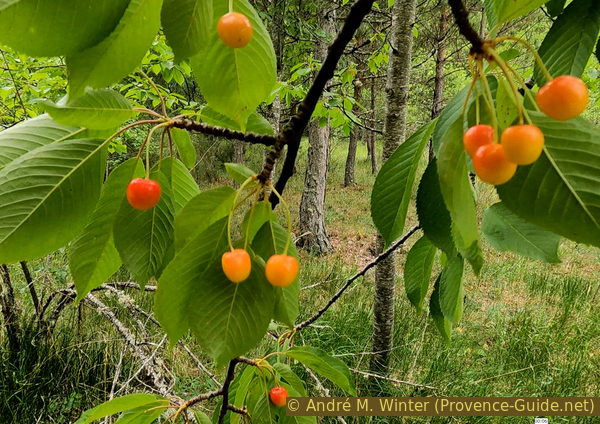
Wild cherries in Ravin de Richelme valley
The Ravin de Richleme would continue to climb towards the Col des Estourons where we passed in section 3, but without a path. A cairn and a mountain bike marker mark the place where we must turn left and go up towards Pas d'Entrages saddle.
When you arrive on the ridge, the path turns right again to fall back on the crossing that we know from the climb.
No reproduction is permitted without the written consent of the author. (id6318)
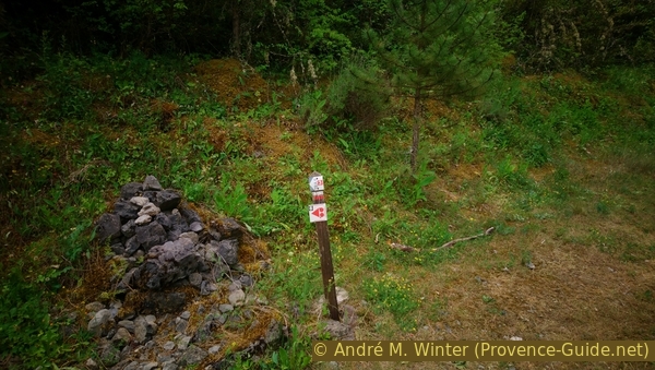
Mark in Ravin de Richelme valley
Section 5: Pas d'Entrages - Entrages
➙ 1,9 km ... 30 min ➚ 0 m ➘ 255 m ↝ with marks
50% easy trails, with marks
50% dirt roads, few marks
The clues
- Pas d'Entrages saddle, 1215 m
- Entrages, 962 m
The last part takes the way we stared on.
At Pas d'Entrages saddle, we turn left and descend towards the one and only bend in this path.
You can see that it is a tour very popular with the locals, you are never alone.
No reproduction is permitted without the written consent of the author. (id6319)
Hiker under Pas d'Entrages saddle
Descending, we see almost constantly towards the village of Entrages leaning against its hill.
No reproduction is permitted without the written consent of the author. (id6324)
View on Entrages
So we return to our starting point.
No reproduction is permitted without the written consent of the author. (id6321)
Descent to Entrages
Sources and additional information
It is better to use a good topographic hiking map: this tour is on the IGN map "Digne-les-Bains, Sisteron, Les Mées", scale 1:25000, 3340ET.
If you don't want to bother with a paper map, you can also use mapping apps on your cell phone. On the one hand, it is the Cartes IGN app from the official map service. However, it requires access to the data network and this is sometimes difficult in canyons or remote locations.
Alternatively, you can use apps that store data directly on the device. They're generally not free, but they don't cost much. We mainly use OSMAnd, here it is possible to add contour lines, relief shading, markings and others. To store this data on your phone you need a lot of space.
Of course, one needs access to satellites for the GPS signal with any app. In some canyons this is not the case. Therefore, do not rely on the position shown, but read the map on your phone as you would read it on paper. Most apps are available for Android and iPhone. The applications usually allow us to record the route travelled and also view the GPS files offered for each of our hikes.
This page has been seen 1931 times since 20 March 2024.