The Terrain Vermicel cave in Vins-sur-Caramy
A historic centre of the Resistance in the Var
scramble
difficult
1 h 30 min
no
yes
no
mountain
Introduction
The Département Var hinterland is home to many places where the Resistance against the Nazi German occupiers was highly active. Most of these activities were thwarted by the German war machine and the Gestapo, often with the help of French collaborators. This was also the case here. However, the operations were not a failure, as an airfield was built on the Terrain Vermicel to transport Allied weapons. The human cost was nevertheless heavy.
We pass by the various memorial stones and explore the cave where weapons and Resistance fighters were hidden.
The facts
5,2 km total distance
1 h 30 min walk time
180 m total elevation
orientation average, difficult inside the cave
mark 45% of the total distance
35% forest roads
30% easy trails
25% hard-surfaced quiet side streets
5% parks
5% hard-surfaced country road
<5% trail through a cave
<5% hard-surfaced roads without motorized traffic
dangers karst terrain
children yes, but with supervision
useful picnic stuff
required Torch, hiking boots, hiking equipment and water
GPS coordinates (WGS84) of start and end point 43.43203023183718,6.142409925382137
downloads ![]()
![]()
Public transport
There are public buses connecting Vins-sur-Caramy to Brignoles, Correns, Carcès and Cotignac. These are school bus routes open to the public, but they do not run at weekends. The routes are SR103 and SCO203. Check Zou! (only french) for timetables by searching for Vins-sur-Caramy.
Access by car
We are in the Var hinterland, in a valley running parallel to the one through which the A8 motorway passes. Whether you are coming from Nice or Marseille, in both cases take the Le Val and Brignoles exit from the motorway. At the next roundabout, turn left towards Le Val. The following roundabout is important: take the third exit towards Vins. There is only a small sign and it looks like the entrance to a retail park. This D24 road takes us directly to Vins-sur-Caramy. Do not enter the village, stay on the D24. After the next right-hand bend, you will come to an unmarked junction. Here is a car park under the road on the right. This is the starting point.
Useful parking spaces
There is a car park to the south of the village, below the D24 road and opposite the medieval bridge. If this car park is full, continue eastwards along the D24. Opposite the other entrance to the village, there are further large car parks on the right. You are now in section 3 of the walk, which you can just as easily start from here.
No reproduction is permitted without the written consent of the author. (id8641)
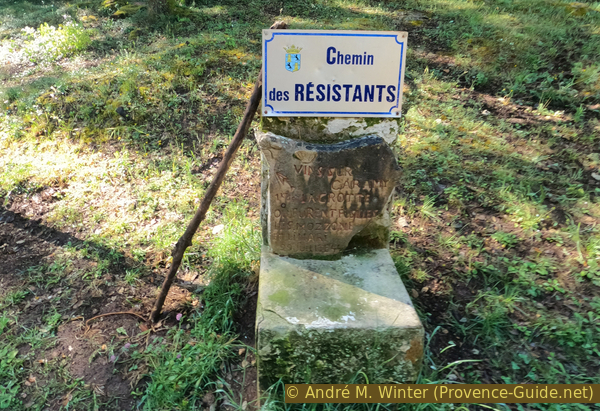
Old signpost at the start of the Chemin des Résistants
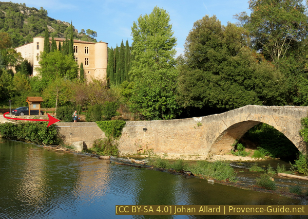
Bridge and castle at Vins-sur-Caramy
Hints
The walk is very easy. However, access to the cave becomes difficult beyond the first chamber as there is no natural light after that point. Although the route is clear, it is easy to panic on the way back as you may not recognise the path. This is common to all caves and is mainly due to the fact that you are walking with a torch that does not illuminate everything. The simplest solution is to keep looking back constantly, literally with every step, to memorise the way back as you go on. If you want to be absolutely sure, you can also bring some chalk and mark the path.
We also point out that a good sense of direction in the open countryside is of no help whatsoever in a cave.
The whole region is a zone with a high risk of forest fires. In summer, but also in other seasons when it is very dry or by strong winds, access to the forest areas can be regulated. As a result, the roads may be closed to traffic and/or the trails prohibited to hikers. Current information: Map of access to the forests of the Var (also english). The map shows the colours green, yellow, orange and red which correspond to levels of danger. The affected area is: Haut Var (3).
The sections
- Hike from Vins-sur-Caramy to Terrain Vermicel.
- Exploration of Savoye Cave, where members of the Resistance used to hide.
- Return via Mauvais Plantier and Vins Castle.
Section 1: Vins-sur-Caramy - Terrain Vermicel
➙ 2 km ... 35 min ➚ 130 m ➘ 5 m ↝ average
5% easy trails, few marks
5% hard-surfaced roads without motorized traffic, with marks
75% forest roads, few marks
15% easy trails, few marks
The clues
- Car park at the old Vins Bridge, 185 m
- Monument on the Terrain Vermicel track, 315 m
- Savoye Cave, 305 m
Basically, we cross the bridge and then turn left, taking always the track uphill.
The medieval bridge spans the Caramy on three arches, forming a double hump. It allowed people to cross, regardless of the river's level, to reach the woods and pastures of Les Plaines on the plateau south of the village. It is often mistakenly called the Roman Bridge, simply because the date of its construction is no longer known.
We cross this bridge because the first part of the walk lies south of the Caramy.
No reproduction is permitted without the written consent of the author. (id8592)
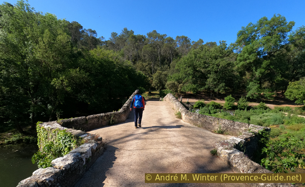
The track on the three-arched bridge known as the Roman bridge at Vins-sur-Caramy
On the riverbank, just ahead on the right, there is a well-shaded picnic bench. To the left, the Chemin des Résistants begins, and there are four small graves here.
Vins-sur-Caramy is a small, quiet village. The area is currently characterised by agriculture and holiday homes. Until the mid-20th century, bauxite was also mined in open-cast quarries, which now form two lakes. This mining activity took place in all the surrounding villages, such as Le Val, Mazauges and, above all, Tourves, where the mining museum is located.
The German occupiers, under the Organisation Todt, took over these mines and even built a railway to transport the extracted rock to Brignoles. Those who have driven along the D24 have partly followed this route. The Germans were therefore very much present in the region from 11 November 1942, when the so-called Free Zone under the collaborationist Pétain was definitively annexed. From the outset, these Germans had to contend with the Resistance fighters, who knew the area far better. The Germans hunted them down and executed them whenever they found them, one such event is the reason we are undertaking this walk today.
The four Resistance fighters who fell to German Nazi bullets in the cave we shall see later were buried here. These graves do not, therefore, mark the site of the shooting.
No reproduction is permitted without the written consent of the author. (id8640)
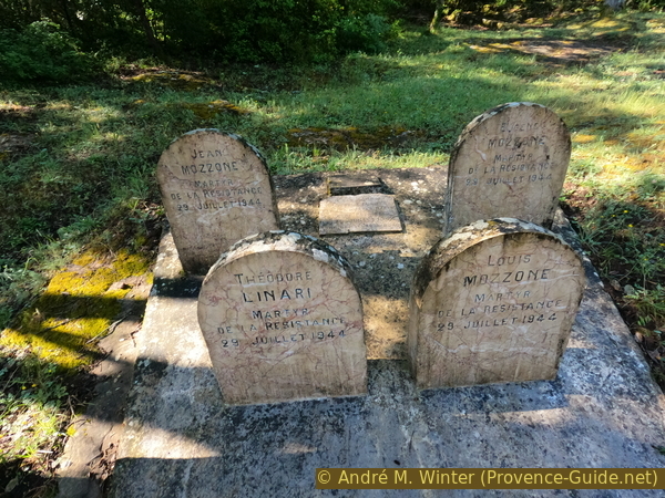
Memorial stones at the start of the Chemin des Résistants
We follow a canal running slightly above the Caramy river.
In Provence, people have always diverted river water for farming. Later on, it was used to power mills. Most of these uses have disappeared, but the canals often remain.
No reproduction is permitted without the written consent of the author. (id8549)
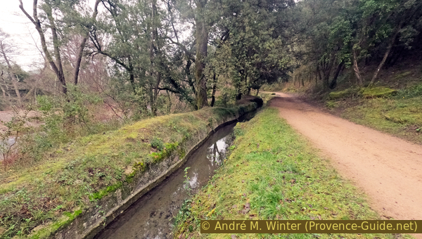
Canal on the banks of the Caramy
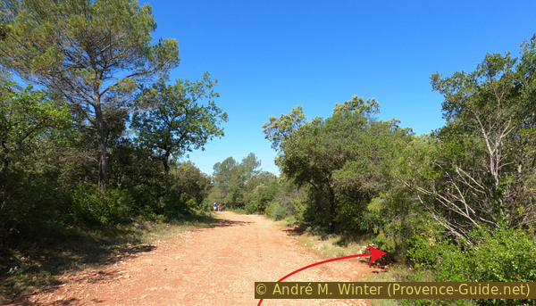
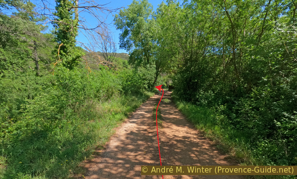
The track climbs and we reach the first fork. We keep to the right and continue uphill.
No reproduction is permitted without the written consent of the author. (id8642)
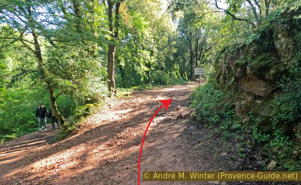
First fork in the Chemin des Résistants at Terrain Vermicel
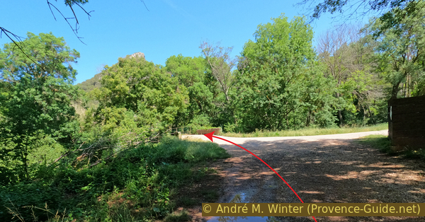
Shortly afterwards, the pattern repeats itself: we keep to the right at the fork.
The forest track continues to climb gently. It takes a few tighter bends as we cross small valleys that are barely visible due to the very dense vegetation.
No reproduction is permitted without the written consent of the author. (id8643)
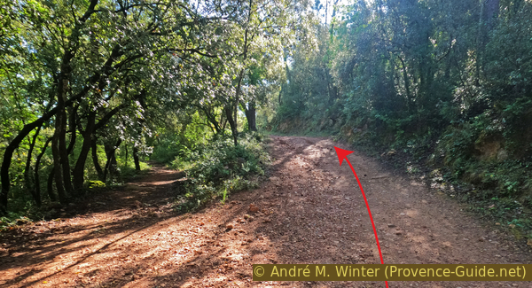
Second fork in the Chemin des Résistants at Terrain Vermicel
About 30 minutes after setting off from the car park, you come to another memorial stone. However, this is still not the site where the Resistance fighters were murdered.
The miners were organised into trade unions, toghether with the fiercely independent farmers, this hinterland was a fertile ground for the Resistance. The karstic, wooded terrain is ideal for hiding or concealing weapons. Leaflets are distributed and the bauxite mines are sabotaged. However, by 1944 the Allies are approaching and the coast is too heavily guarded by the Germans for the Resistance to operate there. They therefore withdrew to the hinterland to arm the Maquis through airdrops. The Plaines de Vins, south-east of the village, were chosen for this operation by the S.A.P. (Landing and Parachuting Section). The code name for the area was Terrain Vermicel. The airdrops began in early 1944. The Vins area was used on the night of 28-29 May 1944 to drop fifteen containers and ten packages.
These weapons and ammunition were collected under cover of darkness, transported and hidden in the Grotte de Savoye (Grotte de Savoio). Several alerts followed, and the weapons were hidden elsewhere, then returned to the same cave. At night, a landing strip was also built at Les Plaines, it is still visible as a straight line on current aerial photographs. All this went more or less to plan, the weapons were handed over to the designated Resistance groups and used in August and September 1944. The operation was completed on 16 July 1944. However, the Nazis were vindictive and still had the resources to track down the Resistance fighters and uncover the weapons caches. With the help of local collaborators, they captured four Communist Resistance fighters from Vins-sur-Caramy on 27 July 1944: Jean Mozzone and his two sons, Eugène and Louis, as well as Théodore Linari. They were interrogated at length and tortured, but they refused to reveal where the weapons had been taken. On 29 July 1944, they were taken to the cave, which was empty of weapons. Our Resistance fighters still refused to speak, and the Germans shot them on the spot. Less than a month later, on 19 August 1944, Brignoles was liberated by American troops. Their bodies were later taken to the site south of the bridge.
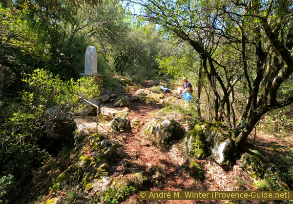
The megalith at the start of the path leading to the cave was erected in 1989 by the ANCVR (National Association of Volunteer Resistance Fighters) and the municipality of Vins-sur-Caramy. A Lorraine cross is carved into the stone.
No reproduction is permitted without the written consent of the author. (id8644)
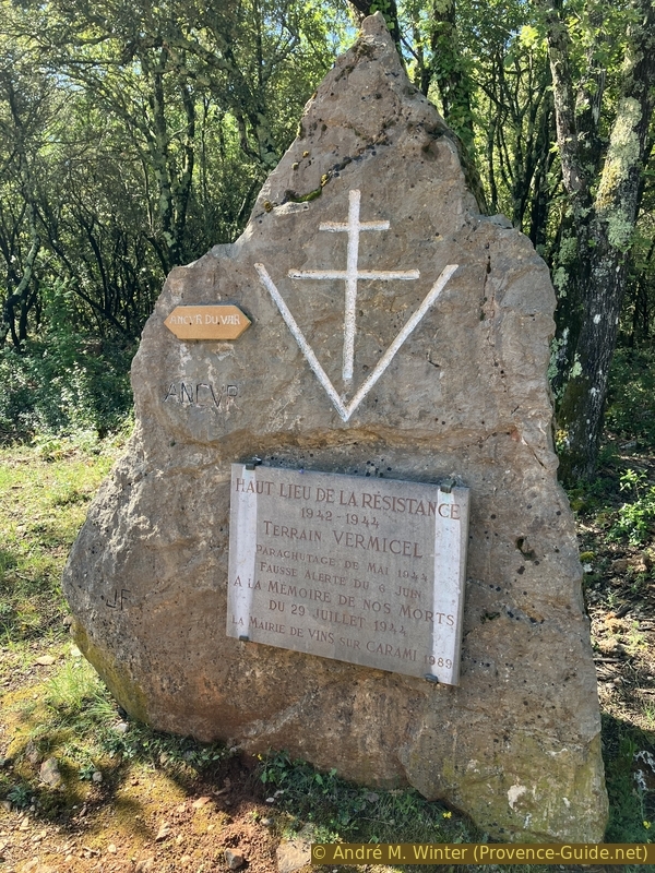
Monument honouring the Resistance at Terrain Vermicel
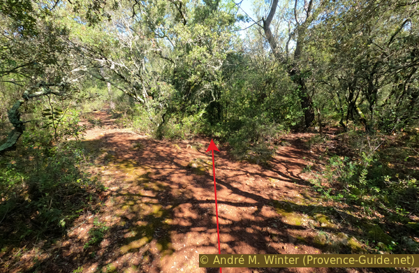
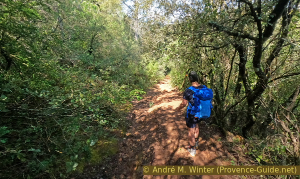
There is still a short way to go to reach the cave. The entrance to the path is before the memorial stone and before the sign on the left.
We head into the forest at right angles to the fire track. This path is almost flat.
No reproduction is permitted without the written consent of the author. (id8645)
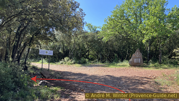
Sign and monument honouring the Resistance at Terrain Vermicel
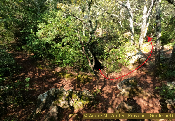
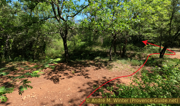
Upon reaching this fork, we find ourselves in front of the cave. The two paths form a loop around the cave entrances.
Since we are here, we explore the cave straight away.
No reproduction is permitted without the written consent of the author. (id8646)
Junction on the path in front of the Resistance Cave at Terrain Vermicel
Section 2: Grotte de Savoye
➙ 0,1 km ... 15 min ➚ 15 m ➘ 15 m ↝ very challenging
100% trail through a cave, without marks
The clues
- Entrance to Savoye Cave, 305 m
- Accessible end of Savoye Cave, 290 m
See the information above regarding safety warnings for entering the cave.
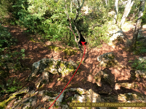
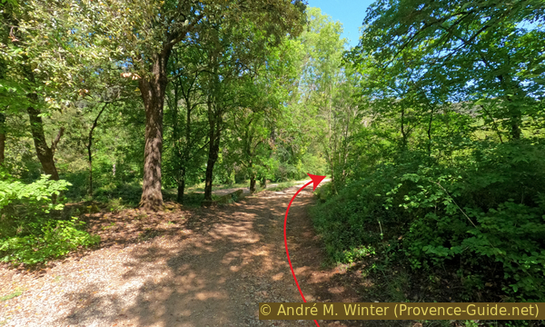
You pass through the bushes right in the middle of the fork. The path immediately leads downhill.
Up ahead, you can see the 1944 memorial through the branches of the trees and bushes. We will climb up there after exploring the cave.
No reproduction is permitted without the written consent of the author. (id8647)
In front of the entrance to the Resistance Cave at Terrain Vermicel
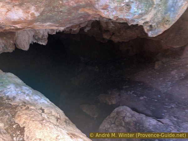
We arrive at a cave entrance. From here on, a head torch is essential. A mobile phone torch isn't enough!
No reproduction is permitted without the written consent of the author. (id8648)
The entrance to the Resistance Cave at Terrain Vermicel
The passage descends, it's still lit by a second opening and then turns to the left.
No reproduction is permitted without the written consent of the author. (id8649)
Stalactites and the second, more vertical opening of the Resistance Cave at Terrain Vermicel
The terrain is easy, but without a torch, you’d inevitably trip.
No reproduction is permitted without the written consent of the author. (id8650)
The narrow passage at the entrance to the Terrain Vermicel Resistance Cave
We are now in the completely dark part of the cave. We are heading towards the black hole, the path turns left again and narrows considerably.
No reproduction is permitted without the written consent of the author. (id8651)
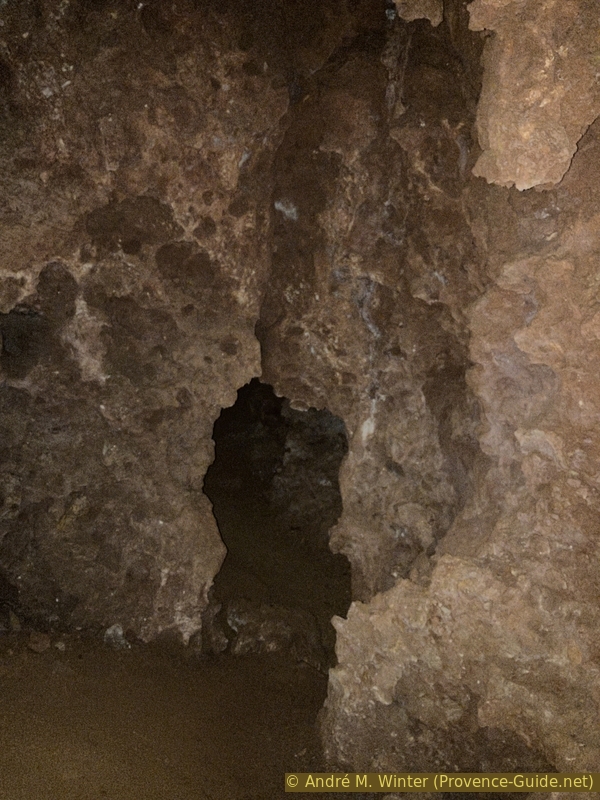
A winding passage in the Terrain Vermicel Resistance Cave
The path continues to slope steeply downwards, turning right and then left again.
The ground here is more uneven.
No reproduction is permitted without the written consent of the author. (id8652)
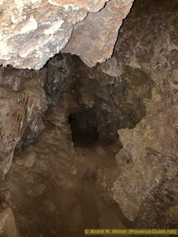
The route to the last easily accessible section of the Terrain Vermicel Cave
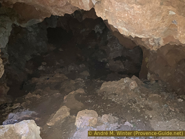
The path leads us to the right and we arrive at a flat area. So far, we can stand upright everywhere. To the right are passages that are too narrow, but there is also a low passage to the left leading to the final chamber. Watch out for a vertical hole on the left. At the end of the section accessible without climbing equipment, there is an arrow on a wall. Now is the time to head back up the same way.
Be careful, however: turn around in the final cavity where you can stand upright. You won't be able to see the way you came! You will only see a passage leading to a dead end at the top right and a very narrow, vertical hole that you should ignore. Take a step towards this hole, and you will then see the passage you came along on the right. Then climb back up the narrow passage as you did on the way down.
No reproduction is permitted without the written consent of the author. (id8653)
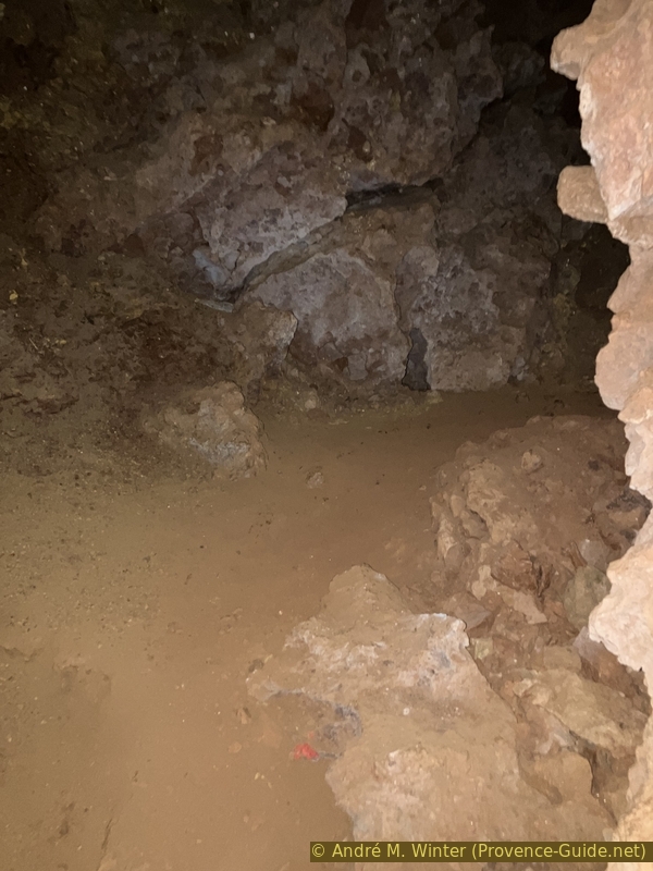
A section near the end of the Terrain Vermicel Cave
If you stand a little way back from the entrance to the cave, you will also see the memorial stone marking the site of the crime against the Resistance fighters.
No reproduction is permitted without the written consent of the author. (id8655)
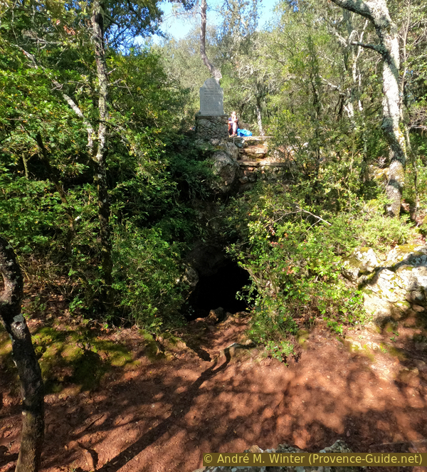
The Terrain Vermicel Resistance Cave and the monument above it
We leave the cave and turn left to walk around the small wood in an anti-clockwise direction.
No reproduction is permitted without the written consent of the author. (id8654)
In front of the entrance to the Terrain Vermicel Resistance Cave
We soon come across a small path leading to the memorial stone, which stands between the two entrances to the cave.
No reproduction is permitted without the written consent of the author. (id8656)
South of the Terrain Vermicel Resistance Cave
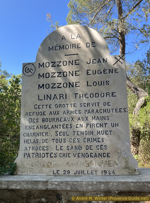
The memorial stone overlooking the cave was erected in 1944. The hammer and sickle are engraved on the stone, a reminder that the four Resistance fighters who were shot were Communists.
The text on the memorial stone reads: In memory of Jean Mozzone, Eugène Mozzone, Louis Mozzone and Théodore Linari. This cave served as a refuge for parachuted weapons. Executioners with bloodstained hands turned it into a mass grave. The only silent witness, alas! to all these atrocious crimes. The blood of these patriots cries out for vengeance. And death to the Germans. 29 July 1944.
This text must be viewed in context. In July 1944, the war was still raging in France, Europe and Asia. Only the south of France had been liberated by the summer of 1944. This explains the cry for vengeance. The words "and death to the Boches" were erased by filling in the engraved letters with light-coloured cement. This was no doubt corrected after the war. The term predates the Second World War, during which it was rarely used. It is a derivation of "alboche", a combination of "Allemand" (German) and "caboche" (stubborn/hard-headed). The term appeared around 1870 and was widely used by the French and Belgians to dehumanise the occupiers.
No reproduction is permitted without the written consent of the author. (id8657)
Memorial stone above the Terrain Vermicel Resistance Cave
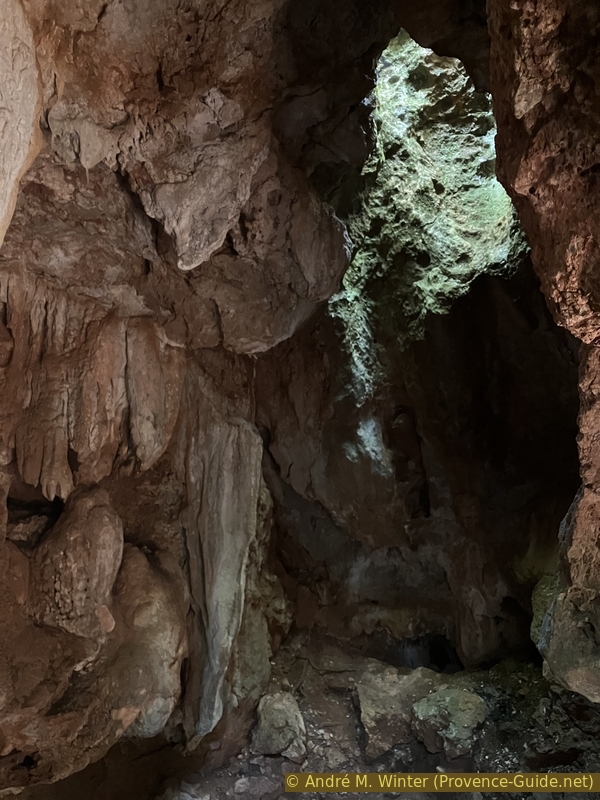
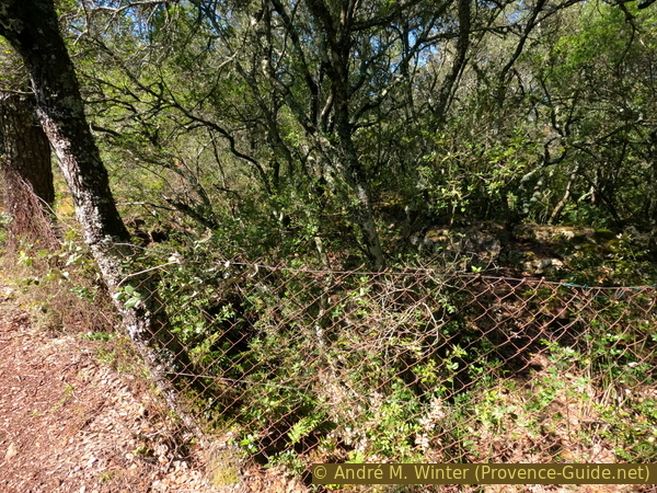
At the back of the stele is a fenced-off area. This is the almost vertical hole that forms the second opening of the cave and also lights up the first chamber.
We then retrace our steps back towards the large stele along the forest track.
No reproduction is permitted without the written consent of the author. (id8658)
The second, more vertical opening of the Terrain Vermicel Resistance Cave
Section 3: Mauvais Plantier - Château de Vins
➙ 3,1 km ... 35 min ➚ 35 m ➘ 160 m ↝ average
10% easy trails, few marks
5% forest roads, cairns
25% easy trails, cairns
10% forest roads, without marks
45% hard-surfaced quiet side streets, without marks
5% parks, without marks
5% hard-surfaced country road, without marks
The clues
- Savoye Cave, 305 m
- Monument on the Terrain Vermicel track, 315 m
- Mauvais Plantier, 190 m
- Vins Castle, 205 m
- Vins, 215 m
- Car park at the Old Bridge in Vins, 185 m
This is the way back. We descend more quickly and include a loop through the centre of the village of Vins.
As we emerge from the forest, we head less than 100 metres to the right, i.e. in the direction from which we came.
When the track curves slightly to the left, we look for a path on the right. A small cairn marks this spot.
No reproduction is permitted without the written consent of the author. (id8659)
Wide bend in the Chemin des Résistants du Terrain Vermicel track
The path descends more steeply than the forest track climbed on the way up. It is a small, clearly visible path but without any markings.
This north-facing slope is called Mauvais Plantier; the soil here is undoubtedly poor.
No reproduction is permitted without the written consent of the author. (id8681)
Path descending via the Mauvais Plantier
The path leads to a track that you need to cross. The route continues, however, slightly to the right.
No reproduction is permitted without the written consent of the author. (id8660)
Offset junction beneath the Mauvais Plantier
The new path is wider. You cross the canal seen at the start of the walk via a bridge.
No reproduction is permitted without the written consent of the author. (id8661)
The path before the bridge over the canal
You then walk directly alongside the Caramy.
No reproduction is permitted without the written consent of the author. (id8662)
The path along the banks of the Caramy
You cross the river via the first bridge on the left.
No reproduction is permitted without the written consent of the author. (id8663)
Junction before the Pont des Lonnes bridge over the Caramy
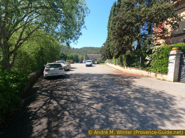
The bridge leads to some car parks and you continue in a fairly straight line towards the A-road, which you cross.
No reproduction is permitted without the written consent of the author. (id8664)
Pont des Lonnes bridge over the Caramy and the Château Vieux rock
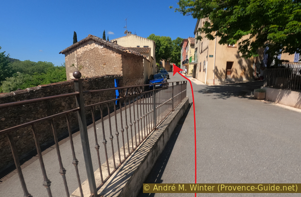
There is a pedestrian crossing to the left of the junction. You then continue to the left.
No reproduction is permitted without the written consent of the author. (id8665)
Junction with the Route de Carcès
This road initially runs parallel to the A-road and is not a particularly pleasant stretch.
No reproduction is permitted without the written consent of the author. (id8666)
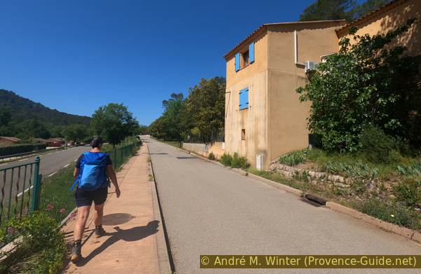
Rue des Prés du Château
About 700 metres past the junction with the county road, we can turn left towards the castle.
No reproduction is permitted without the written consent of the author. (id8667)
Rue du Château
Its four corner towers are pierced with arrow slits. It is the very epitome of a medieval fortress. But the passage of time has softened its purely defensive features: the mullioned windows, its Italian loggias and the main courtyard are in the Renaissance style.
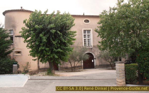
Entrance to the Château de Vins on the north façade
The castle was built in the 16th century to repopulate this abandoned land. It was sold off in ten lots during the Revolution. The castle fell into ruin, but remained standing until the early 20th century. In the 1930s, it lost its roof, and its beams and windows rotted away. The monumental fireplaces and the terracotta tiling were stripped away. Successive looting and a fire caused the main staircase to collapse. The main walls also collapsed. By 1959, only the four towers and the south façade remained standing.
The château was purchased in 1960 by a property investment company owned by three shareholders, along with 5000m² of land. They rebuilt the walls. It is now privately owned but open for concerts, tours and receptions.
Tours are available by appointment for groups of 10 or more during July, August and September, from 10am to 12pm and from 14h30 to 18h30. For further information, visit their website Château de Vins-sur-Caramy (only french).
No reproduction is permitted without the written consent of the author. (id8668)
East side of the Château de Vins-sur-Caramy
We continue along Rue du Château towards the village. We cross a bridge, then head slightly uphill.
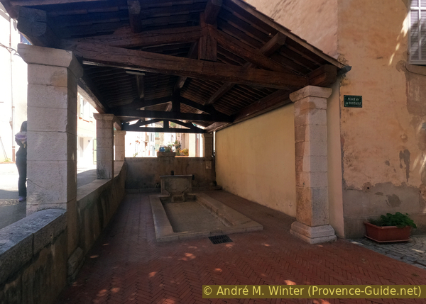
We turn right at the fifth alleyway. It's opposite the church. We walk up to the fountain and the wash house.
No reproduction is permitted without the written consent of the author. (id8669)
Arrival in the village via Rue du Château
zIn the centre of the village stand the wash house and the large fountain known as the Republican fountain. The statue of Marianne was funded by the villagers through a subscription to mark the centenary of the French Revolution.
Marianne is dressed in ancient style. She represents the goddess of Liberty, holding the Declaration of the Rights of Man and of the Citizen and a sword to symbolise justice. She wears a laurel wreath, the symbol of victory.
No reproduction is permitted without the written consent of the author. (id8670)
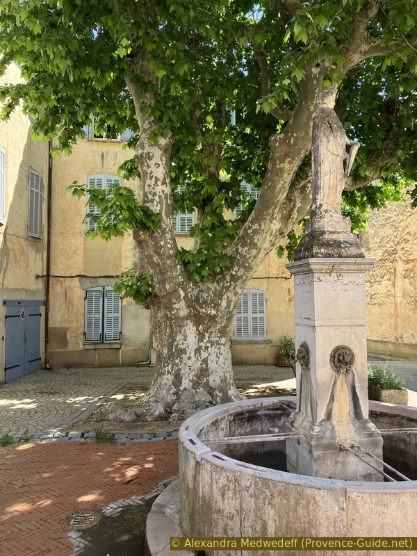
The Grande Fontaine in Vins-sur-Caramy
The wash house is very difficult to use as it is at ground level. There are places where there was no other option, but that is not the case here, the builders did not bother to make it any easier. It was left to the women to ruin their knees and backs by having to wash the laundry in this position.
Turn right twice after the wash house. You'll arrive at a small square with the central bus stop. Cross the square and turn right again. There's a bar here for refreshments.
Then head back towards the street below the center and initially return towards the castle.
No reproduction is permitted without the written consent of the author. (id8671)
The wash house in Vins-sur-Caramy
Pass under the pétanque court and cross the bridge again. Steps descend immediately after.
No reproduction is permitted without the written consent of the author. (id8672)
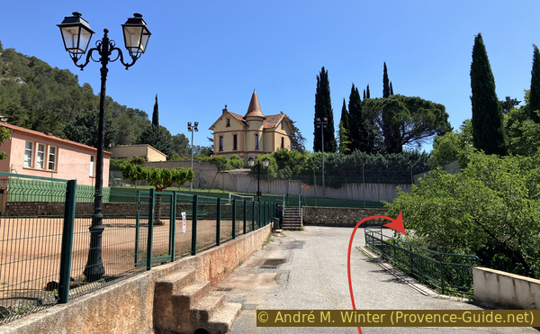
House with turret
The staircase points under the bridge, but the path quickly turns back the other way.
The bridge isn't actually a bridge, it's a structure built to fill the hollow of the valley.
No reproduction is permitted without the written consent of the author. (id8674)
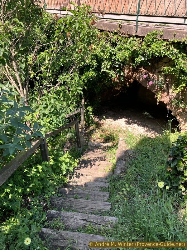
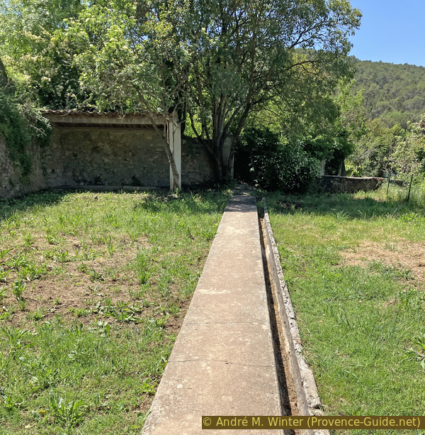
Walk down Rue du Château towards the Vallon des Adrechs
We're in the very wild Vallon des Adrechs park. Several paths intersect here. We're walking south, always downhill. So, turn right here.
No reproduction is permitted without the written consent of the author. (id8675)
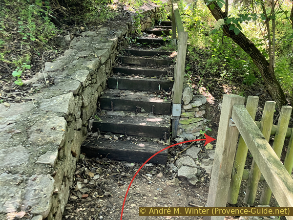
Junction in the Vallon des Adrechs
The path via the footbridge does lead to a sunny bench, but it would take us back up towards the village. So, ignore the footbridge and continue straight ahead.
No reproduction is permitted without the written consent of the author. (id8676)
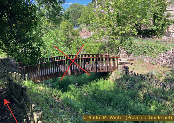
Footbridge in the Vallon des Adrechs
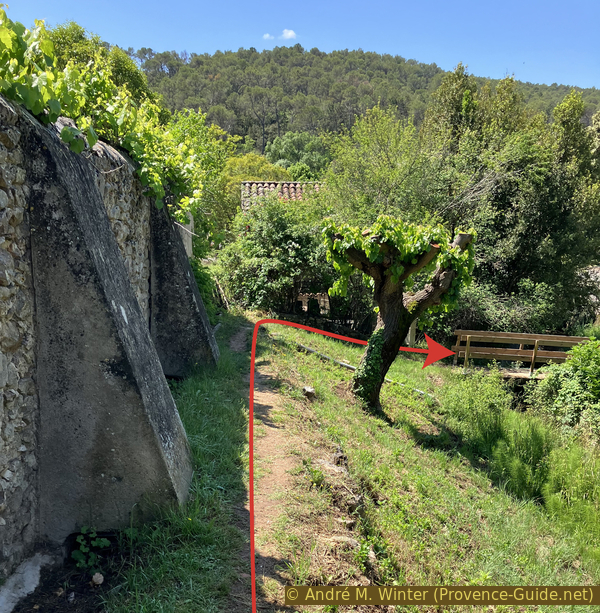
We pass under the castle without entering it, of course. The path skirts the wall, and we follow it.
No reproduction is permitted without the written consent of the author. (id8677)
Path through the Vallon des Adrechs passing beneath the castle
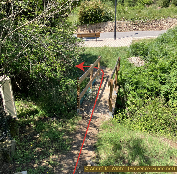
Finally, we have to exit onto the road via this footbridge.
No reproduction is permitted without the written consent of the author. (id8678)
Path beneath the castle
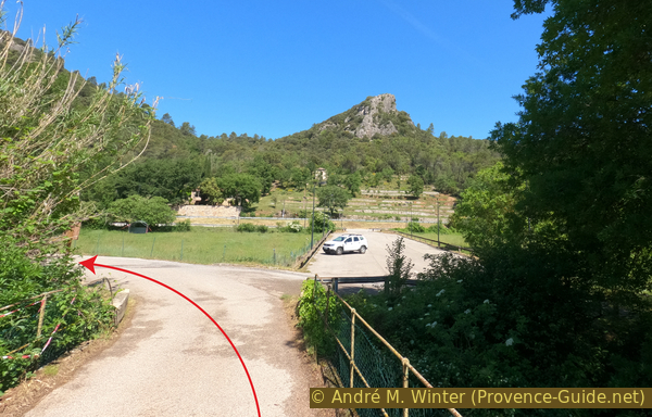
We immediately turn left and find ourselves at the intersection leading to the starting point parking lot.
No reproduction is permitted without the written consent of the author. (id8679)
Footbridge beneath the castle
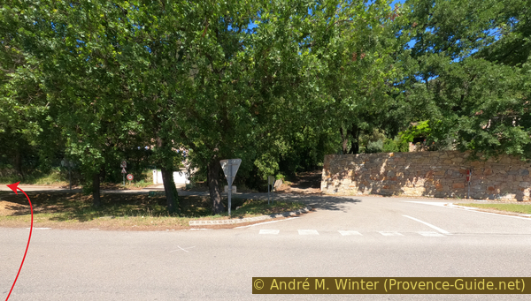
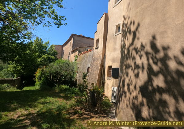
It's a good idea to walk a short distance along the main road to the left to pass under the castle. We have a good view of its west and south sides.
We then descend to the parking lot near the old bridge.
No reproduction is permitted without the written consent of the author. (id8680)
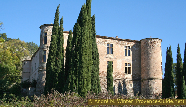
The Château de Vins-sur-Caramy
Sources and additional information
It is better to use a good topographic hiking map: this tour is on the IGN map "Brignoles, Le Luc", scale 1:25000, 3444OT.
If you don't want to bother with a paper map, you can also use mapping apps on your cell phone. On the one hand, it is the Cartes IGN app from the official map service. However, it requires access to the data network and this is sometimes difficult in canyons or remote locations.
Alternatively, you can use apps that store data directly on the device. They're generally not free, but they don't cost much. We mainly use OSMAnd, here it is possible to add contour lines, relief shading, markings and others. To store this data on your phone you need a lot of space.
Of course, one needs access to satellites for the GPS signal with any app. In some canyons this is not the case. Therefore, do not rely on the position shown, but read the map on your phone as you would read it on paper. Most apps are available for Android and iPhone. The applications usually allow us to record the route travelled and also view the GPS files offered for each of our hikes.
This page has been seen 203 times since 20 March 2024.
No reproduction is permitted without the written consent of the author. (id8789)
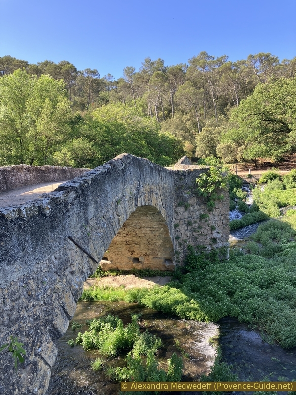
The three-arched bridge known as the Roman Bridge of Vins-sur-Caramy