Oppidum Piégu and the ruins of St. Jean
Lonely round to historic sites of Rougiers
hike
average
3 h
yes
yes
no
mountain
Introduction
Between Brignoles and Saint-Zacharie lies an east-west valley known only to locals as a fast artery to Aubagne and Marseille. It runs through the hills and mountains of the northern part of the Sainte-Baume Regional Natural Park. Only one regional hiking trail leads through this forest area. Otherwise only paths marked with cairns connect vantage points and places steeped in history. With the Oppidum of Piégu and the Castrum St. Jean we find two ruined villages from very different eras.
The facts
8,3 km total distance
3 h walk time
300 m total elevation
orientation difficult
mark 20% of the total distance
35% forest roads
25% easy trails
25% moderate trails
20% hard-surfaced city alleys
dangers slippery sections
children yes
useful picnic stuff
required hiking boots, hiking equipment and water
GPS coordinates (WGS84) of start and end point 43.394,5.851432
downloads ![]()
![]()
Public transport
On the axis between Brignoles and Saint-Zacharie, with an extension towards Aubagne and Marseille, line 92 runs from Zou! (only french) about 8 times a day. This is not frequent, but sufficient for this round. The starting point of this hike is Rougiers Les Rousses bus stop.
Access by car
From the east and from Brignoles, take the DN7 towards Tourves and the exit of the dual carriageway towards Rougiers and Aubagne. The D1 we are now on runs north of Rougiers. Do not take the first street in the direction of the center, but turn left 300 meters further at the next crossing (bus stop).
Coming from Marseille, take the motorway to Fréjus and St. Raphaël, but exit at the long motorway slip road towards St. Zacharie and on to Rourgiers and its bus station.
Useful parking spaces
The parking lot along the country road is a short-term parking zone. You can drive up to the Le Clos car park in the south of the village: go straight towards the center and turn right at the fountain. After 200 meters turn left again at the first opportunity. Also left on the square planted with plane trees and immediately right there. The parking lot is then on the left.
No reproduction is permitted without the written consent of the author. (id5967)
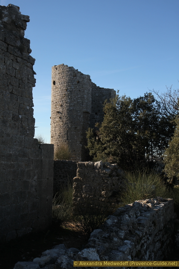
Castrum St. Jean towers
Hints
This hike follows old and narrow paths only used by locals. Vegetation can cover them, but these shrubs do not bear thorns. Only cairns mark the forks. So you have to be able to orientate yourself. It makes sense to use the GPX track provided for download on this page.
The whole region is a zone with a high risk of forest fires. In summer, but also in other seasons when it is very dry or by strong winds, access to the forest areas can be regulated. As a result, the roads may be closed to traffic and/or the trails prohibited to hikers. Current information: Map of access to the forests of the Var (also english). The map shows the colours green, yellow, orange and red which correspond to levels of danger.
The sections
- Rougiers - Piégu summi
- Fort und Oppidum von Piégu - Castrum St. Jean
- Direct path to Rougiers zurück
Bistros and restaurants only in the village of Rougiers. A grocery store is in the small square on Grande Rue west of the fountain.
This tour was undertaken by us on January 1st, 2022 in thick fog pushing up from the sea over Toulon and Marseille. This is not common, but very impressive.
Section 1: Rougiers - Piégu
➙ 2,7 km ... 55 min ➚ 275 m ➘ 0 m ↝ difficult
30% hard-surfaced city alleys, cairns
70% moderate trails, cairns
The clues
- Rougiers, 350 m
- Chemin de l'Argile, 375 m
- Turn in the valley, 430 m
- Climb to the summit, 510 m
- Piégu, 618 m
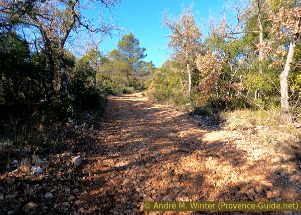
We leave the village heading southwest to get very quickly onto hunters' trails without signs or markings.
Starting from the main street and the bus stop, you get directly to a small square with an old fountain. Here turn right and the next street left again. We are now on the cours shaded by plane trees. Go to the other side of the square and take the first left onto the uphill Chemin du Clos.
We pass the parking lot where those who come by car start. We continue to the sports fields. Now turn left onto Chemin de l'Argile to go around the football field.
No reproduction is permitted without the written consent of the author. (id5930)
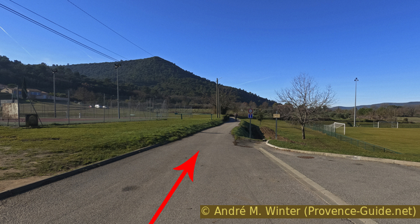
Chemin de l'Argile and sports grounds in Rougiers
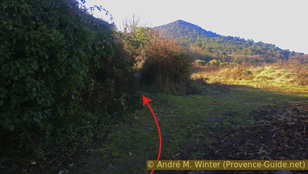
At the next crossroads turn left, go to the last houses and in front of them we take the path on the right that runs between hedges.
No reproduction is permitted without the written consent of the author. (id5931)
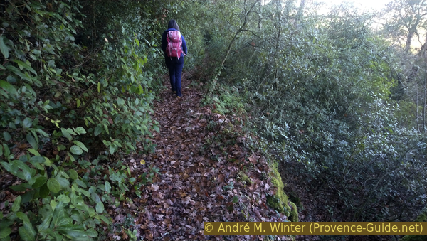
Path to Piégu summit at the end of Chemin de l'Argile
This path passes the houses on the right and climbs to the bottom of the slope. Here we follow on an old path between the edge of the forest and a plain that is covered with more or less hardly cultivated fields.
No reproduction is permitted without the written consent of the author. (id5932)
Path on the foot of slope
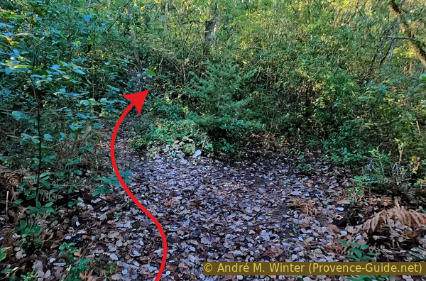
We won't stay long on this section. After a hundred meters or two minutes we see a path on the left.
No reproduction is permitted without the written consent of the author. (id5933)
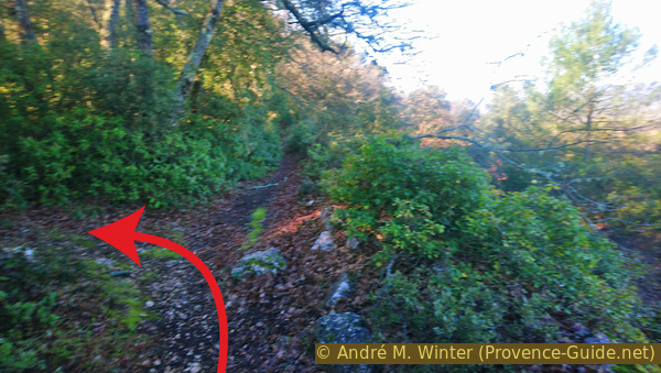
Path into the valley between Piégu and St. Jean
Opposite we have an unobstructed view of a small meadow.
No reproduction is permitted without the written consent of the author. (id5934)
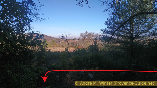
View of the fields at the junction
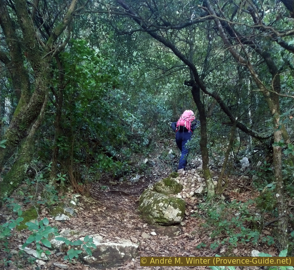
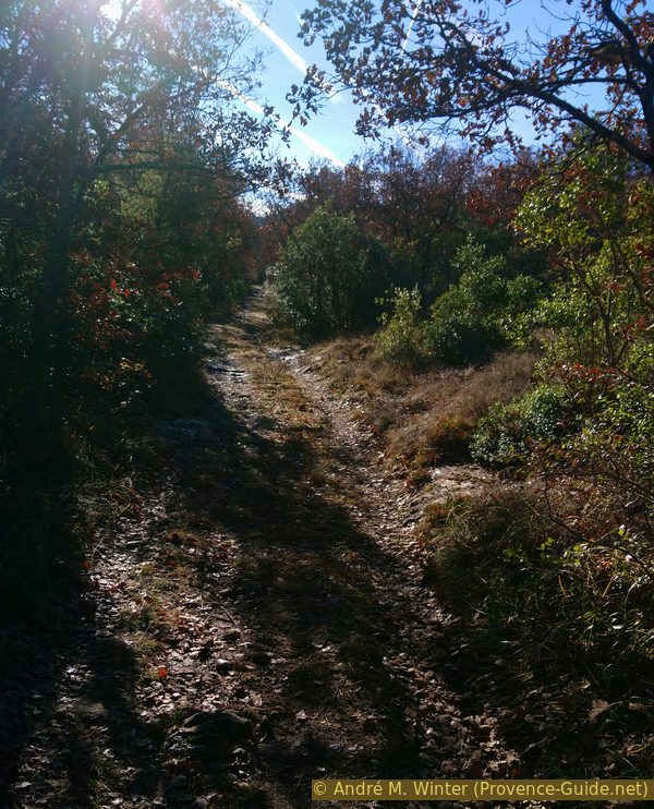
This new path is very narrow and leads between bushes about two meters high. It runs in a straight line south and deeper into a valley.
After seven minutes we pass the first rocks uphill and shortly afterwards we see an old dike. It's a dry stone structure sealing off a valley, holding back water and what little soil the limestone soil produces. Today this area is again covered by the forest, nothing is cultivated here anymore.
No reproduction is permitted without the written consent of the author. (id5935)
Rocks and then right onto an old retaining wall
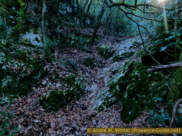
We stay more or less on the valley floor, the path turns a little to the right and follows the topography. The rise is now more pronounced.
No reproduction is permitted without the written consent of the author. (id5936)
Wider path with small terrain steps
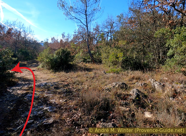
Arriving at a slightly more open spot, we reach a fork with a small cairn marking our path. So we turn right, leaving the valley to go up the eastern slope of the Piégu peak. The trail here is flatter but still uphill.
No reproduction is permitted without the written consent of the author. (id5937)
Cairn at the turn in the valley between Piégu and St. Jean
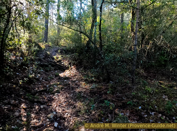
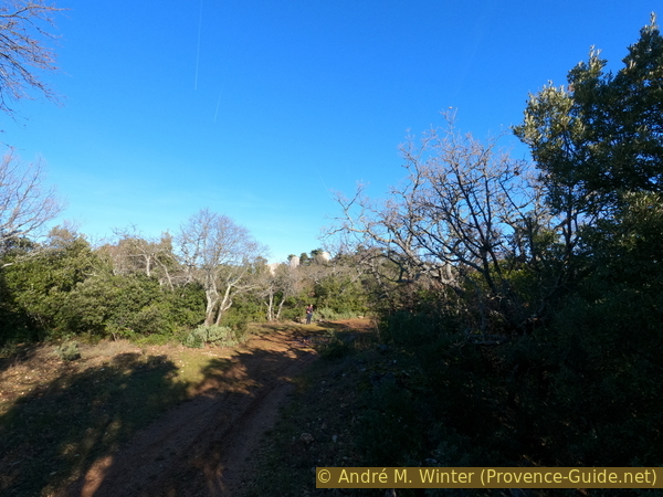
After crossing a pine forest with slightly taller trees, we reach the north slope of the Piégu hill. We hear the traffic noise again on the road between Brignoles and St. Zacharie.
No reproduction is permitted without the written consent of the author. (id5938)
Path north of Piégu
The north slope is drier and less covered with tall pines. At times we see the summit to the left and the plain to the right. The trail climbs more steadily, but the hike is still easy.
No reproduction is permitted without the written consent of the author. (id5939)
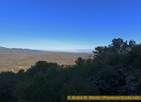
The mist rises from the Caramy valley to the Rougiers plateau
Ten minutes after the dense pine forest, we must pay attention to a small cairn on the left. This is where the more direct ascent to the summit begins.
No reproduction is permitted without the written consent of the author. (id5940)
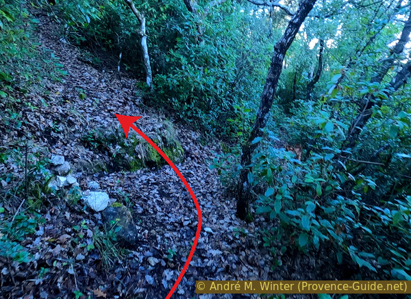
A cairn marks the access to the summit
It starts with a fairly steep path and you pass over some rocks with a detour to the right.
No reproduction is permitted without the written consent of the author. (id5941)
Up here over the rocks
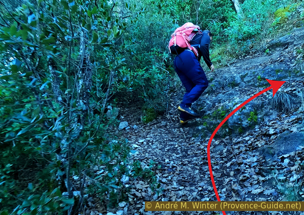
The path then continues up a fairly steep slope between some rocks. The path is strenuous, but you get to the summit quickly. This is reached as soon as the terrain flattens out. We are then on an irregular limestone plateau covered with various bushes.
No reproduction is permitted without the written consent of the author. (id5942)
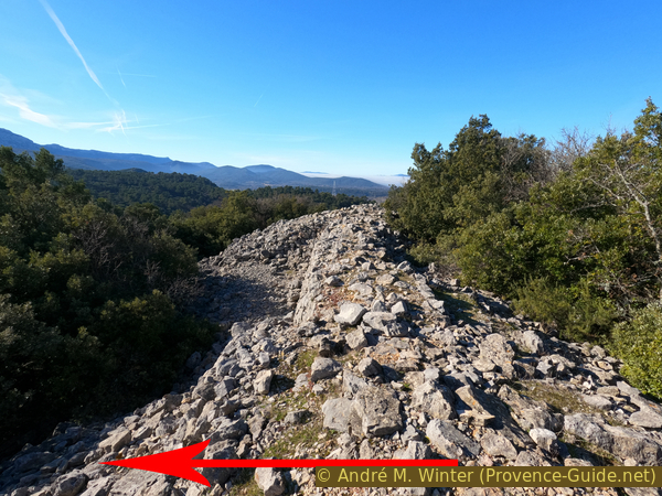
It stays steep
After the climb, keep left to be able to climb rocks sticking out of the vegetation. From here we look back towards Rougiers and towards the next stage, the Castrum de St. Jean.
There is no trace of the oppidum at this summit, which is further south and covered in the next section.
No reproduction is permitted without the written consent of the author. (id5943)
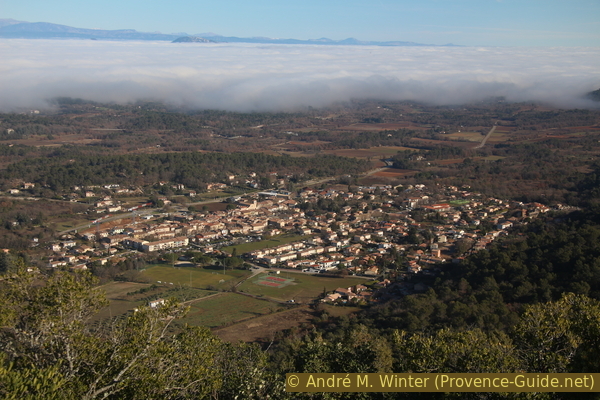
The fog rises from the Caramy valley towards Rougiers
Section 2: Piégu - Castrum de St. Jean
➙ 3,7 km ... 1 h 30 min ➚ 85 m ➘ 120 m ↝ average
5% easy trails, without marks
10% forest roads, without marks
10% easy trails, cairns
40% forest roads, faulty marks
20% forest roads, without marks
10% easy trails, without marks
The clues
- Piégu, 618 m
- Oppidum, 590 m
- Forest saddle, 564 m
- Spring catchment, 525 m
- Forest crossing, 545 m
- Dry stone ruins, 570 m
- Forest crossing, 559 m
- Forest road crossing, 550 m
- Towers of St. Jean, 605 m
A loop to the south and mainly on forest roads.
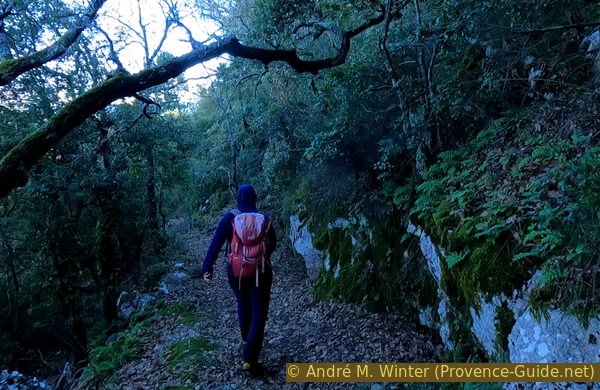
We descend from our vantage point into bushes, a little thornier here than on the climb, and meander south. This path leads slightly downhill and also has no markings.
After 140 meters we come to the ruins of Fort Piègu.
It is not the oppidum, but about a reoccupation of the area in the 5th century. It consisted of two rooms arranged in a T. Traces of a smithy were found.
No reproduction is permitted without the written consent of the author. (id5944)
South wall of Piégu fort
Another 100 meters further on we pass a large heap of stones that forms a 75 m long transverse barrier.
It was the dry stone wall that protected the south side of the settlement in the 2nd century, while the other sides of the rock formed a natural barrier.
An oppidum is a type of urban center found in Western Europe and dating back to pre-Roman times. With the Roman occupation of the territory and the peace, the populations moved to the valleys. With the fall of the Roman Empire and the return of insecurity, some of these oppida began to be used again from the 4th century.
Nowadays these ramparts look like long piles of stones. In the beginning there were long, well-ordered embankments that were kept in shape with wooden beams. This wood has since decomposed and the embankments today form the same long cairns in most similar places.
No reproduction is permitted without the written consent of the author. (id5945)
Southern rampart of the Piégu Oppidum
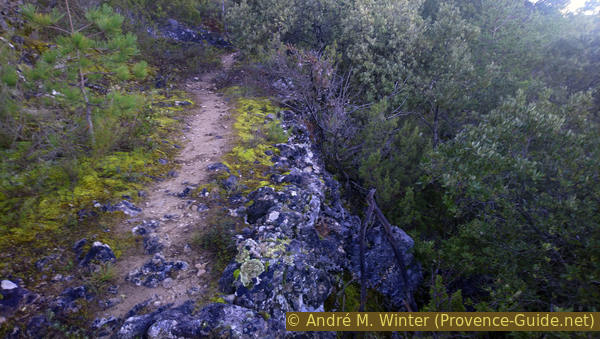
So we cross this pile of stones and a few meters further on we come to the beginning of a forest road. This is the type of path we will be walking for the majority of the next hour.
No reproduction is permitted without the written consent of the author. (id5946)
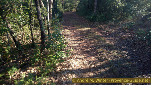
Forest road south of the Piégu Oppidum
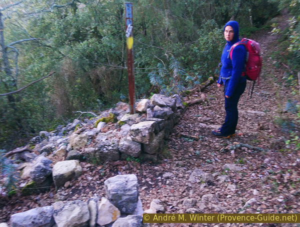
Ten minutes after the oppidum, the path turns right. Before this bend we must find our path marked with a cairn on the left at point 564.
No reproduction is permitted without the written consent of the author. (id5947)
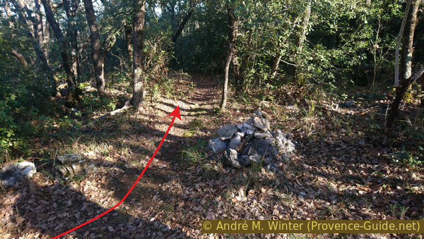
A cairn at point 564 marks the path eastwards
This trail is initially flat but then drops off quite steeply to a bordered spring with green cover. We are now in the same valley that we turned into after leaving the village.
We turn right and south in the valley.
No reproduction is permitted without the written consent of the author. (id5948)
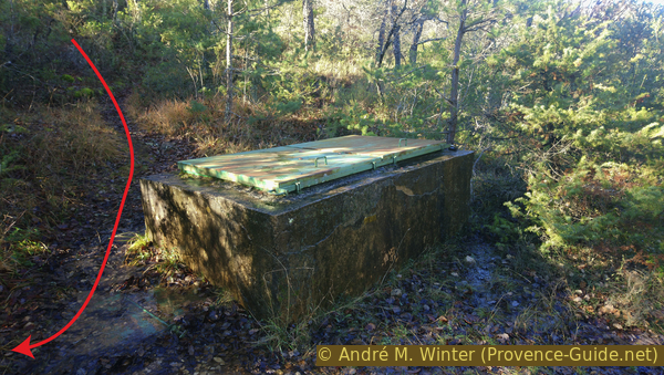
Spring tapping in the valley between Piégu and St. Jean
We are back on a slightly uphill forest road.
The height now rotates long by 555 meters.
No reproduction is permitted without the written consent of the author. (id5949)
Forest road in the valley between Piégu and St. Jean
Less than ten minutes later we turn left at the crossroads at point 545.
No reproduction is permitted without the written consent of the author. (id5950)
Approaching the intersection at point 545 from the north
50 meters after a right turn there is a ruin in the bushes to the right of the forest road. It is a dry stone building that appears to have had a terracotta roof.
No reproduction is permitted without the written consent of the author. (id5951)
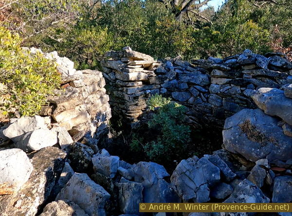
Remains of a dry stone hut
However, we continue along the path, passing point 559, where we and keep left.
No reproduction is permitted without the written consent of the author. (id5952)
The track north of point 559
We reach another crossing. Here again on the left. Now it goes uphill on a path covered with large gravel and stones. It's a lot more awkward than the previous sections.
No reproduction is permitted without the written consent of the author. (id5953)
Stony track north of the crossing between points 559 and 510
This ascent takes less than ten minutes. We turn right and see cedars on the horizon in front of us. They mark the end of this section and as we advance we see the ruins of the towers of a medieval fortress.
No reproduction is permitted without the written consent of the author. (id5954)
Shortly before the St. Jean castrum
Section 3: St. Jean - Rougiers
➙ 1,9 km ... 30 min ➚ 0 m ➘ 125 m ↝ average
60% easy trails, cairns
40% hard-surfaced city alleys, without marks
The clues
- Towers of St. Jean, 605 m
- Wayside shrine and path junction, 467 m
- Water castle, 395 m
- Rougiers, 350 m
Exploring the ruins and descending directly to the village of Rougiers.
We are right in front of the remains of the castle after having advanced under the Lebanon cedars.
These trees aren't medieval like the ruins, they're a fairly recent introduction but seem to like soft-topped limestone ridges. They are mainly found in the Luberon.
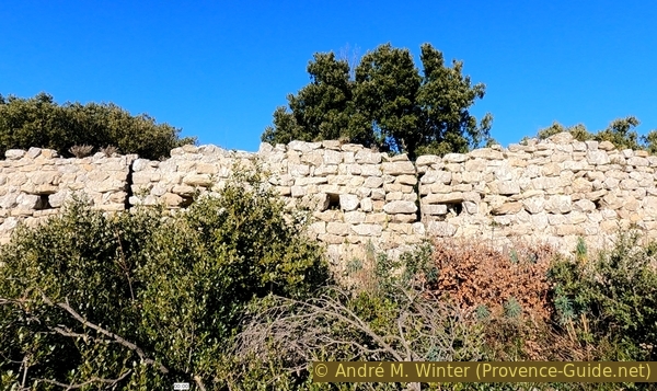
The village of Castrum de St. Jean was built in the 12th century. The enclosure was initially continuous, the semi-circular turrets are part of it. These had a clear defensive function, but also made the complex visible from afar.
The square building that we see upon arrival is the keep of the old castle. All around was the manorial residence and to the north houses were arranged according to a certain hierarchy. Artisans and farmers occupied the center but there were no livestock sheds as the herds were kept on the plateau and outside the defences.
No reproduction is permitted without the written consent of the author. (id5955)
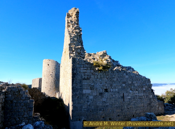
St. Jean castle donjon
The location is a bit odd, as residences and important defensive lines also jut over the edge of the cliff.
No reproduction is permitted without the written consent of the author. (id5956)
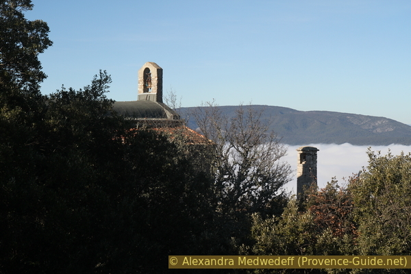
The fog rises towards the Saint Jean chapel
The village was abandoned in the 15th century. The population first moved to the foot of the hill in a place called Pays Haut (High Country). It is on the right when we reach the first houses on the way down. Later, the center shifts even further down to the current location.
Exploration takes place via several entrances, all located on the right-hand side to the east. So we also go around the defensive wall to the right and advance along the edge of the plateau.
No reproduction is permitted without the written consent of the author. (id5958)
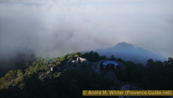
Ruins of St. Jean castrum and the shadow of the chapel on the fog
We arrive in front of the Saint-Jean de Solférino chapel and a statue of the Madonna mounted on a stone column. Here you have the ideal view of Rougiers.
No reproduction is permitted without the written consent of the author. (id5957)
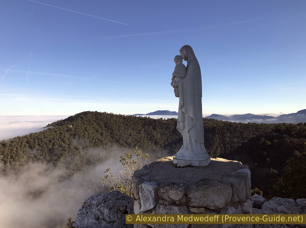
Madonna in front of St. Jean chapel
The chapel was rebuilt in 1860 to celebrate the victorious return of Emperor Napoleon III from Solferino after defeating the Austrian army. Although it is the only building that has not yet collapsed, the chapel is also falling into disrepair.
No reproduction is permitted without the written consent of the author. (id5959)
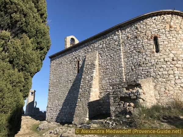
St. Jean chapel
We go back, turning our backs on Rougiers and staying to the left of the chapel. In a breach, an old path leads down to the left.
No reproduction is permitted without the written consent of the author. (id5968)
Old path downhill to the ruins of the dwellings
After the descent we always keep to the left.
This is how we get to a panoramic table that we could already see from the chapel. Here we can see better into the ruins that are left of the houses.
It doesn't make much sense to climb past this vantage point.
No reproduction is permitted without the written consent of the author. (id5960)
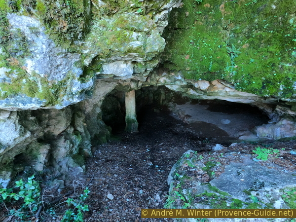
Cave under St. Jean chapel
We go back again and at the fork we turn left and downhill.
No reproduction is permitted without the written consent of the author. (id5961)
Direct way to Rougiers
After a few steps we see a path on the left that leads back to the foot of the ruined village. You can explore this part here and then come back to the main trail afterwards.
No reproduction is permitted without the written consent of the author. (id5962)
Low access to St. Jean castrum
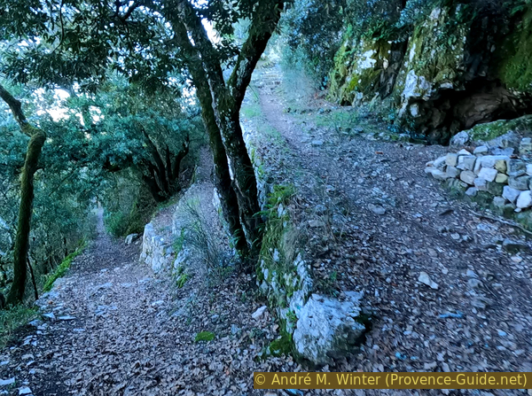
The wide downhill path continues along the foot of the cliff. A few minutes later there is a tight bend to the left.
No reproduction is permitted without the written consent of the author. (id5963)
Old path from the castrum to Rougiers
The path continues with the same width, you can see that carts were pulled here.
In this long straight line downhill between rocks we come to a second wayside shrine. The slope is now less pronounced. Two minutes later we come to a not very obvious crossroads where we take the smaller path to the left.
We pass under pine trees that grow taller than on the plateau. This trail, like all others, is unmarked. He makes a big curve to the right and at the end we descend faster to the right of a fence.
No reproduction is permitted without the written consent of the author. (id5964)
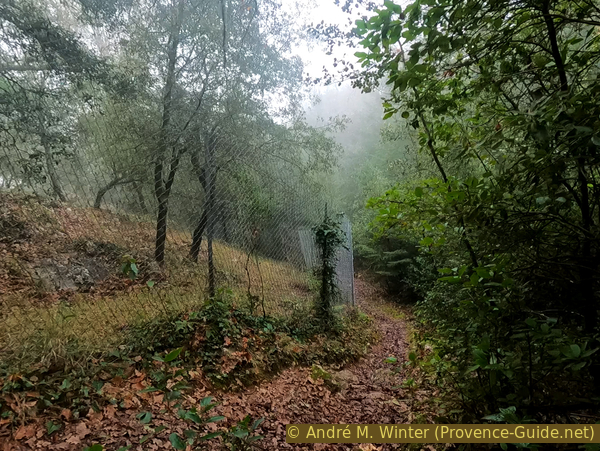
Descent along a fence
We reach a moated castle that is half buried. If we turn right, we come to rue Sainte-Anne, which takes us in a straight line towards the center. Continue straight to return to the bus stop.
No reproduction is permitted without the written consent of the author. (id5965)
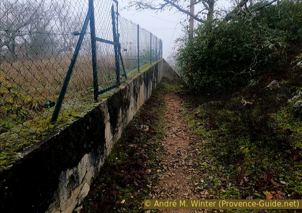
Descent to Rougiers along the water reservoir
To return to the Le Clos car park: go up to the first houses that form a continuous facade and turn left here onto the Cours. Turn left again at the first intersection to get to the car park.
We started at the top in the sun, on the way down we were quickly swallowed up by the fog. The Cours de Rougiers is grey-white due to this fog that rises from a sea that is much too warm in January. Another consequence of global warming!
No reproduction is permitted without the written consent of the author. (id5966)
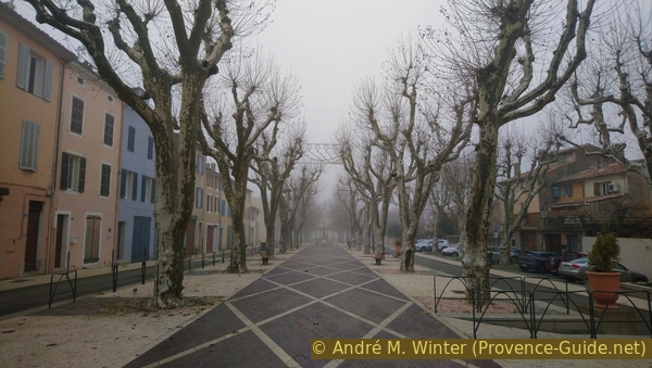
Le Cours in Rougiers
Sources and additional information
It is better to use a good topographical hiking map: this tour is on the IGN map "Saint-Maximin-la-Sainte-Baume, Barjols, Trets, Mont-Aurélien", scale 1:25000, 3344OT.
If you don't want to bother with a paper map, you can also use mapping apps on your cell phone. On the one hand, it is the Cartes IGN app from the official map service. However, it requires access to the data network and this is sometimes difficult in canyons or remote locations.
Alternatively, you can use apps that store data directly on the device. They're generally not free, but they don't cost much. We mainly use OSMAnd, here it is possible to add contour lines, relief shading, markings and others. To store this data on your phone you need a lot of space.
Of course, one needs access to satellites for the GPS signal with any app. In some canyons this is not the case. Therefore, do not rely on the position shown, but read the map on your phone as you would read it on paper. Most apps are available for Android and iPhone. The applications usually allow us to record the route travelled and also view the GPS files offered for each of our hikes.
This page has been seen 2189 times since 20 March 2024.