Saint-Sauveur and Sainte-Philomène starting from Rocbaron
Two chapels and some ruins along a very lonely path
hike
easy
3 h
yes
yes
no
mountain
Introduction
The village of Rocbaron is marred by a sprawling retail park and detached houses. However, the old town centre remains inhabited, and in the hills further to the east lie remnants of times gone by, such as the ruins of Saint-Sauveur Castle and Sainte-Philomène Chapel. The latter is located in the commune of Puget-Ville.
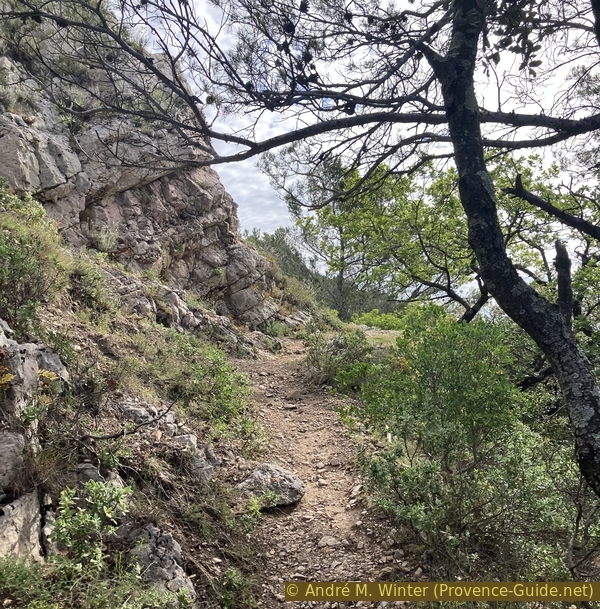
We walk along old paths that are sometimes signposted but poorly maintained. There are also sections of winding hunters' tracks, though these are clearly visible. This walk is very solitary.
The facts
8,6 km total distance
3 h walk time
400 m total elevation
orientation average
mark 35% of the total distance
30% easy trails
30% forest roads
15% hard-surfaced quiet side streets
10% hard-to-recognize trails
5% rutted dirt roads
5% moderate trails
<5% hard-surfaced country road
dangers exposed sections
children yes, but it's long
useful picnic stuff
required hiking boots, hiking equipment and water
GPS coordinates (WGS84) of start and end point 43.3024800924769,6.090989804387915
downloads ![]()
![]()
Public transport
There is just one regular bus route between Toulon and Brignoles that passes by the village in the shopping area. This is route 848 between Toulon and Brignoles, with around ten services a day, see the Zou! (only french) website for timetables.
To reach the starting point, you unfortunately have to walk over two kilometres and spend 30 minutes on rather unpleasant roads. This route is also marked in burgundy red on the map and included in the GPX and KML files provided. See the appendix for this route to the starting point.
Access by car
Rocbaron is located north of Toulon and Hyères. Coming from that direction, take the A57 motorway (no toll) to the Cuers exit and continue towards Brignoles. You will go up a hill and, further down, you will reach a built-up area. At the large roundabout, turn right towards Rocbaron.
Coming from Marseille or Nice on the A8, exit at Brignoles and take the ring road westwards towards Tourves and Toulon, then southwards towards Cuers and Toulon on the D43. This dual carriageway passes through the countryside before running alongside Forcalquier. You will head back into the countryside, running alongside an industrial estate on the left-hand side of the road. At the large roundabout, turn left towards Rocbaron.
Drive up through the residential area towards the village, turn right at the roundabout, continue straight on, and turn left towards the town centre at the next junction.
Useful parking spaces
There are several car parks along this road leading towards the town centre and the schools. We pass this way on the way back, so there is plenty of choice when it comes to parking.
On Sundays, a flea market is held in the unpaved car park, so you will need to look further towards the town centre.
No reproduction is permitted without the written consent of the author. (id8818)
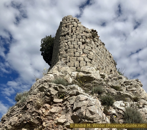
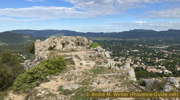
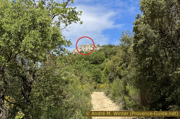
Eastern spur of St. Sauveur Castle
No reproduction is permitted without the written consent of the author. (id8790)

Avenue Marcel Le Bihan
Hints
The walk mainly follows unmarked paths. These can change in appearance quite quickly and become overgrown after a few years. We do our best to suggest alternative routes and ask that you let us know of any changes via the feedback form at the bottom of the page. In any case, we strongly recommend downloading the GPS file for the route, as it allows you to quickly retrace your steps.
The whole region is a zone with a high risk of forest fires. In summer, but also in other seasons when it is very dry or by strong winds, access to the forest areas can be regulated. As a result, the roads may be closed to traffic and/or the trails prohibited to hikers. Current information: Map of access to the forests of the Var (also english). The map shows the colours green, yellow, orange and red which correspond to levels of danger. The affected area is: Sainte Baume (2).
The sections
- Rocbaron - Saint Sauveur Castle
- Castle Saint Sauveur - Sainte Philomène Chapel/li>
- Sainte Philomène Chapel - Rossignol - Rocbaron
Section 1: Rocbaron - Château St. Sauveur
➙ 1,3 km ... 40 min ➚ 140 m ➘ 5 m ↝ easy
45% hard-surfaced quiet side streets, few marks
30% easy trails, few marks
30% moderate trails, with marks
The clues
- Rocbaron schools, 380 m
- St. Sauveur Chapel, 475 m
- St. Sauveur Castle, 515 m
We head straight up towards the ruins of Château St. Sauveur to enjoy a panoramic view of the area.
After the car park shown in the photo, head down to the lower street. We continue along this street, past the nursery school, towards the centre.
On the right are some old wells and a water intake.
No reproduction is permitted without the written consent of the author. (id8791)
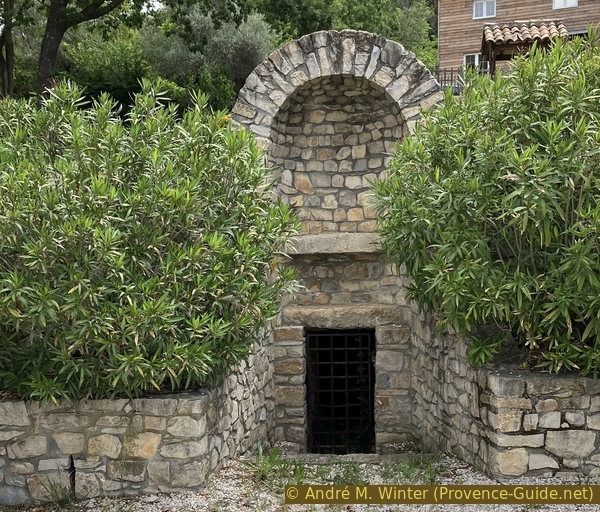
The Rocbaron spring
We pass the town hall and then turn right into Rue Saint Sauveur.
No reproduction is permitted without the written consent of the author. (id8792)
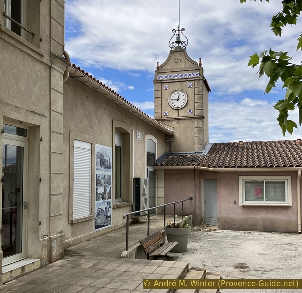
The clock tower at Rocbaron Town Hall
We are now on the main direction for a while, and it is a continuous climb.
No reproduction is permitted without the written consent of the author. (id8793)
Rue St. Sauveur in Rocbaron
This street climbs relentlessly. It leads us to a sloping square.
No reproduction is permitted without the written consent of the author. (id8794)
The square at the top of Rue St. Sauveur
In this square stands a mission cross dating from 1858.
There are many such crosses in the French countryside. They date from the reactionary period under Napoleon III. The state Catholic Church sent out missions to erase the traces of the Revolution. To mark this action, mission crosses were erected, which still stand here and there.
No reproduction is permitted without the written consent of the author. (id8806)
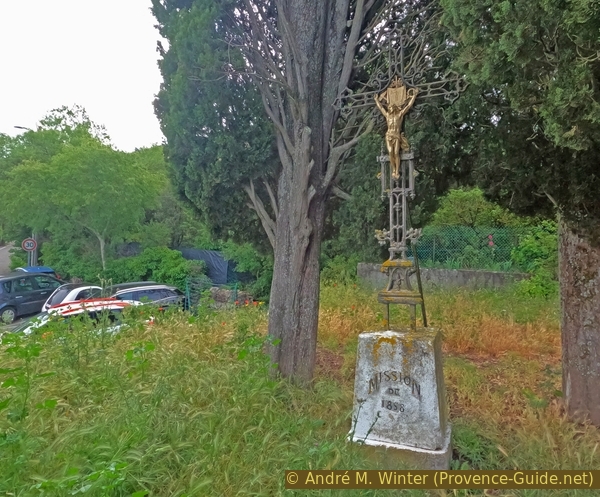
Mission Cross of 1858
The lane is now called Chemin Saint Sauveur and is lined with more scattered villas.
No reproduction is permitted without the written consent of the author. (id8807)
Start of Chemin de St. Sauveur
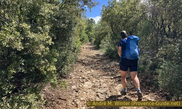
Where the houses end, the path narrows, becomes covered in pebbles and is no longer passable by vehicles.
No reproduction is permitted without the written consent of the author. (id8808)
Chemin de St. Sauveur
The direction remains the same. By setting off early enough, we stay in the shade during this somewhat strenuous climb.
No reproduction is permitted without the written consent of the author. (id8809)
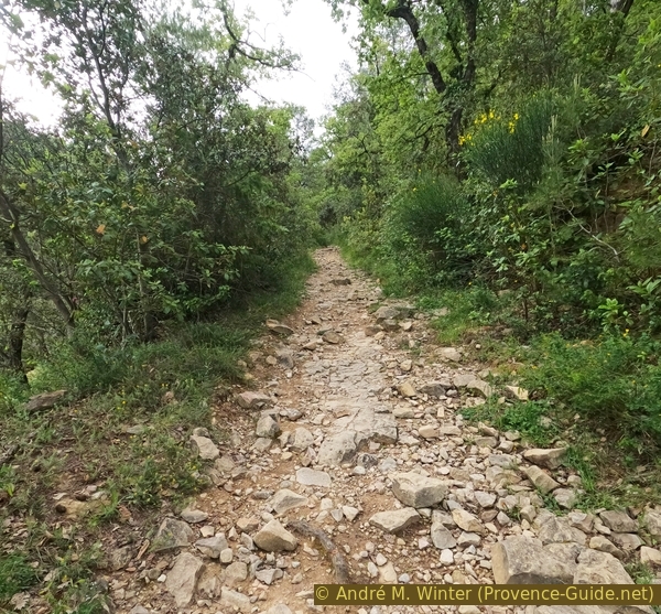
Chemin de St. Sauveur not suitable for vehicles
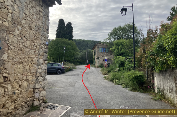
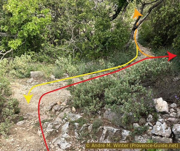
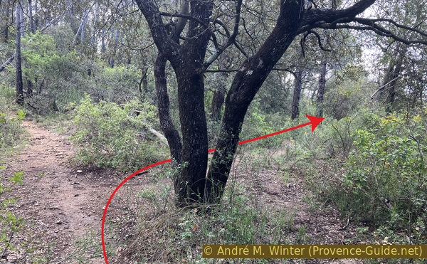
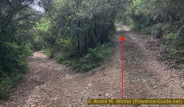
We arrive at a wooded pass which is also a crossroads.
We turn right first. The yellow arrow indicates the direction to take when we return here after visiting Château Saint-Sauveur.
No reproduction is permitted without the written consent of the author. (id8810)
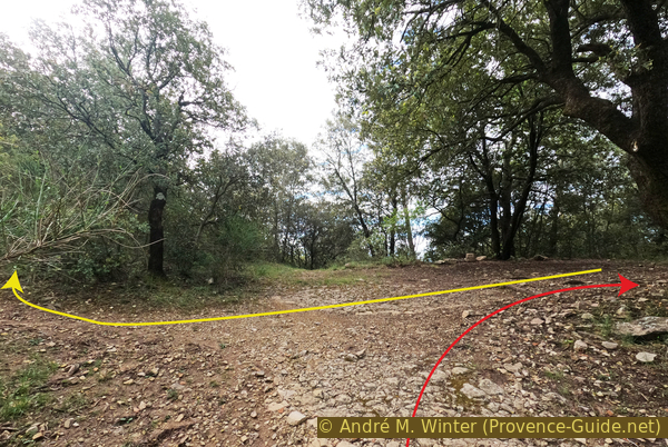
Crossroads near St. Sauveur Chapel
However, we soon come across the remaining walls of a fairly large church, though without an apse or bell tower. It is called the Chapelle Saint-Sauveur.
No reproduction is permitted without the written consent of the author. (id8811)
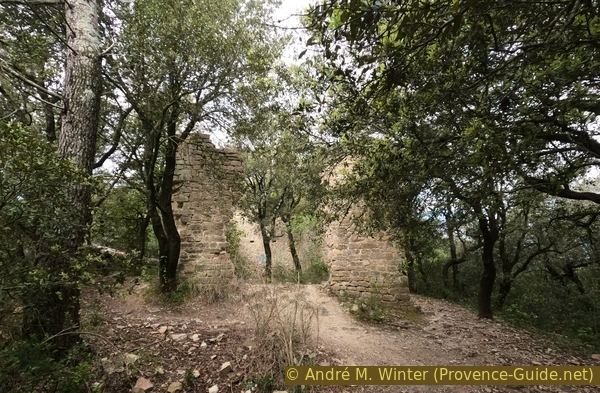
The ruins of St. Sauveur Chapel
It is thought that this chapel dates from the 17th century. In any case, it is much more recent than the castle.
No reproduction is permitted without the written consent of the author. (id8812)
Empty nave of St. Sauveur Chapel
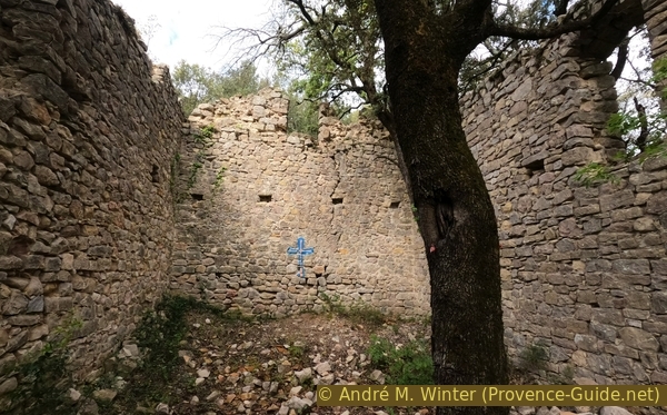
The walls are in poor condition and have not been stabilised. The stones are only roughly hewn. This structure is doomed to collapse.
No reproduction is permitted without the written consent of the author. (id8813)
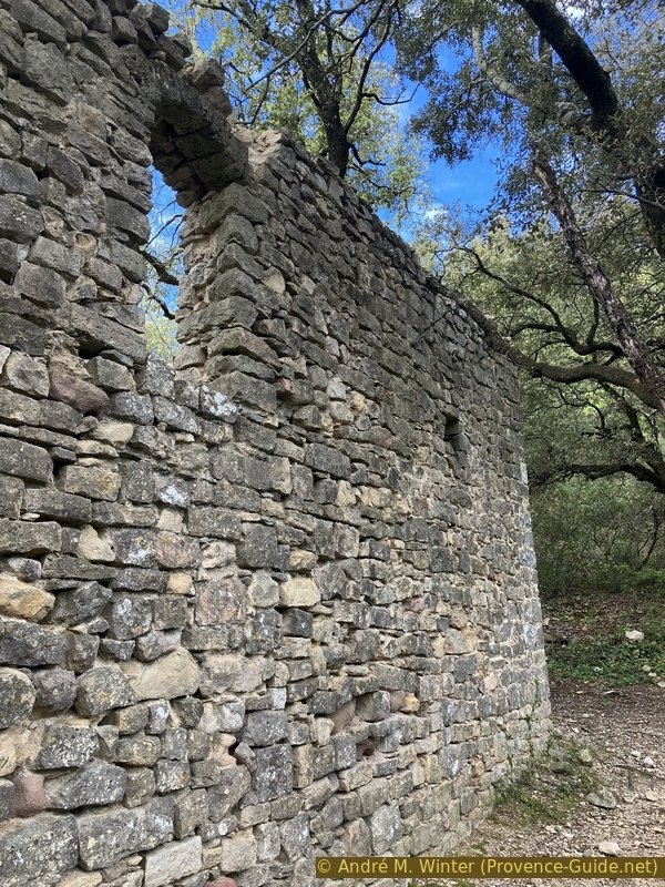
A window in the ruins of St. Sauveur Chapel
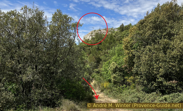
A path continues to the right of these ruins. It climbs in two wide bends towards the southern side of the rock bearing the ruins of Château Saint-Sauveur. This path is marked in yellow.
No reproduction is permitted without the written consent of the author. (id8814)
Climb towards St. Sauveur Castle
As you climb, the view gradually opens up. The Vallon de Limbaud is a farming plain to the south of Rocbaron.
No reproduction is permitted without the written consent of the author. (id8815)
Vallon de Limbaud
Once you reach the southern edge of the summit plateau, the path turns west.
No reproduction is permitted without the written consent of the author. (id8816)
Ascent to St. Sauveur Castle
The climb is steep and almost alpine, though these are only very short sections.
No reproduction is permitted without the written consent of the author. (id8819)
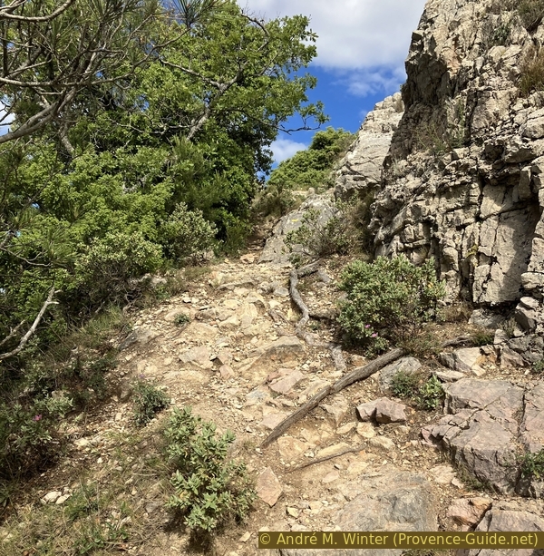
Ascent to St. Sauveur Castle
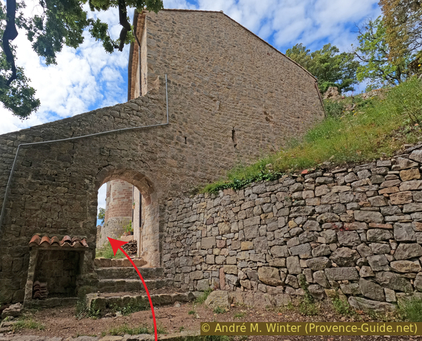
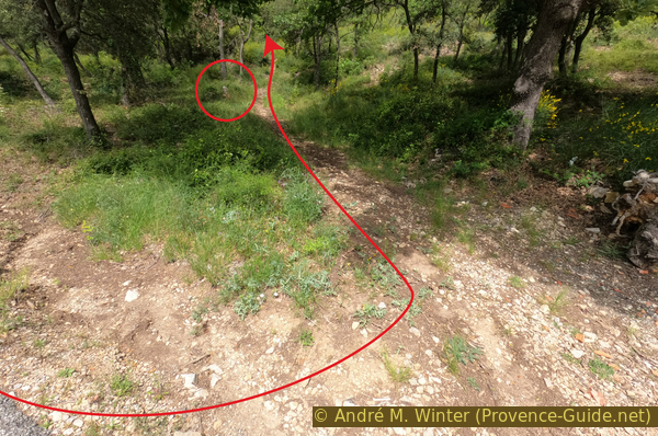
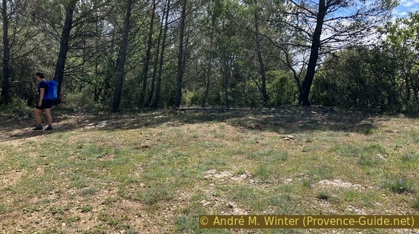
You then come to a signpost indicating a right turn. After a bush, a path does indeed turn right. However, this leads only to a ditch. Just beyond the bush in the photo, another, less steep path climbs up. It takes us onto the summit plateau, which must have been entirely covered by the small castle.
The junction visible in the photo is where we return to the three times. First we head up to the right, then turn back and continue straight on. Finally, we pass this way again to head down towards the ruined chapel.
No reproduction is permitted without the written consent of the author. (id8820)
Ascent to St. Sauveur Castle
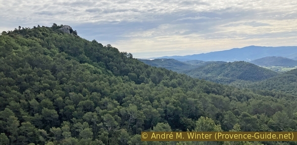
The name Rocbaron comes from this castle on the Roc, which belonged to Baron Guillaume Rochabaron. Its strategic position offers a fine view of this part of the Massif des Maures and the Garéoult plain. It was built in the 10th century but abandoned and dismantled in the 15th century when it was replaced by the Château de Forcalqueiret, three kilometres away. From there, the lordship ruled over Rocbaron, Forcalquieret and Sainte-Anastasie.
No reproduction is permitted without the written consent of the author. (id8821)
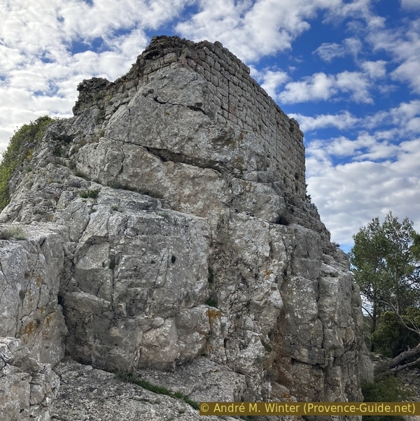
Ruin of St. Sauveur Castle
In the photo, the path leading up to the highest point of the plateau.
No reproduction is permitted without the written consent of the author. (id8822)
A steep climb to the ruins of St. Sauveur Castle
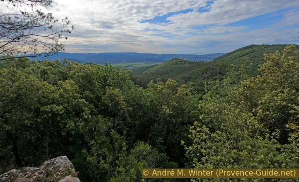
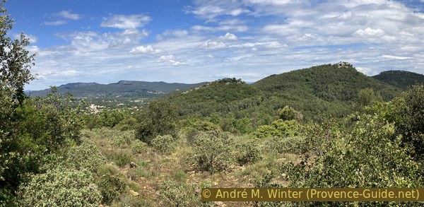
Here, the view towards the east.
On Thémeré Hill lies an oppidum, that is to say a prehistoric fortified village. Excavations carried out in 1971 in caves on the hill have dated the settlement to between the end of the Bronze Age and the beginning of the Iron Age. The finds consisted mainly of pottery shards, bones and a few metal objects.
No reproduction is permitted without the written consent of the author. (id8823)
Théméré Hill and the Massif des Maures
This view looks south-east. It is the valley of the motorway between Toulon and Le Muy.
No reproduction is permitted without the written consent of the author. (id8824)
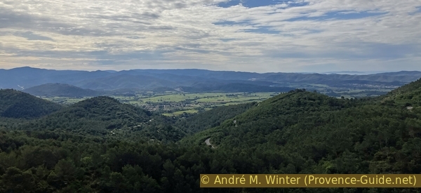
The Puget-Ville plain
La Barre de Cuers lies to the south-west. It is a very secluded ridge where few people go hiking
No reproduction is permitted without the written consent of the author. (id8825)
La Barre de Cuers
Here is the view towards the east and north. Forcalquieret Castle is visible in this photo on the lowest hill to the left.
The two castles of Rocbaron and Forcalquieret are within sight of one another. Rocbaron castle may therefore have served as an outpost for the more recent Forcalquieret castle.
No reproduction is permitted without the written consent of the author. (id8826)
The hills east of Rocbaron
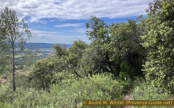
The Saint-Sauveur plateau is therefore an ideal vantage point for a sweeping panoramic view. One would never expect such a panorama whilst climbing through the forest from Rocbaron. We shall see later that the forest remains very much in evidence throughout this tour.
No reproduction is permitted without the written consent of the author. (id8827)
St. Sauveur Castle and the La Loube Massif
Little remains of the castle, only a few particularly narrow arrow slits survive. You can barely see through them, one wonders how anyone could have fired from them.
No reproduction is permitted without the written consent of the author. (id8828)
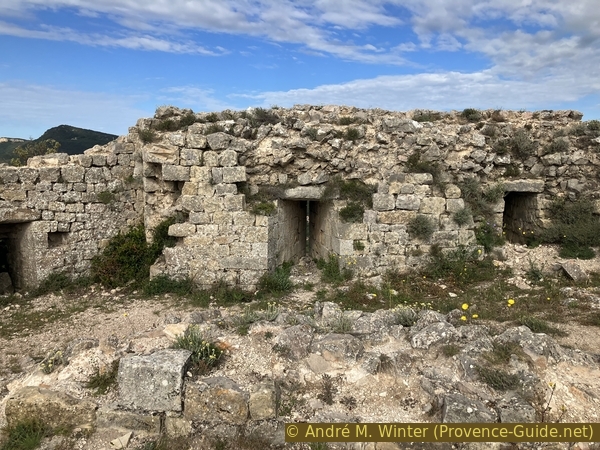
Very narrow arrowslits at St. Sauveur Castle
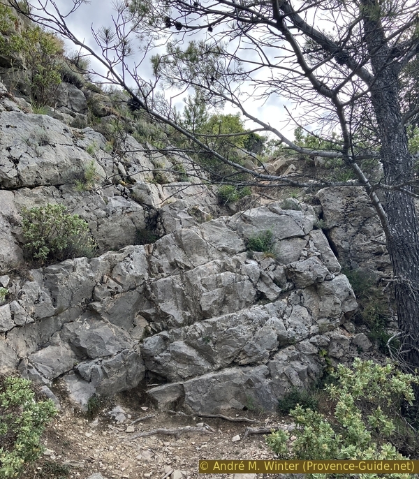
After descending from the upper level, we can walk along the path towards a sort of ditch that appears to have been dug into the rock for defensive purposes.
In any case, we then return to the ruined church and the saddle in the forest.
No reproduction is permitted without the written consent of the author. (id8830)
Descent from St. Sauveur Castle
Section 2: Château St. Sauveur - Chapelle Ste. Philomène
➙ 3,4 km ... 1 h ➚ 60 m ➘ 235 m ↝ difficult
5% moderate trails, with marks
25% hard-to-recognize trails, faulty marks
20% easy trails, without marks
20% rutted dirt roads, without marks
30% easy trails, without marks
The clues
- St. Sauveur Castle, 515 m
- St. Sauveur Chapel, 475 m
- Le Gros Clapier saddle, 435 m
- Crossing under Ste. Philomène, 320 m
- Ste. Philomène Chapel, 345 m
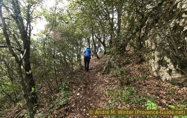
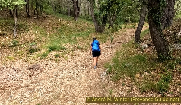
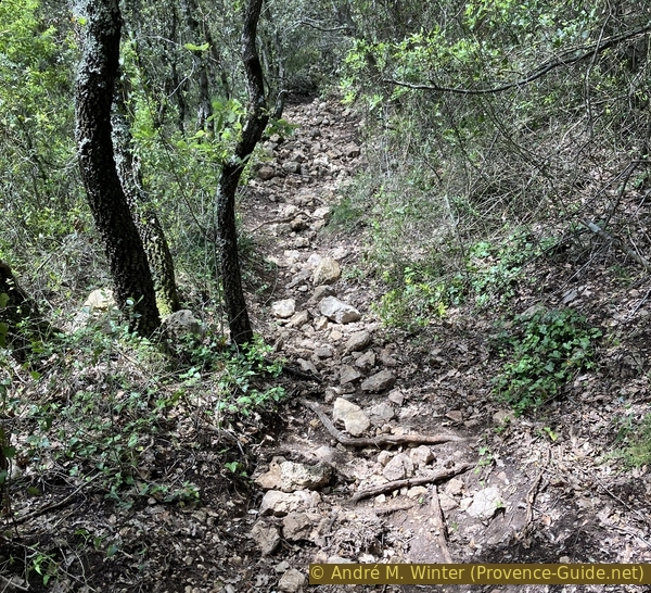
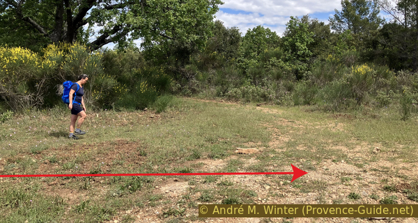
Here is a connecting section with some elevation gain and paths that are not always easy to follow in the heart of the forest. Welcome to the Provençal forest!
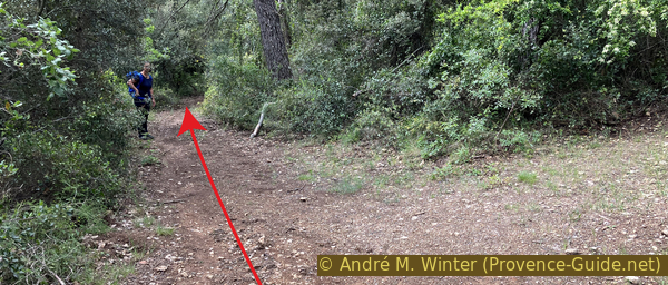
After passing the ruined church, we head back up the saddle through the forest. We continue straight on (to the left of the original ascent path), but only for about ten metres.
No reproduction is permitted without the written consent of the author. (id8831)
Crossroads near St. Sauveur Chapel
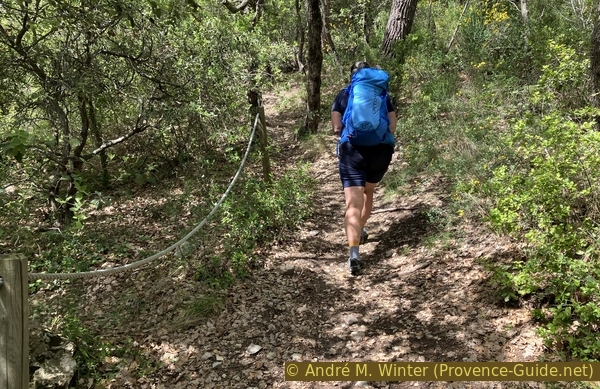
We spot a simple path on the right, which we take. This hunters' track is not signposted, but here and there we can see branches that have been cut back to clear the way.
No reproduction is permitted without the written consent of the author. (id8832)
Junction to the north of the crossroads near St. Sauveur Chapel
We follow dry stone walls, the most recent of which date from the early 20th century. These are mainly enclosures for sheep and goats.
No reproduction is permitted without the written consent of the author. (id8834)
Path heading east
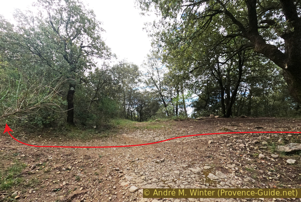
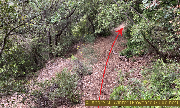
After 150 metres of gentle descent, there are two forks where we always take the right-hand path. Here is the first one.
The other fork is very overgrown; it even leads downhill in the wrong direction.
No reproduction is permitted without the written consent of the author. (id8835)
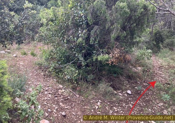
Junction to the south-east of the crossroads near St. Sauveur Chapel
And here is the second fork.
The other fork simply leads to a hunter's hide in the forest
No reproduction is permitted without the written consent of the author. (id8836)
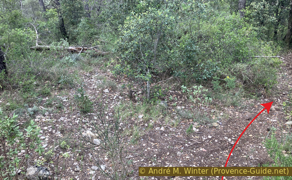
Second junction to the south-east of the crossroads near St. Sauveur Chapel
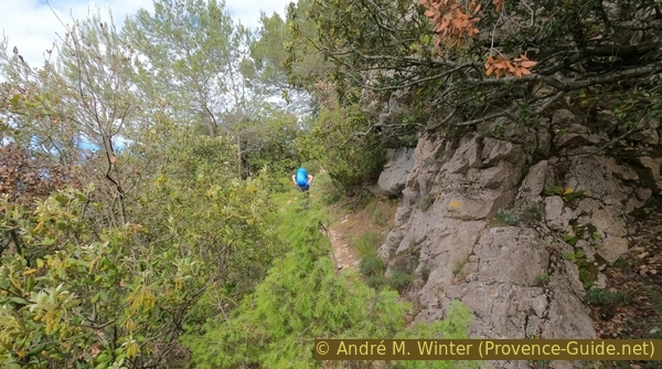
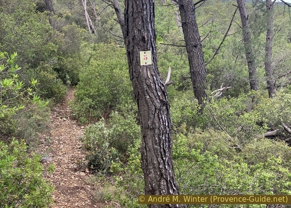
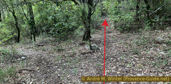
The path descends gently and in a straight line into a pass before climbing up to the left to the summit of an unnamed hill. It is marked as 464 metres high on the IGN map. The route to follow is clear, but the sparse forest has a few small clearings that can be misleading. In such cases, always retrace your steps and refer to the GPS track available for download on this page!
The number on this tree is not a marker.
No reproduction is permitted without the written consent of the author. (id8837)
Path heading south
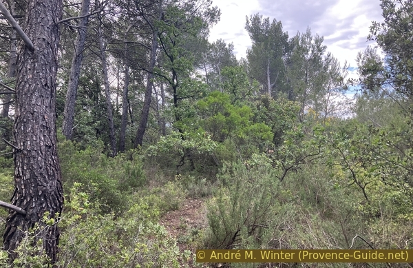
Once you reach the wooded summit, you might want to continue in the same direction, but the only path that is clearly clear turns to the right and north-west to descend the hill.
No reproduction is permitted without the written consent of the author. (id8838)
Path on the hill to the south-east of St. Sauveur
This descent follows a fairly straight line. When you reach this waterhole and a small cairn a little further on, but especially when you can no longer continue in a straight line, turn left.
No reproduction is permitted without the written consent of the author. (id8839)
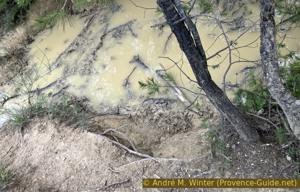
Waterhole
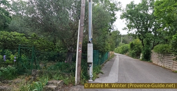
We emerge from the forest onto the wide firebreak that runs alongside the road from Rocbaron to Puget-Ville. Here we find a path where we turn left towards the road pass. If the path in the firebreak is too overgrown, you can also take the forest track below the main road.
A few metres further on, by the roadside and hidden from view from above, stands a monument commemorating Marcel Pierre Marie Le Bihan, a French pilot officer. From January 1940, he was based at the Cuers fighter squadron, not far from Rocbaron. This base served to protect the military port of Toulon. On 15 June 1940, he and the squadron engaged in combat with a formation of Italian aircraft. He was hit and, instead of attempting to land, collided with one of the Italian fighters, dragging it down with him. Seriously injured, he died the same day in Brignoles Hospital. The battle took place at this spot. This aviation hero should not be confused with Marcel Le Bihan, a very active member of the Resistance in the Tarn.
No reproduction is permitted without the written consent of the author. (id8840)
Firebreak alongside the D12
We remain at a higher elevation, without descending towards the road.
No reproduction is permitted without the written consent of the author. (id8841)
Path through the firebreak alongside the D12
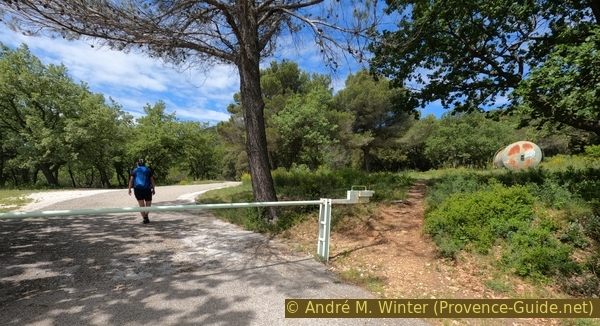
We come to a lay-by with a water tank. Here, we continue straight on for about fifty metres along a forest track.
No reproduction is permitted without the written consent of the author. (id8842)
Water tank on the Col du Gros Clapier saddle
When this forest track veers too far to the left, we head down to the right towards the road pass.
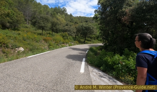
No reproduction is permitted without the written consent of the author. (id8843)
The road on the Col du Gros Clapier saddle
At the pass, the road splits into routes towards Puget-Ville and Cuers.
No reproduction is permitted without the written consent of the author. (id8844)
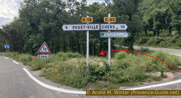
D21 and D40 roads on the Col du Gros Clapier saddle
Just between these two directions, a forest track descends towards the south-east without any signposting. We take it.
No reproduction is permitted without the written consent of the author. (id8845)
Font Julliou track
The slope levels out after about 200 metres, where we keep right at the fork in the forest tracks.
No reproduction is permitted without the written consent of the author. (id8846)
Junction on the Font Julliou track
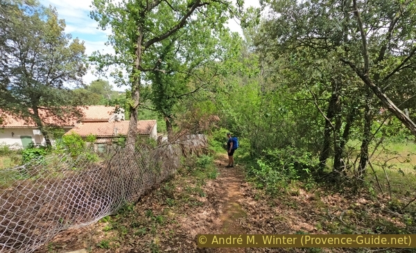
We pass a few low walls marking properties that appear to be abandoned.
No reproduction is permitted without the written consent of the author. (id8847)
Forest track beneath the D40
Beyond that, the forest track is increasingly reclaimed by the woodland and ends in a gentle descent.
Our route continues along a path to the left without changing direction significantly. The descent becomes steeper.
No reproduction is permitted without the written consent of the author. (id8848)
Forest track beneath the D40
We now keep heading in this direction without turning left.
We pass ruined terraces. The forest reclaimed these cultivated areas long ago.
No reproduction is permitted without the written consent of the author. (id8849)
Junction on the path beneath the D40 towards the Chapel of Sainte Philomène
At an altitude of around 360 metres, the path turns right and continues at this height for a while. You walk along what used to be the boundary between the forest and the terraces below. Nothing remains of these lower terraces. Nowadays, vine and olive cultivation is confined to the plain.
No reproduction is permitted without the written consent of the author. (id8850)
The path beneath the D40 towards the Chapel of Sainte Philomène turns and passes over low walls
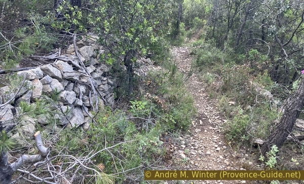
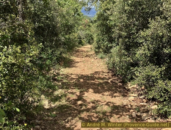
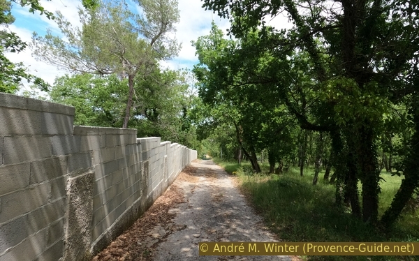
We walk for 500 metres along this man-made path, which is no longer in good condition.
No reproduction is permitted without the written consent of the author. (id8851)
The path beneath the D40 towards the Chapel of Sainte Philomène passes over low walls
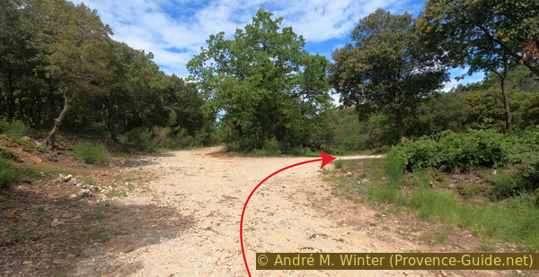
We come to a much wider path. This is the classic trail from Puget-Ville to the Sainte-Philomène Chapel.
We continue straight on. For us, it's time to head back up.
No reproduction is permitted without the written consent of the author. (id8852)
Junction of paths beneath the Chapel of Sainte Philomène
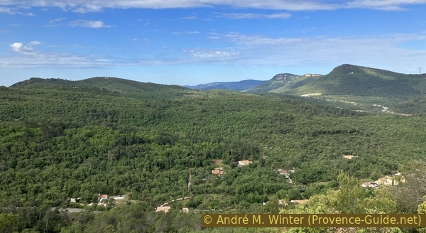
This path climbs and curves slightly to the right. When we catch our first glimpse of the chapel, the final ascent to the chapel begins.
No reproduction is permitted without the written consent of the author. (id8853)
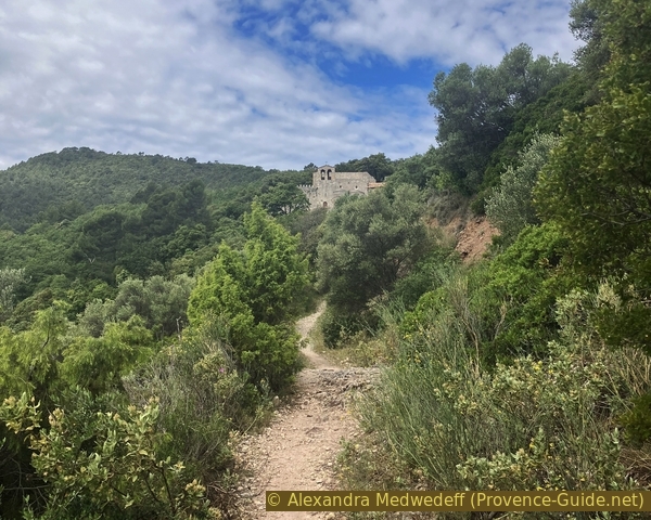
The Chapel of Sainte Philomène in view
The telephoto lens allows you to bring the chapel closer without actually being there.
No reproduction is permitted without the written consent of the author. (id8854)
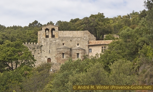
Sainte Philomène Chapel in view
Beneath the chapel lie the unsecured ruins of the old village of Puget.
You can take a short walk there and back.
No reproduction is permitted without the written consent of the author. (id8855)
Ruins beneath Sainte Philomène Chapel
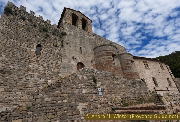
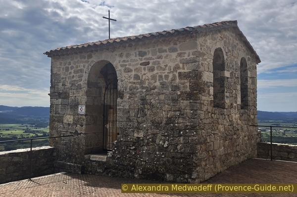
The church has been renamed several times since its foundation in the 11th century. Enlarged in 1328, it gained two additional naves in the Provençal Gothic style, giving it a blend of Romanesque and Gothic styles. It appears that from the 14th century onwards, it was incorporated into the defensive system of the medieval castle.
Around the chapel are works by artists that remain unexplained and neglected.
No reproduction is permitted without the written consent of the author. (id8856)
Sainte Philomène Chapel
We pass through the lower porch.
No reproduction is permitted without the written consent of the author. (id8857)
Porch leading to Sainte Philomène Chapel
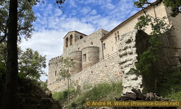
The chapel has two apses and an adjoining house which is inhabited, though the occupants are neither site keepers nor guides.
No reproduction is permitted without the written consent of the author. (id8858)
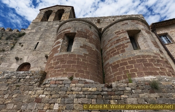
The two apses and the bell tower of Sainte Philomène Chapel
You can walk around the lower part beneath the apses.
This is also where the only entrance is located. It is open by appointment only, to be arranged at Puget-Ville Town Hall. Any signs indicating otherwise are incorrect.
No reproduction is permitted without the written consent of the author. (id8859)
Sainte Philomène Chapel
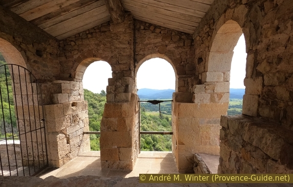
A flight of steps allows you to continue walking around the religious building in a clockwise direction. You can then see that the chapel is built into the side of the rock, as you are now level with the roof.
No reproduction is permitted without the written consent of the author. (id8860)
Climb to the south of Sainte Philomène Chapel
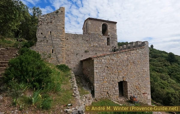
A gate, which is usually open, leads onto the terrace that forms the chapel's roof. A cubic structure with large openings is the chapel's bell tower.
No reproduction is permitted without the written consent of the author. (id8861)
Large bell tower of Sainte Philomène Chapel
The bell tower was originally intended to house two bells, but none remain, even the clamping mechanisms are missing.
No reproduction is permitted without the written consent of the author. (id8862)
Empty large bell tower of Sainte Philomène Chapel
Apart from the view over the Puget Valley and the Massif des Maures, the terrace also offers a bird's-eye view of the roofs of the two apses.
No reproduction is permitted without the written consent of the author. (id8863)
The two apses of Sainte Philomène Chapel
Section 3: Chapelle Ste. Philomène - Rossignol - Rocbaron
➙ 4 km ... 1 h 15 min ➚ 200 m ➘ 160 m ↝ average
5% easy trails, faulty marks
5% hard-surfaced quiet side streets, faulty marks
<5% hard-surfaced country road, cairns
10% easy trails, faulty marks
60% forest roads, without marks
20% hard-surfaced quiet side streets, without marks
The clues
- Ste. Philomène Chapel, 345 m
- Rossignol east ridge, 535 m
- Les Bréguières, 380 m
- Rocbaron schools, 380 m
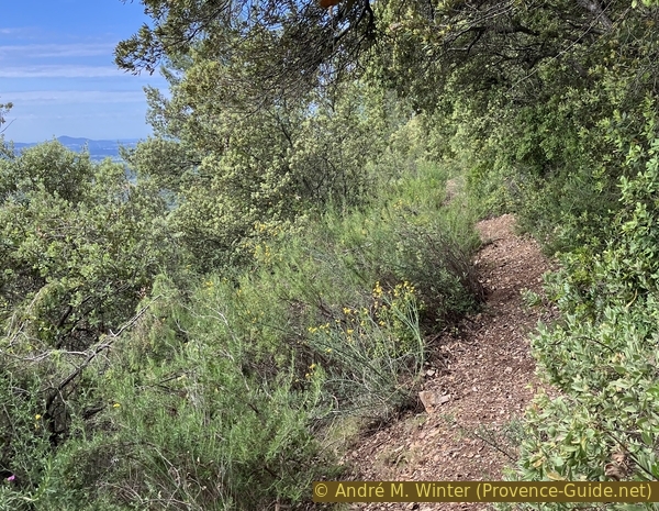
The return journey is mainly along wide forest tracks. In this section, we pass the highest point of the route.
Head back down towards the north side of the chapel and turn left there. This is a large forecourt with further ruins. At the far end there is a water tap, but it was dry in May 2023.
No reproduction is permitted without the written consent of the author. (id8870)
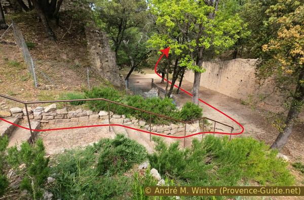
Descent from the roof of Sainte Philomène Chapel
A little further on, there is a path leading up to a meadow shaded by tall trees. The spot is ideal for a picnic, but there is a severe lack of benches and tables.
No reproduction is permitted without the written consent of the author. (id8864)
Path to the north of Sainte Philomène Chapel
The path continues beyond the large meadow, climbing all the while. It used to be a themed plant trail, but in the meantime, other plants have grown without the signs being updated.
No reproduction is permitted without the written consent of the author. (id8865)
Path to the north-west of Sainte Philomène Chapel
Further up, we come back onto the access road to the house adjoining the chapel and the car parks dedicated to the chapel.
No reproduction is permitted without the written consent of the author. (id8866)
Access road to Sainte Philomène Chapel
Further up, the county road follows, where we turn right for less than 80 metres.
No reproduction is permitted without the written consent of the author. (id8867)
The D40 near Sainte Philomène Chapel
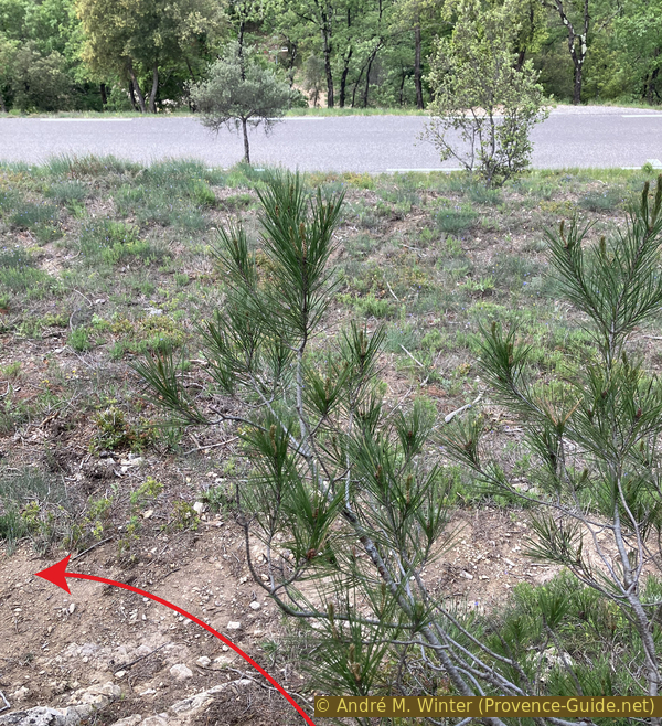
We come to a narrow path that has become somewhat overgrown. A small cairn indicates the access.
This path is a shortcut. If it is too overgrown, you can continue along the road and take the first forest track on the left.
No reproduction is permitted without the written consent of the author. (id8868)
Path leading up from the D40 to the pass south-east of Rossignol Hill
This path climbs steadily towards the end.
No reproduction is permitted without the written consent of the author. (id8869)
Path leading up from the D40 to the pass south-east of Rossignol Hill
It leads us uphill to a pass between the hills. It is also a junction of forest tracks. We turn right here.
As we turn, we pass a sign explaining that we are entering private land, but access is permitted on foot. We are on an officially marked trail.
No reproduction is permitted without the written consent of the author. (id8871)
The pass south-east of Rossignol Hill
This track climbs relentlessly.
This stony track features small hunters' hides at irregular intervals.
No reproduction is permitted without the written consent of the author. (id8872)
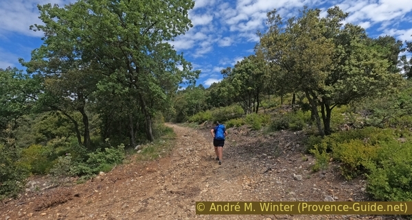
The forest track leading up south-east of Rossignol Hill
Head towards a rock topped with a cross. Finally, you climb two hairpin bends.
No reproduction is permitted without the written consent of the author. (id8873)
The forest track leading up south-east of Rossignol Hill
We pass beneath the rock with the cross on our right.
There is no easy access from this side.
No reproduction is permitted without the written consent of the author. (id8874)
The forest track south-east of Rossignol Hill
We reach a junction where we continue straight on.
No reproduction is permitted without the written consent of the author. (id8875)
Junction east of Rossignol Hill
The path continues to climb gently until we reach the highest point of the route.
No reproduction is permitted without the written consent of the author. (id8876)
The forest track east of Rossignol Hill
It is a meadow with no view, at an altitude of around 525 metres.
No reproduction is permitted without the written consent of the author. (id8877)
Meadow on the forest track east of Rossignol Hill
We walk straight across here to descend to a flat area where the forest track makes us turn left. Now begins the descent towards the north-west. From here on, keep heading in this direction without turning at the various forest track junctions.
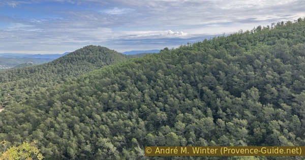
Shortly after the left-hand bend, there is a viewpoint on the right as the hill is quite steep here. You can look back over part of the route.
No reproduction is permitted without the written consent of the author. (id8878)
La Loube, Rocbaron, the Rock of St. Sauveur, Théméré and Les Terres Blanches
The descent remains steep for a track suitable for vehicles.
No reproduction is permitted without the written consent of the author. (id8879)
The Coquillades track towards Rocbaron
250 metres past the viewpoint, there is a car wreck in the bushes to the right of the track.
A little further down, on the right, there are some rather wild but managed chestnut trees. Naturally, picking the nuts is prohibited.
No reproduction is permitted without the written consent of the author. (id8880)
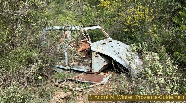
Abandoned 2CV Duck wreck in the forest
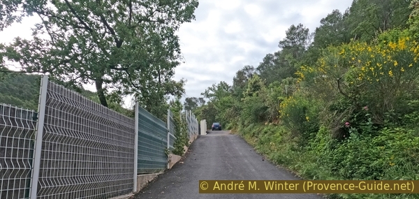
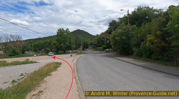
When the path no longer runs straight ahead, turn right and go through a closed gate.
No reproduction is permitted without the written consent of the author. (id8881)
Junction at Les Bréguières towards Rocbaron
This brings us to Impasse Paul Arène, which begins with a large, derelict house on the left.
No reproduction is permitted without the written consent of the author. (id8882)
The Chemin des Bréguières leads to Impasse Paul Arène
The road continues to descend steeply.
No reproduction is permitted without the written consent of the author. (id8883)
Impasse Paul Arène towards Rocbaron
The road gradually becomes more passable.
No reproduction is permitted without the written consent of the author. (id8884)
Impasse Paul Arène towards Rocbaron
At the T-junction, turn left.
No reproduction is permitted without the written consent of the author. (id8885)
Impasse Paul Arène joins Chemin des Bréguières
We arrive at an offset junction where, in theory, we continue straight ahead. In practice, we first turn right and then immediately left at the pedestrian crossing.
No reproduction is permitted without the written consent of the author. (id8886)
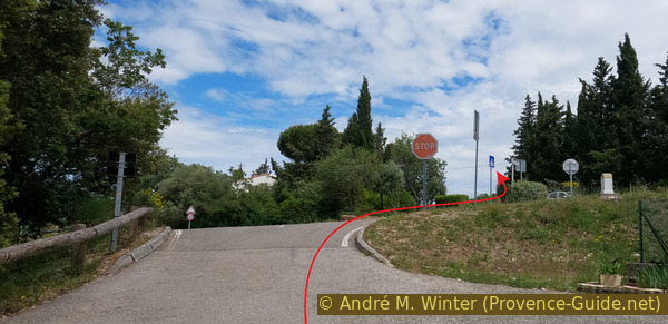
Chemin des Bréguières joins the D12
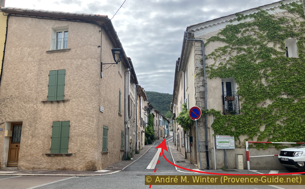
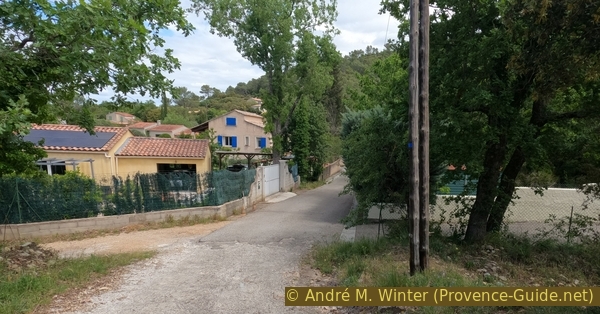
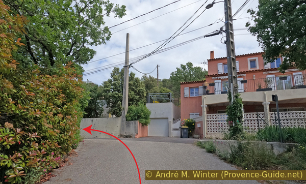
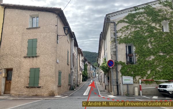
After that, it is straight ahead to return to the starting point at Le Grand Chêne nursery school.
Those coming from the Fray Redon shopping area continue straight ahead to rejoin their return route under Rue Saint Sauveur.
No reproduction is permitted without the written consent of the author. (id8887)
Avenue Marcel Le Bihan
Appendix: Fray Redon - Rocbaron
➙ 2,3 km ... 30 min ➚ 80 m ➘ 15 m ↝ easy
20% hard-surfaced country road, without marks
5% parks, without marks
10% hard-surfaced quiet side streets, without marks
10% hard-surfaced country road, without marks
55% hard-surfaced country road, few marks
The clues
- Roundabout Quatre Chemins, 320 m
- Fountain Fontaine de Rico, 330 m
- Chemin des Vignes, 360 m
- Rue Saint Sauveur, 380 m
The climb from the Fray Redon shopping area towards the centre of Rocbaron is not exactly the most scenic, but you do pass a curious fountain.
Walk eastwards from the bus stop near the roundabout. Keep to the left-hand side of the road.
Fray Redon roundabout
You will walk alongside a park, entering it at the first opportunity over a small bridge. Cross the green space to reach the Fontaine de Rico (or Ricaud) spring and its wash place. For a long time, this was the village's only spring providing water all year round.
The Rico fountain owes its name to one of its former owners. For a long time, it served a dual purpose in Rocbaron. Whilst the village fountain was used for washing small items of laundry, the Rico wash house was used for larger items such as sheets. As the place was some distance from the centre, the women (since the men were at the café) carried their laundry and meals in baskets or wheelbarrows. Under a large plane tree, similar to the one standing here today, these women would gather to share a meal in a spirit of camaraderie. The open space around the fountain allowed the laundry to be left to dry on the grass.
This fountain provided a continuous supply of water, whereas the village fountain would run dry for two to three months during the summer. The spring is located about thirty metres upstream. The Rico fountain is situated on a pasture, a fallow field where sheep graze before setting off on their transhumance. Sheep and shepherds rest there, just as the women did between washing sessions.
No reproduction is permitted without the written consent of the author. (id8889)
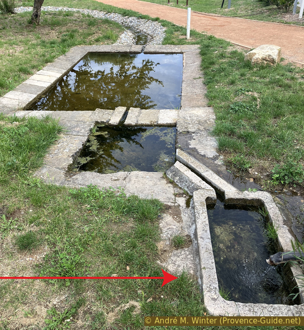
La Fontaine de Rico
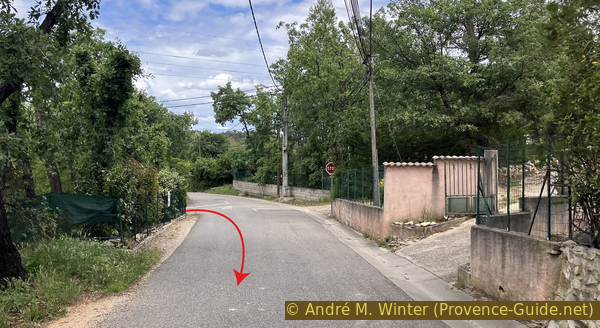
When you reach the fountain, look out for the small road bridge, cross it and continue along this road. It takes you back to the busy road leading to the village of Rocbaron. Walk on for 200 metres and turn left onto Chemin des Blaques. Continue on and climb up to the T-junction, then turn right onto Chemin des Vignes.
No reproduction is permitted without the written consent of the author. (id8890)
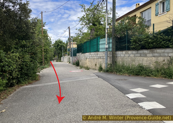
Chemin des Vignes
At the next junction, stay on the wider lane on the left.
No reproduction is permitted without the written consent of the author. (id8891)
Chemin des Vignes
150 metres further on, you cross a bridge over the Pésséguière stream.
No reproduction is permitted without the written consent of the author. (id8892)
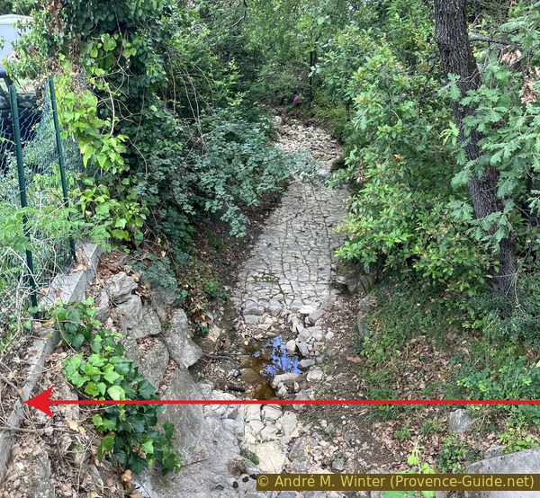
The bed of the Ruisseau de la Pésséguière
You will come to a small roundabout with a tree in the centre. Turn left here onto Rue Fernand Gueit. This takes you straight to the centre, passing the Church of the Transfiguration.
You then arrive at the start of section 1 and on Rue Saint Sauveur.
No reproduction is permitted without the written consent of the author. (id8893)
Rue St. Sauveur in Rocbaron
Sources and additional information
It is better to use a good topographic hiking map: this tour is on the IGN map "Cuers", scale 1:25000, 3445OT.
If you don't want to bother with a paper map, you can also use mapping apps on your cell phone. On the one hand, it is the Cartes IGN app from the official map service. However, it requires access to the data network and this is sometimes difficult in canyons or remote locations.
Alternatively, you can use apps that store data directly on the device. They're generally not free, but they don't cost much. We mainly use OSMAnd, here it is possible to add contour lines, relief shading, markings and others. To store this data on your phone you need a lot of space.
Of course, one needs access to satellites for the GPS signal with any app. In some canyons this is not the case. Therefore, do not rely on the position shown, but read the map on your phone as you would read it on paper. Most apps are available for Android and iPhone. The applications usually allow us to record the route travelled and also view the GPS files offered for each of our hikes.
This page has been seen 510 times since 20 March 2024.
No reproduction is permitted without the written consent of the author. (id8896)
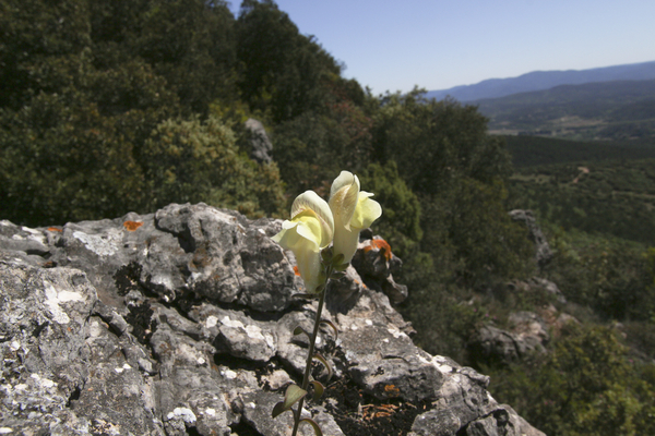
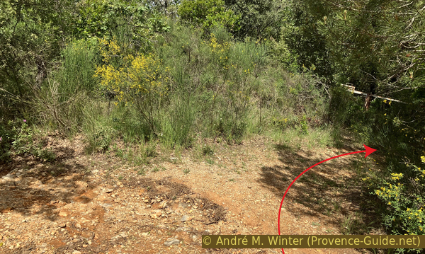
Flowers of Phlomis lychnite