Dolmens des Adrets and Notre-Dame de Pitié chapel
Megalithic treasures hidden between Le Val and Brignoles
hike
difficult
2 h 15 min
no
yes
no
mountain
Introduction
Well-preserved dolmens are quite rare in the département Var because of the geology which does not lend itself well to extract large slabs. Here between Brignoles to the south and Le Val to the north passes a small limestone ridge which has four dolmens fairly close to each other spread over two hills. They are only accessible by hunters' paths and frankly difficult to find because of the scrubland which covers everything. The relief is not very pronounced, so it cannot be used for benchmarks. This tour is very difficult in terms of orientation and you have to know how to struggle with the brambles.
Adret designates the southern slope of a mountain or a hill, the sunny side. This word is common in many Provençal localities. Despite this name, the survey of the tour was carried out on a rainy day in January. The photos are therefore very dark. In good weather, all the dolmens are in the sun. New photos with better weather were taken in January 2025 by a user of the site, he kindly makes them available here, they have been online since February 2025.
The facts
5,5 km total distance
2 h 15 min walk time
240 m total elevation
orientation very difficult
mark 5% of the total distance
30% cross country
25% forest roads
25% moderate trails
15% easy trails
5% hard-to-recognize trails
<5% hard-surfaced quiet side streets
dangers hunters
children no
useful picnic stuff
required hiking boots, long trousers, hiking equipment and water
GPS coordinates (WGS84) of start and end point 43.4327,6.070158
downloads ![]()
![]()
Public transport
There is no public transport to the tour apart from school buses which are not useful for hikers. It ist useful to complain about at the tourist offices of the region.
Access by car
Le Val is north of the Brignoles motorway exit. After the tollbooth, at the following two roundabouts, turn left towards Le Val. Now go up the ridge north of Brignoles. After the saddle, a long hairpin bend descends. At the next bend, we see the welcome monument of the village Le Val, here we must continue straight, thus turn left despite the heavy traffic from the right.
Useful parking spaces
A fairly large space is located on the outside of the bend and before the barrier.
No reproduction is permitted without the written consent of the author. (id6555)
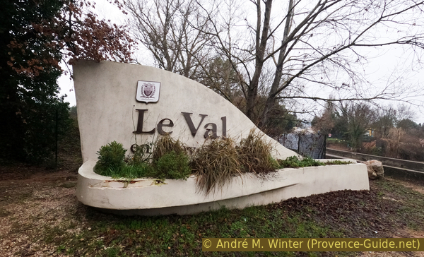
Monument entering Le Val
Hints
There are almost no markers apart from approach paths. Dolmens 2, 3, and 4 are surrounded by bushes and you can't see them until you are directly there. The paths indicated to approach them are visible on the ground, even if it strongly depends on the time of year. When you no longer see a kind of a path, you have necessarily chosen the wrong direction. For this reason, we also take several sections back and forth.
It is strongly recommended to use a GPS with the files provided on this page. Many off-road sections are clearly oriented in one direction, so it's also helpful to use a compass or orient yourself by the sun, if present.
The four dolmens have no names and are simply numbered 1 through 4, which was probably the order of scientific discovery in 1962. On the maps and texts dolmens 1 and 4 are clear, on the other hand there is confusion about dolmens 2 and 3. Wikipedia places dolmen 3 south of dolmen 1 and dolmen 2 north of dolmen 4, while the OSM map reverses 2 and 3. Here we're following the OSM map with dolmen 2 south of dolmen 1 and dolmen 3 north of dolmen 4. To complicate things, we tackle them in the 1, 2, 4, and 3 order. But that is also mainly due to an easier orientation. Domen 1 is north-east, dolmen 2 is south-east, dolmen 3 is north-west and dolmen 4 is south-west.
We are on a hunting ground. Avoid Wednesdays, Saturdays and Sundays in winter when you see many cars parked at the crossroads of forest tracks.
The whole region is a zone with a high risk of forest fires. In summer, but also in other seasons when it is very dry or by strong winds, access to the forest areas can be regulated. As a result, the roads may be closed to traffic and/or the trails prohibited to hikers. Current information: Map of access to the forests of the Var (also english). The map shows the colours green, yellow, orange and red which correspond to levels of danger.
The sections
- Chemin du Carnier - Dolmen des Adrets 1 et 2
- Dolmen des Adrets 3 et 4
- Way back via Notre-Dame de Pitié chapel
No reproduction is permitted without the written consent of the author. (id6573)
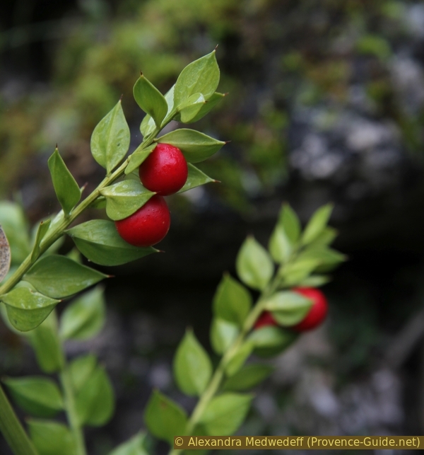
Red berries of the butcher's-broom
Section 1: Dolmen des Adrets 1 + 2
➙ 1,9 km ... 35 min ➚ 110 m ➘ 15 m ↝ very challenging
20% forest roads, few marks
40% moderate trails, without marks
35% cross country, few cairns
The clues
- Source des Treize Rais, 245 m
- Dolmen des Adrets 1, 340 m
- Dolmen des Adrets 2, 355 m
- Dolmen des Adrets 1, 340 m
Up to the first and easily accessible dolmen and through thickets to the second one.
We continue along the forest track called Chemin du Carnier. It further leads to a mine. We pass to the left of a fenced area, it is a source captured to serve the town with drinking water. We also cross a barrier to prevent trucks and motorhomes from passing.
No reproduction is permitted without the written consent of the author. (id6556)
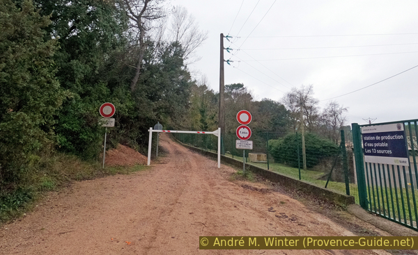
Chemin du Carnier with height limitation
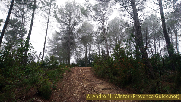
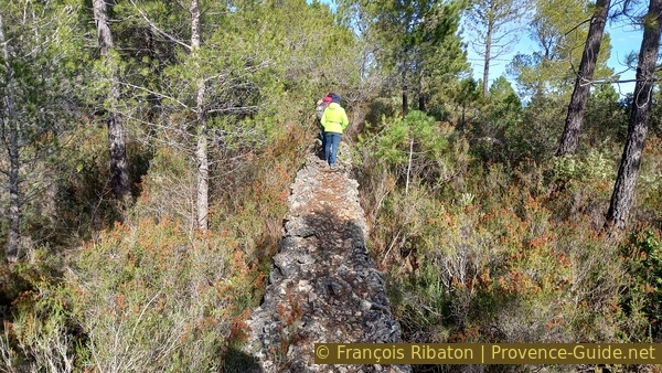
300 meters further on begins our path deviating to the left. These are marked the GR51 and GR653A long distance trails which run along the Mediterranean from east to west. Apart from the red and white marker, there is also an orange and yellow one.
This path runs along the slope. We always take the uphill branch. It ends up climbing into a valley and the slope increases massively.
No reproduction is permitted without the written consent of the author. (id6557)
Chemin du Carnier and junction of the long-distance hiking trail
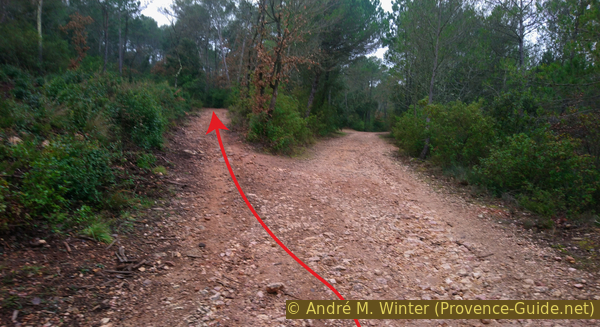
We arrive at a junction with washed-out paths. We take the right branch.
No reproduction is permitted without the written consent of the author. (id6558)
Junction north of the saddle
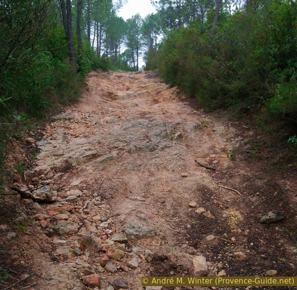
This climb is honestly unpleasant as it is steep and washed out, but here we still have clearly visible clear paths. This will change soon.
No reproduction is permitted without the written consent of the author. (id6559)
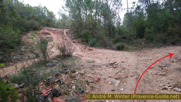
Path leading south and up
What looks like the horizon ahead is a wide trench through where passes a gas pipeline between Fos-sur-Mer and Nice. Arriving at the top, we see the first dolmen on the right on the other side of the road.
No reproduction is permitted without the written consent of the author. (id6560)
Rising track to the gas pipeline
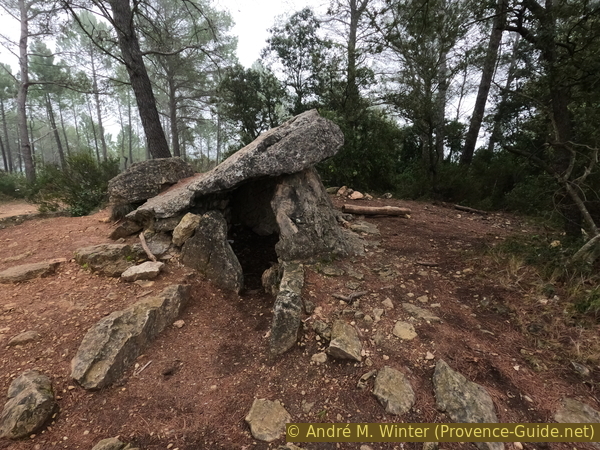
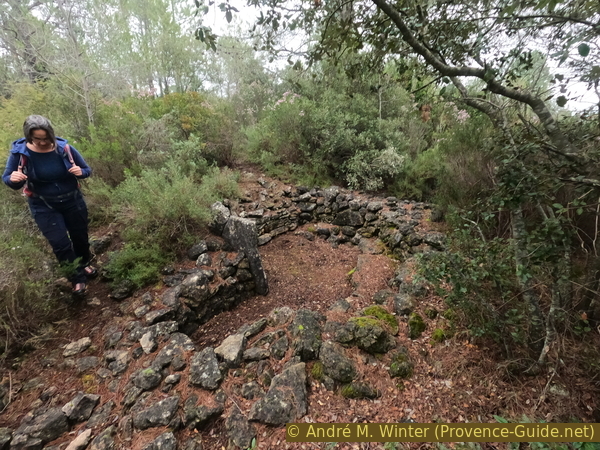
The Dolmen des Adrets 1 rests on an oval hill oriented north-south. The space bounded by rough dry stone to the north and south is slightly rectangular. A threshold stone separates the tomb from the entrance, which is delimited by two side slabs. The dolmen was probably tilted by an earthquake and the massive capstone rests on two of the three supporting stones and on the tumulus.
Archaeological excavations have shown that the dolmen was used for a long time. The oldest layer was destroyed by looting. Burned bones were found under a pavement of small stones. The grave goods consisted of bauxite and steatite balls, rock crystal, bone pendants, shells, some flint arrowheads and a bronze bracelet. The results confirm the hypothesis that the dolmen was used from the end of the Neolithic to the Bronze Age, i.e. -5000 to -1000 years.
This is the only dolmen that still has its cover plate. All four dolmens could contain up to 200 burials.
No reproduction is permitted without the written consent of the author. (id6554)
Dolmen des Adrets #1
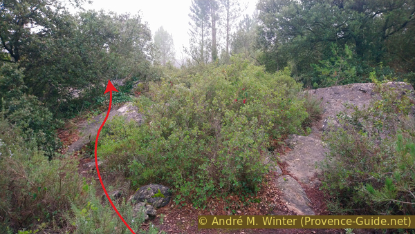
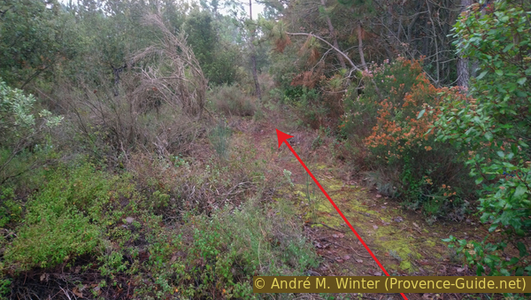
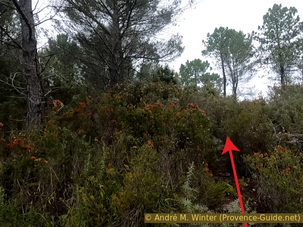
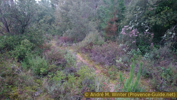
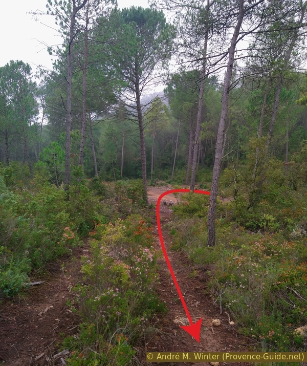
After dolmen 1, the first pathless part begins. It's 350 meters south and just as much back. The very confusing terrain also forces us to remember the course of the way there in order to find it again on the way back. The photo pretty much sums up the terrain of conifers, oaks and bushes of varying sizes.
Fluorescent orange markings have been found between dolmens 1 and 2 since 2024.
From dolmen 1 we descend to the south and at right angles to the axis of the gas pipeline. A few rocks might lead us to the right, but we must go through to the left and keep the same direction.
A few minutes later another path branches off to the left, but we are only allowed to go in the south direction. So do not descend to the left, but stay in a straight line without changing the altitude massively.
No reproduction is permitted without the written consent of the author. (id6562)
Rocks south of dolmen #1
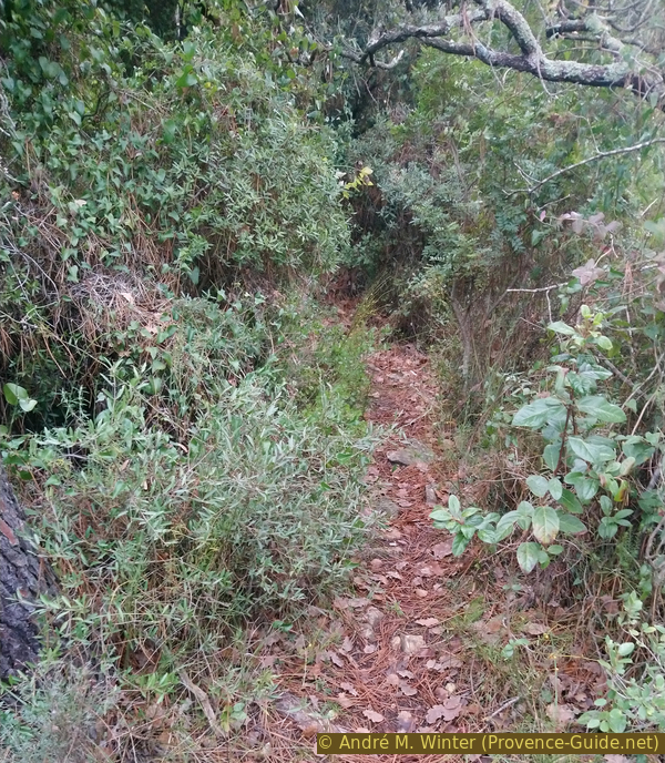
Going south, we're still moving slightly downhill. We come into a somewhat denser pine forest and sometimes we come across old dry stone walls. They marked pastures when that area was forest-less. Big trees, bushes and walls force us to zigzag. However, we must not deviate from the southern direction.
The terrain begins to rise slightly from where the photo was taken. About three minutes later, our path deviates gently to the left and we come to a higher dry stone wall. It is also clearly visible on aerial photos from Google Maps or Géportail (french survey web site).
No reproduction is permitted without the written consent of the author. The permission of use was kindly given to Provence-Guide.net on 11 February 2025. (id7772)
Path on the saddle between dolmen 1 and 3
When we reach the dry stone wall, the Dolmen des Adrets 2 is on the left.
The small dolmen was discovered in 1962 and restored in 1992. The tumulus consists of stones that appear to have been in a double ring wall. The square chamber opens to the west. It is bordered on the north and south by dry stone walls. A stone threshold separates the rooms. Plates were found that showed signs of hammer blows. The cap stone is missing, the front stone is split.
Excavations revealed charred bone deposits protected by slabs and a pile of pebbles. The grave goods consisted of a flint arrowhead, some ceramic fragments and, above all, decorative disc beads made of limestone or soapstone, shell pendants and a pierced boar tooth.
After visiting dolmen 2, we return to dolmen 1 with the top plate by the same route.
No reproduction is permitted without the written consent of the author. (id6564)
Dolmen des Adrets #2
Section 2: Dolmen des Adrets 3 + 4
➙ 2 km ... 1 h ➚ 75 m ➘ 75 m ↝ very challenging
10% forest roads, without marks
20% easy trails, few cairns
50% cross country, few cairns
10% easy trails, few cairns
10% forest roads, without marks
The clues
- Dolmen des Adrets 1, 340 m
- Gas pipeline, 330 m
- Dolmen des Adrets 4, 340 m
- Dolmen des Adrets 3, 350 m
- Dolmen des Adrets 1, 340 m
After short and easy trails we go again more or less pathless to the fourth and third dolmen.
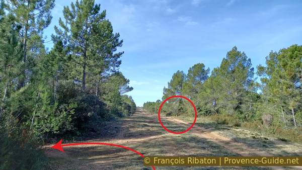
Returning to the first dolmen, we turn left onto the large breach where the underground gas pipeline runs.
About 300 meters further, we turn left again, there is no significant fork before.
No reproduction is permitted without the written consent of the author. The permission of use was kindly given to Provence-Guide.net on 11 February 2025. (id7771)
Turn left from the gas pipeline cut
This unmarked path advances 60 meters to the south and then turns sharply to the right.
No reproduction is permitted without the written consent of the author. (id6566)
On the way to dolmens #4 and #3
We ignore a fork and we continue on the main track, to the right.
No reproduction is permitted without the written consent of the author. (id6567)
Junction north-east of dolmen #3
The path bends to the right and descends a little. 200 meters further follows another junction marked by a cairn. Here we keep to the left to take a path that goes south-east and gradually turns south, all going up a little.
Here we take a direction in the scrubland, there is no longer really a clear trail.
No reproduction is permitted without the written consent of the author. The permission of use was kindly given to Provence-Guide.net on 11 February 2025. (id7770)
Cairn north of dolmens #3 and #4
A last obvious landmark is the dry stone wall you see on the photo. It is also visible in aerial photos.
Thereafter, the terrain becomes very confusing. We force ourselves to keep the direction full south, it is also the one indicated be the dry stone wall. We walk flat without going up to the right and without going down to the left.
No reproduction is permitted without the written consent of the author. (id6569)
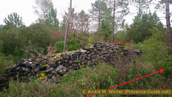
Dry stone wall
We keep this direction south about three minutes and 180 meters beyond the dry stone wall.
The situation is not always as obvious as in the photo.
No reproduction is permitted without the written consent of the author. (id6570)
Situation north of dolmens #4 and #3
Bushes of all sizes are everywhere. The terrain slopes down to the left.
No reproduction is permitted without the written consent of the author. The permission of use was kindly given to Provence-Guide.net on 11 February 2025. (id7769)
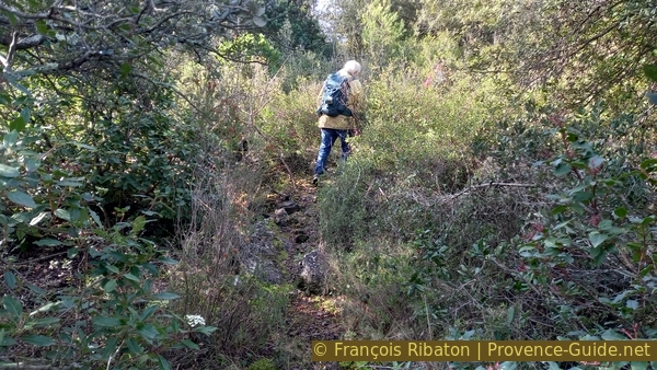
Path towards dolmen #4
Only when our path to the south begins to descend, it's time to spot another path to the right. This portion is slightly uphill. We still have lower ground to the left and rather rising ground to the right of us.
No reproduction is permitted without the written consent of the author. The permission of use was kindly given to Provence-Guide.net on 11 February 2025. (id7768)
Narrow path towards dolmen #4
Finally, we walk west.
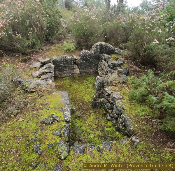
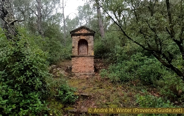
The first thing we see is a curious dry stone shelter, but with a cemented cupola and an entrance of carved stone. In Provence, wells were covered like this, but the ground is here covered with earth. This is of course not the dolmen.
No reproduction is permitted without the written consent of the author. (id6575)
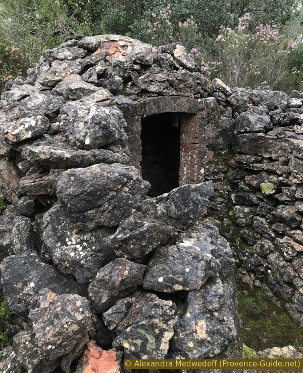
Shelter at dolmen #4
Dolmen 4 is a little further ahead.
Its tumulus has a diameter of about 10 meters. The chamber is slightly trapezoidal and opens to the west. The corridor ends with sill stones arranged in an arch. The north and south walls of the chamber and the corridor are delimited by dry stone walls. Among the megaliths, only one pillar to the left of the entrance still exists. A large displaced stone is next to it, it may have served as a cover.
Although modern looting has destroyed the layers, remains of grave goods (ornamental items and pottery) have been found that date the burials to the Bell Beaker culture (-5000 to -4000 years).
No reproduction is permitted without the written consent of the author. (id6576)
Dolmen des Adrets #4
Arrived at dolmen 4, we turn right to walk north. There isn't really a path here, but a dry stone wall allows us to walk a few meters in the right direction. We are walking on a kind of imperceptible ridge.
No reproduction is permitted without the written consent of the author. The permission of use was kindly given to Provence-Guide.net on 11 February 2025. (id7767)
Dry stone wall north of dolmen #4
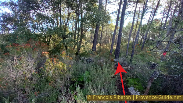
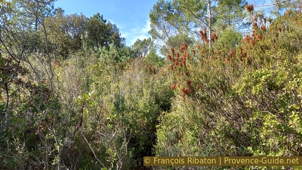
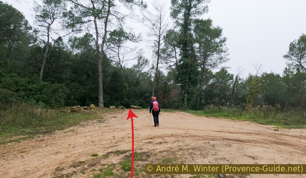
Further on, we have to make our way between the heather. You can see on the photo that we are going up. We are indeed trying to reach the highest point of this wooded hill.
No reproduction is permitted without the written consent of the author. (id6578)
South of dolmen #3
On the top of the hill is the last dolmen. This is the Adrets dolmen number 3.
Dolmen 3 was restored in 1992. It consists of a rectangular chamber opening to the west. It rests in a tumulus. The north and south walls of the chamber and the passage are of dry stone walls. The splintered stone and the megaliths at the entrance are made up of broken menhirs. The covering stone is missing.
The chamber contained charred human bones from up to 30 individuals. The grave goods consisted mainly of jewellry that can be dated to the Copper Age.
No reproduction is permitted without the written consent of the author. The permission of use was kindly given to Provence-Guide.net on 11 February 2025. (id7766)
Dolmen des Adrets #3
From dolmen 3, we first go north-east for about a hundred meters slightly downhill and for less than five minutes.
This path passes a tiny cairn and then takes us south. At this moment we are, without seeing it, near the dry stone wall that we had found when leaving the last visible paths on the way to dolmen 4. We therefore now cross our path from before. We don't continue south but east!
No reproduction is permitted without the written consent of the author. (id6580)
Path north-east of dolmen #3
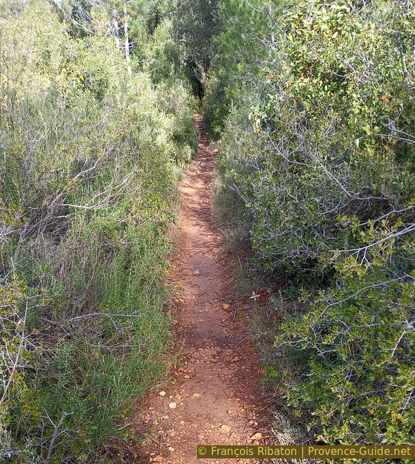
This path to the east remains slightly downhill. On our right are some natural rocks.
Two minutes after crossing the outward path, you come across another tiny cairn made up of two stones. This is the time to turn left because further on you will come across rocks and dry stone walls.
No reproduction is permitted without the written consent of the author. (id6581)
Path north-east of dolmens #3 and #4
This path now heads north-east and takes us to the wider outward path, at the fork we had ignored earlier. We turn right and return along the gas pipeline track to dolmen 1.
No reproduction is permitted without the written consent of the author. The permission of use was kindly given to Provence-Guide.net on 11 February 2025. (id7765)
Path north of dolmens #3 and #4
Section 3: Chapelle Notre-Dame de Pitié
➙ 1,7 km ... 35 min ➚ 55 m ➘ 150 m ↝ average
35% moderate trails, without marks
15% hard-to-recognize trails, without marks
30% forest roads, without marks
5% hard-surfaced quiet side streets, without marks
20% easy trails, without marks
The clues
- Dolmen des Adrets 1, 340 m
- Junction north of the saddle, 285 m
- Antenna road, 340 m
- Notre-Dame de Pitié chapel, 275 m
- Source des Treize Rais, 245 m
Return with an ascent to see an original chapel.
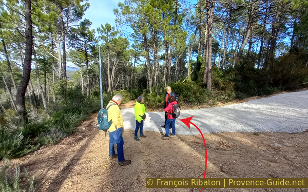
As on the outward way, we descend the steep path in front of dolmen 1 to the first junction. We take to the right here to go up an equally steep and even more washed-out trail.
No reproduction is permitted without the written consent of the author. The permission of use was kindly given to Provence-Guide.net on 11 February 2025. (id7764)
Saddle near dolmen des Adrets #1
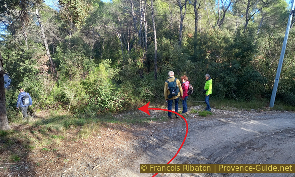
We arrive on a pass between the hill with dolmens 1 and 2 on the right and a hill with an antenna on the left. A few meters further leads forest track up to the left. These are more the traces of forestry machinery than a road. We go up there in a fairly straight line. At a fork, we take the left route that is still steeply uphill.
No reproduction is permitted without the written consent of the author. (id6572)
View back to the forest road on the saddle
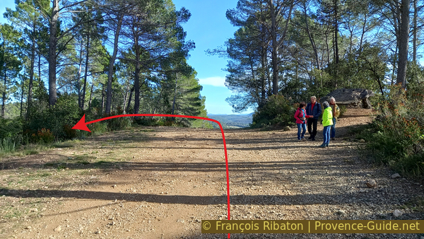
This strenuous climb leads us to a forest road with a concrete curve, where we descend to the left. To the right it leads up to the antenna, but there is no view from there.
No reproduction is permitted without the written consent of the author. The permission of use was kindly given to Provence-Guide.net on 11 February 2025. (id7763)
Road down from the antenna
This road takes us down to a few houses. Further down, it is covered with tar and when it turns more sharply to the right, you take the path that descends to the left. We hear here the traffic of the departmental road between Brignoles and the Val.
No reproduction is permitted without the written consent of the author. The permission of use was kindly given to Provence-Guide.net on 11 February 2025. (id7762)
Down to the left
This path remains above the road and takes us down to a large space where the Notre-Dame de Pitié Chapel is located.
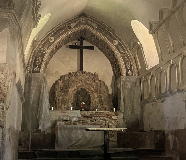
It is called the chapel of 10000 shells because the decor is mainly made up of sea shells, but we are far from the sea here.
A chapel existed here in the 12th century. It was massively enlarged in the 17th century, which means that the two parts have different interior levels. We do not know the date of the decoration with about 30 types of Mediterranean shells. The eight niches in the façade housed statues that no longer exist today.
No reproduction is permitted without the written consent of the author. (id6584)
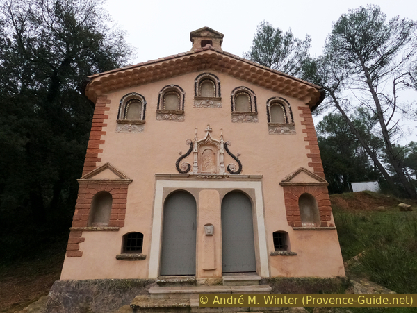
Chapelle Notre-Dame de Pitié
The interior is even more lavishly decorated with shells and pebbles than the facade. 2025 the interior awaits renovation.
No reproduction is permitted without the written consent of the author. (id7761)
Nave and altar of the Chapelle Notre-Dame de Pitié
The way back is in front of the chapel.
No reproduction is permitted without the written consent of the author. (id6585)
Space below Notre-Dame de Pitié chapel
We descend along the Stations of the Cross, three stations have been raised and restored. The path is accompanied by a retaining wall. It first leads on the left above but later changes to the bottom right of it.
No reproduction is permitted without the written consent of the author. (id6586)
Station of the Cross under the chapel
This brings us back to our starting point.
No reproduction is permitted without the written consent of the author. The permission of use was kindly given to Provence-Guide.net on 11 February 2025. (id7760)
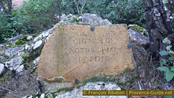
Sign Notre-Dame-de-Pitié
Sources and additional information
This hike is inspired by this Wikipedia page Dolmens des Adrets (only german or french).
It is better to use a good topographic hiking map: this tour is on the IGN map "Brignoles, Le Luc, Lac De Carcès", scale 1:25000, 3444OT.
If you don't want to bother with a paper map, you can also use mapping apps on your cell phone. On the one hand, it is the Cartes IGN app from the official map service. However, it requires access to the data network and this is sometimes difficult in canyons or remote locations.
Alternatively, you can use apps that store data directly on the device. They're generally not free, but they don't cost much. We mainly use OSMAnd, here it is possible to add contour lines, relief shading, markings and others. To store this data on your phone you need a lot of space.
Of course, one needs access to satellites for the GPS signal with any app. In some canyons this is not the case. Therefore, do not rely on the position shown, but read the map on your phone as you would read it on paper. Most apps are available for Android and iPhone. The applications usually allow us to record the route travelled and also view the GPS files offered for each of our hikes.
This page has been seen 2110 times since 20 March 2024.
No reproduction is permitted without the written consent of the author. (id6587)
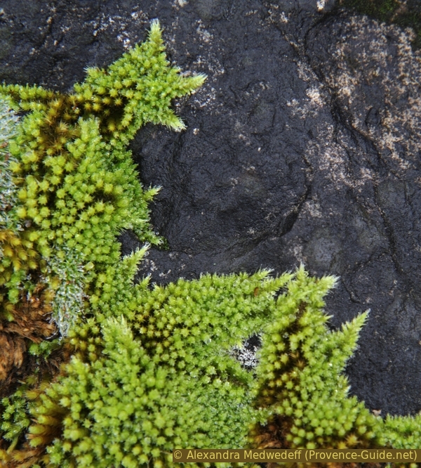
Moss on black rock