On the east coast to Cap Blanc
On the coastal path from Le Lavandou southwards
hike
average
5 h 30 min
yes
forth/back
no
mountain
Introduction
Cap Bénat is a huge private settlement and is known to be very inconvenient for hiking. Always trying to offer circular tours, we still have to be content with a way from Le Lavandou and back on the same route. Alternatives over the ridge are impossible. This and other difficulties make this section of the coastal path one of the least travelled. But that can also be an incentive.
The coast here is oriented strictly to the east, early in the morning the sun shines everywhere and in the afternoon there is already shade. There are a few beaches along the way, but that hardly tempts summer visitors to leave the large beaches of Le Lavandou and Bormes-les-Mimosas. The rocky coast is quite irregular, the path leads up and down like on a roller coaster. These are often steps carved into the stone or exposed paths on the slope. Some areas can be dizzying even if they don't reach great absolute heights.
Two promontories form Cap Bénat: the Pointe du Cristau to the east and Cap Blanc to the south. The latter is the goal on this hike.
The facts
16,2 km total distance
5 h 30 min walk time
510 m total elevation
orientation average
mark 60% of the total distance
45% moderate trails
25% hard-surfaced paths
15% hard-surfaced quiet side streets
10% on beach
dangers summer heat, breezy paths
children yes, but only with experience in the exposed areas
useful picnic stuff, swimwear
required trekking shoes, hiking gear and water
GPS coordinates (WGS84) of start and end point 43.13636,6.367341
downloads ![]()
![]()
Public transport
Le Lavandou can be reached by bus line 878 between St Tropez and Toulon (20 times a day) and by line 873 between St Tropez and Aéroport d'Hyères Airport (4 times a day). Information at Zou! (only french). We get off at Gare Routière Le Lavandou from both directions. From the main street we descend to the parallel Avenue des Martyrs de la Résistance. At the first right-angled intersection, turn right onto Rue de la Rigourette and then immediately left onto Avenue des Commandos d'Afrique. We go straight ahead on this road to the beach, where the starting point of this tour is located.
Access by car
From the A8 motorway and via the A57 or from Toulon and on the A57, continue east on the A570 (St. Tropez) and cross the town of Hyères towards Le Lavandou. Basically, we are aiming for the beaches (Plages) and Port de Bormes further south.
There are several roundabouts on the road from Hyères to Le Lavandou. After a larger roundabout and a supermarket, we turn right towards Centre-Ville, Plages, Port. This road leads towards the sea, but one lane before we turn right to La Favière (corresponds to Port de Bormes). From here to Port de Bormes there are several large car parks and almost everywhere the beach is on the left. This is also where the tour begins.
Useful parking spaces
There are plenty of parking options from Le Lavandou up to and including Port de Bormes, as described above for access by car. Almost all of them are chargeable in summer, but free of charge the rest of the year. Attention, several places can also be occupied by markets. This concerns the Place du Marché in Le Lavandou on thursdays and part of the car park in La Favière in on Bormes harbour saturdays in high season.
No matter where we stow the car, we go to the coast and turn right there. The description starts at the Plage de l'Anglade beach in Le Lavandou.
No reproduction is permitted without the written consent of the author. (id5129)
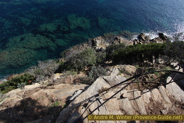
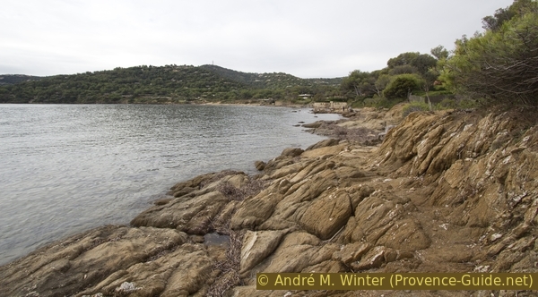
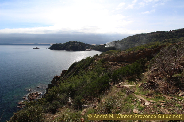
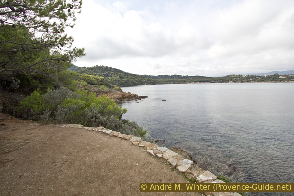
The hiking trail traverses the steep rocky coast
No reproduction is permitted without the written consent of the author. (id5130)
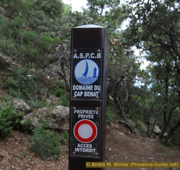
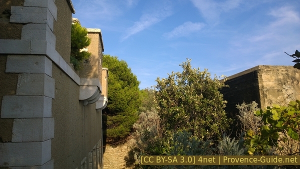
The prohibitions in the Domaine du Cap Bénat can be found everywhere
Hints
This trail is not used too much, some reasons are listed below. As a result, the path is only partially developed, but never fully secured. Exposed areas have no railings. Several times border walls are very close to the water, you have to get through it quite wet, especially when the easterly wind drives the sea to this coast.
From Port du Pradet we have to climb a road to the Phare du Cap Blanc lighthouse because the coast is too steep for a coastal path. The path ends at the lighthouse, the road behind it slid down in 2015 and access is prohibited.
As mentioned at the beginning, the path on the coast between La Londe and Le Lavandou is problematic. The Cap Blanc is the highest point on this route. The path exists for the most part, but there are the following restrictions:
Officially, the path on the south coast between Brégançon and Cap Blanc has been closed for years. However, it can be walked on just below the Cap Blanc.
To the west of Cap Blanc, a landslide has caused the road and path to slide down. The whole area is still unstable and it is very dangerous to look for a passage here. However, no one cares about building a path again because it is closed anyway.
The majority of the eastern slope between Port de Bormes and Cap Bénat is a large privately managed villa area. Access and passing through are prohibited. Only the coastal path is open (and only because of the relevant laws). It is therefore not possible to park a second vehicle at the destination at Cap Bénat. Nor can you go up from the coast to the ridge and start your way back from there.
For these reasons, coupled with the reluctance of the municipality of Bormes-les-Mimosas to invest in hiking in general, make this coastal path a dead end that is also poorly maintained. If a section of the path breaks off, it takes quite a long time for the area to be repaired.
Only Le Lavandou is accessible by public transport, so the hike starts there.
The whole region is a zone with a high risk of forest fires. In summer, but also in other seasons when it is very dry or by strong winds, access to the forest areas can be regulated. As a result, the roads may be closed to traffic and/or the trails prohibited to hikers. Current information: Map of access to the forests of the Var (also english). The map shows the colours green, yellow, orange and red which correspond to levels of danger. The affected area is: Corniche des Maures (4).
The sections
- Plage de l'Anglade - Cap Blanc: from long beaches it goes quickly on a quite demanding coastal path and finally up to a lighthouse
- Cap Blanc - Plage de l'Anglade: return by the same route
Section 1: Plage de l'Anglade - Cap Blanc
➙ 8,2 km ... 3 h ➚ 280 m ➘ 230 m ↝ easy
25% hard-surfaced paths, without marks
5% on beach, without marks
15% moderate trails, with marks
5% on beach, without marks
5% moderate trails, with marks
5% on beach, without marks
25% moderate trails, with marks
15% hard-surfaced quiet side streets, with marks
<5% moderate trails, without marks
The clues
- Plage de l'Anglade beach, 0 m
- Pointe de la Ris cape, 10 m
- Baie du Gau bay, 0 m
- Pointe de l'Esquillette cape, 20 m
- Hafen Port du Pradet, 0 m
- Phare du Cap Blanc lighthouse, 50 m
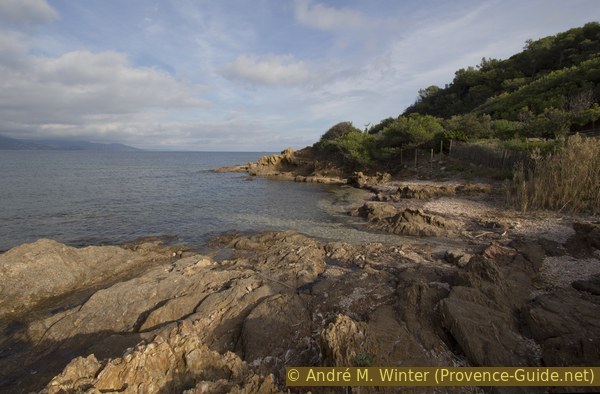
The coast consists of an alternation of capes and rocky bays. The further south we go, the fewer beaches we find. The coastal path is more difficult here than elsewhere.
On the beach in Le Lavandou, you either walk south along the beach promenade of Avenue du Général Georges Bouvet or directly on the sandy beach.
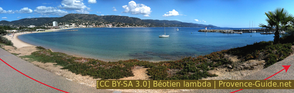
Panorama of Plage d'Anglade beach
After a second stone pier, another stretch of beach follows, but this one turns towards the small Pointe de Gouron cape. When the sea is calm you can walk around by the water, but most of the time you have to go around the rock on the upper path.
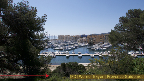
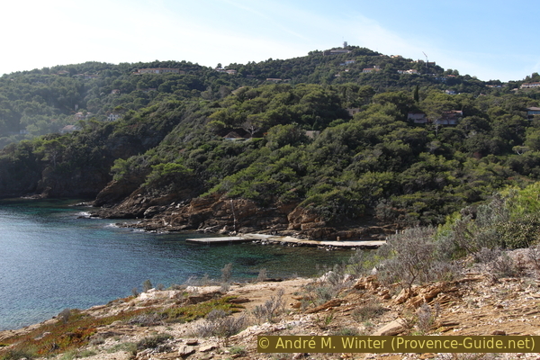
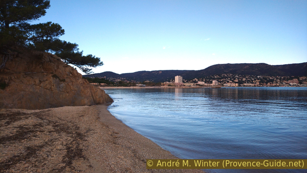
Port de Bormes harbour seen from Pointe de Gouron cape
We leave the footpath at Pointe de Gouron cape as soon as possible and arrive at Port de Bormes. We go south along the quays and so we come to the large Plage de la Favière beach. The large campsite Camp du Domaine is located to the south of the beach. Here the sand band gets narrower and the rocks begin. The coastal hiking trail also starts here.
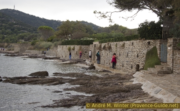
These sections under walls are quite annoying when the water level is higher. When the wind blows, you can't get through here dry. You could easily walk through it at the top of the campsite, but hikers are not allowed to do so. No one will object to this in winter, but there are wristband controls here in summer.
No reproduction is permitted without the written consent of the author. (id5133)
Path under the Camp du Domaine campsite
Private stairs often cross the path. They sometimes look better than the marked path, but mostly lead up to a locked gate. Further ahead there are also several stairs that lead down into rocky coves. This is allowed (because the coast is public area), but these are almost always dead ends.
No reproduction is permitted without the written consent of the author. (id5134)
Private stair at top and coastal path below
Sometimes the coast looks quite brittle, but the path is usually well anchored in the rock. Unfortunately, it often leads directly along fences and walls of private property.
No reproduction is permitted without the written consent of the author. (id5135)
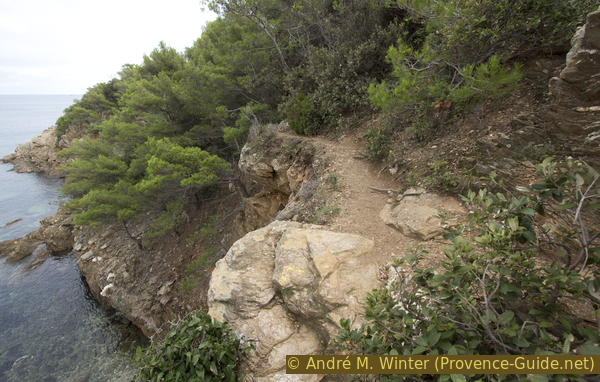
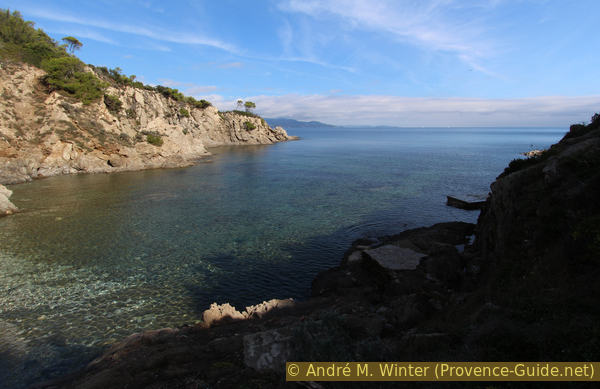
Hiking trail at Pointe de la Ris cape
Here you have to go down into the hole and along the water. The condition of the path is very changeable, especially in the area of private areas that are far too close to the waterline.
No reproduction is permitted without the written consent of the author. (id5136)
Coastal footpath south of Pointe de la Ris cape
After the Pointe de la Ris cape, the path becomes easier and we advance towards the Baie du Gau bay. There is a larger beach there.
No reproduction is permitted without the written consent of the author. (id5137)
Way to the Baie du Gau
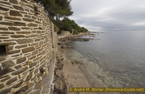
However, just before the beach there is a high wall right on the water. Very often you can only get through here in the water.
Unfortunately, this is a classic illegal situation. One builds a wall too close to the sea and if only the base were made a little wider, nobody would get upset. But as it is, with higher water in winter, the private Domaine du Cap Bénat tramples on the law (three meters of passage on the coast must remain free) and discourages hikers. It can be assumed that this is done on purpose. The municipality of Bormes-les-Mimosas could intervene here, but local council does not seem to recognize the value of hikers in tourism income.
No reproduction is permitted without the written consent of the author. (id5138)
Hikers press themselves against the wall which is too close to the sea
South of the Plage du Gau beach, the path begins again in the rock. As before, you have to cross several curious constructions. They are helpful, but only necessary because the properties of the Domaine du Cap Bénat extend far too far from the water. It is contradictory that the Domaine du Cap Bénat praises itself in its self-portrayal of the preserved nature and the adapted architecture. It's classic eyewash.
No reproduction is permitted without the written consent of the author. (id5139)
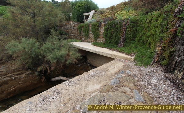
Concrete walkway
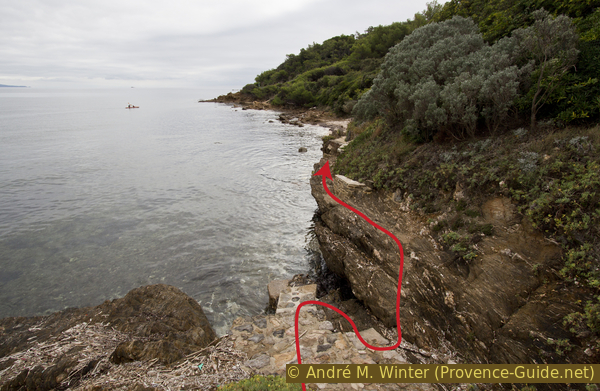
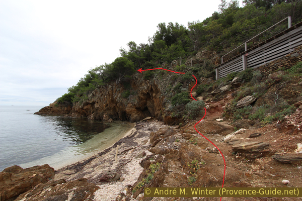
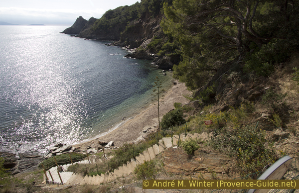
In the following course, the houses deviate slightly from the coastal path. It climbs over promontories and descends into rocky coves. The coast looks wild and in parts one could think to find untouched territory. The marking on the picture indicates descending into the wet gap.
No reproduction is permitted without the written consent of the author. (id5140)
Climbing a rocky bay
The climbs can be impressive and sometimes you doubt that the path goes on. But there is always a way out, even if it can be breezy or very humid.
No reproduction is permitted without the written consent of the author. (id5141)
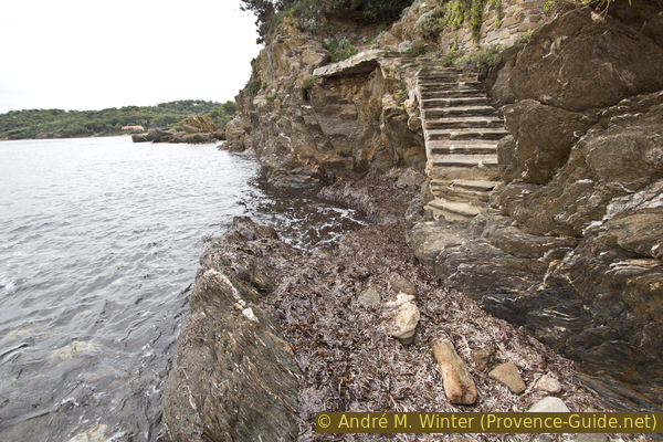
Steps along the coastal path south of the Baie du Gau
South of the main beach in the Baie du Gau bay you can get through several bays full of driftwood. This wild impression contrasts strongly with the new buildings, which always stand out.
Sometimes you wonder if global warming has progressed that far or if the path was really built under water. Here we actually have to take the wet path, the stairs ahead are not dedicated to hikers.
No reproduction is permitted without the written consent of the author. (id5142)
Flooded coastal footpath
We are now on the north side of Pointe de l'Esquillette cape. After the wet section of the trail, we pass a boat ramp and a smaller beach in the Baie du Gau bay. It's quite nice because you don't see as many houses here. The picture was taken on a very gray day in late October.
No reproduction is permitted without the written consent of the author. (id5143)
Beach south of the Baie du Gau
After each beach it goes back into the rugged rock. Here you go along airy above the water. The white area in the middle of the picture is a bench, the hiking trail passes in front of it.
No reproduction is permitted without the written consent of the author. (id5144)
Airy path north of the Pointe de l'Esquillette cape
This same October day also has sunny moments. The coast north of Cape Pointe de l'Esquillette looks a lot nicer.
No reproduction is permitted without the written consent of the author. (id5145)
Coast north of the Pointe de l'Esquillette cape
One bay follows the other. After this wooden terrace, the path leads uphill, but remains under an electric fence (!).
No reproduction is permitted without the written consent of the author. (id5146)
Small beach north of the Pointe de l'Esquillette cape
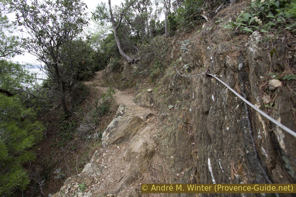
Shortly before the cape, a steel cable secures the narrow section of the trail. This may help. Under normal conditions, however, this is not necessary.
No reproduction is permitted without the written consent of the author. (id5147)
Airy path at Cape Pointe de l'Esquillette cape
In front of the cape we also pass on a semi-circular platform.
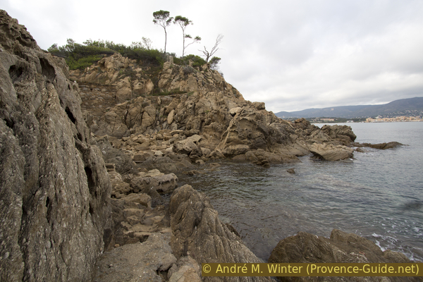
The last area before the promontory is divided into many individual rocky bays and the trail leads up and down several times. Sometimes it leads over narrow stairs that can only be accessed individually.
No reproduction is permitted without the written consent of the author. (id5148)
Narrow stair north of the Pointe de l'Esquillette cape
On the north side of Pointe de l'Esquillette cape there are two parallel paths. The official one is further in and up and not as close to the chasm as the one in the picture. We are higher up here because the rock below is very fragile.
No reproduction is permitted without the written consent of the author. (id5149)
Exposed path north of Pointe de l'Esquillette cape
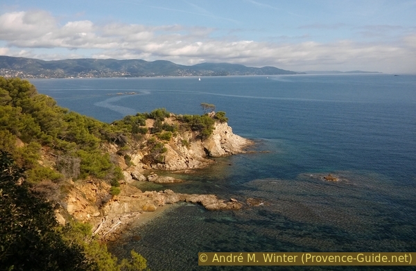
Pointe de l'Esquillette cape is also steep at the top and the marked trail turns right in front of it. But you can also go a bit further for a better overview.
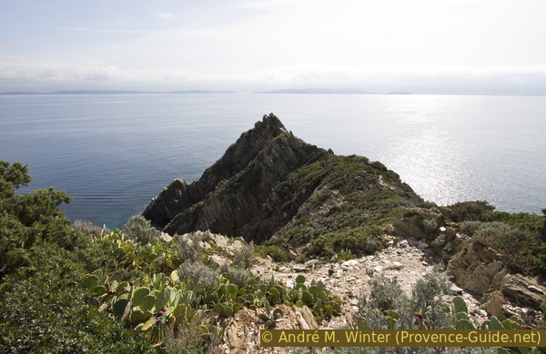
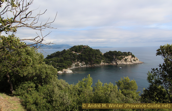
At the back we can see the Passe des Grottes channel between the islands of Île du Levant and Port-Cros. In the center of the picture is Pointe du Cristau cape, which is the eastern outcrop of Cap Bénat. You cannot circum-hike this cape on a coastal path. In front is the smaller Pointe du Pinet, on which we can proceed as we did on the Pointe de l'Esquillette.
No reproduction is permitted without the written consent of the author. (id5150)
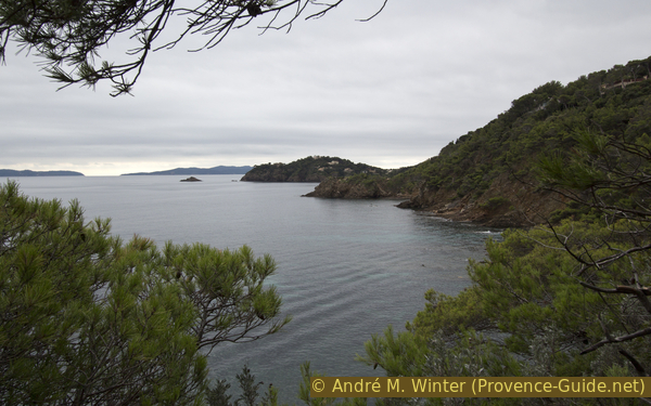
View of the Pointe du Pinet and Pointe du Cristau capes
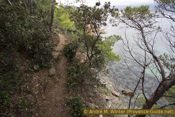
Now there are no longer any beaches. Nevertheless, the path leads inexorably up and down. Sometimes there are stairs going down into coves that can be explored, but after that you have to get back up onto the main path.
No reproduction is permitted without the written consent of the author. (id5151)
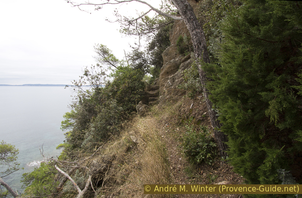
Coastal path south of the Pointe de l'Esquillette cape
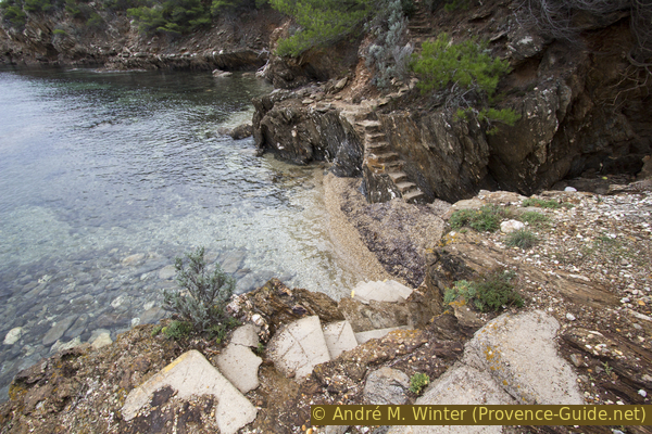
But there are also marked stairs, like these one, that you have to go down.
No reproduction is permitted without the written consent of the author. (id5152)
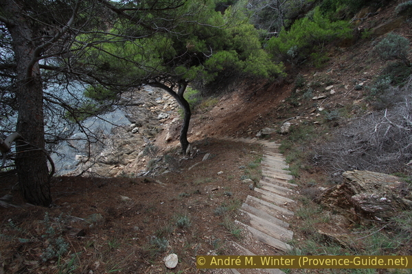
The coastal path steps down to the water
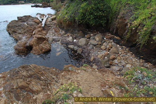
In the rocky bays you can find driftwood, rocks from elsewhere and things that are unlikely to be found here.
No reproduction is permitted without the written consent of the author. (id5153)
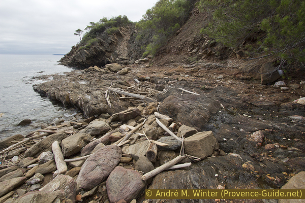
Chaos in the bay north of Cape Pointe du Pinet
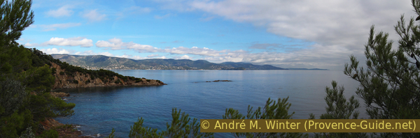
The path now climbs over railway sleepers to the small cape Pointe du Pinet. The photo from the end of October shows bright, beautiful weather on the mainland and dark clouds by the sea.
No reproduction is permitted without the written consent of the author. (id5154)
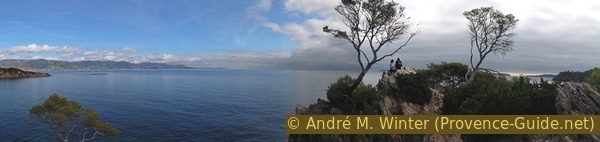
Panorama from Cape Pointe du Pinet
From the beginning of the hike we found prohibition signs on the right and on the land side. This time one is on the other side. The cape is nice though, the rocks here are lighter and more rugged than usual.
No reproduction is permitted without the written consent of the author. (id5155)
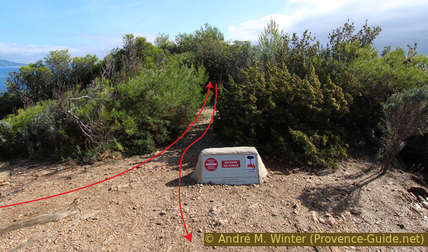
Theoretical access ban to Pointe du Pinet cape
Beware, just south of the cape, a path leads down to a small beach. This is a dead end, the main path continues opposite the prohibition sign.
No reproduction is permitted without the written consent of the author. (id5156)
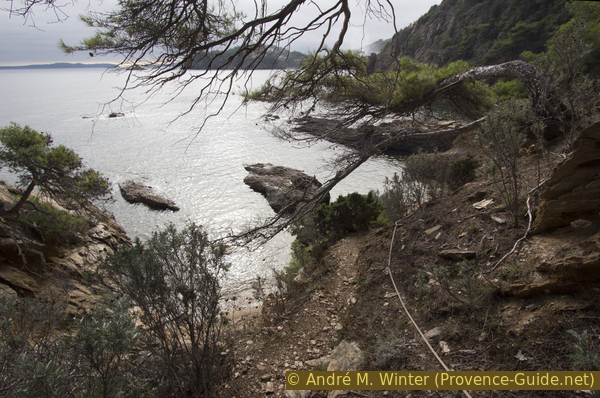
Descent to a tiny beach south of the Pointe du Pinet
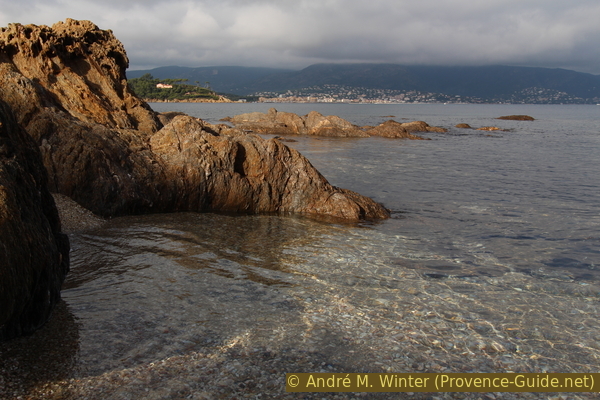
South of the Pointe du Pinet, our trail stays much higher above the water. We are also getting closer and closer to Cap Bénat. The Port du Pradet harbor is located in the indentation in front. There the path leaves the coast to the lighthouse at Cap Blanc.
No reproduction is permitted without the written consent of the author. (id5157)
On the way towards Cap Bénat
We still have to descend into several bays before we can climb to the lighthouse. The first indentation is the Porto Fino beach, which is more deep than it is wide.
On the hill is the former coast watchtower of Cap de Bénat. The ascent is forbidden because it is in the private domain of the Domaine du Cap Bénat.
No reproduction is permitted without the written consent of the author. (id5158)
Bay of Porto Fino
Another unnamed beach often remains covered in driftwood and seaweed. Even the owners of the houses would have to walk to this beach. So it stays unkempt.
No reproduction is permitted without the written consent of the author. (id5159)
Nameless cove south of Plage de Porto Fino beach
First we walk high above the private harbor of Port du Pradet, but in the end we have to go down its quays.
No reproduction is permitted without the written consent of the author. (id5160)
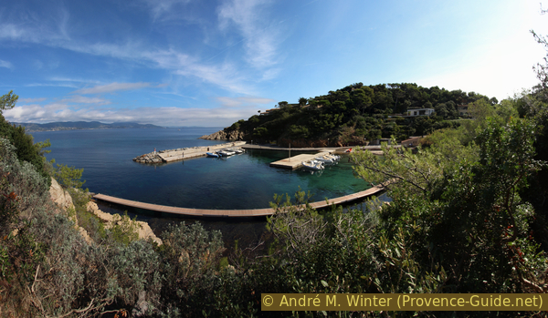
View of the Port du Pradet harbour
phare = lighthouse
fort = fortress
From the port, the path leads a good kilometer on an asphalt road up to the lighthouse. The street crossings are marked and all other streets are blocked or garnished with prohibition signs. It goes at least continuously uphill and partly in the shade.
But this less nice section is still worth it: we come to a nice little lighthouse, an old fortress and a great view.
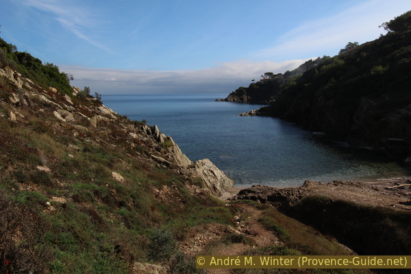
Passionate altimeter collectors or beach lovers can descend after the first straight section of road to the last beach before the cape.
No reproduction is permitted without the written consent of the author. (id5161)
Bay Grande Calanque between Cap Bénat and Cap Blanc
The further ascent is monotonous and leads through a settlement where everyone hides behind high walls and hedges. In the off-season, you'll mostly find workers renovating houses, maintaining gardens, and cleaning swimming pools.
The markings clearly indicate that you should make a sharp left turn at the following intersection. Then just follow the road. Even if you don't see anything at first, we've reached our goal when the road makes a wide arc to the right and the gradient tends to zero. Exactly where the bushes are thickest on both sides, is the lighthouse on the right and the fortress on the left. Further ahead you can see a bench on the left, from where you have an unobstructed view of the lighthouse back.
The lighthouse probably dates from the end of the 19th century (old documents have been destroyed). It has been remotely controlled by Porquerolles since 1984.
No reproduction is permitted without the written consent of the author. (id5162)
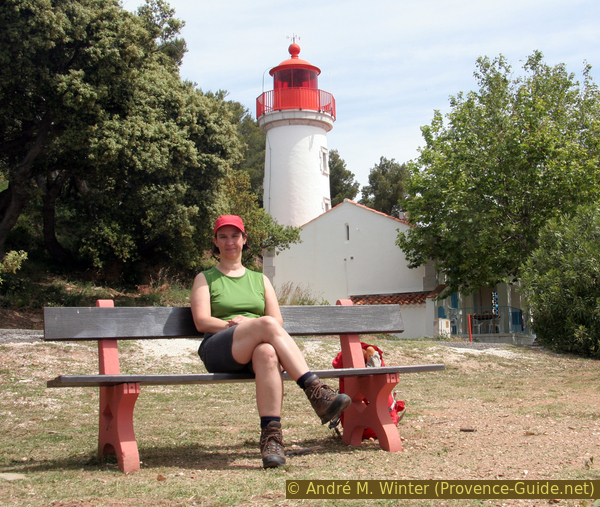
Break at the lighthouse at Cap Blanc
From the bench you can walk a little further in the direction of Cap Blanc. It's very steep and rugged. Descending to the water is impossible. The cape is not white (blanc), but the mica schist can reflect the sun. The rocks look really bright when viewed from the sea.
No reproduction is permitted without the written consent of the author. (id5163)
Cap Blanc
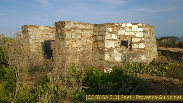
If we turn around we see the ruins of the fortress, the lighthouse and at the top the former military coast guard tower.
No reproduction is permitted without the written consent of the author. (id5164)
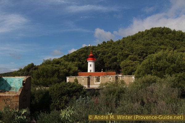
Fortress, lighthouse and coastal watchtower at Cap Blanc
The small fortress is still surrounded by a moat. In front of it is a concrete bunker.
Fort and bunker at Cap Blanc
At the very front is a curious octagonal building that looks less old. It was built from the weak local stones. It is the housing of a radar that the German occupiers operated here in 1943.
We have arrived at the end of this hike. Since there is no traffic, it is very quiet here even in summer.
In 2015, the further road slipped and there is no longer any way to Brégançon, and you can't even walk through it. Access to the Plage de la Lanterne beach below is technically possible, but very frequent rockfalls make the descent dangerous.
As noted at the beginning, we can now only go back on the way we came here.
German radar housing at Cap Blanc
Section 2: Cap Blanc - Plage de l'Anglade
➙ 8 km ... 2 h 30 min ➚ 230 m ➘ 280 m ↝ easy
15% hard-surfaced quiet side streets, with marks
25% moderate trails, with marks
5% on beach, without marks
5% moderate trails, with marks
5% on beach, without marks
15% moderate trails, with marks
5% on beach, without marks
25% hard-surfaced paths, without marks
The clues
At the very front is a curious octagonal building that looks less old. It was built from the weak local stones. It is the housing of a radar that the German occupiers operated here in 1943.
We have arrived at the end of this hike. Since there is no traffic, it is very quiet here even in summer.
In 2015, the further road slipped and there is no longer any way to Brégançon, and you can't even walk through it. Access to the Plage de la Lanterne beach below is technically possible, but very frequent rockfalls make the descent dangerous.
As noted at the beginning, we can now only go back on the way we came here.
We look one last time at Pointe du Cristau cape, which you could only circum-hike by climbing in the water.
No reproduction is permitted without the written consent of the author. (id5167)
Pointe du Cristau cape at Cap Bénat
Since there is (really!) no other alternative, we first go back across the road to the small port of Port du Pradet.
No reproduction is permitted without the written consent of the author. (id5168)
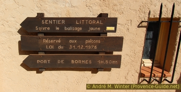
Signpost at Port du Pradet harbour
We now go through numerous rocky bays one after the other and just as many more or less large rocky outcrops. We start with the nameless bay south of Porto Fino.
No reproduction is permitted without the written consent of the author. (id5169)
Nameless bay south of Porto Fino
The Pointe du Pinet cape follows afterwards. In autumn, when the sun breaks through the clouds, the colours are suddenly much richer.
No reproduction is permitted without the written consent of the author. (id5170)
Pointe du Pinet cape in the autumn sun
At the same time, Pointe de l'Esquillette cpae is in the shadow of a large cloud.
No reproduction is permitted without the written consent of the author. (id5179)
Pointe de l'Esquillette cape and rocky cliffs
To the north of the Pointe de l'Esquillette there are a few breezy sections, but you can bypass them on a higher path on the left.
No reproduction is permitted without the written consent of the author. (id5171)
Path on the north edge of Cape Pointe de l'Esquillette cape
This platform is not connected to any house above, the coastal path runs over it. Is it an old military position?
No reproduction is permitted without the written consent of the author. (id5172)
Semi-circular platform north of the Pointe de l'Esquillette cape
On the way back, the sun's rays make the rocks shine.
No reproduction is permitted without the written consent of the author. (id5173)
Tiny gravel beach
To the north of the Baie du Gau, the walls are still too close to the water.
No reproduction is permitted without the written consent of the author. (id5174)
Wall standing too close to the sea
Cape Pointe de la Ris is not high, but the rocks here are particularly wildly weathered, so the trail makes several turns.
No reproduction is permitted without the written consent of the author. (id5175)
Coastal path at Pointe de la Ris cape
After these last rocks we come to the Plage de la Favière. The Port de Bormes harbor glows in the evening sun. In the background the mountains of the Massif des Maures.
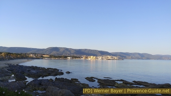
Plage de la Favière beach seen from the south
On the way back, if you want to go around the Pointe de Gouron rock by the water, go past the boat garages to the small beach south of it. The photo shows the place where you have to climb through the water or over the rock.
No reproduction is permitted without the written consent of the author. (id5177)
Pointe de Gouron cape and Le Lavandou
After the Port de Bormes we come back to the long beach Plage de l'Anglade. So we are back at the end of this tour.
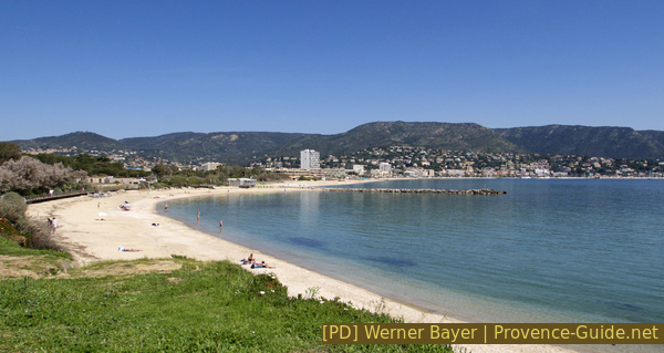
Plage de l'Anglade beach
The photo was taken at noon.
Sources and additional information
It is better to have a good topographic hiking map: this tour is on the IGN map "Le Lavandou, Corniche des Maures, Parc national de Port-Cros", scale 1:25000, 3446ET.
If you don't want to bother with a paper map, you can also use mapping apps on your cell phone. On the one hand, it is the Cartes IGN app from the official map service. However, it requires access to the data network and this is sometimes difficult in canyons or remote locations.
Alternatively, you can use apps that store data directly on the device. They're generally not free, but they don't cost much. We mainly use OSMAnd, here it is possible to add contour lines, relief shading, markings and others. To store this data on your phone you need a lot of space.
Of course, one needs access to satellites for the GPS signal with any app. In some canyons this is not the case. Therefore, do not rely on the position shown, but read the map on your phone as you would read it on paper. Most apps are available for Android and iPhone. The applications usually allow us to record the route travelled and also view the GPS files offered for each of our hikes.
This page has been seen 2906 times since 20 March 2024.