The Roman monuments of Fréjus as a city walk
All freely visitable traces of the ancient Forum Julii
walk
easy
2 h 45 min
yes
yes
built-up area
walk
Introduction
The urban area of Fréjus has the highest density of Roman ruins in all of southern France. In contrast to the more famous Arles or Nîmes, very few monuments are still well preserved here. The reason is geological: the rock types mica slate and porphyry are not suitable for buildings with large stone blocks, these rocks are simply too weak for this. The Romans built everything here from burnt bricks, which, however, do not survive as well as large and heavy limestone blocks. But we find here an aqueduct, Roman city walls, embankments, remains of thermal installations and a port. Most of these relics can now be found in public parks and these oases of calm help you forget the few sections in heavy traffic. There are also many medieval buildings.
A city that is so rich in history naturally has appropriate museums and buildings that have opening hours or must be visited with guided tours. These are highly recommended, there are hints in the text. The tour is designed in loops that always lead back to the old town centre. The path is optimized in terms of walking and does not follow any historical or urban planning logic.
The facts
11,5 km total distance
2 h 45 min walk time
45 min visiting time
90 m total elevation
orientation easy
mark 0% of the total distance
40% hard-surfaced city alleys
30% hard-surfaced city roads
25% parks
5% easy trails
dangers traffic
children no
useful picnic stuff
required trekking shoes, hiking gear and water
GPS coordinates (WGS84) of start and end point 43.431988,6.732871
downloads ![]()
![]()
No reproduction is permitted without the written consent of the author. (id3942)
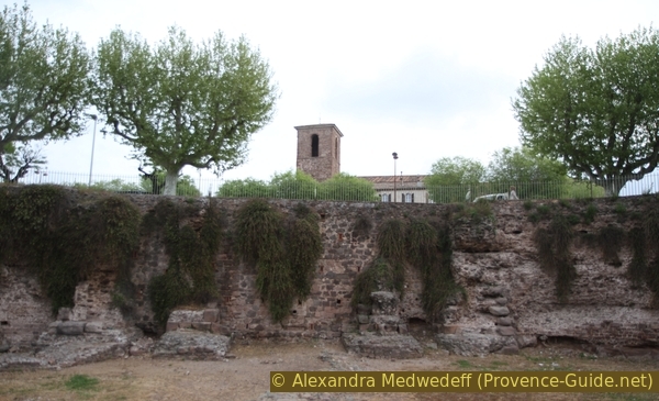
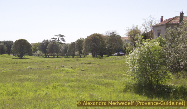
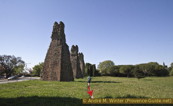
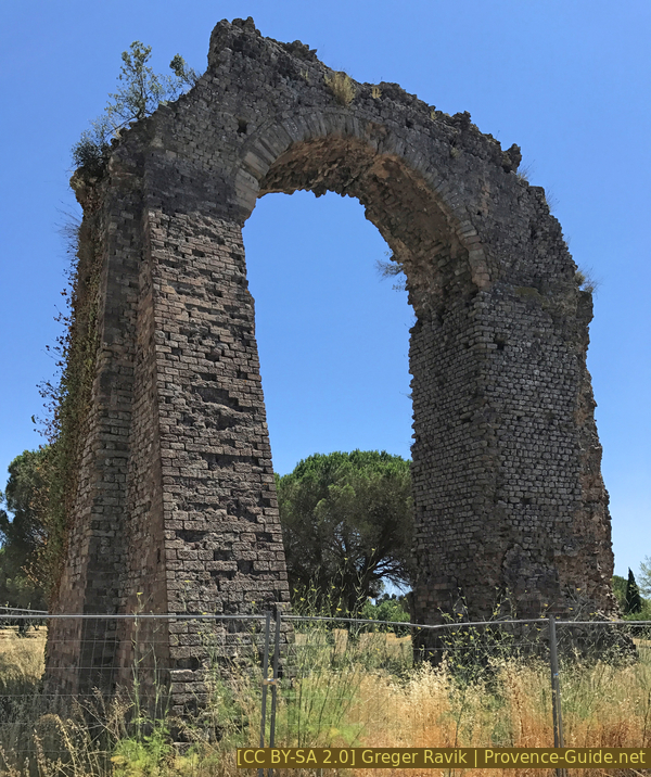
Aqueduct in the Sainte-Croix plain
Public transport
The TER PACA (only french) local train lines between Toulon and Cannes regularly stop at Fréjus station, which is just south of the centre. This is also the starting point of the city tour.
Access by car
Fréjus lies on a plain between the Massif des Maures and the Massif de l'Esterel. The city is easily accessible via the A8 motorway, which passes to the north. Following the indications for Centre and Les Arènes (the amphitheatre), you will enter the area of the tour presented here.
Useful parking spaces
There are several free parking lots along the loop, they are indicated on the map. There are other garages not far from the city centre for a fee.
Hints
The loop runs in a regrettably very car-friendly city. The parks and the traffic-calmed centre allow you to relax from the madness. There are a few long stretches with no significant landmarks, but they are necessary to connect the different sites.
A visit to the amphitheatre (Arènes) and the cloister (Cloître) is recommended. In addition to the admission prices, the opening hours should also be noted: lunch break and often closed on Sundays, Mondays and public holidays. These two sights are in the first half of the loop, if you start in the morning you can get to both before noon. There are tickets combining several sites and valid for one week. They are worth it with at least two sites visited.
The tour accesses a few parks. They are closed at night and also by strong winds because of the tall trees.
The whole region is a zone with a high risk of forest fires. In summer, but also in other seasons when it is very dry or by strong winds, access to the forest areas can be regulated. As a result, the roads may be closed to traffic and/or the trails prohibited to hikers. Current information: Map of access to the forests of the Var (also english). The map shows the colours green, yellow, orange and red which correspond to levels of danger. The affected area is: Esterel (8).
The sections
- From the train station to the Lanterne d'Auguste and the amphitheatre.
- From the amphitheatre to the centre and the garden of the Clos de la Tour.
- Along the aqueduct in the garden of the Villa Aurélienne.
- Park of Villa Marie and the former Roman port.
Section 1: Lanterne d'Auguste - Arènes de Fréjus
➙ 4,2 km ... 1 h ➚ 15 m ➘ 20 m ↝ easy
15% hard-surfaced city roads, without marks
35% hard-surfaced city alleys, without marks
5% hard-surfaced city roads, without marks
30% hard-surfaced city alleys, without marks
10% hard-surfaced city roads, without marks
10% parks, without marks
The clues
- Train station, 8 m
- Lanterne d'Auguste, 2 m
- Mausolée de la Tourrache, 2 m
- Columns, 10 m
- Amphitheatre, 3 m
This section includes long stretches of road between the monuments. As we progress, it gets greener.
gare = train station
passage souterrain = underpass
ouest = west
We leave the station to the north and turn right towards the town centre. We stay on the Rue Martin Bidoure and along the tracks. We pass a pharmacy and take the underpass to come out on the other side of the railway line. We come to a car park and a roundabout, both of which we leave on the right and go straight ahead onto Boulevard Séverin Decuers. Unfortunately there is a lot of traffic here.
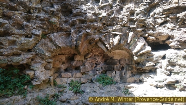
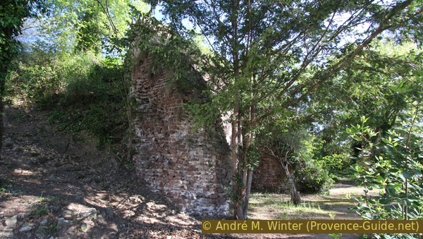
We take the left walkway (to the east). After the last houses, a rather dilapidated looking brick wall begins.
However, it is 2000 years old and surrounds a mound (la Butte Saint Antoine) on which a large villa was located. At the end of the tour we also pass the other side, where the former Roman harbour basin was. The coastline was then more than a kilometre inland. The Roman harbour silted up in the early Middle Ages.
Further ahead, the wall takes on more original forms.
After a concrete bunker that Nazi Germany built here, you can see semi-circular supporting arches.
We continue along this wall and take the first possibility on the left. Further ahead, the Chemin de la Lanterne d'Auguste actually takes us to the monument of the same name. The narrow street makes a long arc through a craft zone and then turns right. You stay on the dead straight road between fences, walls and reeds. We also go straight ahead at the one-way sign.
After that, the alley narrows even further, turning left and an old Roman wall begins on the right.
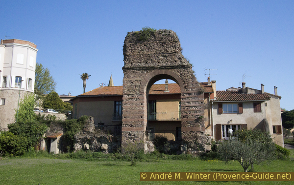
In front is a stone tower called the Lanterne d'Auguste. The 10 meter high and hexagonal tower tapers at the top. It is made entirely of stone and brick, so it is not a lighthouse but a maritime landmark.
This is exactly where the southern mole of the Roman harbour basin ended, the wall was the quay. The Chemin de la Lanterne d'Auguste follows exactly the course of this pier from the Butte Saint-Antoine. The harbour basin was directly north (left) of the road.
Later we will walk directly through the remains of the harbour basin, which is now a large field in the middle of the city. However, it is also crossed by the railway line, so we can't just go north here. A bit like in Roman times, we have to walk back to the Butte Saint Antoine on the pier to the mainland.
No reproduction is permitted without the written consent of the author. (id3959)
Roman landmark Lanterne d'Auguste
Back on Boulevard Séverin Decuers, we cross the street and go back to the right. However, at the first opportunity we turn to the left, you can cut a corner over the parking lot. We are now in the Rue Jean Carrara. Slight right at the following roundabout, La Poste and École Maternelle are written here. We are now in the Avenue de Villeneuve, which is lined with large blocks of flats. The left walkway (south) is a bit nicer and shadier.
Another roundabout follows. In front we see sports facilities and a school building, we go left (indication Collège de Villeneuve). On the right-hand walkway we come along a white fence after a few metres.
When the sports facility is open, you can enter at the front right and better approach the old building. Pass the parking lot, follow a fence until you find a passage on the left.
No reproduction is permitted without the written consent of the author. (id5536)
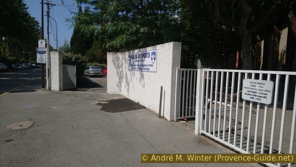
Access to the Jean Vilain & Jo Tedesco sports hall
We come in front of an old octagonal brick block called the Mausolée de la Tourrache, which dates back to the 2nd century.
You may go further down into the monument.
No reproduction is permitted without the written consent of the author. (id3084)
Mausolée de Tourrache in Fréjus
Small niches are arranged inside, where urns may have been kept.
More information can be found on a plaque that can be read from the street.
If the door is closed, one may go further along the white fence and have a similar good view on the monument from the street.
After the mausoleum we go back, past the roundabout but staying in the alley. In front of the Marché Franprix shop, turn left and then right again into Rue d'Auriasque. From here to the other end to a roundabout, turn left and cross the street. This Rue du Capitaine Blazy runs south of the railway tracks. Under the trees is a footpath and cycle path that takes us away from the traffic.
No reproduction is permitted without the written consent of the author. (id2958)
Niches of the Mausolée de Tourrache in Fréjus
Souterrain = underpass
colonne = pillar
At the end of the path we have to turn left to cross the road alive, but then turn right and go under two underpasses (railway and road DN7). Now we are inside the three-quarter circle that leads to the upper level.
After more than half a turn we are in front of two Roman Marnor columns from Carrara. The nibbled exterior testifies to the long dwelling time of the columns on the seabed off Saint-Tropez in a sunken Roman galley. The columns were perhaps intended for the temple la Maison Carrée in Nîmes. They were found in 1951 and donated to the city of Fréjus in 1968.
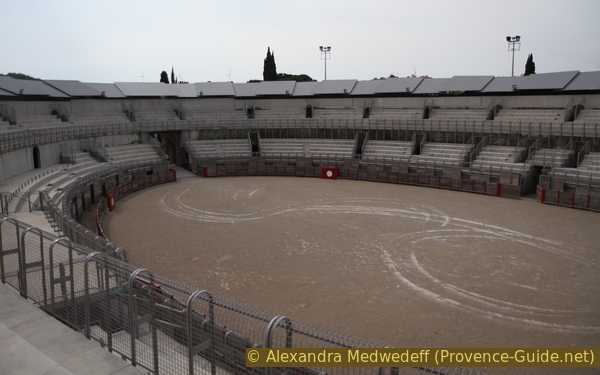
We are now very close to the amphitheatre. We continue on the same side of the street (Avenue de Verdun), pass the entrance to a car park and soon see the ancient building behind the umbrella pines. You either go through the park or further ahead left to get to the east side of the oval building. Here is the ticket office and entry. The opening hours change, but the principle remains the same in the long term: usually closed from 12 to 2 p.m., completely closed on public holidays, Sundays and Mondays. Information under Fréjus Roman Amphitheatre.
No reproduction is permitted without the written consent of the author. (id3388)
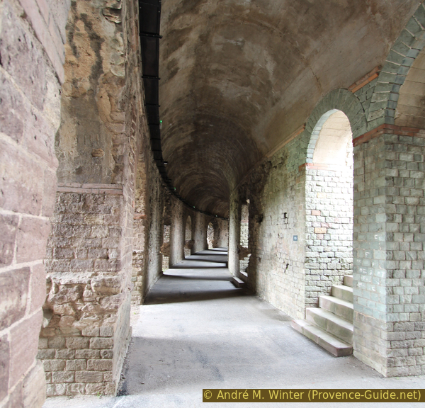
Aisle in the Fréjus amphitheater
From the outside you can already see that a lot of concrete was used to preserve the remains of the ancient building. It was rebuilt in such a way that the building can be used again for events, which means that even more concrete can be seen inside. It is true that an amphitheatre has been created that corresponds to the size and purpose of the time, but the historical patina, as in Arles or Nîmes, has been completely lost. However, it is still advisable to pay the entrance fee and go inside, this way you can also access the ground floor corridors, which are the only surviving covered elements that have been preserved.
From the outside you can still get the best view of what the ruins looked like in the 19th century. The outside of the building can be reached through corridors and stairs.
You can walk around clockwise around the outside, in the north you have to go over a parking lot. Always keep right and you come back to the starting point.
No reproduction is permitted without the written consent of the author. (id3387)
In the amphitheater of Fréjus
Section 2: Arènes - centre - Clos de la Tour
➙ 1,3 km ... 20 min ➚ 25 m ➘ 10 m ↝ easy
100% hard-surfaced city alleys, without marks
The clues
- Amphitheater, 3 m
- Place Formigé, 20 m
- Clos de la Tour park, 28 m
We stroll through the famous Place Formigé with the Cathedral, the Municipal Office and nice terraces. Not far from there is the archaeological museum, where most of the pieces found in the city are exhibited.
Leaving the amphitheatre behind, we head towards the centre on Rue Henri Vado. We pass a long building that looks like a train station, but it's actually the wine cooperative.
Building of the wine cooperative
The street bends slightly to the right and here another Roman monument follows on the left: the city gate Porte des Gaules in the west of the Roman complex.
Today it is difficult to recognize it as a gate, the passage was in the middle of the semicircle with a diameter of 50 meters
No reproduction is permitted without the written consent of the author. (id3386)
Porte des Gaules
We continue to the crossroads and then slightly left onto Rue du Général de Gaulle. After the wall on the left. The statue depicts Julius Agricola, a Roman general who was born in Fréjus.
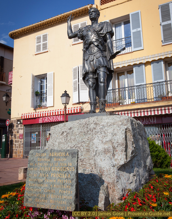
Julius Agricola
Above is the chapel of St. François de Paule with the statue of the saint in front.
The chapel was built in 1560 in the Gothic style, but also has Renaissance elements.
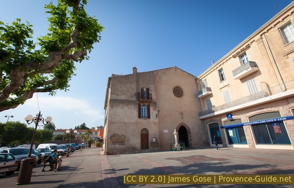
St. François de Paule chapel
jardin = park
tour médiévale = medieval tower
musée archéo. = archeolog. museum
cloître = cloister
We continue in the alley on the right in front of the chapel, which is of course called Rue St. François de Paule (pedestrian zone). In front we come out on the circular rue Jean Jaurès, where the medieval city walls ran.
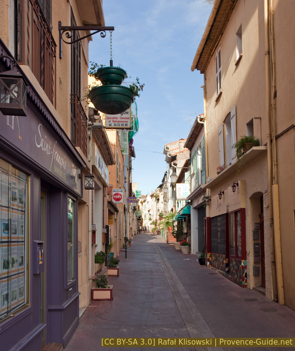
Rue St. Francois de Paule
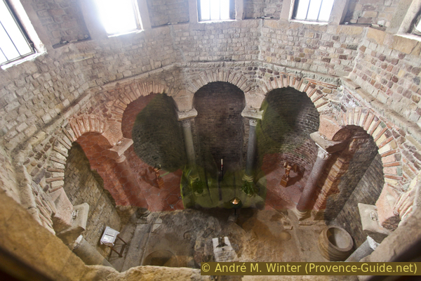
We now turn right and the first street (Rue Sieyes) left again. This is also a pedestrian zone, here you will find a few good shops. This is how we get to the Place Formigé square with the orange municipal office and the entrance to the cathedral. Behind is the entrance to the cloister and a little further back is the Archaeological Museum. The bristro's enticing terraces need no special mention, we think. Now you have to choose from the offers and note the opening hours.
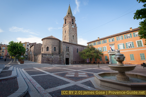
Place Formigé and the Saint-Léonce cathedral
The Saint-Léonce Cathedral is always open, except for masses and weddings and baptisms (which are quite common here). In the entrance you can take a look into the architecturally pre-Christian and octagonal baptistery from the 5th century. Antique columns were also used on the antique base.
The high nave dates from the 13th century, the sparse decoration from the 16th century.
No reproduction is permitted without the written consent of the author. (id3498)
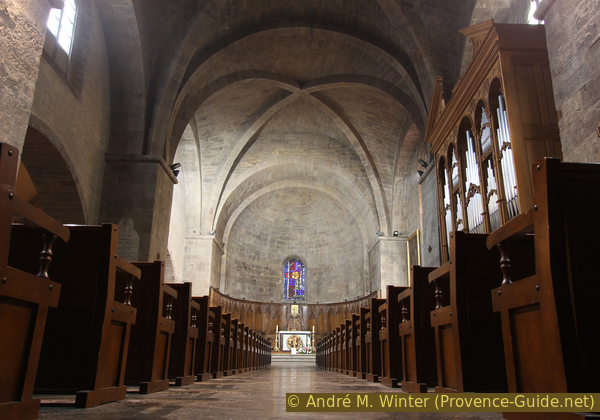
Inside the Saint-Léonce cathedral
To the left of the cathedral is the 12th-century Romanesque, two-story cloister. Entry to this medieval gem is chargeable. The opening times depend on the season, but generally open between 10am and 1pm and 2pm and 5pm. More detailed information: cloister of Fréjus.
No reproduction is permitted without the written consent of the author. (id3495)
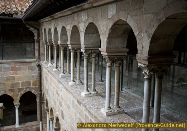
Narrower columns in the upper cloister in Fréjus
On the upper floor one should pay attention to the original paintings of the roof beams, not all of them can be described as good christian.
No reproduction is permitted without the written consent of the author. (id3496)
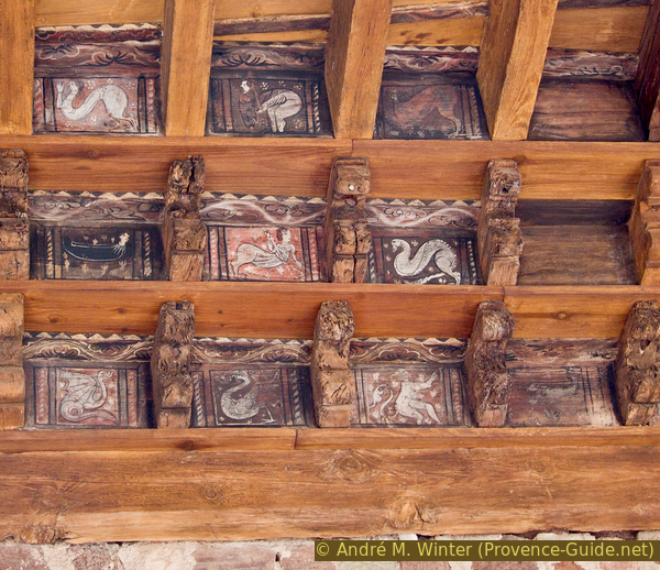
Mythical creatures in the roof of the cloister in Fréjus
From the cloister there is also access to a small episcopal museum. Through a pane you can look into the baptistery from above.
No reproduction is permitted without the written consent of the author. (id3497)
Baptistery of Fréjus
In the alley on the left behind the cloister is the small archaeological museum. Temporary exhibitions show the current results of ongoing excavations in the municipality of Fréjus. Here you can also find the sculpture of Hermès Bicéphale (two-headed Hermes), which is now found in the city's coat of arms. The opening times are comparable to the amphitheatre: Fréjus archeological museum.
The terraces in front of the municipal office are open all day, but it can be difficult to find a seat at lunchtime.
No reproduction is permitted without the written consent of the author. (id3385)
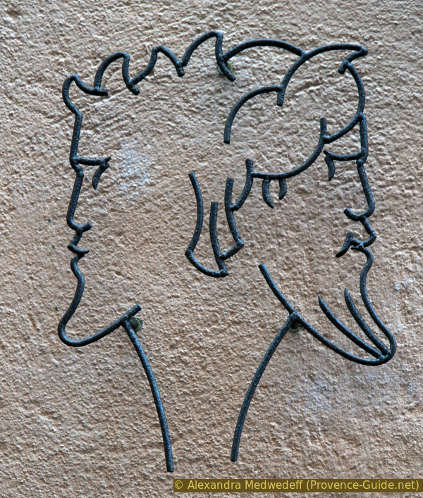
Two-headed Hermès, the symbol of Fréjus
After we have visited everything in the central square, we go north in the alley Rue de Fleury and thus get back into the traffic of the ring road Rue Jean Jaures, here right and immediately left again. We come through a development area built within the city walls, which we will see in a moment. We go up the stairs under a red building.
This defensive wall of 1578 covered a much smaller area than at the time of the Roman administration. In front of the wall go on the right and to a tower, of which there were originally several. A panel explains the medieval wall.
No reproduction is permitted without the written consent of the author. (id3958)
Tower of the medieval city walls of Fréjus
Then back where you came up before and at an opening through the wall and on the street Rue Joseph Aubenas to the left. Turn right again as soon as possible: Rue du Paouvadou leads us to a parking lot and in front you can see a large green area with a few trees. Go in there through the gate.
No reproduction is permitted without the written consent of the author. (id3957)
Access to Parc Clos de la Tour from the south
Section 3: Clos de la Tour - Aqueduc - Parc Aurélien
➙ 3,1 km ... 50 min ➚ 30 m ➘ 20 m ↝ average
10% parks, without marks
10% hard-surfaced city alleys, without marks
15% parks, without marks
15% hard-surfaced city roads, without marks
50% parks, without marks
The clues
- Clos de la Tour park, 28 m
- Roman Theatre, 26 m
- Avenue du 15e Corps d'Armée, 22 m
- Villa Aurélienne, 45 m
- Avenue du 15e Corps d'Armée, 22 m
For almost the whole of this section, we are in the immediate vicinity of the remains of the Fréjus aqueduct. The Villa Aurélienne and its overgrown park form the most natural part of the circuit.
This large meadow is a public park, the Jardin du Clos de la Tour, which we now cross after entering the gate. The park is laid out in an arc around a couple of houses in the middle.
There, in this separated area, is the most important excavation area of the city, Roman villas are still being excavated here. Behind the houses you can look over the wall at the excavations.
No reproduction is permitted without the written consent of the author. (id3956)
Roman foundations in Clos de la Tour park
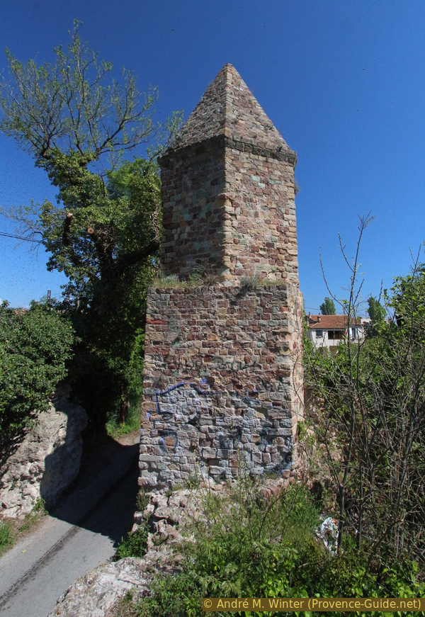
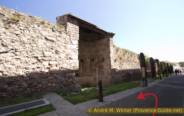
If we continue on the path, another historical city wall follows on the left, this is the Roman defensive rampart in the north of the city at that time.
The openings in the upper part of the half-open tower correspond to the level of the wooden battlement parapet of the time.
No reproduction is permitted without the written consent of the author. (id3955)
Tower of the Roman city wall
Soon after, we come to the north park gate and we cross Rue Gustave Bret.
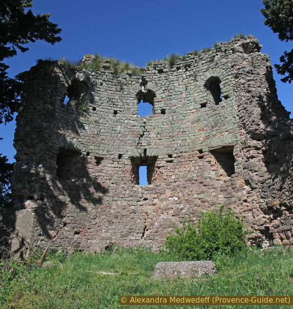
Now there is the possibility to look down to the Roman theatre. If we now walk down the street to the right, after about 100 metres there is a fence through which one can see the remains of the ancient theatre. Only the retaining walls of the original rows of seats are still standing. The condition of the ancient brick building is no better than that of the amphitheatre and here a new metal superstructure was achieved. It is therefore not expedient to go further to the entrance (bottom left), you don't see much more there. We then have to go back up to where we crossed the Rue Gustave Bret after the park.
No reproduction is permitted without the written consent of the author. (id3954)
Remains and new use of the Roman theatre
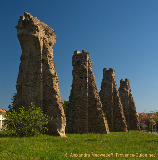
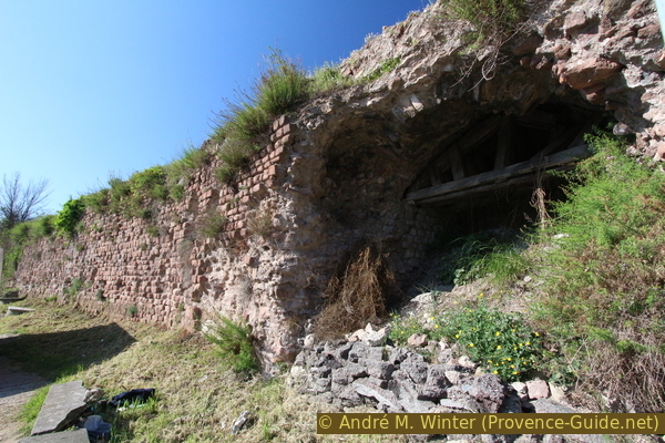
A path leads from the road straight through the meadow next to a control box. Behind the bushes we can already see an arc of the aqueduct that led from Mons to Fréjus.
It runs mostly underground, east of Roman Fréjus it led on 86 arches through the plain of Sainte-Croix. About 10 of them are still standing.
No reproduction is permitted without the written consent of the author. (id3953)
Roman city walls of Fréjus
In the further course, the curious situation occurs that the aqueduct crosses the Roman city wall. We follow this masonry that is always on our right. In this way we go east, but also follow the bend made by the city wall and the aqueduct. Now we see the most well-known section of the aqueduct, because these pillars are completely free here. Only a few of them still show the course of the canal at the top.
The path follows the aqueduct pillars and then joins the pavement of Avenue du 15ème Corps d'Armé. This main street (DN7) is the ancient Via Aurelia. When it later led from Italy to Arles, it was called Via Julia Augusta. Construction began on the section from the Alpes-Maritimes westwards from the year 13 BCE. However, it is inconceivable that the Via Aurelia severed the aqueduct as brutally as the DN7 does today.
No reproduction is permitted without the written consent of the author. (id3952)
Aqueduct of Fréjus in the Sainte-Croix plain
potager = vegetable garden
vieux bassin = old basin
We stay on the north side of the road and pass other former pillars. We don't need to change to the arch on the other side of the street, since we'll pass it on the way back. We cross the road at the roundabout to enter Parc Aurélien further ahead on the left through a gate. The area is closed at night. Immediately we come to more arches, the aqueduct seems to be in better condition here. This impression is deceptive, these are restorations from the 1940s that do not correspond to current knowledge. The green sandstone edges are not original.
No reproduction is permitted without the written consent of the author. (id3945)
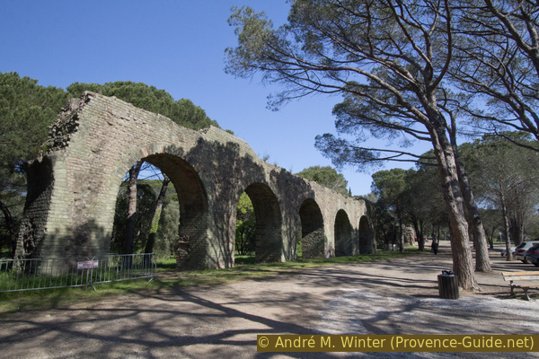
Arches of the aqueduct in Parc Aurélien
As we continue to follow the aqueduct, we notice that the arches are less and less high. Further ahead, the channel is already at ground level and disappears into the ground. It was not buried here, the course and the terrain was the same 2000 years ago. The aqueduct ran underground in the hill of today's Villa Aurélienne.
No reproduction is permitted without the written consent of the author. (id3946)
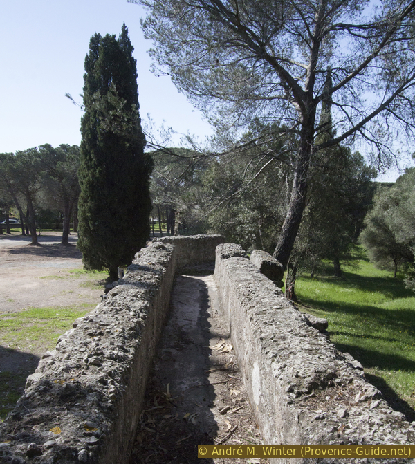
Channel of the aqueduct in the Parc Aurélien
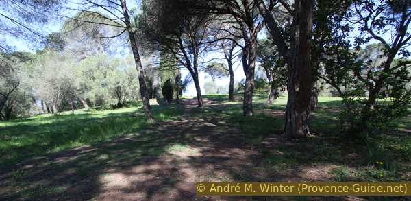
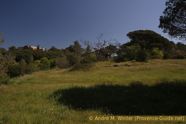
Now that we no longer have an aqueduct to guide us, we continue along its axis, the path leading to the highest point of the hill.
No reproduction is permitted without the written consent of the author. (id3947)
Hill in Parc Aurélien
The park is quite overgrown, but there are also a vegetable garden and obviously planted flowers.
No reproduction is permitted without the written consent of the author. (id3948)
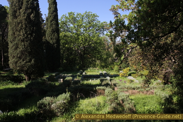
Overgrown garden in Parc Aurélien
You come over stairs and a small bridge and shortly afterwards you see a magnificent building ahead.
No reproduction is permitted without the written consent of the author. (id3949)
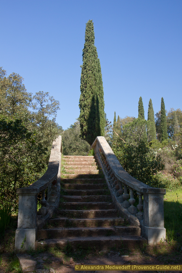
Bridge in Parc Aurélien
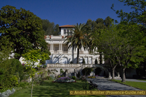
The Villa Aurélienne is the most beautiful summer villa built in Fréjus at the end of the 19th century. Its name comes from the ancient Via Aurelia below. It was built in 1889 by entrepreneur James Crossman, heir to English brewers, and has been owned by the city since 1988. Changing exhibitions are shown here.
No reproduction is permitted without the written consent of the author. (id3950)
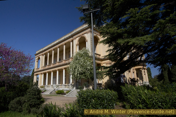
Villa Aurélienne in Frejus
We have to leave the park again at the same entrance. You either go back the same way or explore a little more the extensive park: we go down behind the villa on the left down a path that quickly turns south and therefore in a good direction. But we come to an area with terraces and walls, at an old water basin the path forces us a little to the left.
As soon as it works again, we descend to the right, the path is more overgrown here. We pass a surge tank in the form of a pagoda, there are several in the park. At the bottom right and in front of the vegetable garden, continue right onto the larger path. It leads us to the left again and after a few minutes we are back at the aqueduct arches and at the entrance.
No reproduction is permitted without the written consent of the author. (id3951)
Lots of green in the Parc Aurélien
Section 4: Parc Aurélien - Villa Marie - Port antique
➙ 2,9 km ... 40 min ➚ 20 m ➘ 40 m ↝ easy
40% hard-surfaced city roads, without marks
15% parks, without marks
5% hard-surfaced city roads, without marks
5% hard-surfaced city alleys, without marks
15% easy trails, without marks
20% hard-surfaced city roads, without marks
The clues
- Avenue du 15e Corps d'Armée, 22 m
- Rue Aristide Briand, 3 m
- Villa Marie, 8 m
- Les Horts, 1 m
- Train station, 8 m
Back to the city and other Roman relics.
Arch of the aqueduct south of the main street
We return to the wide Avenue du 15ème Corps d'Armée, but this time switch to the other side of the street (south) to be able to take a closer look at the remains of the aqueduct there. The first arch after the houses looks very dilapidated.
No reproduction is permitted without the written consent of the author. (id3943)
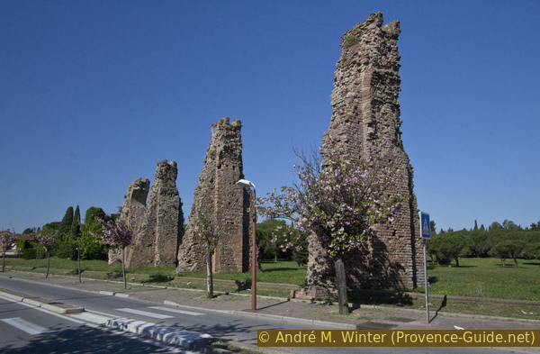
Fréjus aqueduct on the DN7 road
mur romain = Roman wall Mauer
vivier marin = fish reservoir
At the following roundabout turn left, you can go through the parking lot. We have to go down along the busy Rue des Marsouins. At the top right is a sports field on a remarkably flat and large ancient level. It is a mound like the one we saw at the Butte de St. Antoine.
The location here was much more conspicuous: high above the city and much larger. There was also an extensive Roman villa here. At the same time it was the south-eastern corner of the Roman city wall. Before the rue des Marsouins makes a slight curve and before the first houses, you can see part of the Roman retaining wall at the top, which still serves its supporting purpose.
No reproduction is permitted without the written consent of the author. (id3941)
Rue des Marsouins
Looking back, the Roman retaining wall is at the top left.
We follow the road and at the roundabout we turn right. We are now on the outside of the Parc de la Villa Marie, unfortunately only one entrance remains open (also closed at night). This entrance is at the other end on the south-west. We enter anyway, not only because of the beautifully tended French garden.
No reproduction is permitted without the written consent of the author. (id3939)
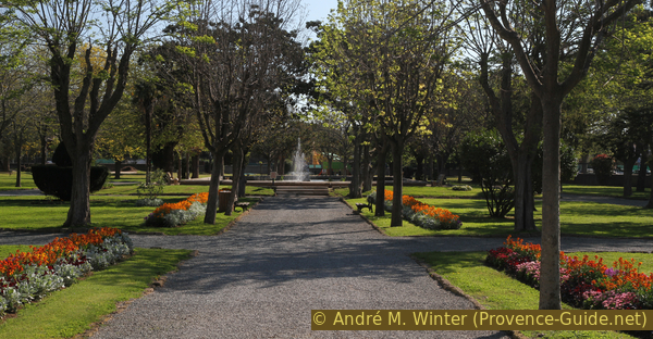
Villa Marie park in spring
Villa Marie was an eclectic style summer resort residence. It was built in 1906 for the politician François-Marie Thévenet. Today the municipal library is located here.
No reproduction is permitted without the written consent of the author. (id3940)
Villa Marie in Fréjus
Since we are also looking for Roman traces, we go up to the villa, around to the right and behind it up to the embankment under tall trees. There are massive retaining walls of the same platform that we saw from Rue des Marsouins.
No reproduction is permitted without the written consent of the author. (id3938)
Southern wall of the Roman platform in Fréjus
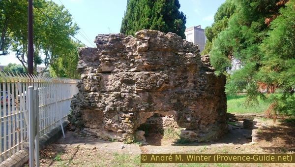
After a well-deserved break in the park, we go out onto the entrance again and turn right there. Rue Aristide Briand takes us back to the city centre. Just before the roundabout, there is a new building with the sign Centre Communal d'Action Sociale on it. During construction, a Roman freshwater basin was discovered, fish were kept alive here.
The visit is only possible with a guided tour, but the times are not very accommodating: only one day a week during school holidays, see visit roman fish pool.
At the parking lot you can see old Roman foundations.
No reproduction is permitted without the written consent of the author. (id3937)
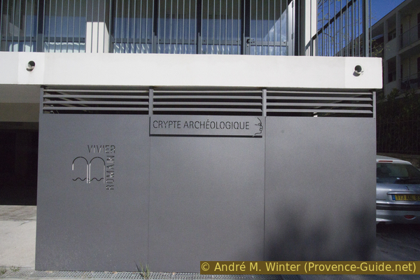
Access to the Roman fish tank
Coming from the Villa Marie park, turn left at the roundabout onto Rue Albert Einaudi (signposted Fréjus-Plage). At the first possibility, we turn right, you can shorten the path a bit via the parking lot. We go to Rue des Horts, the dead end sign does not apply to us. There is another car park ahead on the right.
At the far end, right of garbage cans, we go on a path into the large field on the right. We are now in the middle of the basin of the former Roman port!
The trail can be muddy after rain or even flooded in winter. In this case, go back to the roundabout, turn left there and follow rue Edmond Poupe, past a house with a tower and until before the railway underpass. Then we are back on the main route.
No reproduction is permitted without the written consent of the author. (id3936)
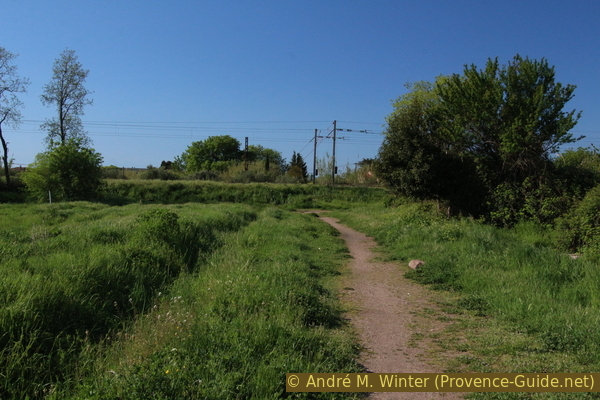
Field in the basin of the former Roman port
gare = train station
passage souterrain = underpass
est = east
By normal weather conditions you cross the field (aka the former port) until you arrive at the fences of vegetable gardens. Now turn left to the railway line and turn right then. Now you can see a large arch, which is much more beautifully executed than those of the aqueduct.
It is not a gate as the name (Porte d'Orée) suggests it, but the only remaining part of a large thermal complex. The arch was part of the cooling room (frigidarium) in the centre of the Roman bathing facility.
No reproduction is permitted without the written consent of the author. (id3935)
Porte d'Orée in Fréjus
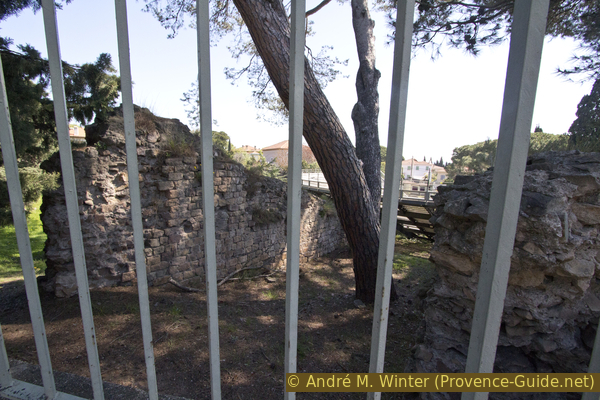
We go on the rue des Moulins and under the underpass. There are two entrances to parking lots on the outside of the curve. The second brings us to the last Roman relic of the tour. The spot is not very charming, but here is the eastern wall of the Butte Saint-Antoine, it was also the wall that formed the dock here.
To return to the starting point, we continue along Rue des Moulins. In front we see the roundabout from the beginning of the tour and on the right is the underpass that you take to go back to the train station.
No reproduction is permitted without the written consent of the author. (id3934)
Butte St. Antoine on the former port side
Sources and additional information
This tour is inspired by this good hiking guide: Le Rando Malin, le Var, du littoral au Verdon (Clever hiking, Var, between the coast and Verdon, only french), Mémoires Millénaires Éditions, ISBN 978-295266479-0. This book offers many hikes where history and nature are in the foreground. However, the maps in it are rather poor. The tour here leads to other points and significantly reduces the sections on busy roads.
Good scientific information can be found in the archaeological guide Fréjus antique (only french), Éditions du Patrimoine, various editions.
It is better to use a good topographical hiking map: this tour is on the IGN map "Fréjus, Saint-Raphaël, Corniche de l'Estérel", scale 1:25000, 3544ET.
If you don't want to bother with a paper map, you can also use mapping apps on your cell phone. On the one hand, it is the Cartes IGN app from the official map service. However, it requires access to the data network and this is sometimes difficult in canyons or remote locations.
Alternatively, you can use apps that store data directly on the device. They're generally not free, but they don't cost much. We mainly use OSMAnd, here it is possible to add contour lines, relief shading, markings and others. To store this data on your phone you need a lot of space.
Of course, one needs access to satellites for the GPS signal with any app. In some canyons this is not the case. Therefore, do not rely on the position shown, but read the map on your phone as you would read it on paper. Most apps are available for Android and iPhone. The applications usually allow us to record the route travelled and also view the GPS files offered for each of our hikes.
This page has been seen 7819 times since 20 March 2024.