Malmont hill of Draguignan
From the city centre to the panoramic mountain
hike
easy
2 h 45 min
yes
yes
no
mountain
Introduction
Draguignan is not a tourist destination and the place is not known for hiking. However, the city has some medieval jewels and to the north there is a large hill that protects the city from the mistral wind. Urbanization is slowly climbing up the slopes, but you can still walk up and down quiet streets between dry stone walls.
Picnic spots are available at the top and there is also a panorama board.
The facts
8,8 km total distance
2 h 45 min walk time
360 m total elevation
orientation easy
mark 10% of the total distance
30% hard-surfaced quiet side streets
25% easy trails
20% hard-surfaced city alleys
15% hard-surfaced city roads
10% forest roads
<5% stairs
dangers traffic
children yes
useful picnic stuff
required hiking boots, hiking equipment and water
GPS coordinates (WGS84) of start and end point 43.53422521637431,6.463835118612764
downloads ![]()
![]()
No reproduction is permitted without the written consent of the author. (id3961)
Tour de l'Horloge in Draguignan
Public transport
The bus station is south of the town centre. There are many connections here, Draguignan is a historical and still important regional metropolis. See Zou! (only french). The tour starts at the bus station.
Access by car
Draguignan is located between Fréjus and the Verdon north of the A8 motorway. You exit the highway at Le Muy en drive then in northern direction.
Useful parking spaces
There are many parking lots around the historic city centre, but they are often full. You better search in the southern part of the city. But the hike is north.
Hints
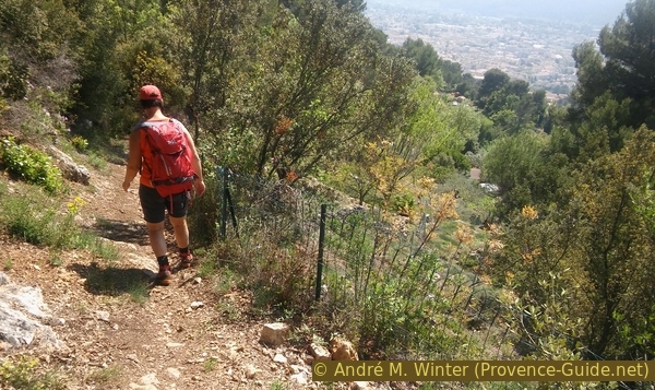
It is a hike that runs halfway through the urban area. The ascent takes place over narrow asphalt roads. The whole tour runs on a southern slope, in summer you should avoid midday.
Twice the week take place markets in Draguignan and you can also find many shops in the centre. Here you can stock up on hiking provisions.
The whole region is a zone with a high risk of forest fires. In summer, but also in other seasons when it is very dry or by strong winds, access to the forest areas can be regulated. As a result, the roads may be closed to traffic and/or the trails prohibited to hikers. Current information: Map of access to the forests of the Var (also english). The map shows the colours green, yellow, orange and red which correspond to levels of danger.
The sections
- From the bus station to the old town centre and up the Butte aux Herbes hill, then the real ascent to the Malmont from the east.
- Descent between old dry stone terraces and individual houses to the city centre and back to the starting point.
Section 1: Gare routière - Butte aux Herbes - le Malmont
➙ 5 km ... 1 h 40 min ➚ 330 m ➘ 25 m ↝ easy
10% hard-surfaced city roads, without marks
5% hard-surfaced city alleys, without marks
5% stairs, without marks
10% hard-surfaced city alleys, without marks
35% hard-surfaced quiet side streets, without marks
10% forest roads, faulty marks
10% hard-surfaced quiet side streets, faulty marks
5% easy trails, without marks
5% forest roads, without marks
The clues
- Bus station, 180 m
- Butte aux Herbes, 210 m
- Portaiguières, 190 m
- Ford over Riaille creek, 380 m
- Panoramic table on Malmont hill, 540 m
Ascent from the centre to the hill north of the city.
marché = market
We go to the centre and climb the city hill with the clock tower. After a short descent, we tackle the Le Malmont ridge through the streets in the north of the city.
The bus station is built south of the old train station building. We bypass the heterogeneous structure and aim for Boulevard Garbriel Péri behind it.
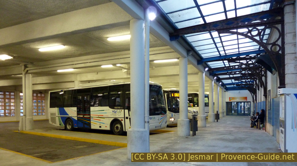
Draguignan bus station
Turn left on Boulvard Clemenceau and take the second street on the right again onto Boulevard Jean Jaurès (signposted Parking du Marché). Immediately left again into Rue Pierre Clément and so on to the market square.
No reproduction is permitted without the written consent of the author. (id1834)
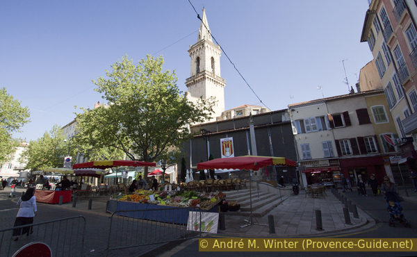
Place du Marché in Draguignan
marché = market
escalier = stairs
Tour de l'Horloge = clock tower
We leave the market on the left and turn right onto Rue des Marchands. At the first opportunity we keep left to go from Place aux Herbes under a first former city gate.
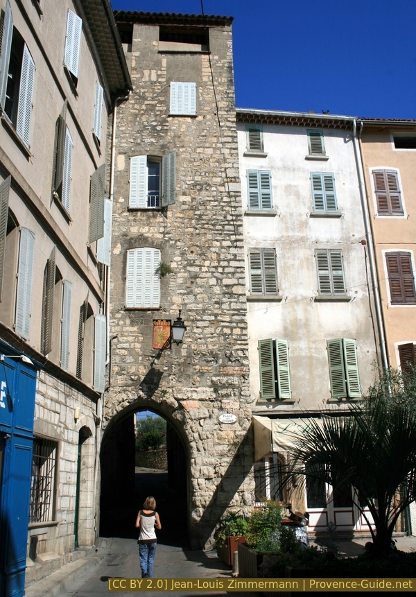
Tower gate Place aux Herbes
Now straight ahead and on the right we see the steeply landscaped park under the Butte aux Herbes hill. We enter through the lower gate and go up.
No reproduction is permitted without the written consent of the author. (id3960)
Up in Rue Saint-Clair
It's worth turning around!
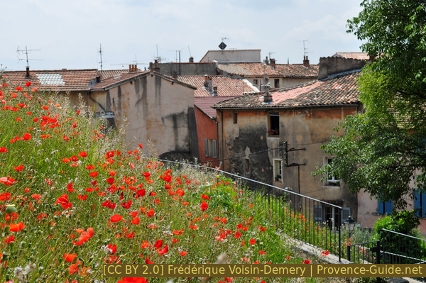
Poppies on the Butte aux Herbes
You climb over many steps and tend to keep to the left.
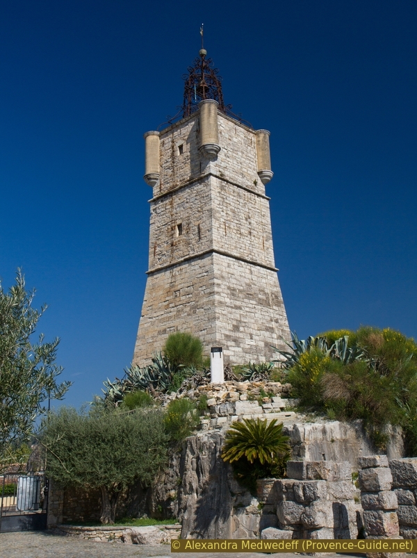
So we come to the Saint-Sauveur chapel from the 12th century. Further ahead is the Tour de l'Horloge clock tower, it is the fourth edition of the timer, the current tower dates from 1661.
No reproduction is permitted without the written consent of the author. (id3962)
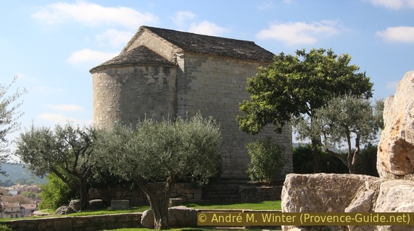
Saint Sauveur chapel
The small park is nicely situated above the city, but it's not time to rest yet. You can see only too well that you haven't gained much height yet.
No reproduction is permitted without the written consent of the author. (id3963)
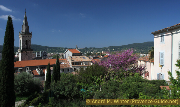
View of Draguignan from the Butte aux Herbes
We leave the quiet park through the upper gate and turn right downhill. At the bottom left across the car park at Rue de l'Horloge and then right down the stairs of Montée du Four de Peisse. Here you pass new buildings in the old city centre.
No reproduction is permitted without the written consent of the author. (id3964)
Rue de l'Horloge
Behind the parking lot down on the right.
Below we cross an alley and opposite we can pass another city gate: Portaguières (literally: water gate).
No reproduction is permitted without the written consent of the author. (id3965)
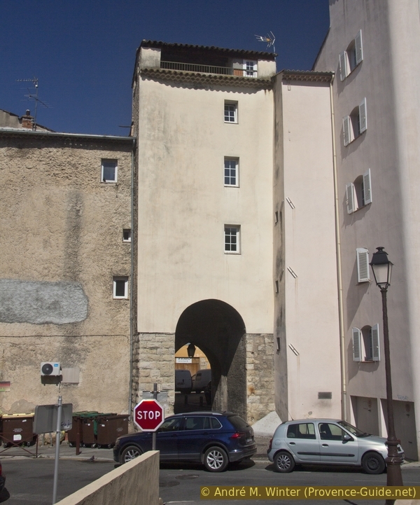
Portaguières tower gate
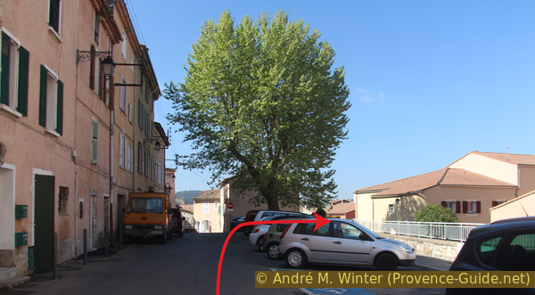
After the medieval gate, turn right and immediately left into Rue du Jardin des Plantes. So we get to a large traffic junction with a small dragon statue in the middle. A signpost points to the viewpoint at Malmont. I'll mention it here first: you can also drive up the hill by car... We'll shortly go up here as well.
No reproduction is permitted without the written consent of the author. (id3966)
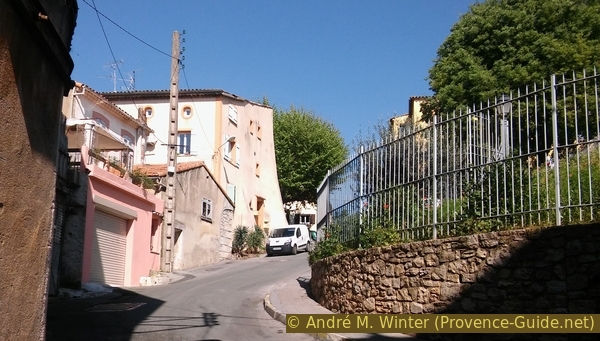
Opposite uphill on Boulevard Joseph Collomp
After approx. 100 metres, an even steeper lane leads away to the right.
No reproduction is permitted without the written consent of the author. (id3967)
Climbing the Chemin de Laucate
We take this quieter lane and after a few houses, our path runs between two high stone walls, which are supposed to prevent views of the large properties. After 150 metres we change from the Chemin de Laucate to the left onto the Chemin de la Calade, the walls remain and it gets even steeper.
No reproduction is permitted without the written consent of the author. (id3968)
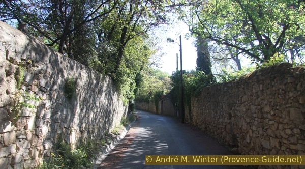
Chemin de la Calade between high walls
You rarely see over the disturbing walls. We are slowly but surely leaving the city behind us.
No reproduction is permitted without the written consent of the author. (id3969)
View of Draguignan
When the walls come to an end, we come to a crossroads. We traverse here to get onto the higher road, keeping the heading north-east. The lower alley is interrupted in the middle. After the last houses the road leads into the wooded hills.
No reproduction is permitted without the written consent of the author. (id3970)
Junction at Chemin du Malmont
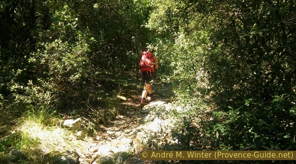
After a right turn, a forest road starts on the left, an old sign points to the Chemin de Malmont. This earthy road first leads us flat into the valley to ford the small creek La Riaille. Then it turns left and northwest, the road becomes more and more chaotic and is badly washed out.
No reproduction is permitted without the written consent of the author. (id3971)
Now left on Voie Romaine
The remains of an old paving appear again and again on the sides, giving the street the name Voie Romaine (Roman street). However, the Via Aurelia never passed here. It is probably a parallel road laid out in the Middle Ages.
No reproduction is permitted without the written consent of the author. (id3972)
Old paving on Voie Romaine
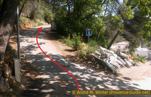
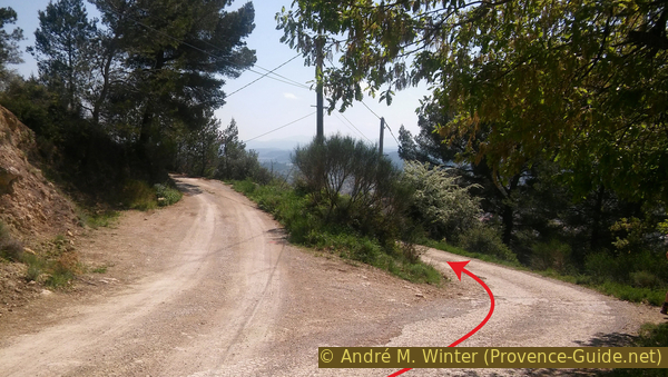
The direction is maintained and the road gets better again. Starting at a higher water tank, an asphalt surface appears again. We continue on the slightly uphill road. After 300 metres there is a turn-off to the left, but we go forward another 200 metres.
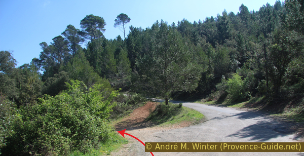
In a right-hand bend, a path seems to lead straight ahead. Here, however, we turn left into the forest and climb in a southerly direction.
No reproduction is permitted without the written consent of the author. (id3973)
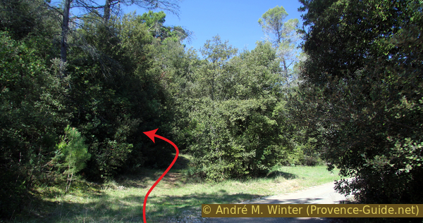
Path to the saddle left here
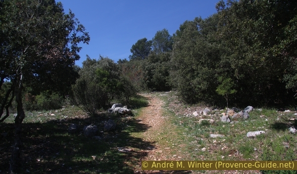
After a right turn, the path crosses a reforestation area after a forest fire. You don't stay between the regular rows but traverse them in a south-westerly direction.
No reproduction is permitted without the written consent of the author. (id3974)
Path to the saddle under the Malmont hill
This takes us to an asphalt road and to a water tank (DGN1), we are now on a saddle just below the Malmont. There are picnic benches under the trees on the left ahead.
tour de guet = watch tower
citerne = water tank
A path climbs behind the benches to the flat summit.
No reproduction is permitted without the written consent of the author. (id3975)
Path to the viewpoint at Malmont hill
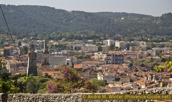
To the south, under the fire lookout tower, there is an observation deck with a panoramic table. The view extends over the town of Draguignan to the sea at Fréjus and the chain of hills of the Massif des Maures.
No reproduction is permitted without the written consent of the author. (id3977)
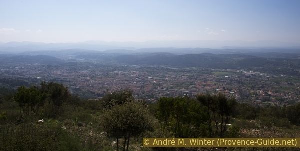
View of Draguignan from Malmont hill
Section 2: Le Malmont - la Riaille - gare routière
➙ 3,8 km ... 1 h ➚ 25 m ➘ 330 m ↝ easy
30% easy trails, without marks
15% hard-surfaced quiet side streets, without marks
5% forest roads, without marks
15% easy trails, without marks
20% hard-surfaced city alleys, without marks
15% hard-surfaced city roads, without marks
The clues
- Malmont, 550 m
- Chemin des Amandiers, 340 m
- Ford on Riaille creek, 245 m
- Bus station, 180 m
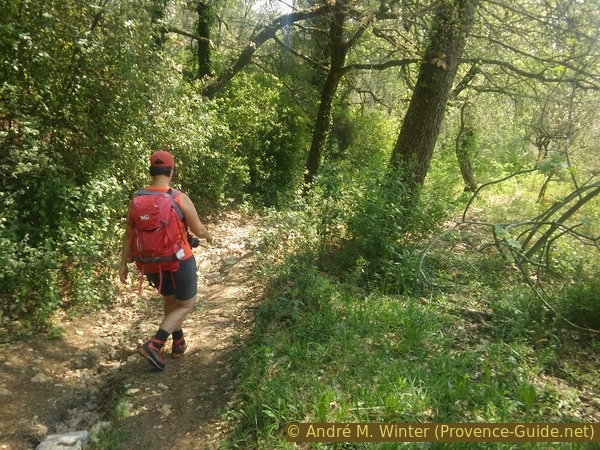
The descent is faster and leads over old and partially reactivated cultural terraces. Old paths lead us down into the city.
No reproduction is permitted without the written consent of the author. (id3976)
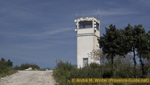
Fire lookout tower at Malmont hill
To the right of the watchtower you can choose a shady path to the saddle with the picnic tables. Bottom go right and south. We ignore all paths on the left and aim for the large cistern (DGN9) under the road.
No reproduction is permitted without the written consent of the author. (id3978)
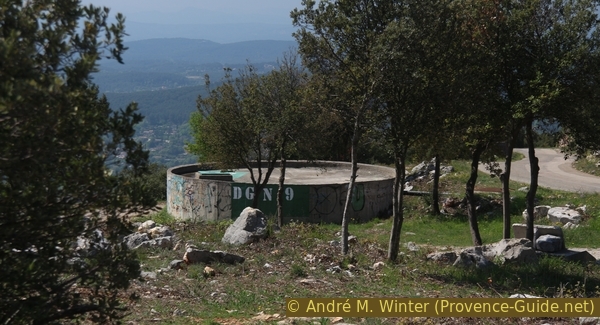
DGN 9 water reservoir
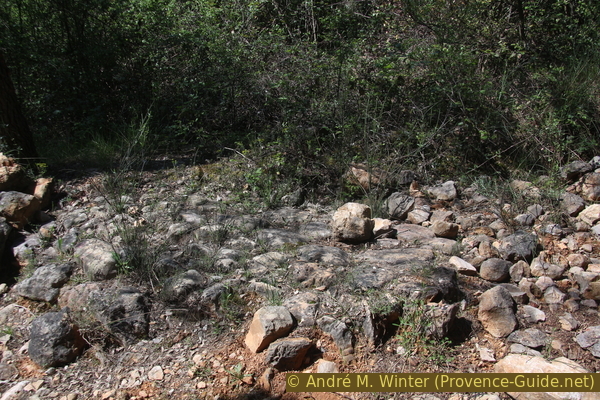
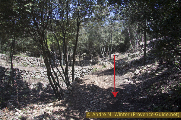
Two paths start under the cistern, we take the right one, which leads steeply down into a dry valley. Due to the clearing of the bushes in spring 2017, old dry stone walls (restanques) are now visible. Longer terraces are also uncovered further down, perhaps olive trees will be planted here again?
No reproduction is permitted without the written consent of the author. (id3979)
Path in the valley south of the saddle under the Malmont hill
Here you can also meet the small Greek tortoise. In the spring they warm up here in the sun. Do not touch the animals and do not carry them off the path into the bushes, they are an endangered species in France!
No reproduction is permitted without the written consent of the author. (id3980)
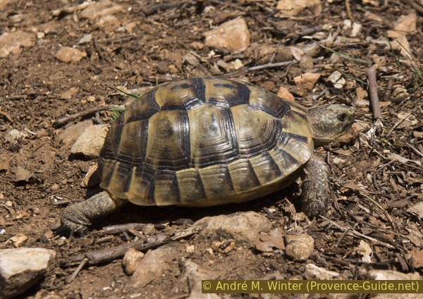
Greek tortoise
We are slowly approaching civilization again. It begins with fences, later the path becomes a gravel road and asphalt comes under our soles again.
No reproduction is permitted without the written consent of the author. (id3981)
Descent to the Chemin des Amandiers
We keep to the left, although the alley leads uphill after the first crossing (dead end sign).
No reproduction is permitted without the written consent of the author. (id3982)
Left at the crossing on Chemin des Amandiers
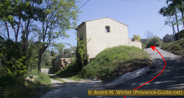
The layer of asphalt soon ends and at the next crossroads we turn right down the concrete lane. We walk past driveways and this alternating earth or concrete alley leads down to the last houses in two bends.
No reproduction is permitted without the written consent of the author. (id3983)
Right at this junction on the Chemin des Amandiers
Exactly in front of a beginning fence and a gully (photo) our path leads down to the right.
No reproduction is permitted without the written consent of the author. (id3984)
Chemin des Amandiers and turnoff to Vallon de Riaille
Now it's back downhill quickly between fences and private properties.
But we come back into a natural stretch of the Riaille valley. We had already crossed this creek once on the ascent.
No reproduction is permitted without the written consent of the author. (id3985)
Way down to Boulevard Joseph Collomp
The ford in the Vallon de la Riaille also marks a change of direction and we pass behind houses again. At the bottom we come out at the Chemin de Laucate, which we already know from the ascent.
No reproduction is permitted without the written consent of the author. (id3986)
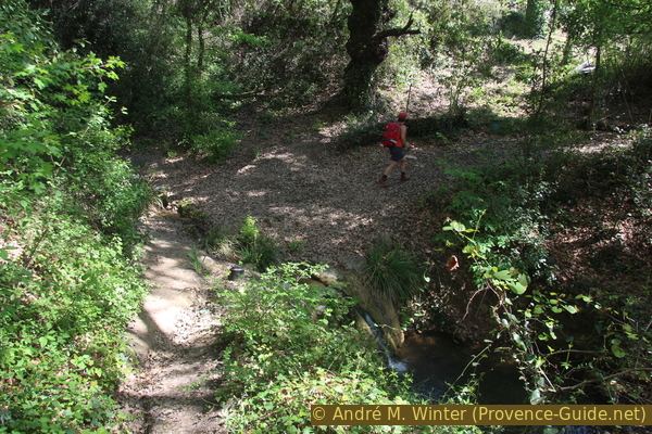
Ford of the Riaille creek
marché = market
lavoir = washhouse
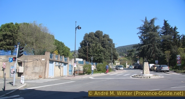
You can now go back to the starting point as you wish. Here we briefly explain a way through the city that does not lead back over the Butte aux Herbes:
Go down to the crossroads with the little dragon statue in the middle, cross and at the far end of the car park on the right there is a very large wash house. Here the sheets of the former hospital were cleaned.
No reproduction is permitted without the written consent of the author. (id3987)
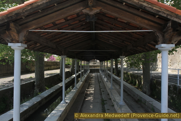
Lavoir de Folletière washhouse
marché = market
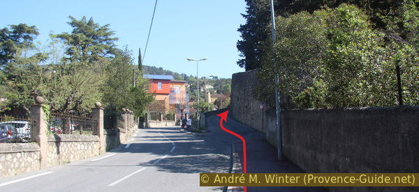
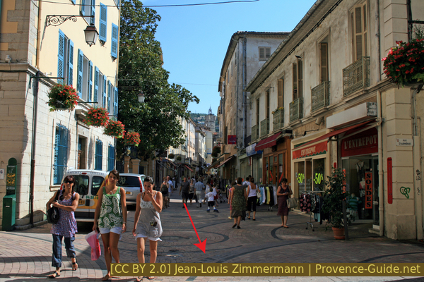
Now back to the crossroads and we follow the signs to the centre (centre-ville). Turn left at the first square and right again on Grande Rue. A pedestrian zone begins at the fountain on Place Roger Fréani and we keep to the left. So we come to the upper end of the market place, here immediately turn right into Rue Gorge Cisson (also a pedestrian zone).
At the other end, turn left onto Boulevard Clemenceau and take the first right and then right again onto Boulevard Marx Dormoy. After the halls on the right we see a park in front of us. It is right next to the bus station.
Rue Georges Cisson
Looking back, behind the clock tower.
Sources and additional information
It is better to use a good topographic hiking map: this tour is on the IGN "Draguignan" map, scale 1:25000, 3543OT.
If you don't want to bother with a paper map, you can also use mapping apps on your cell phone. On the one hand, it is the Cartes IGN app from the official map service. However, it requires access to the data network and this is sometimes difficult in canyons or remote locations.
Alternatively, you can use apps that store data directly on the device. They're generally not free, but they don't cost much. We mainly use OSMAnd, here it is possible to add contour lines, relief shading, markings and others. To store this data on your phone you need a lot of space.
Of course, one needs access to satellites for the GPS signal with any app. In some canyons this is not the case. Therefore, do not rely on the position shown, but read the map on your phone as you would read it on paper. Most apps are available for Android and iPhone. The applications usually allow us to record the route travelled and also view the GPS files offered for each of our hikes.
This page has been seen 2536 times since 20 March 2024.