Chapels and megalithic tombs around Cabasse
Round trip over three hills in the Issole valley
hike
average
4 h
no
yes
no
mountain
Introduction
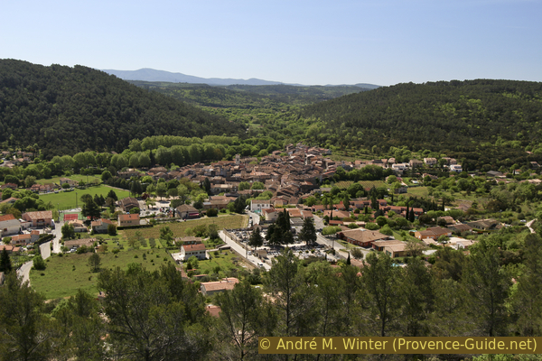
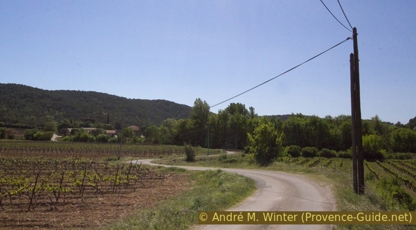
The village of Cabasse-sur-Issole is isolated in the hinterland, with the classic small streets in the narrow town centre and quite a lot of green countryside all around. Unfortunately, the town centre is slowly dying out and the villas are also growing into the landscape here. Nevertheless, Cabasse remains a peaceful place with many small sights in the surrounding area. The Issole river forms the landscape, Cabasse lies on its banks in a wide valley here, surrounded by rock plateaus with sharply sloping edges. in the river are large turquoise-transparent water basins, which Are partly natural, partly historically man-made to drain water into the fields.
On this circuit around the village we will be able to see it from different directions from above. On the big tour, there are three uphills and just as many downhills: in the north-west (le Défens), in the north (Notre-Dame du Glaive) and in the west (la Bouissière). At each elevation we will also find something worth seeing: dolmens, burial mounds, chapels etc.
The facts
9,4 km total distance
4 h walk time
450 m total elevation
orientation AVERAGE
mark 25% of the total distance
50% easy trails
25% forest roads
15% hard-surfaced quiet side streets
10% hard-surfaced city alleys
5% hard-to-recognize trails
<5% cross country
<5% hard-surfaced country road
dangers rock edges
children with a lot of persuasion
useful picnic stuff
required hiking boots, hiking equipment and water
GPS coordinates (WGS84) of start and end point 43.427726941513946,6.222042651118775
downloads ![]()
![]()
Public transport
There is no viable public transport for this hike. Not even school transport exists. It ist useful to complain about at the tourist offices of the region.
Access by car
Cabasse is north of the A8 motorway, between Brignoles and Le Luc. From the Brignoles exit, follow the signs to Flassans and later on the D97 to Cabasse. From Le Luc exit, first head in the direction of Le Luc and then to Cabasse on the D33.
Useful parking spaces
A sufficiently large car park is located in the north of the village of Cabasse. A ramp takes you to the square below the street, here is also the sports centre. The tour is described starting from here.
No reproduction is permitted without the written consent of the author. (id4086)
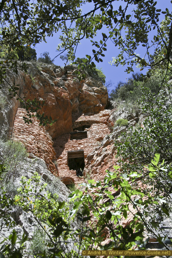
Trou des Fées fortified cave
One of the sights on this tour.
Hints
The round offers both cultural and sporting highlights. You can later feel the three climbs in your legs.
Some accesses are difficult to find, most important points are not marked. Sometimes it's down to a meter, so please follow the instructions here and/or use the GPS data provided. If you do get lost, you should go back to a known place and look for the right route from there. Short cuts are not always possible because of the rock edges and the river.
The river Issole has a very variable water level. Floods can occur in autumn, and the stream bed has dried up completely in recent summers. At high tide it is difficult to get to Cabasse anyway, so you should refrain from the tour. A dry creek bed is a sad sight, but the tour is still nice.
There is no safe source of drinking water found along the route. There is a bar and a few shops in Cabasse.
The whole region is a zone with a high risk of forest fires. In summer, but also in other seasons when it is very dry or by strong winds, access to the forest areas can be regulated. As a result, the roads may be closed to traffic and/or the trails prohibited to hikers. Current information: Map of access to the forests of the Var (also english). The map shows the colours green, yellow, orange and red which correspond to levels of danger.
The sections
- Cabasse - le Défens - Castéou Sarrin: Climbing the limestone plateau north of Cabasse and west of Issole
- Castéou Sarrin - Trou des Fées - Dolmen du Pont Neuf - Chapelle Notre-Dame du Glaive: Across the Issole river and onto the plateau northeast of Cabasse
- Chapelle Notre-Dame du Glaive - Chapelle Saint-Loup - Dolmen de la Gastée: down the Via Crucis, through the windyards on the plain and up the wooded hills to the south-east of Cabasse
- Dolmen de la Gastée - Issole - Cabasse: back to the village
Section 1: Cabasse - le Défens - Castéou Sarrin
➙ 2 km ... 1 h ➚ 150 m ➘ 20 m ↝ average
20% hard-surfaced city alleys, without marks
15% hard-to-recognize trails
50% forest roads, without marks
10% easy trails, without marks
10% cross country
The clues
- Cabasse, 200 m
- East ridge of Le Défens, 340 m
- Castéou Sarrin, 320 m
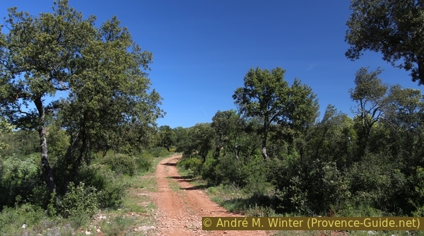
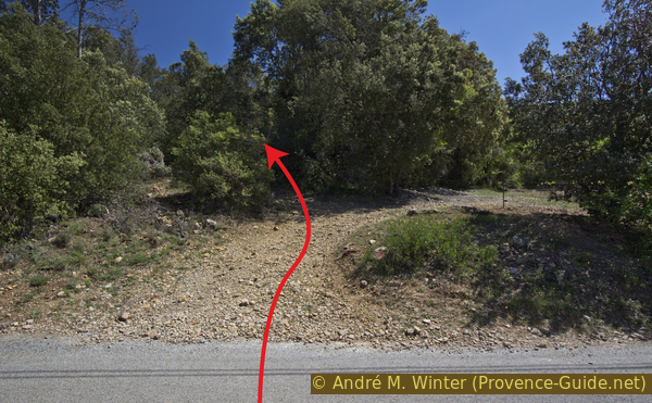
An old and steep hunters trail leads us to the plateau and along its edge we hike north.
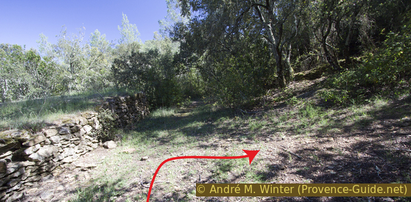
This path through the forest is not difficult, but very steep towards the end. People for whom this is too uncertain can take a much longer and much sunnier path, this route is marked in gray on the mall map below. From the car park at the lower end, go in the direction of the village centre, you will come to another car park and then onto the main road. We go straight over it and west on Rue du Vallon. Between villas we branch off to the right onto the Route Fontaine des Romarins, here we are going uphill. Proceed to the last house and continue up when the asphalt ends. Already in the forest at the first opportunity to the right (forest roads M132 and then M137), it goes further uphill. Progressively the forest becomes lighter and it also becomes flatter. We see antennas in front of us that can also be reached on the normal route.
No reproduction is permitted without the written consent of the author. (id4032)
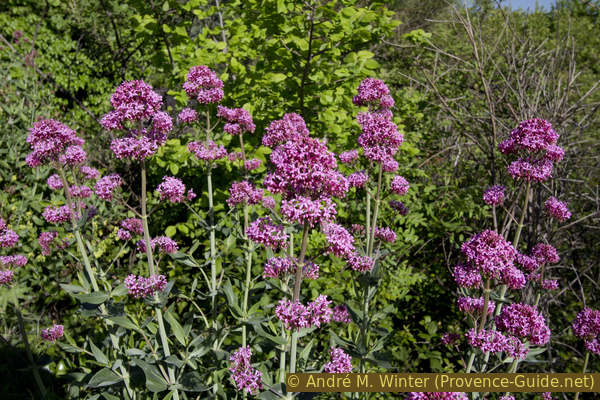
Red spur flower
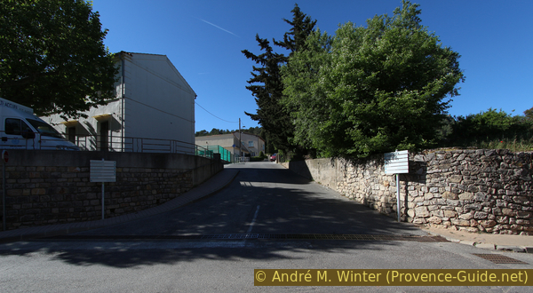
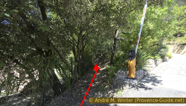
We leave the car park via the access ramp or the tiny path to the left of the newer house up to the main road, cross the road and turn towards the village. We climb the first street on the right to the cemetery.
No reproduction is permitted without the written consent of the author. (id4110)
Ascending Chemin du cimetière
Under the gate of the cemetery we turn right (sign dead end) and continue up next to the cemetery wall in the district of Les Darboux.
No reproduction is permitted without the written consent of the author. (id4067)
Street next to the Cabasse cemetery
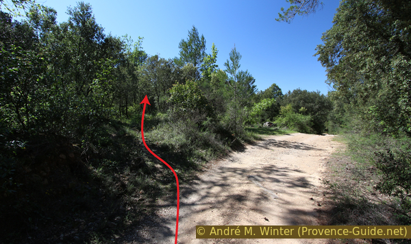
If we are at the end of the road, we continue left uphill to a barrier at number 350. To the left of this begins our path between fences and up to the plateau, you may have to open an electric fence against wild boars.
No reproduction is permitted without the written consent of the author. (id4068)
Climb to the M137 forest road at Défens
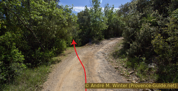
At first the path leads quite flat between two properties, below a barking dog can be irritating, but it is well locked in. As the fences end, the trail becomes rougher and slowly curves up towards the fall line. In the middle of the forest we see old retaining walls, sometimes we have to go up to the left, sometimes to the right, but we don't fundamentally deviate from this direction.
No reproduction is permitted without the written consent of the author. (id4069)
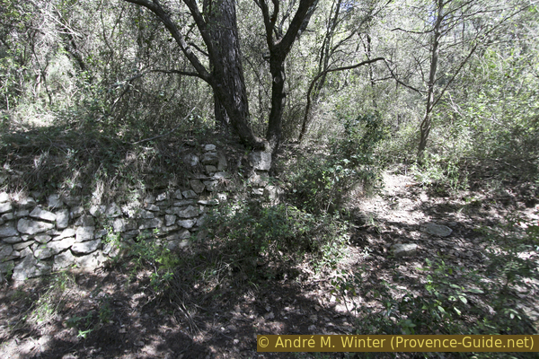
Dry stone walls in the forest in the ascent
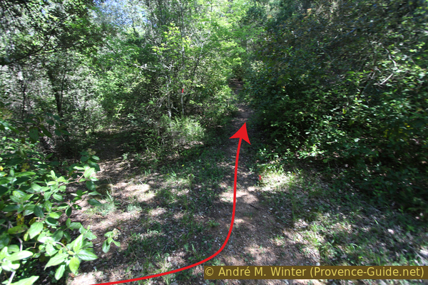
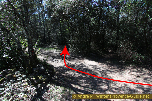
We gradually come to the plateau, climbing over natural rock ridges and the forest becomes lighter. You have to climb over a few bushes and you come to a flat forest road. Here turn right.
No reproduction is permitted without the written consent of the author. (id4070)
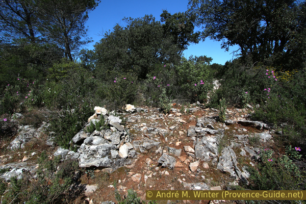
On the plateau just before the M137 forest road
In front you can see two transmission masts, which we are now targeting.
No reproduction is permitted without the written consent of the author. (id4071)
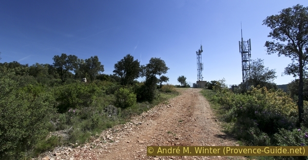
M137 forest road and transmission towers
At the antennas on the left there is a memorial for fallen resistance fighters against the German Nazis on this limestone bar. On the right, between the two antennas, there is a small belvedere with a good view of Cabasse and the Issole valley to the south.
No reproduction is permitted without the written consent of the author. (id4072)
Cabasse seen from the vantage point near the transmitters
In the further course we follow the cliff edge to the north, either along the gravel road or directly between the bushes on the edge. In the second case, we still have to turn left and back onto the road after 200 meters because the bushes are getting denser and especially because a densely overgrown side valley is crossing.
No reproduction is permitted without the written consent of the author. (id4073)
Forest road north of the antennas
On the forest road we come to a large water tank, behind which you can see the wide valley below.
No reproduction is permitted without the written consent of the author. (id4074)
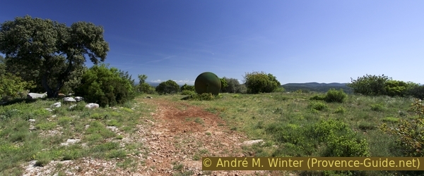
Point 341 and water tank
From the edge you can see a white cross in the north-east (left), which will be reached later on our route. But first we have to descend 150 meters to the Issole river.
No reproduction is permitted without the written consent of the author. (id4075)
Crest of the Notre Dame du Glaive chapel
Standing by the water tank and looking north we see the forest road continuing to the left but there is another path to the right of it. It is narrower, initially runs north and is used to bring sheep up and down. This path is now leading us downhill.
No reproduction is permitted without the written consent of the author. (id4076)
Path branching behind the water tank
ligne électrique = power line
ancienne carrière = former quarry
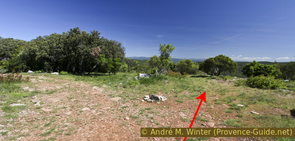
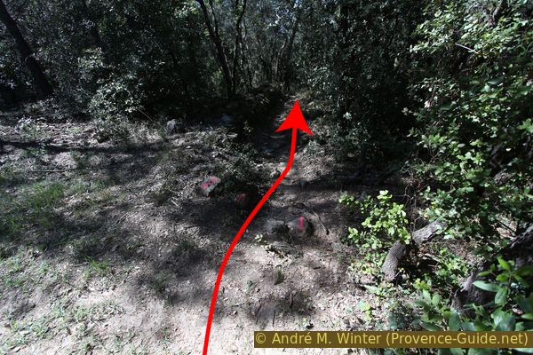
First it goes along the cliff edge. After about five minutes, the path turns left into the dark forest to continue downhill. Exactly in this not very distinctive left turn you can see a bare heap of stones through the forest on the right in front.
There are probably several Stone Age burial mounds that were built here on the cliff edge. Three of the broad mounds have a crater in the middle, suggesting that the mortuary chamber below collapsed. You shouldn't trudge over the graves, you can easily get around the outside.
Below the burial mounds we go left (west) back into the forest to get back on the path.
No reproduction is permitted without the written consent of the author. (id4077)
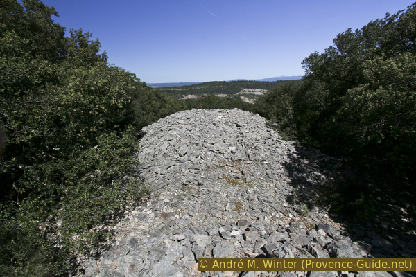
Tumuli at Castéou Sarrin
Section 2: Castéou Sarrin - Issole - Notre-Dame du Glaive
➙ 2,3 km ... 1 h 15 min ➚ 150 m ➘ 150 m ↝ average
35% easy trails, without marks
15% forest roads, without marks
5% hard-surfaced country road, old marks
20% forest roads, faulty marks
25% easy trails, faulty marks
The clues
- Castéou Sarrin, 320 m
- Down around the abandoned quarry
- Road bridge over the Issole, 185 m
- On a ledge up into the rock wall on the other Issole bank
- Dolmen du Pont Neuf and Chapel of Notre-Dame du Glaive, 320 m
Descent to the Issolle and opposite up again to the previously seen white cross.
On the way down the northern slope, we pass several junctions, none of which are marked. We always descend in a fairly straight line to the north-west, ignoring any uphill or level paths. At approx. 365 meters above sea level we cross a power line, the path then continues in the usual direction and with the same gradient.
No reproduction is permitted without the written consent of the author. (id4078)
Turn off on the descent towards the quarry
When you realize that you are slowly but surely getting to the bottom of the valley (approx. 210 meters above sea level), a path leads to the right in a right-hand bend. You can only recognize it by the exposed white limestone slabs in the forest. This path on the right leads to an abandoned bauxite quarry. There are several devastated zones of this type in the area between Carcès and Thoronet. You can descend through the mining area and come just south of the car bridge over the Issole.
After the right-hand bend, the normal route leads steeply downhill to a ruin, we turn right here between grapevines and the edge of the forest to later hike along the Issole. This brings us to the D13 road, immediately on the left is the road bridge over the Issole (on the right one would come down from the quarry).
No reproduction is permitted without the written consent of the author. (id4079)
Vineyards on the banks of the Issole
We walk over the bridge, but watch out for the traffic, the locals are usually criminally fast driving here.
No reproduction is permitted without the written consent of the author. (id4080)
Bridge of the D13 road over the Issole
East (right) of the bridge you can descend to the water on both banks. The pools invite you to swim, the water stays cool even in the warm period (as long as the river does not dry up). You still have to be careful, when the water is high, the river carries away various objects that can lie hidden at the bottom of these basins for years (road signs, wheel rims etc.). You should also wear shoes in the water. Don't just jump in, the clear water makes the pools appear deeper than they actually are. Not to forget: there is also a current that should not be despised.
No reproduction is permitted without the written consent of the author. (id4081)
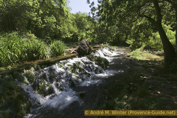
Weir on the Issole
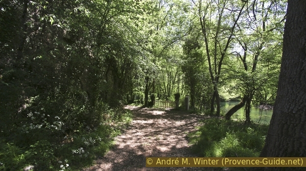
Continue at the other end of the bridge (north). Immediately afterwards our path leads downhill and along the water. After a small bridge we come to a fenced property.
No reproduction is permitted without the written consent of the author. (id4082)
Fence on the banks of the Issole
You can continue walking along the water, there is a fishing path here. Depending on the previous side effects of the flood, the path ahead becomes more and more chaotic, at the latest after the fence you should turn left and return to the forest road.
No reproduction is permitted without the written consent of the author. (id4083)
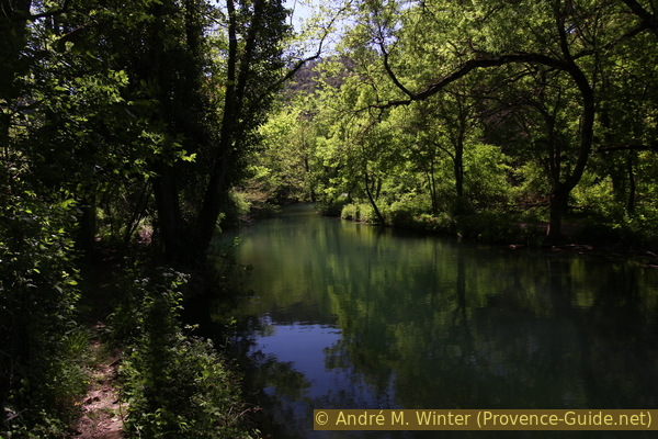
Path on the banks of the Issole
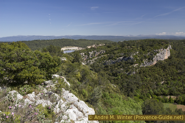
The forest road runs here under a rock wall that used to be formed by the Issole. You can't see it completely yet, the wall is much higher. We slowly realize the extent when the forest becomes a little less dense. Some markings also start here, they help us, but are unfortunately quite contradictory:
The white-green marking with thin lines is old and often no longer recognizable.
The signs, consisting of a wide white rectangle and a green line, are not markings, it is a forest boundary. As we walk along this border, the signs will accompany us often, but not everywhere!
Unofficial orange markers also exist and mark the entire rest of the loop, but these markers are not consistent, you only see them in the direction of travel and as above we deviate from them at times. The spray paint is certainly not visible for long.
No reproduction is permitted without the written consent of the author. (id4084)
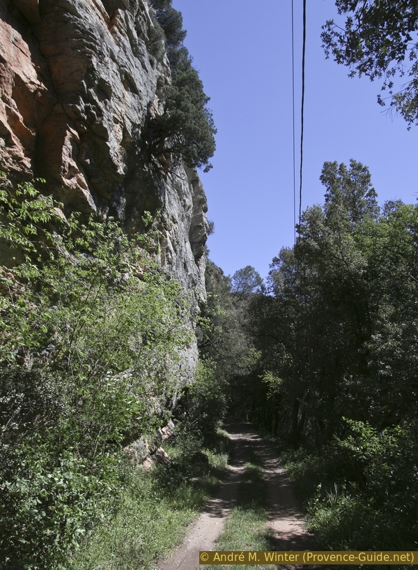
Forest road under the rock wall
We follow the road and the meanders of the river, but once you get used to walking in the shade, you can see a barrier ahead and that the further road is partially concreted. About 30 meters before that, our path branches off steeply to the left into the forest. You can recognize the spot by the piled up round stones on the left and the orange dots. It is also an approach to climbing routes in the rock wall above. Climbers can sometimes be found here off-season.
No reproduction is permitted without the written consent of the author. (id4085)
Beginning of the path on the left in front of a driveway
We climb over an overgrown gravel slope and our path becomes a little less steep as we come from the forest nearer to the rock wall base. The sun is also heating up at the top and the rock band on which we are now progressing remains rising for the time being. In the rock you can see some climbing hooks, so we can ignore the paths that lead directly to the foot of the wall.
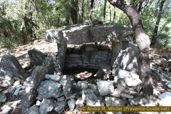
A little later we see a curious ruin in the upper third of the rock wall, it is called Trou des Fées (fairy hole). In 2017, a climbing ladder was attached at the bottom, but it was so damaged that climbing it didn't seem advisable to us. In any case, one can wonder how the inhabitants got into this cave. They probably came from above, because the stones used to build the wall must have come from above. Here the inhabitants of Cabasse entrenched themselves during military conflicts in the Middle Ages.
No reproduction is permitted without the written consent of the author. (id4087)
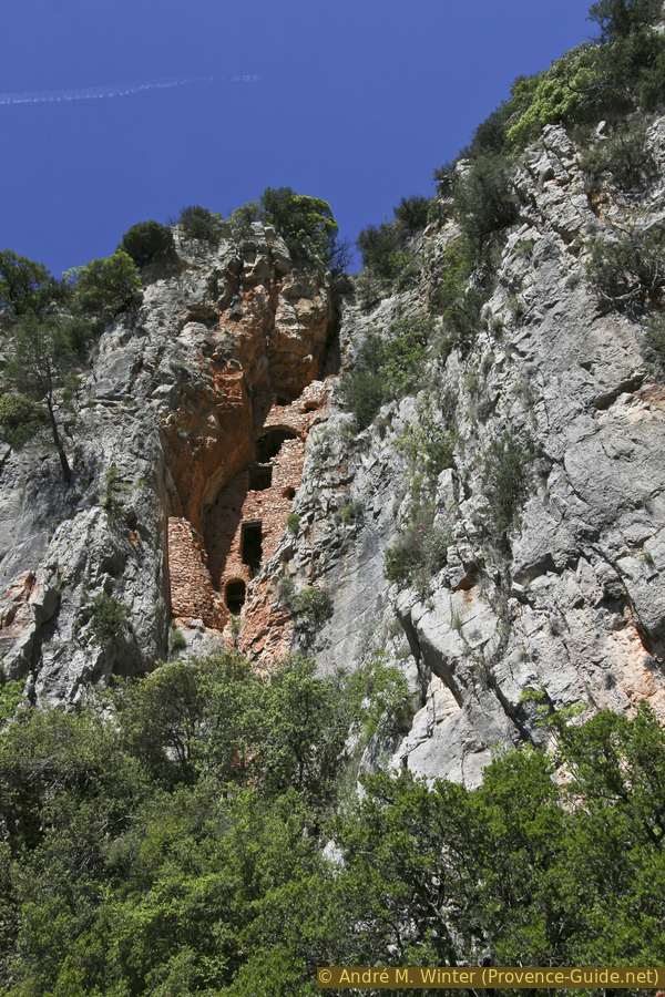
Trou des Fées fortified cave
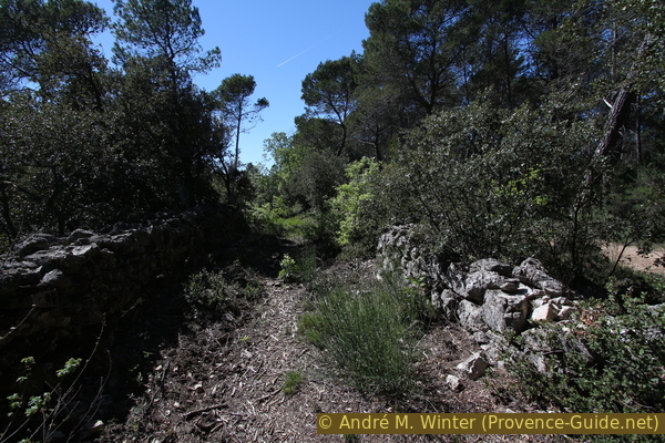
In any case, we continue to climb the ledge, it becomes progressively wider, and in various places we can see the remains of walls. There are again access routes to climbing routes and a small cave.
No reproduction is permitted without the written consent of the author. (id4088)
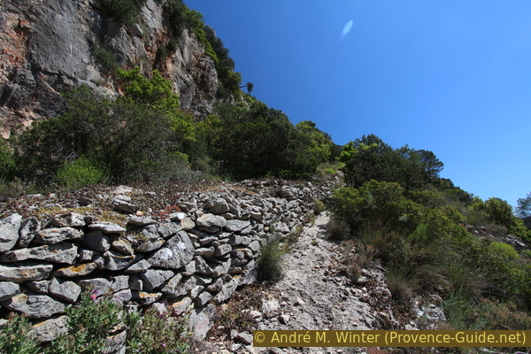
Old cultural terraces under the rock wall
croix blanche = white cross
vignes = vineyards
aire de battage = threshing floor
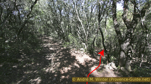
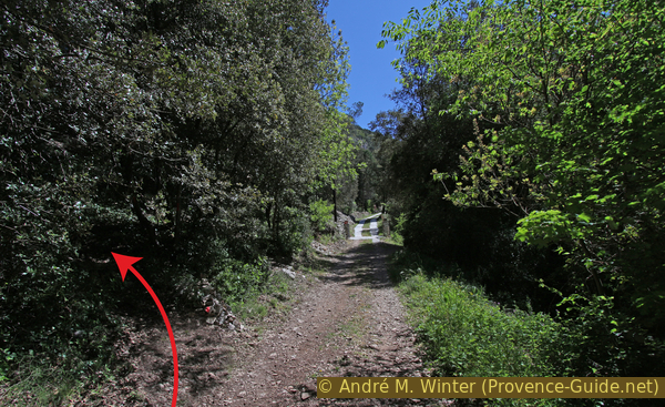
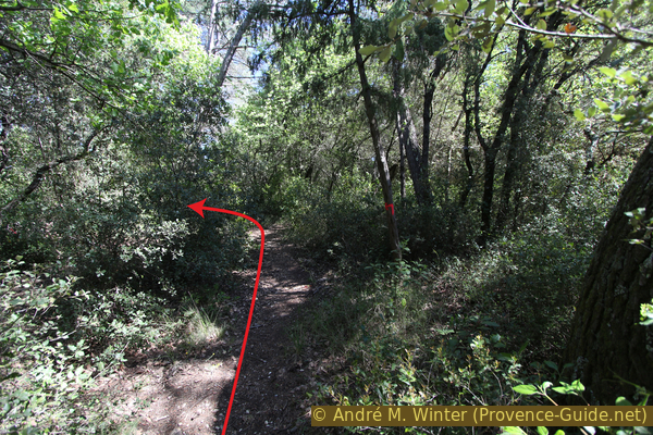
After the cave we have arrived at the plateau, the path turns to the right and becomes flatter. So we come to a not very distinctive path fork. Straight ahead we would go to the chapel, but we make a detour to the left here.
No reproduction is permitted without the written consent of the author. (id4089)
Direct way to the chapel
But here we go to the left!
So we come directly to the white cross. Here we have a good look back on the previous elevation, in the Issole valley and on to Cabasse.
No reproduction is permitted without the written consent of the author. (id4090)
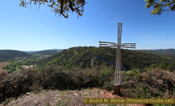
White Cross opposite Castéou Sarrin
We turn around and take the wide path to the chapel.
Scattered here are statues and other installations that don't really fit into this forest. The chapel in front also has paintings that pay homage to the cult of Mary. It is mostly closed, on August 25th a procession should take place here.
No reproduction is permitted without the written consent of the author. (id4091)
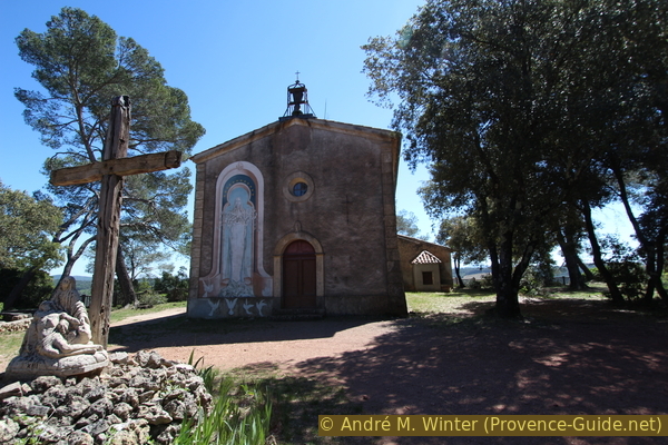
Notre-Dame du Glaive chapel
Above all, the chapel is a reference point for us: about 40 meters to the west in front of it you will find the Dolmen du Pont Neuf under the large pines. The photo shows the position of the Stone Age burial place in relation to the church building. The edge of the rock with the railing is on the right in the picture.
No reproduction is permitted without the written consent of the author. (id4093)
Location of the Dolmen du Pont Neuf
The tomb was originally located under the Castéou Sarrin rock, i.e. within the area oft the bauxite mine. It was therefore moved here, retaining the stones and orientation. That explains the good tidy condition. The cover plate is missing and the pit must have been deeper in the past,
No reproduction is permitted without the written consent of the author. (id4092)
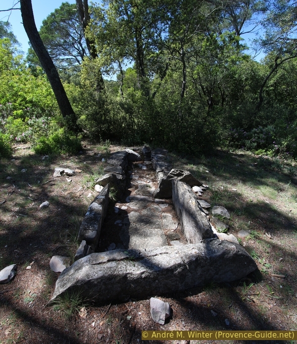
Dolmen du Pont Neuf
Section 3: ND du Glaive - St.-Loup - Dolmen de la Gastée
➙ 2,8 km ... 1 h ➚ 130 m ➘ 130 m ↝ average
15% easy trails, faulty marks
35% hard-surfaced quiet side streets, without marks
20% easy trails, without marks
15% hard-surfaced quiet side streets, without marks
20% easy trails, without marks
The clues
- Dolmen du Pont Neuf and Chapel of Notre-Dame du Glaive, 320 m
- Saint Loup chapel, 210 m
- Wideyards and Château Réquier, 190 m
- Dolmen de la Gastée, 320 m
Descent into the large plain to climb an easier hill opposite. However, it is no less high than the previous plateau.
We leave the dolmen and the chapel in a northwesterly direction, i.e. further along the rock edge. At the same time we walk backwards along the way of the cross of the chapel. After 150 meters there is a cut in the cliff edge, it is designed with stone steps and leads almost hidden and comfortably downhill. Below we come to the forest on a scree and finally the path leads us back to civilization with newer houses and fences.
No reproduction is permitted without the written consent of the author. (id4094)
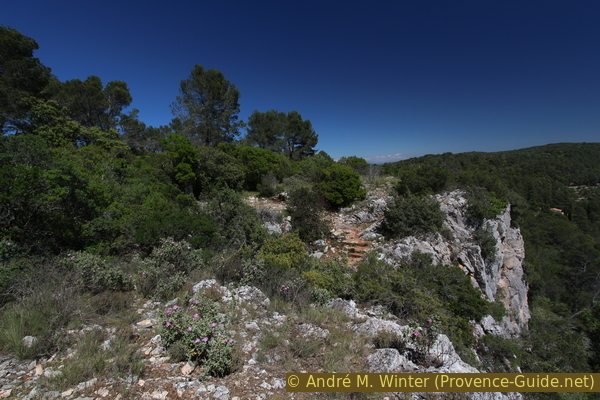
Stair of the Way of the Cross of Notre-Dame du Glaive
Below, at the crossroads, we continue downhill to the right and quickly come to a much more charming chapel. It is also locked, but on the street side you can look through a window into the two naves. Below the chapel, shady grass terraces invite you to take a break.
No reproduction is permitted without the written consent of the author. (id4095)
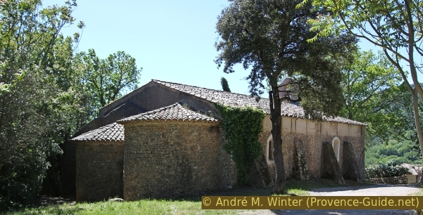
Saint Loup chapel at Cabasse
We continue down below the Chapelle Saint-Loup. About 30 meters further down you can see a new villa on the right over the gate.
Its parking lot is a former large and round grain threshing ground with a star-shaped paving pattern.
No reproduction is permitted without the written consent of the author. (id4096)
Old threshing floor under the St. Loup chapel
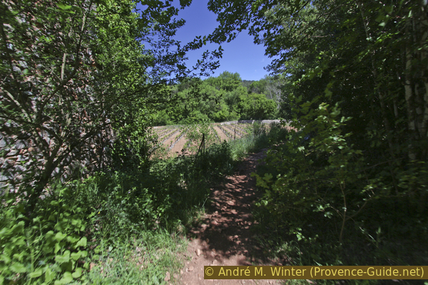
It continues downhill, once left and immediately right again further south. We walk on a narrow asphalt road along vineyards. We pass the Réquier winery, which includes the small castle that we saw from the last two plateaus.
No reproduction is permitted without the written consent of the author. (id4097)
Road to the Réquier Castle and Cabasse
vignes = vineyards
champ = field
mur double = double wall
chiens = dogs
We come to a crossroads where we go straight up the hill opposite. There is a signpost here, but it does not show our way. To the right is a vineyard, but we go straight and then left through a forest. Further up the path runs along a field to get to another narrow asphalt road. Here left.
No reproduction is permitted without the written consent of the author. (id4098)
Climb straight ahead to La Bouissière and the dolmen
After about five minutes, this road turns right and loses its asphalt surface. Here we go straight ahead on a path slightly down into a valley.
No reproduction is permitted without the written consent of the author. (id4099)
Curve on the road to the Bastide Vieille
Straight on from here.
Below we turn left and the path then splits, we take the right branch and thus go slightly uphill again. We go here on a path overgrown with moss, towards the southeast.
No reproduction is permitted without the written consent of the author. (id4100)
Branching in the valley
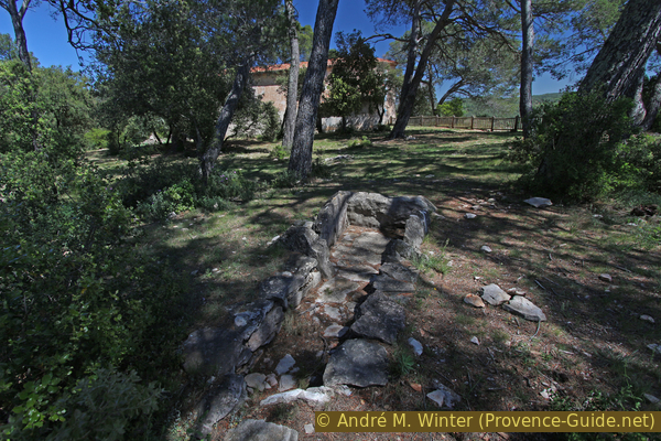
After some time you will see a small wall on the left, behind which a cistern is probably hidden. Exactly at this point we go right. The path is now more overgrown and you walk along old retaining walls.
No reproduction is permitted without the written consent of the author. (id4101)
Old water reservoir
After some time the path becomes wider and flatter, we come back to the top of a limestone plateau. On the left you can now make out bare rock slabs in the oak forest.
No reproduction is permitted without the written consent of the author. (id4102)
Here left to the Dolmen de la Gastée
Here is another destination of this tour, the Dolmen de la Gastée. Bone remains of about 80 people were found in it.
If you have not found the dolmen, it helps to turn around after you have come across a dirt forest road on the way. About 25 meters behind, at the right angle of this street, you can find the Stone Age grave.
No reproduction is permitted without the written consent of the author. (id4103)
Dolmen de la Gastée near Cabasse
Section 4: Dolmen de la Gastée - Issole - Cabasse
➙ 2,3 km ... 45 min ➚ 20 m ➘ 150 m ↝ average
10% forest roads, faulty marks
10% easy trails, without marks
10% forest roads, faulty marks
15% easy trails, faulty marks
40% easy trails, without marks
20% hard-surfaced city alleys, without marks
The clues
- Dolmen de la Gastée, 320 m
- Crête de la Bouissière, 325 m
- Hameau d'Issole, 195 m
- Cabasse, 200 m
Sescent to the village.
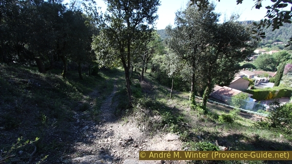
We walk from the grave to the forest road to the south and turn right here. It climbs a little but now roughly follows the ridgeline of the broad wooded ridge.
We arrive at a double stone wall. The path runs in the middle between them, to the right of which runs the gravel road. After some time, a fence begins between the two old walls, at the latest here you should switch to the street, because in the enclosure are quite unsympathetic fighting dogs.
No reproduction is permitted without the written consent of the author. (id4104)
Path between two wide walls
200 meters after the fence, a forest road leads down to the right, but we continue straight west along the remains of the wall. On the left in the forest you can see old tin huts.
No reproduction is permitted without the written consent of the author. (id4105)
Forest road to La Bouissière and our path on the left
300 meters ahead there is a road from the left, which shortly afterwards joins another.
No reproduction is permitted without the written consent of the author. (id4107)
Crossroads on La Bouissière
Here you can see two washed out paths descending on the right. Although the first one on the right looks wider and better, we have to take the narrow one and the second one on the left. In 2017 there were orange markings here. This path takes us northwest and down the shady slope into the village. It descends between ancient walls with a constant gradient, even crossing a small valley.
No reproduction is permitted without the written consent of the author. (id4106)
Access to the path down to Issole hamlet and Cabasse
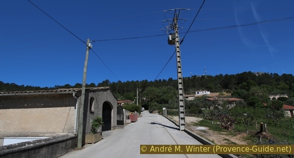
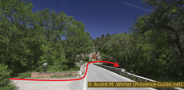
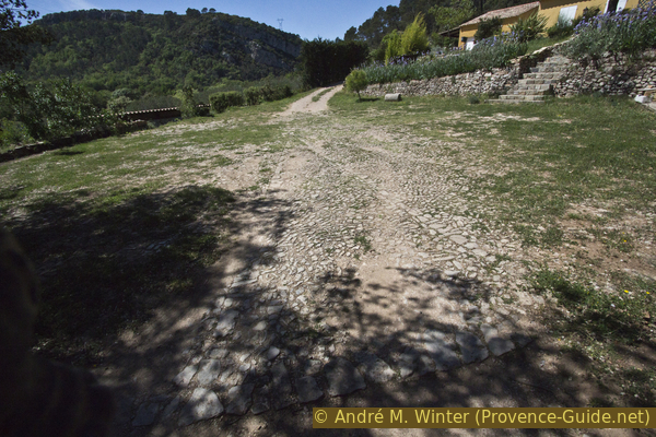
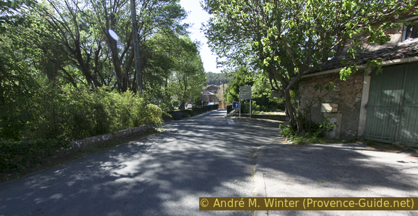
The first houses of the L'Issole district can now be seen and you descend to a square with a signpost, which is located directly at a road bridge over the Issole river. We go straight through the village to the D13 road and turn right there. The second street on the right leads to a square, on the left at the back there is a passage to the parking lot at the sports centre and thus to the starting point.
No reproduction is permitted without the written consent of the author. (id4108)
Path above Issole hamlet
Sources and additional information
This hike is inspired by this good book: Le Rando Malin, le Var, du littoral au Verdon (Clever hiking, Var, between the coast and Verdon, only french), Mémoires Millénaires Éditions, ISBN 978-295266479-0. This book offers many hikes where history and nature are in the foreground. However, the maps in it are rather poor. The tour here extends the one in the book with additional sights, vantage points and access routes.
It is better to use a good topographical hiking map: this tour is on the IGN "Brignoles, Le Luc" map, scale 1:25000, 3346OT.
If you don't want to bother with a paper map, you can also use mapping apps on your cell phone. On the one hand, it is the Cartes IGN app from the official map service. However, it requires access to the data network and this is sometimes difficult in canyons or remote locations.
Alternatively, you can use apps that store data directly on the device. They're generally not free, but they don't cost much. We mainly use OSMAnd, here it is possible to add contour lines, relief shading, markings and others. To store this data on your phone you need a lot of space.
Of course, one needs access to satellites for the GPS signal with any app. In some canyons this is not the case. Therefore, do not rely on the position shown, but read the map on your phone as you would read it on paper. Most apps are available for Android and iPhone. The applications usually allow us to record the route travelled and also view the GPS files offered for each of our hikes.
This page has been seen 2317 times since 20 March 2024.
No reproduction is permitted without the written consent of the author. (id4109)
Bridge to Cabasse