Coastal path from Brégançon to La Londe
Plage de Cabasson, Plage de l'Estagnol, Plage de l'Argentiere
hike
average
3 h 45 min
no
no
no
mountain
Introduction
The most beautiful beaches of the Côte d'Azur are well hidden between Le Lavandou and Hyères. Strictly speaking, we are between Bormes-les-Mimosas and La Londe, or more precisely between Cabasson and L'Argentière. Here you hardly see any houses from the hiking trail, there are easy and good sections of the trail, but also a few rocks and of course countless beaches. These positive aspects also have a downside: you can't make a loop, one way is almost nine kilometres long and there is no viable public transport. To make matters worse, parking in Cabasson is quite expensive. But if you take your time and start early in the morning, you can walk the entire route in both directions. You can also only explore parts of both sides.
The tour described here starts in Cabasson and leads to L'Argentière, so you go from east to west. The way in the other direction is described here: Coastal trail from La Londe to Brégançon.
This stretch of coast is fundamentally different in winter and in summer. In winter only the car parks in Cabasson and L'Argentière are open. In summer there are more beaches at Plage de l'Estagnol and Plage du Pellegrin, but they are not useful for this hike. But that's how much more people come to this coastal area. In summer there are also many boats in the bays. More information in the chapter parking.
The facts
8,8 km total distance
3 h 45 min walk time
160 m total elevation
orientation easy
mark 80% of the total distance
60% easy trails
40% on beach
dangers heat in summer, no drinking water on the way
children yes
useful picnic stuff, swimwear
required trekking shoes, hiking gear and water
GPS coordinates (WGS84) of starting point 43.121207,6.26006
GPS coordinates (WGS84) of end point 43.100058,6.324816
downloads ![]()
![]()
Public transport
There is no public connection to Cabasson.
But you can reach the other end by bus and start the tour there, despite making the tour much longer. For this, see Coastal trail from La Londe to Brégançon.
Access by car
Coming from Cavalaire and Le Lavandou, follow the direction to Hyères. Pass through Le Lavandou and you will come to the roundabout where you could go up to Bormes-les-Mimosas. Further to Hyères follows a long straight with a crossroads. Here we turn left towards Cabasson and Brégançon. This road leads straight out of the built-up area onto the Pas de la Griotte saddle. On the other side it goes south and down. At the only crossroads here, we turn left and follow the indications for Fort de Brégançon and Plage de Cabasson.
Coming from Hyères, leave the expressway at the roundabout in the direction of La Londe and Les Plages, later straight on to Quartiers Sud Ouest. So we circle La Londe in the south and at crossroads we follow the indications to Les Plages, Les Bormettes and L'Argentière. Under no circumstances should you go to Miramar. Before a regulated crossing, we line up on the left to get to L'Argentière. We follow this road and these signs up to a roundabout with an old transformer tower on the right of the road. Straight on here and on to Fort de Brégançon and Plage de Cabasson.
Useful parking spaces
In Cabasson you pay around EUR10 for parking. The private car park is open all year round and is free from November to the end of March. This is where the described tour begins.
If you only want to go in one direction, it makes sense to place a second vehicle at the end in L'Argentière. At first you follow the same route as to Cabasson, but turn right at the crossroads after the saddle to La Londe. You come through vineyards, past the associated castles and after almost 10 kilometers in the settlement area of L'Argentière to the first roundabout. The only notable feature here is an old transformer tower just before on the left. Here we turn left towards Plage de l'Argentière. You get to large parking lots behind the beach, this is the goal of the described tour.
In summer, from April to the end of September, there are two other car parks between the two mentioned. They lie behind the beaches of Plage de l'Estagnol and Plage du Pellegrin. The privately managed parking spaces also cost around EUR10. Those can be reached by taking the road between Cabasson and L'Argentiere. Normally you don't need them for this tour. In winter, these parking lots are completely closed and you can only get to the sea on foot without any possibilty to park your car outside on the road.
No reproduction is permitted without the written consent of the author. (id4943)
An access to the Plage du Pellegrin beach
No reproduction is permitted without the written consent of the author. (id4985)
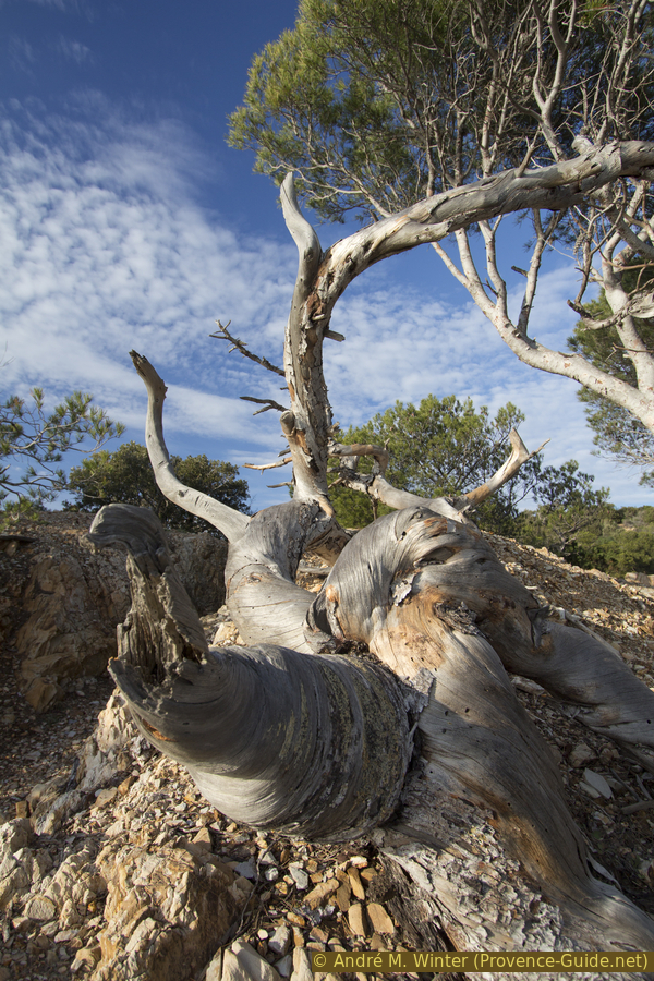
Sun bleached roots and branches
Hints
As mentioned above, only the route from Cabasson to L'Argentière is described here. The way back is on the same route. This is set out in Coastal trail from La Londe to Brégançon. You pass many different beaches and capes and you don't always remember where to get back from the beach, so the description in the opposite direction can be helpful.
Both directions together make up almost 18 kilometers, but as you're on the move all day, the position of the sun also changes and as a result the coves and rocks appear radically different in both directions.
In summer there are bars and showers on the large beaches with access, in winter there are no food options within walking distance at the starting point, on the way and at the destination. There are toilets open all year round in Cabasson and L'Argentière.
It is perhaps important to disentangle the place names of Cabasson and Brégançon. On the one hand there is the large winery with the Château de Brégançon and on the other hand the fortress Fort de Brégançon on the rock in the sea. In between lies the hamlet and the beach of Cabasson.
The photos on this page are from different years and seasons.
The whole region is a zone with a high risk of forest fires. In summer, but also in other seasons when it is very dry or by strong winds, access to the forest areas can be regulated. As a result, the roads may be closed to traffic and/or the trails prohibited to hikers. Current information: Map of access to the forests of the Var (also english). The map shows the colours green, yellow, orange and red which correspond to levels of danger.
The sections
- Plage de Cabasson - Plage de l'Estagnol: this section is shorter, here are the beaches that may not be as crowded in summer, we like to pause on the loveliest of all, the Plage de l'Estagnol or more precisely on one of the surrounding headlands with a view of Brégançon
- Plage de l'Estagnol - Plage de l'Argentière: this section is longer, but the path is a bit easier here
Section 1: Plage de Cabasson - Plage de l'Estagnol
➙ 5,1 km ... 2 h 15 min ➚ 100 m ➘ 100 m ↝ easy
10% on beach, few marks
5% easy trails, with marks
15% on beach, few marks
15% easy trails, few marks
<5% on beach, without marks
5% easy trails, few marks
15% on beach, few marks
15% easy trails, few marks
<5% on beach, without marks
15% easy trails, few marks
The clues
- Plage de Cabasson, 0 m
- A series of at least seven beaches and as many capes, the latter rising between 5 and 20 meters
- Plage de l'Estagnol west, 0 m
This section is slightly shorter than the second. Maybe the beaches here are less crowded in summer.
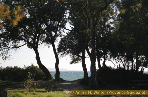
From the parking lot and the shady picnic benches we go straight out onto the beach and immediately see the Fort de Brégançon on the left.
It is a holiday residence of the French President. When he is present, police officers patrol the beach and the navy cruises in front of the small rocky island.
No reproduction is permitted without the written consent of the author. (id4944)
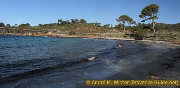
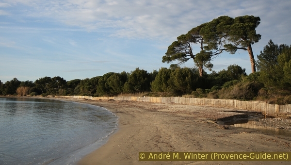
Beach and Fort de Cabasson
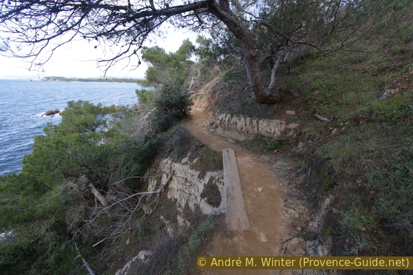
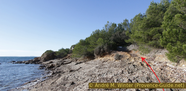
However, we go in the other direction and to the end of the beach. Above we see a particularly large boundary stone. We have to go up there and behind it the path to the next beach begins.
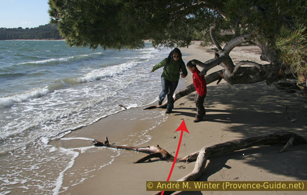
The photo also shows a very patchy forest and dead trees. A large forest fire devastated a short stretch of coast in 2017. The path initially leads through a lot of dead wood. But soon the route becomes much nicer and more pleasant.
No reproduction is permitted without the written consent of the author. (id4945)
Plage de Cabasson beach and Pointe de la Vignasse cape
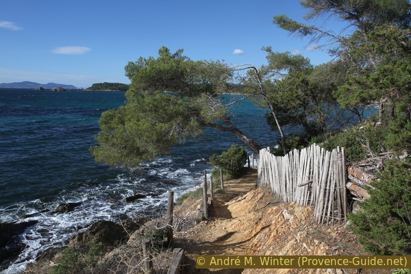
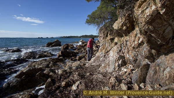
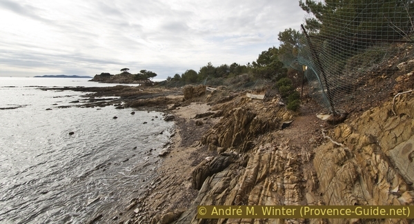
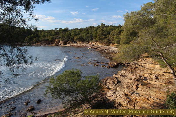
The first headland we cross is the Pointe de la Vignasse. After the deadwood zone, the path changes to a ledge above the water.
No reproduction is permitted without the written consent of the author. (id4946)
Good coastal path at Pointe de la Vignasse cape
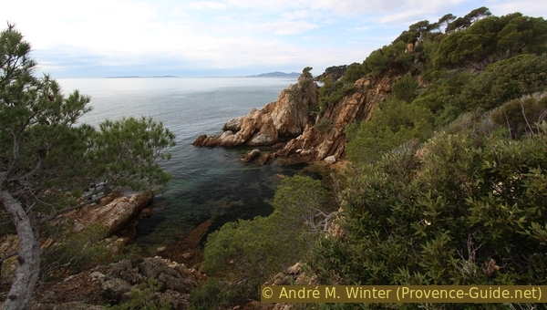
You gain a bit of altitude, here we are on a fairly rugged stretch of coast. Some find a nice spot here in the winter sun.
No reproduction is permitted without the written consent of the author. (id4947)
Winter sun at Cape Pointe de la Vignasse cape
On the land side, a fence accompanies us, which at times forces us down to the water. There is not a laid-out path everywhere, here you can also find completely natural sections. In addition to the large beaches, there are also rocky bays with small gravel beaches.
No reproduction is permitted without the written consent of the author. (id4948)
Rocky coast at Cape Pointe de la Vignasse cape
When we are closer to the water again, the path turns right and we come to the abandoned harbor in the bay of Anse de la Vignasse.
No reproduction is permitted without the written consent of the author. (id4949)
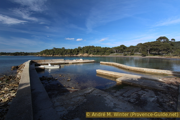
Port in Anse de la Vignasse bay
There is a sandy beach in the bay, but it is often buried under large amounts of Neptune grass. Here these seaweeds continue to cover sections of the beach and rocks. You often have to walk directly on it, it feels like you're walking on a particularly thick carpet.
No reproduction is permitted without the written consent of the author. (id4950)
Plage de la Vignasse beach
This path leads over the Pointe de la Mère Dieu cape.
No reproduction is permitted without the written consent of the author. (id4951)
Coastal footpath at Pointe de la Mère Dieu cape
Before we get to another beach, we come to a stone hut, here glowing in the winter sun.
No reproduction is permitted without the written consent of the author. (id4952)
Cabin at Pointe de la Mère-Dieu cape
Shortly afterwards we come to the Plage de la Villa de Brégançon. It can also be the case that you have to walk over washed up Neptune grass. This beach is probably one of the quieter ones in high summer.
No reproduction is permitted without the written consent of the author. (id4953)
View to the beaches of Brégançon
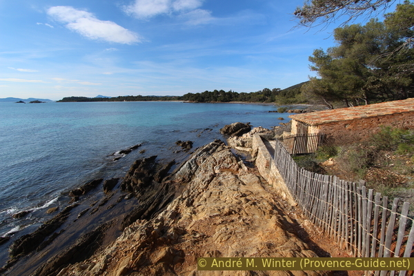
This is immediately followed by the Plage du Domaine de Brégançon beach, which is much larger. You can only get here via the coastal hiking trail. After that there is a rocky section with no path, just walk along the waterline.
No reproduction is permitted without the written consent of the author. (id4954)
Coastal path between the beaches de Brégançon
And then there's another beach, this time Plage de l'Îlot du Jardin. Wou can only come here on foot, too.
No reproduction is permitted without the written consent of the author. (id4955)
beaches
Since you can't pause on every beach, let's move on. The Plage de l'Îlot du Jardin beach follows to the west, but many rocky ridges break through the strip of sand. But you often walk directly on the compactly deposited Neptune grass, which is also much easier than over the rocks.
No reproduction is permitted without the written consent of the author. (id4956)
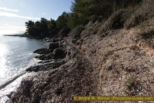
Coastal path on Neptune grass west of the Plage du Jardin beach
Several rocky areas follow, sometimes the remains of a prepared path make walking easier.
No reproduction is permitted without the written consent of the author. (id4957)
Coastal footpath west of the Plage du Jardin beach
If the path leads further up, like here, we always stay to the left of the fence.
No reproduction is permitted without the written consent of the author. (id4958)
Path between Plage de l'Îlot du Jardin beach and Pointe de l'Estagnol cape
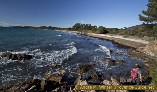
We're slowly but surely coming to the Cap de l'Estagnol, but for now the coastal area remains fairly flat. In winter the sea is a bit higher and in summer the beach is a bit wider here.
No reproduction is permitted without the written consent of the author. (id4959)
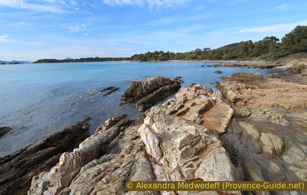
Plage des Niouvelles beach in winter
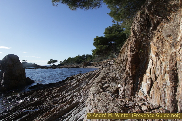
A little later it really goes up to a higher cape, it's only 12 meters, but that's more than before. The path leads over rocky bays that are difficult to reach.
No reproduction is permitted without the written consent of the author. (id4960)
Calanque du Toupet Vert
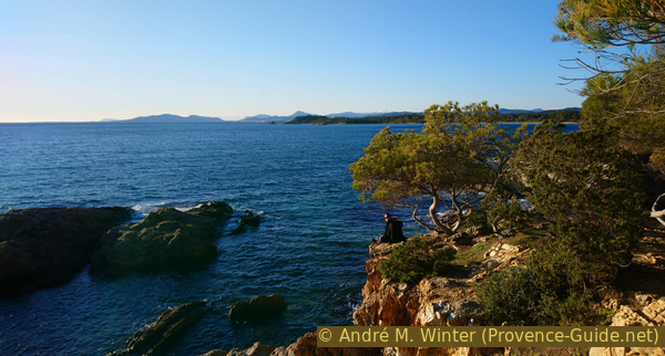
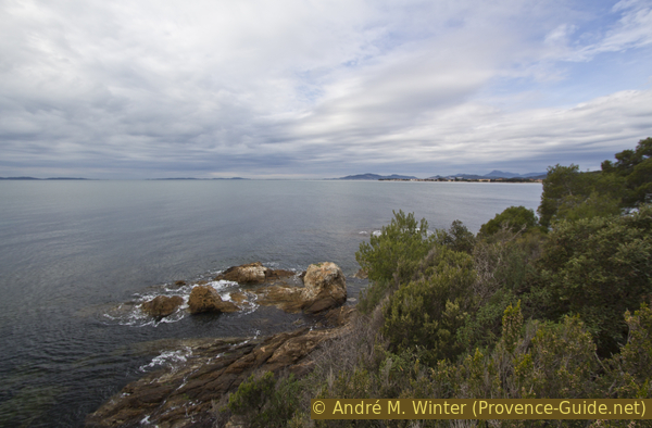
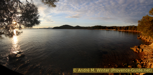
When we reach the highest point, we should turn around to see the Fort de Brégançon up close one last time. In front of the cape are the rock islands Îlots de l'Estagnol, the only pine on it is a popular photo motif.
No reproduction is permitted without the written consent of the author. (id4961)
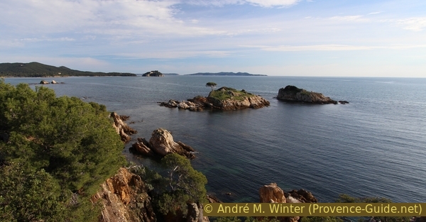
Îots de l'Estagnol and the Fort de Brégançon behind
Inland stands the proud Château de Brégançon.
You can buy good wine there.
No reproduction is permitted without the written consent of the author. (id4962)
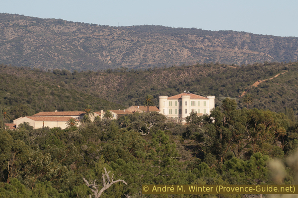
Château de Bregançon
In front of us, the path turns to the right and the view opens onto the beautiful bay with the Plage de l'Estagnol beach. In winter, when the sun is low in the sky, you can enjoy wonderful light shows here.
No reproduction is permitted without the written consent of the author. (id4963)
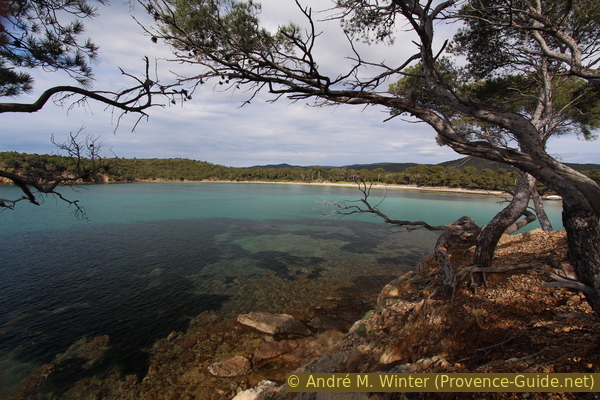
View from Cap de l'Estagnol to the beach of the same name
North of the cape the path leads down to the beach. One path stays longer further back under the umbrella pines. You can also switch to the water earlier, but you have to hike over a few rock ridges there.
No reproduction is permitted without the written consent of the author. (id4964)
Rocky section south of the Plage de l'Estagnol beach
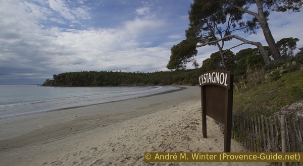
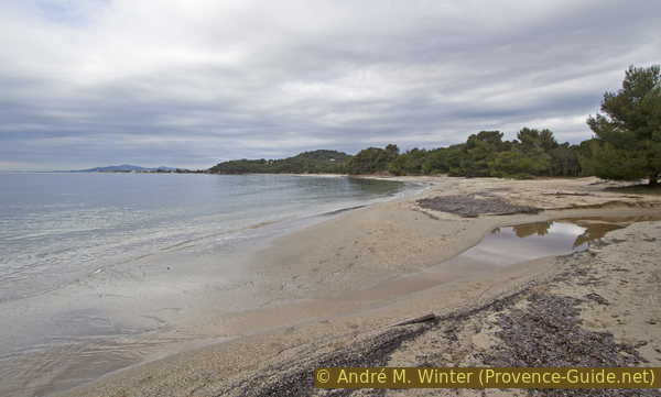
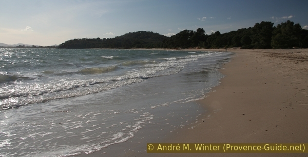
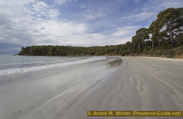
L'Estagnol beach is framed by two long and rugged promontories. At the back of the bay lies a silver glittering sandy beach. Behind it are tall umbrella pines.
No reproduction is permitted without the written consent of the author. (id4965)
Plage de l'Estagnol beach
We've come to the end of this section and it's a good place to take a break when it's not busy.
No reproduction is permitted without the written consent of the author. (id4966)
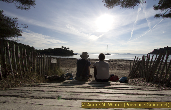
Break at the Plage de l'Estagnol beach in winter
If you're there in the off-season, you might find several donkeys clearing the undergrowth between the beach and the vineyards.
No reproduction is permitted without the written consent of the author. (id4967)
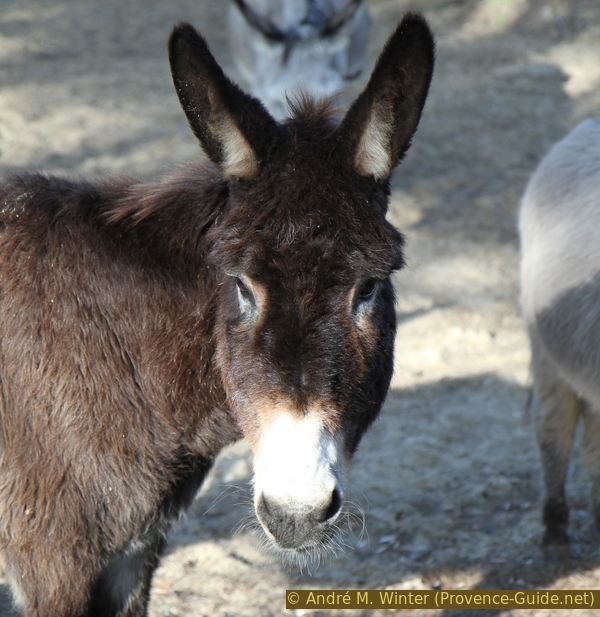
Black donkey
Section 2: Plage de l'Estagnol - Plage de l'Argentière
➙ 3,7 km ... 1 h 25 min ➚ 60 m ➘ 60 m ↝ easy
10% on beach, without marks
30% easy trails, few marks
15% on beach, without marks
5% easy trails, few marks
5% on beach, without marks
10% easy trails, few marks
5% on beach, without marks
15% easy trails, few marks
5% on beach, without marks
The clues
- Plage de l'Estagnol West, 0 m
- Around nine beaches and as many capes, between 10 and 30 meters high
- Plage de l'Argentière, 0 m
This section is shorter than the first.
We collect our snack leftovers and set off again. More than a third of the way still lies ahead of us. The path is a little easier than before.
No reproduction is permitted without the written consent of the author. (id4968)
Panel at the Plage de l'Estagnol beach
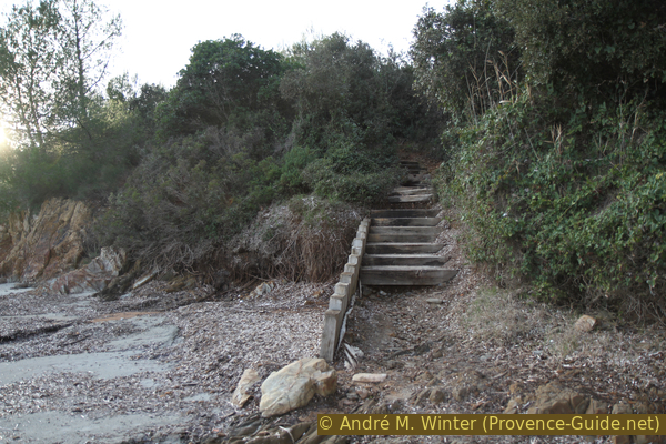
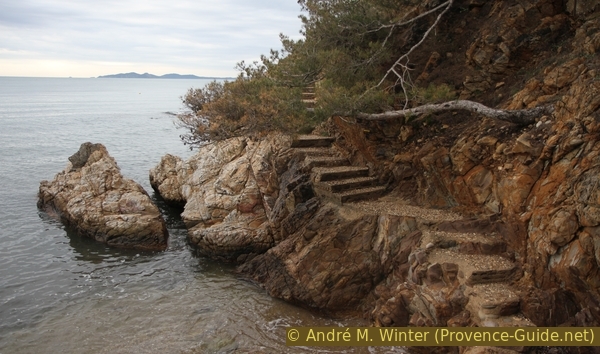
We go to the western end of the beach, but just before that, stairs on the right lead up to the marked path. This brings us around Cape Pointe de Cousterette.
No reproduction is permitted without the written consent of the author. (id4969)
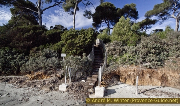
Steps from the Plage de l'Estagnol beach up to the coastal path
Behind these rocks we come to the small bay of Anse de la Cousterette. It is divided into a rocky section and a small beach to the west. Both are mostly buried under Neptune grasses. You can descend into the rocky bay, but the official path leads around the top.
No reproduction is permitted without the written consent of the author. (id4970)
Anse de la Cousterette bay
The Anse de la Cousterette beach area is easier to access. From here the path goes up to the Cap de Léoube. At 30 meters this is one of the higher caps of this tour.
No reproduction is permitted without the written consent of the author. (id4971)
Cap de Léoube and Plage de la Cousterette beach
The trail first heads inland, but soon turns left and continues to climb. When we come to a level, the path turns to the right. However, there is also a path on the left, it is blocked off with a chain.
If we turn left, we quickly come to an old fortification, the Batterie de Léoube.
The base dates from the 18th century, improvements were made until 1841. Signs indicate that the site is still a restricted military area.
You can't get in, but you can walk around to the left, so you see sometimes inside.
No reproduction is permitted without the written consent of the author. (id4972)
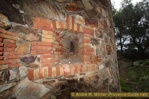
Loophole in a tower of the fortress at Cap de Léoube
After the fortress we come back to the main path and continue from there. You are guided by arrows and barriers. After a while on an old forest road we have to go down to the left to get closer to the water again.
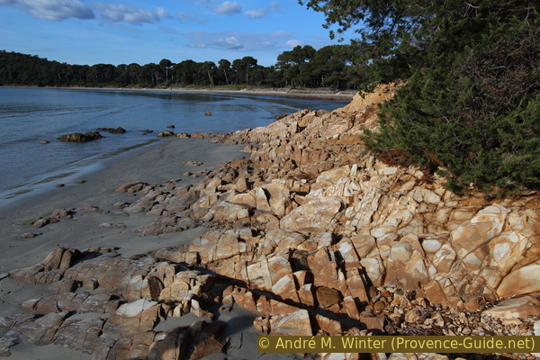
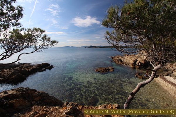
The path takes us to the bay of Anse de Léoube. In the southern part there is a curious section of rock that looks like it has been planed. You make good progress here.
No reproduction is permitted without the written consent of the author. (id4973)
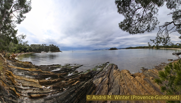
Flat rocks in the bay of Léoube
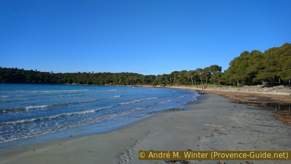
The Plage de Léoube beach can only be reached via the coastal footpath. In summer, however, there are many boats in the bay. Only hikers come here in winter.
No reproduction is permitted without the written consent of the author. (id4974)
Plage de Léoube beach in the evening light
A few meters before the end of the beach, somewhat broken stairs lead up to climb the next small cape. The trail alternates between a small path in the maquis and old forest roads.
No reproduction is permitted without the written consent of the author. (id4975)
Steps up from the Plage de Léoube beach
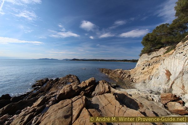
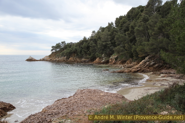
The small beach Plage de la Chapelle St. Georges is often covered in seaweed and can be circumnavigated on the trail behind. So we come to Pointe du Pellegrin cape.
No reproduction is permitted without the written consent of the author. (id4976)
Rocks of Pointe du Pellegrin cape
Steps made from old railway sleepers now take you to the eastern part of the Plage du Pellegrin beach. In the summer, this beach can be as crowded as L'Estagnol.
In winter, creeks that flow into this bay can be difficult to cross. It can make sense to wade through barefoot.
No reproduction is permitted without the written consent of the author. (id4977)
Plage du Pellegrin beach and a creek estuary
In addition to the creeks that cross the beach, trees can also lean towards the water.
No reproduction is permitted without the written consent of the author. (id4979)
Fallen pine tree on the Plage du Pellegrin beach
It is a larger beach on this stretch of coast. But purely visually it is not as appealing as L'Estagonl or Léoube, probably due to the lack of framing rugged capes.
No reproduction is permitted without the written consent of the author. (id4978)
Plage du Pellegrin beach
In the west the beach gets narrower and finally you reach a gently sloping path almost automatically. It leads us to the small cape Pointe de l'Argentière. In the rocky area, some routes have steps.
No reproduction is permitted without the written consent of the author. (id4980)
Stair on Pointe de l'Argentière cape
The path now leads downhill to the last beach of the tour: Plage de l'Argentière.
No reproduction is permitted without the written consent of the author. (id4981)
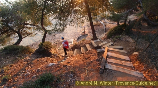
Steps down to Plage de l'Argentière beach
We have now come to the end of the hike, but many who started at Cabasson will now be making the return journey. The way is the same. If you want to see what the beaches look like and especially the approaches to the capes in the east direction, you can do so on this page: Coastal trail from La Londe to Brégançon.
If you want to get to the bus station in Port de Miramar, continue along the beach until you get at a pier. There you go inland to the footbridge. On the other side again inland and right onto a parking lot to the bus stop.
No reproduction is permitted without the written consent of the author. (id4982)
Pellegrin bay in the evening light
Sources and additional information
It is better to have a good topographic hiking map: this tour is on the IGN map "Le Lavandou, Corniche des Maures, Parc national de Port-Cros", scale 1:25000, 3446ET.
If you don't want to bother with a paper map, you can also use mapping apps on your cell phone. On the one hand, it is the Cartes IGN app from the official map service. However, it requires access to the data network and this is sometimes difficult in canyons or remote locations.
Alternatively, you can use apps that store data directly on the device. They're generally not free, but they don't cost much. We mainly use OSMAnd, here it is possible to add contour lines, relief shading, markings and others. To store this data on your phone you need a lot of space.
Of course, one needs access to satellites for the GPS signal with any app. In some canyons this is not the case. Therefore, do not rely on the position shown, but read the map on your phone as you would read it on paper. Most apps are available for Android and iPhone. The applications usually allow us to record the route travelled and also view the GPS files offered for each of our hikes.
This page has been seen 1822 times since 20 March 2024.
No reproduction is permitted without the written consent of the author. (id4983)
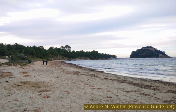
Empty Plage de l'Estagnol beach in winter
No reproduction is permitted without the written consent of the author. (id4984)
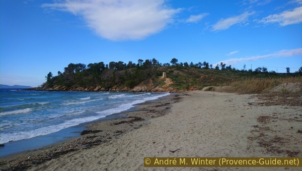
Plage du Kiosque Blanc beach