On the Mont Dauphin via the marmot trail
Walk up the fortified town
walk
easy
2 h
yes
yes
built-up area
walk
Introduction
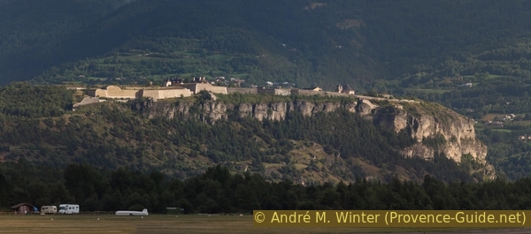
Mont Dauphin is a well-known sight in the Durance Valley. The fortress builder Vauban did not fortify a previously existing site here, but built a fortress town from scratch. Within the walls is a village that is still inhabited today. The fortress was built and expanded several times, but the village never reached its planned size and battles were never fought here. Today you walk through a museum village, which you can visit freely.
Of course you can get to the spur by car, but you miss a lot. In the south-west, start at the marmot educational trail (Boucle des Marmottes), where there is a very high probability of seeing marmots. They are well fed here, but are basically free-living. This is how you get to the north portal of the fortress. Downhill it goes over the narrow road in the south.
The facts
6,2 km total distance
2 h walk time
160 m total elevation
orientation easy
mark 40% of the total distance
35% easy trails
30% hard-surfaced quiet side streets
20% hard-surfaced city alleys
10% hard-surfaced country road
10% hard-to-recognize trails
dangers none
children ideal
useful picnic stuff
required trekking shoes, hiking gear and water
GPS coordinates (WGS84) of start and end point 44.674651,6.616171
downloads ![]()
![]()
No reproduction is permitted without the written consent of the author. (id3576)
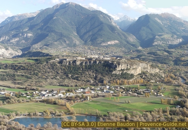
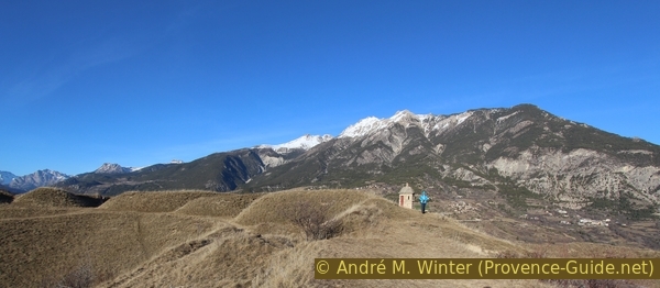
Mont Dauphin seen from Saint Crepin
You can see the side with the ascent here.
Public transport
Eygliers train station is called Mont Dauphin Gare. The train, intercity buses and also regional buses all stop here. There are around 15 daily train connections: TER PACA (only french) for line between Gap and Briançon and as many long-distance buses: Zou! (only french), see line 69. The seasonal local bus connections to the side valleys, such as the Queyras area, also start here, timetables also at Zou! (only french).
Access by car
The Mont Dauphin is located directly on the national road 94. In the hamlet of Eyguiers-Gare, in front of the turn-off to Réotier, the circuit starts at the Milaure parking lot for those arriving by car. If you travel publicly, the starting point is a little further north. The tour is described starting at the train station.
Useful parking spaces
The Milaure car park in Eyguiers-Gare is right next to the RN94 road and is free. If it is full, there are additional parking spaces at the train station.
Hints
The marmots can be found mainly in the morning and only in the warmer season. In the village above, on Rue Catinat, there is a fountain with drinking water. Of course there are also bars, but not all of them are open all year round. The southern part of the complex is a large green area, where you can have a picnic under the trees.
The sections
- From the train station to the Milaure car park
- Climb to the north side of the fort via the Boucle des Marmottes
- Free visit of Mont Dauphin
- Descent in the south via the Rampe d'Embrun
- From the Milaure car park back to the train station
Section 1: Gare d'Eygliers - Parking de Milaure
➙ 0,6 km ... 10 min ➚ 0 m ➘ 0 m ↝ easy
50% hard-surfaced country road, without marks
50% hard-surfaced quiet side streets, without marks
The clues
- Mont Dauphin train station in Eygliers, 888 m
- company Dekra
- Milaure car park, 889 m
Reach the foot of Mont Dauphin.
gare = train station
The station Mont Dauphin Gare in Eygliers is above all the station of Guillestre. There is no particularly nice way from the train station to the start of the marmot educational trail: follow the avenue to the main road and turn right there. Go ahead to the parking lot of the Dekra company and cross the busy RN94 road at the pedestrian crossing with the appropriate caution. Opposite we take the small road into the fields.
At the following crossroads, turn right and in a few minutes we are at the Milaure car park. Now turn left and you are in front of the boards that show and explain the paths at the foot of the Mont Dauphin.
Eygliers-Gare train station and the Milaure car park in front of Mont Dauphin
The train station is on the left and the car park further ahead on the right.
Section 2: Sentier des Marmottes - Lunette d'Arçon
➙ 1,6 km ... 40 min ➚ 150 m ➘ 0 m ↝ easy
20% hard-surfaced quiet side streets, with marks
60% easy trails, with marks
20% hard-to-recognize trails, without marks
The clues
- Milaure car park, 889 m
- Sentier des Marmottes nature trail
- Climb north to the fort
- Lunette d'Arçon, 1045 m
Easy path between the rodents and ascent to the plateau.
montée = ascent
fort = fortress
La Boucle des Marmottes nature trail is a small circuit at the foot of the wall under Mont Dauphin. The marmots are indeed wild and free here, but of course very used to the people who pass behind the barriers. Although it is strictly forbidden, the animals are lured and fed with all sorts of things. It's not worse for them, but it's no comparison to finding these animals in the high mountains. Here you can see them just a few steps from the parking lot, so smaller children are sure to be delighted.
No reproduction is permitted without the written consent of the author. (id3579)

Young and mother marmot fight over a dandelion leak
The nature trail consists of an old road and a path further up and thus forms a loop, but we only ascent here. The road comes directly from the parking lot and after 150 meters our path branches off uphill.
No reproduction is permitted without the written consent of the author. (id3578)
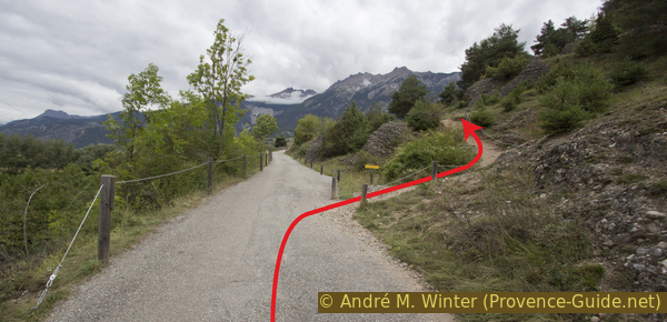
Junction of the trail
The path has some forks. In order to find the right one up to the castle, you have to take the upper path at every junction, but without leaving the laid out paths. Do not climb up the wild paths, they usually only lead to bouldering rocks.
Further up, the path becomes easier but also steeper. In a few hairpin bends you get through the forest to the plateau north of the fortress. The first level reached is not the correct one. At this field, turn right and immediately back into the forest to overcome a second edge of the terrain. Then we are on the road to the fort, which is immediately to the right.
No reproduction is permitted without the written consent of the author. (id3577)
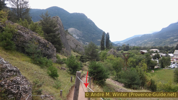
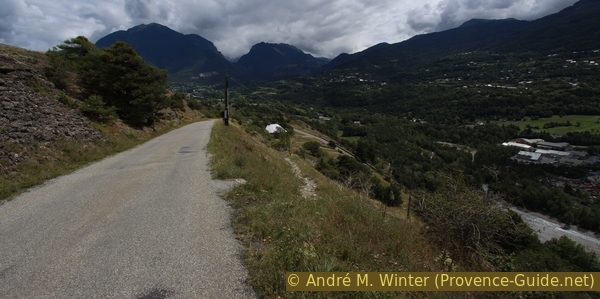
Looking back on the marmot trail
Section 3: Lunette d'Arçon - Porte d'Embrun
➙ 2,1 km ... 30 min ➚ 10 m ➘ 30 m ↝ easy
60% hard-surfaced city alleys, without marks
10% hard-to-recognize trails, without marks
30% easy trails, without marks
The clues
- Lunette d'Arçon, 1045 m
- Porte de Briançon
- Armoury
- Porte d'Embrun, 1020 m
Wander through the fortified city.
porte = gate
arsenal = armory
échauguette = guard post
This page shows a hike up Mont Dauphin and does not claim to be a tourist guide. The most important information can be found here: Mont Dauphin (Monuments Nationaux). Don't let the opening times and entrance fees confuse you, this information only applies to guided tours (2 hours). The entire village is open for us to explore. Of course, this is not meant to be a license to look everywhere, because the place is still inhabited. Mont-Dauphin is also a municipality in its own right.
No reproduction is permitted without the written consent of the author. (id3580)
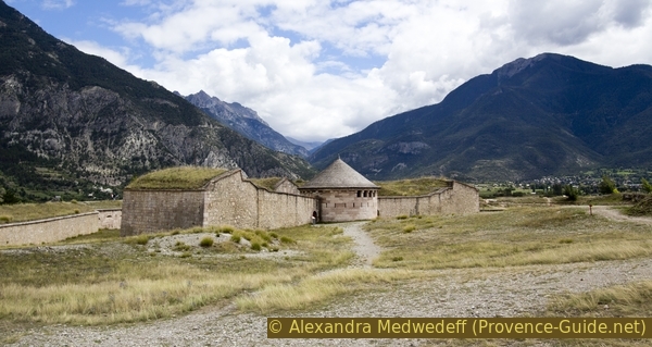
Lunette d'Arçon in front of Fort Mont Dauphin
Forward position for rear cover with underground connection to the main fortress.
Only a walk through the streets in the fortress is presented here, you can walk around here freely. Only residents are allowed to enter the fortress by car.
You enter through the Porte de Briançon. It is the only front without natural protection, the defences are omnipresent here. We are at the highest point of the fortress. The only other gate is in the south, where we will leave the place later.
To the west you have a tremendous view of the Durance valley and the southern part of the Écrins massif. To the east you can see the wild gorge of the Guil and the peaks of the Queyras region. The town of Guillestre is barely visible. To the south you can see a commercial area.
No reproduction is permitted without the written consent of the author. (id3581)
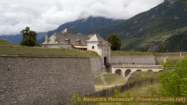
Fort gate Porte de Briançon of Mont Dauphin
The commandant of the fortress lived in the building behind the gate.
The fountain at the central crossing provides drinking water. Once around, a look at the unfinished church, the vegetable garden and the arsenal is a good thing in half an hour.
No reproduction is permitted without the written consent of the author. (id3582)
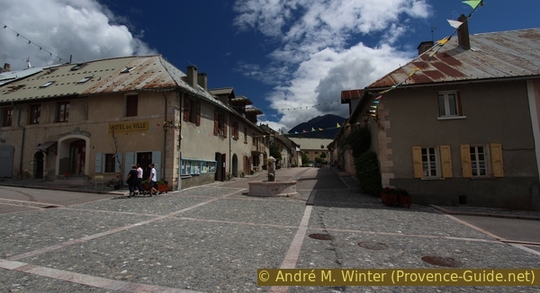
Fountaine des Quatre Coins
The central crossroads in the village.
Then you go south and downhill, you almost automatically reach the Rochambeau barracks, under which the Porte d'Embrun gate is open for our descent.
No reproduction is permitted without the written consent of the author. (id3676)
Defensive ramparts and the sentry post at the Guil to the east
Section 4: Porte d'Embrun - Parking de Milaure
➙ 1,3 km ... 30 min ➚ 0 m ➘ 130 m ↝ easy
70% hard-surfaced quiet side streets, few marks
30% easy trails, few marks
The clues
- Porte d'Embrun, 1020 m
- Rampe d'Embrun
- Milaure car park, 889 m
Descent on a quiet road.
porte = gate
After passing through the Porte d'Embrun, you might wonder why there are far fewer defenses here than in the north. It is on the road that still leads into the valley, the rock wall has not yet been overcome.
You can cut off the first bend in the road, then you should stay on the road. It is reserved for residents, there is hardly any traffic here.
No reproduction is permitted without the written consent of the author. (id3584)
Route St. Guillaume with shortcut
After the gate in front, it becomes clear why this front still represents a natural barrier despite the road.
No reproduction is permitted without the written consent of the author. (id3585)
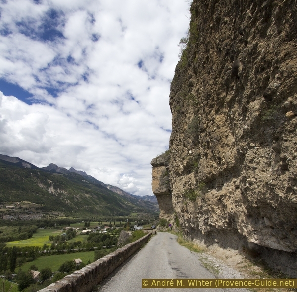
Route St. Guillaume in the southern cliff
When the rock face turns right and the road makes a left turn, we're heading straight downhill. At the next crossroads, straight ahead and under the trees to the Milaure car park.
No reproduction is permitted without the written consent of the author. (id3586)
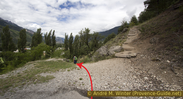
Way down to the car park
On the right, a path at the foot of the wall leads up to the north portal.
Section 5: Parking de Milaure - Gare d'Eygliers
➙ 0,6 km ... 10 min ➚ 0 m ➘ 0 m ↝ easy
50% hard-surfaced quiet side streets, without marks
50% hard-surfaced country road, without marks
The clues
- Milaure car park, 889 m
- company Dekra
- Mont Dauphin train station in Eygliers, 888 m
Those who have to return to the train station only need to follow the same path as when coming here: right past the car park, then left, across the main road and then right again to the station.
Sources and additional information
It is better to use a good topographic hiking map: This tour is on the IGN map "Guillestre, Vars, Risoul, Parc du Queyras", scale 1:25000, 3537ET.
If you don't want to bother with a paper map, you can also use mapping apps on your cell phone. On the one hand, it is the Cartes IGN app from the official map service. However, it requires access to the data network and this is sometimes difficult in canyons or remote locations.
Alternatively, you can use apps that store data directly on the device. They're generally not free, but they don't cost much. We mainly use OSMAnd, here it is possible to add contour lines, relief shading, markings and others. To store this data on your phone you need a lot of space.
Of course, one needs access to satellites for the GPS signal with any app. In some canyons this is not the case. Therefore, do not rely on the position shown, but read the map on your phone as you would read it on paper. Most apps are available for Android and iPhone. The applications usually allow us to record the route travelled and also view the GPS files offered for each of our hikes.
This page has been seen 2342 times since 20 March 2024.
No reproduction is permitted without the written consent of the author. (id3583)
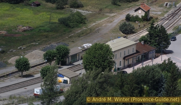
Mont Dauphin Gare train station
View from the fortress wall.