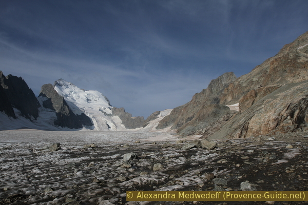
Full view of Glacier Blanc and Barre des Écrins
Classic ascent to the first hut, but also a bit further
hike
difficult
8 h 30 min
yes
no
yes
mountain
Introduction
Usually, we only present hikes that describe a circular tour and tend to avoid the crowds. Here, in the heart of the Écrins National Park, that's unfortunately not possible. Transitions would be far too exposed and the Glacier Blanc is far too well known. You can, however, go further than most excursion tourists, to a point where you can see the entire Barre des Écrins and where the glacier lies at your feet as if you were on the terrace of Refuge des Écrins.
First you have to take the path of the average Joe to the Refuge du Glacier Blanc. Of course, these people are also there because of the stunning beauty of the mountain landscape. But we continue at a sign that warns of the "high mountain area". The first part of this further path is easy, the second part is more difficult on rock and on loose moraine material.
We get to the point where the normal route to the Refuge des Écrins finally leads over the glacier. So you don't reach a summit or any other point worth mentioning, but you will have the magnificent view. Possibilities to continue from here are given in the appendices, however these suggestions all lead either over the glacier or are pathless in the rock area and thus require the appropriate material and the necessary experience.
The facts
13,9 km total distance
8 h 30 min walk time
1290 m total elevation
orientation easy in the first part, high mointain area for the second part
mark 75% of the total distance
70% easy trails
25% moderate trails
5% cross country
<5% via ferrata
dangers erosion and steep scree slopes
children long and interesting is only at the very end
useful picnic stuff, binoculars
required hiking boots, warm clothing and hiking equipment
GPS coordinates (WGS84) of start and end point 44.917555,6.416065
downloads ![]()
![]()
No reproduction is permitted without the written consent of the author. (id3571)
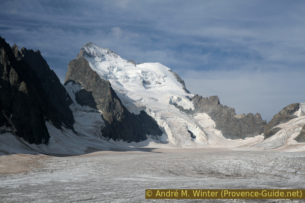
Barre des Ecrins, 4102 metres
Morning view in summer from the Refuge des Écrins.
Public transport
First to l'Argentière-la-Bessée: either by train TER PACA (only french) on the line between Gap and Briançon, about 10 connections per day, or by bus Zou! (only french) on line 69. With the minibus (Navette) we continue to Pelvoux. You can only get to the Pré de Madame Carle twice a day and only in summer. The road is open much longer of the year and hitchhiking is common here.
Access by car
Coming from the north and Briançon, turn off onto the D4 road at Saint-Martin-de-Queyrières to get to Vallouise via les Vignaux. From the south or Guillestre, turn left at l'Argentière-la-Bessée towards Vallouise. From there it goes to the end of the Pré de Madame Carle valley via a narrow and steep road. In winter, the road is closed depending on snow conditions.
Between l'Argentière-la-Bessée and the Pré de Madame are more than 20 km and it takes about 30 minutes by car.
Useful parking spaces
At the bottom of the valley of the Pré de Madame Carle there is a huge paid car park (EUR 2.00/day). Don't stop before the car park and proceed until the hut! On weekends when the weather is nice, it can also be full at midday. Beware, there are rodents who like to target cables and rubber hoses in the engine compartment.
Hints
Even if carefree tourists in sandals stumble to the Refuge du Glacier Blanc, the path from the parking lot remains a tour in the high mountains where good hiking boots are mandatory and weather changes have to be taken into account. You can avoid the crowds by doing this first part of the trail before 10am or after 5pm. If you do the tour in one day, you will almost certainly be sufficiently early and late in the lower part, as is if you are staying at the Refuge du Glacier Blanc.
The second part of the tour presented here is a continuation of the first two-thirds of the ice-free path to the Refuge des Écrins. This path is hardly marked and changes again and again as gravel masses slide down or side moraines open ravines. The guided groups on this route mostly go down on the glacier before. This means that this path is not often rehabilitated. You will have to check on site whether you can continue here, especially if there are still old snow fields at the beginning of summer or if there is already fresh snow in autumn.
Due to a lack of useful clues, some location information on this tour is given in the form of an altitude only. These are elevations collected on site and corrected using information from the IGN map. It therefore makes sense to carry a well-adjusted altimeter with you. Reference points are, for example: Pré de Madame Carle at the top of the car park 1874 m, Refuge du Glacier Blanc 2542 m. The altimeters on GPS devices and portable phones are far too inaccurate!
The sections
- From the Pré de Madame Carle car park to the former Refuge Tuckett
- From Refuge Tuckett to Refuge du Glacier Blanc
- From the Refuge du Glacier Blanc to approx. 2855 m on the easy side moraine
- From the side moraine over rocks and scree slopes up to 3000 m
- Back from the north side of the glacier to the former Refuge Tuckett
- From Refuge Tuckett down to Pré de Madame Carle
Section 1: Pré de Madame Carle - Refuge Tuckett
➙ 3,8 km ... 2 h ➚ 595 m ➘ 30 m ↝ easy
85% easy trails, with marks
15% moderate trails, with marks
The clues
- Pré de Madame Carle car park, 1874 m
- Torrent du Glacier Noir footbridge, 1907 m
- Torrent du Glacier Blanc footbridge, 2267 m
- Lakes at the former Refuge Tuckett, 2435 m
It makes sense to divide the steep ascent into stages. The lakes at the former Refuge Tuckett provide an ideal setting for a break.
If you arrive by public transport, the exit point is also the beginning of the trail at the National Park House. You will have to drive by here before looking for a parking space. One should ignore the time given to the Refuge du Glacier Blanc on the signpost here, it is a gross understatement.
"Pré de Madame Carle" means "Pasture of Mrs. Carle". The name goes back to a legend or at least a half-true story from the 16th century: Madame Carle's husband, Geoffroy Carle, took revenge on his wife here, whom he claims to have caught cheating. He led her mule into the torrent, where she drowned. In the middle of the 19th century, the glacier tongues of Glacier Noir and Glacier Blanc met here.
About 100 meters after the parking lot is a fountain with drinking water on the left in the forest.
No reproduction is permitted without the written consent of the author. (id3540)
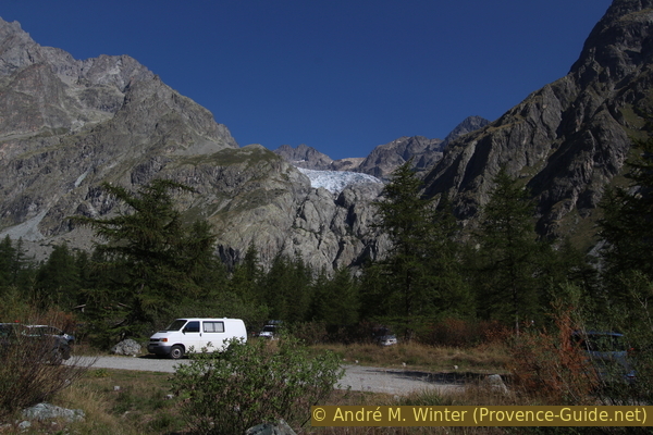
Parking at Pré de Madame Carle
Above Glacier Blanc.
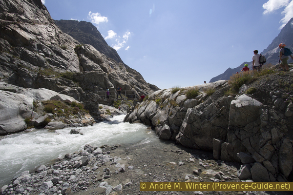
At the beginning you go on a straight gravel road in the forest and then over the alluvial fans of the Torrent du Glacier Noir torrent. Only the Glacier Noir brings the gravel and rock masses because its tongue is completely covered with moraine debris in the lower area. This contrast gave the two glaciers their names Black Glacier and White Glacier. The latter is exactly the opposite of the other because it carries particularly little debris on its surface.
No reproduction is permitted without the written consent of the author. (id3542)
Paved path after the Torrent du Glacier Noir
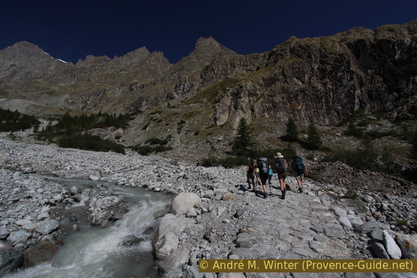
The lower part of the trail is designed for the large number of hikers who pass here.
After crossing the first water course, the actual ascent begins. The trees are quickly dwindling and so is the shade. The path is very wide and you don't get in each other's way even with a lot of "traffic".
No reproduction is permitted without the written consent of the author. (id3543)
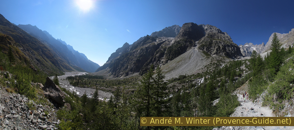
Pré de Madame Carle and the base of Mont Pelvoux
One will see Mont Pelvoux much better from higher above.
At the beginning, the ascent is merciless: steep, exposed to the south, without any special view or variety. If you go up here at 10am, you will regret not setting your alarm earlier.
No reproduction is permitted without the written consent of the author. (id3541)
Hairpin bends to the Refuge du Glacier Blanc
View from the Pré de Madame Carle..
The long hairpin bends end at around 2200 m above sea level and you cross a rocky shoulder to change from the Glacier Noir valley to that of the Glacier Blanc. However, this does not mean that the path climbs less steeply.
No reproduction is permitted without the written consent of the author. (id3545)
The path changes into the valley of the Glacier Blanc
At the end of the long hairpin bends.
chemin = path
vallon comblé = heaped valley
After the rock shoulder, the path becomes more varied and leads over glacier-polished rocks. The glacier retreated here at the end of the 19th century.
Now a valley is filled with a dry stone footbridge where iron ladders have been for many years. It is then possible to go right over the glacial polish and take a first break there. This makes sense because you have already covered more than 300 meters in altitude, but also because most of the other hikers will settle down shortly afterwards at the bridge at the Torrent du Glacier Blanc.
About 30 m after the filled valley, climb up to the right of the path or continue on the normal path.
No reproduction is permitted without the written consent of the author. (id3546)
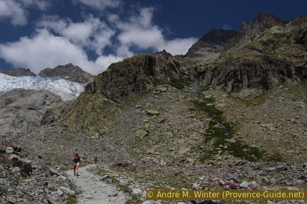
Easy way, from here you can see the Glacier Blanc again
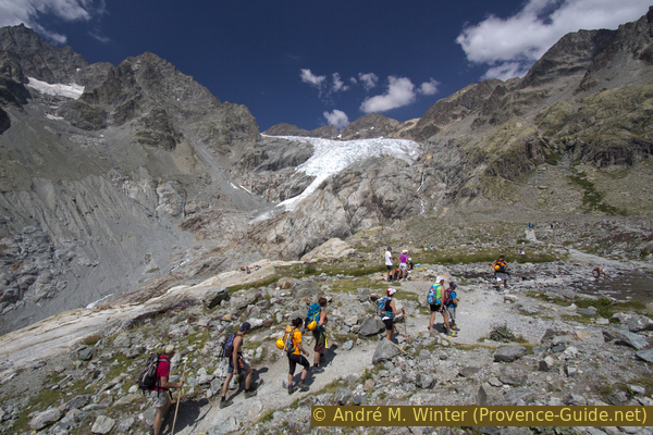
The path to the Refuge du Glacier Blanc is well prepared and many difficult sections have been made easier in recent years.
Another reason to stop here is the view: for the first time you can see back to the glacier on the summit plateau of Mont Pelvoux. The rock face goes up 1000 m from the Pré de Madame Carle! You can now see the glacier lobe of Glacier Blanc well ahead. Here it is on a steep step, in a curve and it is also in the process of dissolving and therefore appears very jagged.
No reproduction is permitted without the written consent of the author. (id3547)
Séracs on the glacier lobe of Glacier Blanc
Pic de Neige Cordier mountain in the background.
A bridge takes you definitely north of the creek and later stays on the north side of Glacier Blanc.
No reproduction is permitted without the written consent of the author. (id3548)
Bridge at Torrent du Glacier Blanc between glacier cuts
Although it is very hot, not much meltwater is flowing at midday this day.
After the Torrent du Glacier Blanc, the path leads over a rock ramp that is neither particularly steep nor slippery. However, the cable is helpful when the spot is icy.
No reproduction is permitted without the written consent of the author. (id3549)
Path to Refuge du Glacier Blanc after the bridge
The path climbs on a natural ramp under the dark rock wall.
Above the dark rock wall, the path turns right and continues to climb in crevasses between the glacial cuts.
No reproduction is permitted without the written consent of the author. (id3550)
Steps carved into the rock
Mont Pelvoux in the background.
Further up is another passage in glacial polish. The rock looks smoother here, and there is hardly any scree. But the surface is rough and has a good grip.
No reproduction is permitted without the written consent of the author. (id3551)
Second section in glacial polish
lac périodique = periodic lake
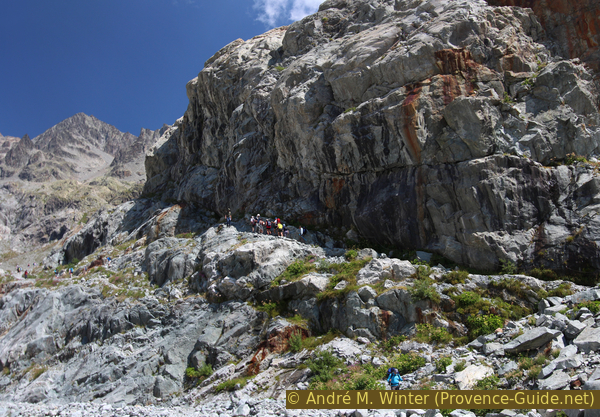
About 50 meters after the last hairpin bend and after the rocks you can turn right to the former shelter. Boards explain the history of the hut as part of the first ascents of the mountains around Glacier Blanc.
The Refuge Tuckett was built in 1886 to replace the simple shelter under a rock. It was only replaced further up by the Refuge du Glacier Blanc in 1948. Today, it has been renovated and left as it was in 1920. It is the showpiece of a whole epoch of mountaineering.
Then proceed parallel to the path to the small lakes or get there via the normal path.
No reproduction is permitted without the written consent of the author. (id3552)
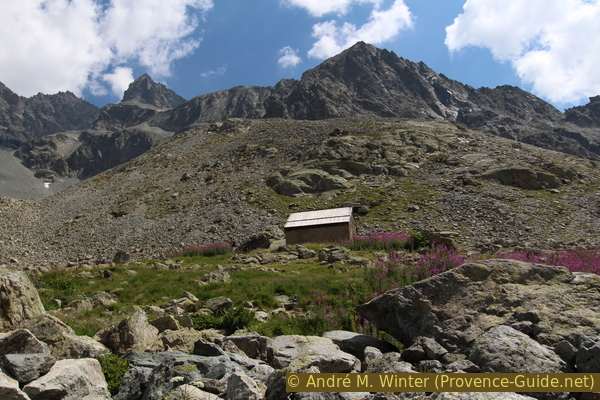
Former Refuge Tuckett
After the ascent, the water surfaces have a calming effect. Behind us, Mont Pelvoux is more and more imposing. Looking ahead you can already see the Refuge du Glacier Blanc. However, it is not easy to spot because the walls were built with the surrounding dark stones.
No reproduction is permitted without the written consent of the author. (id3575)
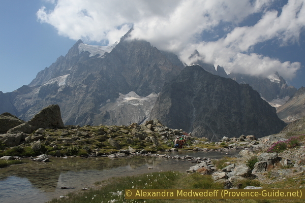
Lake at the former Refuge Tuckett
Mont Pelvoux and Ailefroide mountains in the background.
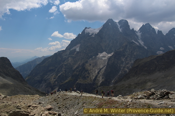
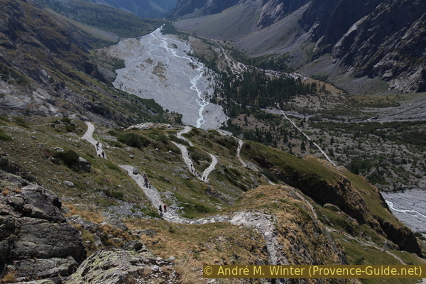
Sunday hikers, mountain runners, groups of guided tours (the ones with the orange helmets in the picture, for example) and a few mountaineers follow the same path to the Refuge du Glacier Blanc.
Glacier Blanc can be seen just as well from the lakes at Refuge Tuckett as from Refuge du Glacier Blanc. The Refuge Tuckett is therefore a good turning point for those who have already sweated enough here.
No reproduction is permitted without the written consent of the author. (id3553)
Hikers and mountaineers on the same path
Section 2: Refuge Tuckett - Refuge du Glacier Blanc
➙ 0,8 km ... 30 min ➚ 110 m ➘ 10 m ↝ easy
90% easy trails, with marks
10% moderate trails, with marks
The clues
- Lakes at the former Refuge Tuckett, 2435 m
- Refuge du Glacier Blanc, 2542 m
This section to the hut is quite short.
After the lakes, the path initially remains quite flat and then climbs in hairpin bends under the rock with the hut. The rock is bypassed on the left. In the photo, the hut is in the center above the dark rocky outcrop.
No reproduction is permitted without the written consent of the author. (id3554)
Path under the Refuge du Glacier Blanc
Here you can also see another path that makes good use of the natural conditions. Via this ramp, the rock step on the left is passed by ascending.
No reproduction is permitted without the written consent of the author. (id3556)
On the rock ramp below the Refuge du Glacier Blanc
moraine facile = easy moraine
After the left turn, the path continues to climb on loose material. You can see a person on the right edge of the picture, the path to the Refuge du Glacier Blanc pulls up there. If you don't want to stop there, you can continue climbing straight ahead to join the path to the Refuge des Écrins higher up at about 2565 m.
The tour describes the route via the hut.
No reproduction is permitted without the written consent of the author. (id3557)
Way past the Refuge du Glacier Blanc
Directly below the Refuge du Glacier Blanc, the path leads through the rock and over steps that have been roughly hewn into the rock.
No reproduction is permitted without the written consent of the author. (id3558)
Steps carved into the rock under the Refuge du Glacier Blanc
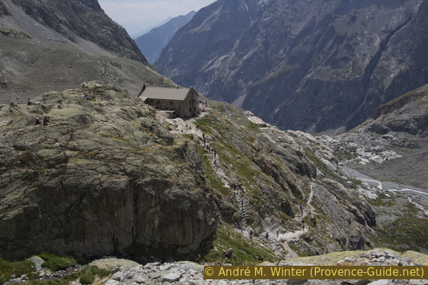
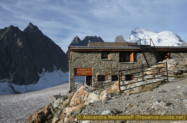
The Refuge du Glacier Blanc has a nice natural terrace. Coffee and cakes are also available here during the day. In the evening, however, the refuge becomes a classic spartan high mountain hut with the standard menu for everyone. Climbers all go to bed early in order to get up very early and to make extensive rock and glacier tours on the Montagne des Agneaux.
The hut is staffed from mid-April to mid-September. The photo shows the refuge in autumn when it has already closed. It is a view back from the path towards Refuge des Écrins.
No reproduction is permitted without the written consent of the author. (id3102)
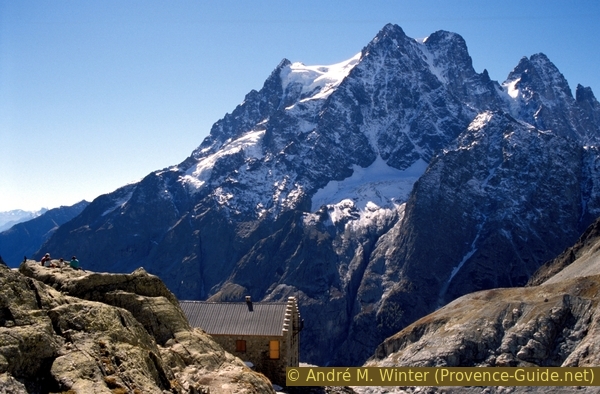
Refuge du Glacier Blanc and Mont Pelvoux in autumn 1996
Section 3: Refuge du Glacier Blanc - Moraine 2855 m
➙ 1,4 km ... 1 h 30 min ➚ 320 m ➘ 10 m ↝ average
70% easy trails, without marks
30% moderate trails, without marks
The clues
- Refuge du Glacier Blanc, 2542 m
- Ascent above the hut on the lateral moraine
- Proceed up to the easy moraine, 2855 m
From the Refuge du Glacier Blanc, you can continue towards the Refuge des Écrins. The normal route is divided into four clearly separated sub-sections: an easy ascent on the lateral moraine without markings, a more difficult path in rock and scree, a section on the glacier and a steep ascent from the glacier to the hut.
Important: this tour only describes the first two sub-sections, because all other further options lead over the glacier or via climbing sections and therefore require specific equipment and appropriate material.
The section, unlike the previous one, is completely unmarked, but the trail is clearly on the lateral moraine or to the right of it. The end of the section can be recognized by the fact that it goes slightly downhill at the back of the lateral moraine. From there at about 2855 m you have a better view of the glacier and you can already see the main summit, the Barre des Écrins.
No reproduction is permitted without the written consent of the author. (id3560)
Path to the Refuge des Écrins on the lateral moraine
The impressive Mont Pelvoux, the Pic Sans Nom and the Ailefroide in the background.
moraine latérale = side moraine
fin de la moraine = end of moraine
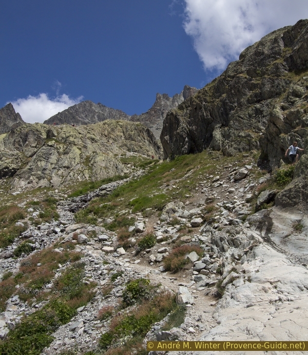
There are no more markings, and prominent points are also missing. You first climb a glacial cut interspersed with moraine material, only to walk on the lateral moraine at the end. So you can easily climb up to about 2855 m. There the path branches: to the left a path leads down to the glacier and another leads straight ahead supposedly to the rocks in the photo. The course of the paths is not always clearly recognizable in the terrain here, the larger one on the left leads down to the glacier because most of the guided and fully equipped tour groups already change to the ice here.
No reproduction is permitted without the written consent of the author. (id3561)
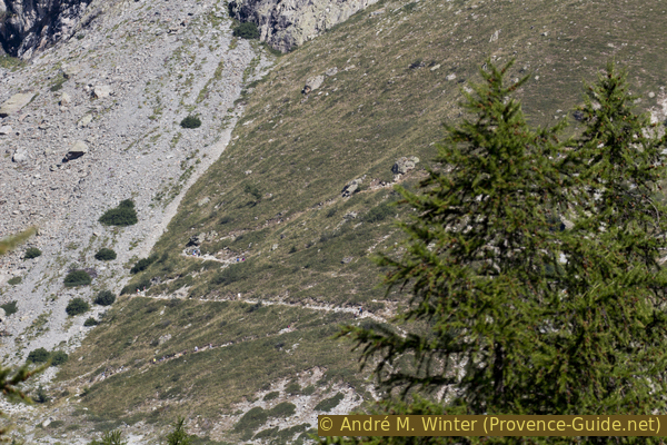
End of the easy moraine at 2855 metres
View of the trail at the end of the easy section.
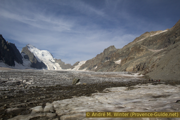
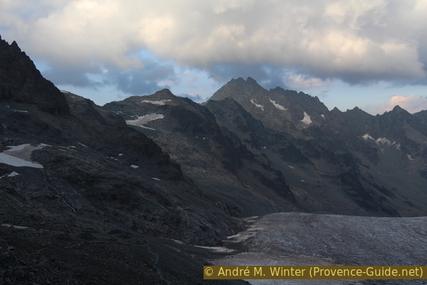
In this picture you can see half of the Barre des Écrins in front. In order to see this imposing glaciated mountain in its entirety, you have to walk the tour described here to the end.
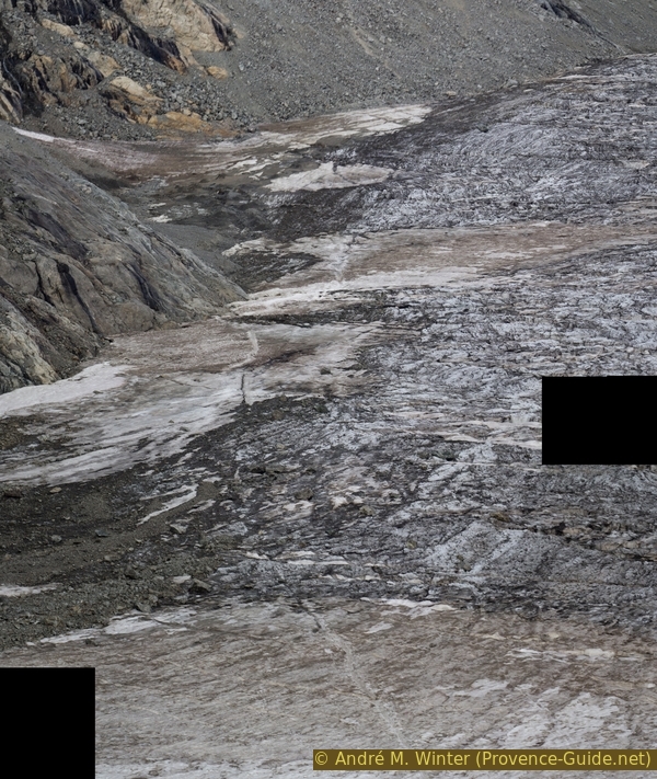
Below us is the glacier and the area where the groups with rope, crampons and ice ax enter the glacier to the Refuge des Écrins, because you can progress faster on it than on the rock. However, the thickness of the ice has decreased significantly here and large crevasses lead to the lateral moraine or the rock. There is also a ridge here and the glacier becomes more and more dangerous further up. It is absolutely unthinkable to climb here without the appropriate glacier equipment and experience.
When there is no snow, however, it is possible to descend to the ice here. This works best in August, when the transition is clearly visible and the bare ice is easy to grip.
This point is the turning point for all those who don't feel safe enough for the further rock and gravel section. The further advance does not lead to a special point or a summit, it is only about seeing the Barre des Écrins in full width. The path is not difficult, but it is poorly marked and often changes course in loose material after snow-melt, during thunderstorms and due to climate change in general.
No reproduction is permitted without the written consent of the author. (id2899)
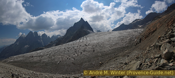
Panorama over the Glacier Blanc
Section 4: Moraine 2855 m - Glacier Blanc 3000 m
➙ 1 km ... 45 min ➚ 185 m ➘ 40 m ↝ difficult
65% moderate trails, faulty marks
25% cross country
10% via ferrata, faulty marks
The clues
- End of the easy moraine, 2855 m
- Rocks and scree
- Moraine and rocks
- Moraine at 3000 m
A high mountain section.
petite moraine latérale
= small side moraine
ravin érodé = open ravine
fin de la moraine = end of moraine
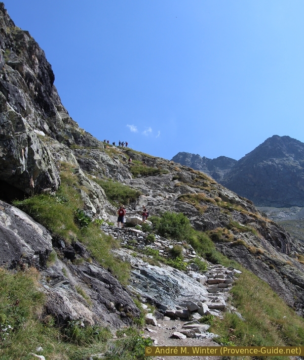
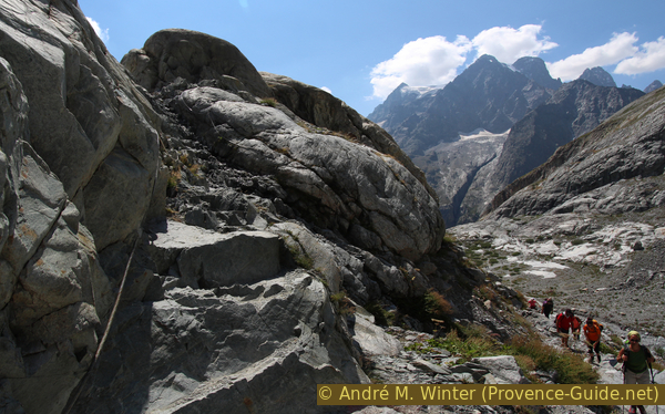
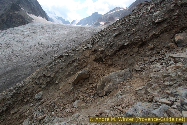
At the end of the simple moraine, you reach a steeper stone field. The path climbs here to the rocks, crosses and immediately follows a torn scree slope.
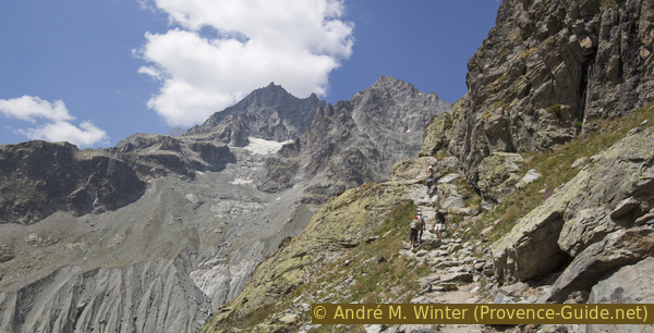
The picture shows the transition on the rock. You can also see a white-coloured and round point. These markings point the way in places. You don't see them very well and they are more found in the solid rock. You usually have to find your way around on the scree fields and in the moraines. This case occurs right after this first rock passage.
No reproduction is permitted without the written consent of the author. (id3563)
First rock passage after the simple moraine
There are isolated white markings.
In 2015, immediately after the rocks, you encountered this steep gully. You had to climb very high to find a reasonably suitable place to cross. Attention: this situation can change here and in the further course of the year from year to year. It doesn't look too bad in the picture, but the gully gets much steeper at the bottom and there are hardly any solid boulders in it. The main problem in 2015 was that the channel pointed to the exact spot where the guided groups put on or removed crampons and ropes on the glacier. It is essential to avoid letting stones roll off here!
After the ravine, you have to descend to the same level you were before, even if paths continue upwards. The reason is very simple: more rock passages follow and the marked path naturally crosses them at the most ideal places. If you stay too high, you will find it difficult to find your way again later. See also the small map above.
The path continues at about 2900 m above sea level on an eroded side moraine, in places, you climb over rocks. You don't gain much altitude here.
No reproduction is permitted without the written consent of the author. (id3564)
Dangerous scree ravine in summer of 2015
The situation on site can often change!
When the lateral moraine begins to dissolve, you come back to solid rock. This transition is not always very pleasant.
One should try to follow the white markings and in any case not descend to the left.
No reproduction is permitted without the written consent of the author. (id3574)
Glacial material on bedrock
fin sentier hors glace
= train end without ice
petite moraine latérale
= small side moraine
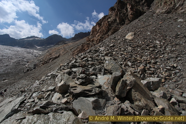
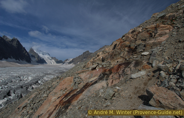
At the cairn in the middle of the picture, go up to the right. Definitely do not descend straight into the eroded moraine, although there are faded orange markers here.
The path leads upwards in the rock and thus gains a significant amount of height.
No reproduction is permitted without the written consent of the author. (id3573)
Cairn with right arrow
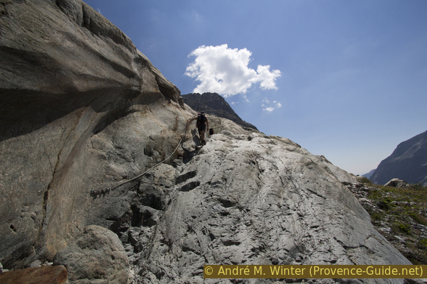
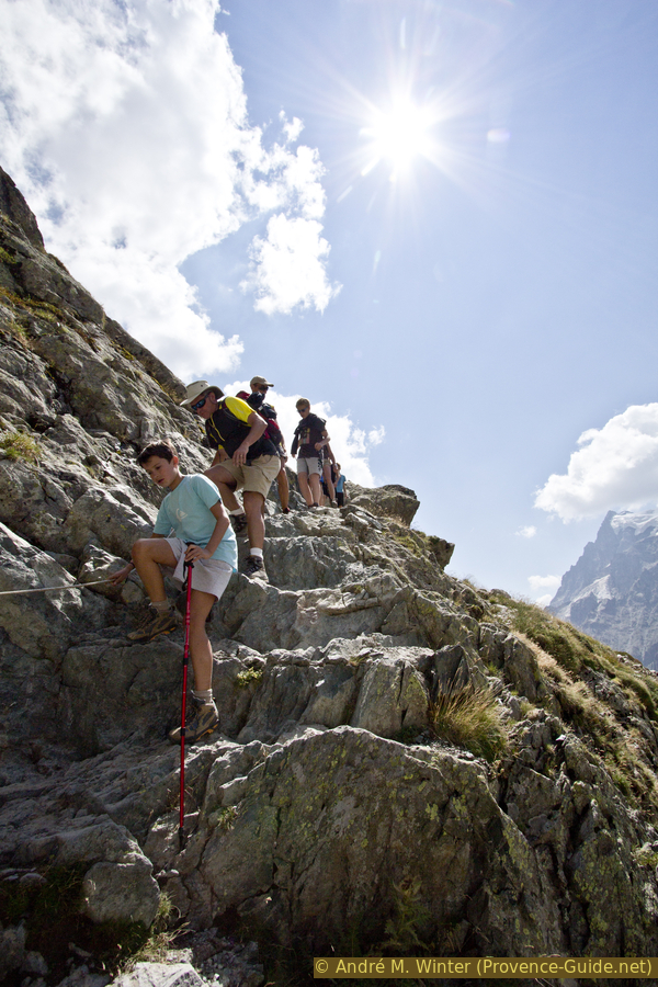
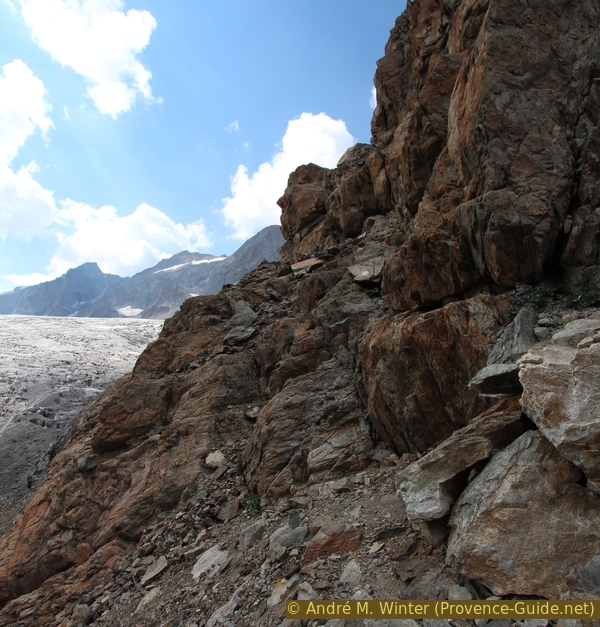
In the rocks there is a single short but good secured rock passage.
When the markings in the upper area of the rocks point to the lateral moraine again, you are already just under the 3000 m mark. Now the goal of the hike has actually been reached, because you can see the Barre des Écrins with its 4102 meters and the Dôme de Neige in their entirety.
No reproduction is permitted without the written consent of the author. (id3572)
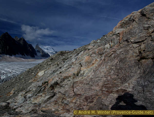
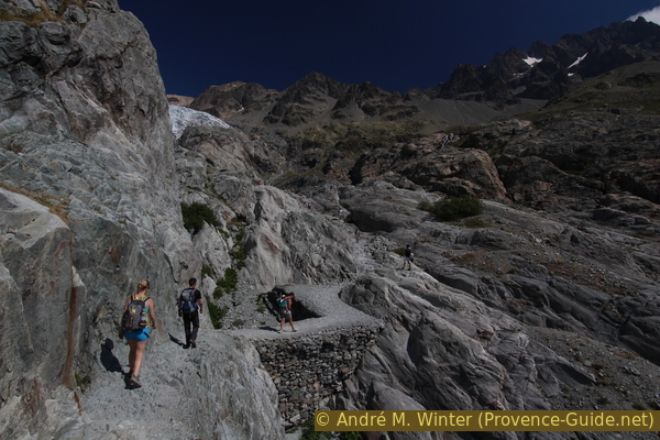
Iron clamps under the Pic du Glacier d'Arsine
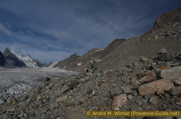
It pays to walk another 300 meters to the west on the lateral moraine, which is firmer here. Here you hardly climb and at the end you can descend to the glacier. At this point the marked and ice-free path definitely ends.
The glacier appears flat here (but it isn't) and you can see the entire Barre des Écrins. If visibility is good, the Refuge des Écrins can also be seen. Like the previous hut, this one was also built with the surrounding dark stones and is therefore well camouflaged. In the photo, the hut is on the rocks to the right of the snow field, to the right of the center of the image.
In the appendices are suggestions on how to proceed here. However, these routes run over the glacier or in the rock away from marked paths and can no longer be described as hikes. Those interested can contact the Guides in Vallouise.
The tour described, as noted in the KML and GPX data and on the maps, ends here and the way back is therefore recommended.
No reproduction is permitted without the written consent of the author. (id3570)
View from Glacier Blanc to Barre des Écrins and Refuge des Écrins
Section 5: Glacier Blanc 3000 m - Refuge Tuckett
➙ 3,2 km ... 2 h 15 min ➚ 50 m ➘ 610 m ↝ average
20% moderate trails, faulty marks
10% cross country
5% via ferrata, faulty marks
30% easy trails, without marks
10% moderate trails, without marks
25% easy trails, with marks
<5% moderate trails, with marks
The clues
- Moraine at 3000 m
- Rocks
- Easy moraine
- Refuge du Glacier Blanc, 2542 m
- Under Refuge Tuckett, 2426 m
Back on the path of ascent. All possible circular tours lead here via climbing and ice passages.
moraine facile = easy moraine
The way back follows the ascent route. This section summarizes the previous three sections in reverse order. There are no significant alternatives to this descent other than bypassing the rock at Refuge du Glacier Blanc (to the right).
No reproduction is permitted without the written consent of the author. (id3559)
Refuge du Glacier Blanc seen from above
Below the Refuge du Glacier Blanc, we go again over the gravel surface with the lakes.
No reproduction is permitted without the written consent of the author. (id3555)
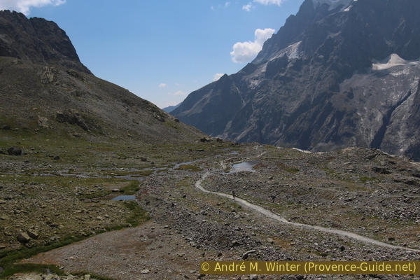
Lakes at Refuge Tuckett
Section 6: Refuge Tuckett - Pré de Madame Carle
➙ 3,8 km ... 1 h 30 min ➚ 30 m ➘ 590 m ↝ easy
85% easy trails, with marks
15% moderate trails, with marks
The clues
- Under Refuge Tuckett, 2426 m
- Pré de Madame Carle, 1874 m
Further down we come back to the hairpin bends from the beginning of the tour.
If you complete the whole hike in one day, you already have many meters of altitude in your legs. Even if the path is now easy, you should continue to concentrate on the descent and not risk injuries!
No reproduction is permitted without the written consent of the author. (id3544)
Way down to the Pré de Madame Carle
Appendix: Glacier Blanc 3000 m - Refuge des Écrins
➙ 1,3 km ... 45 min ➚ 190 m ➘ 0 m ↝ challenging
75% on glacier
25% difficult, few marks
The parameters above only apply to the way up.
The clues
- Moraine at 3000 m
- Glacier Blanc
- Ascent to the hut
- Refuge des Écrins, 3294 m
Warning: The last part of the normal route to the Refuge des Écrins necessarily leads over the glacier. The right equipment and experience are required here, even if the section is described as "easy". In addition, the following points should also be considered:
- A relatively large number of people walk over the glacier here, so there are several well-trodden paths. However, these can be several days old and the crevasses may have changed significantly in the meantime. In the summer, this section of the glacier remains mostly snow-covered, making it difficult to find your way. Even if a path looks good, you should walk it with the same precautions as when opening a trail.
- In the summer of 2015, the cracks were rarely wider than 50 cm, but they were quite deep. The crevasses traverse the glacier from one edge to the other, so there is no point in looking for detours. Walking on the northern edge of the glacier is particularly to be avoided. The lateral moraine is in the process of dissolving because the glacier has sunk in recent years. The bergschrund is covered with loose material and everything is in motion. This situation is likely to worsen in the coming years.
- Do not walk across the glacier when visibility is poor (at night, weather changes) and also take this into account for the descent. The glacier here is flat, greyish, and there are no landmarks or marker poles to speak of.
- Don't walk the glacier alone.
The picture shows the point of transition from the end of the trail to the glacier. The surrounding rocks cannot be used as a guide for the way back because they change from year to year. Already on the ascent, you should look at the clues for the descent!
No reproduction is permitted without the written consent of the author. (id3569)
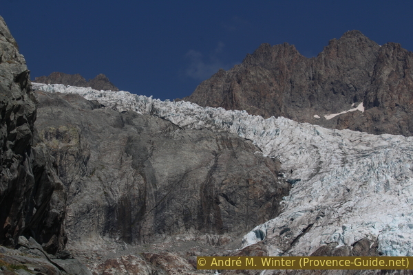
Glacier Blanc at about 3000 metres
View in the morning in summer. In the foreground are stones on the glacier, they come from the mountain ridges around the Pic du Glacier d'Arsine and are a result of global warming which thaws the permafrost in the ridges over the summer.
This photo shows in rertrospect most of the 800 meters to be covered on the glacier. In summer, you are in the transition between ice-free and permanently snow-covered glacier sections. It makes sense to memorize the course, because the exit is difficult to see on the way back.
No reproduction is permitted without the written consent of the author. (id3565)
Looking back from Refuge des Écrins on the path at Glacier Blanc
The pile of old snow in the picture marks the spot where you put on or take off your crampons and rope. A banner marks the exit point because you are so deep under the hut that you cannot see it from down there.
From the ice, you then climb steeply on a bad path in the lateral moraine. The way gets better at the top.
No reproduction is permitted without the written consent of the author. (id3566)
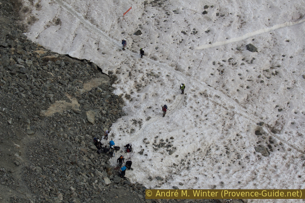
Hikers arrive at the glacier below the Refuge des Écrins
Situation in 2015
The Refuge des Écrin is managed from the end of March to the end of September. You have to reserve in advance, as the camp beds are often fully booked by guided tours. Reservations can only be made online, even at short notice, at Refuge des Écrins (only french).
For those unfamiliar with the customs of high mountain huts in France, they are far more spartan than in the rest of the Alps. In the evening is a standard menu (although there is also a vegetarian option), and you eat at a fixed time. The night is not necessarily restful, in the bedrooms for 32 people there will always be someone snoring. There are no single rooms. Mornings are just as strict as evenings, with breakfast at 3, 4 and 7 a.m.
There is no drinking water at the Refuge des Écrins. Icy and hardly mineralized meltwater flows in the wash-rooms. With effervescent tablets you can mineralize the water and make it reasonably drinkable. Otherwise you can also buy expensive bottled water.
All tours beyond the Refuge des Écrins are year-round ice and snow tours. There are also simple ones, but material and experience must be brought along. The maps and guides at the hut are poor. 95% of people come here on guided tours.
Back down into the valley, the ascent path takes you past the Refuge du Glacier Blanc.
No reproduction is permitted without the written consent of the author. (id3568)
Morning sun at the Refuge des Écrins, 3175 metres
Appendix: Glacier Blanc 3000 m - Pic du Glacier d'Arsine
➙ 1 km ... 1 h ➚ 380 m ➘ 10 m ↝ very challenging
80% cross country
20% Trails with scramble passages, without marks
The parameters above only apply to the way up.
The clues
- Moraine at 3000 m
- Col du Glacier Blanc saddle, 3275 m, or south-east below
- Pic du Glacier d'Arsine, 3364 m
The Glacier d'Arsine lays north of the summit.
Warning: This is a high mountain climb with no visble path that requires climbing skills and a good sense of direction. The ridge and the peak are exposed. The greatest difficulty is finding the way over and around the old snow fields, which are always in different positions. The picture shows a view from the Refuge des Écrins in mid-August 2015 with little snow.
The ascent begins at the end of the trail at the edge of the glacier at about 3000 m above sea level. You climb over an old medial moraine (obscured by the ridge in the picture) before turning right into the middle of the cirque (below the snow field in the picture). Then there are two options:
- Climb north into the Col du Glacier Blanc and turn right at or just below the ridge to the summit. Difficulty level 2. The most difficult areas are directly under the saddle.
- Climb further to the right in the area of the upper end of the snow field in the picture. You are there under a cliff edge and follow a dark ledge (photo) until under the main ridge. From there just to the summit. This variant is a bit easier if you can find the way through and it is snow-free. Difficulty level 2.
Descent via the same route.
Sources and additional information
A good topographic hiking map is a better guide: this tour is on the IGN "Meije, Pelvoux, Parc National des Écrins" map, scale 1:25000, 3436ET.
If you don't want to bother with a paper map, you can also use mapping apps on your cell phone. On the one hand, it is the Cartes IGN app from the official map service. However, it requires access to the data network and this is sometimes difficult in canyons or remote locations.
Alternatively, you can use apps that store data directly on the device. They're generally not free, but they don't cost much. We mainly use OSMAnd, here it is possible to add contour lines, relief shading, markings and others. To store this data on your phone you need a lot of space.
Of course, one needs access to satellites for the GPS signal with any app. In some canyons this is not the case. Therefore, do not rely on the position shown, but read the map on your phone as you would read it on paper. Most apps are available for Android and iPhone. The applications usually allow us to record the route travelled and also view the GPS files offered for each of our hikes.
This page has been seen 4053 times since 20 March 2024.
No reproduction is permitted without the written consent of the author. (id3567)
Normal approach to the Pic du Glacier d'Arsine
Evening view from the Refuge des Écrins.