Peirou pass-trough cave, ladders on Mont Gaussier and a rock with two holes
An almost alpine tour in the Alpilles massif south of St. Rémy
hike
average
3 h 15 min
near
yes
no
mountain
Introduction
The Alpilles are a small massif of limestone lying west of the Luberon forest. The mountains are not as high, but the terrain is much more rugged and gorges cut through the massif. We get an overview by climbing some of these rocky outcrops.
We are located south of the town of Saint-Rémy-de-Provence and the starting point is close to the Roman ruins of Glanum. The tour thus runs in a highly touristic area. But people from the area also like to walk in the Massif des Alpilles, so you will rarely be alone on the trails. That is why this tour is based on classic sections and partly on pathless connecting trails.
The facts
7,3 km total distance
3 h 15 min walk time
410 m total elevation
orientation average
mark 75% of the total distance
35% forest roads
30% easy trails
10% exposed trails
10% cross country
10% hard-surfaced city alleys
<5% difficult trails
<5% moderate trails
<5% via ferrata
dangers slippery sections
children from 10 years on
useful picnic stuff
required hiking boots, hiking equipment and water
GPS coordinates (WGS84) of start and end point 43.776634,4.833169
downloads ![]()
![]()
Public transport
There are around ten services a day between Avignon and St. Rémy on line 707 and a little less on the line 704 route between Arles, St. Rémy and Cavaillon. Information at Zou! (only french). The only stop in town is called République. From here you can reach the beginning of the tour in about 15 minutes. This ascent from the town centre is noted on the map, it is also to be found in the GPX file provided.
After leaving the bus stop, we follow the avenue around the town centre, a road sign here points to Cavaillon. We leave the street at the first opportunity to the right (direction Office de Tourisme). After a long wall, we turn left onto Avenue Pierre Barbier. We stay longer in this alley and cross the small Canal des Alpilles. At the next crossroads, we go straight ahead in alley Chemin Marie Gasquet (dead end sign). We continue in this direction, even when the alley becomes a path next to the wall of the monastery of St. Paul de Maussole. At the top, we come to a narrow street, here on the right to the south-west corner of the wall.
Access by car
St. Rémy-de-Provence is indicated from everywhere. From Cavaillon, Avignon or Arles, follow the indications for the centre and Glanum. However, before you get to the Roman excavations, turn left towards the clinic and the former monastery of St. Paul de Mausole. The starting point is at the south-west corner of the monastery area.
Useful parking spaces
A free car park is west of the Monastery of St. Paul de Mausole and a few other places can be found after the southern wall on the right. If you arrive before 9 a.m. you should still find free parking here because the monastery only opens after 9:30 a.m.
There is another car park opposite Glanum, but this is subject to a charge.
No reproduction is permitted without the written consent of the author. (id4744)
The holes in the Rocher des Deux Trous
Hints
This loop connects very well-known sections, but they are linked by little-used paths. A GPS device can be helpful, but reception is not particularly good in the deep gorges. Orientation is therefore difficult and the description here is all the more important.
There are two insured sections. However, these are not real via ferratas and no via ferrata sets can be used. These sections are still steep and exposed, and inexperienced hikers should be warned. There are no alternatives to the difficult passages!
We come to the small reservoir Lac de Peirou, which lies quite nicely between the rocky outcrops. Bathing is forbidden here, however, and fishermen are often here as well. We come here at the beginning, so you don't get into the embarrassment of wanting to cool off.
The whole region is a zone with a high risk of forest fires. In summer, but also in other seasons when it is very dry or by strong winds, access to the forest areas can be regulated. As a result, the roads may be closed to traffic and/or the trails prohibited to hikers. Current information: Map of access to forests and exposed areas in Bouches-du-Rhône (only french). The map shows the colours green, yellow, orange and red which correspond to levels of danger.
The sections
- Monastery of St. Paul de Maussole - Glanum - Peirou passage cave - Gaudre de Notre-Dame de Laval valley: climb to the lake and continue to the valley that conducts the D5 road
- Gaudre de Notre-Dame de Laval valley - Sentier des Échelles du Mont Gaussier Nord trail - Rocher des Deux Trous: via the highest points of the tour
- Rocher des Deux Trous - Gaudre de Valrugue valley - Chemin des Carrières: back on little-used paths and on the roman Via Domita
No reproduction is permitted without the written consent of the author. (id4710)
Path east of the monastery
This is where you come from if you are walking from the city center.
Section 1: Glanum - Peirou - Gaudre de ND de Laval
➙ 2,2 km ... 1 h ➚ 130 m ➘ 100 m ↝ difficult
10% easy trails, without marks
25% forest roads, without marks
15% cross country, without marks
5% moderate trails, with marks
5% via ferrata, with marks
5% difficult trails, with marks
10% easy trails, with marks
30% easy trails, faulty marks
The clues
- Monastery of St. Paul de Maussole, 105 m, starting point
- Les Antiques de Glanum, 110 m
- Ascent in the ridge east of Lake Peirou, 170 m
- Descent in the passage cave including a via ferrata
- Lac de Peirou reservoir, 125 m
- Over the saddle in the south-east of the lake, 180 m
- Gaudre de Notre-Dame de Laval valley with the D5 road between St. Rémy and Maussane, 130 m
Right at the beginning we take unmarked paths. The passage cave in the course of the section is a highlight of the tour.
cabestan = winch
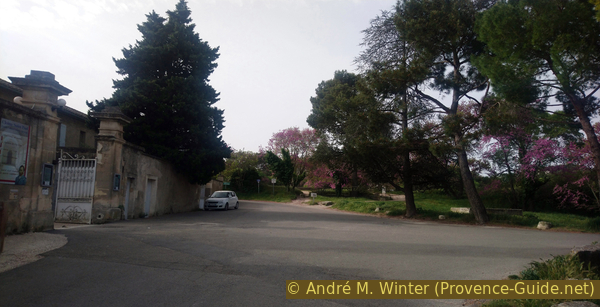
We skip the visit of the Monastère St.-Paul-de-Mausole. You can also visit a room where Van Gogh spent part of his life. A visit is worthwhile, you can schedule it after the tour or come by another day. Standing at the entrance, we turn south and climb into the somewhat overgrown park.
No reproduction is permitted without the written consent of the author. (id4711)
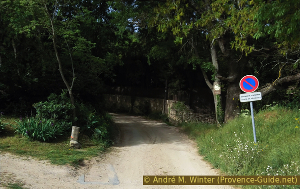
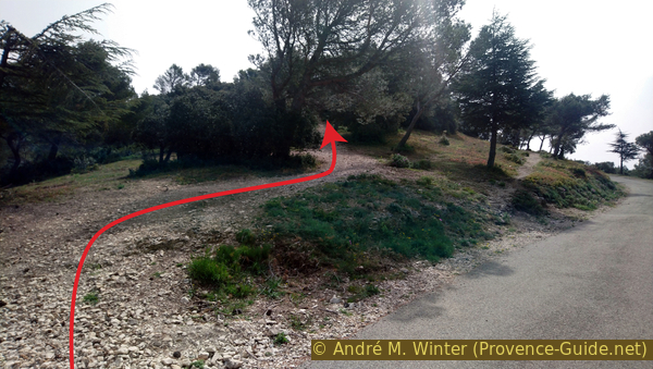
Access to St. Paul de Mausole monastery
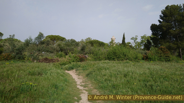
Behind the approach to the field to start the hike.
Quite quickly we are in front of a cable winch called Cabestan. This was used to pull stones from the nearby quarries. The Romans cut blocks for their city from the foothills of the Alpilles. The various small quarries were active until the 19th century.
No reproduction is permitted without the written consent of the author. (id4712)
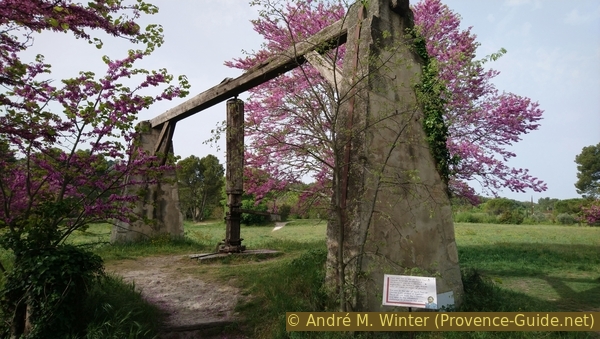
Saint Paul quarry winch
Now we go right past the winch and we keep right on the path across the field. Rocks can be seen above the trees and a tower to the right. This is the top of Glanum's mausoleum and we are targeting this structure. On the way there we first have to cross the busy road to Maussane at the zebra crossing.
No reproduction is permitted without the written consent of the author. (id4713)
In front the mausoleum of Glanum
The D5 road crosses the ancient city of Glanum. The triumphal arch and the mausoleum are thus cut off from the rest of the Roman city. This is a catastrophe for archaeology, but it gives us the pleasure of being able to visit these monuments freely and free of charge. They are called Les Antiques.
The town of Glanum itself is also worth a visit. The ruins are well preserved and the explanations on the plaques are very well done.
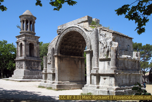
Les Antiques de Glanum
After Les Antiques we walk down the dusty road to the lower car park and then further into the forest. We turn left, we keep going in this direction and ignore all driveways on the right.
No reproduction is permitted without the written consent of the author. (id4715)
Chemin du Gaudre du Rougadou
After Les Antiques we walk down the dusty road to the lower car park and then further into the forest. It turns left, we keep going in this direction and ignore all driveways on the right.
No reproduction is permitted without the written consent of the author. (id4716)
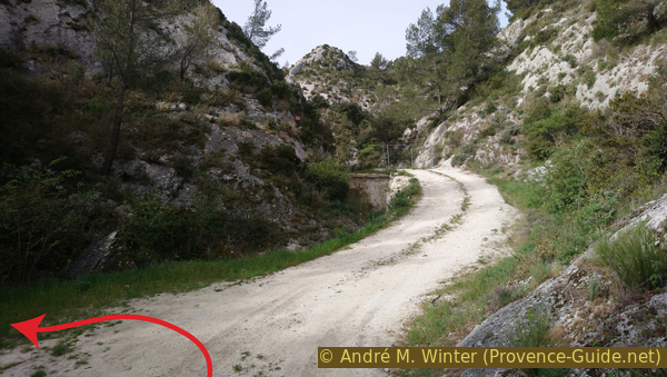
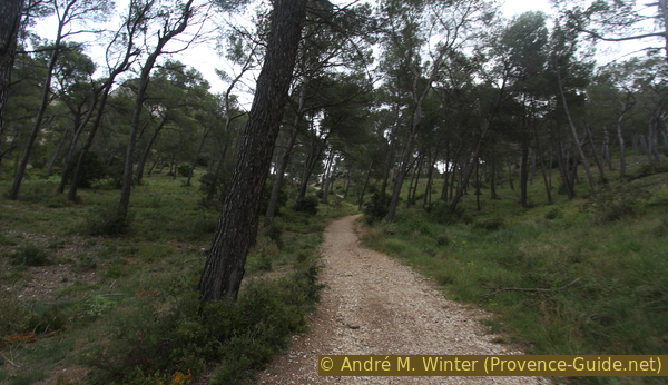
Chemin du Gaudre du Rougadou goes straight ahead
barrage = dam wall
grotte = cave
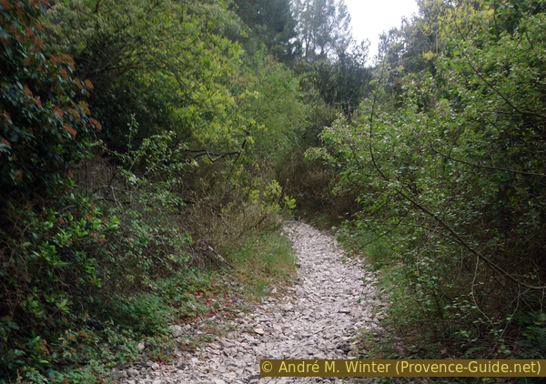
This dirt road climbs slightly and leads into a narrowing valley. We are at the lower access to the dam of Lac de Peirou. We look out for a concrete footbridge on the left without crossing it. Approximately 75 metres ahead there is a cairn on the left at the foot of a valley. Here we turn left.
If you go too far on the driveway, you will come to a fence that prevents access to the dam.
No reproduction is permitted without the written consent of the author. (id4717)
Turn off before the dam becomes visible
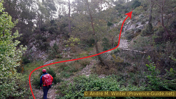
You first have to climb through the undergrowth and then steeply to the right. You walk on a gully filled with gravel. With every step you slide back a bit, so the ascent is quite tedious.
No reproduction is permitted without the written consent of the author. (id4718)
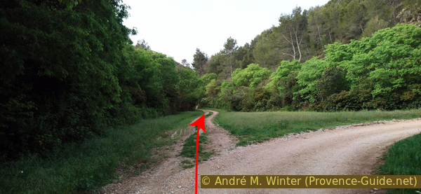
Connection to the GR6 marked trail
Further up, our path leads under cedars, which probably come here from the Luberon Massif.
No reproduction is permitted without the written consent of the author. (id4719)
Cedars along the way
We come to a saddle where we can proceed a bit on the ridge to the right.
No reproduction is permitted without the written consent of the author. (id4720)
Reservoir Peïrou and the ridge to the west
Here we have a good view of the reservoir, the ridges to the west, St. Rémy and also back to the starting point at St. Paul de Maussole.
No reproduction is permitted without the written consent of the author. (id4721)
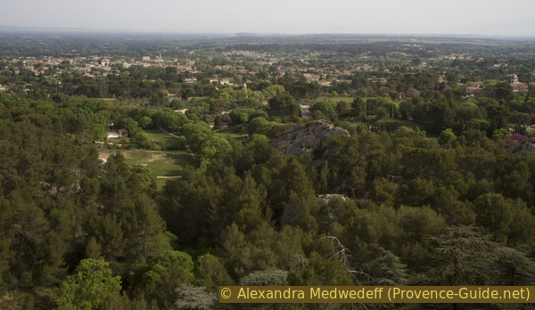
View to St. Rémy
We go back into the saddle and further into a grove behind the main ridge. Here we turn right and continue uphill. The path under the trees is clearly visible.
We come to a junction and here we reach the GR 6 long-distance hiking trail. We continue in the same direction, marked red and white.
No reproduction is permitted without the written consent of the author. (id4722)
Ridge east of the Peirou dam
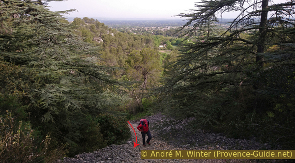
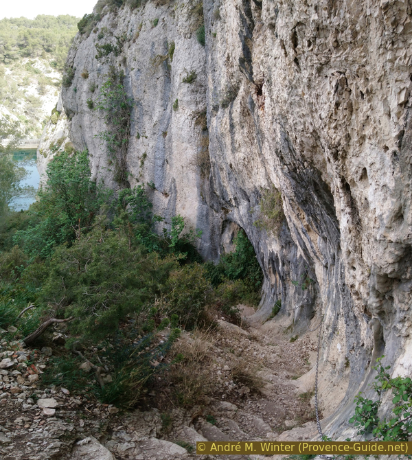
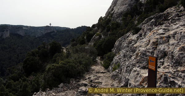
The path becomes flatter and we ignore climbs to the ridge on the right. Progressively it goes downhill into a dark hole. We are at the top entrance of Peirou Passage Cave!
No reproduction is permitted without the written consent of the author. (id4723)
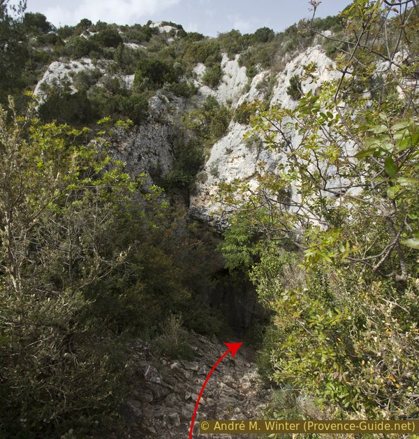
Upper entrance to the Peirou pass-through cave
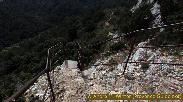
Further down you can already see the exit, the cave route is quite short. But it's a steep descent and the limestone is polished smooth. The section was well renovated in 2017, but you still have to concentrate on the descent.
There is a ladder at the top and bottom, in between it's less steep but no less uneven.
No reproduction is permitted without the written consent of the author. (id4724)
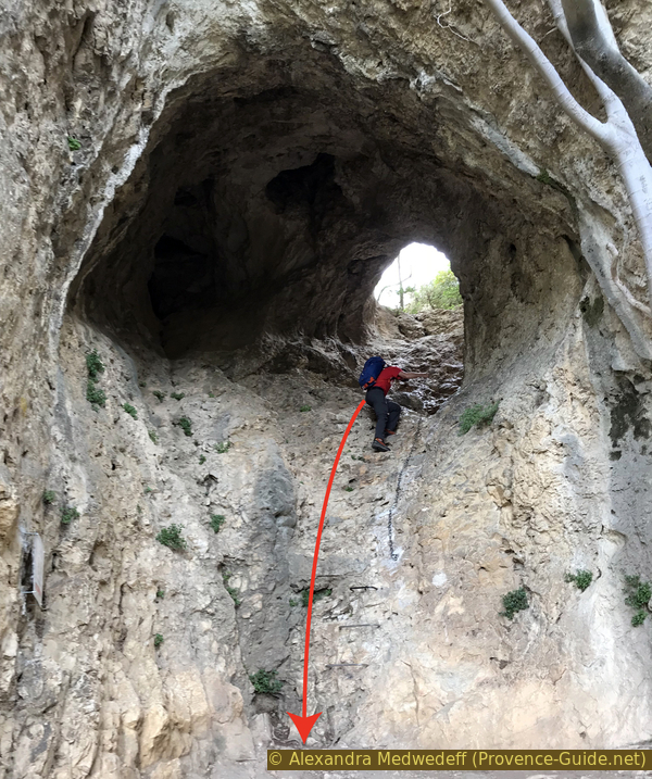
Lower ladder in Peirou Cave
After the cave, the path remains challenging. We first follow the foot of the rock wall down to the right.
No reproduction is permitted without the written consent of the author. (id4725)
Path under the Peïrou cave
When it gets too steep, the path turns left and crosses the slope, including the following notch (photo). The rocks are smooth here too, sometimes it is difficult to walk upright.
No reproduction is permitted without the written consent of the author. (id4726)
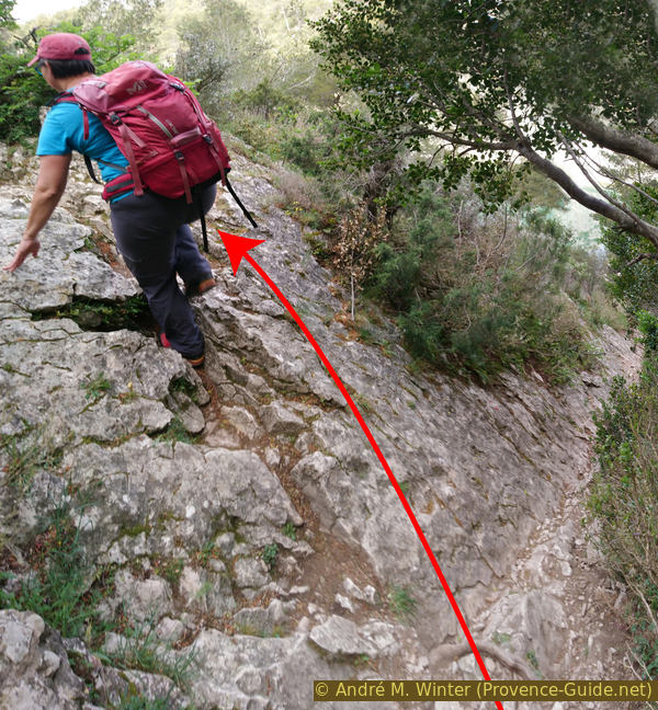
Cross here and do not descent
Only after the crossing we can descend through another incision (marked).
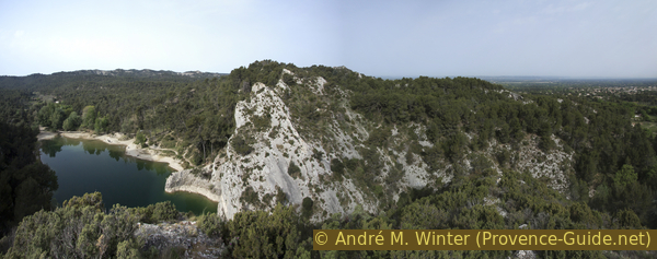
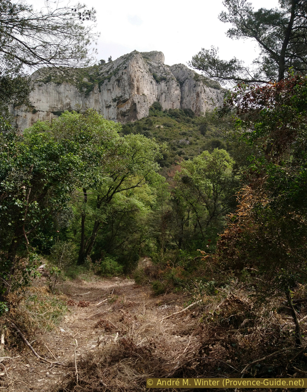
After a forest section, another rocky area follows. We can already see the lake below.
No reproduction is permitted without the written consent of the author. (id4727)
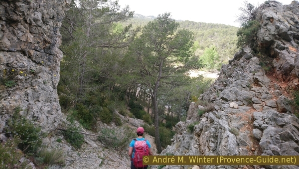
Last rock passage before the Lac de Peirou
You are not allowed to swim in this lake, we leave it to the left and to the south on a forest path.
No reproduction is permitted without the written consent of the author. (id4728)
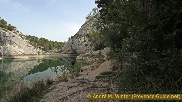
On the west bank of the Peirou reservoir, looking north
About 100 metres south of the lake, we turn left and go up into a wooded saddle. At the top we continue straight to the east, even if fallen trees can block the path here.
We cross here south of the ridge with the passage cave in the south. Further down the path widens again, turns left and passes under a water tank.
No reproduction is permitted without the written consent of the author. (id4729)
Way over the saddle to the D5 road
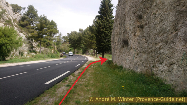
After a barrier we come to the D5 road between St. Rémy and Maussane. You should cross it as soon as possible, further ahead in the curve you can see even worse. Drivers do not expect hikers to cross here, you really have to be careful.
We walk north along the road a bit and come to a climbing car park. From here we will go up to Mont Gaussier.
No reproduction is permitted without the written consent of the author. (id4730)
On the D5 road
Section 2: Mont Gaussier - Rocher des Deux Trous
➙ 1,9 km ... 1 h ➚ 270 m ➘ 90 m ↝ easy
40% exposed trails, with marks
30% easy trails, few marks
30% easy trails, without marks
The clues
- Gaudre de Notre-Dame de Laval, the valley with the D5 road, 130 m
- Ascent in the west face of Mont Gaussier and onto a plateau north of the summit, 235 m
- Hill south of the Rocher des Deux Trous, 350 m
- Rocher des Deux Trous, 300 m
Mont Gaussier looks quite high, but it's not the highest point of the tour. Later one located on the nameless hill south of the Rocher des Deux Trous. We don't climb Mont Gaussier or the Rocher des Deux Trous, these rocky outcrops are reserved for climbers.
col = saddle
escalier = stairs
Some climbing parking lots have been set up along the road to Maussane. We are east of the D5 road at the Mont Gaussier #1 car park.
No reproduction is permitted without the written consent of the author. (id4731)
Approach to the west side of Mont Gaussier
An easy path leads up into a side valley. You walk on fine gravel.
No reproduction is permitted without the written consent of the author. (id4732)
Way up on gravel
Below a rock wall we come to a first fork in the path. In the photo taken from further ahead, this junction is in the middle. The first two arrows indicate the ascent to the first junction, the following ones the further course of the path.
On the left we could go through the rock gate Trou Souffleur and over the southern part of the Sentier des Échelles. Here you can get back faster to Glanum and the starting point.
On the right you walk the northern part of the Sentier des Échelles. This is how we get to the Rocher des Deux Trous and the route is clearer.
No reproduction is permitted without the written consent of the author. (id4733)
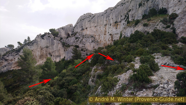
View of the path to Trou Souffleur
After a saddle that you hardly notice, the path becomes less steep. Follow a rocky edge to get to another junction. This time we go left and up in a rocky cauldron.
No reproduction is permitted without the written consent of the author. (id4734)
Looking back into the ascent cirque after the second junction
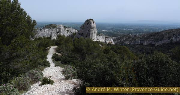
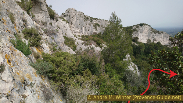
We thus climb under the main ridge of Mont Gaussier to a more open area north of the summit. From there we can see three parallel rock ridges. On the left the one with the Peirou passage cave, in the middle the north ridge of Mont Gaussier and on the right the somewhat more complicated ridge north of the Rocher des Deux Trous.
No reproduction is permitted without the written consent of the author. (id4735)
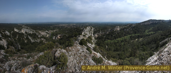
Three rock ridges touched on this hike
One sees between the first two ridges on Saint-Rémy-de-Provence.
You can plan a break here.
No reproduction is permitted without the written consent of the author. (id4736)
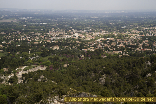
Saint Rémy seen from Mont Gaussier
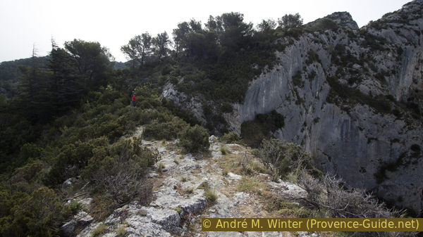
The rest of the way runs along the other side of the ridge. So we turn right and head south on a rock step that has been artificially widened. A handrail helps in the narrow places.
No reproduction is permitted without the written consent of the author. (id4737)
Sentier des Échelles to the south-east of Mont Gaussier
This is how we come to one of the ladders that gives its name to the Sentier des Échelles. However, this is rather a steep stair.
After that, the trail is much easier and stays on the flat ridge south of the summit of Mont Gaussier.
No reproduction is permitted without the written consent of the author. (id4738)
Stair to the south-east of Mont Gaussier
After leaving the cliff behind us, you can make a detour to the right onto the south-west face of Mont Gaussier. Here you can see into beautiful semi-caves (called Baume in Provence).
We come back to the main path and continue strictly south along the ridge. After a barely noticeable saddle, the path leads up again under pine trees. We come on a hight similar of the one of Mont Gaussier.
No reproduction is permitted without the written consent of the author. (id4739)
Looking back to Mont Gaussier
Lebanon cedars grow on the last peak of the ridge. In front below we see a narrow paved road. It leads to the antenna at the Plateau de la Caume. We go left here for a few meters.
No reproduction is permitted without the written consent of the author. (id4740)
On the road to the Plateau de la Caume
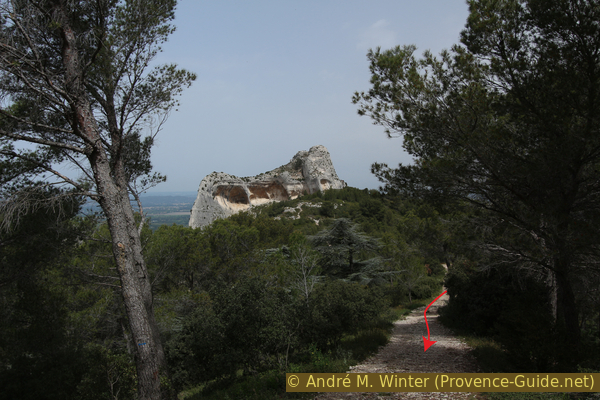
We ignore the signposts. After a few steps on the road we turn left again and take the medium and rocky uphill path. It is not marked.
No reproduction is permitted without the written consent of the author. (id4741)
In the middle the path to the Rocher des Deux Trous
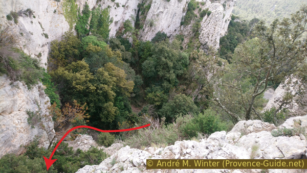
This path leads us in a large arc to a tree-free summit. It has no name, but there is a large cairn on top. It is also the highest point of our circuit, we overlook the various ridges and also see down to St. Rémy. If it's not windy, you can plan a break here with a panoramic view.
No reproduction is permitted without the written consent of the author. (id4742)
Path down to the Rocher des Deux Trous
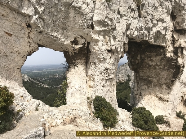
The closest rock to the north is the Rocher des Deux Trous, we can reach it in a few minutes. We pass it on the right to be able to look through the two holes, you can also see back to Mont Gaussier. In the following section we also descend into the valley via this side on the right.
No reproduction is permitted without the written consent of the author. (id4743)
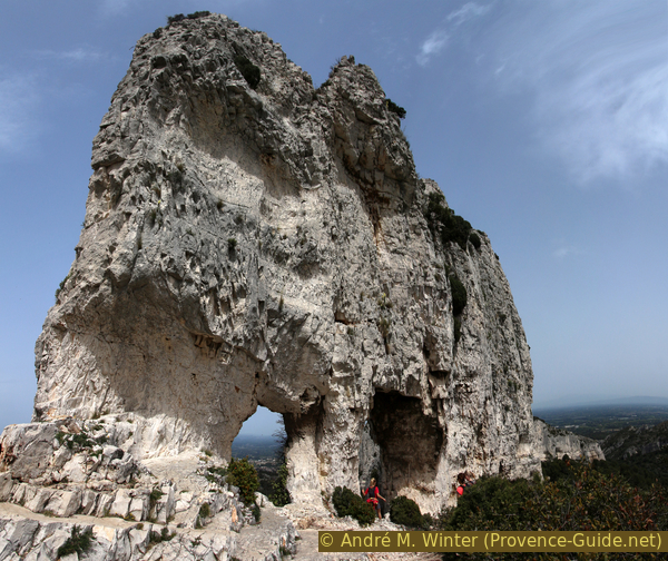
The rock with the two holes
Section 3: Rocher des Deux Trous - Gaudre de Valrugue
➙ 3,2 km ... 1 h 15 min ➚ 5 m ➘ 215 m ↝ difficult
15% cross country, without marks
70% forest roads, few marks
15% hard-surfaced city alleys, few marks
The clues
- Rocher des Deux Trous, 300 m
- Descent into the Gaudre de Valrugue valley, 195 m
- Out into the plain at Séraillet, 145 m
- Ancient quarries, 110 m
- Chemin des Carrières and back to the monastery of St. Paul de Mausole, 105 m
Unlike most hikers at Rocher des Deux Trous, we continue on the right to the north-east.
colline = hill
éboulis = scree
Next to the two holes, we descend onto a path and stay close to the rock foot.
No reproduction is permitted without the written consent of the author. (id4745)
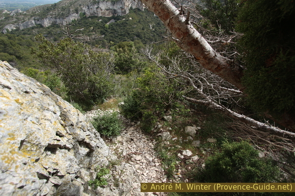
Path east under the Rocher des Deux Trous
After about 20 meters in the bushes, the dense vegetation forces us a few meters away from the rock to the right. But after that we continue in the previous direction to get closer to the rocks on the left.
No reproduction is permitted without the written consent of the author. (id4746)
East face of the ridge north of the Rocher des Deux Trous
But shortly thereafter we turn right at a right angle and thus arrive at an open scree field. The path is clearly visible here. However, it leads back into the overgrown forest.
Fallen trees can block the way, but we have to continue descending towards the east.
No reproduction is permitted without the written consent of the author. (id4747)
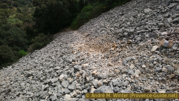
Crossing an open scree field
In 2019, a wide aisle was created by forestry work, but over time the wide path will grow over again.
Arriving at the valley floor, we are now on a forest road. Here left and further down in the Gaudre de Valrugue valley.
No reproduction is permitted without the written consent of the author. (id4748)
Wide path opened by forest work
Further down and further north, the forest road becomes a narrower path, forest machines have to come from above and from the south. At the narrowest point you can see small caves in the foot of the rock wall.
No reproduction is permitted without the written consent of the author. (id4749)
Bottleneck in the Gaudre de Valrugue valley
Shortly thereafter we come to the valley exit and thus into hilly terrain. There is a path on the left that leads back to Glanum, but it goes up and down several times. So we continue north between fields and villas.
When the valley narrows again, you can see cuts in the rocks next to the road. These are quarries that were already used by the Romans. Glanum was built with these stones, the Via Domita was paved and later St. Rémy was built with it.
No reproduction is permitted without the written consent of the author. (id4750)
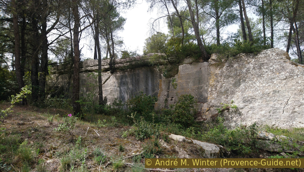
Quarry at Chemin de Valrugue
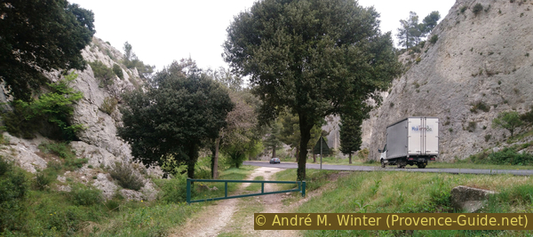
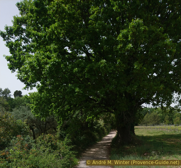
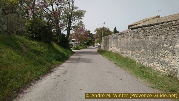
A little further ahead we come to a crossroads and turn left. A signpost points to Les Antiques via St. Paul de Mausole and west. The gravel road is called Chemin des Carrières and it is a bit bumpy at the beginning. You cross a dipp and then the surface gets better. An asphalt surface follows later.
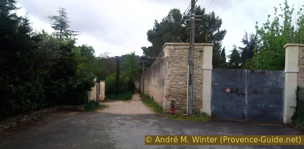
We come to the wall surrounding the monastery of St. Paul de Mausole. Those who came up from the city now go downhill to the right in front of the wall. Everyone else goes back along the wall to the starting point at the monastery entrance.
No reproduction is permitted without the written consent of the author. (id4751)
Path Chemin des Carrières to St. Paul de Mausole
Sources and additional information
It is better to use a good topographical hiking map: This tour is on the IGN map "Tarascon, Saint-Remy-de-Provence, Chaîne des Alpilles", scale 1:25000, 3042OT.
If you don't want to bother with a paper map, you can also use mapping apps on your cell phone. On the one hand, it is the Cartes IGN app from the official map service. However, it requires access to the data network and this is sometimes difficult in canyons or remote locations.
Alternatively, you can use apps that store data directly on the device. They're generally not free, but they don't cost much. We mainly use OSMAnd, here it is possible to add contour lines, relief shading, markings and others. To store this data on your phone you need a lot of space.
Of course, one needs access to satellites for the GPS signal with any app. In some canyons this is not the case. Therefore, do not rely on the position shown, but read the map on your phone as you would read it on paper. Most apps are available for Android and iPhone. The applications usually allow us to record the route travelled and also view the GPS files offered for each of our hikes.
This page has been seen 2740 times since 20 March 2024.
No reproduction is permitted without the written consent of the author. (id6143)
Chemin des Carrières south of St. Paul de Mausole