Valley hike along the Roya between Italy and France
First down the river by train and back on foot
hike
easy
4 h
yes
with train
built-up area
mountain
Introduction
The great advantage of the Roya Valley is that a railway line runs here, so sections can easily be hiked. There are only a few cross-border connections per day, so you have to keep an eye on the departure times. Since it is not pleasant to hurry or to have to wait long, it is advisable to first take the train from Breil to Airole and then hike leisurely and without appointment stress through the valley back to France. If you leave in the morning and then walk back, you can come to the terrace on Place Biancheri in Breil in the afternoon to quench your thirst.
The trail (signed locally as Sentier Valléen de la Roya) runs up a shoulder high on the left bank. From here you have good views of mountain villages, the Alps in the background and old cultural terraces. This is the historical connecting path between the villages in the valley, it is mostly wide and comfortable, but there are also steep ascents and descents. Along the way are so-called "casouns", small stone huts typical of the lower Roya Valley that were used to dry fruit and sweet chestnuts.
Tuesday morning you can get your snack at the market in Breil!
The facts
13,9 km total distance
4 h walk time
860 m total elevation
orientation easy, well marked
mark 100% of the total distance
65% easy trails
20% hard-surfaced city alleys
15% dirt roads
dangers none
children if they can effectively walk that long
useful picnic stuff
required hiking boots, hiking equipment and water
GPS coordinates (WGS84) of starting point 43.870447,7.55288
GPS coordinates (WGS84) of end point 43.943862,7.516531
downloads ![]()
![]()
No reproduction is permitted without the written consent of the author. (id3345)
Roya Valley and Fanghetto
After the village you cross the border on foot.
Public transport
There is a train from Nice to Breil about 10 times a day. It takes about an hour for this. However, for this hike you need the side branch of the railway line from Breil to Ventimiglia with only 3 regional trains per day. Departure times change frequently, check out Breil-sur-Roya train station on Trenitalia. Do not search on SNCF site, you wont find any connection to Airole.
Tickets to Italy cannot be bought at the train station in Breil, you have to buy them on the train. However, the train journey between Breil and Airole only takes few minutes, and you will rarely see a conductor. However, keep some change ready. You have to request a stop by pressing a button, otherwise the train will go through. The station is located between two tunnel sections, so there is only limited space for the train. There is nothing written about the route directly at the train station, see section 1 for how to get on the trail.
Access by car
Breil-sur-Roya is a large village on the road to the Col de Tende (and on to Cuneo). The town is around 40 km north of Menton and 30 km from Ventimiglia.
Useful parking spaces
In the centre of Breil you can rarely park your car all day. But in front of the train station, in the north of the city, it usually works quite well and that's where we have to leave. If there is no more space here, you can look for parking spaces in the small industrial area to the left. If you're dying to skip the convenience of the train and plan to tour with two cars, realize that Airole has next to no parking space. The village literally sticks to a rock.
Hints
The trail passes right through some villages, but these are so small that neither open bars nor inns can be found. There are fountains and occasional water taps, but it is better to bring your own drinking water.
Measured on the river, the difference in altitude between Airole and Breil is just over 100 m. But the path is not always flat and some rocky outcrops have to be crossed. Some times you can also go straight down to the river. So you have to cope with about 800 m difference in altitude. Together with the 14 km distance, you've been on the hike for quite some time. The tour cannot be shortened as the road usually runs along the opposite bank of the river. The train also only has one stop between Breil and Airole and this is also on the wrong side of the valley.
One should not fail to take advantage of the rare opportunities to descend to the water of the Roya or to the valleys of the tributaries to be crossed. The water is crystal clear and nice and cool even in summer.
In the Alpes-Maritimes department, all the signposts have numbers, here you can find numbers between 1 and 420, we mention them in the description and on the maps. The order is arbitrary and has no meaning for this or other tours.
The whole region is a zone with a high risk of forest fires. In summer, but also in other seasons when it is very dry or by strong winds, access to the forest areas can be regulated. As a result, the roads may be closed to traffic and/or the trails prohibited to hikers. Current information: Access map to the Alpes-Marimes forests (also english). The map shows the colours green, yellow, orange and red which correspond to levels of danger. The affected area is: Moyen pays ouest.
The sections
- From Airole station to the church, across the border and to Libre.
- Follow the markings from Libre to Breil.
No open rest stops in the places crossed.
Section 1: Airole - Fanghetto - Libre
➙ 7,4 km ... 2 h ➚ 750 m ➘ 252 m ↝ easy
15% hard-surfaced city alleys, few marks
15% dirt roads, few marks
70% easy trails, few marks
The clues
- At Airole train station, 145 m, cross the track and go uphill
- Pass left the church, go around it and take the valley path
- Continue north on this path
- In front of the village of Fanghetto you can descend to the river
- Pass under the arches of Fanghetto
- Cross the border inconspicuously
- Climb to the plateau of Libre
On the historic route in the Roya Valley.
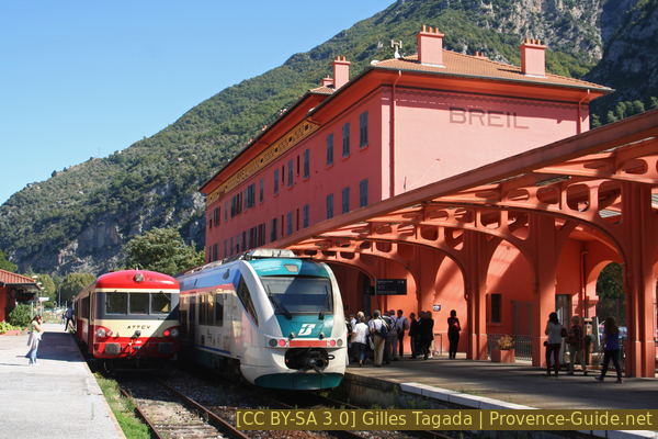
Italian train in Breil station
vers = to
église = church
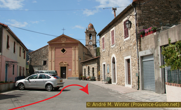
After getting off the train, continue in the direction of travel and cross the tracks on the steep bridge. You come to a side street, which you follow briefly to the left. Not far after that, the first street on the right uphill (signpost Cimeterio), later the street is called Via Madonna and we actually get to the church this way, but from behind. Do not climb any further here, but pass the church building on the left and immediately right in front of the main facade.
No reproduction is permitted without the written consent of the author. (id3342)
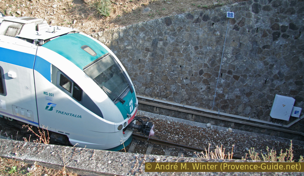
Italian regional train at Airole station
Looking back at Airole in the morning (photo). We still pass through other villages, but they are all much smaller.
No reproduction is permitted without the written consent of the author. (id3343)
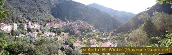
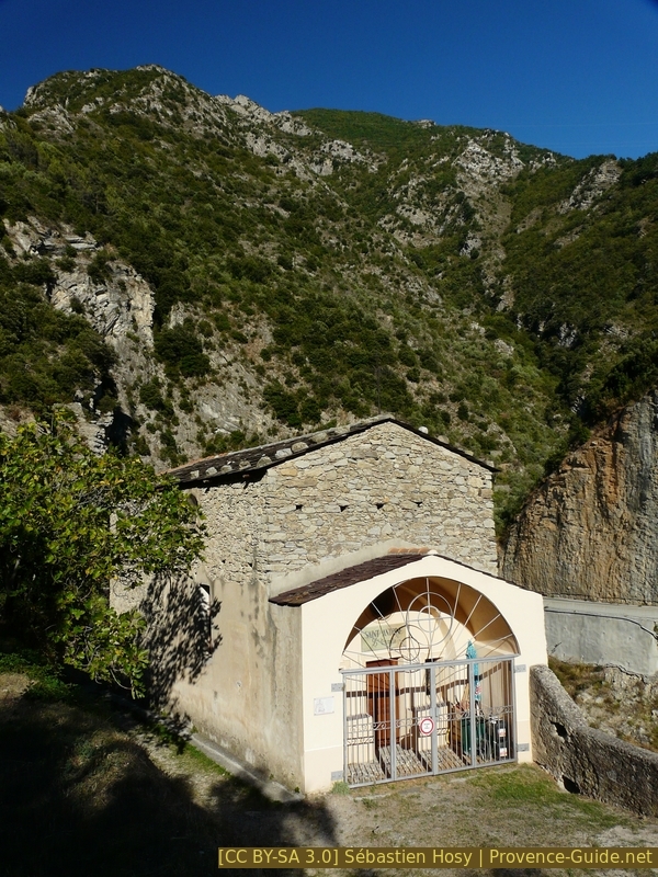
Airole seen from the church
Directly in front of the church of Nostra Signora delle Grazie, continue on the other side (no-driving sign). The valley path is called Sentiero Valle Roja here.
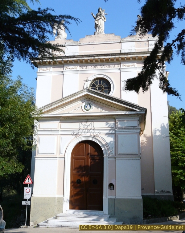
Sanctuary of Our Lady of Graces
In the further course we walk on a dirt road that keeps the altitude constantly. We pass a few last houses, then only small huts follow and the dirt road turns into a path that later crosses small ridges and side valleys with more difference in altitude.
In the picture you can see the path above the terraces and the isolated houses.
No reproduction is permitted without the written consent of the author. (id3344)
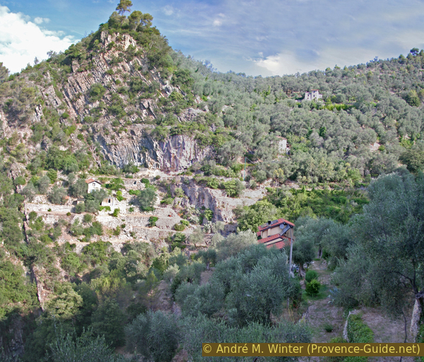
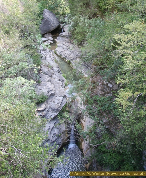
Side valley of the Rio Mantici
frontière = border
accès à la rivière = access to the river
passage voûté = gangway
We continue along the path that follows the meanders of the Roya. From a ridge you will see the village of San Michele on the other bank, in front you will occasionally see the houses of the village of Fanghetto. However, our forest path goes downhill before the village. Here is the rare opportunity to go straight to the river. A small path leads flat to the rocky shore. This is an ideal place for a short break after about an hour's walk.
No reproduction is permitted without the written consent of the author. (id3346)
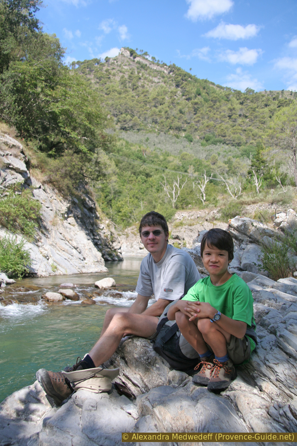
Rest on the banks of the Roya
After a break by the water, we go back to the main path and then uphill through olive trees to Fanghetto. Like other places, the village is located directly on the valley path. This proves well that the path is much older than the road on the other bank. The village really sticks to the slope, you also go under passages and arches to come out at the other end. The usual path soon begins there again, so you go straight ahead in the first hairpin bend and thus leave the road again.
On this section of the trail, we also pass the border between Italy and France at the Serre de l'Arpette without much fuss. There is a boundary stone, but you have to look for it carefully, because here you will be more concerned with sweating during this climb.
No reproduction is permitted without the written consent of the author. (id3347)
Fanghetto in Italy's Roya Valley
From Fanghetto we can also see the first French villages in the lower Roya valley, such as Piène-Haute, which is actually very high ("haut") and is enthroned on the other bank, impregnable for us on foot.
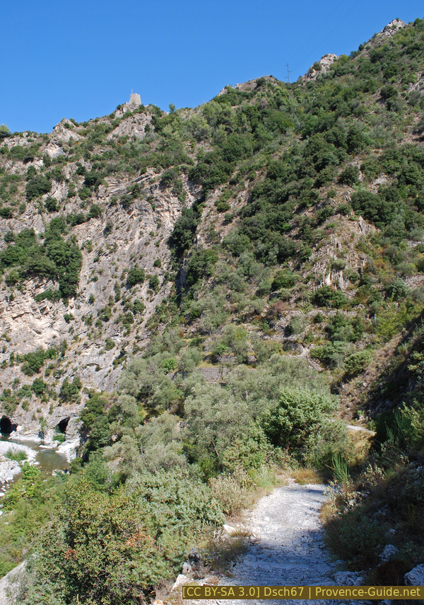
After the border, the terrain becomes more rugged, the path has more ups and downs and there are fewer cultivated terraces. We cross some narrow side valleys with streams.
No reproduction is permitted without the written consent of the author. (id3349)
Audin torrent , a left tributary of the Roya
In the deeply cut side valleys you can enjoy the refreshing shade after the ascent at the border. Mainly because it's then another 250 meters uphill. Only then do we stand on the sunny plateau of Libre, planted with fruit trees.
No reproduction is permitted without the written consent of the author. (id3350)
Old stone bridge on the Audin torrent
pont = bridge
After the Audin torrent (the first stream after the border ridge) the path becomes almost alpine. It rises noticeably in bends. At the signpost number 412 we are under the sunny plateau of Libre. There are some "casouns", the peculiar dry huts made of stone. We turn onto a field path under orchards and get to the village center. There is a water tap on the inside of the curve in the main square.
To exit the village again, see section 2 below.
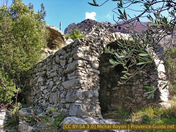
Casoun, typical drying room and shelter in the lower Roya Valley
Section 2: Libre - Praghiou - Breil
➙ 6,5 km ... 2 h ➚ 290 m ➘ 420 m ↝ easy
25% hard-surfaced city alleys, with marks
55% easy trails, few marks
20% dirt roads, few marks
The clues
- In Libre continue along the road
- In Borgogni follow the markings on the right side of the road
- Pass through Praghiou
- Descend from Rougna to the Carleva Valley
- Continue north and pass the old town gate of Breil
- Through the village back to the train station
The path is less shady in this section, and you can already feel the tiredness in your legs. There are fewer climbs but some steep descents.
We cross the village of Libre. Then it goes down along the road to some houses in the hamlet of Bourgogni. After the road bridge at the Aubé torrent, there is a house above the road. Our path leads up under the house (signpost number 416) and continues at the same level, while the road meanders down into the valley.
No reproduction is permitted without the written consent of the author. (id3351)
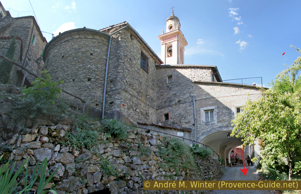
Central square in place Libre village
The path runs under the shoulder of the slope with the village of Cotté on wide rock bands, before diving back into denser forest. This is how you get to the Praghiou agricultural road. After about 4 km and an hour's walk you come to an open plateau called Rougna (signpost number 104). An old paved path begins here again, but now it goes 100 meters downhill steeply into the Carleva valley.
No reproduction is permitted without the written consent of the author. (id3352)
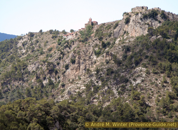
Piène Haute looks even more impregnable from the other side
The step on the slope on which the village of Libre is located, seen from the Piène Haute. The Roya flows far below.
No reproduction is permitted without the written consent of the author. (id786)
View from Piène Haute towards Libre
After the steep descent, the trail crosses the Carleva valley. An old and beautiful stone bridge spans the stream.
In the creek bed there are several pools where you can cool off in summer. The depth is usually not sufficient for a real bath. It is also worth climbing a little further upstream in the creek bed. This is one of the last wild sections of nature on the trail, soon we will come back to civilisation.
No reproduction is permitted without the written consent of the author. (id3353)
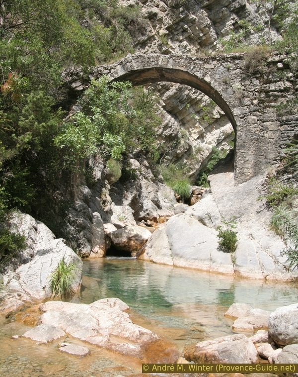
Stone bridge in the side valley of the Carleva
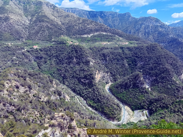
The path widens again without turning into a road. High up on the ridge are the ruins of Cruella, already announcing Breil-sur-Roya.
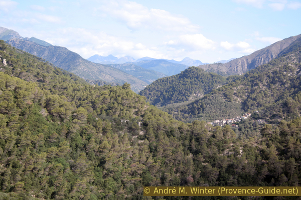
Valley path of the Roya downstream from Breil
tour = tower
porte (here) = town gate
vers = to
gare = train station
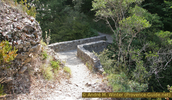
After a bend in the river, there is further proof that we are on the historic valley path: we pass through the southern town gate of Breil. Until 1814, the state border ran between the towns of Breil and Libre.

Path an Porte de Gênes south of Breil
A few metres further on, the Saint-Antoine chapel is on the path.
Saint-Antoine-l'Ermite chapel south of Breil
In Breil you can get to Rue de Turin or Rue Pasteur, both of which allow you to cross the city without having to walk along the busy road. However, Rue Pasteur, further to the left, has the advantage of passing Place Biancheri. There is a bar with a terrace where you can treat yourself to an ice cream or a beer after the hike.
Tp go back to the train station, we continue north and over the bridge. Then the Avenue des Combattants de l'Afrique du Nord on the right. At the public swimming pool, we come back to the main road. There is a parking lot on the right, but we should choose the narrow footpath along the street, because after 100 meters the train station is on the left.
Sources and additional information
It is better to use a good topographical hiking map: the French part of this tour is on the IGN map "Vallée de la Roya, Vallée des Merveilles, Parc national du Mercantour", scale 1:25000, 3841OT. There are no current maps for the section in Italy.
If you don't want to bother with a paper map, you can also use mapping apps on your cell phone. On the one hand, it is the Cartes IGN app from the official map service. However, it requires access to the data network and this is sometimes difficult in canyons or remote locations.
Alternatively, you can use apps that store data directly on the device. They're generally not free, but they don't cost much. We mainly use OSMAnd, here it is possible to add contour lines, relief shading, markings and others. To store this data on your phone you need a lot of space.
Of course, one needs access to satellites for the GPS signal with any app. In some canyons this is not the case. Therefore, do not rely on the position shown, but read the map on your phone as you would read it on paper. Most apps are available for Android and iPhone. The applications usually allow us to record the route travelled and also view the GPS files offered for each of our hikes.
This page has been seen 3820 times since 20 March 2024.
No reproduction is permitted without the written consent of the author. (id3354)
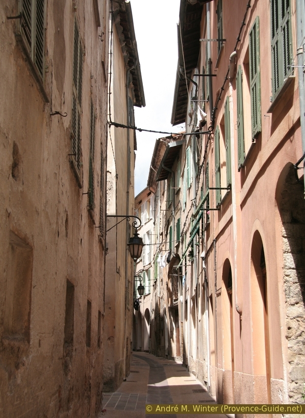
Rue Pasteur in Breil sur Roya