Round the Cap Martin in Roquebrune
The paths at the cape and the Promenade Le Corbusier
walk
easy
2 h
yes
yes
built-up area
walk
Introduction
In the departments of Var and Bouches du Rhône, the riverside path often leads through genuine natural landscapes. Here on the Riviera of the French Maritime Alps (Alpes-Maritimes) all is much more urban and the topography makes the coastline much narrower. On the other hand, you can easily arrive by public transport and make circular tours more easily. The tour around Cap Martin offers good views of the Italian coast, but above all in the other direction: Monaco.
This trail is easily accessible from the city area. Along the way there are a number of small stairs on the south side, which lead down to the sea. They are sometimes private, but since the shoreline is a public property, one can usually use them to descend to the sea. The whole cape is rocky, there are no sandy beaches. The tour can be undertaken in any weather and at any time of the year. We went here on an overcast morning in February.
On the way back we pass through the Cap Martin Park, where you can stretch your legs under hundred-year-old olive trees!
In the city, along the coast, especially on the north side and directly on the cape, you will look in vain for solitude, there are always many people and joggers on the move. The south side, the stepped paths in the city area and the Parc du Cap Martin are more in line with the claim of finding quiet and natural places on an otherwise hectic coast.
The facts
5,1 km total distance
2 h walk time
120 m total elevation
orientation easy on the coast, in the urban area follow the instructions in the text
mark 45% of the total distance
45% hard-surfaced paths
30% hard-surfaced city alleys
15% stairs
10% parks
dangers none
children yes
useful picnic stuff, swimwear
required trekking shoes, hiking gear and water
GPS coordinates (WGS84) of start and end point 43.75784,7.474004
downloads ![]()
![]()
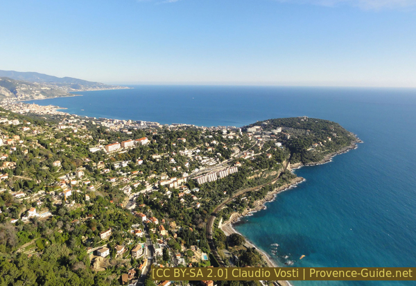
Cap Martin seen from a paraglider
A similar view of the cape is available from the upper road between La Turbie and Roquebrune.
Public transport
The train line runs just along the coast and regional trains also stop in the small stations near the start of the tour, even if you have to add some walking time. With TER PACA (only french) and line between Menton and Nice, you can use the following stations:
- Roquebrune Cap Martin station is located on the coast between Monaco and Cap Martin. If you start here, you move from the beginning on the coastal path, which is already called Promenade Le Corbusier here, see also the beginning of the tour Le Corbusier at Roquebrune. Exit the small railway station sea-side (underpass) and turn east (towards Menton) and immediately take the path that first runs near and sea-side by the railway. Passing the houses of Massolin and further east, after a small cape, the path literally sticks to the railway embankment again. You are then immediately at the crossroads called La Dragonnière, a point that is already on the circuit described here. It goes up the further stairs on the left, so you start with section 3. At the end of the round we come back to this point. 1,3 km and an additional 20 minutes one way for this alternative easy approach.
- Carnolès station is north-east of the cape in the urban area. Exit the train station on the sea side (underpass) and proceed along Avenue François de Monléon to the beach. Here right along the sea to the next roundabout, which is at the end of the first section of the tour described here. Turn left here and continue along the sea. 1,3 km or 15 minutes extra one way. On the way back to the same train station, do not go down to the sea again but go up the steps of the Chemin de Fontanouille, beyond Avenue de la Paix, down the same street further along the dam before to the train station Carnolès.
Arriving on interregional trains, you can only get off at Monaco and Menton. From both stations it is better to take a bus from Zest Transports Riviera (only french), tickets are available on the bus:
- Monaco Train Station: take bus line 18 from the Pont Sainte Dévote Gare SNCF terminus, right at the exit of the underground train station. Get off at the Mairie de Roquebrune station, this is the starting point of our tour at the municipal office. There are between 10 and 15 connections per day and the journey takes around 30 minutes.
- Menton Train Station: take bus line 21 at Menton Gare SNCF station. Leave the train station, go across the car park, the bus stop is then on the right. Get off at Mairie de Roquebrune station, this is the starting point of our tour. There are about 5 connections per day and the journey takes about 20 minutes.
Access by car
The traffic situation in the coastal strip of the Alpes Maritimes is extremely difficult, it is better to travel by public transport. Otherwise the best way is via the A8 motorway:
- Coming from Marseille or Nice: take exit 57 La Turbie, from the first roundabout Roquebrune-Cap-Martin is signposted, although we are still a long way from our destination (10 minutes by car high above the sea). Go through the town of La Turbie.
- Coming from Genoa or Menton: take exit 58 Roquebrune, follow the signs to Roquebrune.
Pass under the old village of Roquebrune from both exits. When you come to a traffic light controlled junction with Monaco on the right and Menton on the left, keep left and at the next major junction turn right towards Cap Martin. Drive down, at the following T-junction, before the grassed water reservoir, turn left onto Avenue Paul Doumer. After the first right-hand bend, you will see the Roquebrune town hall (Hôtel de Ville) on the right, the starting point of this tour. We're going in the opposite direction.
Useful parking spaces
Some park possibilities on Avenue Paul Doumer, less in the side streets. On the main streets, parking is all paid.
There is no large parking lot or underground car parks, even paid, near the tour.
Hints
The round runs entirely on paved paths, almost all the steeper sections lead over steps. However, three quarters of the way are away from traffic. There are two water points: directly at Cap Martin and in the Parc du Cap Martin. Shopping on the coast in Carnolès.
You can extend this walk into a hike with: Le Corbusier at Roquebrune.
The whole region is a zone with a high risk of forest fires. In summer, but also in other seasons when it is very dry or by strong winds, access to the forest areas can be regulated. As a result, the roads may be closed to traffic and/or the trails prohibited to hikers. Current information: Access map to the Alpes-Marimes forests (also english). The map shows the colours green, yellow, orange and red which correspond to levels of danger. The affected area is: Littoral est.
The sections
- Visit the Roman funerary monument and descent via stairways to the sea at Carnolès
- Circum-hike of Cap Martin on the Promenade Le Corbusier clockwise
- Ascent between villas and through the olive grove in the Parc du Cap Martin to the starting point
No reproduction is permitted without the written consent of the author. (id3491)
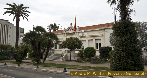
The municipal office of Roquebrune-Cap-Martin
The starting point and bus stops are in front of this public building.
Section 1: Mairie de Roquebrune - Carnolès
➙ 1,9 km ... 30 min ➚ 15 m ➘ 90 m ↝ easy
60% hard-surfaced city alleys, without marks
20% stairs, without marks
20% hard-surfaced paths, without marks
The clues
- Mairie de Roquebrune (town hall), on the ridge of Cap Martin, 70 m
- Mausolée de Lumone, Roman funerary monument
- Stairs of the Chemin de Fontanouille and the Escalier de la Plage
- Carnolès, 0 m
- Avenue Winston Churchill
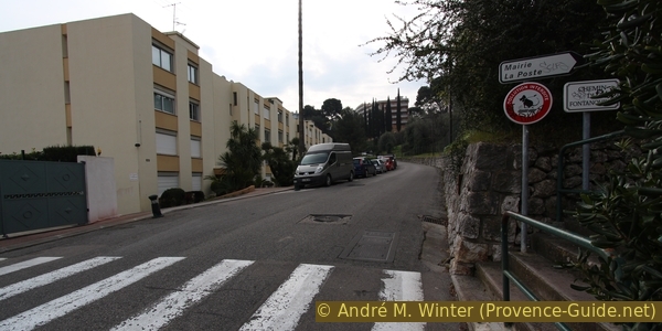
For a first orientation, we position ourselves so that we have the municipal office (Hôtel de Ville) in front of us and turn right, i.e. north and inland. If necessary, we immediately cross to the opposite side of Avenue Paul Doumer, pass the modern church of Saint Martin du Cap and a house further on we see the Roman ruins in a small park on the right.
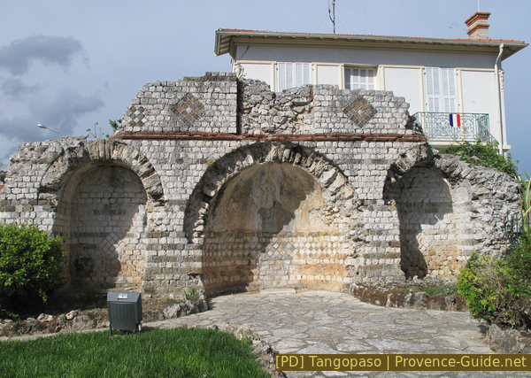
Lumone Mausoleum
Roman funerary monument of the so-called Villa Lumone, on the ancient Via Julia Augusta, today D52 and here Avenue Paul Doumer.
mairie = municipal office
tombeau romain = Roman grave
flèche = arrow
Plage = beach
After the grave monument, we turn around, pass the church again, and take the first street downhill on the left. All side streets are locked with gates, so we automatically come to the Chemin du Fontanouille, which leads us to the beach (arrow). The path passes between gardens, with steps in the steeper sections. There are no junctions until the next street crossing.
No reproduction is permitted without the written consent of the author. (id3490)
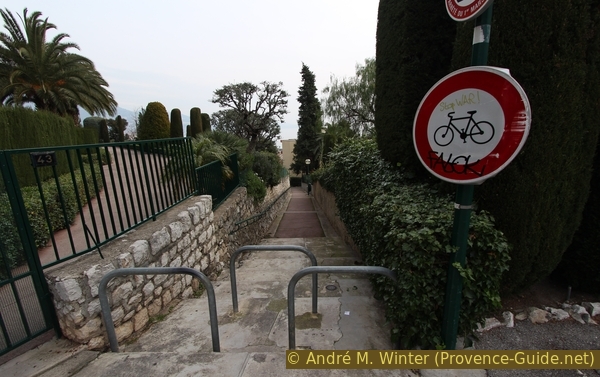
Upper part of the Chemin du Fontanouille
Here we go downhill.
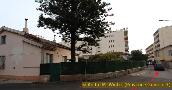
The upper part of the Chemin du Fontanouille ends abruptly at the Avenue de la Paix. There is a pedestrian crossing, but you really have to watch out for the cars, especially those coming from below. Although the stairway would continue downhill, we continue to the right along the narrow footpath. Here we have a slight counter climb along large residential buildings and cross the railway line that disappears into a tunnel.
No reproduction is permitted without the written consent of the author. (id3489)
Avenue de la Paix seen from the Chemin du Fontanouille
Cross the street, turn right and continue up.
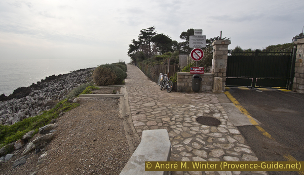
After the railway line there is a small parking lot. The footpath widens and leads over an iron structure. There are steel stairs down to the left which could be mistaken for a private entrance to the house, but this is the Escalier de la Plage public route!
No reproduction is permitted without the written consent of the author. (id3488)
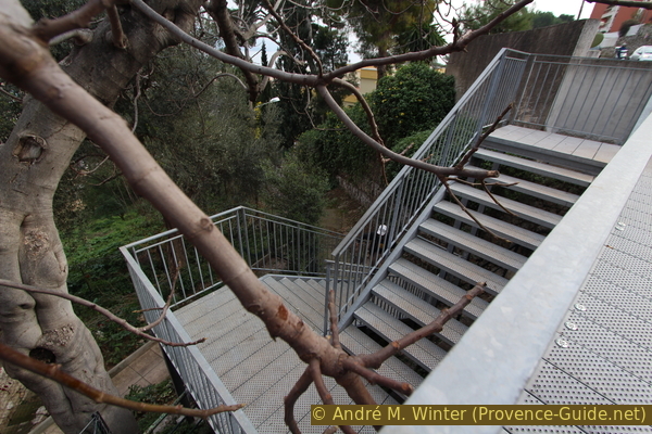
Upper access to the Escalier de la Plage stair
This path, which also alternates between concrete strips and steps, quickly returns to its old, deserted appearance. Apparently few people walk to the beach...
At the end of the path, turn right and walk down the newly created, wide footpath with benches.
No reproduction is permitted without the written consent of the author. (id3487)
Old way Escalier de la Plage
At the following Y-junction, turn right onto Avenue de la Plage and proceed to the roundabout by the sea. There is a bakery here if there is still a lack of baguettes for a snack.
No reproduction is permitted without the written consent of the author. (id3486)
Avenue de la Plage
arc = arch
We continue in the same direction, crossing the roundabout at the pedestrian crossings. Ahead of us is Avenue Winston Churchill, which leads us directly to the coastal footpath. It is better to walk on the left because there are more pleasant sections with a path by the sea below the road.
No reproduction is permitted without the written consent of the author. (id3485)
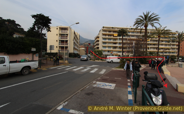
Avenue Winston Churchill and the roundabout
Looking back to the roundabout, behind it: the Avenue de la Plage.
There is a curious arch on Avenue Winston Churchill, it is neither historic nor particularly worth seeing, but it gives us a clue: here we enter a waterfront path away from traffic.
The picture shows the arch in retrospect.
No reproduction is permitted without the written consent of the author. (id3484)
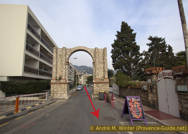
Arch in Avenue Winston Churchill
From the path you have a view back to Carnolès.
No reproduction is permitted without the written consent of the author. (id3483)
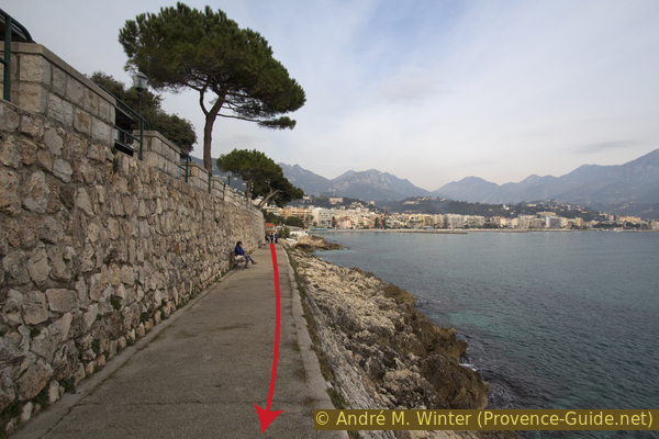
Shore walk under Avenue Churchill
At a bottleneck we have to climb up to Avenue Churchill again, but after another small parking lot we go down to the sea again, here it is also a bit wider than before.
Second shore walk below Avenue Churchill
Section 2: Promenade Le Corbusier - Cap Martin
➙ 2 km ... 1 h ➚ 40 m ➘ 30 m ↝ easy
10% stairs, with marks
90% hard-surfaced paths, with marks
The clues
- Avenue Winston Churchill
- Cap Martin
- Under the villas at Cap Martin
- La Dragonnière junction
The Promenade Le Corbusier is a path along the coast between Carnolès and Monte-Carlo. There are numerous opportunities to descend to the water along the way. On the land side, high above the path, there are some magnificent buildings such as the Villa Cyrnos by Eugénie de Montijo, wife of Napoleon III. The path bears the name of the famous architect Le Corbusier. He died in 1965 and is buried in Roquebrune Cemetery.
The trail always leads along the water, flat sections alternate with steps. It is permanently stabilised.
eau = fresh water
sous terrasse = under terrace
After the last section by the sea below Avenue Churchill, we come back up to the road, cross a car park and when the road goes up to the right, we keep left and get to the beginning of the Promenade Le Corbusier (signpost). The beginning and the circum-hike of the cape are still flat, later several sections with stairs will follow.
No reproduction is permitted without the written consent of the author. (id3482)
Beginning of the Promenade Le Corbusier on the Carnolès side
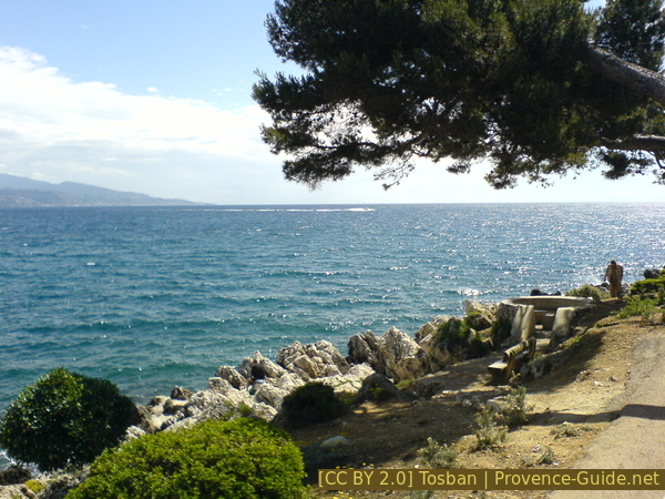
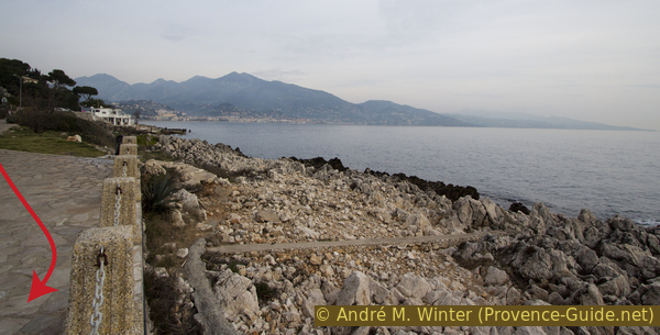
The Cap Martin is not particularly pronounced, there is a platform at the easternmost point (photo). From here you can see one last time back to Menton and the Italian Riviera beyond. There is a water tap at the edge of the platform covered with stone slabs.
After the platform, the path turns right and you pass the cape. New views open up west to Cap Ferrat!
Shortly thereafter, the path takes a curious turn: it passes under the terrace of the swimming pool of the former Grand Hôtel du Cap-Martin. Beware of the head, the concrete beams hang quite low!
No reproduction is permitted without the written consent of the author. (id3481)
Platform at Cap Martin
View back to Italy.
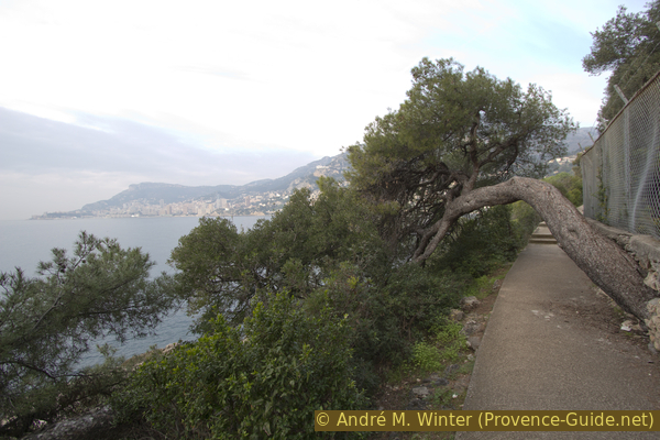
After this last structural disruption the path really becomes a coastal path and the terrain gets a little steeper and more choppy. You can no longer get to the water at every point, and the vegetation is more lush here. Some exotic plants bloom here, they are offshoots of the private gardens above.
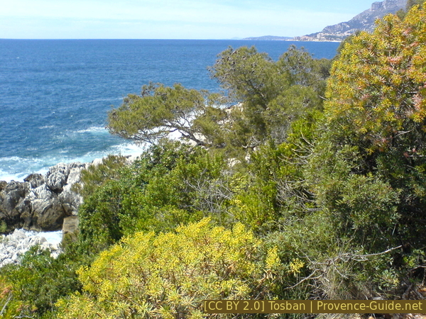
Promenade Le Corbusier in a green setting
The skyscrapers in Monaco in the background.
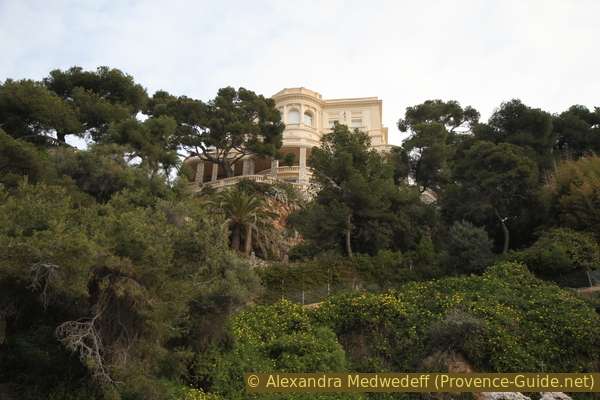
The large villas are located high up and are mostly well hidden, so that you can't even see them from the shore path. The exception to this is the seafront gallery of Villa Cypris. This construction enabled a wealthy heiress to watch her daughter Virginie Hériot regatta sailing in Roquebrune Bay.
No reproduction is permitted without the written consent of the author. (id3480)
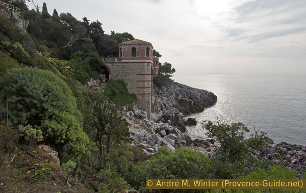
Sea-side veranda of Villa Cypris
View back.
This side of Cap Martin is particularly popular for views of Monaco. From this perspective, one almost has the impression that one is heading for the city-state with a ship.
No reproduction is permitted without the written consent of the author. (id4591)
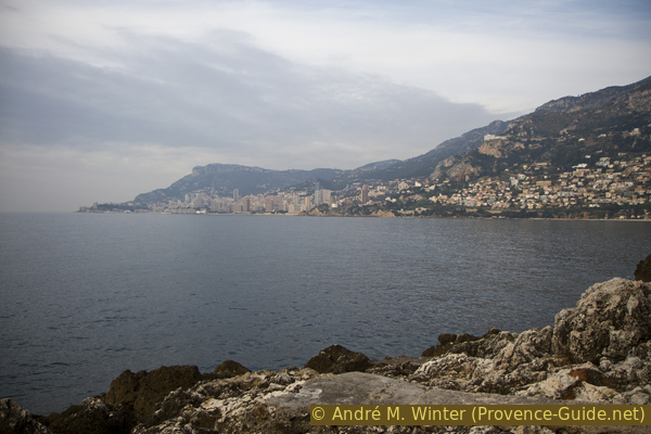
View of Monaco from the Promenade Le Corbusier
The picture was taken on a very cloudy winter morning. A clear and early spring morning is recommended for a better view.
A number of large villas, some of which are historic, have been built on the south-west front of Cap Martin. However, most of the other buildings are better hidden than this one (see photo).
No reproduction is permitted without the written consent of the author. (id3478)
One of the villas on Avenue de l'Impératrice Eugénie
The Promenade Le Corbusier is a concrete path but there are many steps and some obstacles like this one (photo).
No reproduction is permitted without the written consent of the author. (id3477)
A pine tree bends over the Le Corbusier coastal path
Section 3: La Dragonnière - Parc du Cap Martin
➙ 1,2 km ... 30 min ➚ 65 m ➘ 0 m ↝ easy
25% stairs, with marks
35% hard-surfaced city alleys, without marks
40% parks, without marks
The clues
- La Dragonnière junction, 18 m
- Avenue Virginie Hériot
- Parc Cap Martin, 70 m
- Mairie de Roquebrune (municipal office )
The way back to the starting point leads through the public Parc du Cap Martin. This pleasantly quiet area has regular opening hours: 9am to 7pm in summer and 9am to 5pm in winter. If you come here outside of these times, it is better to turn left after the stairs on Avenue Virginie Hériot. This leads to Avenue Paul Doumer and next to a green water reservoir. Keep right and immediately you are in front of the municipal office (Hôtel de Ville).
There are no signposts or markings in the city area.
vers = to
et = and
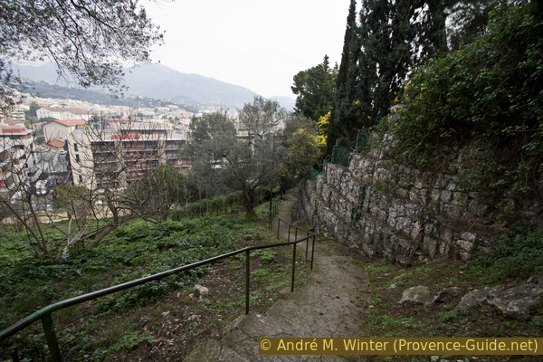
At La Dragonnière junction, we leave the coastline to the right and begin the ascent to the starting point.
If you continue straight ahead you can get to Monaco in just over an hour.
The ascent takes place quickly in one piece, partly via stairs, but always in the shade of the vegetation. You wind your way between gardens and the railway line. At the top you come to the end of a short cul-de-sac, at the T-junction that is immediately visible we keep to the right and follow the Avenue Virginie Hériot until we can enter the Parc du Cap Martin through a gate on the left.
No reproduction is permitted without the written consent of the author. (id3475)
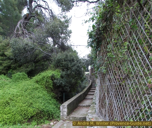
Stair from the coast to Avenue Virginie Hériot
In this photo you can see a gate of the park. There are several entrances, please note the opening times!
On the side we enter there is a large olive grove, there are many benches, a toilet and a drinking water point. A straight path leads to the other half of the park, there is a children's playground. A kiosk offers drinks and small snacks.
No reproduction is permitted without the written consent of the author. (id3494)
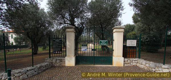
A gate of Parc du Cap Martin
portails = gates
eau = fresh water
The Parc du Cap Martin contains around 300 olive trees, many of which are several hundred years old. The last owners left the 3,5 hectare area to the municipality.
You can explore the park in different ways.
Leaving the park on the opposite northern side via the straight path, you arrive on Avenue Paul Doumer, further to the left is the municipal office (Hôtel de Ville) and our original starting point.
No reproduction is permitted without the written consent of the author. (id3493)
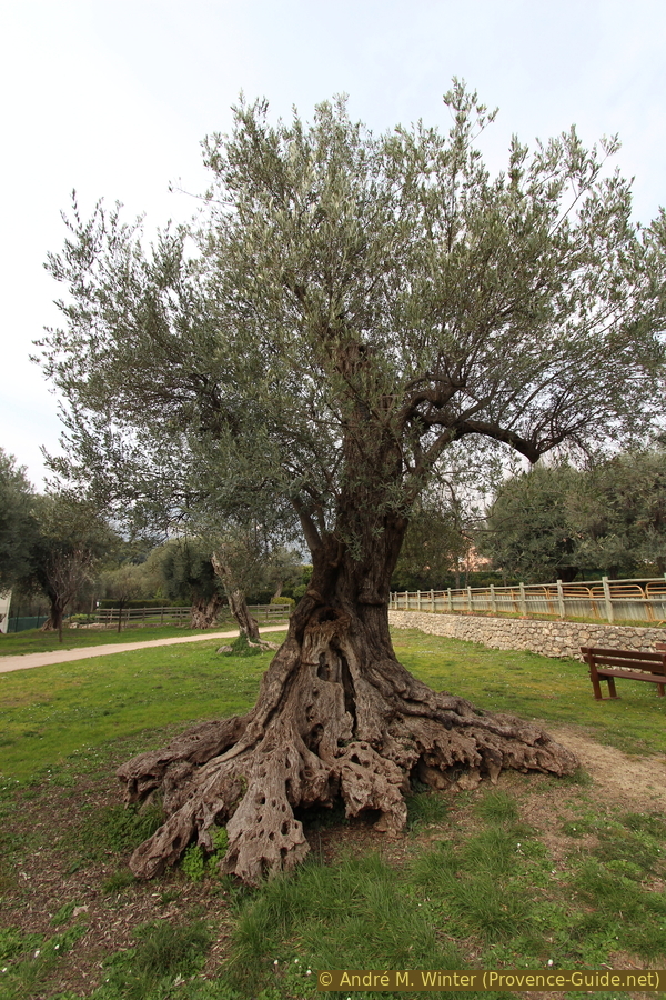
Olive tree in Parc du Cap Martin
Sources and additional information
It is better to use a good topographical hiking map: This tour is on the IGN "Nice, Menton, Côte d'Azur" map, scale 1:25000, 3742OT.
If you don't want to bother with a paper map, you can also use mapping apps on your cell phone. On the one hand, it is the Cartes IGN app from the official map service. However, it requires access to the data network and this is sometimes difficult in canyons or remote locations.
Alternatively, you can use apps that store data directly on the device. They're generally not free, but they don't cost much. We mainly use OSMAnd, here it is possible to add contour lines, relief shading, markings and others. To store this data on your phone you need a lot of space.
Of course, one needs access to satellites for the GPS signal with any app. In some canyons this is not the case. Therefore, do not rely on the position shown, but read the map on your phone as you would read it on paper. Most apps are available for Android and iPhone. The applications usually allow us to record the route travelled and also view the GPS files offered for each of our hikes.
This page has been seen 6709 times since 20 March 2024.