Le Corbusier at Roquebrune
Via stairs to the village and back via the Parc du Cap Martin
hike
easy
2 h 15 min
yes
yes
built-up area
walk
Introduction
Roquebrune is an unspoilt village, situated high enough not to be under the pressure of the coast's real estate machinations. Between the sea and the village there are a number of historical paths and stairs that are still accessible. They open up wonderful views over the Riviera. Unlike driving through by car, you can stop and admire the scenery at any time.
Roquebrune is also a patch of land where the architect Le Corbusier lived. The tour leads to three places of activity, even if two of them concern his death: his place of death, la Plage du Buse, and his grave, which he designed himself, high above Roquebrune. But there is also architecture to admire: at the end of the tour you will pass the Cabanon le Corbusier.
The facts
6,6 km total distance
2 h 15 min walk time
320 m total elevation
orientation easy on the stairways and the coast, in the urban area follow the instructions in the text
mark 65% of the total distance
30% hard-surfaced paths
25% stairs
10% hard-surfaced city roads
10% easy trails
10% hard-surfaced city alleys
5% parks
5% on beach
5% moderate trails
dangers slippery by wet weather
children yes
useful picnic stuff, swimwear
required trekking shoes, hiking gear and water
GPS coordinates (WGS84) of start and end point 43.760223,7.455693
downloads ![]()
![]()
No reproduction is permitted without the written consent of the author. (id3817)
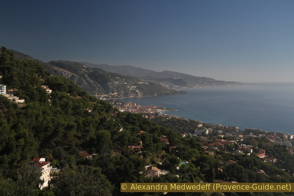
View from the cemetery towards Menton and Bordighera
Public transport
The railway line runs along the coast and regional trains stop conveniently at the start of the tour. With TER PACA (only french) and lines between Menton and Nice, get off at Roquebrune-Cap-Martin station. This small train station is located on the coast between Monaco and Cap Martin. Exit the station on the sea side (underpass) and take the path east that runs very close and parallel to the tracks towards Menton. So you are already on the right path.
If you arrive with interregional trains, you can only get off in Monaco. Change to the regional line (see above) or continue with a bus of Zest Transports Riviera (only french), tickets are available on the bus. We board line 21 at the Pont Sainte Dévote Gare SNCF terminus and travel to Vilarem. From here continue up to the main road (D6007), merge across the zebra crossing and the stepped Escalier de Corinthille. You start the tour a little higher than from the train station. For the return, the stop is called 1er Escalier, right by the stairs and the main road (D6007). There are between 10 and 15 connections per day and the journey takes around 30 minutes.
Access by car
The traffic situation in the coastal strip of the Alpes Maritimes is extremely difficult, it is better to travel by public transport. Otherwise the best way to come is via the A8 motorway:
- Coming from Marseille or Nice: take exit 57 La Turbie, from the first roundabout Roquebrune-Cap-Martin is signposted, although we are still a long way from our destination (10 minutes by car high above the sea). Go through the town of La Turbie and follow the signs for Roquebrune.
- Coming from Genoa or Menton: take exit 58 Roquebrune, follow the signs to Roquebrune.
From either exit you will come to the crossroads in front of the Hotel Maybourne Riviera, from here follow the indications for the Roquebrune bypass for lorries, this will take you onto the Moyenne Corniche. Here sharp left, always in the direction of Roquebrune. At the roundabout over the sea, take the following exit: Gare SNCF de Cabbé. This is the entrance to the train station. However, you should keep an eye out for a parking space from here, because it will rarely be possible to find a place at the train station.
Useful parking spaces
Parking on Avenue Georges Drin, on the access to the train station in Cabbé and another car park is directly at the train station. On the main streets, parking is paid.
There is no large parking lot or underground car parks, even paid, near the tour.
Hints
The tour is mainly on concrete or asphalt, but three-quarters of the tour are far away from traffic. On the descent there is a passage on an old path that can be slippery.
There are places to stop for refreshments in the village of Roquebrune, in the Park du Cap Martin and on the Plage du Buse.
You can combine this tour with the tour around Cap Martin.
In the Alpes-Maritimes department, all signposts have numbers, here you can find numbers between 4 and 540, we mention them in the description and on the maps. The order is arbitrary and has no meaning for this or other tours.
The whole region is a zone with a high risk of forest fires. In summer, but also in other seasons when it is very dry or by strong winds, access to the forest areas can be regulated. As a result, the roads may be closed to traffic and/or the trails prohibited to hikers. Current information: Access map to the Alpes-Marimes forests (also english). The map shows the colours green, yellow, orange and red which correspond to levels of danger. The affected area is: Littoral est.
The sections
- Via stairways up to the village of Roquebrune
- Ascent to the cemetery with the tomb of Le Corbusier
- Descent to the La Pausa Chapel
- Descent via the Sentier Pelissier and visit to the Roman tombs
- Parc du Cap Martin, Promenade Le Corbusier and Cabanon Le Corbusier
No reproduction is permitted without the written consent of the author. (id3807)
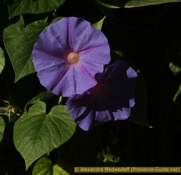
Flowering morning glory in autumn
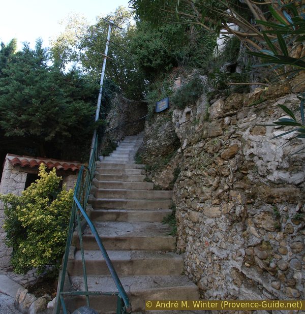
Section 1: Cabbé - le Buse - Roquebrune
➙ 1,5 km ... 20 min ➚ 260 m ➘ 10 m ↝ easy
5% hard-surfaced city alleys, faulty marks
30% easy trails, few marks
65% stairs, few marks
The clues
- Roquebrune-Cap-Martin train station in Cabbé
- Stairs Escalier Massolin, Escalier de Corinthille, Escalier Grana
- Roquebrune Place des Deux Frères, 220 m
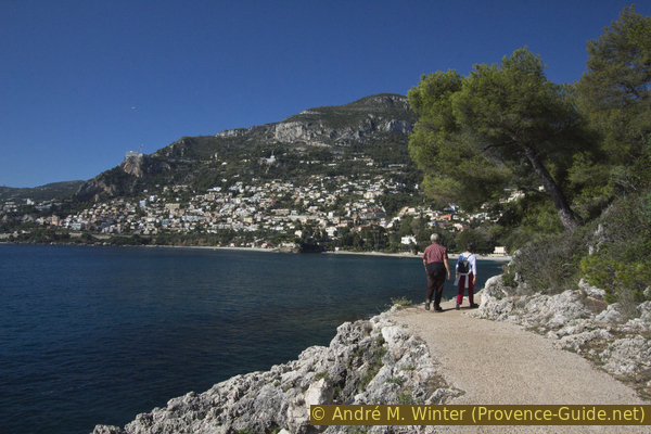
We climb straight from the sea to the village of Roqubrune, away from traffic, on the old stairways that date back to a time when most people walked.
gare = train station
pointe = cape
plage = beach
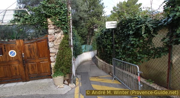
We leave the station to the south and sea side. If you come from Nice, you have to take the underpass first. Ignore the car park on the right and turn left towards the hedge and the path. This is also the coastal path, which follows the rails here.
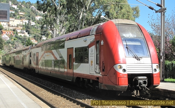
TER regional train at Cabbé station
plage = beach
eau = water
After looking at the Plage du Buse further down, we arrive at a junction with a drinking water point. Here we turn left, pass under the rails and start to climb our first set of stairs, those of Massolin. The stair goes up between villas and apartments, at the end lead over two hairpin bends and lead to the intersection of Avenue de Vilarem (road to the train station) and Avenue de la Côte d'Azur (D6007).
No reproduction is permitted without the written consent of the author. (id3829)
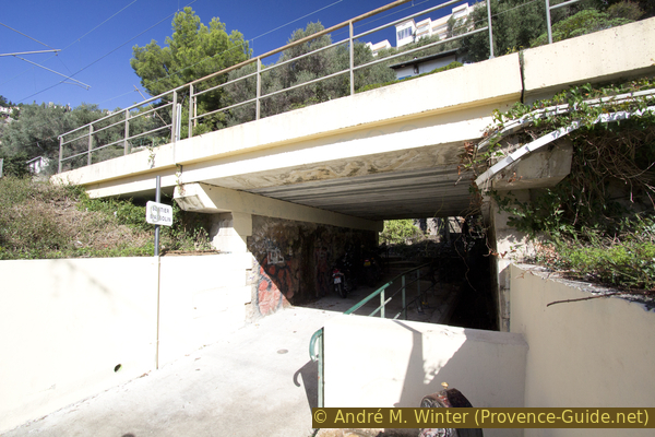
Underpass to Escalier Massolin
Here we continue to the Escalier de Corinthille and the old town of Roquebrune.
gare = train station
You have to cross at the zebra crossing. Be careful: drivers here either look up into the air or they drive like crazy. Opposite, the Escalier Corinthille awaits us, which, like the previous one, climbs steeply, but the view of the coast now opens up better.
For the houses here, the stairway is the only access.
No reproduction is permitted without the written consent of the author. (id3806)
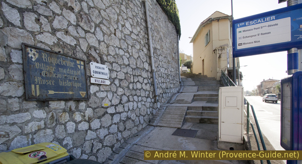
Bottom of Escalier Corinthille staircase
Since we climb practically on the direct path, it is logical that we cross the road that leads up in bends. Here as before: we cross, while we pay attention to the cars and continue on our way vis-à-vis. The stair changes the name here and is now called Escalier du Chanoine Grana.
No reproduction is permitted without the written consent of the author. (id3808)
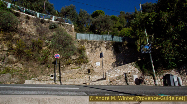
Lower end of the Escalier Chanoine Grana
The walls are getting longer, higher and older. Here we walk along old country estates. A small corner with a bench and an olive tree allows you to take a break in the shade, but then you have to continue climbing.
No reproduction is permitted without the written consent of the author. (id3809)
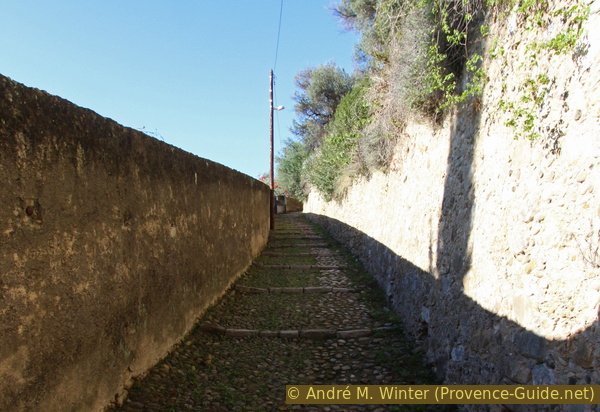
On the Escalier Chanoine Grana stair
Through a gate you can see a large garden. This point also marks a fork, we turn left and come to the Chemin sous le Mûrier.
No reproduction is permitted without the written consent of the author. (id3810)
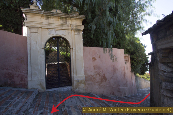
Old gate to the garden of the Maison du Gouverneur
The path runs below the old village. Some stair lead up to houses, we take the first passage on the right that looks like a street (but it still has steps) and go through an archway into Rue Pie. We climb it and turn left twice.
No reproduction is permitted without the written consent of the author. (id3811)
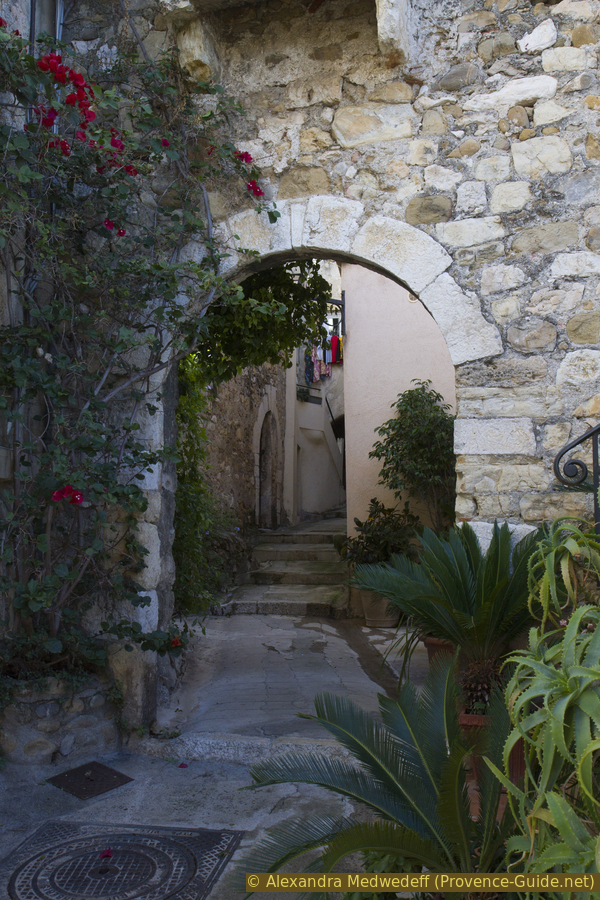
Archway of Rue Pie
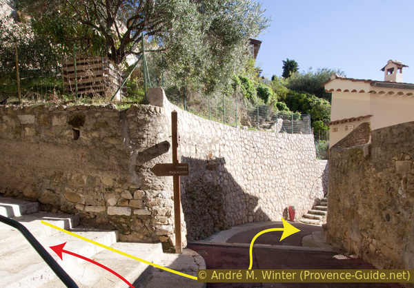
After the steep and narrow streets, we are amazed that we arrive at a large and completely flat square. This square is called Place des Deux Frères and on the left side it ends in a terrace with a unique view over the Bay of Roquebrune and Monaco. On Thursday mornings, the small market in Roquebrune is held in the square.
No reproduction is permitted without the written consent of the author. (id1630)

Market stalls in the old village of Roquebrune
There is a great viewing terrace at the front of the square.
Section 2: Roquebrune - Tombe Le Corbusier
➙ 0,7 km ... 20 min ➚ 50 m ➘ 10 m ↝ easy
30% stairs, few marks
30% hard-surfaced city alleys
40% hard-surfaced paths, few marks
The clues
- Roquebrune Place des Deux Frères, 220 m
- Rue du Château, 240 m
- Rue de la Fontaine
- Roquebrune cemetery, 275 m
A small detour for a view and a modern grave monument.
After a break in the square, we leave it in the only direction where there is also access for cars and go down a few meters towards the parking lot to find the Chemin de Cantinella on the right on the way down, which is of course made of steps. A sign here also shows access to the medieval castle.
No reproduction is permitted without the written consent of the author. (id3812)
Chemin de Cantinella
Here up to the castle hill.
The path leads around the castle hill. Access to the ruins is to the north. There is a fee to visit, but there is not very much to see either. Inside, of course, you get a little higher and the view gets even better, for those who haven't had enough of it yet.
We resume the path around the castle hill, but this time along the rue de la Fontaine, which branches off to the east and descends. Several dark passages under the houses are on our way.
No reproduction is permitted without the written consent of the author. (id3813)
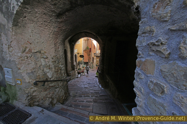
Overbuilt street in the old town of Roquebrune
After the gloomy streets, we come to our surprise on another spacious and sunny square in the east of the village. On the other side of the square we leave the village through a large city gate in the medieval city wall.
No reproduction is permitted without the written consent of the author. (id3814)
Place du Capitaine Ernest Vincent in Roquebrune
Immediately after the gate, the Chemin de Gorbio leads up to the left (signpost 533). From there, in a few minutes, we climb up to the Roquebrune cemetery, which houses the tomb of Le Corbusier. And like many cemeteries in the region, the location offers a very good view of the coast, see also the Menton cemetery
No reproduction is permitted without the written consent of the author. (id3815)
The cemetery is on the left of the Chemin de Gorbio
We enter the cemetery through the main gate at the bottom. There are no particularly picturesque areas, the cemetery is classically arranged in zones (carrés) and the grave we are looking for is in Carré J. We go up the main path, area J is on the right.
The tombstone was designed by the architect himself.
Caution: the water available at the cemetery is not drinking water!
We go down any path to the main gate of the cemetery. But before returning the same way to the city gate of Roquebrune, it is advisable to take the opportunity and enjoy the view from the road to the left and east to Bordighera in Italy.
No reproduction is permitted without the written consent of the author. (id3816)
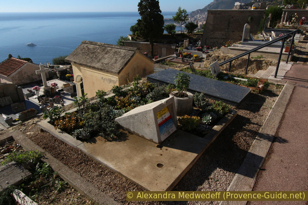
Tomb of Le Corbusier in Roquebrune cemetery
Section 3: Cimetière - Chapelle La Pausa
➙ 0,7 km ... 20 min ➚ 0 m ➘ 110 m ↝ average
100% hard-surfaced paths, few marks
The clues
- Roquebrune cemetery, 275 m
- Millennial olive tree
- Saint Roch chapel
- La Pausa chapel, 180 m
Descend to Menton via the historic path.
We return along the Chemin de Gorbio towards Roquebrune, but instead of going into the village we turn left down the Chemin de Menton. This is the old access road for carts, today only residents and the post office are allowed to drive here.
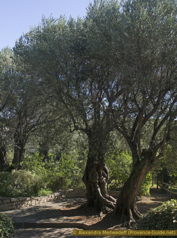
After a few hundred meters, the thousand-year-old olive tree grows out of a retaining wall on the left. It measures 18 meters in circumference and is estimated to be between 1800 and 2200 years old.
No reproduction is permitted without the written consent of the author. (id3818)
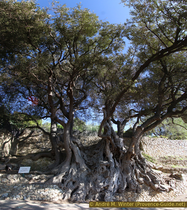
Thousand-year-old olive tree on the Chemin de Menton
The path continues downhill and meanders a bit, but keeps the same direction. We pass two chapels. At the crossroads after the first (signpost 532), we turn left. The second (Chapelle la Pausa) is a little better maintained and is a point of reference for us: on the one hand there is a small park with benches under olive trees and on the other hand we turn right at the following crossroads (signpost 532).
For almost 500 years there has been a procession between the church in the village and the lower chapel on the afternoon of August 5th.
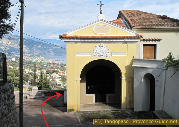
La Pausa chapel on the Chemin de Menton
Section 4: Chapelle La Pausa - Parc du Cap Martin
➙ 1,3 km ... 30 min ➚ 0 m ➘ 130 m ↝ easy
15% easy trails, few marks
20% moderate trails, few marks
15% hard-surfaced paths
50% hard-surfaced city roads, without marks
The clues
- La Pausa chapel, 180 m
- Sentier de la Torraca
- Sentier Pelissier
- Parc du Cap Martin, 60 m
Descent through the forest to the nearby town.
Below the Chapelle de la Pausa, all the markings indicate to stay on the Chemin de Menton, but we leave it anyway and turn right, following the wall of a large property and having a forest on our left. This unpaved path is unobtrusively marked in yellow and is called Sentier de la Torraca.
No reproduction is permitted without the written consent of the author. (id3819)
Chemin de Menton and Sentier de la Torraca right
After about 150 metres there is a sign that shows us the way to Cap Martin. The spot can also be recognized by the fact that a wall begins here on the valley side.
No reproduction is permitted without the written consent of the author. (id3820)
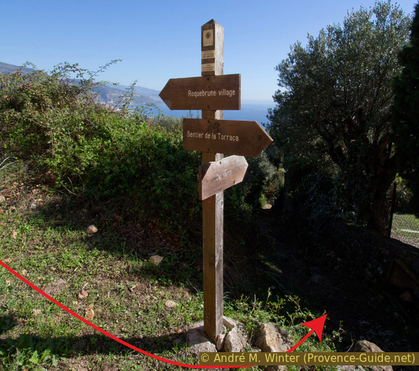
Signpost 529 to Sentier Pelissier
We go down this steep path called Sentier Pelissier. The path is gloomy, covered with low-lying vegetation and scattered stones. You have to concentrate well and watch your ankles when going down.
No reproduction is permitted without the written consent of the author. (id3821)
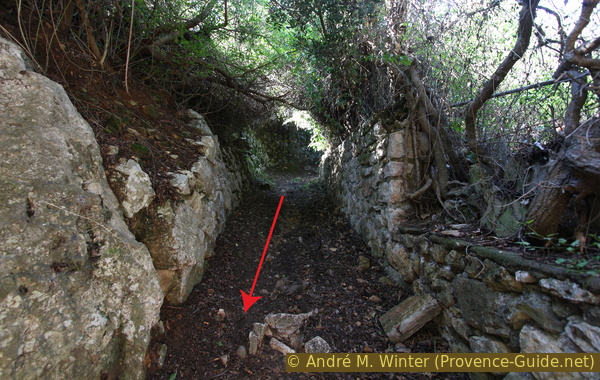
Sentier Pelissier between rocks and ancient walls
The Sentier Pelissier passes a bend of the Avenue des Cyprès (on the left in the photo).
The path continues straight ahead, but here it is concreted and finally ends on the Avenue de Verdun. This is the D6007 which we have already crossed in the ascent. We cross it carefully (the zebra crossings are not where we would need them), we turn left and take the next street on the right, this is Avenue du Général Leclerc.
No reproduction is permitted without the written consent of the author. (id3822)
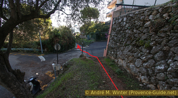
Sentier Pelissier at the Avenue des Cyprès
mairie = municipal office
mausolée = tomb
portail = gate
eau = water
We go all the way down Avenue Leclerc and arrive at Avenue Paul Doumer. You can see the crossing by the water tanks opposite. We do not cross Avenue Doumer, but turn left and cross another street. In a small park is the Mausoleum de Lumone, a Roman tomb that was built here along the ancient Via Julia Augusta. Today the monument is on the D52 (here Avenue Paul Doumer).
No reproduction is permitted without the written consent of the author. (id3823)
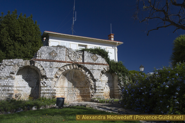
Lumone Mausoleum
Roman grave monument of the so-called Villa Lumone.
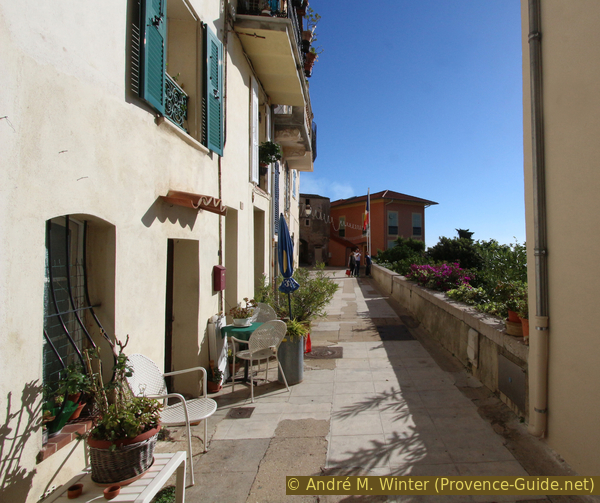
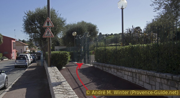
Continue along Avenue Paul Doumer in the direction of Cap Martin, you will pass the Roquebrune Town Hall. 150 meters further we can return to nature and enter the Parc du Cap Martin through one of the gates on the right.
However, this recreational area has opening hours: 9am to 7pm in summer and 9am to 5pm in winter. If you come here outside opening hours, it is better to cross Avenue Paul Doumer at the height of the mausoleum, turn right opposite and take the first left, this is Avenue Virginie Hériot. After a right turn, take the cul-de-sac opposite house number 227. You join then section 5 of this hike here.
No reproduction is permitted without the written consent of the author. (id3824)
Entrance to Parc de Cap Martin from Avenue Paul Doumer
The northern part of the park has been developed with a playground and a snack bar, a straight path leads to the other side of the park with its old olive trees.
At the end of the straight path there are toilets and a fountain with drinking water on the right hand side.
No reproduction is permitted without the written consent of the author. (id3492)
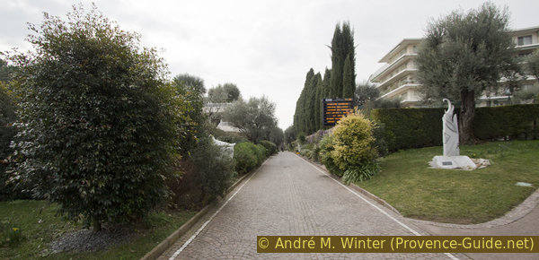
This wide path connects the two parts of the Parc du Cap Martin
On the south side of Cap Martin Park there is an olive grove with around 300 trees, including several that are hundreds of years old. The last owners donated the 3,5 hectares to the municipality. There are several ways to stroll around.
After the straight path we turn right to leave the park through the eastern gate. There are several gates, we must turn right and follow Avenue Virginie Hériot.
No reproduction is permitted without the written consent of the author. (id3825)
Olive trees in Parc du Cap Martin
Section 5: Parc du Cap Martin - Cabbé
➙ 2,3 km ... 45 min ➚ 10 m ➘ 60 m ↝ easy
20% parks, without marks
5% hard-surfaced city alleys, without marks
15% stairs, with marks
35% hard-surfaced paths, with marks
15% on beach
5% stairs, few marks
5% hard-surfaced city alleys, without marks
The clues
- Parc du Cap Martin, 60 m
- Avenue Virginie Hériot
- La Dragonnière junction, 18 m
- Promenade Le Corbusier
- Cabanon Le Corbusier
- Plage du Buse beach
- Roquebrune-Cap-Martin train station in Cabbé
On an easy way back to the starting point along the coast.
No reproduction is permitted without the written consent of the author. (id3474)
Descent to Promenade Le Corbusier
After a long straight stretch, Avenue Virginie Hériot curves to the right. At the next crossroads we take the cul-de-sac on the left. A green arrow hidden behind ivy shows us the direction. Below starts a path that takes us to the coastal path, here it is called Promenade Le Corbusier. We go down a concrete and gloomy path, cross the railway track and reach the La Dragonnière junction.
Here turn right towards Cabbé and Monaco.
No reproduction is permitted without the written consent of the author. (id3476)
Promenade Le Corbusier to Cabbé at the crossing of La Dragonnière
Here we are rewarded with views of Monaco at sea level. There are a few steps, but the path is concrete and easy to walk on.
No reproduction is permitted without the written consent of the author. (id3826)
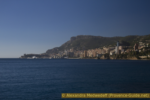
Skyscrapers in Monaco
The path leads up to the railway line and is built directly on the retaining wall of the railway.
No reproduction is permitted without the written consent of the author. (id3827)
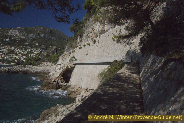
Promenade Le Corbusier
In front of the foot-bridge along the railway embankment.
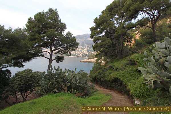
The rocky coast is very steep, if you want to take a bath you'd better wait until you reach the beach at the end of the tour, which doesn't take long either.
No reproduction is permitted without the written consent of the author. (id3828)
Promenade Le Corbusier in the Bay of Roquebrune
plage = beach
eau = water
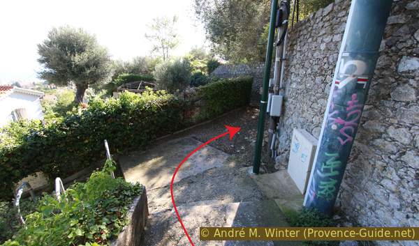
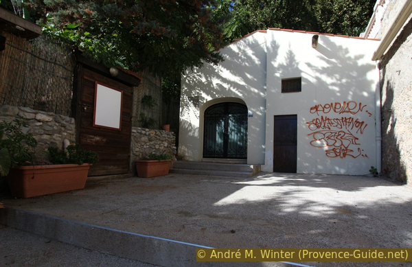
The path continues closer to the tracks, bushy vegetation and a fence begin on the left. Behind it are wooden huts that seem forgotten. But that's not the case, it's Cabanon Le Corbusier, built in 1952, and campsites in the form of a succession of five identical units, built between 1954 and 1957. A little further down is Villa E-1027 by Eileen Gray, built in 1929. These sights can only be visited after reservation at Cap Moderne.
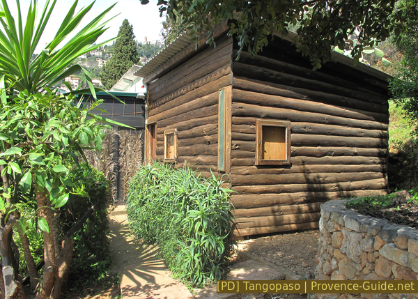
Cabanon Le Corbusier in Massolin
We then reach the underpass under the railway at the start of the hike. Continue straight ahead and at the first possibility on the left go down towards the sea.
We arrive at the Plage du Buse, where Le Corbusier went swimming every day and where he was found dead on 27 August 1965 from a cardiac infarction.
But that shouldn't stop anyone from throwing themselves into the water. The Cabbé train station is just above the beach, so we're almost at the end of the tour.
No reproduction is permitted without the written consent of the author. (id3830)
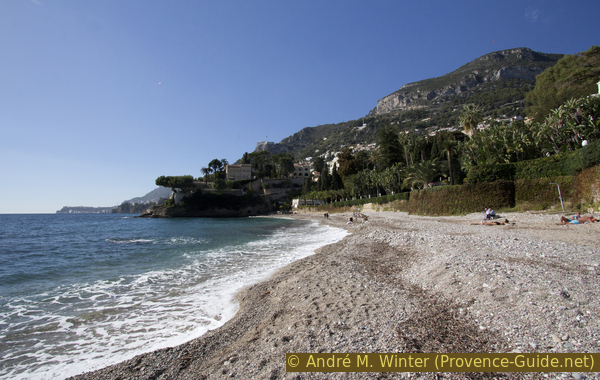
Plage du Buse beach and Pointe Cabbé cape
One of the visible villas from the beach is Villa Casa del Mare. Many celebrities have passed by here. The less posh end: Mobuto, the dictator of Zaire, squandered his people's money here and the villa was finally bought by Russians and probably overtaken 2022 by Ukrainians.
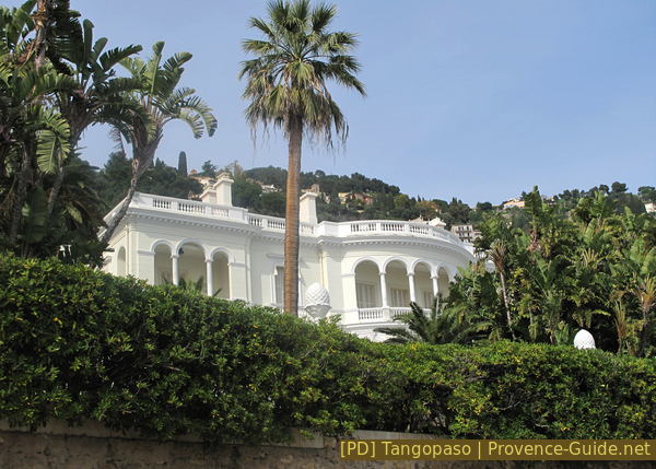
Villa Casa del Mare
vers = to
gare = train station
pointe = cape
plage = beach
We go to the other end of the beach where there is a small restaurant. A path leads up between the buildings and shortly afterwards you will find yourself in the parking lot of the train station, where the tour ends.
Sources and additional information
It is better to use a good topographical hiking map: This tour is on the IGN "Nice, Menton, Côte d'Azur" map, scale 1:25000, 3742OT.
If you don't want to bother with a paper map, you can also use mapping apps on your cell phone. On the one hand, it is the Cartes IGN app from the official map service. However, it requires access to the data network and this is sometimes difficult in canyons or remote locations.
Alternatively, you can use apps that store data directly on the device. They're generally not free, but they don't cost much. We mainly use OSMAnd, here it is possible to add contour lines, relief shading, markings and others. To store this data on your phone you need a lot of space.
Of course, one needs access to satellites for the GPS signal with any app. In some canyons this is not the case. Therefore, do not rely on the position shown, but read the map on your phone as you would read it on paper. Most apps are available for Android and iPhone. The applications usually allow us to record the route travelled and also view the GPS files offered for each of our hikes.
This page has been seen 3738 times since 20 March 2024.
No reproduction is permitted without the written consent of the author. (id3831)
Way from the beach at Pointe Cabbé to the railway station