Chapel of St. Trophime in Robion
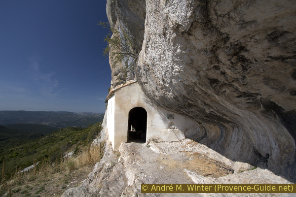
A little church under an overhang in the cliff of the Montagne de Robion
hike
easy
2 h
no
yes
shelter
mountain
Introduction
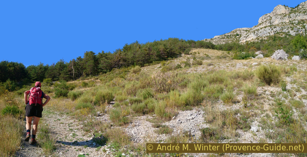
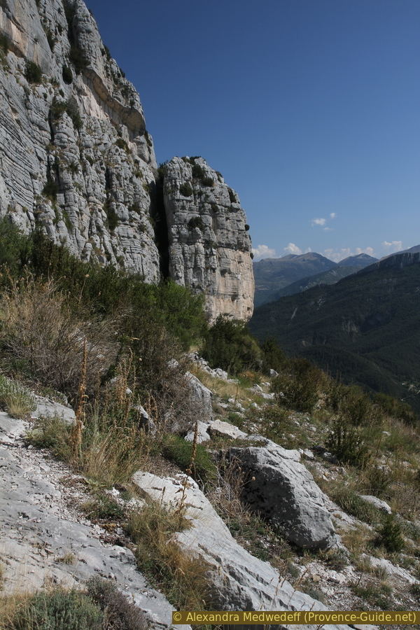
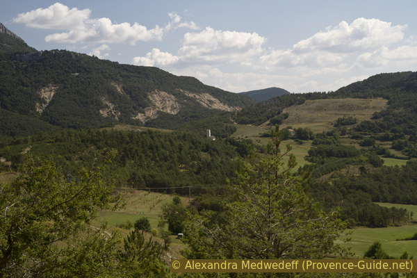
The chapel hangs impressively in the southern rock wall of the Montagne de Robion. We climb via the usual route. It doesn't really spare the pilgrims' legs, the climb is very steep and rocky. Downhill we take a rarely used path that runs closer to the rock wall. This path is mainly used by climbers in winter.
The facts
4,1 km total distance
2 h walk time
320 m total elevation
orientation average
mark 50% of the total distance
45% easy trails
25% hard-surfaced quiet side streets
15% forest roads
10% moderate trails
<5% stairs
dangers southern exposure
children yes
useful picnic stuff
required hiking shoes, hiking gear and water
GPS coordinates (WGS84) of start and end point 43.813477,6.499228
downloads ![]()
![]()
Public transport
No public transport comes close to the starting point, which is 8 km from the centre of Castellane. Castellane can be reached publicly, however, with the long-distance buses from Zou! (only french).
Access by car
You can get to Robion either via Castellane in the north or Comps-sur-Artuby in the south: the road from Castellane is very narrow and forbidden to vehicles over eight meters long, the curves are simply too narrow. At the saddle, at the Chapel Saint-Thyrse, the road branches off to the village of Robion (dead end sign). You pass the driveway to a house with holiday rooms and drive up to the next crossroads.
Useful parking spaces
There is space on the left immediately before the intersection, so that some vehicles can stop. There are a few other options along the road to the left (we'll come back this way at the end of the tour). All of these parking spaces are on the side of the road, they are not public parking spaces. Be careful not to obstruct the field accesses and also not to drive into cultivated land.
Hints
The hike is easy, but it is important to note the south orientation, in summer it is better to start very early.
There is no fresh water along the hike.
The whole region is a zone with a high risk of forest fires. In summer, but also in other seasons when it is very dry or by strong winds, access to the forest areas can be regulated. As a result, the roads may be closed to traffic and/or the trails prohibited to hikers. Current information: Access map to the forests of Alpes de Haute Provence (also english). The map shows the colours green, yellow, orange and red which correspond to levels of danger. The affected area is: Moyen Verdon.
The sections
- Ascent via Le Petit Robion to the chapel in the rock wall
- Descent at the foot of the cliff and through Robion
No reproduction is permitted without the written consent of the author. (id4534)
View from St. Trophime at Robion chapel
Section 1: Petit Robion - Chapelle St. Trophime
➙ 2 km ... 1 h ➚ 315 m ➘ 0 m ↝ average
15% hard-surfaced quiet side streets, without marks
10% forest roads, with marks
15% easy trails, with marks
15% forest roads, few marks
45% easy trails, few marks
<5% stairs, without marks
The clues
- Le Coulet car park, 1063 m
- Hamlet of Le Petit Robion, 1085 m
- End of the forest roads, 1217 m
- Chapel of St. Trophime, 1380 m
Direct ascent to the chapel.
lavoir = wash
From the crossroads we turn right towards the houses of Le Petit Robion. The narrow road rises steeply between large trees. In the course there is a former washing place with a cattle trough.
No reproduction is permitted without the written consent of the author. (id4524)
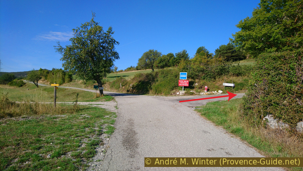
Parking on the left and ascent to the hike on the right
A little further up we come to the houses of the hamlet of Le Petit Robion. After the first house, turn left and then immediately right onto a forest road. A wayside shrine and a signpost stand here. The point that the chapel of St. Trophime is only 1,5 km away is correct, but you also have to take into account the 300 meters of altitude difference that you have to overcome on this route.
No reproduction is permitted without the written consent of the author. (id4525)
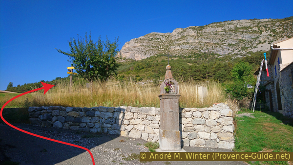
Shrine and the further way up behind it
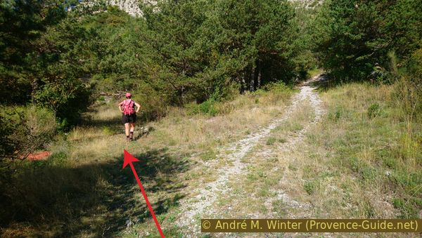
It starts with a wide but rocky forest road that gets progressively steeper. After a few minutes we can leave it via a path on the left, a signpost marks this point. However, the path is no less steep. It cuts off a curve in the forest road that we come across again later.
No reproduction is permitted without the written consent of the author. (id4526)
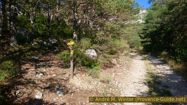
Way to the shortcut of the forest road
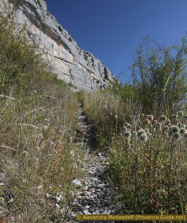
We come to a forest-free area that looks like a wild gravel pit. However, we continue uphill on the marked path to the chapel and pass a signpost at 1170 meters above sea level. We have to remember this crossing for the way back.
No reproduction is permitted without the written consent of the author. (id4527)
Beginning of the steep climb
The forest road now again reaches a more shady forest area, but it is really difficult to walk on: the steepness increases and the stones are not pleasant. However, there is no alternative to this section, everything around is overgrown with prickly wild roses, blackberries and juniper.
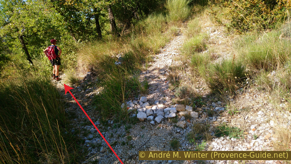
When the forest road becomes a little flatter, the dirt road turns to the right. However, we continue in a straight line, as can be seen in the photo. From now on, we continue on paths that are no longer passable.
No reproduction is permitted without the written consent of the author. (id4528)
Junction at 1217 metres above sea level
It is now a bit flatter and we come to a fork, where we go shortly downhill to the left. On the right side of the path, a barrier is indicated with stones, here we come down on the way back.
No reproduction is permitted without the written consent of the author. (id4529)
Junction at 1260 metres above sea level
The further course of the path is clearly visible and it goes steadily uphill. After a small double bend we see the chapel a little closer for the first time.
No reproduction is permitted without the written consent of the author. (id4530)
First sight of the chapel in the rock wall
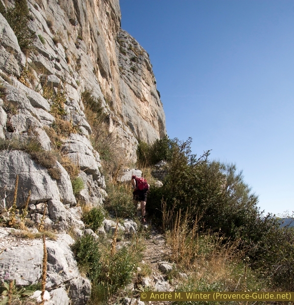
We seem to be passing under the chapel, but this is where the path turns right and we continue uphill in hairpin bends. In the absence of trees, the sun is beating down on the slope and on us hikers.
No reproduction is permitted without the written consent of the author. (id4531)
Ascent after the first bend
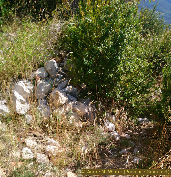
We come to the foot of the wall and cross ruins of old facilities.
No reproduction is permitted without the written consent of the author. (id4532)
Just before reaching the cliffs foot
When we are at the highest point under the rock face, we come to stone stairs and go up here to the left. A steel cable serves as a handrail.
After the collapse of some ruins under the chapel, access was quite dangerous for many years. In 2010, the stairs were rebuilt by volunteers.
No reproduction is permitted without the written consent of the author. (id4533)
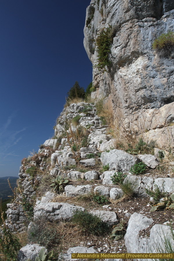
Stone steps up to the chapel
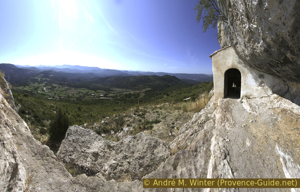
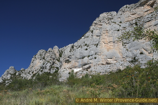
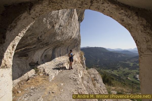
In a short time you are at the top and are standing on a natural platform under an overhang. The chapel without a tower is squeezed into the western part. This area faces south-east and there is hardly any shade here until the afternoon.
No reproduction is permitted without the written consent of the author. (id4535)
St. Trophime chapel in the cliff
But the chapel is open and it stays quite cool even in summer. Inside, a stone wall serves as a bench and further ahead is a simple altar. More recent, rather naïve-looking frescoes cover the masonry.
No reproduction is permitted without the written consent of the author. (id4536)
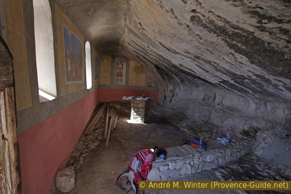
Simple interior of St. Trophime chapel
It is believed that St. Trophime was the first bishop of Arles. This city also has the much more famous cathedral dedicated to the same saint. Little is known about the chapel, it is assumed that it was built in the 17th century on the remains of an older place of worship. This is how Merovingian signs were found, which unfortunately were stolen. A first restoration took place in the 18th century, and several more have recently followed.
No reproduction is permitted without the written consent of the author. (id4537)
Door and natural forecourt of St. Trophime chapel
Section 2: Chapelle St. Trophime - Robion
➙ 2,2 km ... 1 h ➚ 0 m ➘ 315 m ↝ average
<5% stairs, without marks
20% moderate trails, few cairns
10% easy trails, few marks
10% forest roads, few marks
15% easy trails, wrong marks
10% easy trails, without marks
35% hard-surfaced quiet side streets, without marks
The clues
- Chapel St. Trophime, 1380 m
- Along under the rock wall
- junction, 1170 m
- Church Notre-Dame, 1085 m
- Le Coulet, 1063 m
We are looking for a way down that runs closer to the foot of the wall.
First we go down the stone stairs and turn right under the chapel (but you can't see it any more from below). From here you look for a passage on the left between the old stone walls of a sheep farm. So we initially go to the north-east and thus come to a less distinctive downward-leading path.
The path becomes steeper and you cross two hairpin bends marked with cairns.
No reproduction is permitted without the written consent of the author. (id4538)
Cairn along the path at the foot of the wall
In the following course it becomes flatter and you walk along the edge of a rock slab.
On this flatter and more open area, it is worth looking up into the rock face: swallows nest in the small holes in the rock under the large overhang. If you come by in good thermals, you can see vultures circling here.
No reproduction is permitted without the written consent of the author. (id4540)
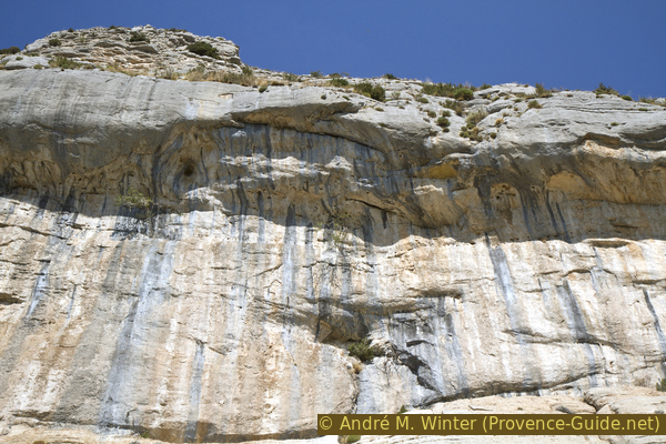
Large overhang in the rock wall of the Montagne de Robion
faille = crevice in rock
Further on, the path climbs up again on the stone slab. Several cairns make it easier to find the way.
In front you can see a massive rock split off from the main rock mass. Our way leads in the direction of the column.
No reproduction is permitted without the written consent of the author. (id4539)
Path at the foot of the rock wall
After the big slab of rock, the path descends again and aims for the large crevice in the rock wall. Shortly afterwards we stand directly under the cliff. Here the path turns to the right and steeper down. It runs between boulders and bushes. Further down it goes over gravel slopes overgrown with grass.
No reproduction is permitted without the written consent of the author. (id4541)
Descent between rocks under the cliff
After a few minutes we reach the ascent path and go down to the left.
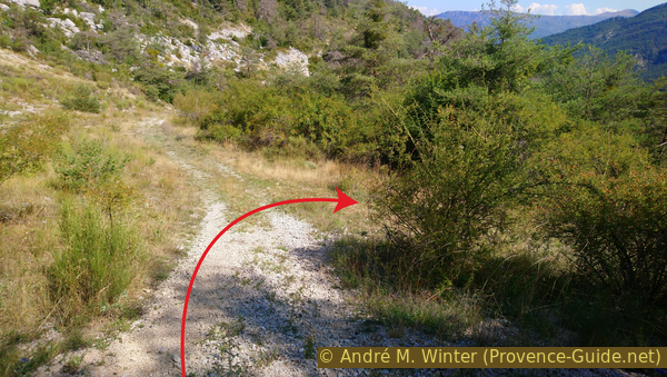
We stay on the path of the ascent for about 300 meters. Unfortunately, this is also the section with the steep and bumpy forest road. Below we come to a crossroads with a signpost to Robion.
On the photo is the said place: at the bush we go to the right!
No reproduction is permitted without the written consent of the author. (id4542)
Junction at 1217 metres above sea level
This new path is a forest road that slowly becomes overgrown. It is flat and has a few weak counter ascents.
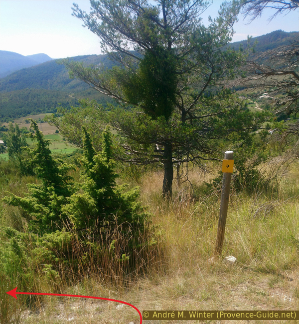
Here we are on a themed path (Sentier toponymique du Déffends), which we already encountered on the way up. It connects sequentially numbered locations and arrows sometimes point the way. We pay attention to such a sign with an arrow on this fairly flat forest road: but contrary to the indication, we go down to the left!
No reproduction is permitted without the written consent of the author. (id4543)
Signpost for the themed trail at Deffends
We follow a water pipe downhill, which doesn't seem to be particularly tight: many water-loving plants grow here that you won't find anywhere else in the area. The course is not very clearly recognizable, you make a wide arc to get to a more open forest road. Here further down and so you can descend next to a field to the road.
No reproduction is permitted without the written consent of the author. (id4544)
Section on forest road
Bottom right and now we go to the end of the tour on asphalt. At the next crossing there is a big tree with a red bench underneath. Behind it is a somewhat clumsy-looking house. It is the church of Robion, the house is built right next to it.
No reproduction is permitted without the written consent of the author. (id4545)
Our Lady of Robion church
At the crossroads we turn left (coming from the church turn right). In front you can see a large sheep pen, our road passes it above.
No reproduction is permitted without the written consent of the author. (id4546)
Pass Sarrayer's farm
You can reach the starting point via this road in a few minutes.
No reproduction is permitted without the written consent of the author. (id4548)
Back at Le Coulet
Below you can see the Chapel Saint-Thyrse. You can reach it on foot in about 15 minutes.
No reproduction is permitted without the written consent of the author. (id4547)
View of the St. Thyrse chapel
Sources and additional information
It is better to use a good topographical hiking map: This tour is on the IGN "Castellane/Lac de Castillon" map, scale 1:25000, 3542OT.
If you don't want to bother with a paper map, you can also use mapping apps on your cell phone. On the one hand, it is the Cartes IGN app from the official map service. However, it requires access to the data network and this is sometimes difficult in canyons or remote locations.
Alternatively, you can use apps that store data directly on the device. They're generally not free, but they don't cost much. We mainly use OSMAnd, here it is possible to add contour lines, relief shading, markings and others. To store this data on your phone you need a lot of space.
Of course, one needs access to satellites for the GPS signal with any app. In some canyons this is not the case. Therefore, do not rely on the position shown, but read the map on your phone as you would read it on paper. Most apps are available for Android and iPhone. The applications usually allow us to record the route travelled and also view the GPS files offered for each of our hikes.
This page has been seen 2127 times since 20 March 2024.
No reproduction is permitted without the written consent of the author. (id4549)
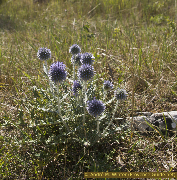
Ruthenian globe thistle