Gorges de Trévans
Tour with insight into the deep cuts
hike
average
2 h 30 min
no
yes
shelter
mountain
Introduction
Unlike other canyons, this one does not bear the name of the body of water that flows through it, which would be the Estoublaisse creek. The name of the Gorges de Trévans comes from the hamlet at the gorge exit. Incidentally, the French word for gorge (gorges) is always in the plural. This canyon, about 200 meters deep, is marked by a ridge on the east side. But above all, the confluence of the Estoublaisse and the Clovion impresses with its vertical cliffs, the narrow gorges and the paths that run in these deep ditches.
Unfortunately, you can't walk along the water for a very long time, the round necessarily has long sections far above. However, the path is very varied. Many visitors only penetrate into the lower area and mostly only in summer. Very few make the full loop.
We suggest doing the itinerary anti-clockwise because the path on the left bank of the Estoublaisse river includes long steep stretches that are better walked uphill. The descent to the east via the Ravin du Pas de l'Escale is less steep.
The facts
8,8 km total distance
2 h 30 min walk time
480 m total elevation
orientation average
mark 95% of the total distance
75% moderate trails
15% easy trails
5% forest roads
<5% hard-surfaced quiet side streets
<5% cross country
dangers hazardous sections, pine processionary caterpillars
children yes
useful picnic stuff
required hiking boots, hiking equipment and water
GPS coordinates (WGS84) of start and end point 43.948319,6.222085
downloads ![]()
![]()
Public transport
The starting point is not accessible by any public transports. Riez can be reached, see the network Zou! (only french). By taxi, it takes 20 km and 30 minutes to reach the starting point.
Access by car
We are north of the Verdon Gorges. The only access to Trévans is through Estoublon, which is on the D907 road between Riez and Digne-les-Bains. The narrow cul-de-sac leads about 4 km to the east to the starting point.
Useful parking spaces
You shouldn't drive up to the hamlet of Trévans, the parking facilities are all in front of the small road bridge over a creek. You can park next to the road or further down on a larger gravel area with picnic benches.
No reproduction is permitted without the written consent of the author. (id4555)
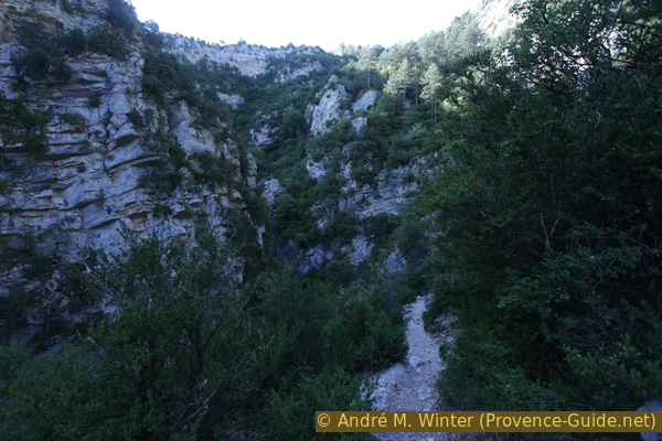
Morning climb in the Gorges de Trévans
No reproduction is permitted without the written consent of the author. (id4550)
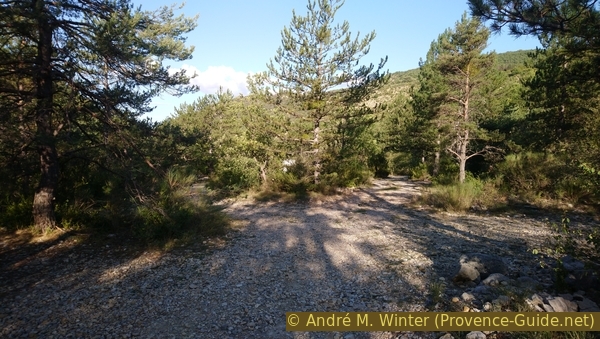
Car park at the entrance to the Trévans gorge
Hints
In winter, the sun hardly penetrates the gorge and rocky sections can be covered with ice and frost, in which case you should not walk this tour. In the summer it can get very warm and many visitors just stay down by the cool creek. In order to be able to hike comfortably in the nice season, you can only start early in the morning. So it is quite shady on the ascent, but on the descent you might be lucky enough to have some sun in the most impressive section.
The whole region is a zone with a high risk of forest fires. In summer, but also in other seasons when it is very dry or by strong winds, access to the forest areas can be regulated. As a result, the roads may be closed to traffic and/or the trails prohibited to hikers. Current information: Access map to the forests of Alpes de Haute Provence (also english). The map shows the colours green, yellow, orange and red which correspond to levels of danger. The affected area is: Forcalquier-Entrevennes.
The sections
- From the car park on the left bank, via the Ravin de Turquet ditch to the Abri de Valbonnette shelter
- Descent from Valbonnette to the Clovion creek and back via the Carrefour des Gorges. Possible access to the gorge of the Clovion creek
Section 1: Trévans - Turquet - Valbonnette
➙ 4,7 km ... 1 h 30 min ➚ 330 m ➘ 185 m ↝ easy
<5% hard-surfaced quiet side streets, without marks
5% forest roads, with marks
15% easy trails, with marks
80% moderate trails, with marks
The clues
- Trévans car park, 600 m
- On a wide path to the Carrefour des Gorges junction, 630 m
- Steep climb to Turquet, 873 m
- More leisurely path to the Abri de Valbonnette shelter, 746 m
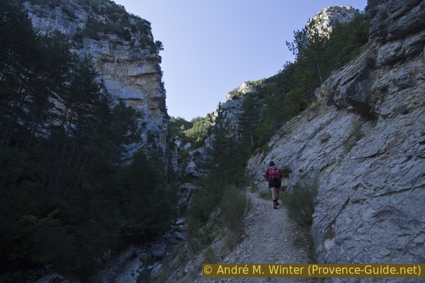
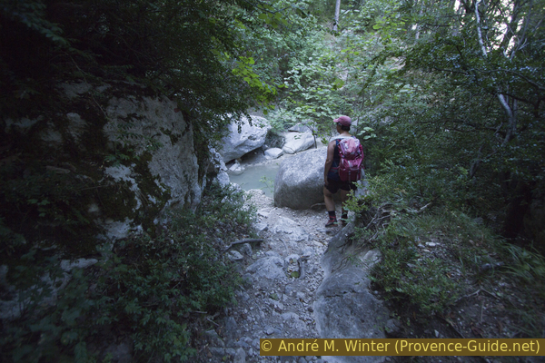
We climb along the main gorge in the Gorges de Trévans.
Access to the dirt road on which the tour begins is after the road bridge. If you leave the lower somewhat overgrown parking lot, you have to go up to the road, turn right and up to the dirt road with the barrier in front. After 200 meters you cross the Estoublaisse stream on a concrete bridge and continue in the same direction on the other bank.
We are to the right of the torrent and the path is still wide here, but no longer passable for traffic. You walk under trees and so you don't see the bottleneck that you will soon pass through. In some places you can descend to the creek, in the basin of which flows turquoise-milky water.
No reproduction is permitted without the written consent of the author. (id4551)
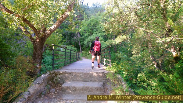
Bridge over the Estoublaisse stream
From below you can see a little better upstream into the following rocky section.
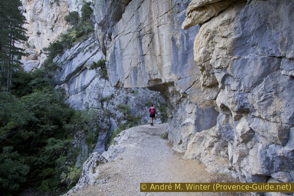
The path approaches the right cliff face and shortly after it enters the cliff face: here it was blasted out.
No reproduction is permitted without the written consent of the author. (id4578)
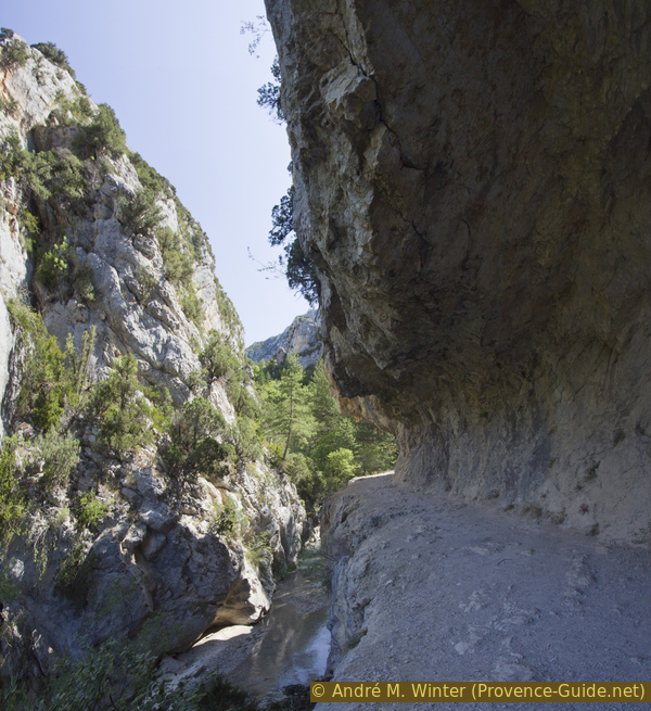
Path blasted into the rock wall
After this narrow stretch, we come to the Carrefour des Gorges junction. Here we turn right up to Turquet. This is our route into the main section of the Gorges de Trévans.
In front of the footbridge a trail follows the Clovion stream (other name: Ravin du Pas de l'Escale), we will come back here at the end of the tour.
No reproduction is permitted without the written consent of the author. (id4552)
Left bank climb in the Gorges du Trévans
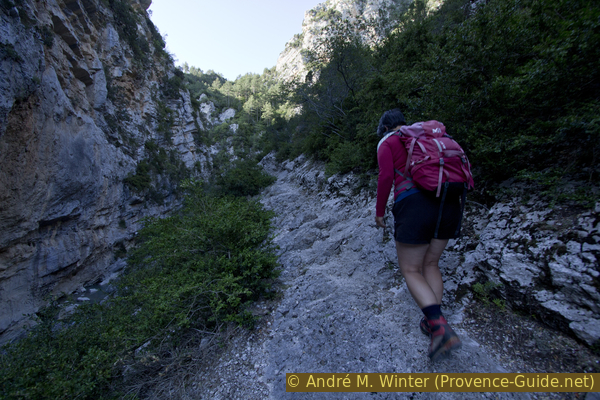
You come through another blasted section, but the rock wall on the other bank of the Estoublaisse is much higher. Immediately afterwards, the path climbs steeply and leads through a varied terrain.
No reproduction is permitted without the written consent of the author. (id4553)
Another section blasted into the rock
It begins with a rocky area that slopes down into the gorge. Although there are many irregular steps, there are no railings. But the section looks wilder than it actually is, as long as you wear good shoes.
No reproduction is permitted without the written consent of the author. (id4554)
Narrow trail on sloping rock
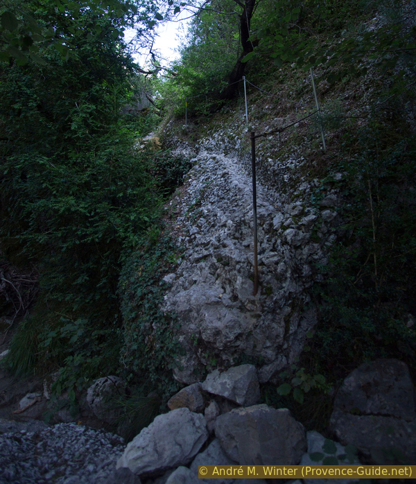
After that, the path climbs steeper and steeper over fine gravel. There are a number of small bends in the way to go through. Some rocky areas have good handrails.
No reproduction is permitted without the written consent of the author. (id4556)
The gorge of the Estoublaisse stream
The path continues to climb. However, when we cross the Ravin de Turquet ditch, the course is no longer so chaotic. You now cross several ditches and the forest becomes higher and denser. At the Turquet junction (a little further than the ditch of the same name), you pass the highest point of the tour.
No reproduction is permitted without the written consent of the author. (id4557)
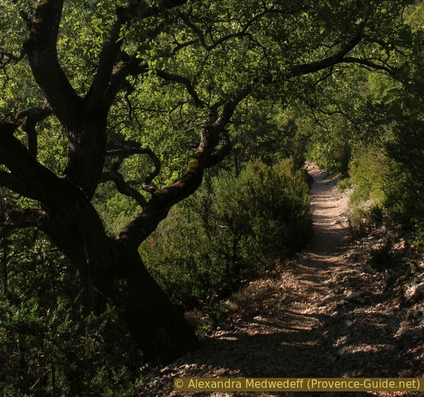
Big oak on the way in the Gorges de Trévans
abri = shelter
Our path now descends slightly and, after a curve, we cross the ruins of the hamlet of Hameau de Valbonnette, abandoned since the 1930s. Silent walls stand under tall trees. You can still see an oven.
No reproduction is permitted without the written consent of the author. (id4558)
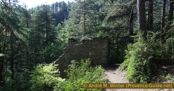
Hameau de Valbonnette
Then we come to a fork in a dark valley. We take the path to the left further down.
No reproduction is permitted without the written consent of the author. (id4559)
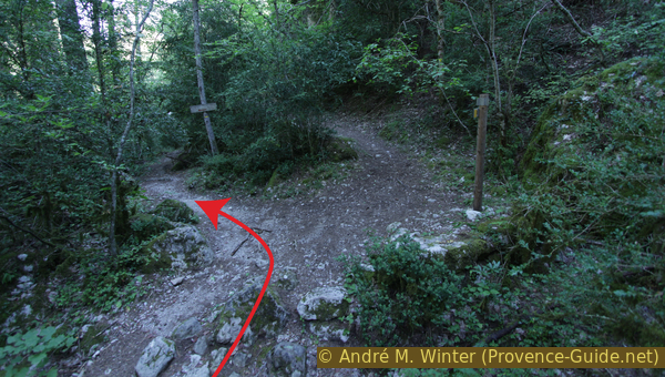
Crossroads in the Ravin de Mayaiche ditch
After a right turn we are in a large clearing. It is called Jardins de Valbonnette and these were the fields of the ruined hamlet seen before. Immediately to the right is a dilapidated shelter. Only the walls and roof are left. Doors, windows and the interior are missing. The beams are rotting and it is not clear whether sheltering here during a thunderstorm is advisable.
The meadow, on the other hand, is very suitable for a well-deserved break. We are now at the end of the first section of the tour. The valley in which we are is that of the Estoublaisse creek and it forms the narrow gorge further down.
No reproduction is permitted without the written consent of the author. (id4560)
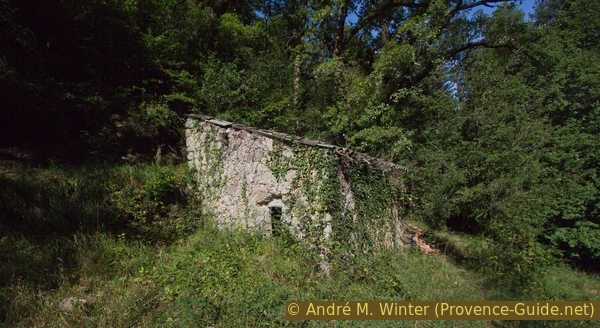
Shelter Abri de Valbonnette
Section 2: Valbonnette - le Clovion - Trévans
➙ 4,2 km ... 1 h ➚ 145 m ➘ 290 m ↝ easy
70% moderate trails, with marks
<5% cross country, without marks
5% moderate trails, with marks
<5% cross country, without marks
15% easy trails, with marks
5% forest roads, with marks
<5% hard-surfaced quiet side streets, without marks
The clues
- Shelter Abri de Valbonnette, 746 m
- Continue under the ridge to Carrefour St. André, 795 m
- Crossing of the Le Clovion creek, 650 m
- Breakthrough of the Clovion
- Carrefour des Gorges junction, 630 m
- Trévans car park, 600 m
Ascent on the right bank of the Gorges de Trévans and finding the Clovion Gorge.
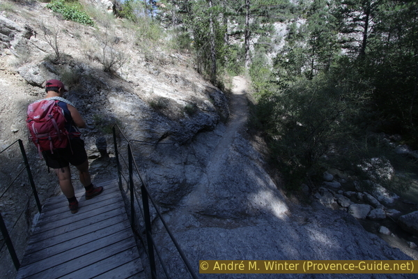
From the shelter we go down to the creek and here we go slightly upstream to the right. We come to a footbridge that leads directly into a scree heap. However, you can go down to the right and continue along the shore.
No reproduction is permitted without the written consent of the author. (id4561)
Passerelle de Valbonnette footbridge
The path was apparently obstructed by scree. A few meters ahead it leads up again. A path has been cut into the rock for this purpose.
No reproduction is permitted without the written consent of the author. (id4562)
Rocky climb after the footbridge
In the further course, we continue crossing the slope slightly uphill. We cross some screes, which here consist of relatively small stones.
No reproduction is permitted without the written consent of the author. (id4563)
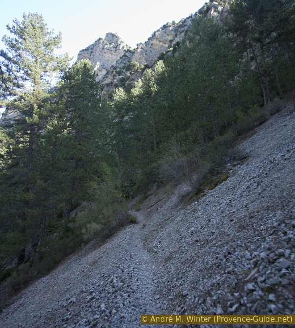
The path crosses scree slopes
We also see here pines suffering from drought and the pine processionary moth: its caterpillars eat the needles of the trees.
On this section of the trail we also pass the Carrefour St. André junction. It is the highest point of this section, from here it is mainly downhill.
From here you can reach the St. André chapel (300 meters and 100 meters in altitude). The ruins of a former monastery have been stabilized 2022 and can therefore be accessed again.
No reproduction is permitted without the written consent of the author. (id4564)
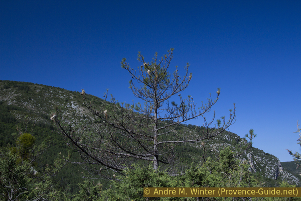
Pine with nests of pine processionary caterpillars
The path runs under the ruins without being seen from below. The area is a bit rockier but the path is well laid out. You don't see down into the gorge either, it's deep down and hidden by the trees.
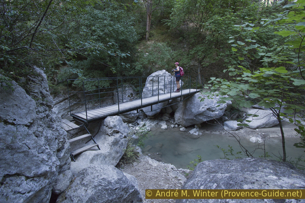
When the path makes a sharp right turn, we go to the valley of the Clovion stream. The terrain is now less steep and the forest is higher and darker again here on the north slope. Arriving at the bottom, we can cross the creek over two footbridges.
No reproduction is permitted without the written consent of the author. (id4565)
Passerelles du ravin du Pas de l'Escale footbridges
On the other side of the creek we turn left and thus we change direction, from now on we go downstream. After a while, on the right, there is a fairly smooth rock face with an engraved inscription: natura numquat errat (nature never makes mistakes). The Dutch artist Herman de Vries left this message.
No reproduction is permitted without the written consent of the author. (id4566)
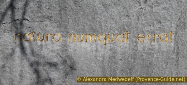
natura numquat errat
After this unexpected engraved message, the path crosses the ridge without changing direction. The Clovion stream turns into an extremely narrow gorge further down, so we have to go to the side valley and descend there. Further down we come to the same water course again, we can look at the breakthrough there.
Our path now goes steeper downhill, in places it leads over short hairpin bends.
No reproduction is permitted without the written consent of the author. (id4567)
Steep descent to the Carrefour des Gorges crossroads
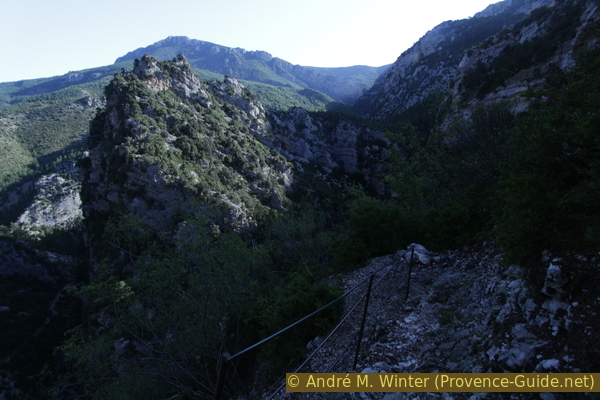
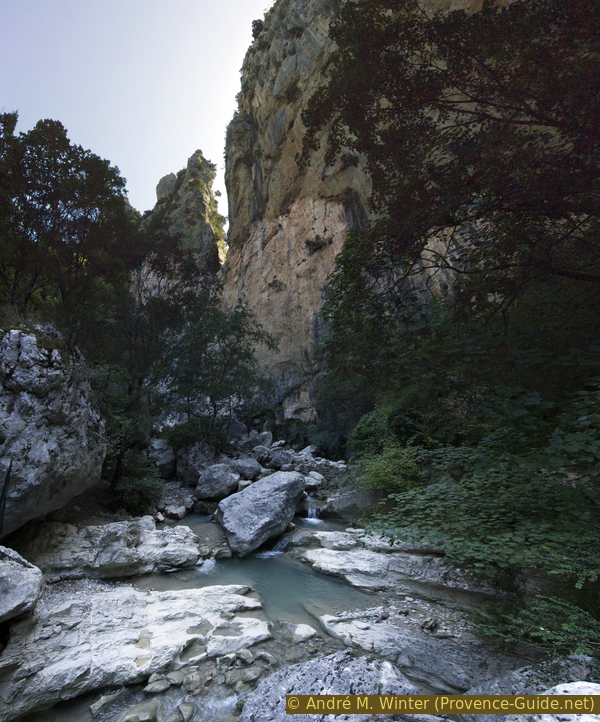
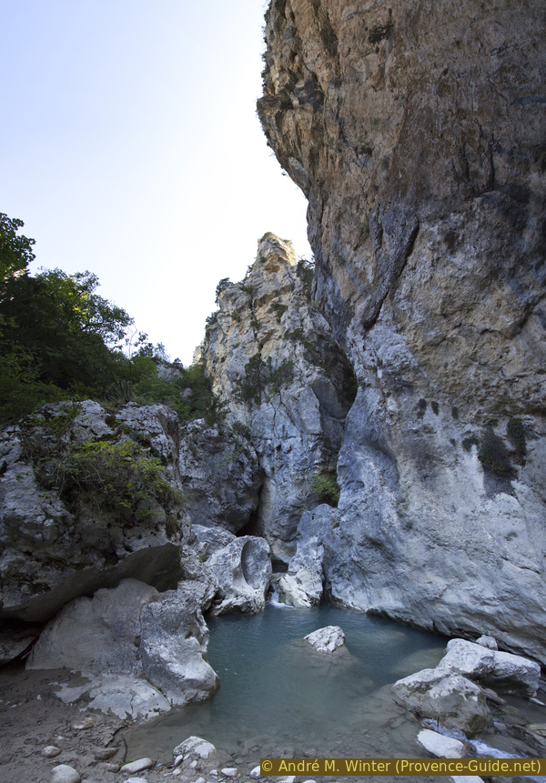
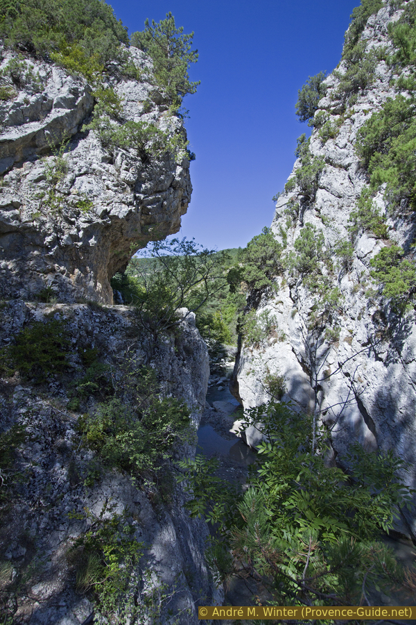
Before we get to the bottom, another steep step offers a good view of the gorge of the Estoublaisse stream, through which we walked at the beginning of the tour.
No reproduction is permitted without the written consent of the author. (id2659)
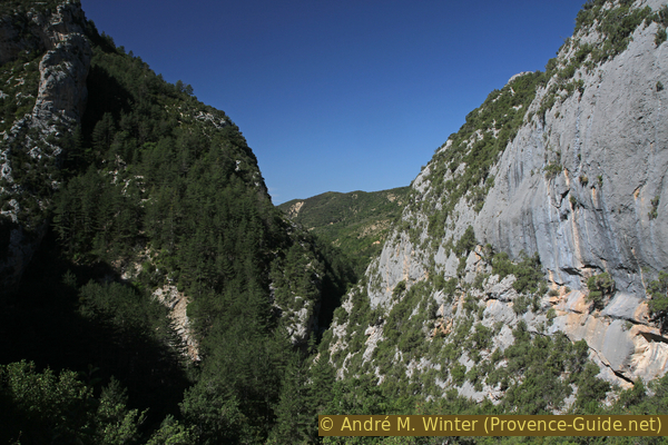
Gorges de Trévans under the Aiglier mountain
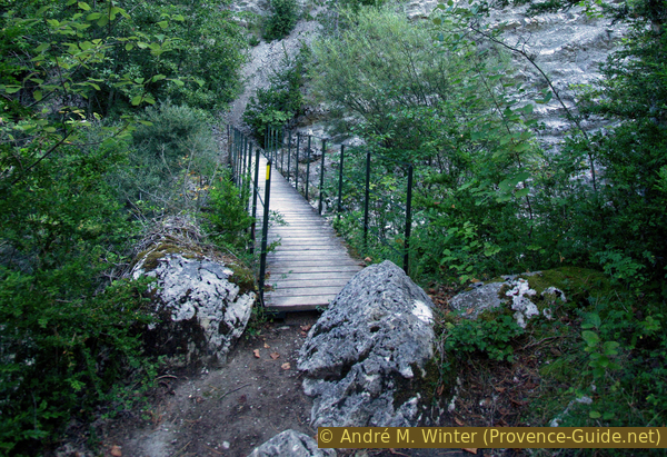
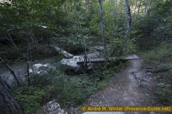
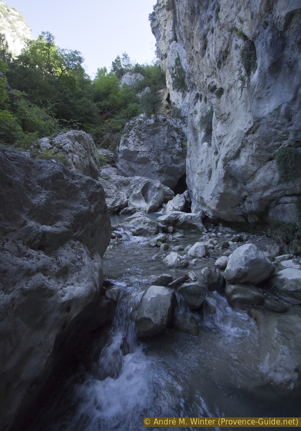
Below we come to a river. It's the Clovion again, flowing along comfortably. There is a footbridge behind the rock.
No reproduction is permitted without the written consent of the author. (id4569)
Rocks in front of the footbridge over Le Clovion creek
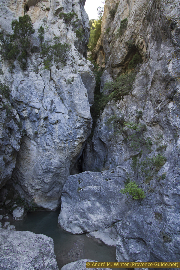
The photo is taken from the footbridge. You can see the deep cut in the rock face behind. You can now proceed along the shore, but it is obstructed with large boulders. The other bank consists of a vertical rock wall.
So, without crossing the stream, let's go upstream to see the Clobion gorge. Attention, this is only possible if not much more water flows in the stream than in the pictures!
No reproduction is permitted without the written consent of the author. (id4571)
Le Clovion downstream of the bottleneck
First you bypass a rock on the water side. A round stone seems to support the large rock, but the stone is probably just wedged underneath.
No reproduction is permitted without the written consent of the author. (id4572)
Stone under larger boulder
After that it gets more complicated: the deeper water gets close to big boulders, so we have to avoid them onshore, like the smooth rock that follows. You have to squeeze through bushes and climb over deadwood and crevices in the stone jumble.
No reproduction is permitted without the written consent of the author. (id4573)
Advance to the bottleneck
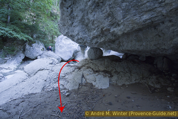
Behind it follows another rock, this one is sparsely overgrown. However, you can see that we are approaching the breakthrough. We climb this rock and then we are right in front of it!
No reproduction is permitted without the written consent of the author. (id4574)
Just below the bottleneck
The breakthrough is very narrow, even from the good location you can't see far in. If there is less water, you can take a few steps into the bottleneck, but you have to be careful with every step: such cuts form scours in the bedrock. If these are filled with sand or mud and the stream washes through them at the same time, the supposedly solid ground can give way and you sink in like in water!
No reproduction is permitted without the written consent of the author. (id2547)
Breakthrough of the Clovion creek
After this vantage point, which is quite difficult to reach, we return to the footbridge at the rock.
We cross the footbridge and continue down the river on the path.
No reproduction is permitted without the written consent of the author. (id4570)
Pedestrian bridge over the Clovion creek
Shortly thereafter another footbridge follows. This time we cross the Estoublaisse stream. On the other bank our path climbs to a well-known junction, we are back at the Carrefour des Gorges. The name comes from the confluence of the Estoublaisse and Clovion streams, which takes place a little further ahead.
No reproduction is permitted without the written consent of the author. (id4576)
Footbridge under the Carrefour des Gorges
Before we go through the bottleneck again with the path blasted into the rock wall, you can proceed to the right on a kind of natural platform in the direction of the water. From there you have a good view of the bottleneck.
Back on the trail, we go back to the parking lot and the starting point. On the way you can descend to the creek at several points. That also works below the lower parking lot.
No reproduction is permitted without the written consent of the author. (id4577)
Gorge of the Estoublaisse creek
Sources and additional information
It is better to use a good topographical hiking map: this tour is on the IGN map "Barrême, Vallée de l'Asse, PNR du Verdon", scale 1:25000, 3441OT.
If you don't want to bother with a paper map, you can also use mapping apps on your cell phone. On the one hand, it is the Cartes IGN app from the official map service. However, it requires access to the data network and this is sometimes difficult in canyons or remote locations.
Alternatively, you can use apps that store data directly on the device. They're generally not free, but they don't cost much. We mainly use OSMAnd, here it is possible to add contour lines, relief shading, markings and others. To store this data on your phone you need a lot of space.
Of course, one needs access to satellites for the GPS signal with any app. In some canyons this is not the case. Therefore, do not rely on the position shown, but read the map on your phone as you would read it on paper. Most apps are available for Android and iPhone. The applications usually allow us to record the route travelled and also view the GPS files offered for each of our hikes.
This page has been seen 2419 times since 20 March 2024.
No reproduction is permitted without the written consent of the author. (id4579)
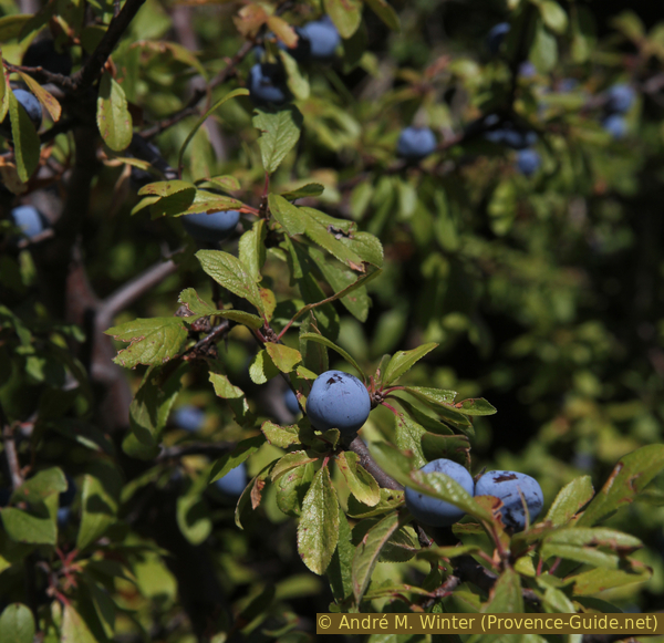
Blackthorn at the gorge exit