Passage cave Grotte du Trou de l'Argent
A small via ferrata with a cave on the way
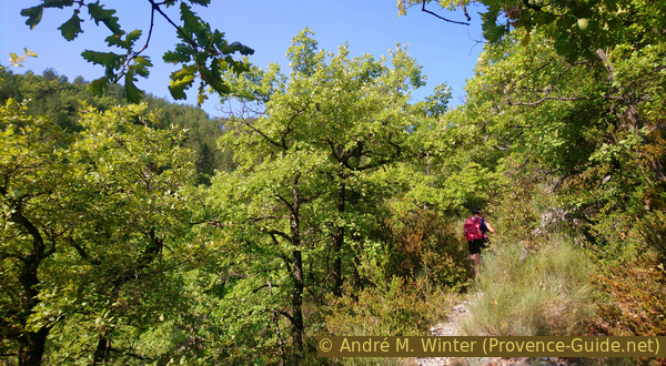
scramble
difficult
3 h 30 min
no
yes
shelter
mountain
Introduction
When you are in Sisteron, you can see a prominent rock ridge to the east. There are many ridges of this type in Provence, but this one is special: it is called Montagne de la Baume, Baume is the Provençal word for cave. Our way to the summit leads through the eponymous cave! The natural corridor in the rock ridge is irregular and has several openings to the south, one stands as if on balconies in the middle of the rock wall. These openings let light into the cave, but there are also dark sections where a headlamp is necessary. There are insured sections before and after the cave.
It is a difficult mountain tour to the top of the Montagne de la Baume. There are exposed passages that are secured with steel cables. However, the path is marked as a normal hiking trail. The cave section is partly very narrow and not very high, you have to crawl. The ground consists of fine and dusty earth, you will certainly not come out of the natural passage completely clean. The way back leads partly without a path over screes on the north slope, here high mountain boots are absolutely necessary.
The circuit through the cave and to the summit is usually made from Sisteron, but the variant presented here has its start and end point in Entrepierres on the east of the ridge. The paths here are much less frequented and very steep. However, you also save around 100 metres in altitude because you start from higher.
The facts
6,5 km total distance
3 h 30 min walk time
680 m total elevation
orientation difficult
mark 50% of the total distance
40% moderate trails
30% easy trails
10% hard-to-recognize trails
10% cross country
5% hard-surfaced quiet side streets
5% forest roads
<5% trail through a cave
<5% exposed trails
<5% via ferrata
dangers via ferrata, cave, gravel fields
children from 10 years with appropriate mountain experience
useful picnic stuff
required hiking boots, hiking gear, flash-light and water
difficulty level UIAA 1 (three points rule)
Difficulty level via ferrata F (easy)
GPS coordinates (WGS84) of start and end point 44.198575,5.990183
downloads ![]()
![]()
Public transport
There is no public transport in the area east of Sisteron and the Durance. The starting point is around 10 km from the centre of Sisteron.
You can also access the mountain from the west. You start at the bridge under the castle: after crossing the Durance, turn right and soon left onto Rue du Rocher. Immediately afterwards turn right again and now follow the signs and markings to the Montagne de Baume. In section 2 you come across the hike presented here. In section 3, go straight on to the Col de Mézien road saddle and then turn left back to Sisteron.
Access by car
The walk is east of Sisteron and the Durance. By car, the area is usually accessed via the A51 motorway, taking exit 22 (Sisteron Centre, Vallée du Jabron). At the roundabout, take the first exit on the right towards Volonne. As soon as the road becomes dead straight, look out for a crossroads: here we have to turn left onto the D217 to Entrepierres.
This road is narrower and after a few curves we come to the new part of the village of Entrepierres. You can see the school building on the right side of the street. Instead of following the road to the right, we drive straight up the ramp to the north to get to the old village of Entrepierres.
Continue beyond the village towards the north for a little over 150 meters to cross a bridge. Just after there is a parking space on the left.
Useful parking spaces
North of the old village, just after the bridge.
No reproduction is permitted without the written consent of the author. (id4505)
West exit of the Grotte du Trou de l'Argent
Hints
For this tour, all participants need good orientation skills in pathless terrain, experience in climbing, exploring caves and slopes, and a head for heights. This round is challenging. The ridge is wooded but exposed, you should avoid the tour in strong winds and when there is a risk of thunderstorms. The round is described in a clockwise direction, so the via ferrata are to be climbed upwards.
The whole region is a zone with a high risk of forest fires. In summer, but also in other seasons when it is very dry or by strong winds, access to the forest areas can be regulated. As a result, the roads may be closed to traffic and/or the trails prohibited to hikers. Current information: Access map to the forests of Alpes de Haute Provence (only french). The map shows the colours green, yellow, orange and red which correspond to levels of danger.
The sections
- Entrepierres - Hauts de Montuery
- Grotte du Trou de l'Argent - Summit of the Montagne de la Baume - Western ridge
- North face - descending towards the pass Col de Mézien - Beaudouze - le Détroit - Entrepierres
No reproduction is permitted without the written consent of the author. (id4487)
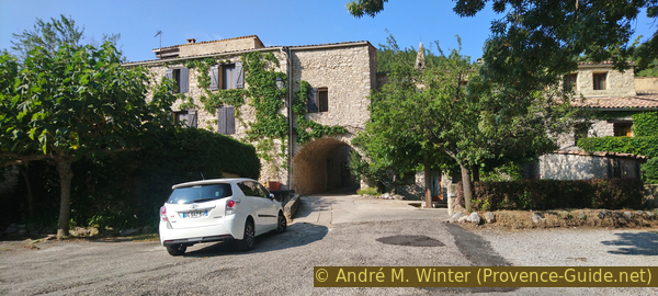
Village square and passage in Entrepierres
Section 1: Entrepierres - Hauts de Montuery
➙ 2,8 km ... 1 h 30 min ➚ 470 m ➘ 30 m ↝ average
15% hard-surfaced quiet side streets, without marks
5% forest roads, without marks
40% moderate trails, without marks
20% hard-to-recognize trails, without marks
20% moderate trails, with marks
The clues
- Through the village of Entrepierres, 600 m
- Through a valley to the Hauts de Montuery plateau, 905 m
We go directly to the entrance of the cave via the southern flanks.
vers = to
source captée = spring tapping
The access is easy to find: return on foot to the village and pass under the big arch. Further up we pass the 17th-century church Église St. Marc.
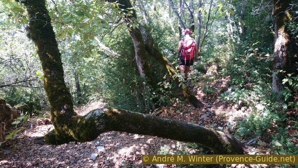
Here we are on an alley that already indicates the further direction. It quickly becomes a forest road. It's already noticeably uphill and later it gets even steeper. At the beginning we pass under large oak trees, which find plenty of water here.
The forest road ends at a spring tapping point, beyond that a simple path continues in the same direction as before. 100 metres later, the path makes its first double bend. The distances are difficult to estimate because of the steepness, you start sweating from the church.
No reproduction is permitted without the written consent of the author. (id4488)
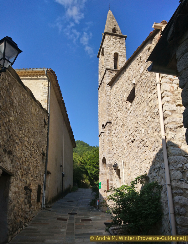
St. Marc church in Entrepierres
The path is not marked, but you can still find old red and white markings from the long-distance hiking trail GR6, which used to go through here. It is a former connecting path, in places it is supported by old dry stone walls. We walk further up and another double bend follows. The path then leads to several deeply cut gullies. To avoid them, the path climbs even more steeply and stays to the right of the first gully.
No reproduction is permitted without the written consent of the author. (id4489)
On the way up from Entrepierres
vers = to
prés = pasture
ravin = ravine
crête = crest
However, at about 890 meters above sea level, the path suddenly turns left to cross the gullies at this somewhat more favorable point. A piece of wood blocks the path that would lead further up, but is badly overgrown. After this curve, the path is flat and leads slightly downhill in places, you can relax here for about 10 minutes from the previously steep climb.
No reproduction is permitted without the written consent of the author. (id4490)
Trenches to be crossed between Entrepierres and Montuery
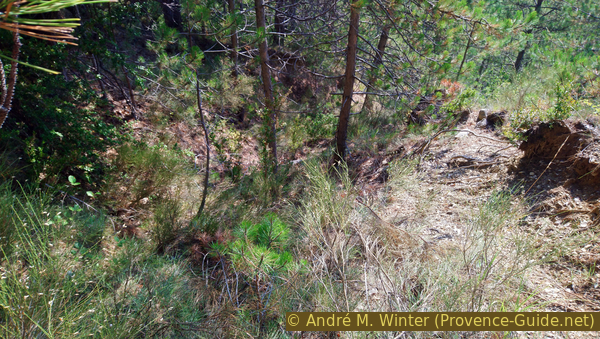
After the ditches, the path heads south-west across pastures that the forest has reclaimed. Suddenly you are on a forest road. On the IGN hiking map, the point is marked with elevation 867. In 2019, the forest road was freshly gravelled up to here. We are on the meadows of Montuery.
No reproduction is permitted without the written consent of the author. (id4491)
Forest road at point 867
Here we go up to an open area on the right. In 2019, the area was freshly cleared and no path was seen. At the field, however, we have to turn left to west-north-west and thus climb roughly parallel under the ridge.
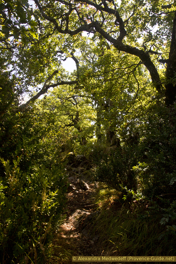
Traces can be seen again in the upper free field. These turn into a path that continues in the same direction. At the end of the last meadow, you enter the oak forest, which apparently grows on former pastures.
No reproduction is permitted without the written consent of the author. (id4492)
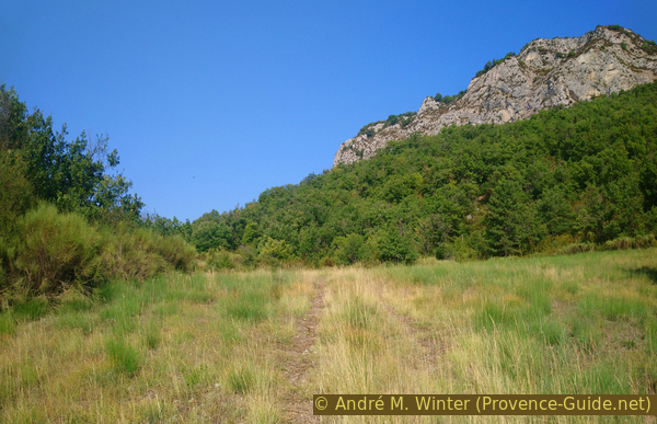
Meadows south of the Montagne de la Baume
We go flat through the low forest and you could really get used to it. A ruin brings some variety and shortly afterwards the path is blocked off with branches. But this applies to those coming up from Sisteron, we climb over it and find a wider path behind. This point is 905 meters above sea level.
No reproduction is permitted without the written consent of the author. (id4493)
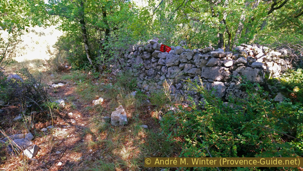
Ruins above Montuery
Section 2: Grotte du Trou de l'Argent - Mt. de la Baume
➙ 0,6 km ... 45 min ➚ 130 m ➘ 50 m ↝ difficult
<5% via ferrata, with marks
15% trail through a cave, without marks
5% exposed trails, few cairns
5% via ferrata, with marks
5% exposed trails, few cairns
5% via ferrata, with marks
5% exposed trails, few cairns
30% easy trails, with marks
35% easy trails, faulty marks
The clues
- Steep climb to the entrance of the cave, 1040 m
- Crossing the Grotte du Trou de l'Argent
- Ascent over secured rock areas to the ridge, 1120 m
- East to the summit and back again, 1147 m
- Continue to the western part of the ridge, 1100 m
This is the heart of the tour and the most challenging part.
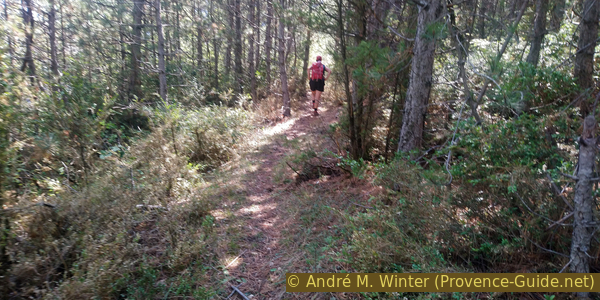
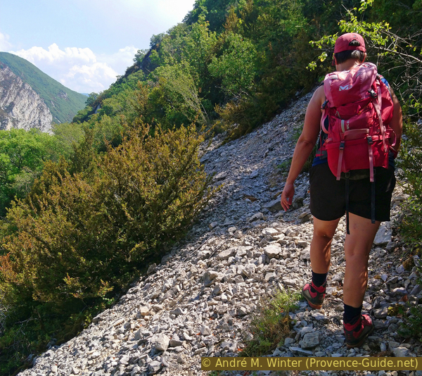
We are now on a wider path marked in yellow up to the cave. It's uphill again and as before, it quickly becomes much steeper. In the forest, you climb in the direction of fall on washed-out paths.
No reproduction is permitted without the written consent of the author. (id4494)
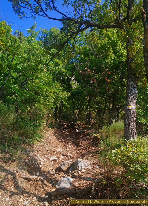
Washed out path in the south of the cliff
You get to the foot of the wall and to two cave entrances in the rock face quite quickly. You can climb up, but they are only short semi-caves that have no connection to the Grotte du Trou de l'Argent. The marking in the shape of a cross also indicates this.
No reproduction is permitted without the written consent of the author. (id4495)
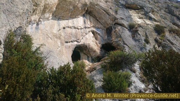
Half-caves in the rock face
Another yellow mark indicates that you should go along the rock wall to the right.
No reproduction is permitted without the written consent of the author. (id4496)
Crossing at the foot of the wall
You quickly advance to another hole in the rock face. You can see a steel cable and step bars, this is where you get into the Grotte du Trou de l'Argent. A plaque reminds of the difficulty of the section and the need for a flash-light.
No reproduction is permitted without the written consent of the author. (id4497)
East access to the Grotte du Trou de l'Argent
With the climbing aids you get into the entrance area and into a first chamber. From here you can see well back to the south.
No reproduction is permitted without the written consent of the author. (id4498)
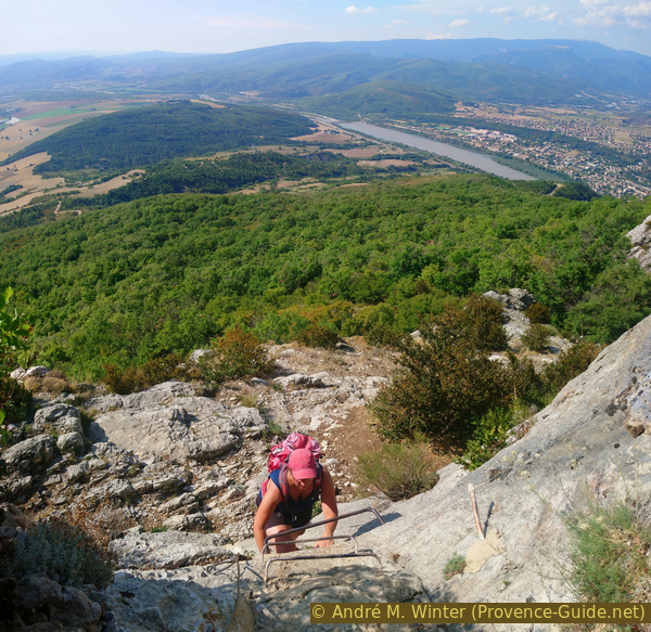
Ascent to the Grotte du Trou de l'Argent
Go to the end of this first chamber and turn left there. Light can be seen in the front, that's where we go to. The ground is quite uneven, you have to cross rocky ridges, but it's still quite easy here, as the daylight illuminates everything.
No reproduction is permitted without the written consent of the author. (id4499)
View to the first window in the Grotte du Trou de l'Argent
If you go to the first two openings in the rock, the ceiling gets lower and lower and you have to be really careful, stone is always harder than your head.
The natural openings form veritable balconies in the rock wall. You can still see south, but it's more impressive here: you feel like you're inside a castle.
No reproduction is permitted without the written consent of the author. (id4500)
View from the first opening of the cave to Vilhosc
In the middle of the long corridor, a hiker left his mark in 1865.
No reproduction is permitted without the written consent of the author. (id4501)
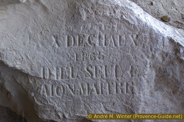
Engraved text in the Grotte du Trou de l'Argent
We continue along this corridor to a last opening, the ceiling height varies.
No reproduction is permitted without the written consent of the author. (id4502)
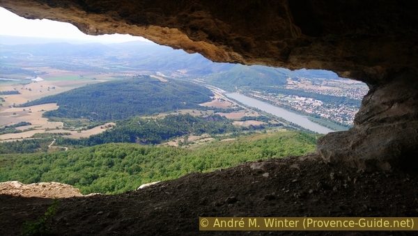
The River Durance seen from the last window of the cave
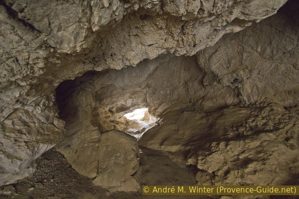
After that you need a good light source, we are now in an area that is not sufficiently illuminated by daylight. We are in a large hall and initially you look in vain for an exit. However, you have to keep the original direction and climb to the upper part of the hall, where it is completely dark.
You will then see a glimmer of light at the top left, which you target now. However, before you can get out of this narrowing tube, a transverse stone slab blocks the way. You have to go through to the right and in any case take off your backpack.
No reproduction is permitted without the written consent of the author. (id4503)
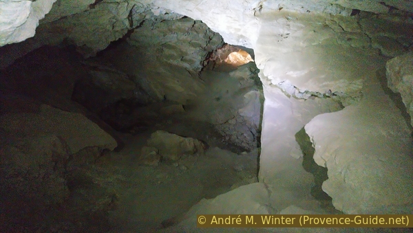
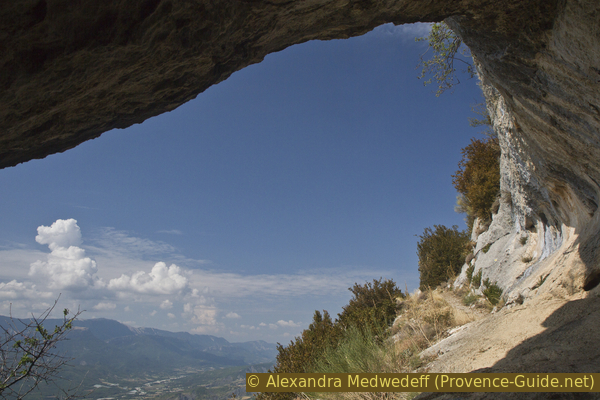
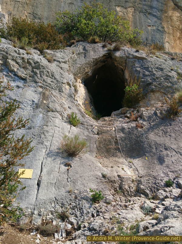
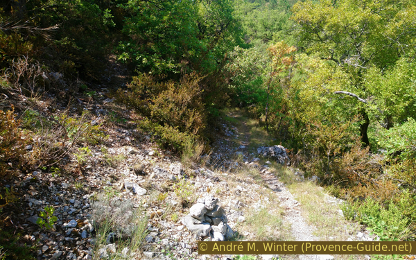
Walk to the west exit from the Grotte du Trou de l'Argent
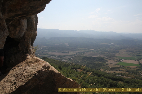
Under an overhang, we come back into the light of day. You didn't gain much height that way, but we are now one rock step higher and thus in an area where it is easier to get up the ridge.
No reproduction is permitted without the written consent of the author. (id4504)
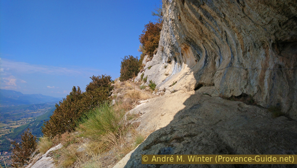
West exit of the Grotte du Trou de l'Argent
The rest of the way is clearly and well marked, you follow a ledge into the slope and find more metal insurence there.
No reproduction is permitted without the written consent of the author. (id4506)
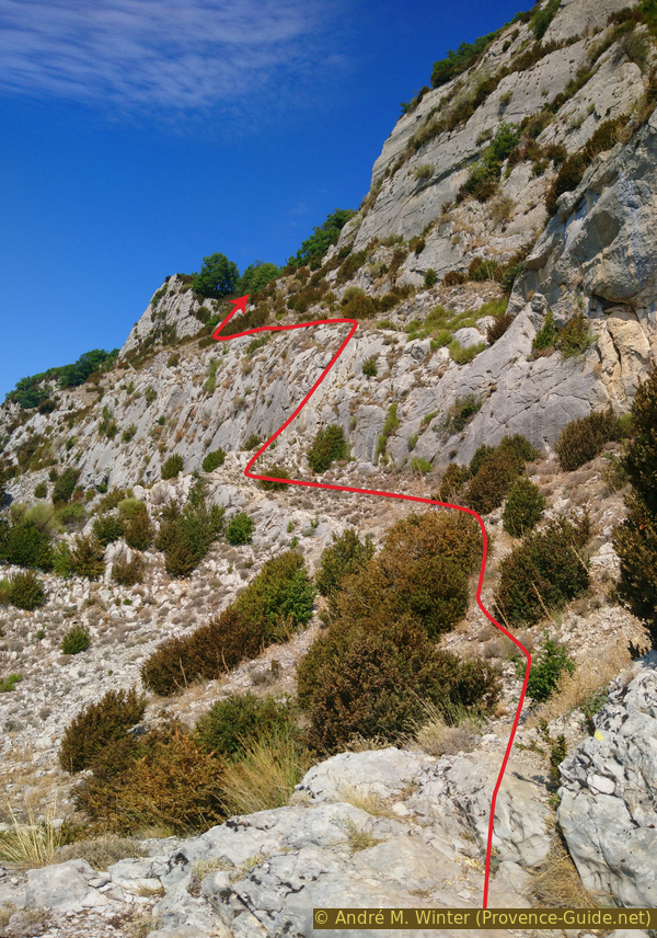
The climb after the cave
The most difficult area is right at the beginning of the further ascent. You have to climb up and traverse under the steel cable to the right. The rope hangs at the right height for your hands, but you have to look for the rock steps for your feet.
No reproduction is permitted without the written consent of the author. (id4507)
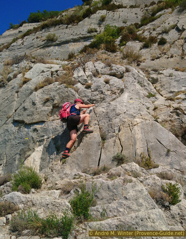
First rocky section after the Grotte du Trou de l'Argent
Further up, the path leads between rocks and bushes, cairns point up to another spot with a steel cable. The rock has large steps here and so you can quickly get up to the crest of the mountain.
No reproduction is permitted without the written consent of the author. (id4508)
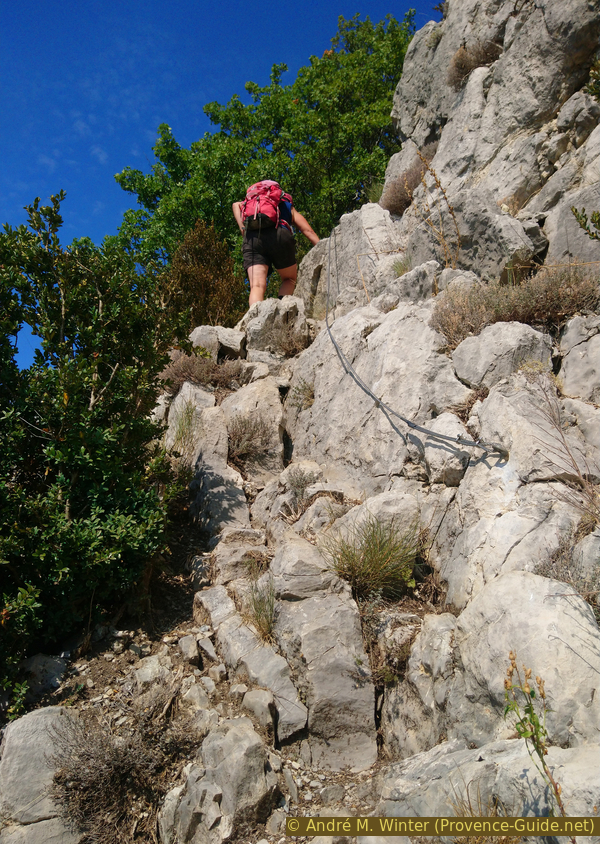
The second section with a steel cable below the ridge line
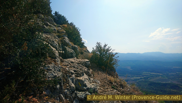
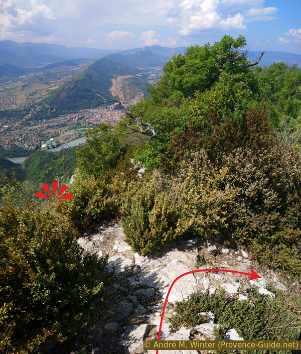
At the top, we keep to the right and take the easy path along the ridge to be at the summit in a few minutes.
The photo shows the view back to the saddle with the ascent on the bottom left.
No reproduction is permitted without the written consent of the author. (id4509)
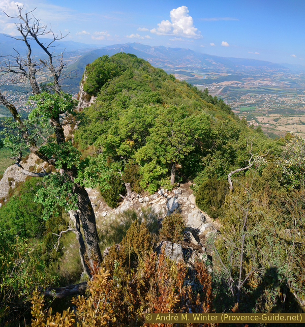
Looking west over the crest of the Montagne de la Baume
The summit is the only area with a clear all-round view, on the rest of the way are too many trees. You don't see all of Sisteron from here. We need a little more patience for this, as you go down you will have a view of the entire old town.
No reproduction is permitted without the written consent of the author. (id4511)
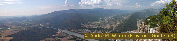
Durance valley seen from Montagne de la Baume
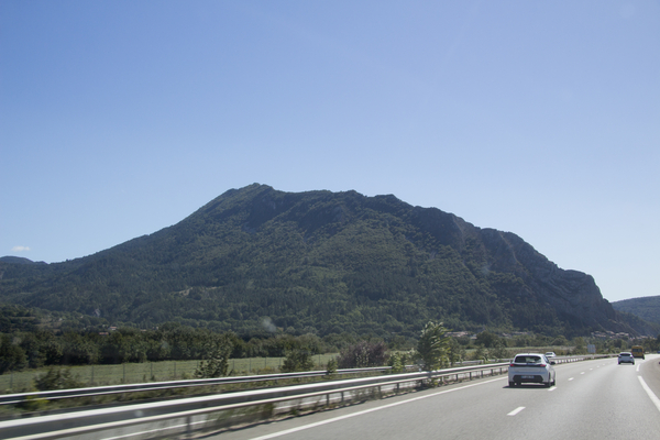
In the north and east you can see imposing rock ridges and the peaks of the Alps.
No reproduction is permitted without the written consent of the author. (id4512)
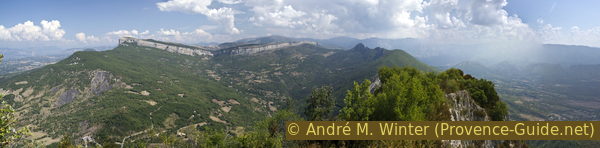
Montagne de Gache north of the Montagne de la Baume
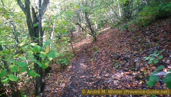
The eastern part of our ridge is overgrown, so we turn around at the summit and go back into the saddle. There, however, continue along the ridge for about 400 metres. We stay under tall oak trees almost all the time. The few views point to the south.
No reproduction is permitted without the written consent of the author. (id4510)
Gnarled oaks on the crest of the Montagne de la Baume
After a few minutes, however, the path, which is not so clearly visible, turns slightly to the right.
No reproduction is permitted without the written consent of the author. (id4513)
Here we go slightly to the right
A little further ahead we come to the southern edge again with an open area between the trees. The entire old town of Sisteron including the castle complex (Citadelle) is now in view.
No reproduction is permitted without the written consent of the author. (id4515)
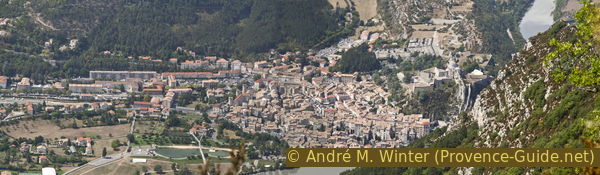
View of the town of Sisteron
You should enjoy this proverbially unique sight, if you descend briefly to the left you have a better view. With the telephoto lens you can see the city in detail.
The path finally turns to the right and we go down on the shady side of the mountain.
No reproduction is permitted without the written consent of the author. (id4514)
Viewpoint on Sisteron in the hairpin bend on the ridge
Section 3: L'Ubac - Beaudouze - le Détroit - Entrepierres
➙ 3,1 km ... 1 h 15 min ➚ 75 m ➘ 595 m ↝ very challenging
35% easy trails, faulty marks
15% easy trails, without marks
5% hard-to-recognize trails, without marks
20% cross country, old marks
30% moderate trails, few marks
The clues
- Steep descent through the north-facing forest, 840 m
- Counter ascent to a water hole, 870 m
- Traversing scree
- Further pathless descent
- Return to the starting point via an old mountain bike route.
This descent is no less steep than the ascent. The knees and thighs will surely suffer.
At the last viewpoint on Sisteron the path turns right and onto the north side of the ridge. On the descent, the environment suddenly changes: the forest is denser and much darker. The name Ubac is Provençal and means shady side of a mountain.
It's a long descent to the north-east. After a short double bend at about 970 meters above sea level, there is a right turn. Shortly thereafter, turn left again and finally descend in the direction of the fall.
Those who came up from Sisteron continue on this straight up to the Col de Mézien saddle and turn left there. Follow the D3 road down to the second hairpin bend and go straight back to Sisteron along the GR6 long-distance trail.
No reproduction is permitted without the written consent of the author. (id4516)
Path down on the north slope
sommet = summit
source = spring
2e éboulis = 2nd scree
crête = crest
When the path begins in the fall line, we look at the clock: after about four minutes we come to a somewhat flatter area and here our path leads sharply to the right back up the slope. The way back to the starting point begins here through the northern slope without having to switch to the opposite sunny slope. This comes at a price: several unexpected climbs.
No reproduction is permitted without the written consent of the author. (id4517)
On the way up towards Beaudouze
About 4 minutes after you have left the main path to the right and after you have gotten used to the leisurely path, it climbs again, at the end also quite steeply. At approx. 860 meters above sea level, you slowly descend again crossing a shady ditch. Then we come to a more open forest area with a tiny water point right by a tree.
No reproduction is permitted without the written consent of the author. (id4518)
Water hole on the way at Beaudouze
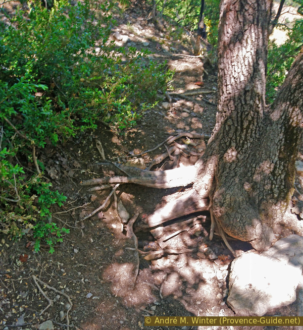
The path, which is quite visible up to here, is more difficult to find after the water hole. From the source we first climb about 10 meters vertically through oak trees to find a path that leads to the left across the slope.
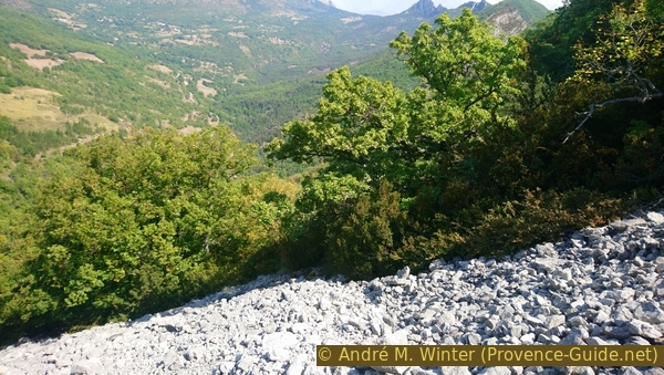
So we come to a first scree slope, our path leads across it. We then keep the same height. On the following scree field we make sure to keep the altitude and not to descend. You have to squeeze your way between small trees and bushes, you can no longer really speak of a path here.
No reproduction is permitted without the written consent of the author. (id4519)
Crossing the first scree heap
We now come to another scree slope, it is more open and larger. Before that, you pass a small tree with a rusty barrel hoop hanging in a branch fork. A narrow path is visible on this scree slope, it now descends slightly in an east-north-east direction.
No reproduction is permitted without the written consent of the author. (id4520)
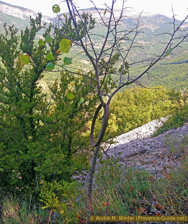
A barrel hoop on a small tree
When we leave the large open scree field, a path first leads down in the same direction into the forest. But here the path gets lost, you only see tracks of game, which mostly run across the slope. However, we now have to descend progressively in order not to get to the ridges further ahead.
We therefore stick to the direction given by the path on the scree field. In the forest, the ground now also consists of a scree slope, but it is overgrown with trees and bushes. As we said, there is no longer a path here, but the terrain is not too steep. In any case, high mountain boots are absolutely necessary here.
No reproduction is permitted without the written consent of the author. (id4521)
Down over the big scree field
We aim for the bottom of the valley because we want to come across a path here. If we roughly keep the walking direction, we will either come to the (mostly dry) creek bed, in this case you have descended too steeply and too far to the left, so you go to the right in the creek bed. Or you come to solid rock ridges, in which case you went too flat and too far to the right. Then you correct the walking direction steeper downwards and left. Ideally, you get straight onto the path without ending up in the creek bed and without ending up in the rock ridges.
No reproduction is permitted without the written consent of the author. (id4522)
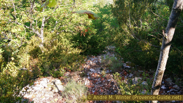
Last recognizable stretch of trail in the Beaudouze area
At the bottom we turn right. This is a former mountain bike trail, and there is also a canal buried under it further ahead. However, one should not hope to be able to proceed comfortably to the starting point. The path has some counter climbs due to the terrain, but in the end it leads us downhill north of the village of Entrepierres and a road bringing us back quickly to the starting point.
No reproduction is permitted without the written consent of the author. (id4523)
Looking back along the path in the Le Détroit area
Sources and additional information
It is better to have a good topographic hiking map: this tour is on the IGN "Digne-les-Bains, Sisteron" map, scale 1:25000, 3340ET.
If you don't want to bother with a paper map, you can also use mapping apps on your cell phone. On the one hand, it is the Cartes IGN app from the official map service. However, it requires access to the data network and this is sometimes difficult in canyons or remote locations.
Alternatively, you can use apps that store data directly on the device. They're generally not free, but they don't cost much. We mainly use OSMAnd, here it is possible to add contour lines, relief shading, markings and others. To store this data on your phone you need a lot of space.
Of course, one needs access to satellites for the GPS signal with any app. In some canyons this is not the case. Therefore, do not rely on the position shown, but read the map on your phone as you would read it on paper. Most apps are available for Android and iPhone. The applications usually allow us to record the route travelled and also view the GPS files offered for each of our hikes.
This page has been seen 2679 times since 20 March 2024.
No reproduction is permitted without the written consent of the author. (id7618)
Montagne de la Baume seen from the north