Grand tour on the Roc de Castellane
Ascent on the little-known eastern side and descent via Le Serre
hike
easy
1 h 45 min
yes
yes
shelter
mountain
Introduction
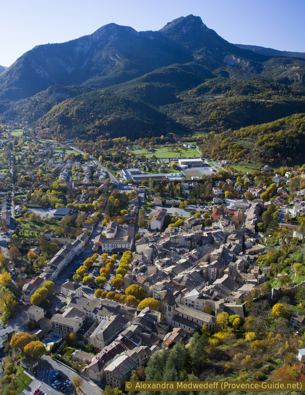
Castellane is the centre of the Verdon region, a town that is both Alpine and Provencal. You can sweat here in summer and freeze in winter. The whole region is a paradise for natural sports. There is a quick hike that starts right in the city centre that all the locals do regularly and the tourists don't miss either. It is the ascent to the Roc de Castellane via the Chemin du Roc. This is also the Way of the Cross of the Notre-Dame du Roc chapel. But the trail is also a little arduous, many people are going up and down at the same time, it is steep, rocky and there is little shade.
You can extend this classic out and back route into a grand Tour du Roc and avoid part of the Chemin du Roc. So you make a round tour and then you pass the foot of Le Serre, where you have a view back on the rock that few people know. If this is still too short, you can add a detour to the Jardin du Parc garden and then descend from there into the shady alleys of the old town.
The facts
5 km total distance
1 h 45 min walk time
250 m total elevation
orientation easy in nature, in the urban area, follow the instructions in the text
mark 75% of the total distance
65% easy trails
15% hard-surfaced city roads
10% hard-surfaced quiet side streets
5% hard-surfaced country road
5% moderate trails
<5% stairs
dangers slippery in wet weather, snow and icy road in winter
children yes
useful picnic stuff
required hiking boots, hiking equipment and water
GPS coordinates (WGS84) of start and end point 43.846266,6.51264
downloads ![]()
![]()
No reproduction is permitted without the written consent of the author. (id3620)
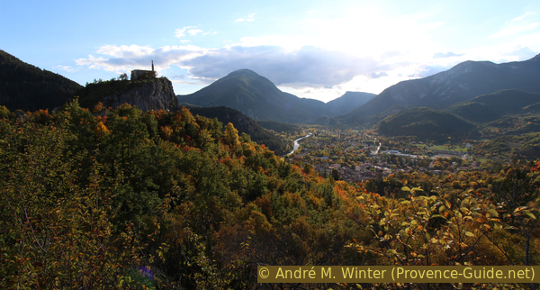
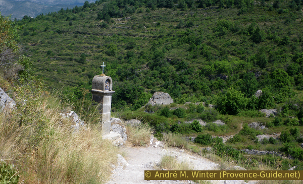
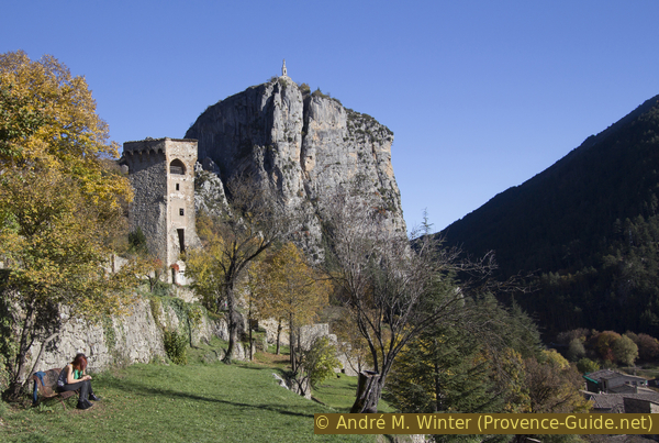
N.-D. du Roc and Castellane seen from the Chemin du Serre
Public transport
One finds Castellane on the Zou! (only french) network: express bus line 51 between Nice and Grenoble (twice daily). The stop is called Place Marcel Sauvaire in the centre of Castellane, which is also the starting point of this tour.
The offers of public transport around the Verdon are deplorable, one should not hesitate to complain to the municipal administrations and the tourist offices of the region. It would be time to set up at least one year-round service for hikers, serving both banks of the Verdon.
Access by car
Castellane is on the N85 between Cannes and Digne-les-Bains. You have to calculate at least 1,5 hours from Cannes and about 1 hour from Digne. The city can also be reached from the west via the roads on either side of the Verdon.
Useful parking spaces
There are several well signposted car parks around Castellane. The parking spaces in the centre are chargeable from April to October.
Hints
The hike can be undertaken in all seasons when there is no snow on Le Roc or Le Serre to the left. In the winter, however, care should be taken as certain spots are shaded for several months and the ice that forms here can be a nuisance. This is the case for the ascent to the east and the final section below Le Serre on the descent. Most of the photos in this description were taken in autumn at the end of October, it's our favourite season here.
The whole region is a zone with a high risk of forest fires. In summer, but also in other seasons when it is very dry or by strong winds, access to the forest areas can be regulated. As a result, the roads may be closed to traffic and/or the trails prohibited to hikers. Current information: Access map to the forests of Alpes de Haute Provence (also english). The map shows the colours green, yellow, orange and red which correspond to levels of danger. The affected area is: Moyen Verdon.
The sections
- Pass under the rock and up from the east
- Walk the big arc over the Serre crest
- Up to the Jardin de la Tour garden and back through the old town
Section 1: Castellane - Pont du Roc - N.D. du Roc
➙ 2 km ... 40 min ➚ 180 m ➘ 0 m ↝ easy
20% hard-surfaced city roads, without marks
20% hard-surfaced quiet side streets, without marks
15% moderate trails, few marks
50% easy trails, with marks
The clues
- Place Marcel Sauvaire, 720 m
- Pont du Roc bridge
- Route du Quartier des Angles
- Ascent through a narrow valley
- Ruins of Petra Castellana, 850 m
- Notre-Dame du Roc chapel, 900 m
Ascent on the hidden side of the typical rock.
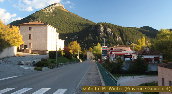
The town of Castellane is very compact. In the current centre there is the central square Marcel Sauvaire, where the market takes place twice a week. Buses arrive near the roundabout west of the square. We leave the square in the other direction and aim for the rock..
No reproduction is permitted without the written consent of the author. (id8927)
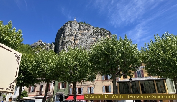
The Roc de Castellane seen from the Place de l'Église
We turn under this house in the medieval tower.
On the western side of the square we come to the Municipal Office, there we turn left and Place de l'Eglise and then we take one of the next streets to the right (do not continue towards the Church of Sacré-Cœur).
No reproduction is permitted without the written consent of the author. (id8928)
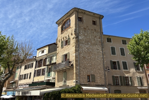
Medieval tower of Castellane integrated into the houses
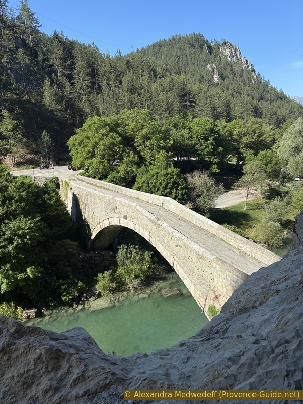
In this way you leave the old centre to end up on the old road to Grasse and on a large parking lot. Always keep towards the rock and take the avenue on the left. We go down to the foot of the cliff to come to a place where the cliff is very close to the Verdon. Here is the former toll bridge of Castellane. A bridge has existed at this point since at least the 11th century. The actual one here dates from the beginning of the 15th century.
No reproduction is permitted without the written consent of the author. (id3613)
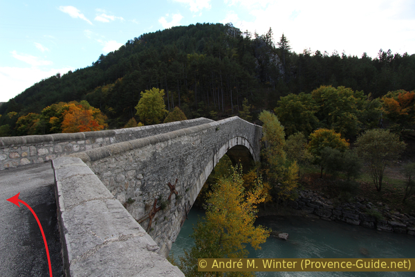
Pont du Roc de Castellane
If you go to the middle of the bridge, you will see a rocky ramp in the cliff wall. You can go up here and watch the bridge from above like in the Middle Ages.
No reproduction is permitted without the written consent of the author. (id8932)
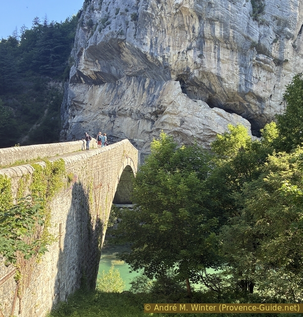
The Pont du Roc and the fault in the cliff
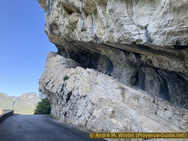
We go back under the cliff and turn right until we are under the fault.
Warning! This short access requires a good knowledge of climbing, even if it seems simple.
No reproduction is permitted without the written consent of the author. (id8934)
The oblique fault beneath the Roc de Castellane
The rocky slope in the fault doesn't look threatening. Right at the beginning, steps have even been carved into it, and the rock is rough. But this changes quickly in the central section.
No reproduction is permitted without the written consent of the author. (id8933)
The oblique fault beneath the Roc de Castellane
The slope is then completely smooth due to the numerous passes.
Shoes with soft rubber are essential. It's also crucial to consider the return journey, which is much more difficult and daunting.
No reproduction is permitted without the written consent of the author. (id8931)
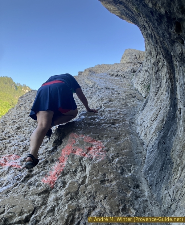
Alex climbs into the oblique fault beneath the Roc de Castellane
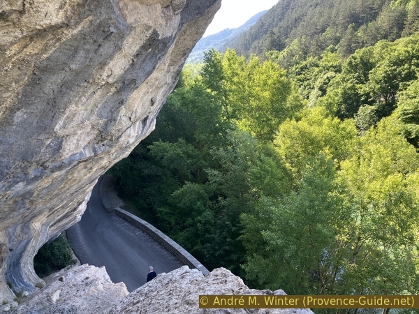
At the top, you reach a sort of natural viewpoint with a good view overlooking the bridge.
Do not attempt to continue beyond, you will reach an unclimbable overhang.
No reproduction is permitted without the written consent of the author. (id8924)
The Pont du Roc seen from the oblique fault beneath the Roc de Castellane
Since climbing to the Roc is impossible here, you have to descend again. The passage is much more impressive from above. The upper section offers slightly better grip.
Turn around in the middle section and scramble down on all fours.
No reproduction is permitted without the written consent of the author. (id8925)
View from above in the oblique fault beneath the Roc de Castellane
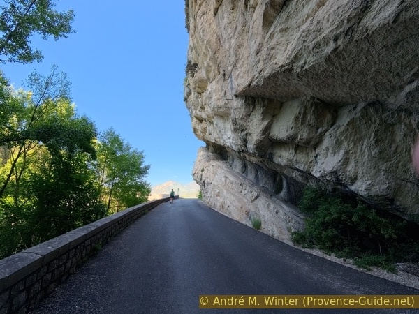
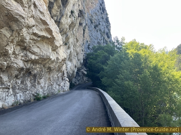
We must continue along the road in the same direction. It seems that the bed of the Verdon widens after the rock, but here comes water from the canal of the power station or dam of Chaudane, located further upstream. We pass a first house.
No reproduction is permitted without the written consent of the author. (id8926)
The Route d'Angles beneath the Roc
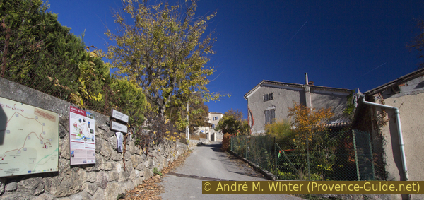
Just before the second house you have to turn off left. There is a prominent wall along which we head north. A signpost indicates the Tour du Roc.
No reproduction is permitted without the written consent of the author. (id3615)
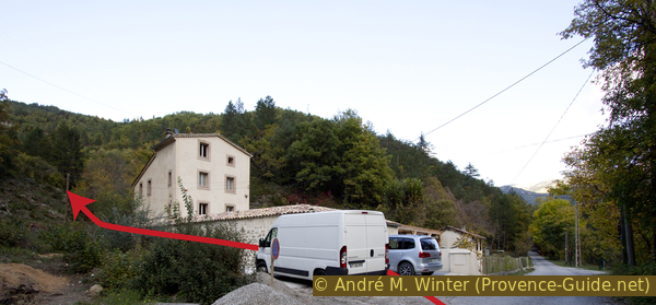
The path goes up in front of this house
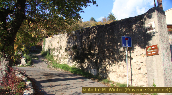
We then go up an old road that takes us to two houses further up. This road splits in a Y-shape and at this junction you have to climb into the undergrowth in the middle to find the way up into the valley.
No reproduction is permitted without the written consent of the author. (id3616)
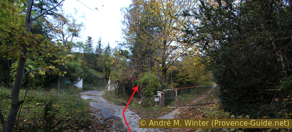
Branching of the roads
Right in the middle between the streets is the access to the path.
The ascent is steep, in autumn and winter certain passages are slippery. Narrow bridges allow crossing the creek, which only flows when it rains heavily. The path has changed several times in recent years, it may be that you have to look for the right ascent.
No reproduction is permitted without the written consent of the author. (id3617)
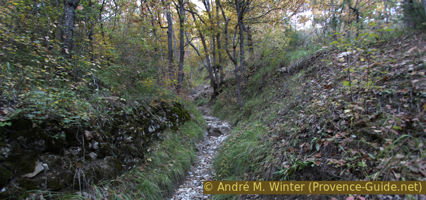
Tour du Roc in the dry ditch
You climb now without a break, even in winter you start to sweat a lot here. Gradually the forest becomes less dense and the path makes a few bends to the left. Finally we come to a plateau and head west towards the chapel on the rock.
No reproduction is permitted without the written consent of the author. (id3618)
Notre-Dame du Roc chapel in backlight in autumn
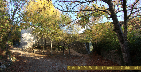
As soon as the path flattens out, you can see the church on the rock. On the right the ruins of Castellane from the time of the invasions come into view. The villagers took refuge here from invading looters up until the 12th century. We pass a building in better condition, the old Saint-André church. Be careful, the ruins are not secured, it is not recommended to venture inside!
No reproduction is permitted without the written consent of the author. (id3619)
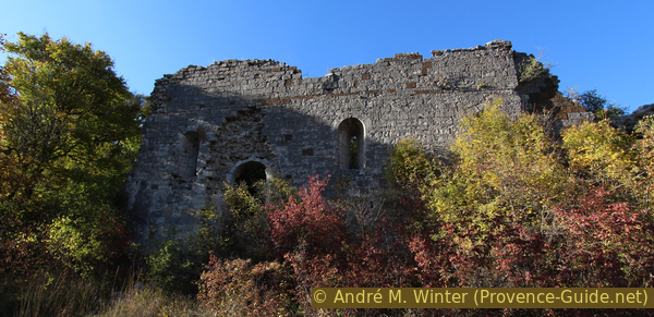
Church ruins of Petra Castellana
We arrive at a junction where we turn left. Now we are on the path where everyone else goes up to the chapel directly from Castellane on the Way of the Cross. We now follow the curves on the east side of the rocky peak. There are good views along the way back to the ruins of Petra Castellana, down in the bushes it was not possible to get a full view.
No reproduction is permitted without the written consent of the author. (id3121)
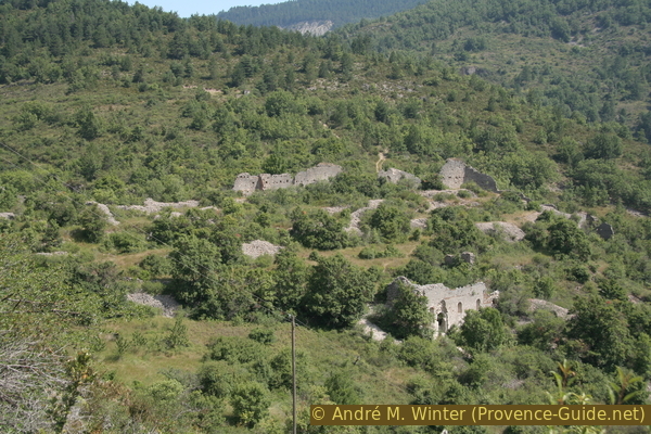
Remains of Petra Castellana seen from above
We quickly arrive at the summit and at the foot of the Notre-Dame du Roc church. The Madonna on the wall that serves as the bell tower seems monstrous here, a bit more modesty would not have hurt, the more subtle 12th-century base building is hard to discern.
There is a covered patio south of the chapel for shelter.
No reproduction is permitted without the written consent of the author. The permission of use was kindly given to Provence-Guide.net on 10 October 2019. (id3645)
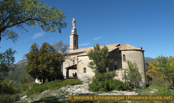
South side of the Notre-Dame du Roc chapel
The church is filled with votive images in the form of many classic engraved tablets, bouquets of flowers from newly-weds and various paintings depicting the procession after the cholera epidemic of 1835. You can see that no oversized statue has then been imposed on the chapel.
No reproduction is permitted without the written consent of the author. (id3122)
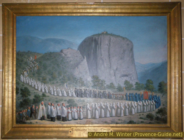
Ex-voto for the end of cholera in Castellane 1835
However, you come up here for the views over Castellane and the Verdon. The panorama opens up over 360°, three quarters of which are really directly above the abyss. Only le Serre obstructs the view to the north. It's also a good place to spot other walks around Castellane.
No reproduction is permitted without the written consent of the author. (id3876)
View over Castellane
Section 2: N.-D. du Roc - Le Serre - Le Bas du Serre
➙ 1,9 km ... 45 min ➚ 40 m ➘ 200 m ↝ easy
100% easy trails, with marks
The clues
- Notre-Dame du Roc chapel, 900 m
- Ruins of Petra Castellana, 850 m
- Le Serre, 890 m
- Le Bas du Serre, 740 m
Passing the old pastures of Le Serre.
We descend again towards the junction in the saddle with the ruins of Petra Castellana.
No reproduction is permitted without the written consent of the author. (id3123)
Stations of the Cross at the Roc de Castellane
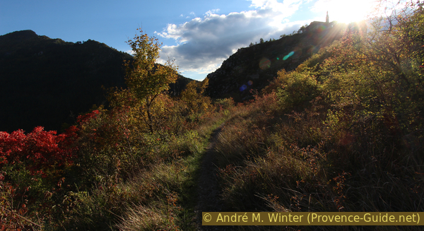
In the saddle, the Way of the Cross descends to the left, but we continue straight on where the path climbs slightly towards le Serre.
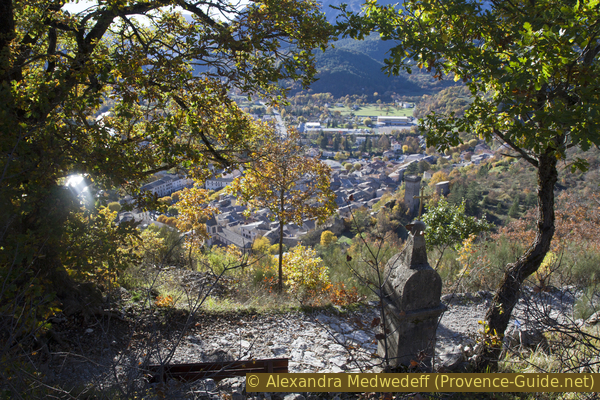
The Chemin du Serre makes a wide curve and at the same time moves further and further away from the rock. You should turn around several times because from here you have a good view of the rocks and of Castellane from different angles. The path is bordered by old walls that delimit and support the abandoned pastures. Like everywhere else, agriculture is on the decline here in the region.
No reproduction is permitted without the written consent of the author. (id3877)
Junction Chemin du Roc and Chemin du Serre
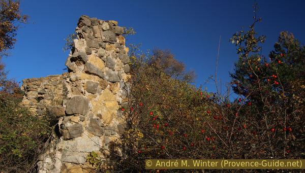
At the highest point the path makes a right angle to the left to pass a ruin surrounded by taller trees. It is an old farmhouse. In autumn you can find rowan berries and rose hips, two edible fruits rich in vitamins that have been supplanted by more easily available and edible fruits such as imported bananas.
No reproduction is permitted without the written consent of the author. (id3878)
House ruins on the Serre
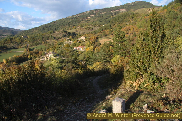
After the ruins, the descent becomes steeper, turns to the right and seems to be moving away from Castellane. When we come to a ridge, we follow the main path and turn sharply to the right. In the evening it is significantly cooler here on the north slope.
Don't try to take a shortcut to the left when you see Castellane, the paths get lost in the undergrowth and private properties. What looks like large straight lines on the aerial photos are just piles of stones that were collected from former pastures and piled up here.
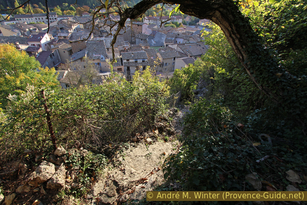
The marked trail first takes us in a north-east direction, but after a curve, it takes us back towards Castellane. The big shop in sight during the descent is the local supermarket. At the bottom we find the national road coming from Digne-les-Bains.
No reproduction is permitted without the written consent of the author. (id3621)
Chemin du Bas du Serre turns towards La Cébière
Section 3: Le Bas du Serre - Jardin de la Tour - Castellane
➙ 1,1 km ... 25 min ➚ 30 m ➘ 50 m ↝ easy
30% hard-surfaced country road, without marks
5% hard-surfaced city roads, with marks
35% easy trails, few marks
10% stairs, few marks
20% hard-surfaced city roads, without marks
The clues
- Le Bas du Serre, 740 m
- Jardin de la Tour garden, 760 m
- Castellane, 720 m
A little along the road and a park above the city.
First you have to go down Boulevard St. Michel, this is the N85 and usually there is a lot of traffic here. You pass an old, abandoned hospital and when the road flattens out, we look for the first ascending road on the left.
No reproduction is permitted without the written consent of the author. (id3622)
Boulevard St. Michel
A yellow signpost points up and other signs denote a part of the tour so far.
No reproduction is permitted without the written consent of the author. (id3874)
Ascent from Bvd. St. Michel
We follow the sign and come to an old forest road with a very steep section at the beginning. But this is also the last climb for the day!
No reproduction is permitted without the written consent of the author. (id3623)
Montée de St. Michel
We walk along a wall above the city and pass a drinking water point. Still at the same level, we arrive at a tower and a wall of the medieval fortification of Castellane. Today there are several passages through the wall, we need three of them. The passage that you see in the photo is our last passage. Here we finally go down to the city. Now, however, we pass the tower on the left and immediately after that we take the second passage on the right.
No reproduction is permitted without the written consent of the author. (id3624)
Passage in the upper city walls of Castellane
So we enter the Jardins de la Tour gardens. The name comes from the pentagonal dungeon, which is the last fully preserved tower from the 14th century. The garden is laid out on several levels, terraces are supported by dry stone walls. In the 18th century this was a public garden with arcades and fountains, which was maintained until the 1980s. Since the 2000s, attempts have been made to breathe more life into the attractive place above the city.
After letting our eyes and mind wander over the city and the valley, we leave the garden either through the opening we came in or through the third most distant one. After that left and back behind the first tower and we take this first passage through the wall.
No reproduction is permitted without the written consent of the author. (id3875)
Cultural terraces in the Jardins de la Tour park
After we have passed the passage, there is a railing and another viewpoint. But you should pay close attention to the path, as the steps carved into the rock are very irregular and the rest of the way is very steep. You almost literally tumble down into the old town.
No reproduction is permitted without the written consent of the author. (id3626)
Steep path down from the city walls to Castellane
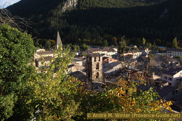
We have a last view of the two bell towers of Castellane. Below, the streets are dark and narrow.
No reproduction is permitted without the written consent of the author. (id3625)
Castellane seen from the city walls
Upon reaching a T-junction, first turn right to exit through the Clock Gate and gain some perspective. You'll then see this beautiful gate and the Chapel on the Roc just behind it. It's an iconic image of Castellane. This view is, of course, even better in the evening.
Then retrace your steps under the gate. You then have to zig-zag a little to get out of the labyrinth of the old town and thus reach Place Marcel Sauvaire, where we left at the beginning.
No reproduction is permitted without the written consent of the author. (id8929)
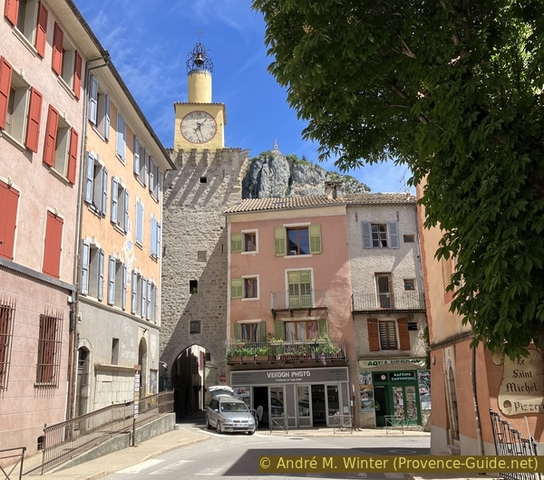
The Clock Tower and the Roc de Castellane
Sources and additional information
It is better to use a good topographical hiking map: This tour is on the IGN "Castellane, Lac de Castillon" map, scale 1:25000, 3542OT.
If you don't want to bother with a paper map, you can also use mapping apps on your cell phone. On the one hand, it is the Cartes IGN app from the official map service. However, it requires access to the data network and this is sometimes difficult in canyons or remote locations.
Alternatively, you can use apps that store data directly on the device. They're generally not free, but they don't cost much. We mainly use OSMAnd, here it is possible to add contour lines, relief shading, markings and others. To store this data on your phone you need a lot of space.
Of course, one needs access to satellites for the GPS signal with any app. In some canyons this is not the case. Therefore, do not rely on the position shown, but read the map on your phone as you would read it on paper. Most apps are available for Android and iPhone. The applications usually allow us to record the route travelled and also view the GPS files offered for each of our hikes.
This page has been seen 2962 times since 20 March 2024.