The Plaine des Maures plain
Rediscovering the site after the 2021 fire
MTB tour
difficult
2 h 15 min
no
yes
no
1 % of the distance
Introduction
On August 16, 2021, a fire broke out at a rest area along the A8 motorway. The surrounding landscape was completely parched, and strong winds caused the blaze to spread rapidly. Fifty percent of the Plaine des Maures National Nature Reserve went up in smoke. While the area's rich biodiversity is naturally adapted to cope with fire, it cannot withstand such frequent occurrences, the same zone was struck in a similar fashion in both 1979 and 1989. For a Mediterranean forest to recover, the interval between fires should ideally be at least 30 to 50 years. A full restoration of the ecosystem's biological maturity, however, would require a fire-free period of 150 to 200 years. Compounding this high frequency is climate change, which places additional stress on Mediterranean plants, many of which rely on resprouting from their rootstocks. If a plant is already in a weakened state, this regeneration process can be severely compromised.
Today, a visit to the Plaine des Maures reveals plenty of green, though mountain bikers might find reason to complain, as the tough, scrubby vegetation is now interspersed with brambles. This resilience is largely due to two favourable factors: the soil is silica-rich and relatively impermeable, and, crucially, the terrain is very flat. Because the soil does not wash away over long distances, it remains largely in place, allowing plants and trees to regenerate more easily.
The facts
13,1 km total distance
2 h 15 min movement time.
160 m total elevation
orientation difficult
mark 60% of the total distance
30% moderate trails
25% rutted forest roads
20% forest roads
10% dirt roads
10% difficult trails
5% hard-surfaced quiet side streets
dangers Water and mud after rain, undergrowth
children no
useful picnic stuff
required Hardtail mountain bike, water, patch kit, pump
GPS coordinates (WGS84) of start and end point 43.32562052256413,6.384789640536712
downloads 

Public transport
It is not possible to reach the route via public transport. However, there is a TER ZOU! (only french) regional rail lines station in Le Cannet-des-Maures. While there is a direct road leading to the start of section 3, it involves travelling 6 kilometres along the D588 (between Le Luc and St. Tropez), a road with constant traffic and no dedicated bike lane. Therefore, the following approach is recommended:
Exit the train station heading west. Turn left in front of the Lou Cannet bar, then take the small, one-way-restricted alleyway to the right. Immediately afterward, pass under the railway tracks (to the left) and then turn right (look for the 19 tonnes sign). Continue parallel to the railway line until the next intersection. Turn right here to cross the tracks at a level crossing. Shortly after, turn left onto a farm track that once again runs parallel to the railway. The track veers slightly to bypass a private property, eventually rejoining a paved road, turn left here to cross the tracks again at another level crossing. Continue straight ahead, passing first an industrial zone and then a residential area, before joining the DFCI D76 Le Pavillon track.
This track leads to the D33 (Route des Mayons), turn left and immediately pass under the motorway. The D33 is narrow, but traffic is very light. About 2.6 kilometres past the motorway, you can take a parallel track on the left after the brown sign marking the entrance to the Plaine des Maures National Nature Reserve. This one brings you onto the D75, a similarly narrow road. Turn left toward Cogolin and continue for 2.7 kilometres to reach the Les Piboules parking area. This adds 12 kilometres, 50 minutes of travel time, and 130 meters of elevation gain (one way). This route is shown in a burgundy red color on the map visible on this page, and it is also included in the GPX file.
Access by car
From Marseille, Nice, or the north, take the A8 motorway to the Le Luc exit. Continue toward Cogolin, 1.5 kilometres after a left-hand bend, turn left again toward Gonfaron on the D75. The Piboules parking area is located 3 kilometres further along on the right.
From Toulon, take the A57 motorway to the Gonfaron exit and continue into the center of the village. Turn right toward Les Mayons. Pass through the village, and about 2 kilometres later, you will find the Piboules parking area on the left.
From the Saint-Tropez peninsula, travel via Cogolin, Grimaud, and La Garde-Freinet toward Le Luc. Follow the winding road, and just as you reach the plain, turn left onto the D75 toward Les Mayons. The Piboules parking area is located 3 kilometres further along on the right.
Useful parking spaces
The Piboules parking area serves as the starting point for the route. It has a dirt surface, during the wet season, the eastern (right-hand) side tends to remain drier. The route begins on the left, near the information signs.
No reproduction is permitted without the written consent of the author. (id9739)
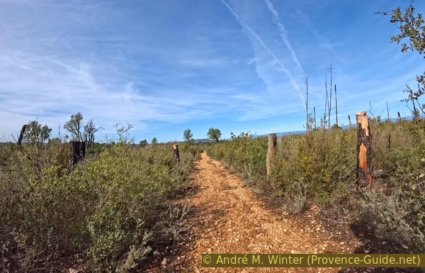
The pine forest replaced by bushes
No reproduction is permitted without the written consent of the author. (id9728)
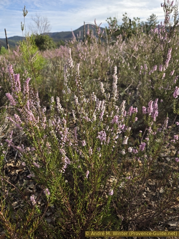
Heather bloom in early winter
Heathers are hard-wooded shrubs that readily regenerate from the rootstock after a fire.
No reproduction is permitted without the written consent of the author. (id9466)
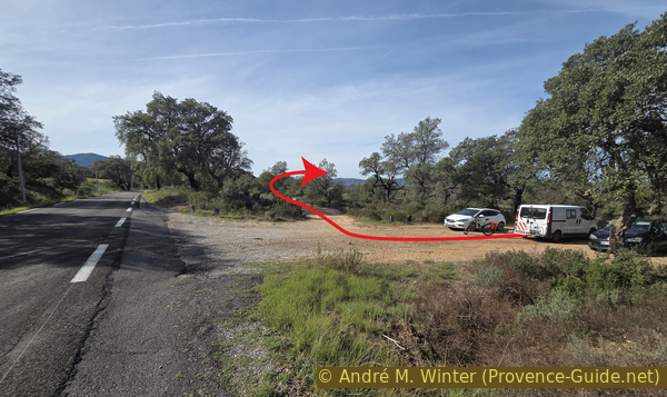
Les Piboules parking area along the D75 road
Hints
Especially in autumn and winter, you will encounter numerous streams and pools of water, some of which form directly on the path. When scouting this route in 2026, some of these large puddles were over 40 centimetres deep, meaning your footwear will inevitably get soaked.
The second part of section 2, beween Vallon des Aurèdes valley and the old bridge over the Aille river, is the most challenging part, the trail has become overgrown with vegetation, and the Vallon de Rouré Trouca valley is invariably flooded during the wet season.
The end of section 3, heading south from the Les Escarcets signpost, follows a trail that is technically forbidden for mountain bikes. This is somewhat curious, given that the initial stretch along the shore of Lac des Escarcets is permitted for cycling. The route described here does pass through this restricted section. Please always yield to hikers, and ride in a way that is both efficient and environmentally conscious: avoid tearing up the ground. As this section is an uphill climb, there is no risk of needing to brake sharply.
The whole region is a zone with a high risk of forest fires. In summer, but also in other seasons when it is very dry or by strong winds, access to the forest areas can be regulated. As a result, the roads may be closed to traffic and/or the trails prohibited to hikers. Current information: Map of access to the forests of the Var (also english). The map shows the colours green, yellow, orange and red which correspond to levels of danger.
The sections
- Les Piboules parking area, la Grande Pinède and crossing at Retenue des Aurèdes reservoir.
- Crossing at Retenue des Aurèdes reservoir, Vallon de Rouré Troucas valley and old bridge over L'Aille.
- Old bridge over L'Aille, Lac des Escarcets lake and Vallon de Saint Daumas valley.
- Vallon de Saint Daumas valley, Val Rouvier valley and Les Piboules parking area.
Section 1: Piboules - Aurèdes
➙ 3,3 km ... 30 min ➚ 20 m ➘ 80 m ↝ average
↙ Colours of the sections like MTB rating but without the duration.
55% rutted forest roads, few marks
45% forest roads, without marks
The clues
- Les Piboules parking area, 138 m
- la Grande Pinède, 103 m
- Rouré Trouca ford, 83 m
- Les Aurèdes junction, 89 m
The initial section offers a preview of what lies ahead: a washed-out path winding between charred tree trunks. Yet, it is clear that vegetation has made a significant comeback, even if few large trees have survived here. At the very least, this provides us with a broader view of the landscape.
We begin at an altitude of 138 metres, so our route northward involves a gentle descent.
No reproduction is permitted without the written consent of the author. (id9467)
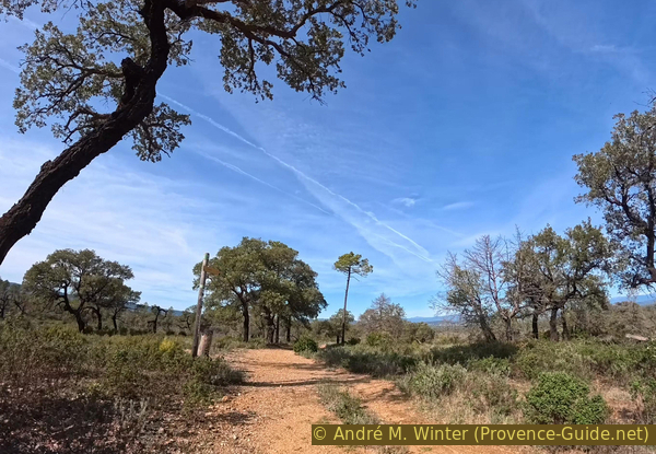
Northern starting point of the local hiking trail at Les Piboules heading toward Val Rouvier
However, we cannot move along quickly, as large rocks litter the path.
We pass the Val Rouvier signpost and continue straight ahead.
No reproduction is permitted without the written consent of the author. (id9536)
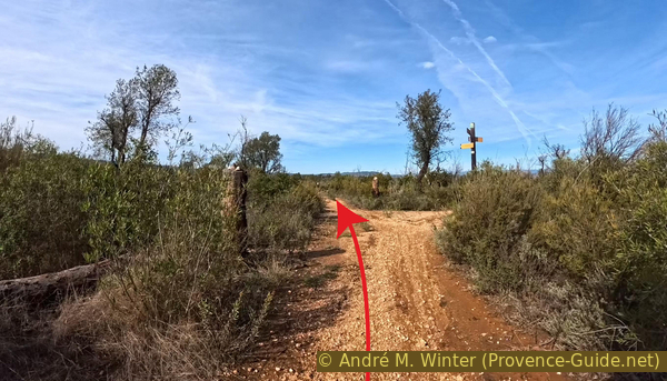
Junction at the Val Rouvier signpost, 115 m
Rainwater has carved gullies into the tracks, this particular path is neither used by vehicles nor maintained.
No reproduction is permitted without the written consent of the author. (id9618)
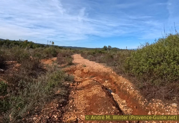
Eroded path between Val Rouvier and Grande Pinède
In the open areas, one finds rounded boulders covered in moss and lichen. The landscape here has been altered since the fire, and these arid, rocky patches are struggling the most to recover, due to a lack of humus.
No reproduction is permitted without the written consent of the author. (id9619)
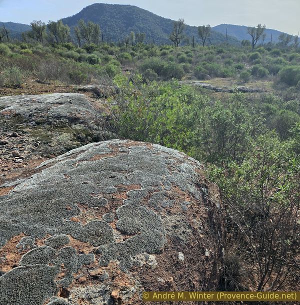
Moss-covered, rounded rocks on the left between Val Rouvier and Grande Pinède
We arrive in a somewhat rockier area.
No reproduction is permitted without the written consent of the author. (id9620)
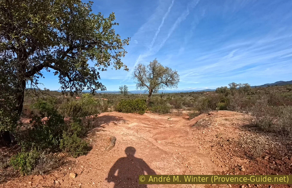
Path running over exposed bedrock between Val Rouvier and Grande Pinède
After the rains, the hollow fills with water. One's instinct is to look for a way around to the right.
Beyond the hollow, the path turns to the left.
No reproduction is permitted without the written consent of the author. (id9621)
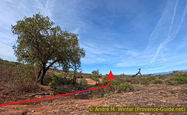
The path north of Les Piboules lies in a hollow
At times, you have to climb up over rocky sections, though none of them are difficult.
No reproduction is permitted without the written consent of the author. (id9645)
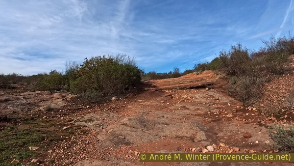
Path over rocky ground between Val Rouvier and Grande Pinède
The rocky stretches are usually followed by flat, sandy patches. Be careful, as the ground can sometimes be soft.
No reproduction is permitted without the written consent of the author. (id9644)
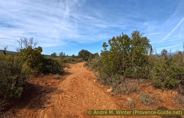
Easier path north of Grande Pinède
We reach the signpost for the Grande Pinède (Great Pine Forest). While it's hard to find any such forest there today, one can certainly hope that the name will once again be fitting before long. For now, however, it is the oaks that dominate the landscape.
In any case, we turn right here onto a wider, better-maintained track, one that is also used by authorized vehicles.
No reproduction is permitted without the written consent of the author. (id9629)
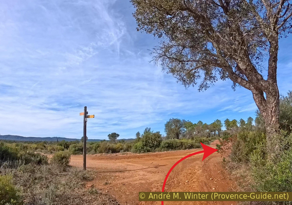
Reaching the Piste des Aurèdes track at Grande Pinède, 103 m
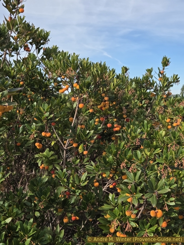
It's a bit boring here, but towards the end of autumn, you can find ripe strawberry tree fruits.
Strawberry trees have hard wood, yet they regrow from the stump after a fire.
No reproduction is permitted without the written consent of the author. (id9626)
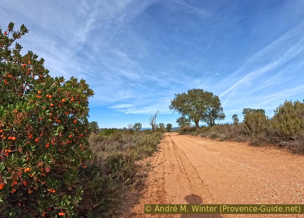
Strawberry tree fruit along the Piste des Aurèdes
The ford at the Vallon de Rouré Troucas must be crossed via concrete slabs, a rather tricky passage on a mountain bike.
Various maps show a path branching off to the left immediately after the ford. This trail is completely overgrown, it is impossible to find, even on foot.
No reproduction is permitted without the written consent of the author. (id9627)
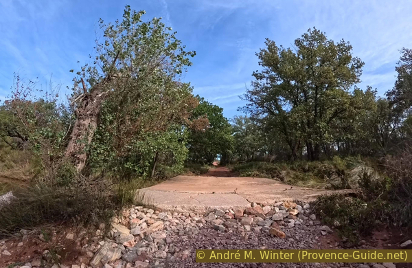
Ford across the Vallon de Rouré Trouca valley on the Piste des Aurèdes
Further on, this fairly straight track climbs upward over rocky sections.
No reproduction is permitted without the written consent of the author. (id9622)
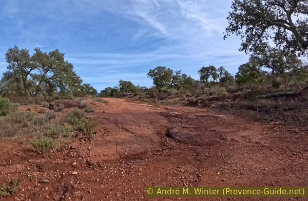
Rocks along the Piste des Aurèdes track
The track also ascends over coarse, gritty soil.
Upon reaching a flat area, you will come to a junction where you need to turn left.
No reproduction is permitted without the written consent of the author. (id9623)
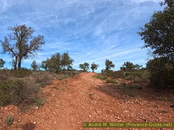
Ascent before the Les Aurèdes junction
Section 2: Aurèdes - Pont de l'Aille
➙ 2 km ... 30 min ➚ 15 m ➘ 30 m ↝ challenging
↙ Colours of the sections like MTB rating but without the duration.
15% rutted forest roads, without marks
60% difficult trails, without marks
↖ sections in the water
25% dirt roads, without marks
↖ potentially muddy passages
The clues
- Les Aurèdes junction, 89 m
- Vallon des Aurèdes ford, 75 m
- Vallon de Rouré Trouca ford, 65 m
- Old bridge over L'Aille river, 66 m
This section begins, like section 1, on a degraded track. However, after 300 meters, things become more complicated.
There is a fork in the tracks here: the Piste des Aurèdes continues straight ahead, while the Piste des Petites Aurèdes turns to the right. To the left, there is what barely qualifies as a track.
In 2026, there was construction work here, these piles of earth are not normally present.
We therefore turn left at the gnarled cork oak tree.
No reproduction is permitted without the written consent of the author. (id9624)
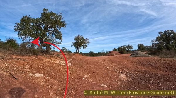
The Piste des Aurèdes intersects with the Piste des Petites Aurèdes, 89 m
For about 300 meters, the route is recognizable as a forest track, but it gradually narrows.
No reproduction is permitted without the written consent of the author. (id9628)
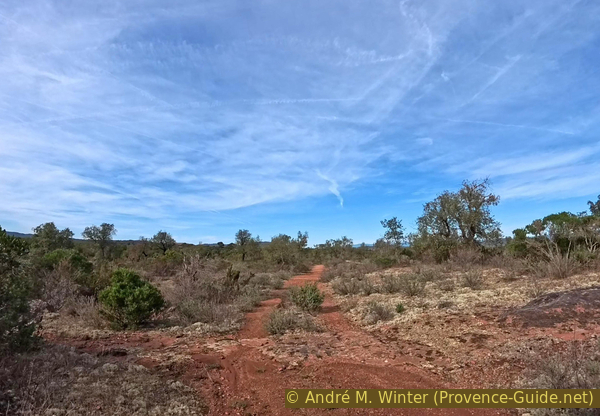
Path toward the Vallon de Rouré Trouca valley
Shortly before the Ruisseau des Aurèdes stream flows into the Ruisseau de Rouré Trouca, the path deteriorates as it descends into the small valley.
No reproduction is permitted without the written consent of the author. (id9686)
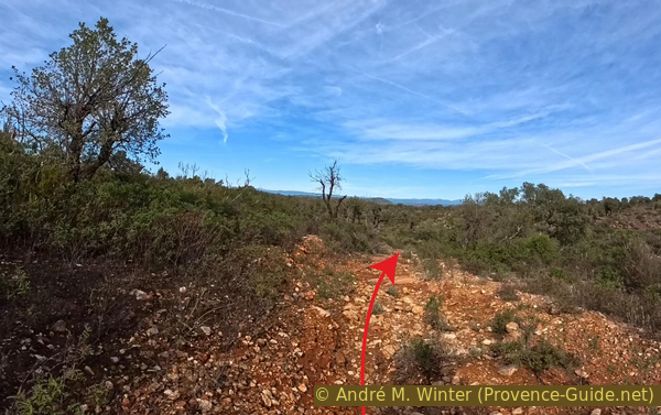
The path descends into the lower Vallon des Aurèdes valley
In principle, you should maintain your general direction and cross the Ruisseau des Aurèdes at the bottom. Afterward, stay to the right of the Ruisseau de Rouré Trouca.
No reproduction is permitted without the written consent of the author. (id9685)
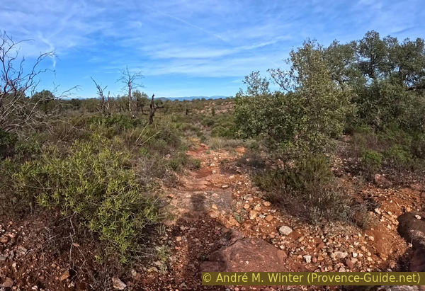
The path descends in a rugged, chaotic manner into the Vallon des Aurèdes valley
Do not deviate from the path, even if the vegetation forms a barrier. At least it is free of thorns.
No reproduction is permitted without the written consent of the author. (id9684)
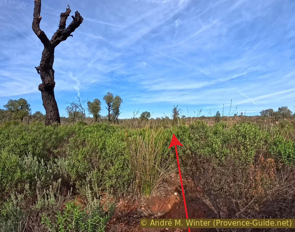
Vegetation barrier to pass through to descend into the lower Vallon des Aurèdes valley
The Ruisseau des Aurèdes only flows when it rains. Afterward, large puddles remain, these can be quite long and difficult to cross, especially since you also have to contend with the surrounding vegetation.
No reproduction is permitted without the written consent of the author. (id9682)
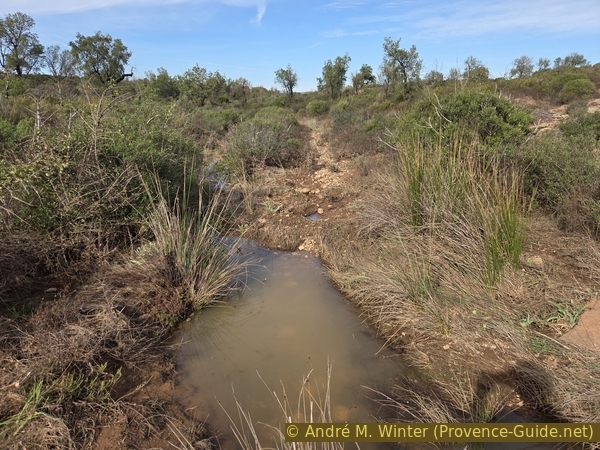
Lower Vallon des Aurèdes valley with water present
This photo shows the standard path, which only crosses the stream further along.
During an exploration in late October 2026, we switched banks earlier, though not without getting thoroughly soaked in the process.
No reproduction is permitted without the written consent of the author. (id9681)
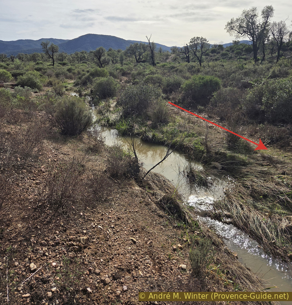
Looking back along the path, right beside the stream in the Vallon des Aurèdes valley
The path climbs slightly afterward, running at some distance along the banks of the Rouré Trouca creek.
No reproduction is permitted without the written consent of the author. (id9680)
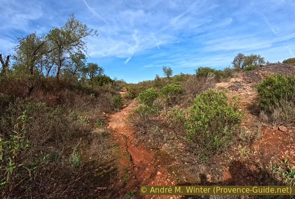
The path leads out of the Vallon des Aurèdes valley by turning to the right
This doesn't mean there's no water left, it still collects in every hollow following the rain.
No reproduction is permitted without the written consent of the author. (id9679)
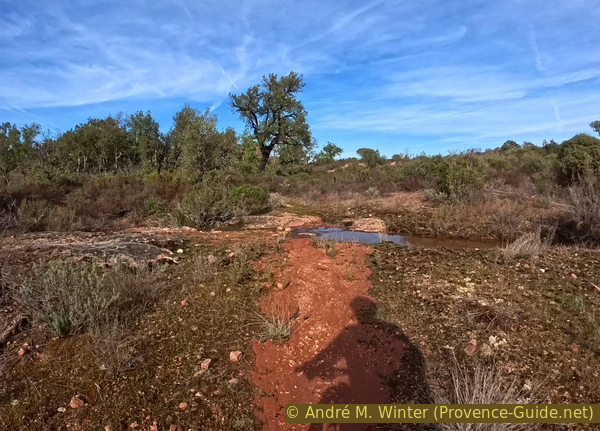
Stagnant water following rainfall east of Rouré Trouca
From this point on, the path remains fairly consistent. The only issue is that, in places, water has eroded the trail, leaving it too deep and narrow for cycling. At times, however, you have no choice but to push through it, as the surrounding vegetation leaves no other option.
No reproduction is permitted without the written consent of the author. (id9678)
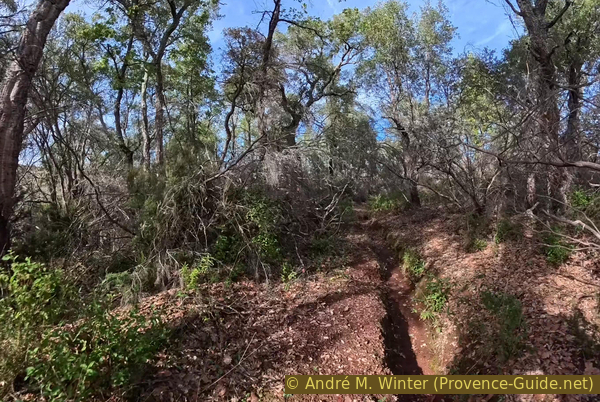
Eroded path east of Rouré Trouca valley
For the most part, though, the path is easy. Note that a small ditch runs alongside us on the right the entire way.
No reproduction is permitted without the written consent of the author. (id9676)
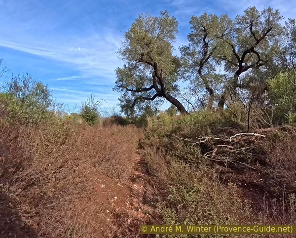
Path that is occasionally easy to ride, east of the Vallon de Rouré Trouca
The path eventually leads into a maze of streams. In theory, you should cross the stream descending from Le Ginestier in a straight line, then turn left to finally cross the Rouré Trouca creek.
In late October 2026, this entire area was one large pool of water. The spot shown in the photo is actually within the stream that descends from Le Ginestier.
No reproduction is permitted without the written consent of the author. (id9675)
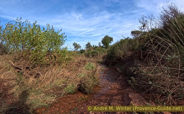
The path in the stream descending from Le Ginestier
The standard path leads to the right, behind the bush.
Given the volume of water in the autumn of 2026, we turned left too early and crossed the Vallon de Rouré Trouca directly at this point.
However, the regular path to the right is no better when there is as much water as shown in the photo.
No reproduction is permitted without the written consent of the author. (id9674)
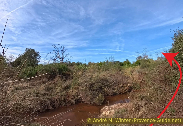
Rouré Trouca creek, south of the old bridge over the Aille
After climbing the bank and pushing through a barrier of reeds, you reach a more civilized area: a vineyard. Turn left, then take the first available turn to the right to cross through the middle of the vineyard.
Alternatively, if the path through the middle is too muddy, you can ride all the way around the vineyard in a clockwise direction.
No reproduction is permitted without the written consent of the author. (id9673)
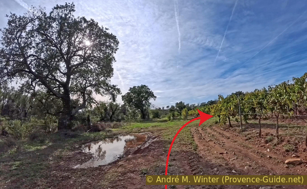
Vineyards south of the old bridge over the Aille
You then arrive at an old paved road, the northernmost and lowest point of the circuit, at the old bridge over the Aille river.
No reproduction is permitted without the written consent of the author. (id9701)
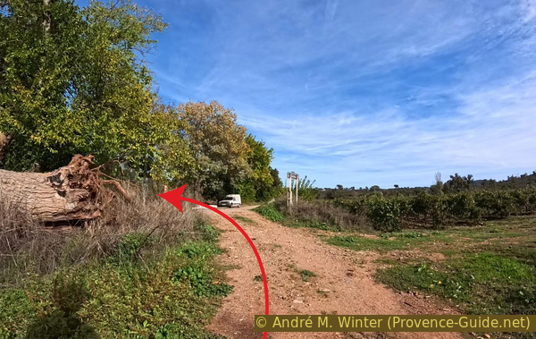
South of the old bridge over the Aille
This bridge appears to date back to the early 18th century, it underwent extensive modifications in the 19th century to accommodate increasing road traffic demands. It remained in use until the D558 road was modernized, sometime before 1972.
The spot is peaceful, though not entirely quiet, as the busy D558 road can be heard nearby. The bridge's parapet, however, offers a place to sit and take a break. We have covered just over a third of the circuit, but the most potentially challenging sections are now behind us.
No reproduction is permitted without the written consent of the author. (id9700)
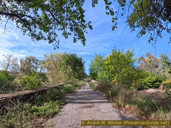
On the old bridge over the Aille
This old bridge over the Aille features three large arches. Under normal water conditions, the river flows only beneath the southernmost arch.
No reproduction is permitted without the written consent of the author. (id9699)
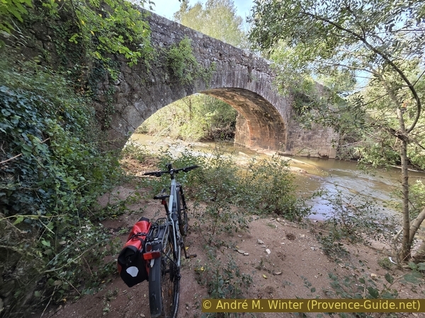
Mountain biking under the old bridge over the Aille
In normal conditions, it is also possible to walk along the riverbank beneath that southern arch.
The bridge remains in good condition.
We get back on our mountain bikes. There remains one connecting stage heading east before beginning the long journey back up to the starting point.
No reproduction is permitted without the written consent of the author. (id9698)
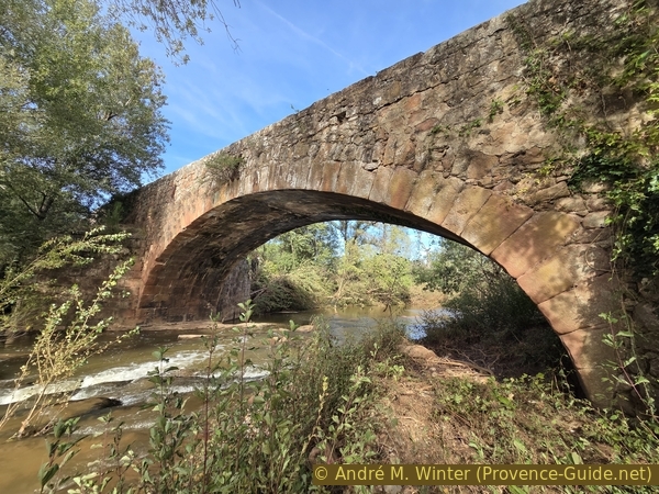
To the west, under the old bridge over the Aille
Section 3: Pont de l'Aille - Saint Daumas
➙ 3,9 km ... 45 min ➚ 60 m ➘ 15 m ↝ easy
↙ Colours of the sections like MTB rating but without the duration.
10% hard-surfaced quiet side streets, without marks
5% moderate trails, without marks
40% forest roads, few marks
<5% moderate trails, without marks
↖ leave the bike and explore on foot
5% hard-surfaced quiet side streets, few marks
10% moderate trails, few marks
30% moderate trails, officially blocked
The clues
- Old bridge over L'Aille river, 66 m
- Le Ginestier parking area, 86 m
- Dam and Lac des Escarcets lake, 93 m
- Les Escarcets signpost, 93 m
- Ford, 97 m
- Vallon de Saint Daumas signpost, 108 m
This section covers the northern and eastern parts of the circuit, which runs along the edge of Lac des Escarcets lake.
From the bridge, head back down toward the south and turn left onto the dilapidated asphalt of the old road. It leads to a somewhat informal parking area beside the busy D558 departmental road.
Do not join the D558 road, instead, turn right.
No reproduction is permitted without the written consent of the author. (id9697)
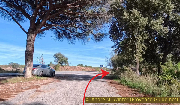
The old road joins the D558 road
A small path climbs up over some rocks.
No reproduction is permitted without the written consent of the author. (id9696)
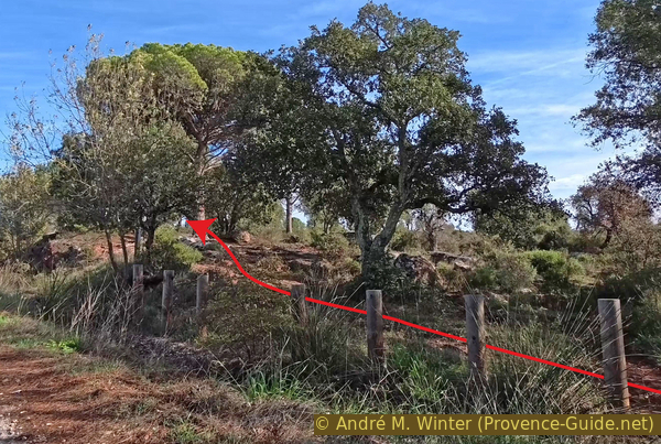
Start of the short path south of the D558 road
It runs alongside the road, following a route that is much more pleasant for mountain biking.
No reproduction is permitted without the written consent of the author. (id9695)
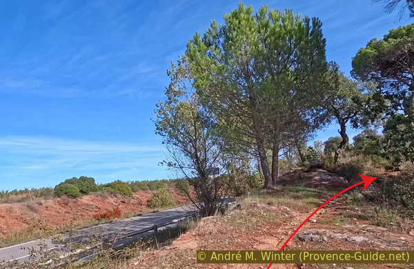
The path south of the D558 road
After a few minutes, you will pass these five posts. Just before reaching them, turn right onto a trail that leads away from the road.
No reproduction is permitted without the written consent of the author. (id9694)
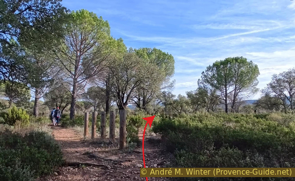
Fork in the path south of the D558 road
This trail arrives at the Le Ginestier parking area, where the straight, direct track Piste de la Tire begins.
No reproduction is permitted without the written consent of the author. (id9693)
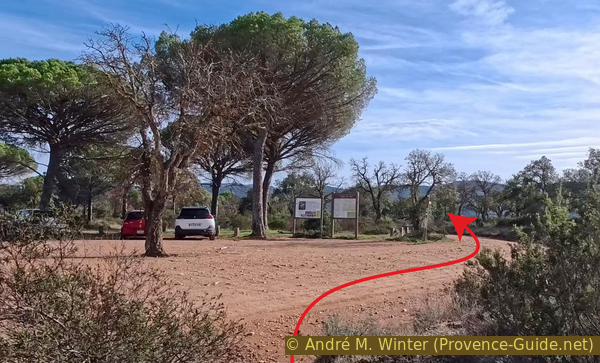
Le Ginestier parking area on the Piste de la Tire
This forest track is open to traffic and provides access to Lac des Escarcets.
No reproduction is permitted without the written consent of the author. (id9692)
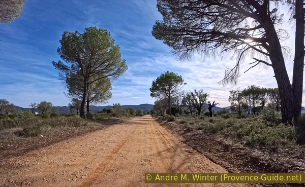
The wide Piste de la Tire
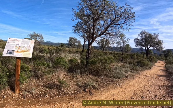
It is possible to take the parallel path on the left, though it is more uneven. It is better to stay on the main track as long as it runs straight!
No reproduction is permitted without the written consent of the author. (id9691)
Path running parallel to the Piste de la Tire
One kilometer past the parking area, turn left here.
No reproduction is permitted without the written consent of the author. (id9690)
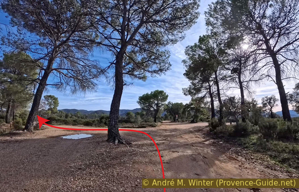
Junction on the Piste de la Tire, 95 m
You arrive at the final parking area for Lac des Escarcets. There are two barriers on the left. Pass the one on the right and continue straight ahead thus.
No reproduction is permitted without the written consent of the author. (id9689)
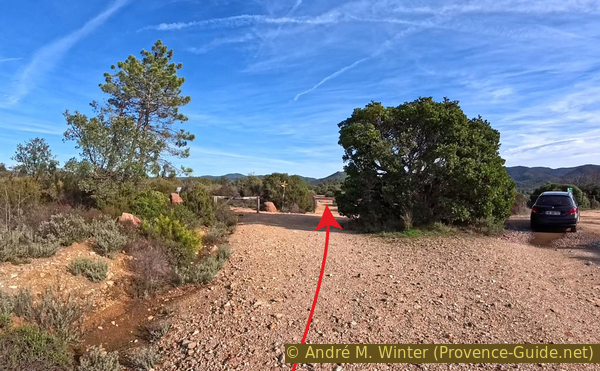
Barriers before the Les Escarcets dam
This track is a dead end that leads to viewpoints overlooking the lake and the dam.
Lac des Escarcets is a 15-hectare artificial reservoir created by a dam built in 1971. Its primary purpose is to serve as a water reserve for firefighting, much like the smaller Les Aurèdes reservoir located further south.
No reproduction is permitted without the written consent of the author. (id9688)
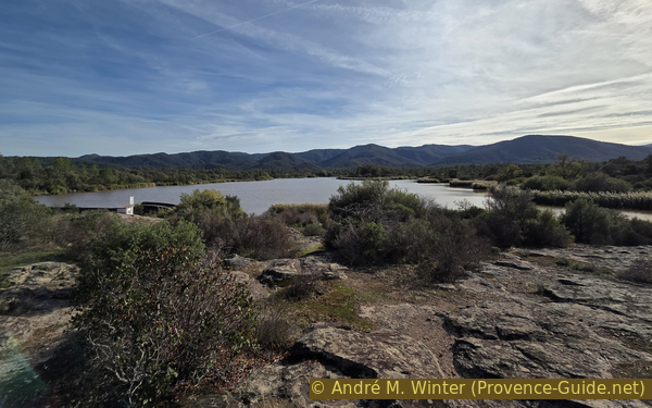
Lac des Escarcets lake
The lake lies at the heart of an area that burned in 2021. The fire spread too rapidly to allow for the deployment of the pumps needed to combat it. Nevertheless, the lake is home to exceptional wildlife, including the European pond turtle and Hermann's tortoise. The very existence of the lake helped protect these species from the fire. Furthermore, the wetland areas allowed seeds to regenerate in the aftermath of the blaze.
In October 2026, the lake is full, and water is flowing over the spillway designed for this purpose.
No reproduction is permitted without the written consent of the author. (id9687)
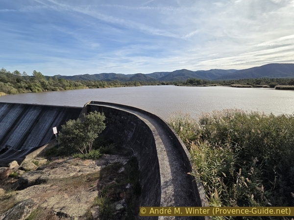
Les Escarcets dam
We head back toward the barrier and turn left.
No reproduction is permitted without the written consent of the author. (id9717)
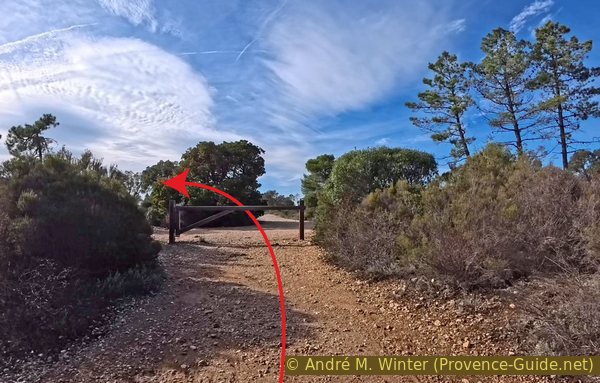
Back at the barrier before the Les Escarcets dam
We pass some informational signs and continue straight ahead, descending toward the western shores of the lake.
No reproduction is permitted without the written consent of the author. (id9716)
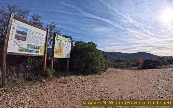
Signposts and the continuation of the path along the western shore of Lac des Escarcets
You'll need to get past this other barrier.
The gravel here is coarse, so keep a firm grip on your handlebars.
No reproduction is permitted without the written consent of the author. (id9715)
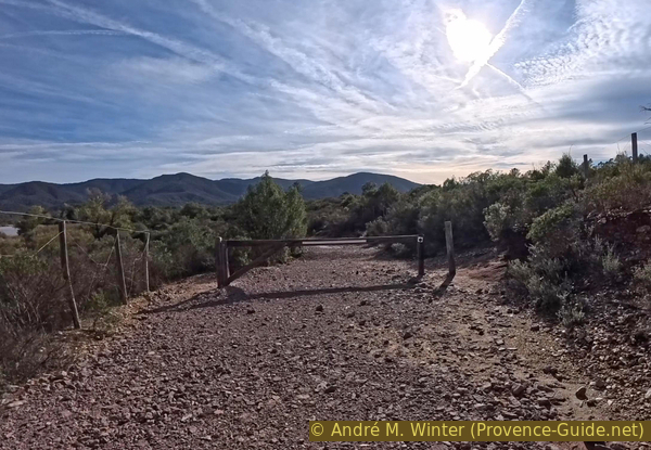
Barrier on the path along the western shore of Lac des Escarcets
The path winds past several small, narrow beaches, as the surrounding vegetation is gradually encroaching on these open areas.
Swimming in the lake is prohibited, even though it isn't explicitly stated in writing anywhere.
No reproduction is permitted without the written consent of the author. (id9714)
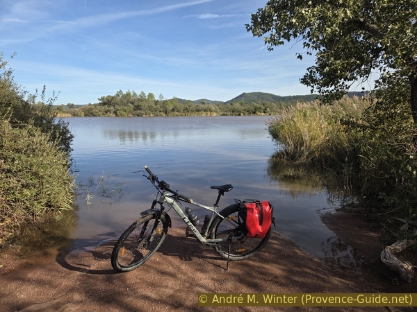
Mountain biking west of Lac des Escarcets lake
Other coves are rockier.
In this section, the path consists entirely of firm, fine sand, reminiscent of Lac du Salagou.
No reproduction is permitted without the written consent of the author. (id9713)
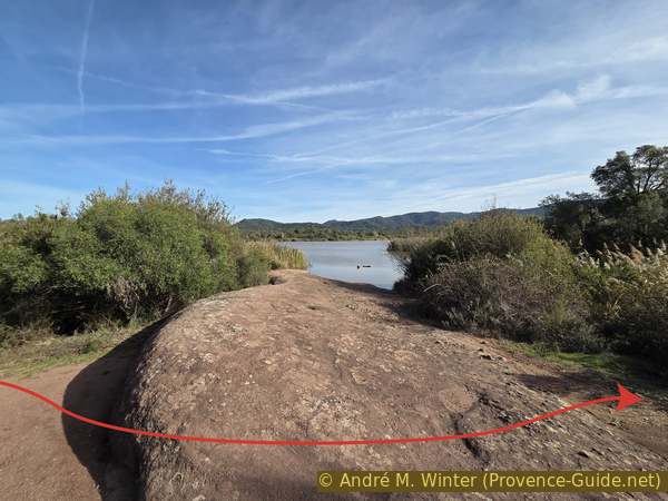
Rounded rocks west of Lac des Escarcets lake
A wire fence guides the way.
This helps prevent excessive erosion of the lake's slopes.
No reproduction is permitted without the written consent of the author. (id9712)
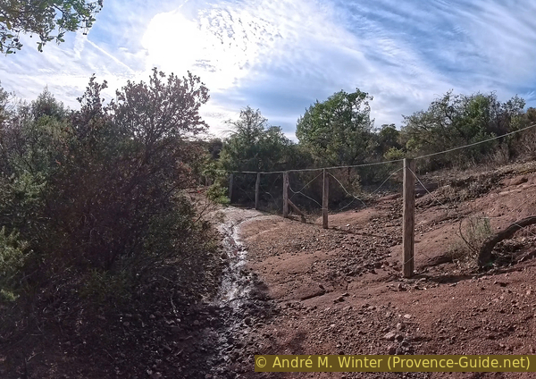
Fencing along the path west of Lac des Escarcets
The large southern section is a strictly protected area, including the shoreline.
Consequently, our path veers to the right.
No reproduction is permitted without the written consent of the author. (id9711)
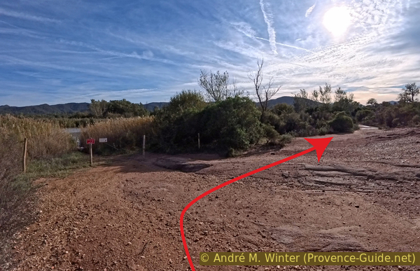
Fencing on the path west of Lac des Escarcets
We emerge into a large, open area devoid of vegetation. There is a marker post here, but you should aim for the signpost further off in the distance.
It's marked with a red circle in the photo.
No reproduction is permitted without the written consent of the author. (id9710)
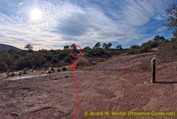
The path leads away from the shore of Lac des Escarcets
Here, we turn right toward the Vallon de Saint Daumas.
Please note: this 1.2-kilometre stretch is technically forbidden for mountain bikes (indicated by a small green icon with a line through it on the yellow sign above). That said, the trail is no different from the previous section along the lake, it just moves a bit further away from the water. The restriction is likely in place to prevent conflicts between hikers and mountain bikers, as the path is tightly hemmed in by dense vegetation. Always yield to anyone on foot here. And, as everywhere else, take care not to damage the trail by braking unnecessarily. Since the path is an ascent, the risk is lower, and you won't be able to ride at high speeds anyway.
The legal alternative is to head to the right here, towards Les Aurèdes, until you reach the next junction, 700 meters away. At this junction, marked as point 101, turn left onto the Piste de la Tire track to rejoin the route described here at point 113.
No reproduction is permitted without the written consent of the author. (id9709)
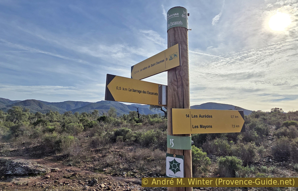
Les Escarcets signpost, 93 m
The path continuing west of the lake, heading south, leads over sloping rock slabs.
No reproduction is permitted without the written consent of the author. (id9708)
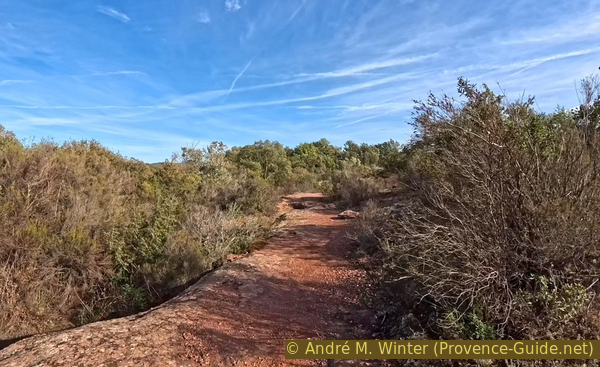
The path toward the Vallon de Saint Daumas crosses a rocky slab
For the most part, the trail takes you through a tunnel of vegetation, as shown in the photo.
No reproduction is permitted without the written consent of the author. (id9707)
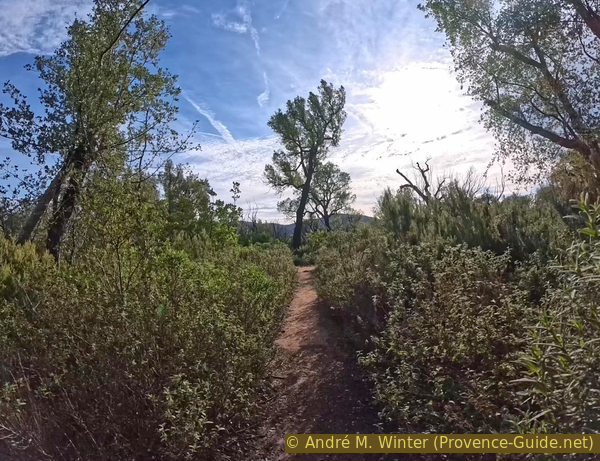
Vegetation-lined corridor on the path toward the Vallon de Saint Daumas
There is also a tricky section here, with thorny brambles in the dip. It is highly recommended to dismount and push your bike through this part.
No reproduction is permitted without the written consent of the author. (id9706)
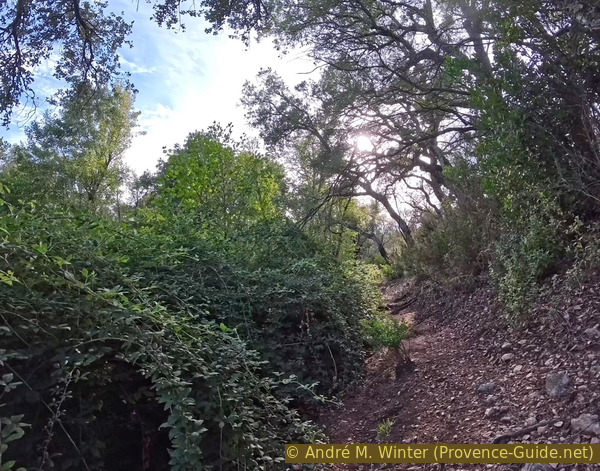
Brambles on the path toward the Vallon de Saint Daumas
Since this is a hiking trail, fallen branches and trees often remain on the path for some time before being cleared.
No reproduction is permitted without the written consent of the author. (id9705)
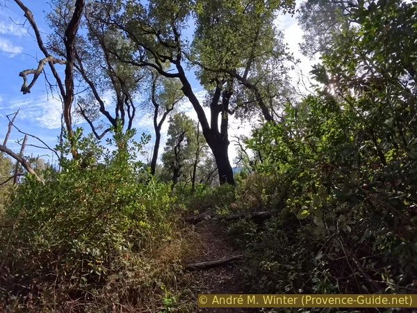
Branches across the path
You cross over rounded rock formations, with a small tributary of the Vallon de Saint-Daumas flowing through them on your left.
No reproduction is permitted without the written consent of the author. (id9704)
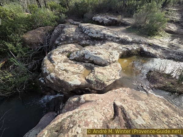
A tributary of the Vallon de Saint Daumas
These rocks are a prelude to more rocky terrain ahead. You will need to navigate a step-up, it's manageable if you carry enough momentum.
No reproduction is permitted without the written consent of the author. (id9703)
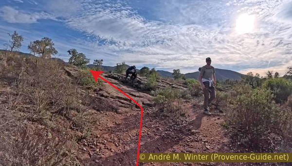
Rocks to climb on the path in the Vallon de Saint Daumas
You soon arrive at the signpost for Vallon de Saint-Daumas, 108 metre. Turn right to continue.
The section where mountain biking is prohibited ends here, as does this particular section of the trail.
No reproduction is permitted without the written consent of the author. (id9702)
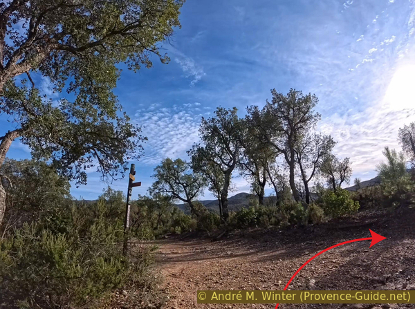
Junction of the Vallon de Saint Daumas, 108 m
Section 4: Saint Daumas - Piboules
➙ 3,9 km ... 30 min ➚ 60 m ➘ 30 m ↝ average
↙ Colours of the sections like MTB rating but without the duration.
10% rutted forest roads, few marks
20% dirt roads, few marks
↖ potentially muddy passages
55% moderate trails, few marks
15% rutted forest roads, few marks
The clues
- Vallon de Saint Daumas signpost, 108 m
- Crossing the Piste de la Tire, 113 m
- La Grande Pièce, 109 m
- Vallon des Jaudelières ford, 99 m
- Vallon des Sauronnes ford, 103 m
- Val Rouvier signpost, 115 m
- Les Piboules parking area, 138 m
We begin with a long stretch heading west, which eventually zigzags to add a bit of extra distance to the route...
Naturally, leaving the Vallon de Saint Daumas requires a climb, which initially takes us across terrain interspersed with flat rocks.
No reproduction is permitted without the written consent of the author. (id9730)
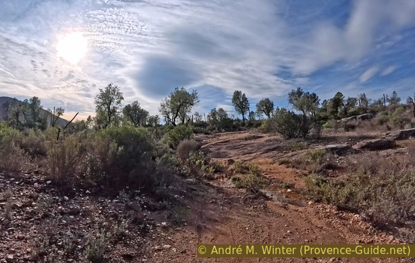
Wider path with rocks, heading west
The ascent concludes on a washed-out track that is barely rideable.
A mountain bike can easily pass beneath the barrier, provided, of course, that no one is riding it at the time.
No reproduction is permitted without the written consent of the author. (id9729)
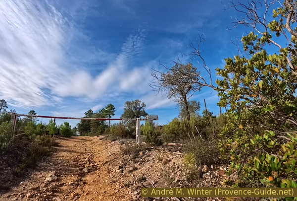
Barrier before the Piste de la Tire
We cross the Piste de la Tire track in a straight line at an elevation of 113 metres.
Those arriving from that track should turn right.
No reproduction is permitted without the written consent of the author. (id9727)
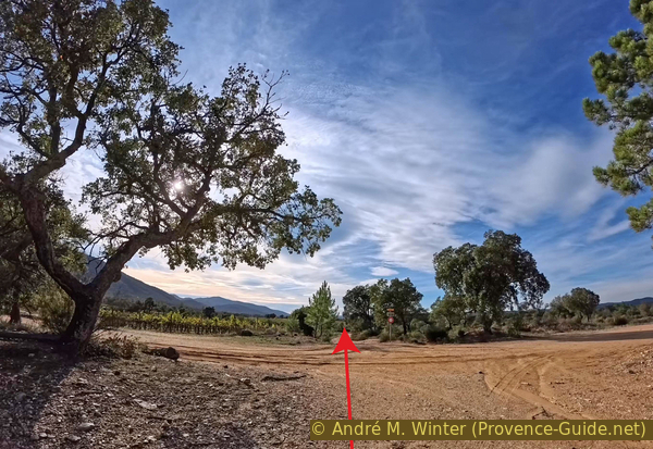
Junction with the Piste de la Tire, 113 m
We pass the Grande Pièce signpost while continuing straight ahead.
The 113 metres elevation indicated on the signpost is incorrect, we are actually at 109 metres.
No reproduction is permitted without the written consent of the author. (id9726)
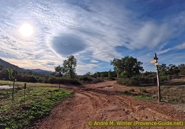
Junction north of La Grande Pièce, 109 m
La Grande Pièce is a wine estate located in the heart of the Plaine des Maures.
While these cultivated areas intersect with natural zones, they also serve a beneficial purpose by acting as firebreaks. Due to the open, expansive nature of the landscape, the vines themselves typically survive fires.
No reproduction is permitted without the written consent of the author. (id9725)
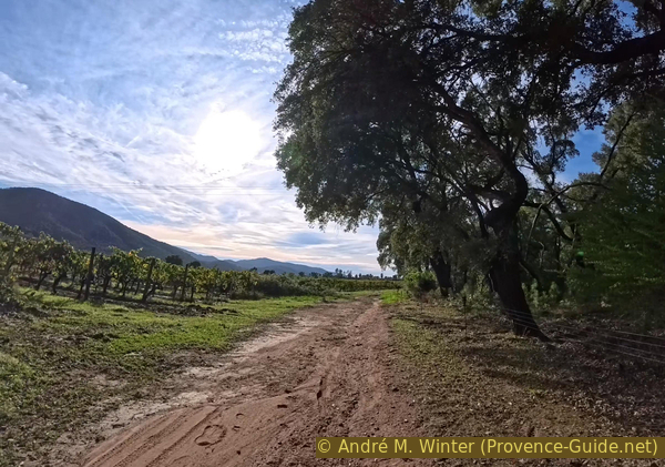
Follow alongside vineyards on the Piste des Petites Aurèdes
Beyond the vineyards lies a field where the vines appear to have been uprooted, presumably to be replanted.
We continue along the edge of this field and carry on in the same direction. The path veers slightly to the right.
No reproduction is permitted without the written consent of the author. (id9724)
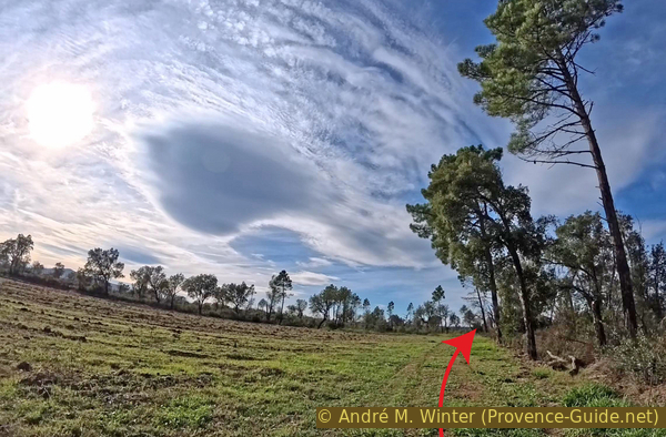
Pass alongside fields and continue on the Piste des Petites Aurèdes
This path leads us northward, and at a marked junction, situated at an elevation of 106 metres, we must make a sharp left turn.
No reproduction is permitted without the written consent of the author. (id9723)
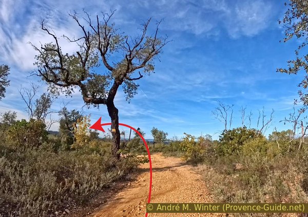
Fork on the Piste des Petites Aurèdes, 106 m
From there, the route follows a fairly straight line toward the southwest for nearly a kilometre.
Our path crosses several streams within the Vallon des Jaudelières valley.
No reproduction is permitted without the written consent of the author. (id9722)
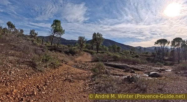
Junction at the Vallon des Jaudelières
At times, these streams flow directly along the path, depositing pieces of dead wood left over from the 2021 fire.
No reproduction is permitted without the written consent of the author. (id9721)
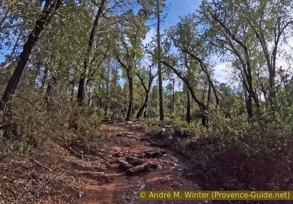
Path turned into a stream south of the Vallon des Jaudelières
During autumn and winter, any depressions in the terrain can fill with water, this particular one lies right across the path.
The 102 marker on the IGN map indicates an elevation point along a path located to the southeast of our current route.
No reproduction is permitted without the written consent of the author. (id9720)
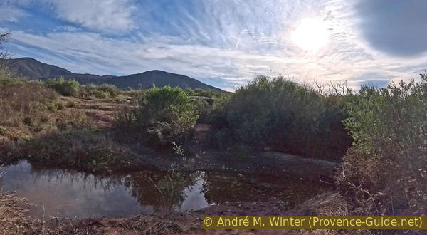
Stream northwest of point 102
Every damp, low-lying area is followed by a drier, rocky stretch.
This serves as a reminder that, generally speaking, we are on an upward incline.
No reproduction is permitted without the written consent of the author. (id9719)
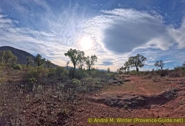
Path before the fork for Val Rouvier
Another ford crosses the Ruisseau des Sauronnes.
While these crossings can usually be navigated without dismounting from a mountain bike, the ground surrounding the pools of water can be quite soft.
No reproduction is permitted without the written consent of the author. (id9718)
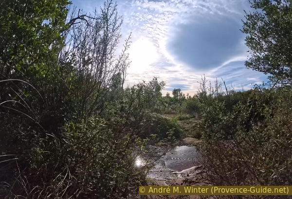
Water in the Vallon des Sauronnes
At Val Rouvier 106 metre, the path turns to the right, heading once again toward the northwest.
This junction is barely visible. The dense, tunnel-like canopy of vegetation naturally guides the way to the right.
No reproduction is permitted without the written consent of the author. (id9738)
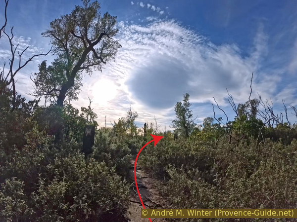
Fork north of Val Rouvier, 105 m
As we head north, the terrain generally slopes downward, like here, as we cross a few easy rock formations.
Point 96 on the IGN map marks the confluence of several streams, located just north of our path.
No reproduction is permitted without the written consent of the author. (id9737)
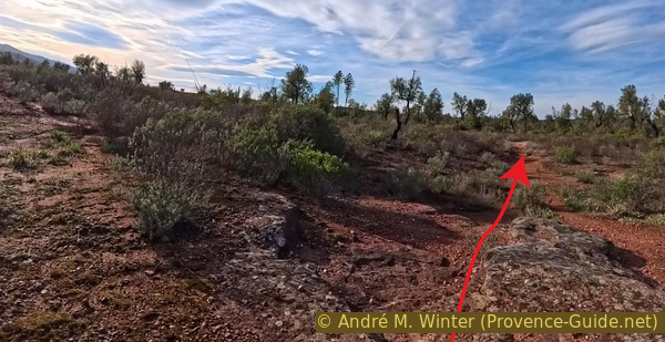
Rocks south of point 96
The puddles seem to have a preference for forming right in the middle of the trail.
No reproduction is permitted without the written consent of the author. (id9736)
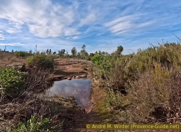
Water hole southwest of point 96
A signpost with a yellow marker directs us to turn left at this junction, situated at an elevation of 100 meters.
We now head southwest, which means we begin our ascent.
No reproduction is permitted without the written consent of the author. (id9735)
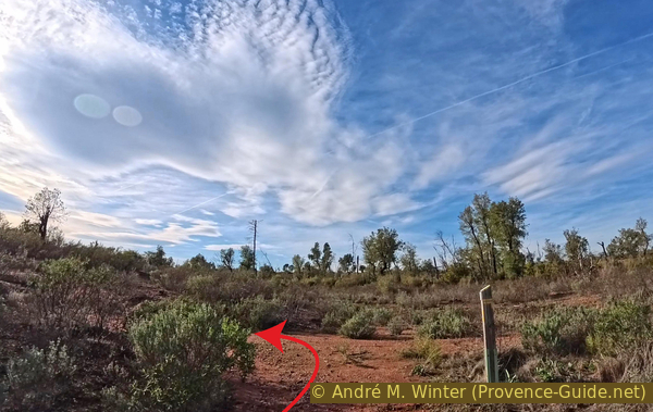
Junction southwest of point 96, 100 m
These rock formations set the tone for what's ahead.
From this point on, it's an uphill climb all the way back to the starting point.
No reproduction is permitted without the written consent of the author. (id9734)
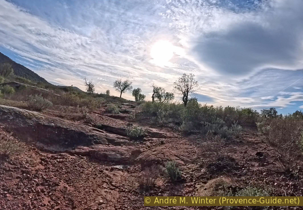
Immediately southwest of point 96, the path begins to climb through rocky terrain
Even the easier sections involve a gentle incline, though the path remains smooth and easy to ride.
The hill we are aiming for is Le Jas de Madame, followed by La Serre, 403 metre. It lies to the southeast of Les Mayons.
No reproduction is permitted without the written consent of the author. (id9733)
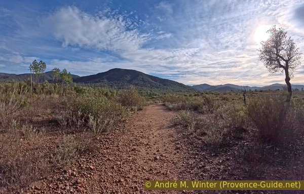
Easier path heading toward point 115
We eventually reach the familiar signpost at Val Rouvier, 115 metre. On the way out, we had sped straight past it on the descent without really noticing it.
Naturally, we turn left, and you can certainly feel the climb here!
No reproduction is permitted without the written consent of the author. (id9732)
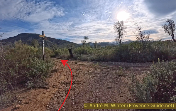
Fork at the Val Rouvier signpost, 115 m
And so, we arrive back at our starting point: the Piboules parking area.
No reproduction is permitted without the written consent of the author. (id9731)
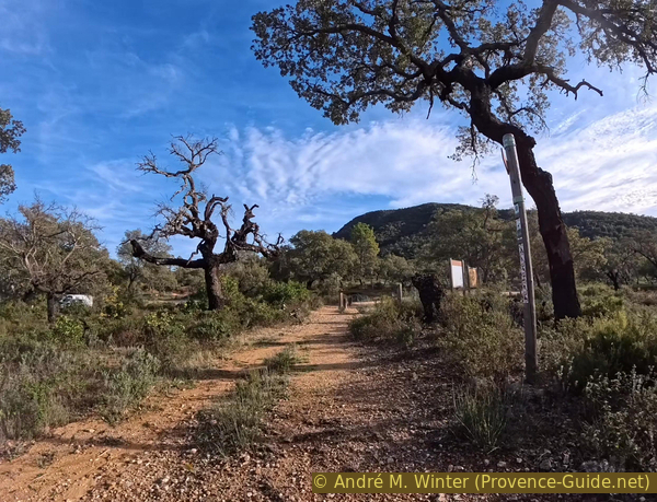
Return to the Les Piboules parking area
Sources and additional information
It is better to use a good topographic hiking map. The route is covered by the following 1:25,000-scale IGN maps: "Cuers" 3445OT (start west), "Le Muy - Lorgues" 3544OT (northern part), and "Saint-Tropez - Sainte-Maxime" 3545OT (end east).If you don't want to bother with a paper map, you can also use mapping apps on your cell phone. On the one hand, it is the Cartes IGN app from the official map service. However, it requires access to the data network and this is sometimes difficult in canyons or remote locations.
Alternatively, you can use apps that store data directly on the device. They're generally not free, but they don't cost much. We mainly use OSMAnd, here it is possible to add contour lines, relief shading, markings and others. To store this data on your phone you need a lot of space.
Of course, one needs access to satellites for the GPS signal with any app. In some canyons this is not the case. Therefore, do not rely on the position shown, but read the map on your phone as you would read it on paper. Most apps are available for Android and iPhone. The applications usually allow us to record the route travelled and also view the GPS files offered for each of our hikes.
This page has been seen 17 times since 20 March 2024.
No reproduction is permitted without the written consent of the author. (id9625)
Strawberry tree fruit along the Piste des Aurèdes