View from Notre-Dame de la Vière and the ruins of Château-Royal
A direct ascent and a quick descent via the same path
bicycle
very easy
1 h 15 min
yes
no
no
3 % of the distance
Introduction
Some viewpoints simply don't fit well into a standard hiking route. In such cases, a mountain bike is a better choice, it makes the return trip much faster.
The hill topped by the Notre-Dame de la Vière chapel sits at the edge of the Grande Tête plateau. With a 200-metre drop, this escarpment is essentially an eastward extension of the Barre de Cuers ridge, located between the towns of Rocbaron and Carnoules. The view stretches across a vast wine-growing plain, with the sea also visible in the distance.
The hill is also home to the ruins of a castrum known as Château-Royal. This medieval fortification once included dwellings, providing shelter for local inhabitants during periods of unrest when the plains below became too dangerous.
The facts
12,4 km total distance
1 h 15 min movement time.
180 m total elevation
orientation average
mark 0% of the total distance
55% hard-surfaced quiet side streets
25% forest roads
15% hard-surfaced city roads
5% hard-to-recognize trails
dangers Gravel on the asphalt, dogs
children yes
useful picnic stuff
required Hardtail mountain bike and water
GPS coordinates (WGS84) of start and end point 43.310753609231234,6.187818233826582
downloads 

Public transport
Carnoules has the advantage of a train station served by the TER ZOU! (only french) regional rail lines. Bicycles can be transported on these trains outside of peak hours.
This station serves as the starting point for the tour.
Access by car
From Marseille, the fastest route is via the A50 motorway toward Toulon, continuing onto the A57 until the Carnoules exit. Proceed toward Carnoules. After crossing a bridge, you will see a row of plane trees on your left, turn right here before. A sign will point toward the town centre parking areas. Follow this direction to enter the old town. Upon reaching a parking area, turn right. Continue uphill to another square, then follow the signs for Besse-sur-Issole. Leave the village, after a right-hand bend, you will cross a level crossing and a bridge. Immediately afterward, turn right.
If arriving by car, it is best to begin the mountain bike tour here, as parking near the train station or in the town centre is difficult. Starting at this location shortens the mountain bike route by 2.7 km and about 15 minutes of riding time for one direction.
Useful parking spaces
We park under the plane trees at the disused Carnoules les Platanes railway station. It is now only served on summer Sundays by trains operated by the Association du Train Touristique du Centre Var, which run trips between this station and Brignoles.
No reproduction is permitted without the written consent of the author. (id9535)
Tour de l'Uba tower of the Carnoules castrum
Hints
The route consists entirely of city streets, minor country roads, and forest tracks. Be aware that these minor roads can be slippery due to loose gravel on the asphalt.
At the Plaine des Thèrmes junction, you may encounter hunting dogs during the autumn and winter months. Although they wear collars and only bark, they appear to have an aversion to bicycles. For this reason, we strongly advise against traveling from this junction toward the south (Notre-Dame) or toward the east along the GR9 trail (the direct route to Pei Pelas and Carnoules).
The whole region is a zone with a high risk of forest fires. In summer, but also in other seasons when it is very dry or by strong winds, access to the forest areas can be regulated. As a result, the roads may be closed to traffic and/or the trails prohibited to hikers. Current information: Map of access to the forests of the Var (also english). The map shows the colours green, yellow, orange and red which correspond to levels of danger.
The sections
- Gare de Carnoules railway station - Chapel Notre-Dame de la Vière
- Ruins of Château-Royal and castrum
- Chapel Notre-Dame de la Vière - Gare de Carnoules railway station
Section 1: Carnoules - ND de la Vière
➙ 6,1 km ... 45 min ➚ 160 m ➘ 10 m ↝ average
↙ Colours of the sections like MTB rating but without the duration.
15% hard-surfaced city roads, without marks
55% hard-surfaced quiet side streets, without marks
30% forest roads, wrong marks
The clues
- Gare de Carnoules station, 195 m
- Under Saint-Jean, 200 m
- Bridge over Font de l'Île river, 210 m
- Chemin de Besse, 220 m
- Gare les Platanes station, 225 m
- Chemin des Fontinelles, 225 m
- Chemin de la Rouvière, 240 m
- Chemin de Puits de Guerrier, 255 m
- Chemin des Plaines, 270 m
- Plaine des Thèmes junction, 300 m
- Chapel Notre-Dame de la Vière, 345 m
This is the stage up to the chapel. The ascent begins below Saint-Jean and intensifies once you reach the Chemin de la Rouvière. Only the final stretch before the chapel is very steep.
We set off from the train station, though, curiously, our first task is to reach another station located on a disused railway line. There are absolutely no facilities for cyclists in Carnoules!
Exit the station to the right, then turn left toward Carnoules. You will find yourself following a wall, with vineyards on your right.
No reproduction is permitted without the written consent of the author. The permission of use was kindly given to Provence-Guide.net on 13 November 2026. (id9534)
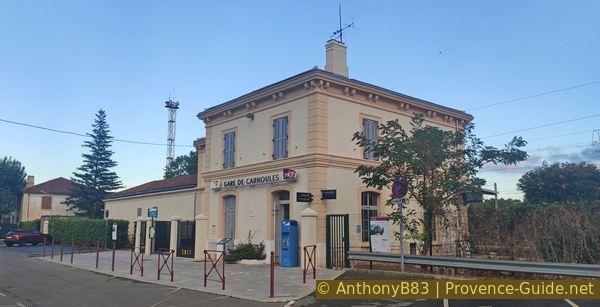
Carnoules Station
Upon reaching the D97, turn right toward Pignans and Le Luc. This departmental road is shaded by an avenue of plane trees, and it is possible to ride for quite a distance along the sidewalk on the right-hand side. Continue in this direction for about 600 metres. After crossing a bridge, you will come upon a cycle lane.
few metres before leaving the town, turn left onto the Chemin de Saint-Jean (there is also a bus stop here). The road climbs in a long, sweeping curve around the village. When you reach an intersection with a bridge to your left, turn right (look for the 3.5-tonne weight limit sign). At the next intersection, turn left onto the Chemin de Besse.
Continue climbing until you finally arrive at the disused Carnoules-les-Platanes railway station.
This serves as a convenient starting point for those arriving by car.
No reproduction is permitted without the written consent of the author. (id9533)
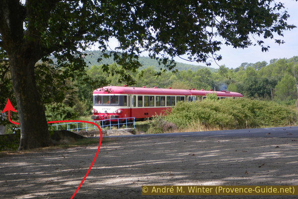
The ATTCV’s Caravelle X-4567 railcar arriving at Carnoules Les Platanes station
After the large plane trees, we turn left onto the departmental road that leads back toward Carnoules. We cross a small bridge and then a railway crossing.
Further on, we reach a large intersection where, just past the trees, we turn onto the only paved, narrow lane. You are on the right track if you see the Chemin des Fontinelles sign in front of a large electricity pylon. This path continues in more or less the same direction for nearly 800 metre.
We then arrive at an intersection, marked by a small bridge and a cluster of signs pointing in various directions. Directly ahead, there is a fairly new black gate.
Here, we turn right onto the Chemin de la Rouvière. It is similar to the previous path, but it runs more through the forest.
The photo shows this section from the opposite direction. During our reconnaissance of the route, we had a breakdown and had to replace the inner tube on one of the mountain bikes.
No reproduction is permitted without the written consent of the author. (id53)
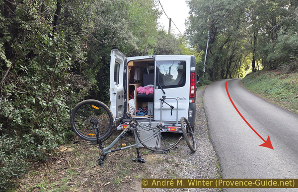
Last available parking area on Chemin de la Rouvière
After 350 metres, you reach another junction, this time featuring a small bridge in the middle. Cross the bridge and continue in the same direction, the path remains the Chemin de la Rouvière.
No reproduction is permitted without the written consent of the author. (id94)
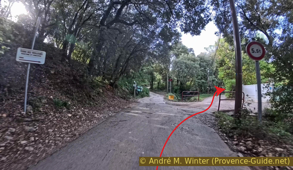
The road crosses the Thèmes stream
140 metres further on, the paved road turns to the right before another bridge, and changes its name to Chemin de Puits de Guerrier.
This small road remains fairly straight for nearly 300 metres.
No reproduction is permitted without the written consent of the author. (id9472)
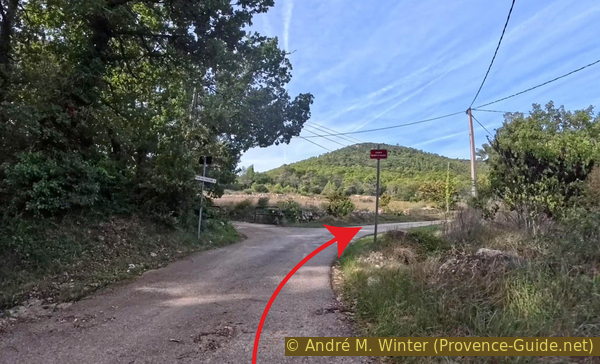
Chemin de Puits de Guerrier continues to the right
Leave this road where it turns to the right: cross another bridge onto an unpaved track. You are now on the Chemin des Plaines, which continues to climb steadily. The track is in reasonably good condition, passing by access points to isolated houses.
You will also find the first signpost here pointing toward Notre-Dame de la Vière. Be careful, however: subsequent signs are poorly placed. The Chemin des Thèmes is not a themed trail: the small stream located here bears this curious name.
No reproduction is permitted without the written consent of the author. (id9464)
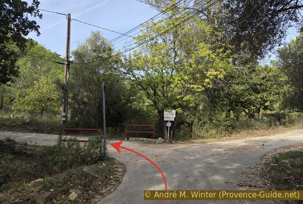
Chemin des Plaines is on the left
We arrive at an intersection featuring a utility pole and a small green transformer on the right. We turn right here.
No reproduction is permitted without the written consent of the author. (id9465)
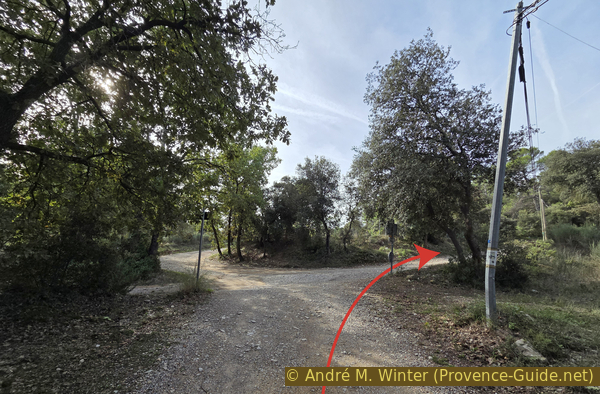
Junction at the Plaine des Thèmes
A few metres further on, we reach a fork where both paths have concrete sections. Despite the large white sign, we take the left-hand path!
No reproduction is permitted without the written consent of the author. (id9468)
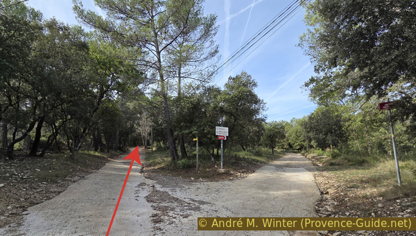
Fourche de la Vière junction, 310 m
We arrive at a level area with one last isolated house ahead. We keep to the left to begin the final stretch.
No reproduction is permitted without the written consent of the author. (id9469)
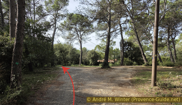
Split in the Chemin du Castrum
This last section is the steepest. You must go around this barrier and continue past it.
No reproduction is permitted without the written consent of the author. (id9470)
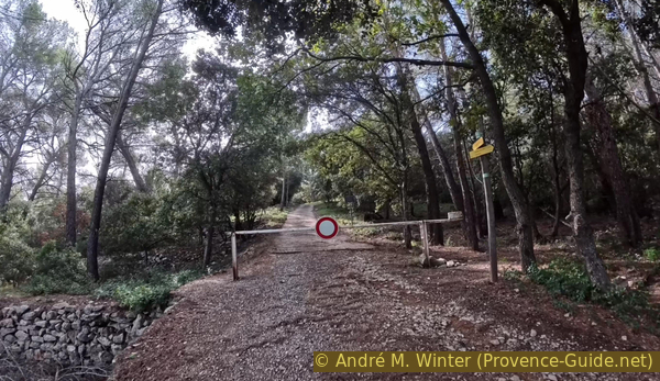
Barrier on the Chemin du Castrum
Here is the view upon reaching the top of the hill. The first ruins are located on the right, but we continue straight ahead first.
The chapel is still hidden here behind the trees.
No reproduction is permitted without the written consent of the author. (id9471)
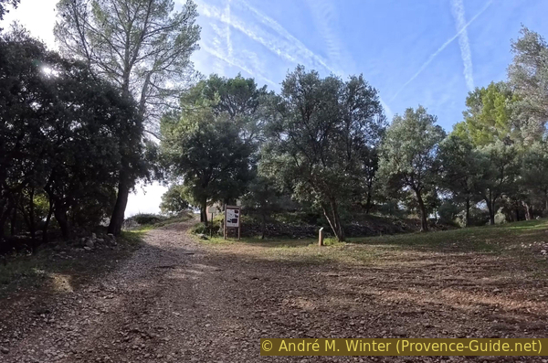
Arriving below the castrum of Château Royal
On the forecourt of the chapel, there are stone blocks that can serve as benches, as well as a cross and a panoramic viewpoint indicator.
No reproduction is permitted without the written consent of the author. (id9473)
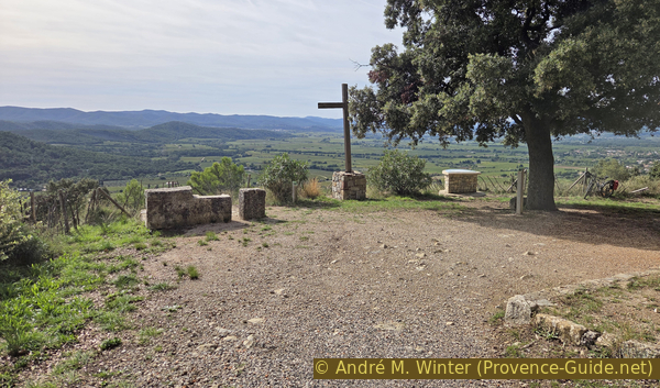
The cross in front of Notre-Dame de la Vière
The panoramic indicator provides an excellent explanation of everything in view. While Mont Blanc cannot be seen from here, there are still several notable peaks.
No reproduction is permitted without the written consent of the author. (id9475)
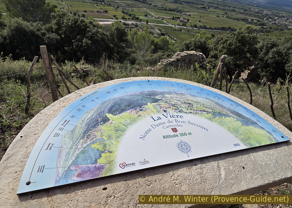
Panoramic viewpoint indicator in front of Notre-Dame de la Vière
Let's start on the right with Mont Coudon, which stands out.
Further to the right, a broad rise marks the Siou Blanc plateau, home to the Pyramide de Cassini.
To the left in the photo, you can see the sea!
No reproduction is permitted without the written consent of the author. (id9476)
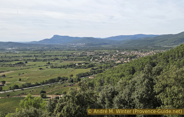
View from Notre-Dame de la Vière toward Le Coudon
To the left lies the highest peak of the Massif des Maures: Notre-Dame-des-Anges, at 768 metres.
In the foreground, you can see the village of Carnoules, situated below the Roucas hill.
No reproduction is permitted without the written consent of the author. (id9477)
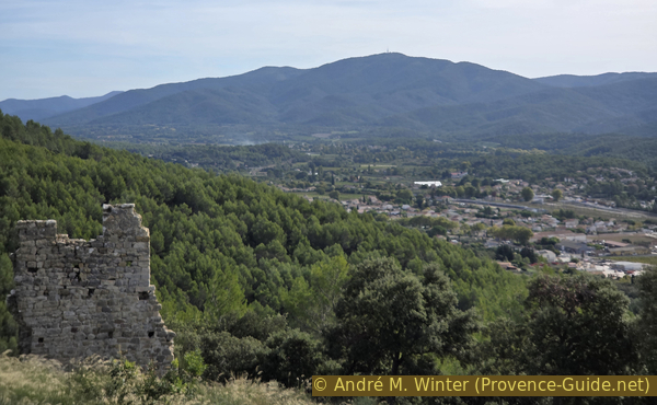
View from Notre-Dame de la Vière toward Notre-Dame des Anges
On the far left is the Roucas, another one of the hills that form a line with the one upon which we are standing.
No reproduction is permitted without the written consent of the author. (id9478)
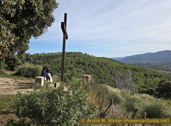
The cross in front of Notre-Dame de la Vière and two hikers
Section 2: Ruines du Castrum
➙ 0,4 km ... 15 min ➚ 10 m ➘ 10 m ↝ difficult
↙ Colours of the sections like MTB rating but without the duration.
100% hard-to-recognize trails, without marks
↖ leave the bike and explore on foot
The clues
- Tour of the site
We take a walk around the ruins of the Castrum of Château Royal, circling the chapel.
The chapel of Notre-Dame de la Vière is also known as Notre-Dame de Bon Secours.
It is of relatively recent origin, having been built from the stones of the former lord's residence and completed in 1825.
No reproduction is permitted without the written consent of the author. (id9479)
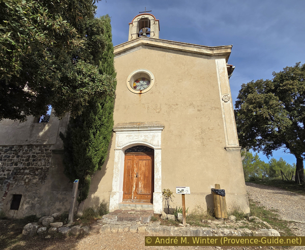
The Chapel of Notre-Dame de la Vière
To the left of the chapel lies a large, ruined building, the former priory and pilgrim shelter. Its substantial size stems from the remains of a feudal residence, to which an additional story was later added.
No reproduction is permitted without the written consent of the author. (id9480)
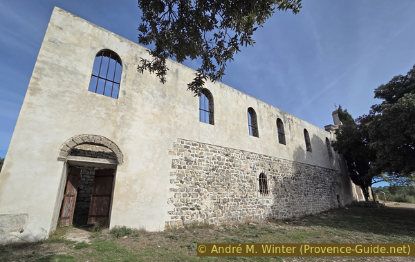
Ruins of the pilgrims' shelter attached to the Chapel of Notre-Dame de la Vière
Inside, one can clearly distinguish the original, low 12th-century walls from the 19th-century additions.
These mixed remains have only been minimally stabilized.
No reproduction is permitted without the written consent of the author. (id9481)
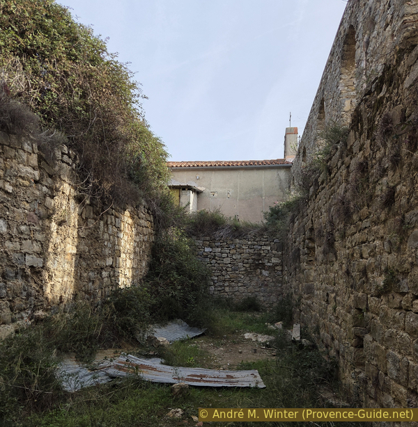
Interior of the ruins of the pilgrims' shelter attached to the Chapel of Notre-Dame de la Vière
Leaving the ruins of the priory, we pass to the left of the structures and begin a wide, clockwise circuit.
In the distance, we can see the Coudon massif, while below us, on the hillside, lie the remains of walls and low-lying structures. These are the remnants of dwellings once located within the walls of the medieval fortress. The site has been occupied, destroyed, and rebuilt multiple times since the Roman era.
No reproduction is permitted without the written consent of the author. (id9482)
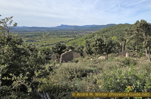
Group of dwellings with Le Coudon in the background
Let us turn to the northern section of the buildings that remain partially standing.
Here, we see the altered remains of the lord's residence. It is unclear whether the base of the chapel is also part of this structure.
The current meadow once served as the High Court (Haute Cour), a space used for ceremonies and banquets, as well as for the administration of justice.
Regarding the names at the site: the hill is called La Vière, and the chapel is therefore known as Notre-Dame de Vière. The stronghold was called Château-Royal, and this type of fortification is termed a castrum, especially if it was used as such several centuries.
No reproduction is permitted without the written consent of the author. (id9483)
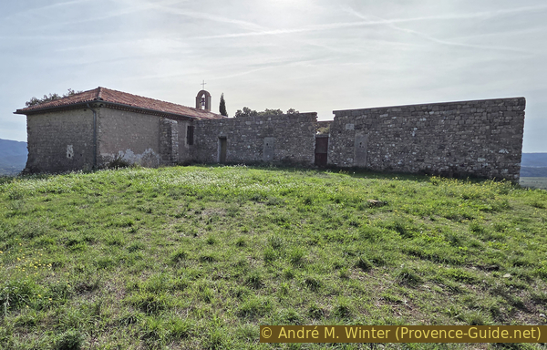
Notre-Dame de la Vière and the adjoining priory, built upon the former lordly residence
Turning around, we follow a path that leads downward. It then veers to the right, arriving at a level area containing the remains of the northern defensive wall of the castrum.
No reproduction is permitted without the written consent of the author. (id9484)
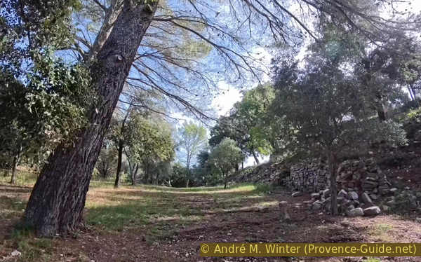
Base of the northern perimeter wall of the Carnoules castrum
Continuing in the same direction, we cross back over the path by which we first arrived on the hill. Here, there is an information board featuring a map that is somewhat difficult to interpret. The structures depicted on it correspond, in part, to numbered signs placed along the circuit.
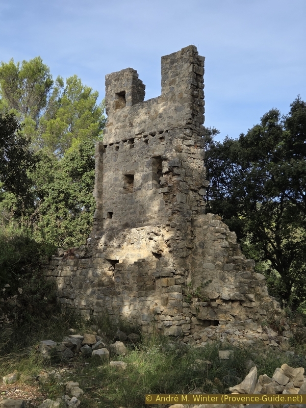
Hidden behind the trees lie the ruins of the Tour de l'Uba tower. The name Uba likely derives from ubac, referring to the northern, shaded side of a slope. This tower, which was once square and stood 10 metres high, guarded the main entrance to the castrum. It was open on the inner side, thus consisting of only three walls. At its base, it features arrow slits, while the top is topped with a large crenellation. Small holes visible on the inner face mark the level where the floor of the wall-walk was once positioned.
No reproduction is permitted without the written consent of the author. (id9485)
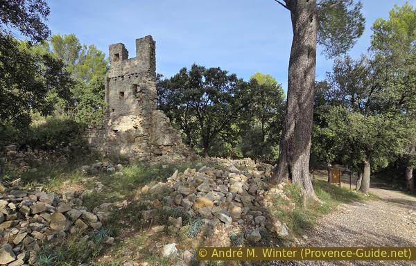
Tour de l'Uba tower of the Carnoules castrum
As you descend along a somewhat overgrown path, you pass beneath a large section of wall, a remnant of the defensive perimeter on the northeastern side of the Castrum.
No reproduction is permitted without the written consent of the author. (id9487)
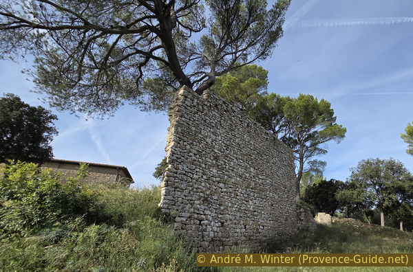
Remains of the eastern perimeter wall of the Carnoules castrum
Further down lie the ruins of the Tour du Levant tower. Situated in the southeastern part of the site, this tower once served as a vantage point for monitoring the Permian depression plain where the town of Carnoules is now located.
Like the Tour de l'Uba, this tower was square, crenellated, and pierced with arrow slits.
No reproduction is permitted without the written consent of the author. (id9526)
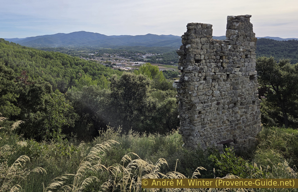
Tour du Levant tower of Château-Royal
Continuing your descent, you come upon a large hollow reinforced by dry-stone walls. This is all that remains of a lime kiln, built on the site after it was abandoned at the end of the 14th century. The site was repurposed as a stone quarry. Because much of the stones were small, they was processed into lime. This substance, used as a binder for mortar, helped in the construction of the present-day village of Carnoules. Only the base of the kiln remains visible today. It was a barrel-shaped structure with an opening at the bottom to fuel the fire, which had to heat the limestone to 900°C.
No reproduction is permitted without the written consent of the author. (id9527)
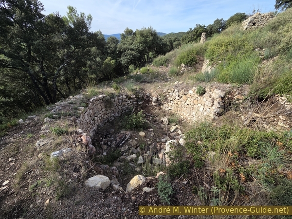
Lime kiln within the castrum
We continue our circuit among the vestiges and ruins.
Before us stands the Porte Aiguière gate. From here, the inhabitants of the castrum would descend to fetch water from the Source des Vallons spring. This gate was discreetly integrated into the fortification walls, allowing residents to exit even during a siege.
No reproduction is permitted without the written consent of the author. (id9528)
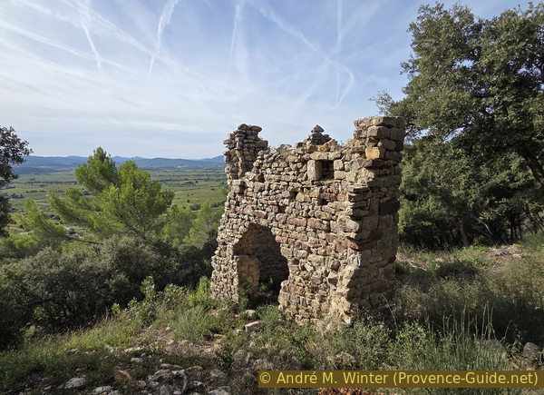
The Porte Aiguière of the Carnoules castrum
A little further down lies the southern perimeter wall, the longest surviving section of the castrum.
These ramparts spanned 400 metres in total and formed the core of the defensive system. The wall stands 7 metres high today, though it would have reached 10 metres originally. Like the towers we saw earlier, it features arrow slits, crenellations, merlons, and holes that once held the wooden patrol walkway.
No reproduction is permitted without the written consent of the author. (id9529)
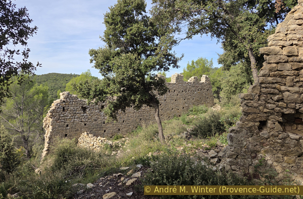
Perimeter wall of the Carnoules castrum
We head back uphill, passing through the ruins of a cluster of dwellings.
This brings our archaeological exploration to a close, and we can now get back on our mountain bikes.
No reproduction is permitted without the written consent of the author. (id9530)
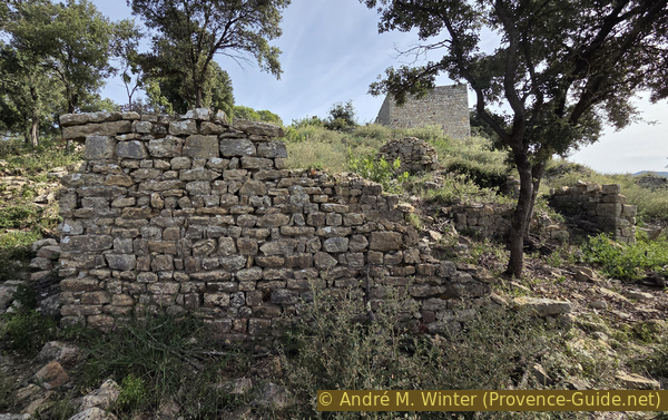
Ruins of the Carnoules castrum
Section 3: ND de la Vière - Carnoules
➙ 5,9 km ... 15 min ➚ 10 m ➘ 160 m ↝ average
↙ Colours of the sections like MTB rating but without the duration.
25% forest roads, wrong marks
55% hard-surfaced quiet side streets, without marks
15% hard-surfaced city roads, without marks
The clues
- Chapel Notre-Dame de la Vière, 345 m
- Plaine des Thèmes junction, 300 m
- Chemin des Plaines, 270 m
- La Rouvière, 270 m
- Chemin de la Rouvière, 255 m
- Chemin des Fontinelles, 240 m
- Gare de Carnoules les Platanes station, 255 m
- Bridge over Font de l'Île creek, 210 m
- Under Saint-Jean, 200 m
- Gare de Carnoules station, 195 m
We head back the way we came to avoid the dogs in the hills and the traffic in the historic centre.
We descend in an almost straight line to the Plaine des Thèmes junction, where we turn left.
No reproduction is permitted without the written consent of the author. (id9531)
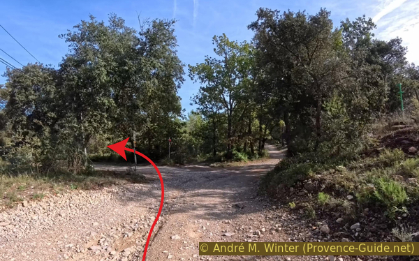
Plaine des Thèmes junction
In just over five minutes, we arrive back at the Chemin de Puits Guerrier, and the asphalt returns beneath our wheels.
There isn't much traffic, but the road is narrow and visibility is not always good. It's best to be cautious on the descent!
No reproduction is permitted without the written consent of the author. (id9532)
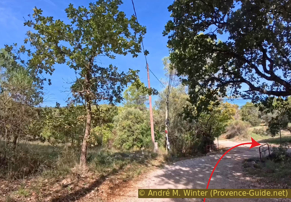
Arrival at the Chemin de Puits de Guerrier
The route leads back onto Chemin de la Rouvière, then Chemin des Fontinelles, with no significant changes in direction.
This brings us back to Gare des Platanes station, from where we continue along Chemin de Besse.
At the only notable intersection, turn right.
On Chemin de la Font de l'Isle, the path crosses a bridge over the former railway line, followed by another bridge over the river. Immediately afterward, turn left to descend along Chemin de St.-Jean.
At the very bottom, you rejoin the short bike lane along the D97, then continue along the alley until you reach a sign, marked with an arrow—pointing toward the train station (Gare SNCF).
Sources and additional information
It is better to use a good topographic hiking map: this tour is on the IGN map "Cuers", scale 1:25000, 3445OT.
If you don't want to bother with a paper map, you can also use mapping apps on your cell phone. On the one hand, it is the Cartes IGN app from the official map service. However, it requires access to the data network and this is sometimes difficult in canyons or remote locations.
Alternatively, you can use apps that store data directly on the device. They're generally not free, but they don't cost much. We mainly use OSMAnd, here it is possible to add contour lines, relief shading, markings and others. To store this data on your phone you need a lot of space.
Of course, one needs access to satellites for the GPS signal with any app. In some canyons this is not the case. Therefore, do not rely on the position shown, but read the map on your phone as you would read it on paper. Most apps are available for Android and iPhone. The applications usually allow us to record the route travelled and also view the GPS files offered for each of our hikes.
This page has been seen 30 times since 20 March 2024.
No reproduction is permitted without the written consent of the author. (id9486)
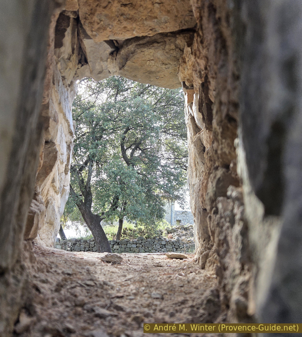
View through an arrow slit in the Tour de l'Uba tower