The Saint Michel chapel near Gignac
Cultural and historical site
30 min
view point
The A55 motorway between Marseille and Martigues runs north of the Côte Bleue and the Chaîne de l'Estaque mountain range. To the south you can see into canyons and vertical limestone cliffs. It is a very deserted natural area, which is only known to a few climbers. At the height of Gignac-la-Nerthe we see remains of the walls and, further on, a chapel in this rocky limestone desert.
It's easy to get to from Gignac, but it's hard to escape from the almost non-stop noise of the motorway.
Description
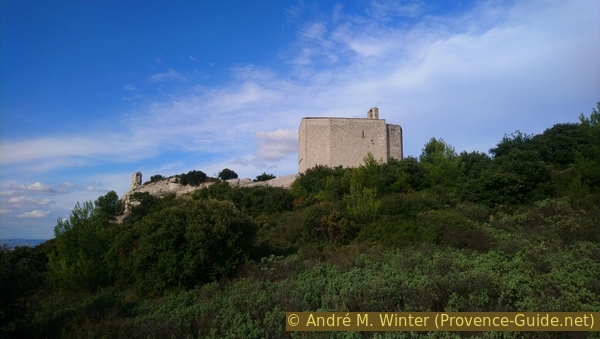
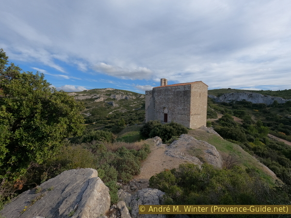
The Templars take possession of the area in the 12th century. They build a fortified complex and also the chapel in the 13th century. It was originally called Sainte-Marthe et Saint-Michel, the latter being the patron saint of the Templars. The castle and the houses of the village were destroyed by Raymond de Turenne in 1388, but the chapel was spared and it was used until the Revolution.
The fortified chapel has remains of battlements on the north side. The few openings are extremely narrow. The bell tower was added at the end of the 15th century.
The capitals in the form of foliage on the columns of the portal are also found inside and testify to the penetration of Romanesque art in Provençal-Gothic buildings.
Special features
Historically and logically, the chapel is part of Gignac-la-Nerthe, but today it is located in the municipality of Le Rove, with the municipal boundary formed by the motorway. This separation was completed in 1853.
Few people go to the chapel because of the noise of the highway. For this reason, you will also meet owners with larger dogs here. Unfortunately, the animals are rarely muzzled or on a leash.
No reproduction is permitted without the written consent of the author. (id5749)
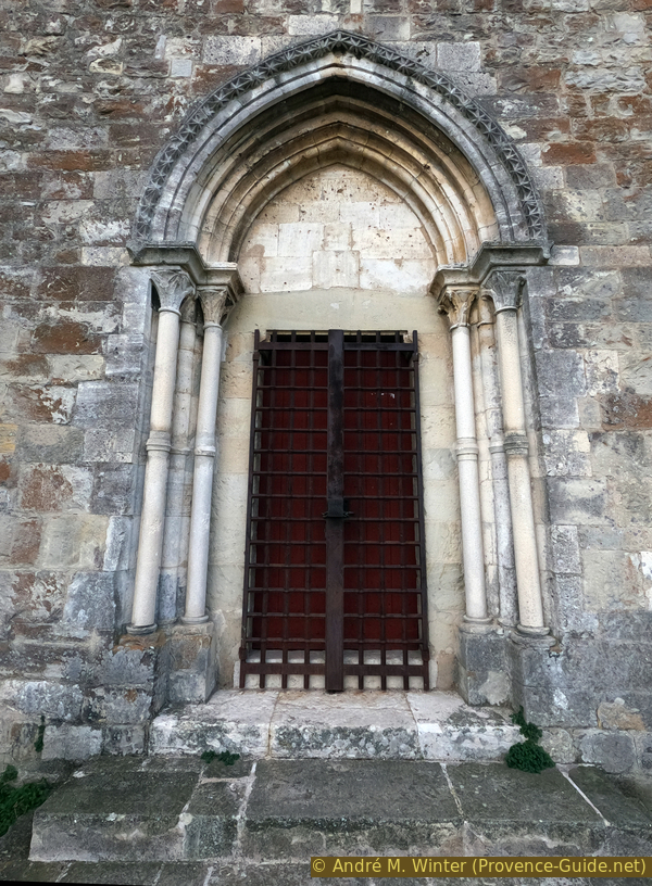
Saint Michel chapel door
Access by public transport
The Poussaraque stop near the Carrefour supermarket is served by several regional and local bus routes. Information under La Métropole Mobilité (only french).
Access by car
Take the A55 west of Marseille towards Martigues and exit at Gignac-la-Nerthe. At the next roundabout, turn right and continue straight. Turn right after the Carrefour supermarket.
Access on foot is described from the bus stop below the supermarket.
Parking site
Parking in the free spaces on the uphill road. Alternative: drive to the mailboxes as described below and look for a place to park there.
Short trail
We get off at the stop under the supermarket and walk up the street to the east and turn right again towards the parking lot entrance. However, here we turn left onto the Chemin de la Chapelle St. Michel (DFCI arrow). Now straight ahead to a T-junction with many mailboxes.
No reproduction is permitted without the written consent of the author. (id5743)
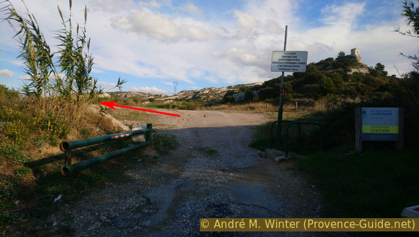
Chemin de la Chapelle St. Michel north of the highway
Left after the gate.
Go then left to a first barrier. We then hear and see the highway on the right. We try to get as far away from it as possible by taking the parallel path on the left after the barrier.
No reproduction is permitted without the written consent of the author. (id5744)
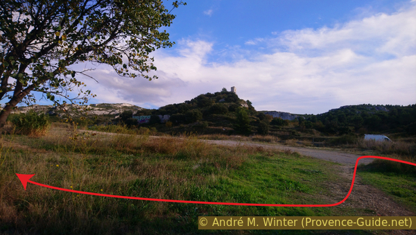
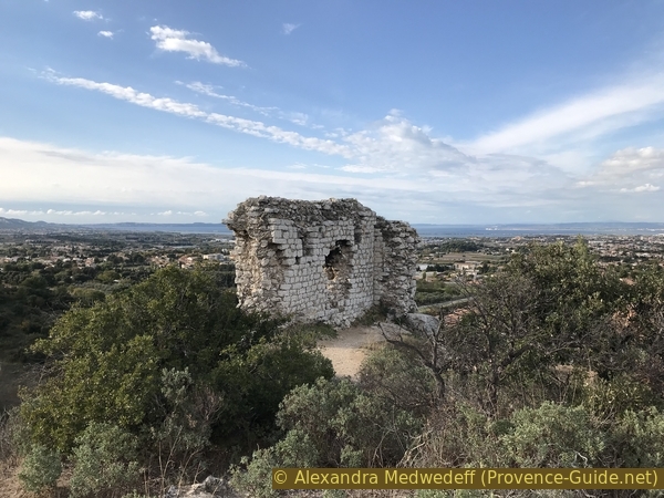
The fort ruin
Take the path far from the noisy highway.
We pass above the houses of the Viguière district.
No reproduction is permitted without the written consent of the author. (id5745)
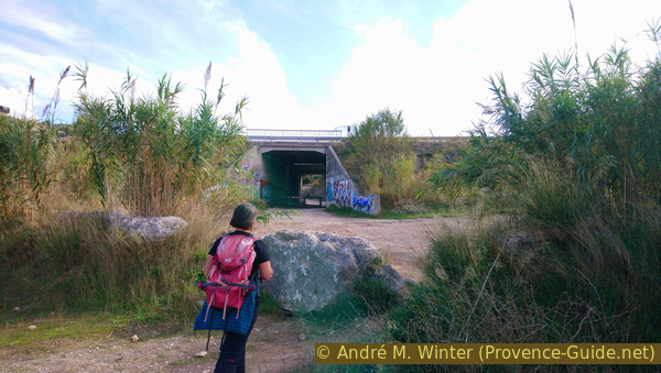
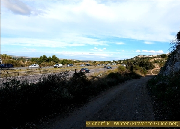
Down to the highway underpass
The path descends into a hollow and we keep to the right to pass under the highway.
No reproduction is permitted without the written consent of the author. (id5746)
The highway underpass
Then straight uphill on the forest path, but take the first path that branches off to the right. It leads directly up to the chapel.
No reproduction is permitted without the written consent of the author. (id5747)
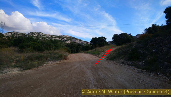
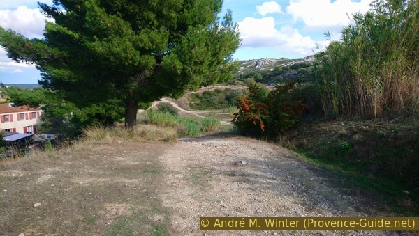
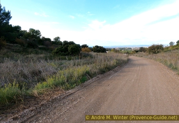
The forest road east of the chapel
Take the first path updards on the right side.
South of the chapel you hardly hear the highway.
No reproduction is permitted without the written consent of the author. (id5748)
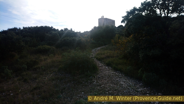
The direct way up to the chapel
We can proceed on the ridge that crests the remains of the castle. Look for a bush north of the chapel, pass it to the right and bypass the rock to the left immediately behind. Then on sight to the remaining walls ahead.
No reproduction is permitted without the written consent of the author. (id5750)
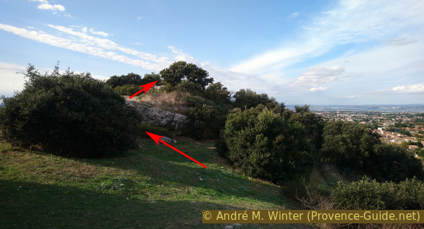
Ridge between the chapel and the castle ruin
The view shows Gignac, Marignane and the Étang de Berre.
No reproduction is permitted without the written consent of the author. (id5751)
Gignac castle ruins
We take a different route back to see some other walls of the castle. South of the chapel we turn right down into the valley, i.e. to the west.
No reproduction is permitted without the written consent of the author. (id5753)
South side of the chapel
We quickly reach a wide forest path that leads directly to the starting point, if the motorway weren't blocking our way.
No reproduction is permitted without the written consent of the author. (id5754)
The forest road west of the chapel
We therefore turn right before the motorway fence to reach the underpass known from the way up.
From there on the same way back to the starting point.
No reproduction is permitted without the written consent of the author. (id5755)
The forest road between the highway and the castle hill
No reproduction is permitted without the written consent of the author. (id5752)
Chapelle Saint Michel