Rock tombs of Carluc
Historical and cultural site
20 min
castle
These rock tombs are a real attraction in the region. Many graves and a chapel remain from a cult site around a spring from the Gallo-Roman period.
Near the ancient Via Domitia (between Spain and Briançon), the town has also been on the pilgrimage route to Santiago de Compostela since the Middle Ages.
The chapel has a pentagonal apse, in its current state it seems to date from the 15th century. The exterior walls of the nave are pierced with holes which remain from scaffolding during construction. Certain corners of the buildings feature columns with capitals decorated with foliage and birds.
No reproduction is permitted without the written consent of the author. (id2325)
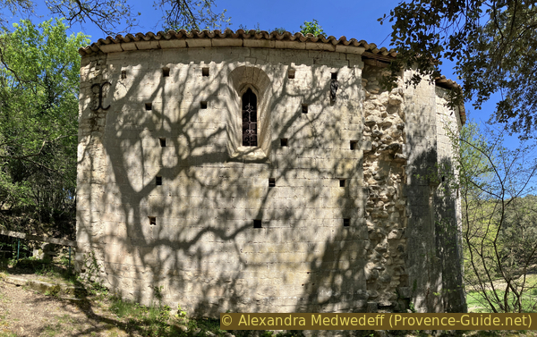
Carluc Chapel 12th century
Site history
A small abbey was built from 1101 at the latest on an ancient cult site and near a grave of a saint who has not yet been identified. Some graves date from the time of the first Christians in Provence.
The priory's peak was around the 12th century with three chapels, of which only the Notre Dame chapel is partially preserved. In addition, several chapels and hermitages are looked after in the area. Carluc was a dependance from the Montmajour Abbey.
No reproduction is permitted without the written consent of the author. (id7335)
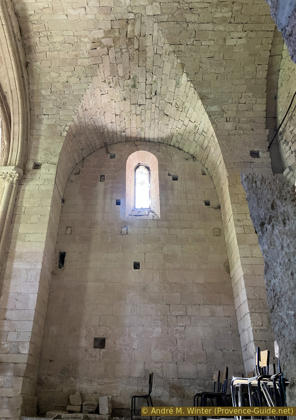
Empty interior of the Carluc Chapel
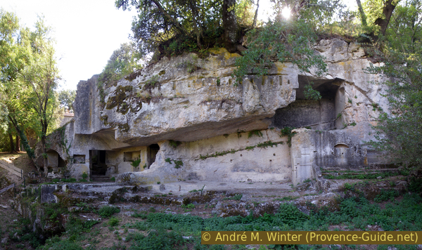
The priory is located in front of a cliff dug with galleries, rock dwellings and a necropolis with anthropomorphic tombs. A part of these tombs are located in a gallery dug into the rock. There are others in various places behind the chapel.
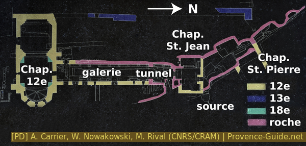
Construction plan of the priory of Carluc
Access by public transport
There is no public transport to the site. However, it is easy to reach Carluc from Céreste, all the necessary information can be found here: Easy hike between Céreste and Carluc.
Access by car
The D4100 and D900 roads link Forcalquier to Apt in an east-west valley in the north of the Lubéron. The site is located in the town of Céreste and on this axis.
Coming from Apt, you cross Céreste and at the exit you find access to the car park. A small sign indicates the direction to follow to access the Priory of Carluc.
Coming from Forcalquier, go up towards Apt on the plateau and go straight through a crossroads where the A51 and Manosque are indicated on the left. We look at the odometer, because 4.9km later you will have to turn right onto a small signposted road Prieuré de Carluc.
Starting from Manosque or Pertuis, we join the D4100 at Les Granons. Here on the left and 4.9km further on the right, a small sign indicates the Priory of Carluc.
We arrive in any case from the west and see the chapel behind the trees.
Parking site
To park, continue on the road which bends, in the next bend there is a meadow on the right which serves as parking for the site. It is spacious enough for all visitors, even on busy days.
Picnic tables are located under the trees in front of the chapel.
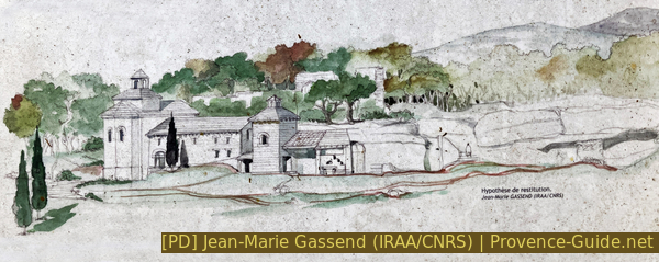
Schematic drawing of the priory of Carluc
No reproduction is permitted without the written consent of the author. (id2322)
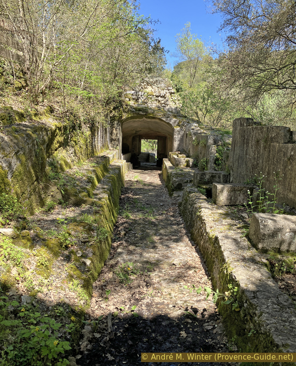
Row of tombs and the breach behind
No reproduction is permitted without the written consent of the author. (id2321)
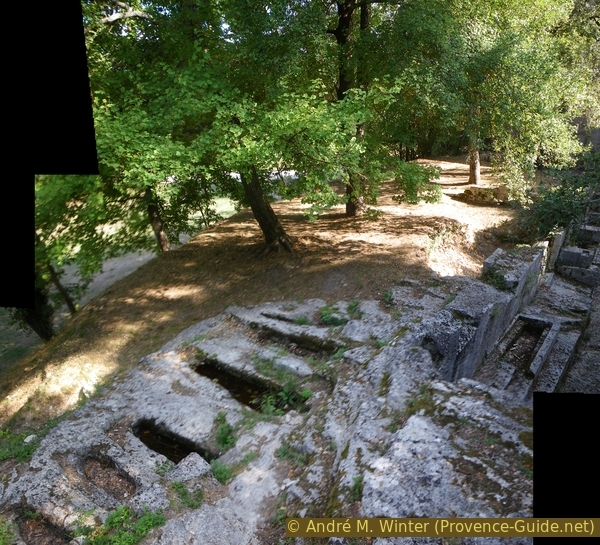
Several stone tombs at Carluc
No reproduction is permitted without the written consent of the author. (id2324)
General overview of the rooms carved in stone in Carluc
No reproduction is permitted without the written consent of the author. (id7355)
Formerly converted natural cave and remains of a cart in Carluc
No reproduction is permitted without the written consent of the author. (id7334)
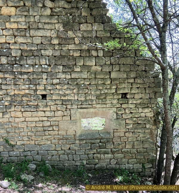
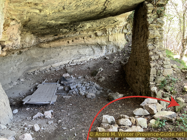
Opening in a wall of a 13th century construction at Carluc priory
No reproduction is permitted without the written consent of the author. (id2323)
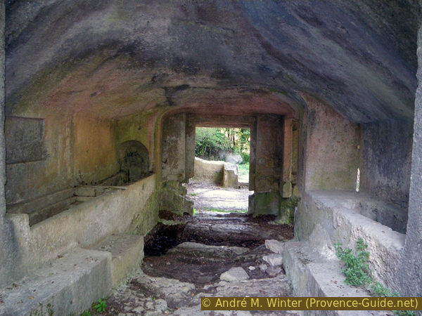
Burial tunnel in Carluc