Hike around Simiane-la-Rotonde
To see more than just the village center
hike
easy
2 h 30 min
yes
yes
built-up area
mountain
Introduction
Simiane is 630 m above sea level on the edge of the limestone plateaux of the Monts de Vaucluse. The terrain is undulating and interspersed with some deeper valleys. You come to the place mainly because of the mysterious rotunda (fortified tower with a magnificent dome inside). However, there are worthwhile round trips that include the place. The village alone would probably be too small to satisfy the hikers' feet. The plan: first do the rounds and then roam through the village again at your leisure.
The facts
6,7 km total distance
2 h 30 min walk time
290 m total elevation
orientation easy, but important branches are not marked
mark 60% of the total distance
30% forest roads
25% hard-surfaced quiet side streets
20% easy trails
15% dirt roads
10% hard-surfaced city alleys
dangers Heat in summer, no water on the way
children if they have appropriate walking experience
useful picnic stuff
required hiking boots, hiking equipment and water
GPS coordinates (WGS84) of start and end point 43.981465,5.560771
downloads ![]()
![]()
No reproduction is permitted without the written consent of the author. (id3470)
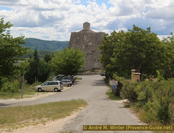
View of the rotunda at the beginning of the path
Public transport
Unfortunately, line 926 between Apt, Simiane-la-Rotonde and Banon only runs once a week. Both stops in Simiane are on the route: above the village by the rotunda and below in the new village next to the school (only for the main variant lower village - Défens). More at Zou! (only french).
Access by car
Simiane-la-Rotonde is located on the limestone plateau on one of the roads between Apt and Banon. But you can also drive here from Sault and Céreste.
Useful parking spaces
Free parking above the village at the rotunda and below in the new village (Faubourg).
Hints
No source of drinking water or creek the entire way, be sure to bring enough to drink. The main ascent can be difficult in summer because of the heat, so patience is required if you have children.
Some sections of the paths and forest roads are strewn with coarse quarry stones. Here it is quite difficult to walk and high mountain boots are necessary to protect the ankles, even if the tour is otherwise easy.
This hiking description has two variants, which vary mainly in the ascent to the hill Le Défens south of the village:
- The main circuit, crossing the town from top to bottom and over the east side of Le Défens hill, is described below. This trail is marked, wider and easier to find. However, one is more exposed to the sun here.
- The second variant: from the village centre to the valley head of La Combe and via the western slope to Le Défens, is shown in the appendix at the bottom of the page. This part replaces section 1 of the main tour. Here we have a narrow path through the low forest of the Garrigue. But you have to walk briefly on the bypass road.
The whole region is a zone with a high risk of forest fires. In summer, but also in other seasons when it is very dry or by strong winds, access to the forest areas can be regulated. As a result, the roads may be closed to traffic and/or the trails prohibited to hikers. Current information: Access map to the forests of Alpes de Haute Provence (also english). The map shows the colours green, yellow, orange and red which correspond to levels of danger. The affected area is: Forcalquier-Entrevennes.
The sections
- Traverse the village from top to bottom, over a bridge and over to the east on Le Défens
- Forest road up to the ruins of Coudal, set in the lavender fields
- Descent into the valley of La Combe, road in the valley and ascent to the Notre-Dame ridge and back to the Rotunda
Bars and restaurants only in the village.
Section 1: Rotonde de Simiane - le Défens
➙ 1,9 km ... 45 min ➚ 150 m ➘ 80 m ↝ easy
35% hard-surfaced city alleys, without marks
20% forest roads, with marks
45% easy trails, with marks
The clues
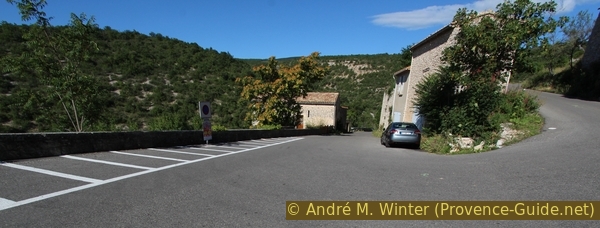
- Simiane, 720 m, start at the car park of the rotunda above the village
- Descent to the right of the rotunda to the Saint-Jean bell tower and the terrace of the Bistro la Palette, there keep left
- Leave the village centre, turn right and down to the school
- Bridge over the mostly dry river bed of the Combe, 650 m
- Ascent to Le Défens, 800 m, always take the forest roads uphill on the right
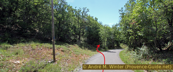
The Simiane rotunda is located in the upper part of the old town centre. Arriving from Sault, the bare and defensive tower welcomes you. Despite this, the interior is beautifully designed and you should definitely plan a visit, either at the very beginning of the tour or at the end of it.
In the picture above you can see the parking lot, the buses also stop in this area.
No reproduction is permitted without the written consent of the author. (id3461)
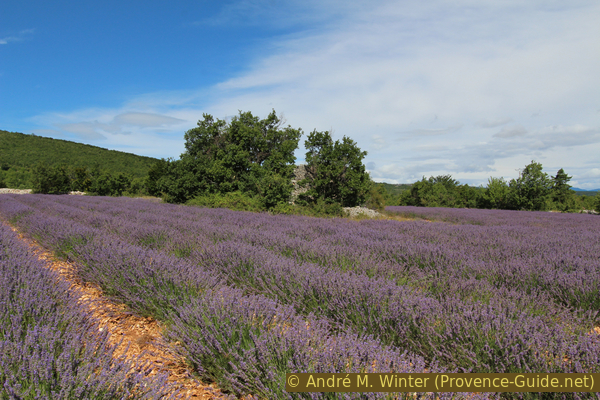
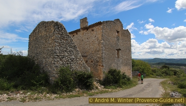
Coudal ruin in a lavender field
clocher = bell tower
école = school
vers = to
et = and
pont = bridge
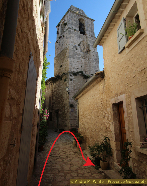
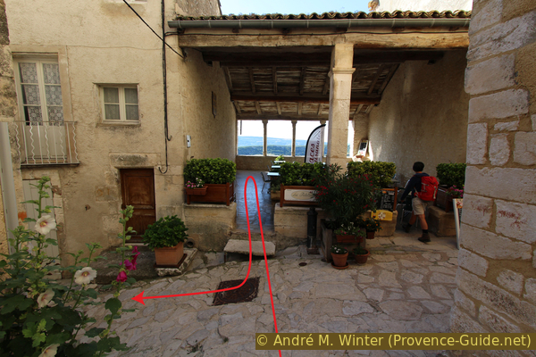
Passing the rotunda on the right leads to the village from above. The entrance to the tower follows immediately on the left. But we turn right and follow the zigzag of the streets down. It's hard to get lost, all the alleyways lead down to a long, criss-crossing cobbled street.
No reproduction is permitted without the written consent of the author. (id3441)
Access to the upper village next to the rotunda
If you keep going down, after a while you will see the Saint-Jean bell tower. There is no need to look for the church, it no longer exists. Also, you don't go all the way to the tower, but rather further down to the right in front of it.
No reproduction is permitted without the written consent of the author. (id3442)
Saint-Jean bell tower in Simiane
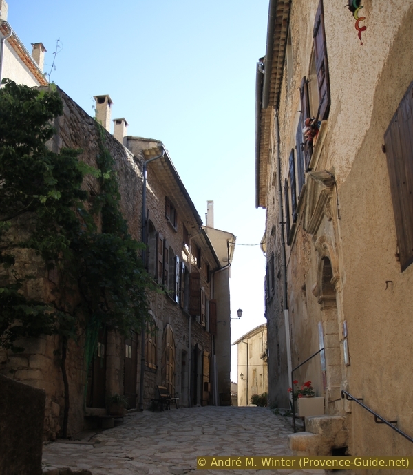
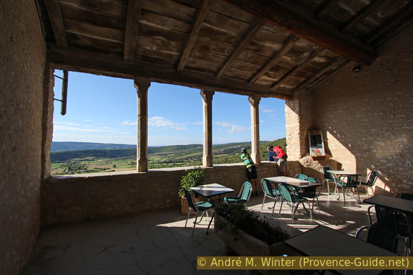
After further angles in the alley we come to the larger straight cross alley. It forms the lower boundary of the old village centre. Here stands a remarkable covered hall. On the one hand, it is a good place to have a drink or eat in the associated bistro La Palette. But even if you don't need refreshment because you've just started the tour, you should enjoy the view, since you can see part of the tour here.
No reproduction is permitted without the written consent of the author. (id3443)
Covered terrace of the Bistro La Palette
View from Bistro La Palette: The green hill on the right is Le Défens. In the middle of the picture (above a rock) you can see a path: this is our way on Le Défens. This side faces east. The sun shines here early, so in summer you should start as early as possible.
Défens is a term from the feudal era and referred to areas that were directly under the ruler and which he used for hunting and farming. They were also not allowed to be grazed by the community after the harvest. The term has survived in rural place names and is very common in France. Défense means forbidden.
No reproduction is permitted without the written consent of the author. (id3445)
Path on Le Défens seen from Simiane
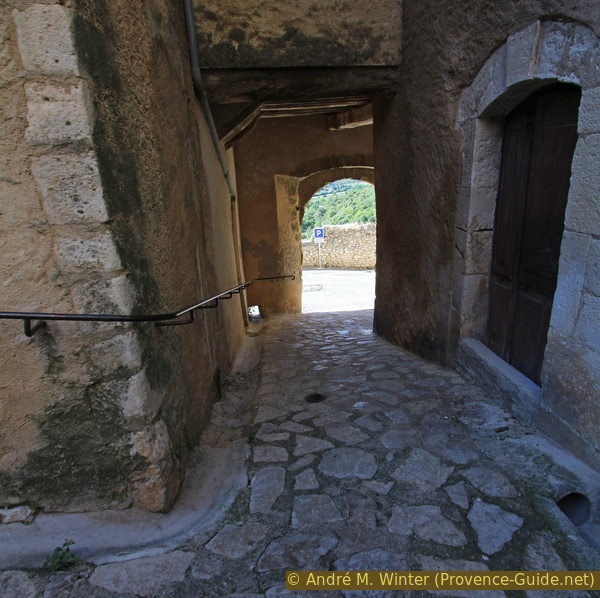
But before we can go out into nature, we still have to get out of the city walls. In front of the terrace of the Bistro La Palette we turn left and continue until we can descend to the right down to a forecourt. Then a bit further in the same direction and sharp right down the next street. This is how we get to the newer and lower village. On the left is the school in a classic building.
No reproduction is permitted without the written consent of the author. (id3446)
Main streets of Simiane
école = school
pont = bridge
ferme = farm
Below we land on the larger road D18, which practically circles the village. On the left you can see the school and parking lots. However, we must go straight on the bridge over the mostly dry stream of La Combe. Then continue straight ahead, now uphill, and leave the paved road on the left. Our ascent path quickly turns into a stony former forest road (motorcycle prohibition sign).
No reproduction is permitted without the written consent of the author. (id3450)
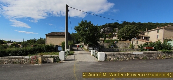
Bridge on the creek of La Combe
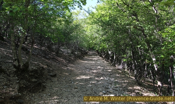
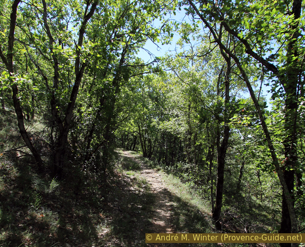
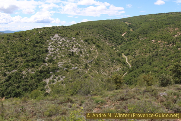
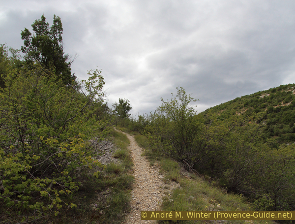
The path is easy and you can't miss it, but the bone-breaking gravel and the early morning sunshine are uncomfortable. It's one of the three ascents on this tour, the others are a bit shadier.
No reproduction is permitted without the written consent of the author. (id3451)
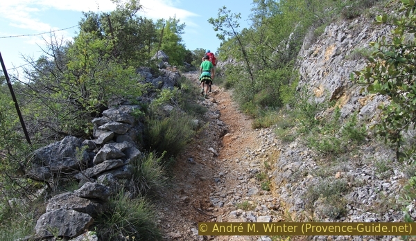
Washed out path on Le Défens
Looking back at the village of Simiane-la-Rotonde from the ascent path.
No reproduction is permitted without the written consent of the author. (id3452)
Simiane-la-Rotonde and the path to Le Défens
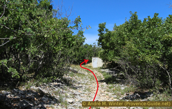
After about 15 minutes of consistent ascent, the path becomes less steep and forks (point 766 on the IGN map). Keep right here and keep going up. The path gradually becomes flatter, we continue to follow the walking direction and tend to stay to the right if there are further forks.
If you go straight on here you enter the Tour de l'Espéron: this is a 981 m high hill and Le Défens is a branch of it. This path is basically marked, but some signposts are missing. At the end of the larger loop you reach the cistern north of the ruins of Coudal. You will pass several dilapidated alpine pastures, first at the Jas d'Estelle. Additional 1 hour 30 minutes.
No reproduction is permitted without the written consent of the author. (id3453)
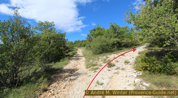
Path junction on Le Défens at 766 metres above sea level
Section 2: Défens - Ruines de Coudal
➙ 1,5 km ... 30 min ➚ 90 m ➘ 10 m ↝ easy
100% forest roads, without marks
The clues
- Straight on, slightly down from Le Défens, 800 m
- Pass above the Simon farm, 790 m, keep slightly right and ascend again
- After a cistern, 875 m, right
- Along the edge of the forest to the ruins of Coudal, 885 m
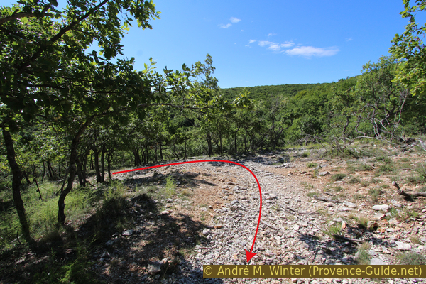
We have now reached the flat ridge of Le Défens and we continue straight ahead. Here, on the right hand side, comes up the other variant.
If you go up to the left, you reach the ruins of Jas de Martel (after 400 m on the right, overgrown).
No reproduction is permitted without the written consent of the author. (id3454)
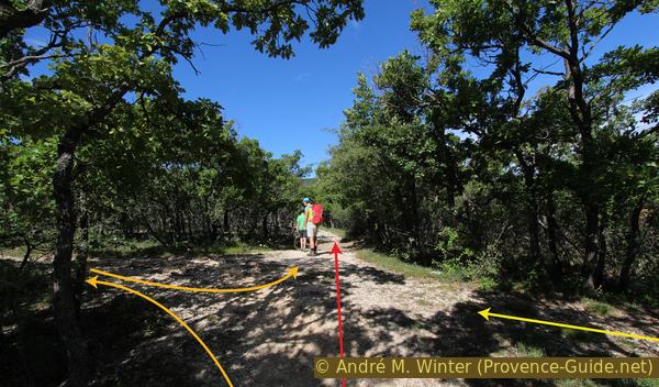
Fork in the path at the back of Le Défens
In orange: the alternative to Jas de Martel, in yellow: the other climb (described in the appendix).
ferme = farm
We continue in the main direction, slightly descending.
No reproduction is permitted without the written consent of the author. (id3455)
Path via Le Défens
We quickly reach the Simon farm under shady trees. Below you can see the stables. There is a signpost at the crossroads, but it doesn't show our way. Without descending strictly to the right into the Ravin de la Combe and without going up to the field on the left, we keep slightly to the right and ascend again.
No reproduction is permitted without the written consent of the author. (id3456)
At the junction above the Simon farm
Our gravel road ascends over a few hairpin bends, it's sunnier and much rockier here than just before. It seems as if a water pipe was buried carelessly here, because old dry stone walls were also recently destroyed.
The picture shows the view back.
No reproduction is permitted without the written consent of the author. (id3457)
Turn between Simon farm and Coudal ruin
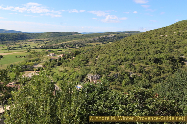
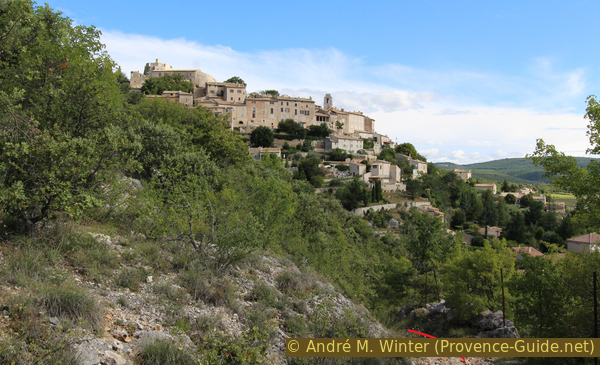
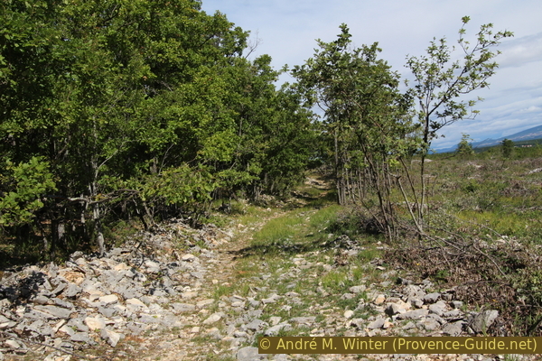
Continuing to ascend, we slowly come to the highest point of the tour. Le Défens has a broad and flat back. The forest is less dense here and lavender fields follow later. This opens up views of the village from which we started, with the massif of the Montagne de Lure behind.
No reproduction is permitted without the written consent of the author. (id3458)
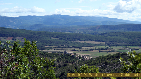
View of Simiane and Montagne de Lure
When the path gets really difficult to walk, you come to a concrete block with a buried cistern hiding under it. Behind it, turn right.
No reproduction is permitted without the written consent of the author. (id3459)
Coudal water pipe
In a few zigzags we walk along the edge of the forest, on the right a cleared area.
No reproduction is permitted without the written consent of the author. (id3460)
Path from the water cistern to the ruins of Coudal
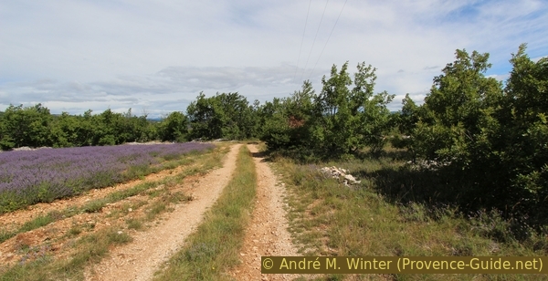
Lavender fields begin on the right, and there are also beehives here during flowering. We aim for the ruins of the Coudal pasture, hidden under the big green trees in the purple lavender field. After that, turn right again.
At the ruins between the lavender fields there is a free place for a rest. The masonry of the ruins is in poor condition and overgrown with thorny bushes, there is not much point in wanting to take a closer look.
In June and July you will be rewarded with the scent of lavender on this round.
Section 3: Coudal - Combe - Moulins - Simiane
➙ 3,3 km ... 1 h 15 min ➚ 50 m ➘ 200 m ↝ easy
20% dirt roads, without marks
55% hard-surfaced quiet side streets, few marks
20% easy trails, with marks
5% dirt roads, with marks
The clues
- Descent from the ruins of Coudal, 885 m, to the Libert farm through the fields
- On the asphalt road right down to the Ravin de la Combe, 795 m
- Follow the red and white markings down there on the right
- After a right turn, the long-distance hiking trail ascends to the left, 750 m
- At the top of the ridge between the former farms, 795 m
- Pass the stumps of the windmills and the Notre-Dame de Pitié chapel, 760 m
- Back to the starting point at the rotunda, 720 m
Down into the valley and up again on the opposite slope.
GR = lomg distance trail
Bas Village = lower village
Follow the gravel road down and turn left at the junction, then right and left again, all other paths end in the lavender fields.
No reproduction is permitted without the written consent of the author. (id3463)
Gravel road north of the ruins of Coudal
Below the Libert farm you come to a narrow asphalt road, turn right here. At the bottom of the Ravin de la Combe valley, we end up on the GR4 long-distance trail from Sault to Céreste. Here turn right along the road until you come to a tighter right-hand bend.
No reproduction is permitted without the written consent of the author. (id3464)
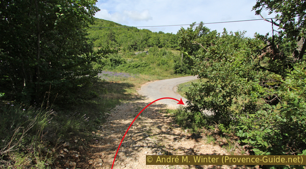
Turn of the road to Limbert farm
An old but marked path, after the bend on the left, ascends up to the upper village of Simiane.
No reproduction is permitted without the written consent of the author. (id3465)
Road in the Ravin de la Combe and junction of the GR4 long-distance hiking trail
First in the shade of the maquis and then we reach a dirt road (keep left) and an old paved road on which we descend to Simiane-la-Rotonde.
No reproduction is permitted without the written consent of the author. (id3466)
Path from the Ravin de la Combe to the Simiane windmills
GR = long distance trail
moulins = wind mills
N.-D. de Pitié = chapel
There were three windmills on the north-western ridge of Simiane, but only the stumps remain. They are all three on the right side of the street, only the top one (and the first one we see on our way) has been renovated.
No reproduction is permitted without the written consent of the author. (id3467)
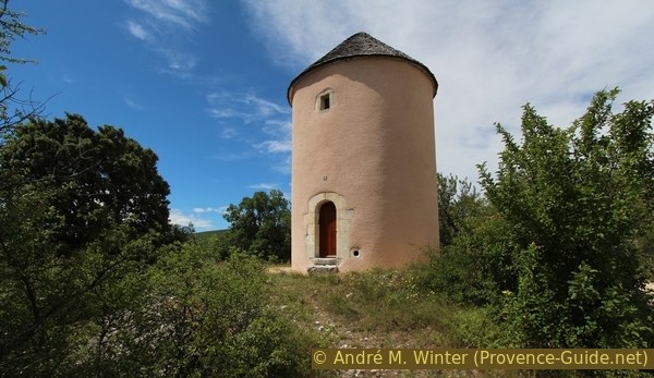
Windmill without wings at Simiane
Soon after, the Notre-Dame de Pitié chapel is on the left, hidden behind the ruined walls in the picture. The chapel cannot be visited.
After a final curve, the road becomes straight and brings us back to the starting point. You can see the rotunda and the upper parking lot again.
No reproduction is permitted without the written consent of the author. (id3468)
Ruins near the Notre-Dame de Pitié chapel
Visit to the Rotunda: this attraction is described in more detail here: The Rotunda of Simiane.
Visit of Simiane: we walked through the town at the beginning of the tour, now it is of course time to stop at the bistro La Palette and its covered terrace.
No reproduction is permitted without the written consent of the author. (id2860)
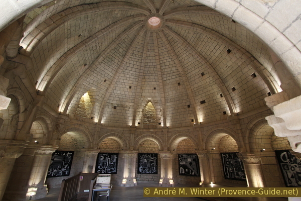
Large dome in the upper room of the Rotunda of Simiane
The hall on the upper floor of the rotunda is covered with a dome, the ribs of which are slightly screwed together to form an opaion (dome eye).
Appendix: Simiane - Combe - Défens
➙ 1,8 km ... 40 min ➚ 135 m ➘ 60 m ↝ average
20% hard-surfaced city alleys, without marks
20% hard-surfaced country road, without marks
60% easy trails, without marks
The clues
- Simiane, 720 m, start at the car park of the rotunda above the village
- Descent to the right of the rotunda to the Saint-Jean bell tower and the terrace of the Bistro la Palette, keep then on the right
- A passage leads down to the road under the upper village, keep right at the bottom, 690 m
- From the hairpin bend on the D18, turn left and descend to the next hairpin bend, 67 m
- Go briefly into the street of the Ravin de la Combe, then look for the further path on the left under the big trees
- A short descent and then a path up to the right along the western slope of Le Défens, 800 m
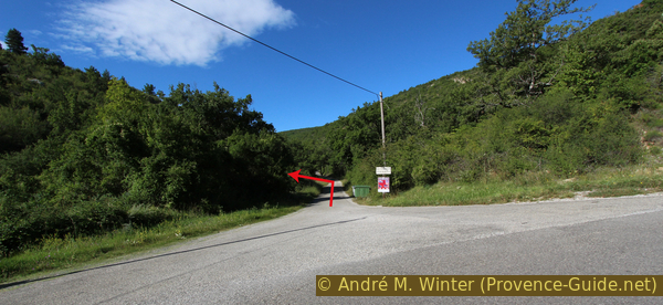
In contrast to the other ascent, this path is clearly visible from the opposite side (in the middle of the picture), even if the entrance to the slope under the village is not easy to find. This climb trail is shadier early in the morning and the trail is in better condition. However, you have to walk along the bypass road for a short time. This description replaces section 1: Rotonde de Simiane - le Défens of the main round.
At the end you also get on the back of Le Défens. If you turn right at the top, you are back on the main route at the beginning of section 2: Défens - Ruines de Coudal.
No reproduction is permitted without the written consent of the author. (id3469)
West side of Le Défens and the road to Simon farm
clocher = steeple
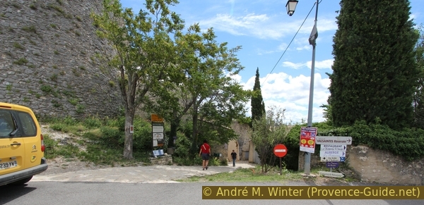
The first section in the village centre is the same, but you have to turn right at the terrace of the Bistro La Palette (picture).
No reproduction is permitted without the written consent of the author. (id3444)
Covered space of the Bar la Palette
Then take the passage down to the road under the upper village, keep right at the bottom and proceed to the bypass road.
No reproduction is permitted without the written consent of the author. (id3447)
Passage to the street below the upper village
Walk down along the little-used ring road to the next hairpin bend in the valley of La Combe.
No reproduction is permitted without the written consent of the author. (id3448)
Hairpin curve of the D18 road under the upper village
In the picture you see the road into the Ravin de la Combe. A telephone pole is on the right. We go into this street, but only about 50 meters far to the height of the next mast.
No reproduction is permitted without the written consent of the author. (id3449)
Street at the exit of the Ravin de la Combe
Opposite the second telephone pole there is a lay-by on the left. A path starts here in the undergrowth on the left under the large trees. You have to search a bit to see it starting. The path initially seems to go backwards and downwards parallel to the road. In the picture, the entry is in the area of the hood of the vehicle. You can also climb straight up at right angle to the road (path above the back window of the car), but that's a nasty and slippery path in the gravel.
Then in small hairpin bends on a poorly recognizable trail up and to the right. You are then in the picture at the level of the small trees on the horizon.
No reproduction is permitted without the written consent of the author. (id3472)
Exit of the path from La Combe on the west side of Le Défens
You get on an old well-preserved path that climbs in a large arc to Le Défens. Once on the path, keep going in that direction.
No reproduction is permitted without the written consent of the author. (id3471)
Path on the west side of Le Défens
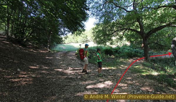
The end point of the ascend is a crossing, shady and almost flat gravel road, you come from the right in the picture with the hikers.
You have arrived at the ridge of Le Défens, keeping to the right you reach the main route and you can continue on section 2: Défens - Ruines de Coudal.
Variant: if you continue straight ahead, you will reach the ruins of Jas de Martel (after 400 m on the right, overgrown).
Sources and additional information
It is better to use a good topographic hiking map: this tour is on the IGN map "Apt, Luberon Parc naturel régional", scale 1:25000, 3242OT.
If you don't want to bother with a paper map, you can also use mapping apps on your cell phone. On the one hand, it is the Cartes IGN app from the official map service. However, it requires access to the data network and this is sometimes difficult in canyons or remote locations.
Alternatively, you can use apps that store data directly on the device. They're generally not free, but they don't cost much. We mainly use OSMAnd, here it is possible to add contour lines, relief shading, markings and others. To store this data on your phone you need a lot of space.
Of course, one needs access to satellites for the GPS signal with any app. In some canyons this is not the case. Therefore, do not rely on the position shown, but read the map on your phone as you would read it on paper. Most apps are available for Android and iPhone. The applications usually allow us to record the route travelled and also view the GPS files offered for each of our hikes.
This page has been seen 2556 times since 20 March 2024.
No reproduction is permitted without the written consent of the author. (id7364)
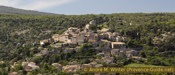
View from the west over Simiane and its rotunda