Cape Point des Sardinaux
Natural and historical site
45 min
view point
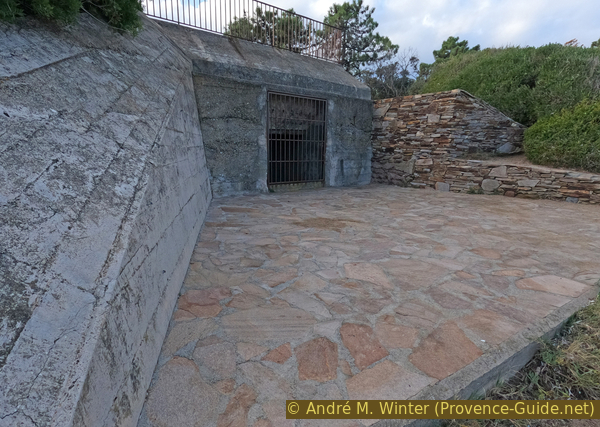
This very flat cape is miraculously spared by the road and the houses built by the sea. This may be due to the presence of a German bunker which was only transformed into a viewpoint in the 1990s.
Another curiosity of the site is a Roman marine pond.
No reproduction is permitted without the written consent of the author. (id5722)
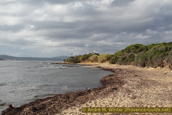
South coast of Pointe des Sardinaux and St. Tropez Gulf
Access by public transport
Bus line 876 runs around 12 times a day on this route between Saint-Tropez, Sainte-Maxime, Fréjus and Saint-Raphaël. The timetable is available under Zou! (only french). Either way, get off at the La Nartelle stop, stay on the sea side or switch there and walk down onto the beach to avoid traffic.
We descend from the road to la Nartelle beach and head right (south) towards Sainte-Maxime. We pass more or less noble restaurants and rocks begin very quickly. Here is a short stretch of the coastal path that takes us along a narrow strip between the sea and the walls along private property to the Pointe des Sardinaux.
With strong waves and easterly winds you will definitely get wet, in this case it is better to walk along the road.
Access by car
Coming from Saint-Raphaël and Fréjus, take the D559 towards Sainte-Maxime and Saint-Tropez. After Les Issambres, continue along the coast and La Nartelle beach begins with a large roundabout. Park here or further ahead at the roadside.
Coming from Toulon or Saint-Tropez, head east towards Sainte-Maxime, through the town and further along the coast of the Gulf of Saint-Tropez. When the road leaves the sea, the Pointe des Sardinaux is on the right. Stop here if there are spaces available at the roadside or continue to Plage de la Nartelle
Avoid the D559 road between 10am and 8pm in summer, you are between St. Tropez and Ste. Maxime and at this time permanently stuck in traffic.
Park at the roadside between Pointe des Sardinaux and Plage de la Nartelle
No reproduction is permitted without the written consent of the author. (id5726)
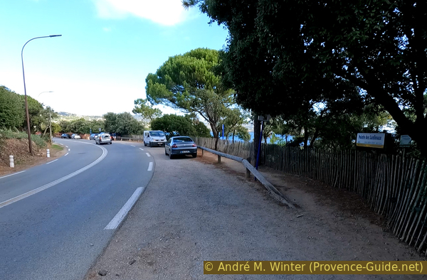
Park area along the road at Pointe des Sardinaux
Description
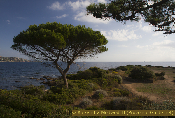
The northern part, the middle and most of the cape are natural and since there is not much parking space, the number of people at the cape is limited even in summer. Few people bother to come on foot.
Let's start the tour around the cape in the north. You can walk directly on the rocks and beaches near the water or along very wide paths on the plateau.
No reproduction is permitted without the written consent of the author. (id5720)
View from the bunker on Pointe des Sardinaux
We quickly reach a German bunker from World War II. It is not immediately recognizable as such, since it was neutralized in the 1990s and converted into a viewpoint. The only access to the upper terrace is on the land side to the east. This installation monitored the Plage de la Nartelle beach, which was a potential landing site for Allied troops. A similar facility existed south of the cape to monitor the Bay of Saint-Tropez.
Among the less warlike and much older remains is a Roman freshwater basin such as at la Gaillarde further north. The system was similar, but here the remains are completely submerged and covered with sand and stones. It is north of the cape.
No reproduction is permitted without the written consent of the author. (id5727)
Bunker of Pointe des Sardinaux
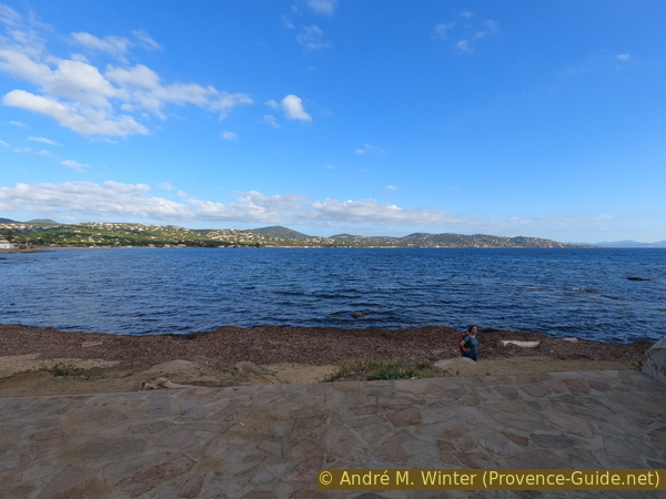
Passing the top of the cape, the view of the Gulf of Saint-Tropez opens up. The well-known city is visible, but we are far from it. The gulf is wide and the land on either side has no prominent elevations, the gulf here looks more like a deep bay.
No reproduction is permitted without the written consent of the author. (id5723)
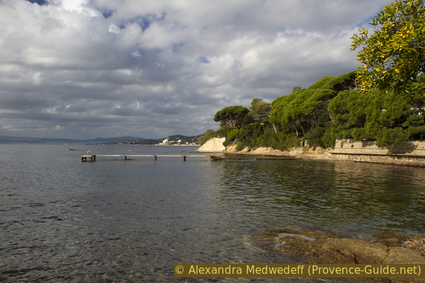
Gulf of Saint-Tropez as seen from Pointe des Sardinaux
There are small stretches of beaches along the south side, but beware of rocks further forward below the surface of the water!
No reproduction is permitted without the written consent of the author. (id5721)
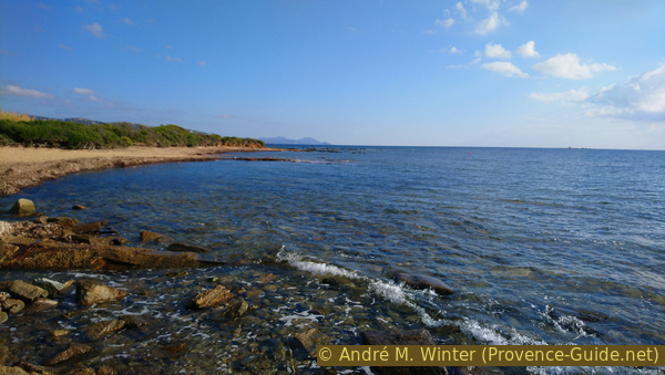
South coast of Pointe des Sardinaux
Services available
In the small pine forest are a few picnic tables. There are other simple benches along the coast of the cape.
No reproduction is permitted without the written consent of the author. (id5725)
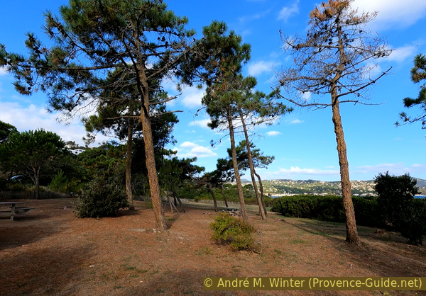
Picknick-area on Pointe des Sardinaux
No reproduction is permitted without the written consent of the author. (id5724)
Pointe des Sardinaux cape as seen from the bunker