Calc-tufa waterfall near Réotier
Natural and with walk site
1 h
view point
In the valley basin at Guillestre, where the Durance and the creek Le Guil meet, there are several geological features in addition to the rivers and the lakes. One of them is the tufa waterfall near Réotier. It is very easy to reach on foot in just a few minutes.
No reproduction is permitted without the written consent of the author. (id1958)
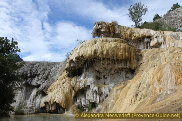
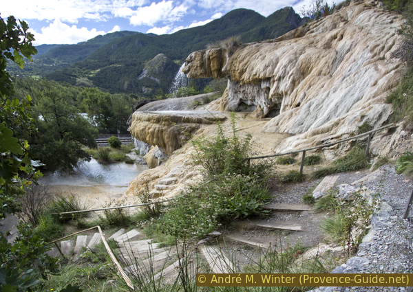
Waterfall in the tufa near Réotier
The waterfall splashes over the overhanging tuff edges, which the calcite-saturated water builds up over the years. In its natural state, the water would always change its flow direction and so the waterfall might not be as impressive. Today, the water is directed at one point to form this two-tiered waterfall. At the foot of the steps is a small lake.
No reproduction is permitted without the written consent of the author. (id1955)
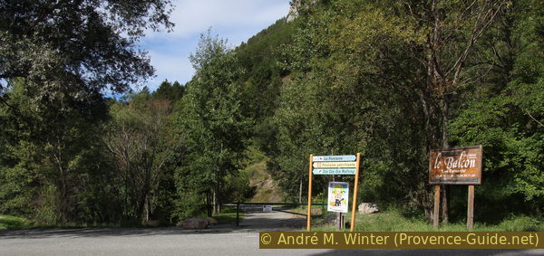
Start of the trail to the Réotier tufa waterfall
Access by public transport
There is no public bus to the starting point, but the Mont-Dauphin Guillestre train station in Eygliers is less than two kilometres away. Time tables can be seen under TER PACA (only french) for the line from Gap to Briançon. As the proposed walk from the car park is less than a kilometre long, it also remains a short distance from the train station. Altogether that makes about 5km and 90 minutes walking time. Unfortunately, you have to walk longer on main roads, because in this area the river Durance and the railway line do not offer many crossing possibilities.
The path to follow shows up purple in the map.
We leave the train station via the car park and take the N94 road, here on the right to the Dekra test centre. Exactly after that and in front of the bakery in the sloping house we turn right again. Further on, the now narrower street turns to the left and runs along the railway embankment. One comes again on a busy road, the D37. Turn right and cross the tracks further ahead.
Then either continue along the road or take the path towards Centre de Loisirs on the other side of the road. After 100m and before a small bridge, turn left into the forest and stay on the path until you get back on the D37. The railway line and the road cross the Durance here, as do we, and after the bridge there is a kayak base parking lot on the left. This is the starting point of the small hike described below.
Access by car
The point of interest is west of Mont-Dauphin and Guillestre. From Lac de Serre-Ponçon, Gap or Guillestre, head towards Briançon. Passing under the Mont-Dauphin fortress, you come to the village of Eygliers Gare. Shortly after entering the village, pay attention to the signposts for Réotier and Les Iscles campsite and turn left.
Coming from Briançon: in Eygliers Gare, after the petrol station, follow the arrows on the right towards Réotier and Camping La Fontaine.
Continue the same way for both approaches: first cross the tracks, then the river Durance and immediately after the bridge to the parking lot of the kayak base turn left. This is where the small described tour begins.
The parking lot west of the bridge is the starting point of the tour.
No reproduction is permitted without the written consent of the author. (id1957)
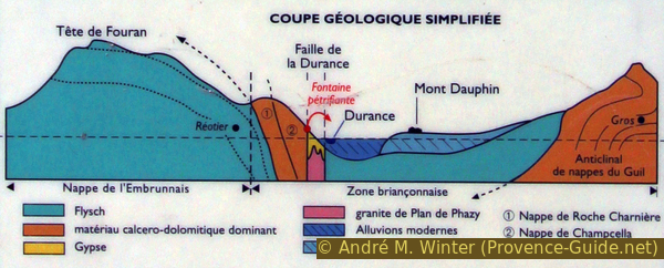
Geological scheme of the area surrounding the waterfall
Access by short walk
We leave the parking lot on foot to the north, that is at the other end. This takes us directly to the access path to the waterfall, where driving is prohibited. We follow the paved path and after 200 meters we come to the lower base of the Réotier waterfall. The access path ends here.
Description
We are standing in front of a small lake that has formed under the waterfall. Above rise the tuff terraces formed by the waterfall. The shape varies from year to year, depending on where the water prefers to run down.
The waterfall is located near the Durance rift valley. The water penetrates and sinks under the force of gravity through limestone and dolomite rock. The water gets warmer 3°C per 100 meters depth.
This water, warmed up, rises again via a small fissure to about 15 meters above the groundwater table and above the Durance. The water at the spring is 21°C warm, so the waterfall is snow-free even in winter. The water is heavily saturated with calcium bicarbonate. When exposed to air, carbon dioxide is released and at the same time calcite precipitates in solid form. The effect is enhanced by the heat and especially by the dripping over the edges of the tufa, where contact with the air is maximized.
No reproduction is permitted without the written consent of the author. (id1959)
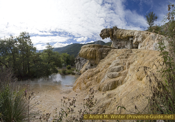
Mid-level view of the waterfall
Each litre of water carries around 140mg of calcite and is mostly excreted directly at the waterfall. This high content is enough to petrify everything around. Above all, mosses and other plants form the structure of the waterfall.
An old calcareous tuff structure can be seen in the back left, this section is gray and dead compared to the active waterfall in front. Without fresh water the structure dissolves quickly. The water builds the structures, but the mineral-poor rainwater dissolves them just as quickly. These gray dull areas are very brittle and very dangerous to walk on.
No reproduction is permitted without the written consent of the author. (id1960)
Path next to the Réotier waterfall
Climb and back down
The wide path ends at the foot of the waterfall. On the right, however, steps lead up along the tufa terraces. Here you can reach the source in a few minutes. The water is directed to the terraces there.
No reproduction is permitted without the written consent of the author. The permission of use was kindly given to Provence-Guide.net on 28 July 2018. (id1963)
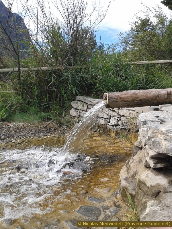
Source of the Réotier waterfall
Even from the level of the source you have a good view of the wide valley basin. You can climb a little further on the path to the right. From this path the view opens up all the way back to the Queyras area.
After a few minutes we look for a way down again in bends to the right. When you come to a road, you will have passed the junction. The path leads steeply back to the starting point.
No reproduction is permitted without the written consent of the author. (id1961)
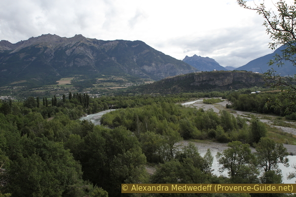
Crest of the Catinat, Mont Dauphin, Durance river and Guil torrent
No reproduction is permitted without the written consent of the author. (id2366)
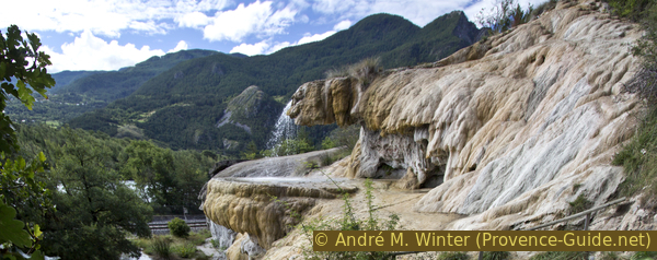
Réotier waterfall