The Roman bridge Pont Julien
Historical and natural site
10 min
river
Until 2005 a normal country road to Bonnieux led over this Roman bridge, cars and light trucks hopped over the crest in the middle as Roman carts did. This elegant bridge has served as a public transport link for over 2000 years.
No reproduction is permitted without the written consent of the author. The permission of use was kindly given to Provence-Guide.net on 25 September 2018. (id2293)
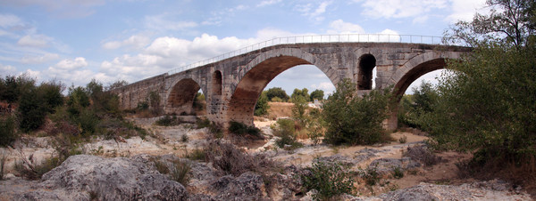
Pont Julien after the construction of the second bridge, seen from the south-west
Site history
The exact year of establishment is not known, but the year 3 before our era is usually given. The Pont Julien crosses the River Cavalon on the Via Domitia, which at that time connected Turin to Nîmes. The name of the bridge goes back to the town of Apt, which was called Colonia Apta Julia in Roman times.
The Via Domitia followed the valley of the Cavalons here, but bypassing the Roquefure gorge stretch to the east via the north, to switch to the easier bank on the south side. From a historical point of view, the bridge was not designed as a connection to Bonnieux.
Since more and more and ever heavier vehicles were clogging the old bridge, a relief road and a new bridge were built to the east. Since then, only pedestrians and cyclists are allowed to cross the Roman bridge.
No reproduction is permitted without the written consent of the author. The permission of use was kindly given to Provence-Guide.net on 25 September 2018. (id2294)
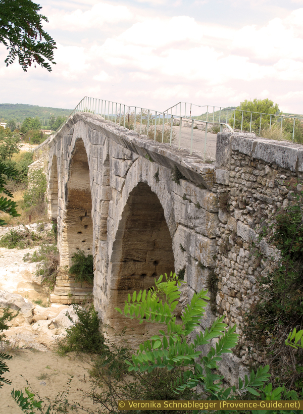
Pont Julien seen from the south
Description
The bridge spans the Cavalon at right angle with three round arches. It is 80 meters long, with the open arches totaling 46 meters wide. The road is a little over 4 meters wide at the top, until 2005 this bottleneck was only one-lane passable.
The most beautiful colors are in the evening when the sun is low in the sky. If you choose your point of view well, you can look at the old bridge without seeing the new one and other new buildings.
There are information boards at the northern and southern accesses.
No reproduction is permitted without the written consent of the author. The permission of use was kindly given to Provence-Guide.net on 25 September 2018. (id2295)
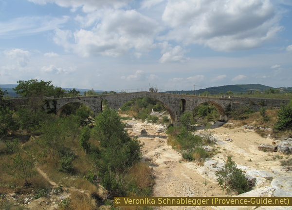
Pont Julien seen from the new bridge
Access by public transport
The route between Apt and Cavaillon is quite well served by public transport. Line 915 buses run between Avignon and Apt. Line 914 runs between Apt and Ilse-sur-la-Sorgue. Line 917 connects Apt and Cavaillon with a few detours, but only in summer.
All of these bus routes stop just east of the roundabout in the north. The stop is called Pont Julien (Bonnieux), see the attached map. Further information and timetables can be found under Zou! (only french).
Access by car
The Pont Julien is located 8km west of Apt, 25km east of Cavaillon, 5km north of Bonnieux and 5km south of Roussillon.
Parking site
Two small parking lots can be found north and south of the old bridge.
No reproduction is permitted without the written consent of the author. (id2292)
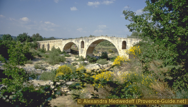
Pont Julien in 1999 and before the construction of the diversion bridge