Gourfouran gorge, Rame chapel and a gravel pond with a view
Natural and historical site
1 h
bathing on a beach at a lake
Description
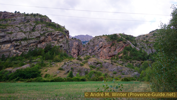
This small round combines three sights that you would not expect to find near the busy N94 road in the Durance Valley: an old chapel, a view into a deep and narrow gorge and a quarry pond with a breathtaking view.
The circular hike around the gorge (Sentier du Gouffre de Gourfouran) is not described here. It is a themed trail with just another lookout point into the gorge. There is an information board for this trail near the chapel.
The nearest bus stop is on the N94 under the village of La Roche-de-Rame. See times for lines 69, 540 and 541 under network Zou! (only french). It is almost three kilometres from the starting point. You have to walk north, pass the last houses and turn left under the railway line. Then follow the description below. You can take the unpaved track that goes around the lake to the east.
No reproduction is permitted without the written consent of the author. (id160)
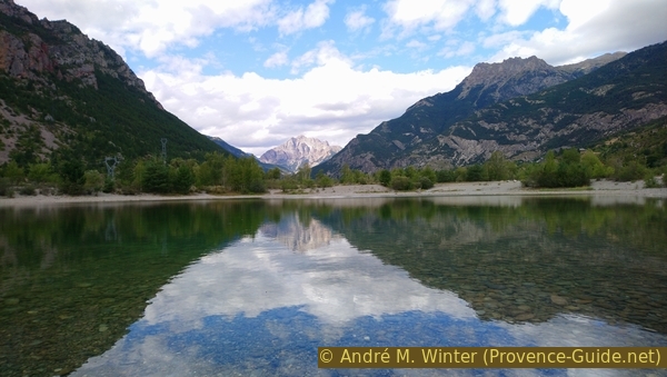
View over the gravel pond in Fonds de Rame to the Montbrison mountain
Access by car
We are in the Durance valley, between Mont-Dauphin and Argentière-la-Bessée, at La Roche-de-Rame.
Coming from Embrun and the South, you pass under the Mont-Dauphin and continue north. Then continue through the traffic-plagued town of Roche-de-Rame. The small round is south of here, but we have to reach a bridge over the river. This is 500 meters further north, road signs point left to Freissinières and Champcella.
Coming from Briançon and the north, you descend a last steeper section at Argentière-la-Bessée. Then you reach a valley section that becomes wider and flatter. The railway line joins the road on the right, behind it runs the Durance river. At the second major crossroads, we turn right at the signs for Freissinières and Champcella.
Now the approach is identical: first we go under the railway and then we cross the level and finally we cross a bridge over the Durance. Shortly afterwards we take the lower left and smaller road. A sign prohibits campers from continuing, another points to the dead end. The road is indeed narrow and you may have to be able to reverse far if there is oncoming traffic, but it is always wide enough for campers. Basically, it really is a (long) dead end.
The road was built for the hydroelectric power station at the exit of the gorge. It leads along the foot of the slope and takes us directly to the three sights.
Parking site
You can park in several places. Either directly at the crossroads under the power plant, as planned here. Or by passing the first bridge and take the parking lot later on the right. You can also turn left from the crossroads over a bumpy gravel road to the lake.
It is no longer possible to drive around the lake in a vehicle as it used to be. To reach the north and east banks, you have to take a no less bumpy gravel road 200 meters to the left after the bridge over the Durance. It leads rocky one kilometre to the lake.
No reproduction is permitted without the written consent of the author. (id2791)
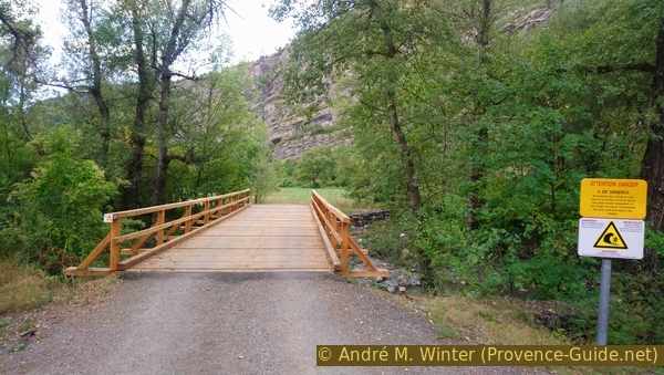
Wooden bridge to get to the viewpoint in the Gouffre de Gourfouran
Chapelle de Rame
Starting from the power plant, we cross the bridge and shortly thereafter we take the path to the right into the forest. Further, you can already see the chapel between the trees. Only the apse dates from the Middle Ages, the rest of the building was rebuilt and renovated by 1855. It was in the center of a former castle complex and one thinks that it was originally the castle chapel.
No reproduction is permitted without the written consent of the author. (id2764)
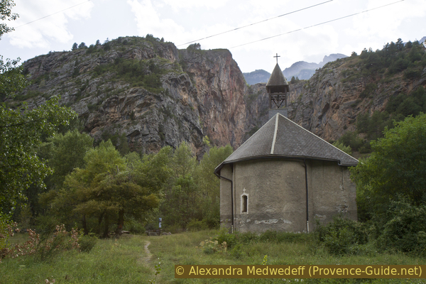
Chapelle de Rame in front of the Gouffre de Gourfouran
All that remains of this castle is a wall from one of the four towers, you can see the ruins to the south-east of the chapel between the trees. Not much is known of the castle complex, it probably experienced its heyday in the 12th century when there was a settlement all around. However, the site was and is plagued by floods and mudslides. From the 15th century, the inhabitants gradually abandoned the village and settled in the surrounding higher areas, such as La Roche-de-Rame. In the 18th century and before the French Revolution, the castle is demolished.
No reproduction is permitted without the written consent of the author. (id2796)
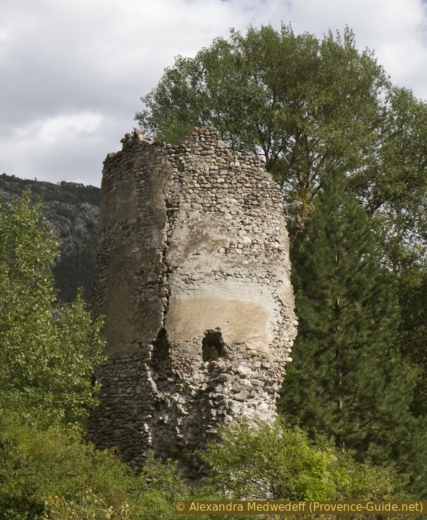
Ruins of a tower of Rame Castle
Access to Gouffre de Gourfouran
From the chapel we return to the road, but this time we pass the ruins of the castle tower on the left. We come to a wooden bridge and cross it. Behind it we take the dirt road on the right. You can already see into the gorge of Gourfouran, but a rocky hill blocks the view a bit.
No reproduction is permitted without the written consent of the author. (id2792)
View of the gorge after the wooden bridge
When we get to the base of the ridge, we are faced with two signs warning of tidal waves in the canyon. The power plant operators can open the dam above without warning. The boards refer to the path on the right, on the photo there is a black hose in this direction.
No reproduction is permitted without the written consent of the author. (id2793)
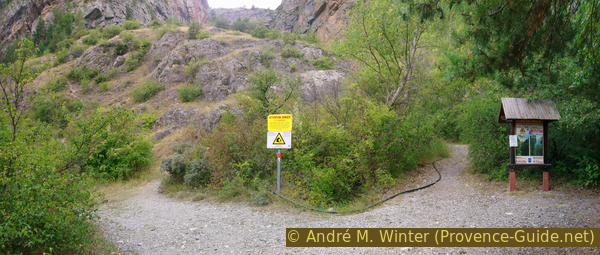
Uphill path on the left and canyon access on the right
You can walk a few meters without getting your feet wet. However, the warnings on the signs should be taken seriously!
No reproduction is permitted without the written consent of the author. (id6146)
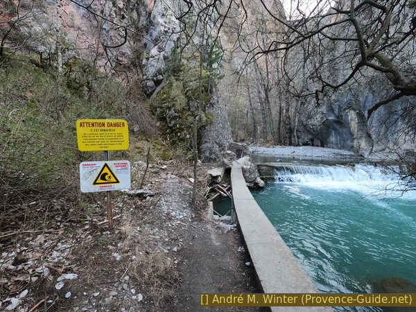
Advancement in the Gouffre de Gourfouran
The path leads to an old water intake and ends with this view.
No reproduction is permitted without the written consent of the author. (id6145)
At the base of the Gouffre de Gourfouran
Viewpoint in the Gouffre de Gourfouran
Our vantage point is directly on the hilltop. You need closed-toe trekking shoes to get to the viewpoint!
We come back out of the gorge and turn right at the first yellow and white sign. A little further on climbs a path on the mound. We follow it. It passes quite steeply between rocks, but you quickly reach the summit.
No reproduction is permitted without the written consent of the author. (id2794)
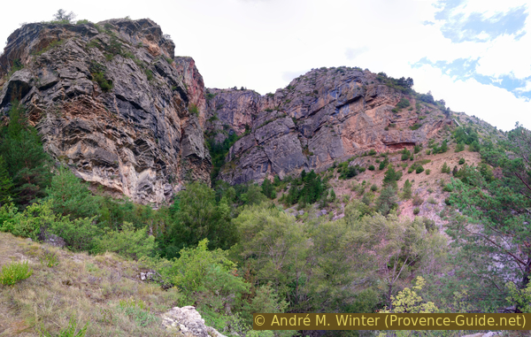
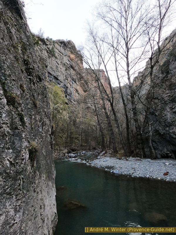
View of the Gouffre de Gourfouran
The natural vantage point is right on the hilltop, from here you have a good view of the gorge and the steep rock faces. In the afternoon you can sometimes see climbers here.
No reproduction is permitted without the written consent of the author. (id6144)
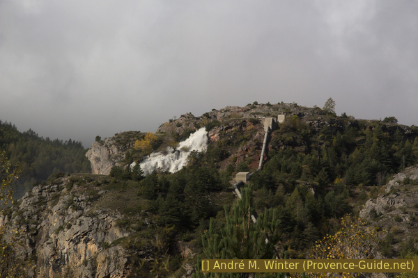
Release water into the Gouffre de Gourfouran
Not only does the knoll look down into the gorge, there are also good views both directions of the Durance Valley. Looking north to the village of La Roche-de-Rame, beyond are the mountains of Tête des Aiguillons and Crête du Peyron. To the south you can see Saint-Crépin.
No reproduction is permitted without the written consent of the author. (id2797)
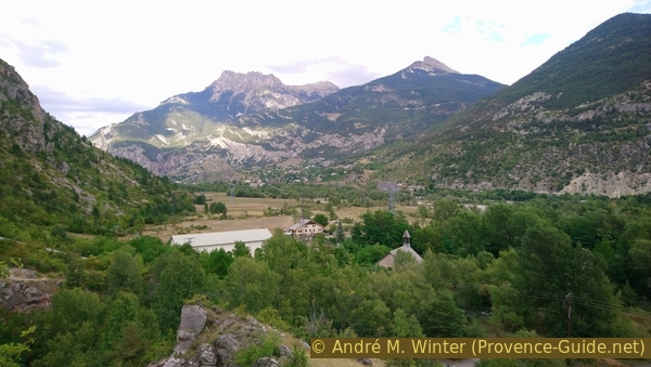
View of Roche-de-Rame and the Tête des Aiguillons mountain
For the descent, we return briefly along the same track, but stay straight ahead on the wider path. This one is a little steep. We get back to the foot of the hill and turn left towards the service road.
Down again over the wooden bridge and on the road ahead over the second bridge and back to the starting point. However, exploring the area doesn't end here!
No reproduction is permitted without the written consent of the author. (id2795)
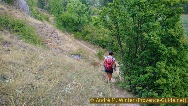
In descent
Pond in the Les Fonds de Rame gravel plain
Les Fonds de Rame is an alluvial area of the Durance, only a meager layer of vegetation covers the rounded river gravel. At the height of the power plant there is a small gravel pond, which probably comes from a former gravel extraction. The water body is connected to the Durance, so the lake stays quite cool even in summer. You can swim here, although you have to walk a long way in to find enough depth.
At the end of the summer, the water level can drop sharply and algae can also appear. Then you should just enjoy the view.
There is another lake right in the village of La Roche-de-Rame, this one is better equipped for swimming, but also rather cold.
No reproduction is permitted without the written consent of the author. (id2798)
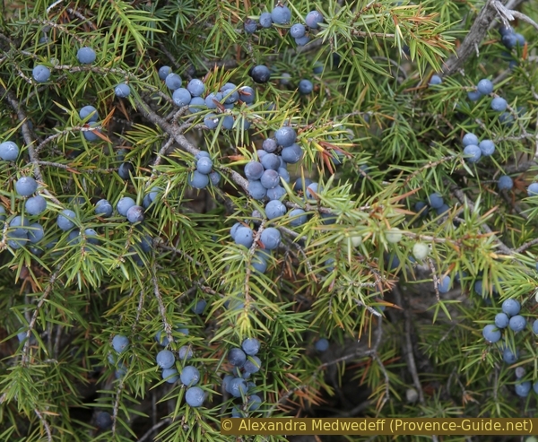
Juniper with berries
No reproduction is permitted without the written consent of the author. (id6147)
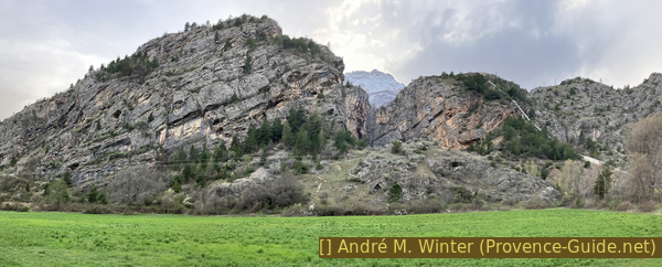
The setting of the Gouffre de Gourfouran